Places
Pontinos hill and castle
22 events
Show on a map (opens in a new tab)
-
c. 160
Pausanias visits Lerna and Mount Pontinos
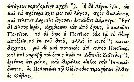
The Greek travel writer Pausanias describes the sacred grove of plane trees that began at Mount Pontinos, the mysteries held there for Lernaean Demeter, the spring of Amymone and the bottomless Alcyonian lake. On the…
-
1175–1399
A castle rises on Pontinos
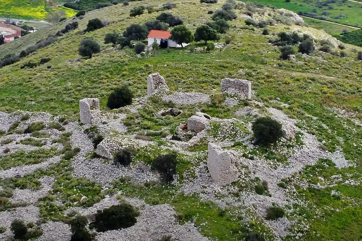
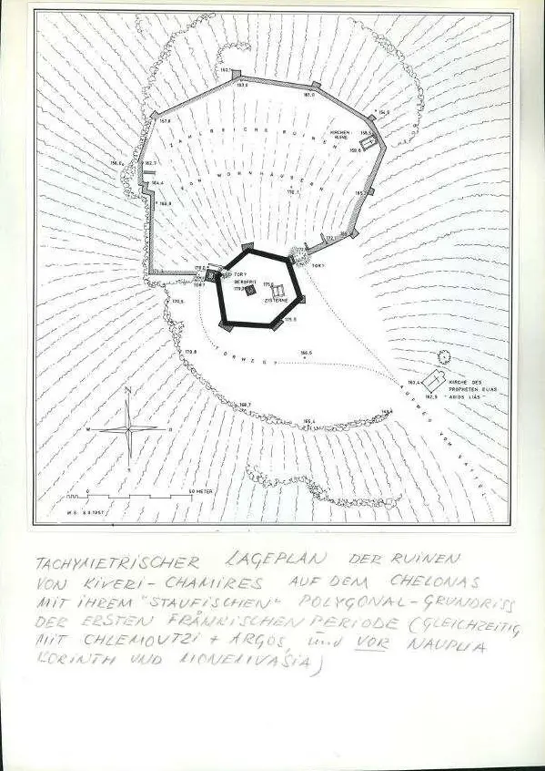
On the summit where Pausanias had seen the ruined sanctuary of Athena, a fortress was built with an outer ward, a six-sided redoubt, a square keep and cisterns. When exactly is disputed: Wallace McLeod thought it…
-
1347
A priest for the castle: the will of Gautier de Brienne
In his will of 1347, Gautier VI de Brienne, Lord of Argos and Nauplia and titular Duke of Athens, names his castle of Chamires. He left sixty hyperpyra a year, from the rent of a cloth shop in Argos, for a priest who had…
-
1388
Argos and Nauplia are sold to Venice
Marie d'Enghien, heiress of the Brienne family's lands in the Argolid, sold her lordship of Argos and Nauplia, including the castle of Kiveri, to the Republic of Venice.
-
1394
Venice finally takes over the castles
The handover after the sale of 1388 was anything but smooth. The Despot of Mystras seized the castles of the Argolid first, and only in 1394 did Venice actually gain control of the area, the castle on Pontinos included.
-
1479
The castle on Pontinos falls out of use
After the Venetian–Ottoman war of 1463–1479 the castle was allowed to stay in Venetian hands on condition that it was not rebuilt. From then on it gradually disappears from the record; roofs collapsed and the walls began…
-
1700
Grain by boat, flour back to Nafplio
In his introduction to the Venetian cadastre of Argos, the engineer Francesco Vandeyk describes a castle on a high hill near the sea, called Anasiri, or by many 'Old Argos' or 'Helen's castle'. Below it, he writes, water…
-
1703
'The ruins of Tyrea near the mills'
In his description of the Morea of 1703, Alessandro Pini writes that across the sea from Nafplio one can see 'the ruins of the city of Tyrea towards the mills'. People then called those ruins the Tower of Helen, and the…
-
21 July 1715 – 4 August 1715
The Ottoman army camps at the mills of Tziveri
On 21 July 1715, the day after Nafplio fell to the Ottomans, Grand Vizier Damat Ali Pasha moved his army away from the stench of the dead to the western end of the gulf, below a hill with the remains of an ancient city.…
-
1806
Leake: the 'Afendiki Myli' are government mills of Nafplio
The British officer and topographer William Martin Leake visited the mills in 1806. He called them the Afendiki Myli, 'mills of Anapli [Nafplio], to which town they belong', and explained the Greek term as 'government…
-
c. 1815
Pouqueville: about thirty houses at the foot of Pontinos
The French consul and traveller François Pouqueville arrived after sunset and, once someone had fetched the key, spent the night in the khan on bare planks, plagued by mosquitoes. 'Lerna or Milos', he wrote, consisted of…
-
1816
'The mills of Nauplia', two hours from Nafplio and from Argos
In his critical notes on Chateaubriand's travels, printed in Padua in 1816, the Argos physician Avramiotti wrote that 'everyone knows' Lerna is the marsh a hundred paces from 'the mills of Nauplia', at the foot of Mount…
-
25 June 1825
The Battle of Myloi
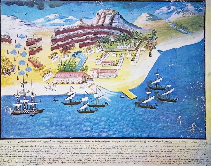
Ibrahim Pasha's army attacked the fortified mills in the late afternoon, in three columns along the Argos road, over the hill and from the Kiveri side. A few hundred Greeks under Dimitrios Ypsilantis, Makriyannis and…
-
1861
Two German archaeologists draw a plan of Lerna
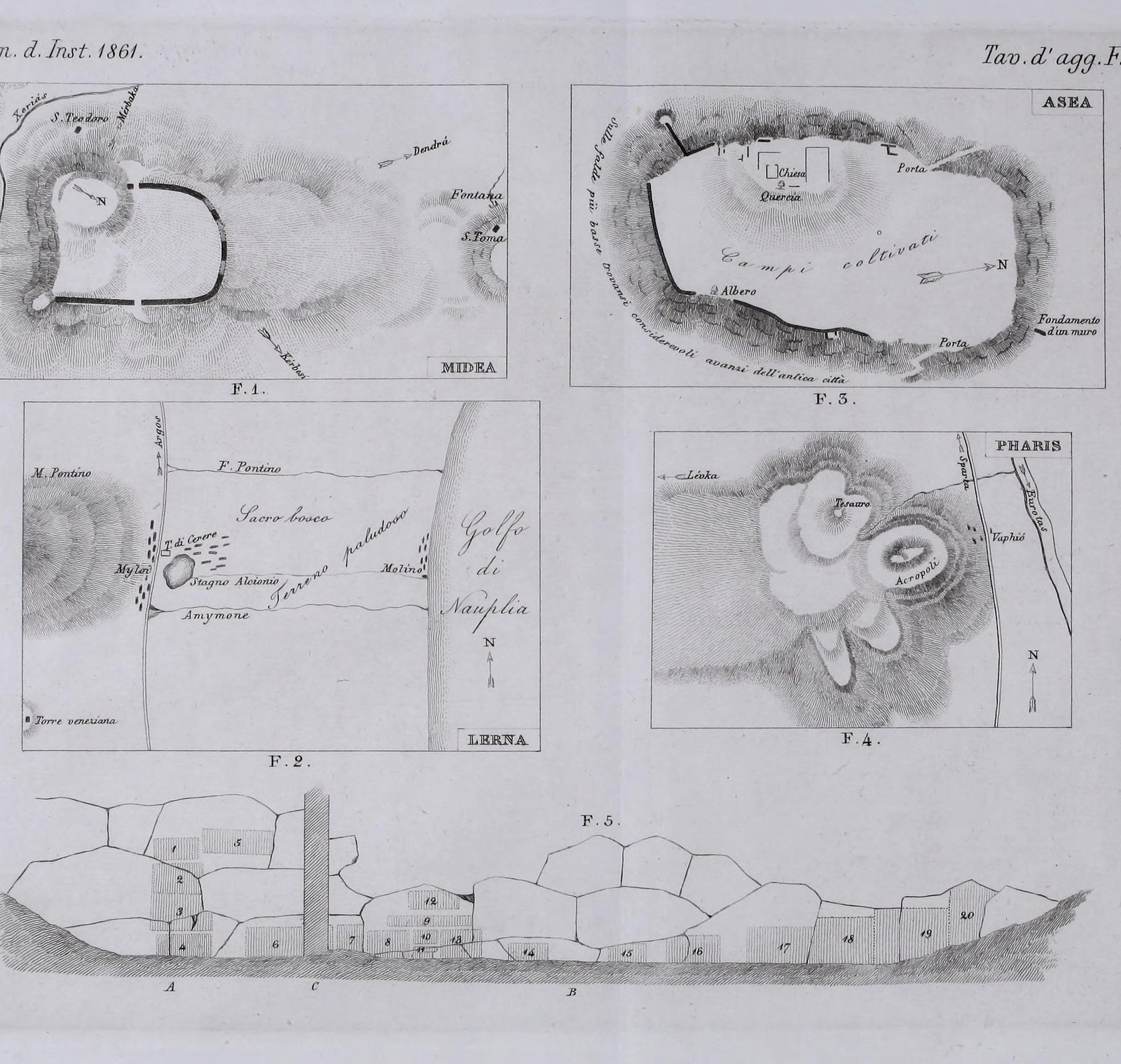
Alexander Conze and Adolf Michaelis published a plate of sketch plans from their travels in the Argolid, including a plan of the Lerna area with Mount Pontinos and the gulf.
-
1883
Baedeker: the 'Skala' with the most important mill
The German Baedeker guide of 1883 described Myli as a village stretching along the road at the foot of Pontinos. Below the road, near the chapel of Agios Ioannis, a mighty spring broke out. Part of the village, the…
-
9 August 1886
A big station: Myloi meant to be the port of the Peloponnese
A reporter wrote that Myloi station was built 'very spacious, with matching warehouses', because this harbour was to become the port of the whole Peloponnese. The station stood right opposite a 'very high ancient…
-
1908
Sailing directions: shallow water off Myloi
The Admiralty's Mediterranean Pilot of 1908 described Myli under Mount Pontinus. 'The shallow ground' prevented large vessels from coming close; the south wind was felt in full, though the holding ground was good. It…
-
1941–1942
A second German reconnaissance flight photographs the bay
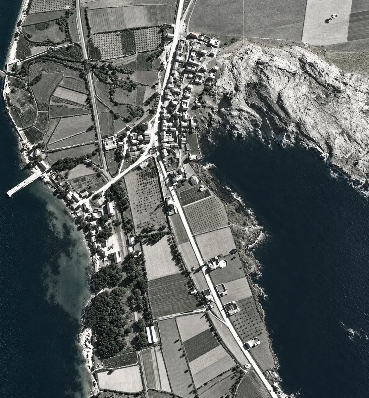
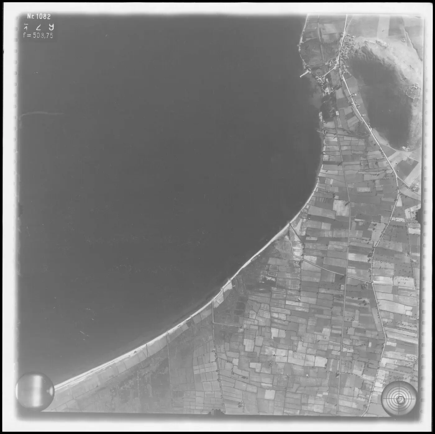
A German strip flight of 1941–1942 (film 93) photographed Myloi again: the curve of the bay, the village along the main road at the foot of Pontinos, the station and the pier.
-
26 April 1941
New Zealand 25th Battalion guards the approaches to Myloi
In Freyberg's new arrangement of 26 April 1941 one New Zealand battalion went north of Argos and one to Tripoli, while the 25th Battalion stayed in reserve at Myloi. Its companies took position between the village and…
-
1955
Graves just beyond the last houses of Myloi
The excavators also found a Geometric cemetery "a short distance beyond the southernmost houses of the village of Myloi", at the foot of Pontinos. Caskey's lists of the graves and their locations are kept in the Lerna…
-
1957–1959
The castle on Pontinos is measured and drawn
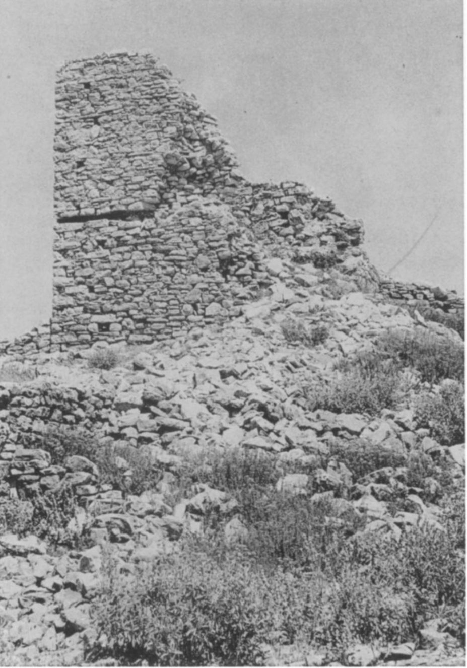
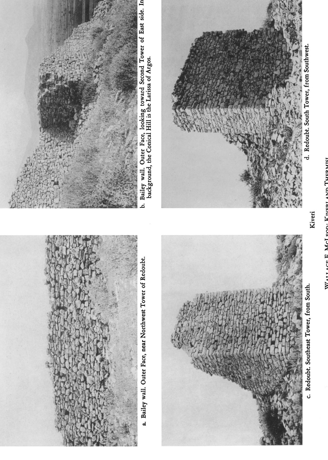
Wallace E. McLeod, a Norton Fellow of the American School who worked at Lerna in 1957–59, photographed and planned the castle on Pontinos and the Tower of the Princess. He published them in Hesperia in 1962 under the…
-
1960
The first pumping station of Lerna is built
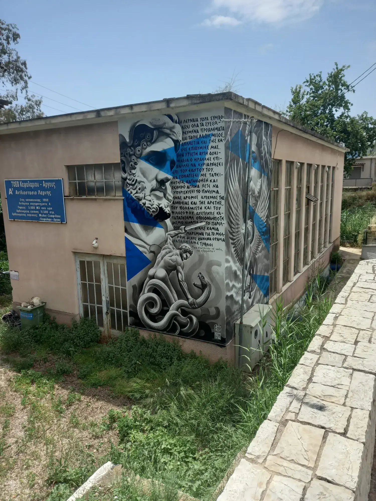
In 1960 the "Α' Αντλιοστάσιο Λέρνης" was built beside the main spring, on the Argos–Tripoli road. Its four pumps lift 5,000 m³ an hour, about as much as the spring gives, to irrigate 11,500 stremmata in Myloi, Skafidaki,…
People
- Pausanias Greek travel writer
- Gautier VI de Brienne Lord of Argos and Nauplia, titular Duke of Athens
- Marie d'Enghien Lady of Argos and Nauplia
- Francesco Vandeyk Venetian public engineer and mapmaker
- Alessandro Pini Author of a Venetian description of the Peloponnese (1703)
- Benjamin Brue Interpreter of the King of France at the Ottoman court, eyewitness of 1715
- Silahdar Damat Ali Pasha Ottoman grand vizier (1713–1716), conqueror of the Morea in 1715
- William Martin Leake British officer, topographer and traveller
- François Pouqueville French consul, traveller and historian
- G. D. Avramiotti Physician in Argos and critic of Chateaubriand
- Ioannis Makriyannis General of the Greek Revolution, politician and memoir writer
- Dimitrios Ypsilantis Commander in the Greek Revolution
- Konstantinos Mavromichalis Maniot commander in the Greek Revolution
- Ibrahim Pasha Commander of the Egyptian army in the Peloponnese
- Alexander Conze German archaeologist
- Adolf Michaelis German archaeologist
- Bernard Freyberg Commander of the New Zealand Division (1941)
- John Langdon Caskey Archaeologist, excavator of Lerna
Pictures
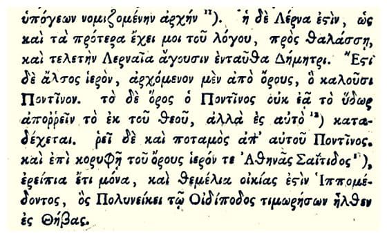
Pausanias’ own words about Lerna and Mount Pontinos (Description of Greece 2.36–37), in Greek, from an old printed edition. Visit Myloi collection
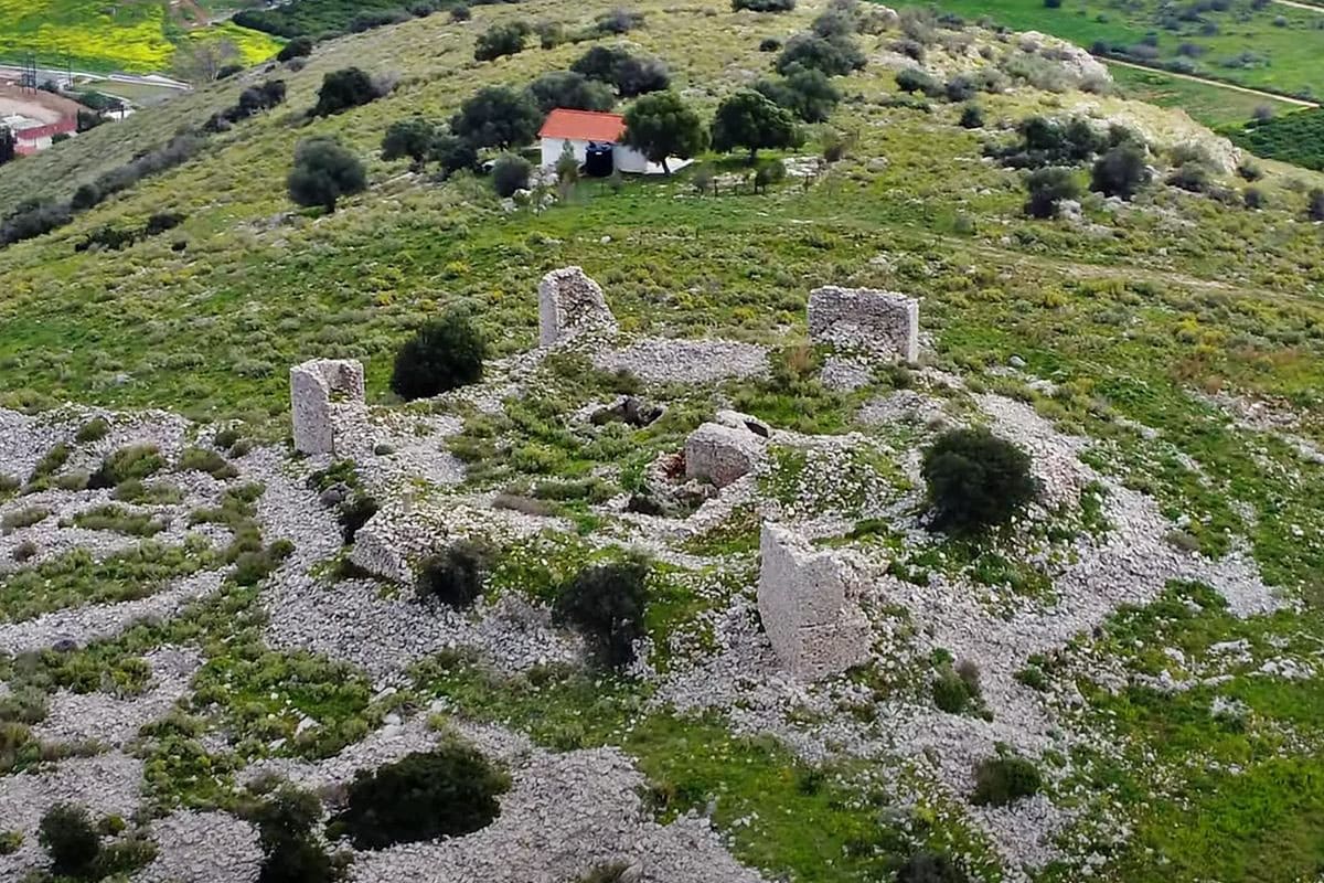
Aerial view of the ruined Frankish castle walls on Pontinos hill, with the white chapel of Profitis Ilias. Visit Myloi
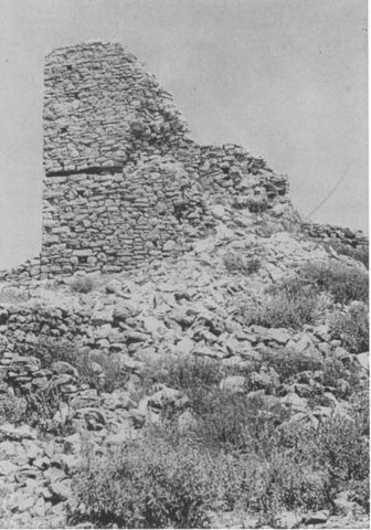
Pl. 114b 'Kiveri, Redoubt. Northwest Tower, from Northwest': the northwest tower of the redoubt of the castle on Mt Pontinos above Myloi, showing the line of a horizontal beam. Probably W.E. McLeod
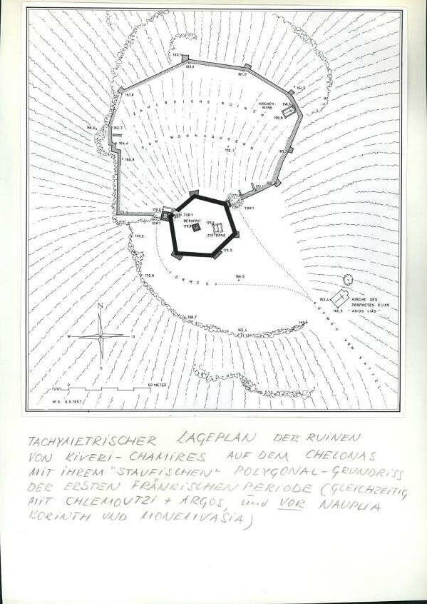
Inked plan of the ruins of Kiveri–Chamires, signed W.S., 5 August 1957, with the “Kirchenruine” in the outer ward and the church of Profitis Ilias below the redoubt. Plan W.S., 5.8.1957 (Schaefer papers, German Archaeological Institute, Athens; supplied by Visit Myloi)
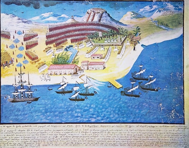
Panagiotis Zografos for General Makriyannis (c. 1836–39), plate 14: the Battle of the Mills (Myloi) near Nafplio, June 1825. Public domain
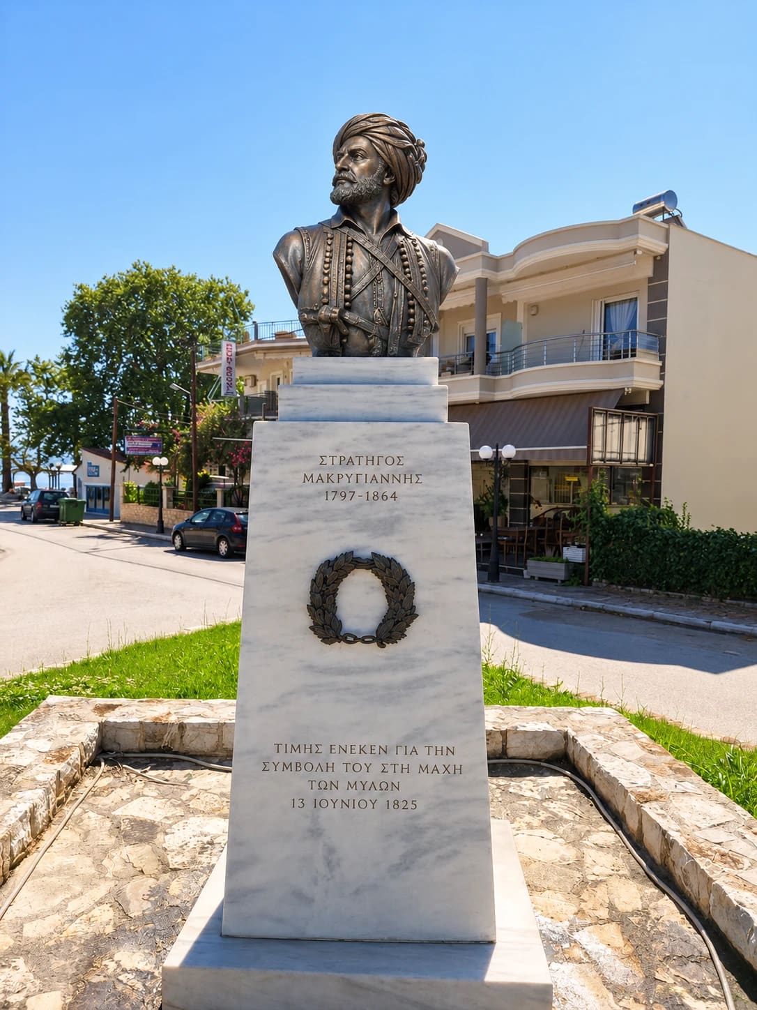
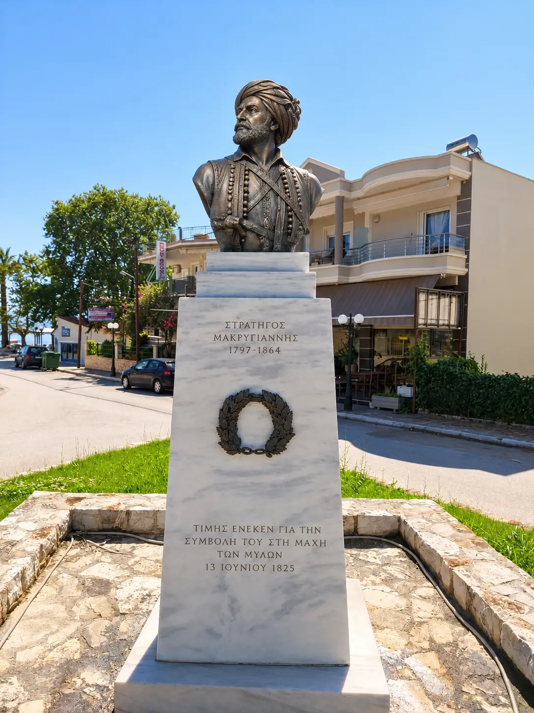
The bronze bust of General Makriyannis (1797–1864) in Myloi, on a marble pedestal “in honour of his contribution to the Battle of the Mills, 13 June 1825”. Visit Myloi
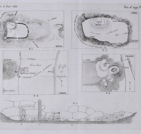
Plate of sketch plans by Conze & Michaelis, including a plan of the Lerna area with Mt Pontinos and the gulf. A. Conze & A. Michaelis
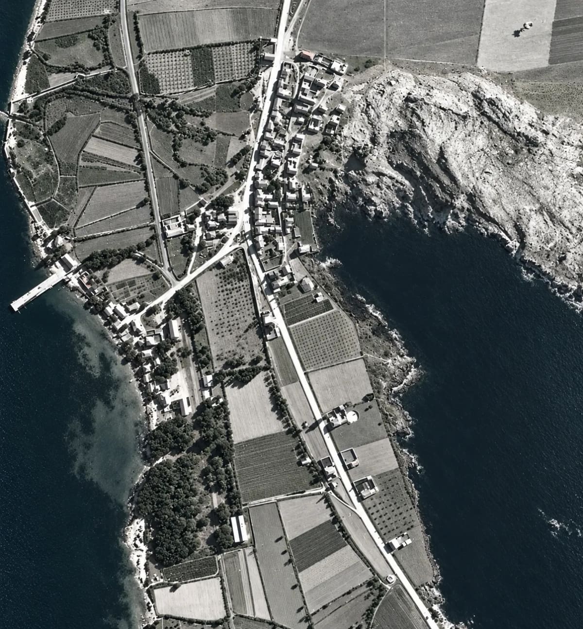
Myloi from a German reconnaissance flight, 1941–1942: the village along the main road, the pier, the station, the orchards and the rocks of Pontinos (digitally restored). Reichsluftfahrtministerium (Sonderluftbildabteilung); DAI Athens Archive
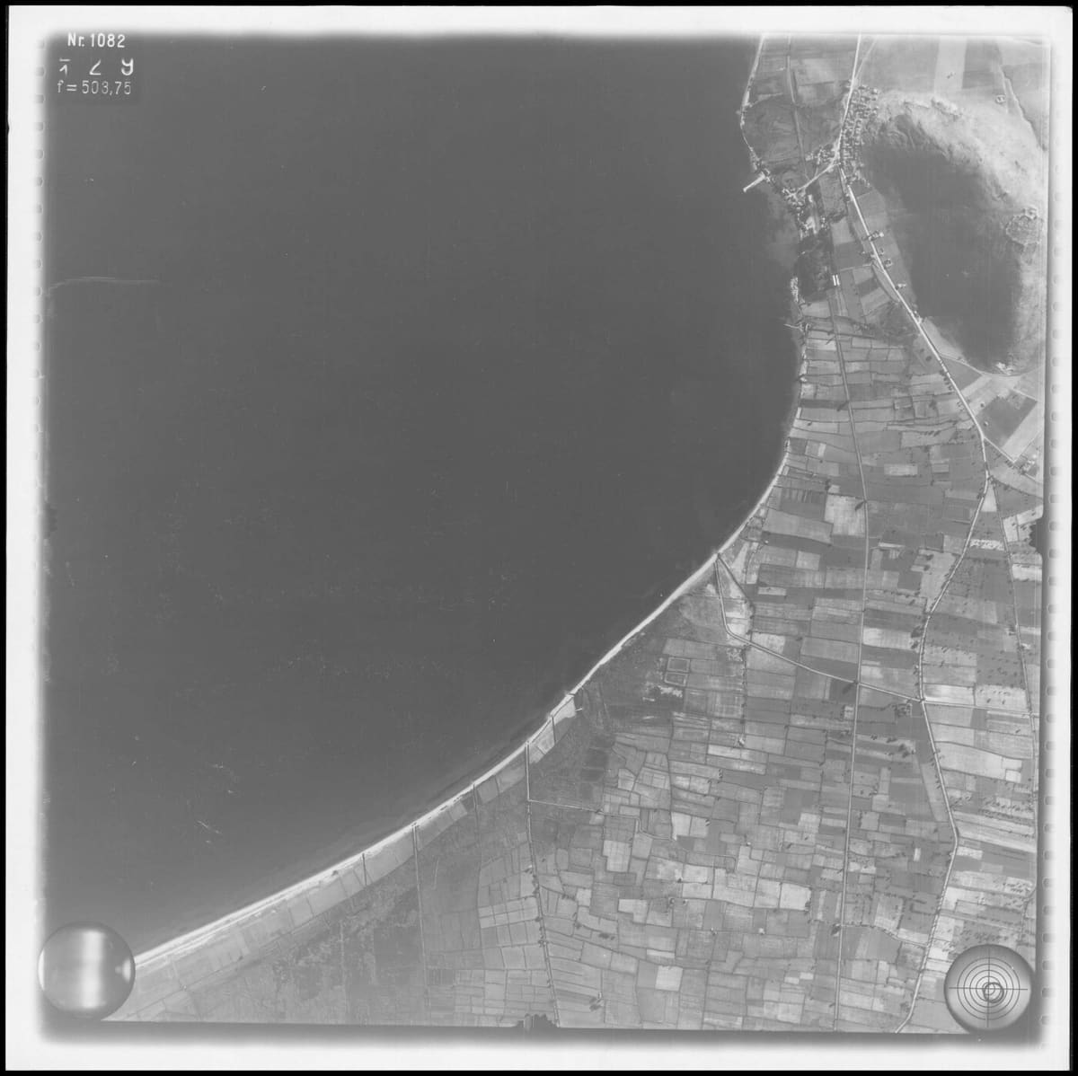
German strip flight 1941–42: the curve of the bay, the fields and the village at the foot of Pontinos. © D-DAI-ATH-Archiv, LB-RLM-SF-3-05-041, courtesy of the German Archaeological Institute, Athens
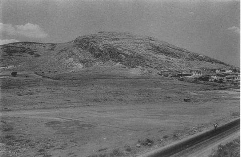
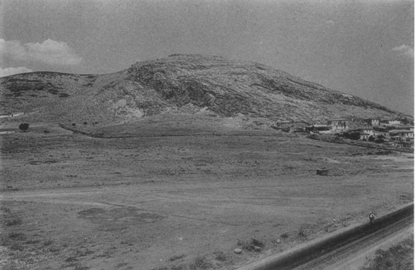
Mt Pontinos and the area of the Geometric cemetery from the south-east, with houses of Myloi and the road/railway. J. L. Caskey / ASCSA Lerna excavation
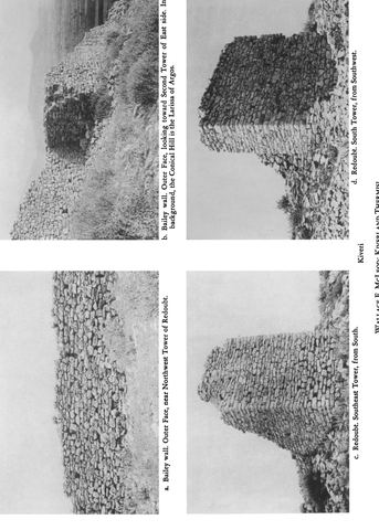
Full Hesperia 31 plate 115 (a–d): bailey wall and redoubt towers of the Pontinos castle ('Kiveri'), one with the Larissa of Argos in the background. W.E. McLeod
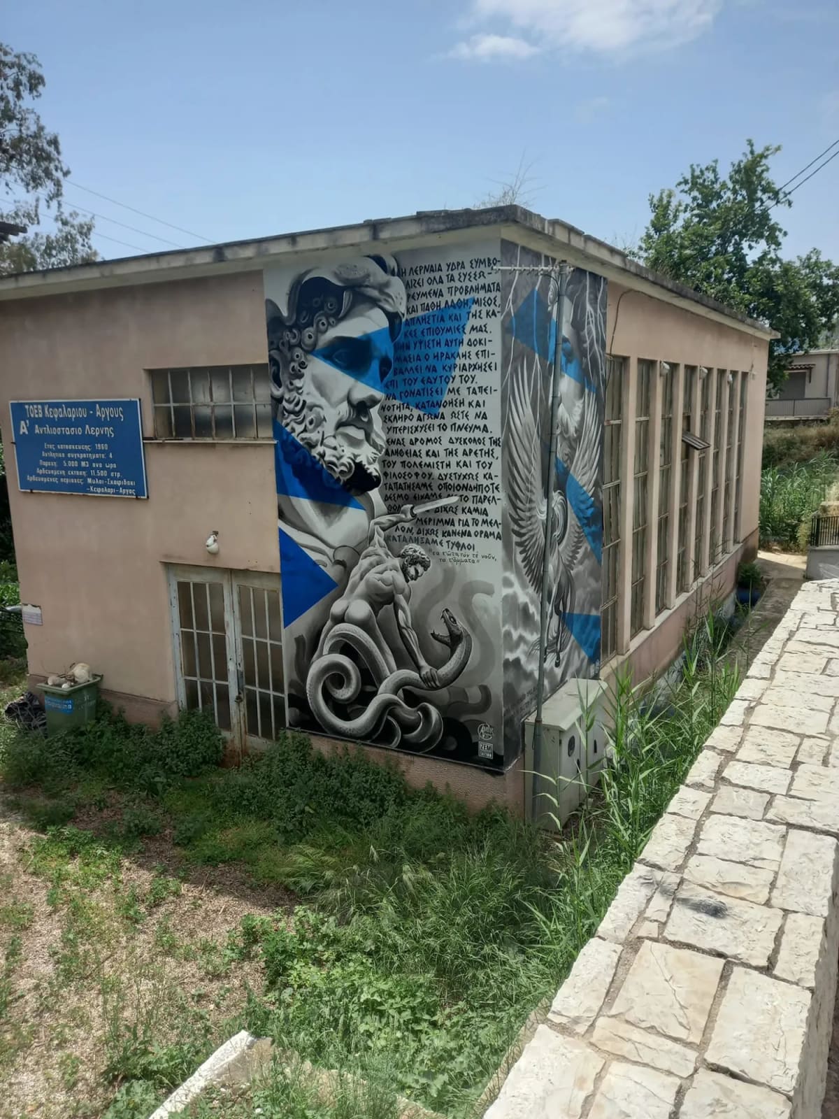
The 1960 pumping station of Lerna on the Argos–Tripoli road in Myloi, with its sign of the Kefalari–Argos irrigation board and the mural of Heracles and the Hydra. Visit Myloi