
The young kingdom · Travellers · Ancient Lerna
Two German archaeologists draw a plan of Lerna
1861 Proven
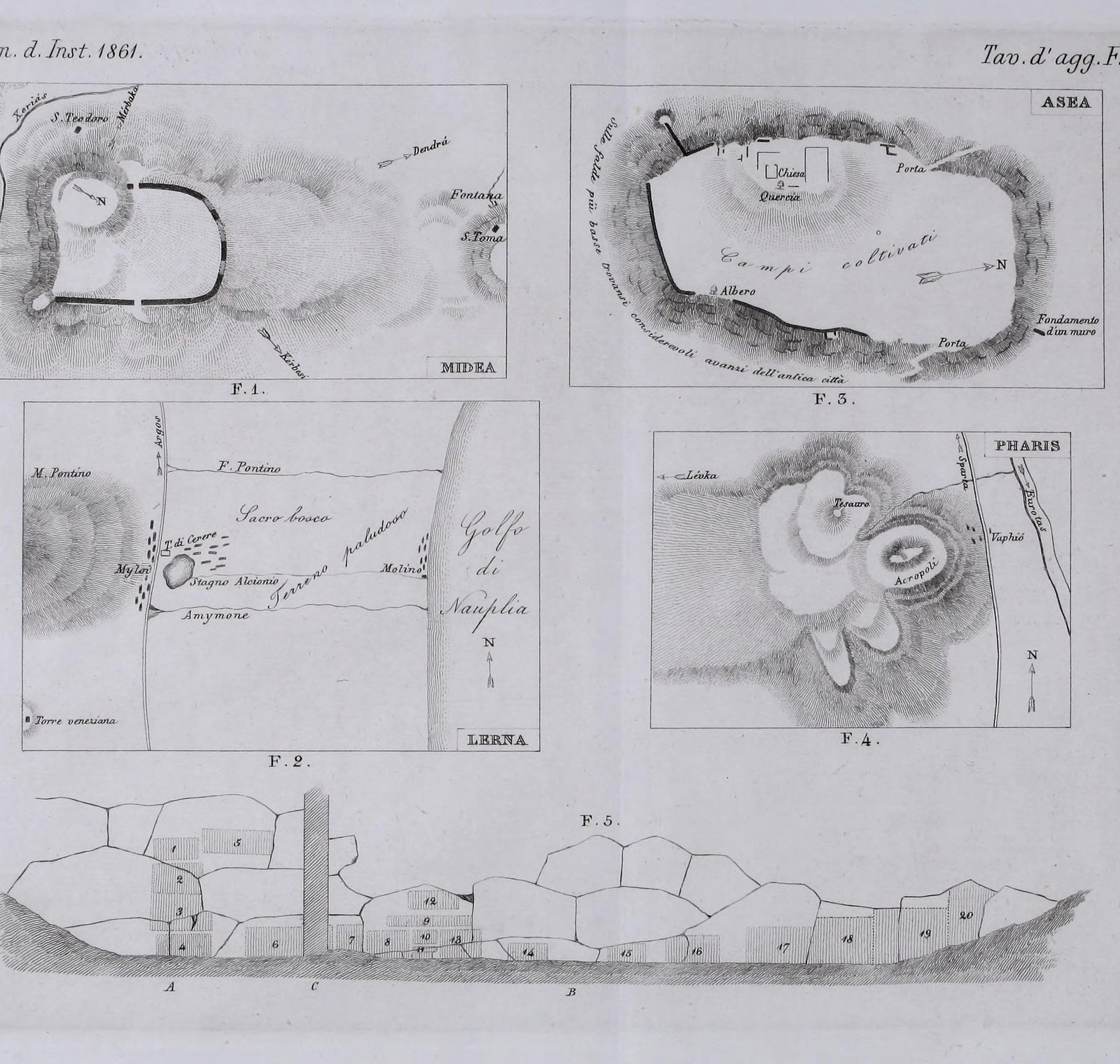
Alexander Conze and Adolf Michaelis published a plate of sketch plans from their travels in the Argolid, including a plan of the Lerna area with Mount Pontinos and the gulf.
- Threads
- Travellers, Ancient Lerna
- Certainty
- Proven confirmed by primary sources
Pictures
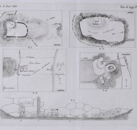
Plate of sketch plans by Conze & Michaelis, including a plan of the Lerna area with Mt Pontinos and the gulf. A. Conze & A. Michaelis
Sources
- A. Conze & A. Michaelis, plate of sketch plans (1861), Tav. F (Visit Myloi archive)
Also in this period
-
1839?
An English book shows the marsh of Lerna
Christopher Wordsworth's illustrated book on Greece, first published around 1839, includes a wood engraving of the 'Lernæan Marsh': water, plain and mountains, with travellers and a mule in the foreground. It is one of…
-
1858
'A landing-place, with a few poor houses'
The English scholar W. G. Clark went by boat from Nafplio to Myloi in one hour and twenty minutes, partly rowing and partly sailing. He found 'a landing-place, with a few poor houses about it', a pebble beach, quaking…
-
1869
An early photograph across the plain to Lerna
Baron Paul des Granges photographed the gulf of Argos from Tiryns 'in the area of the Lernaean marsh'. On the horizon the west coast of the gulf with Lerna and Myloi can be made out below the mountains. It is one of the…
-
1 April 1882
A Danish professor sees the spring by the chapel of Saint John
Travelling by carriage, Johan Louis Ussing wrote that the largest spring came out 'through seven openings by a small chapel of Saint John'. He also noted that at Myli the new carriage road turned west towards the…