Places
Archaeological site of Lerna
21 events
Show on a map (opens in a new tab)
-
6000 BC – 3200 BC
First farmers settle by the springs of Lerna
In the Neolithic, more than 6,000 years ago, farmers settled on a low rise beside the springs, just south of today's village. Each generation built on the ruins of the last, so the settlement mound of Lerna slowly grew.…
-
2500 BC – 2200 BC
The House of the Tiles
At the centre of Early Bronze Age Lerna stood a large two-storey building roofed with baked clay tiles and stone slabs. Rows of seal impressions found inside show that goods were stored and checked here, so it probably…
-
c. 1250 BC
Lerna is abandoned
Lerna stayed inhabited into the Middle Bronze Age. In the Mycenaean period the hill was used mainly as a cemetery and lived on only now and then, and around 1250 BC it was abandoned for good.
-
1861
Two German archaeologists draw a plan of Lerna
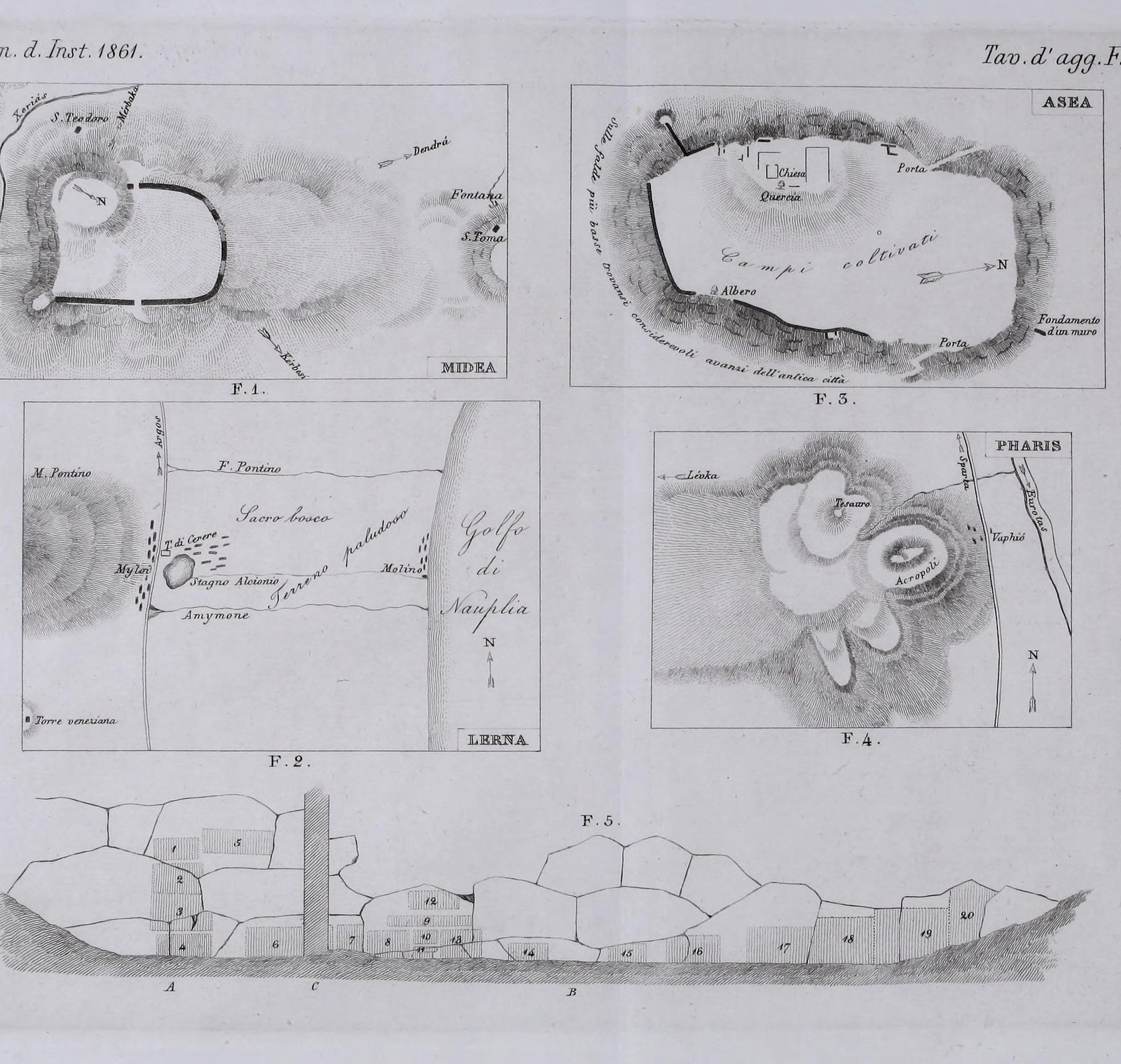
Alexander Conze and Adolf Michaelis published a plate of sketch plans from their travels in the Argolid, including a plan of the Lerna area with Mount Pontinos and the gulf.
-
13 July 1941
A German survey aircraft photographs Myloi from the air
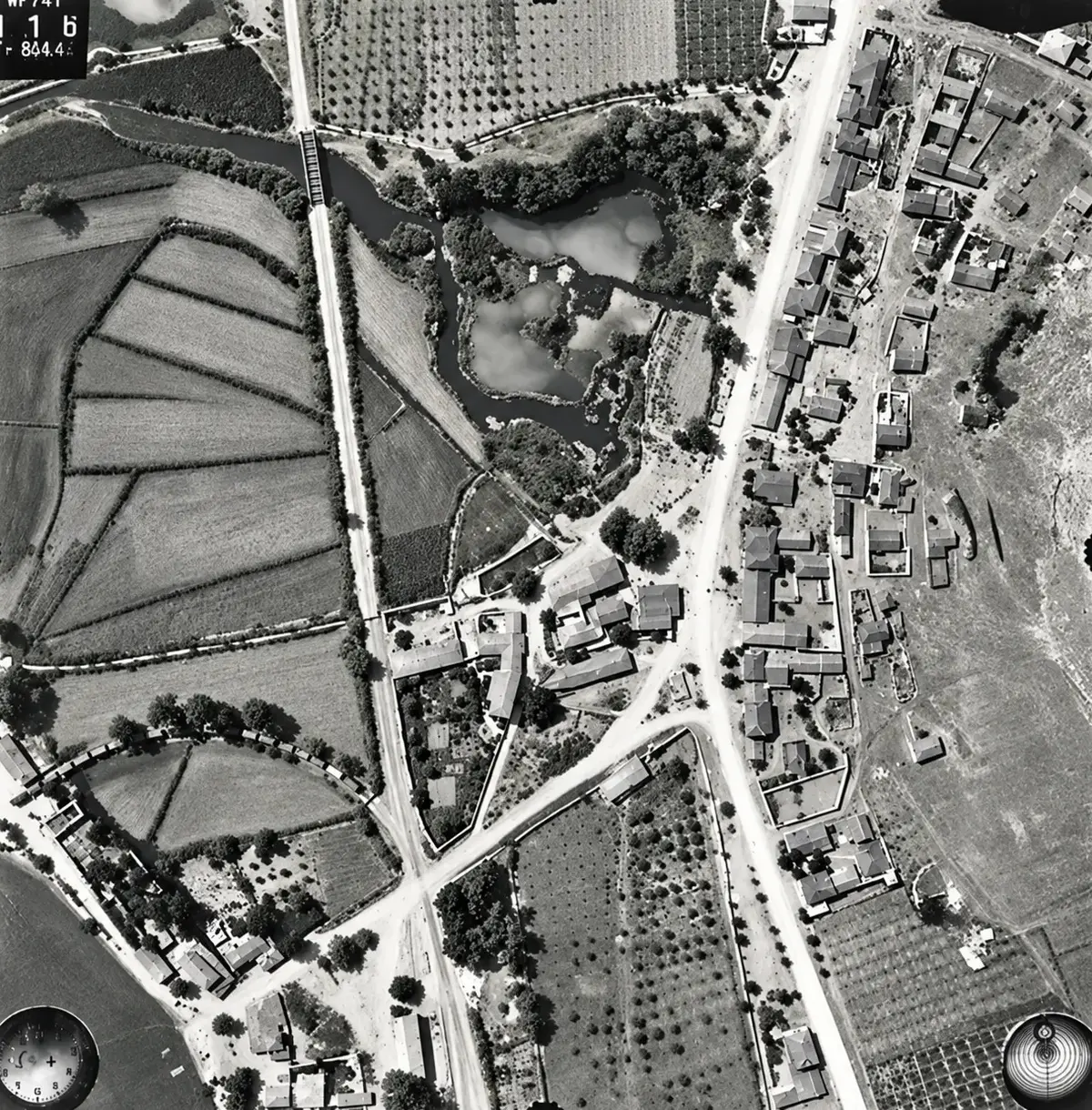
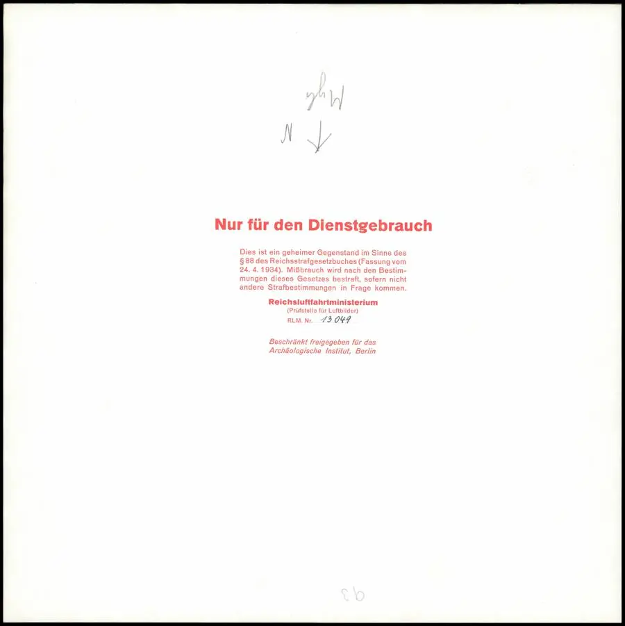
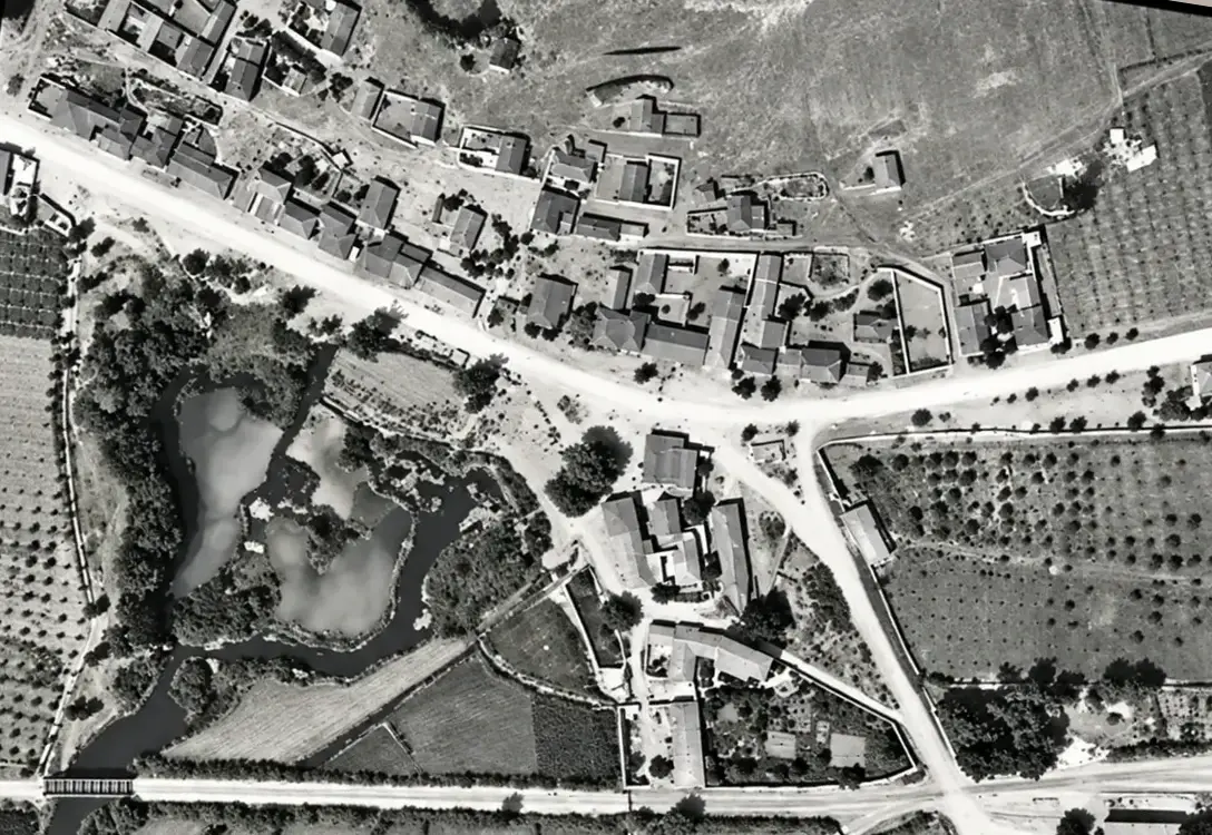
On the morning of 13 July 1941 an aerial survey unit of the German air ministry flew over Myloi at about a thousand metres with camera no. 741 pointing straight down. The photographs, a strip from north to south along…
-
1952
John Caskey starts digging at Lerna
In 1952 the American School of Classical Studies at Athens, led by its director John L. Caskey, opened the first trenches in the low mound by the springs, at the edge of Myloi. The work went on every year until 1958.
-
1952–1953
Caskey photographs the marshes of Lerna
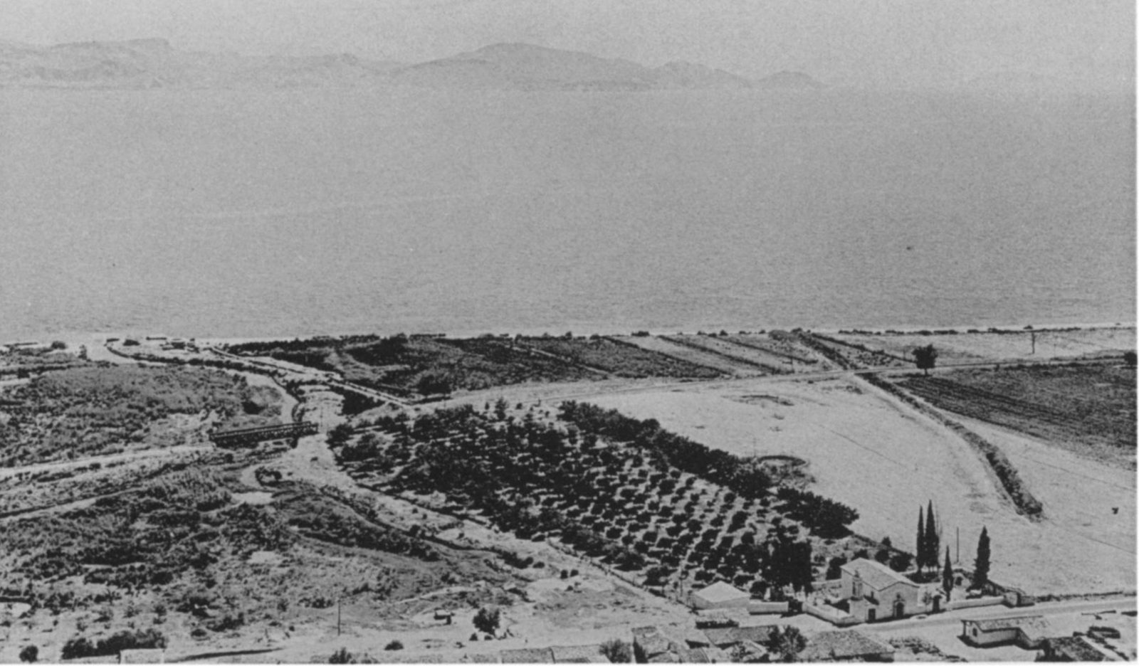
Caskey's first report shows the site from Mount Pontinos: marshes, the stream Amymone running from the spring to the gulf, orchards and the railway. It is one of the best pictures of the water landscape just before the…
-
1953
A trench right beside the railway
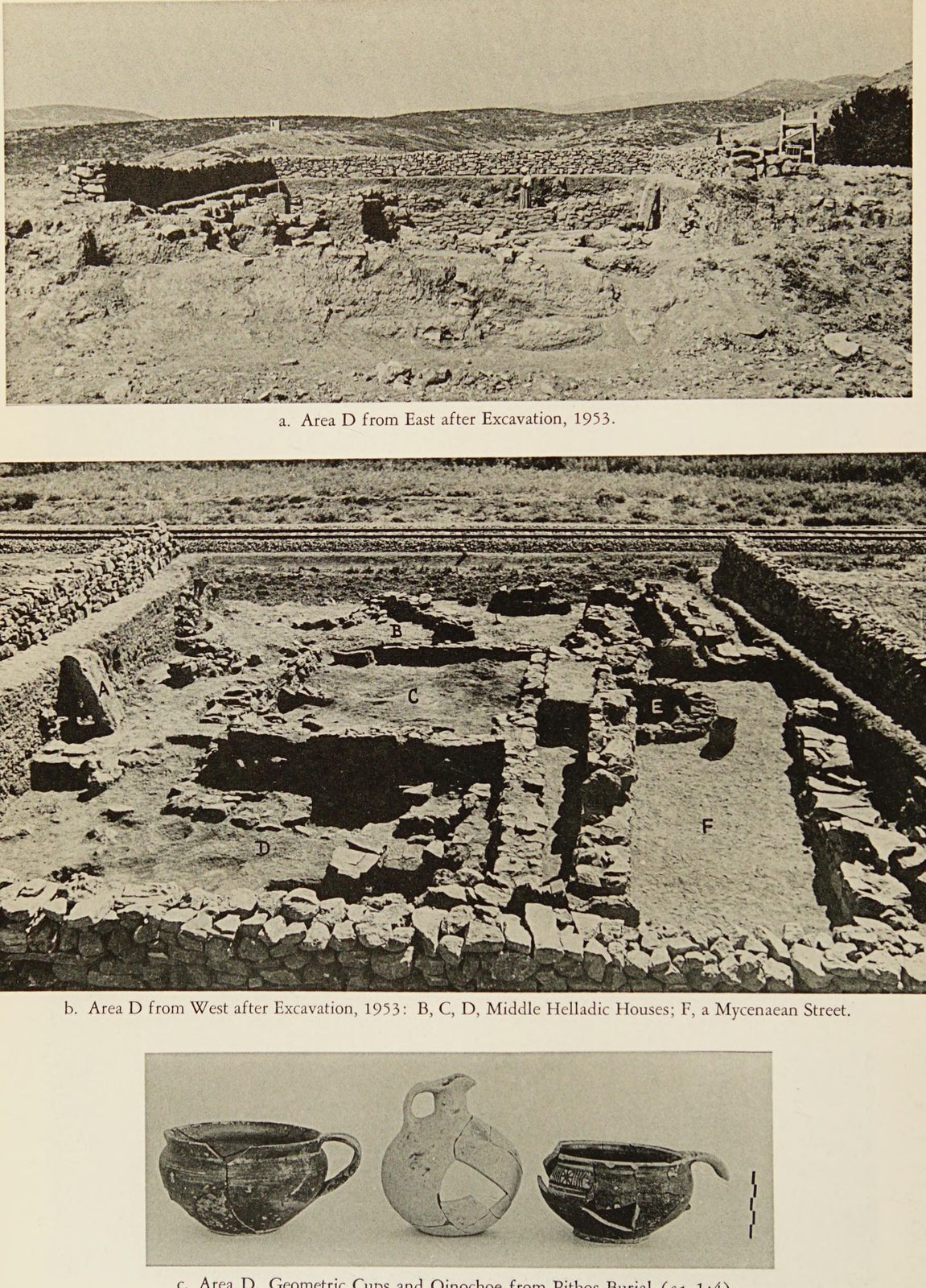
In 1953 the diggers opened Area D right next to the Argos–Myloi railway, so trains passed only a few metres from the trench. The plates in Hesperia show both the ancient walls and the tracks.
-
1954
The House of the Tiles comes to light
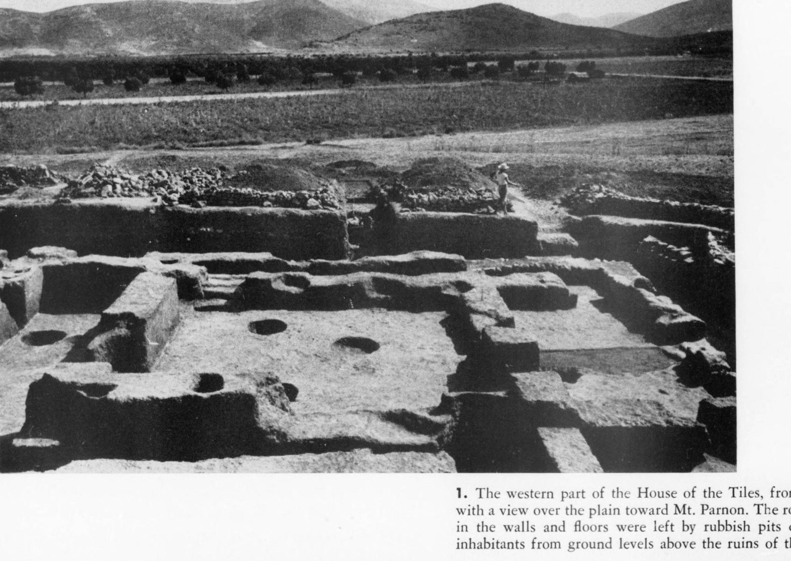
By the summer of 1954 a large part of the House of the Tiles was exposed: a big Early Bronze Age building (around 2500–2200 BC) whose roof had been covered with baked clay tiles. Caskey published the first photographs in…
-
1954
Forty people on the dig, the staff living in Myloi
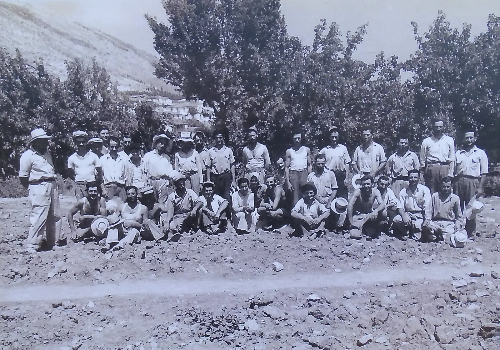
In 1954 the team photographed itself: some forty people, archaeologists and workmen, many of them probably from the village. That season the staff lodged in Myloi, among them the field architect Lloyd Cotsen and the…
-
1955
Graves just beyond the last houses of Myloi
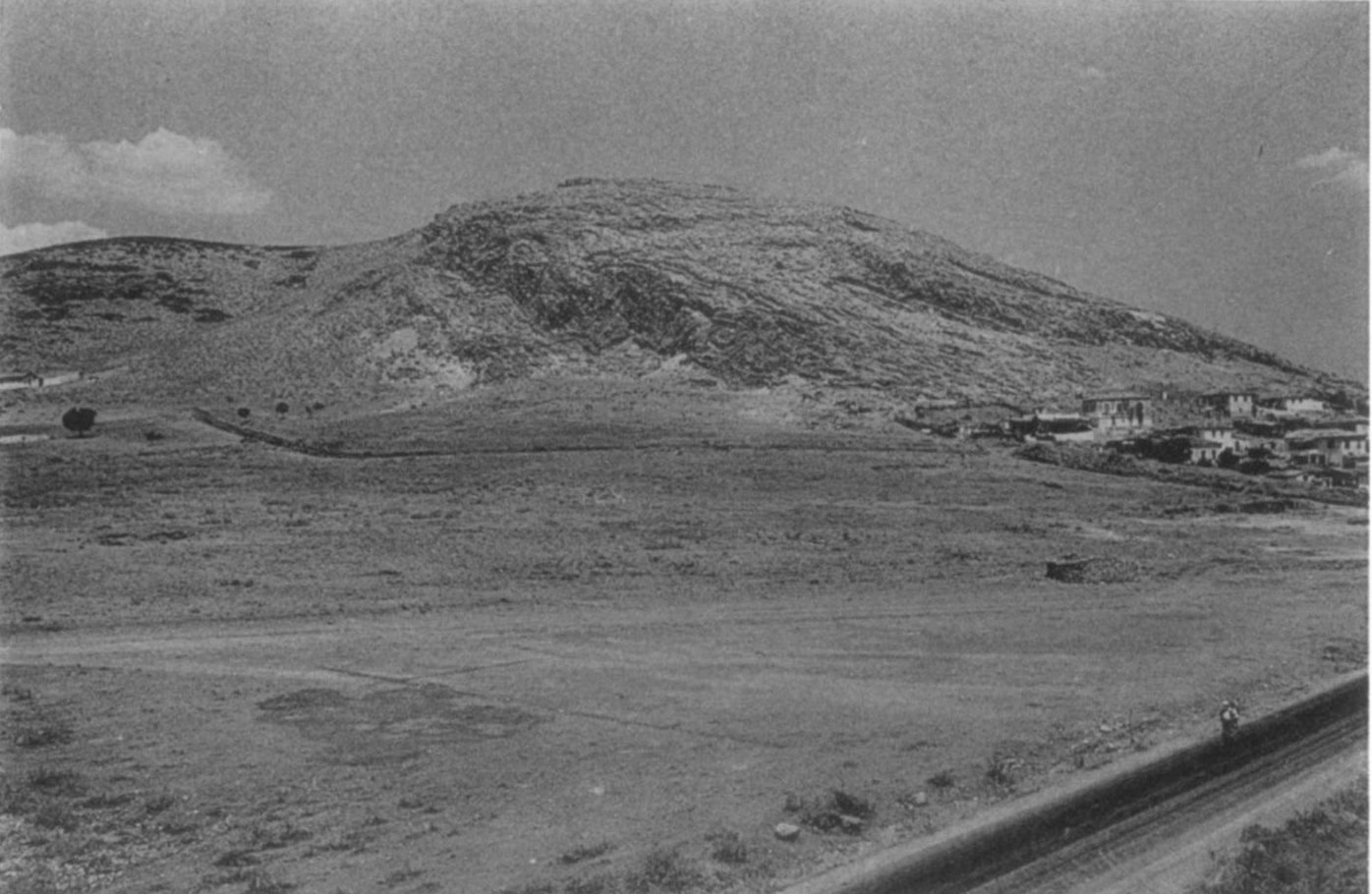
The excavators also found a Geometric cemetery "a short distance beyond the southernmost houses of the village of Myloi", at the foot of Pontinos. Caskey's lists of the graves and their locations are kept in the Lerna…
-
1956
Young George Bass digs at Lerna
In 1956 the American student George F. Bass worked at Lerna, where he was photographed holding a large pot in a trench. He later became one of the founders of underwater archaeology.
-
1957
Land around the site is expropriated
The records of the American School contain a 1957 file of documents about land expropriations at Lerna, which bordered the fields and orchards of Myloi. The file has not yet been studied, so the owners and the…
-
12 January 1957
Lerna in the Illustrated London News
On 12 January 1957 the Illustrated London News printed an article by Caskey about Lerna, with an aerial photograph of the mound and a view of the House of the Tiles. Readers across the world could now see the place by…
-
June 1957 – September 1957
A roof over the House of the Tiles
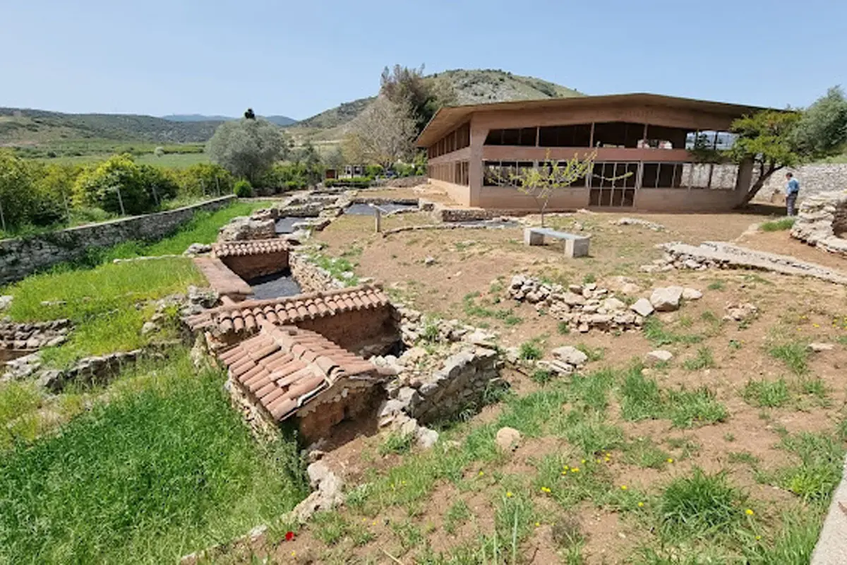
Between June and September 1957 a large protective shelter was built over the House of the Tiles, so the mud-brick walls could stay visible. The roof still stands at the site today.
-
July 1957
Alison Frantz photographs the excavation
In July 1957 the photographer Alison Frantz made the official pictures of Lerna for Hesperia. One shows the site from the north-west with the railway and the sea, another from the east with Myloi and Pontinos behind.
-
1958
Machteld Mellink photographs Lerna in colour
In 1958, the last digging season, the archaeologist Machteld J. Mellink took colour slides of the Early Bronze Age walls and the fortification of Lerna III, already under small tiled roofs. The slides are kept at Bryn…
-
30 June 1959
The village council makes John Caskey an honorary citizen
By unanimous decision no. 45 the council of Myloi declared the American archaeologist John Caskey an honorary citizen, for services to culture and to tourism in the community. It was signed by president Chr. Papagiannis…
-
2 July 1959
Lerna is handed over to the Greek state
On 2 July 1959 Caskey handed over the excavated site and the finds, now displayed in the museum of Argos, to the Greek Archaeological Service. He gave the key of the shelter to Ioannis Papadimitriou, in the presence of…
-
1968
An aerial photo of Lerna and Myloi
Very probably in June 1968 the Jesuit photographer Raymond V. Schoder flew over the gulf and photographed Lerna and Myloi from the east: the shelter over the House of the Tiles, the village, the railway and the orchards.
-
1977
A guidebook for visitors to Lerna
In 1977 the American School published the short guide Lerna in the Argolid for visitors to the site by Myloi. A revised edition followed in 1997; the photographs used for both are kept in the Lerna archive.
People
- John Langdon Caskey Archaeologist, excavator of Lerna
- Alexander Conze German archaeologist
- Adolf Michaelis German archaeologist
- Lloyd E. Cotsen Field architect at Lerna
- George F. Bass Archaeologist, worked at Lerna in 1956
- Alison Frantz Archaeologist and photographer
- Machteld J. Mellink Archaeologist and photographer of Lerna (1958)
- Christos Papagiannis President of the community of Myloi
- Ilias Papoulias President of the community of Myloi
- Ioannis Papadimitriou Director of Antiquities, received Lerna in 1959
Pictures
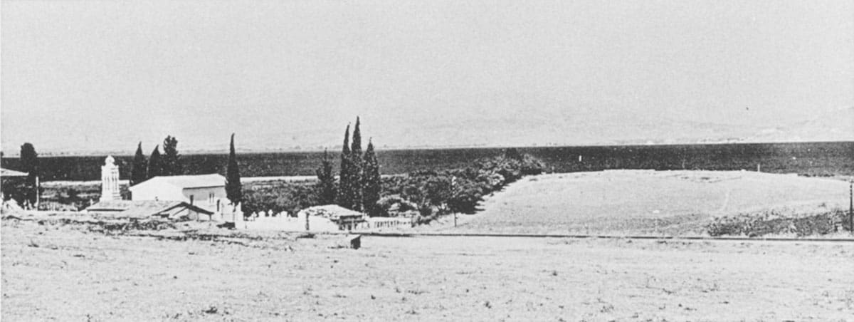
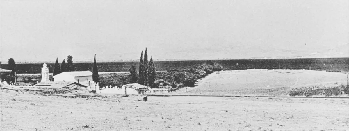
The mound of Lerna from the west, with the church and cypresses, early 1950s. J. L. Caskey, Excavations at Lerna, 1952–1953
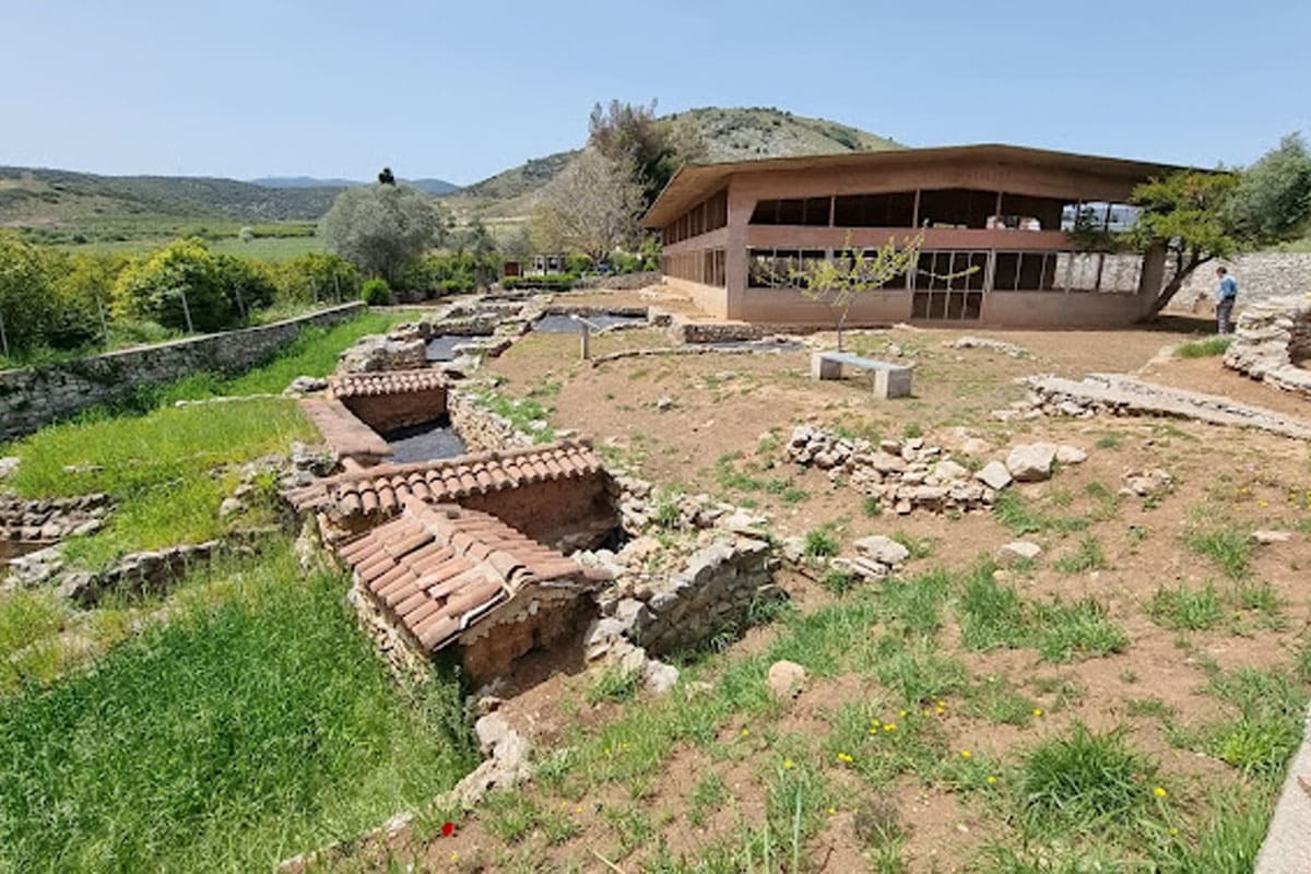
The archaeological site of Lerna with the protective roof over the House of the Tiles. Visit Myloi
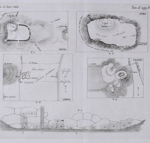
Plate of sketch plans by Conze & Michaelis, including a plan of the Lerna area with Mt Pontinos and the gulf. A. Conze & A. Michaelis
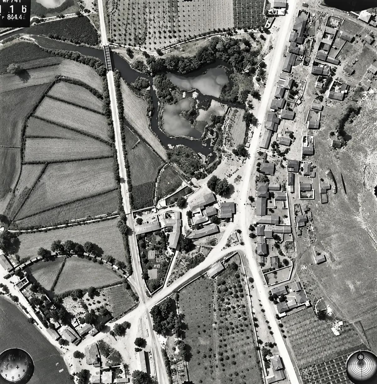
German aerial photograph of Myloi, 13 July 1941 (frame 116) (digitally restored). © D-DAI-ATH-Archiv, LB-RLM-EB-5-11-017, courtesy of the German Archaeological Institute, Athens
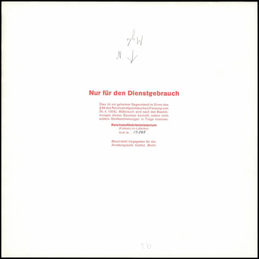
Back of a 1941 aerial print with the pencilled name Myli and a release stamp to the Archaeological Institute in Berlin. © D-DAI-ATH-Archiv, LB-RLM-SF-3-05-042, courtesy of the German Archaeological Institute, Athens
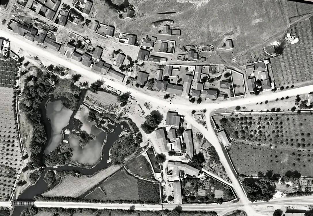
The heart of Myloi from the air on 13 July 1941: houses along the main road, the spring ponds of Lerna, orchards and the railway bridge (digitally restored). Reichsluftfahrtministerium (Sonderluftbildabteilung); DAI Athens Archive
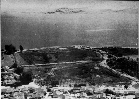
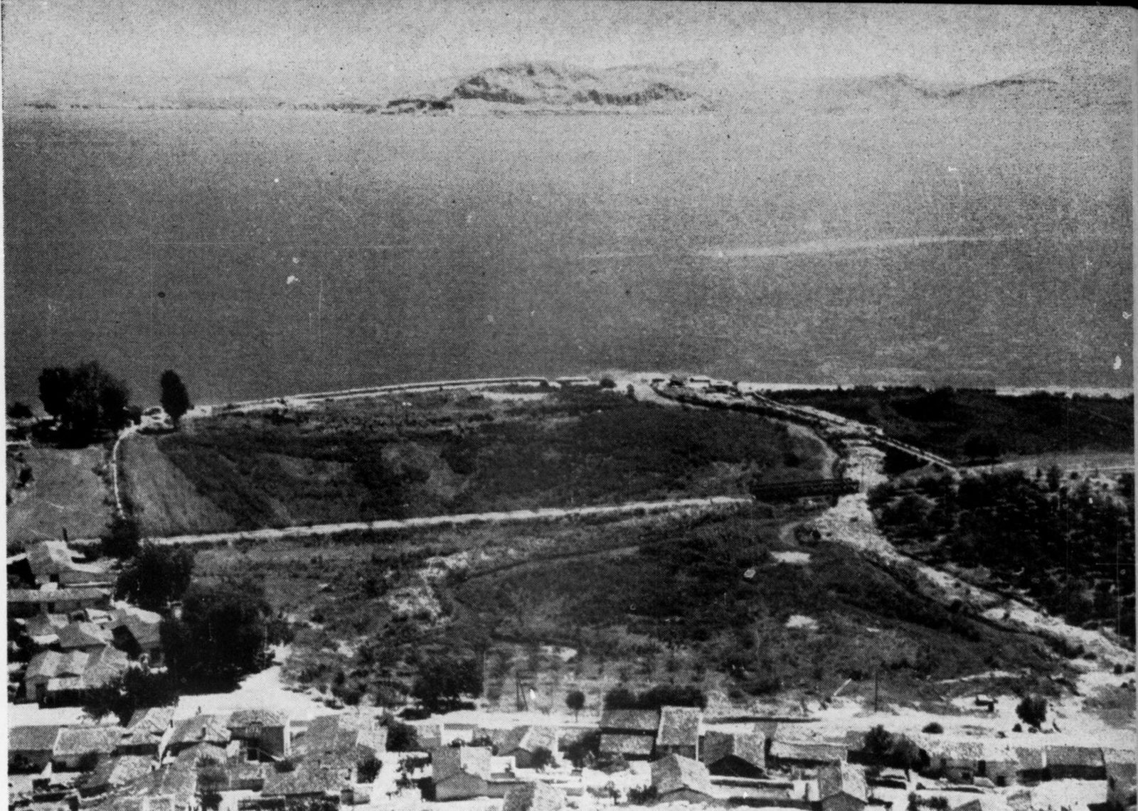
View east from Mt Pontinos over the roofs of Myloi towards the springs and marshes of Lerna, the gulf and Nafplio. J. L. Caskey excavation (photographer not named)
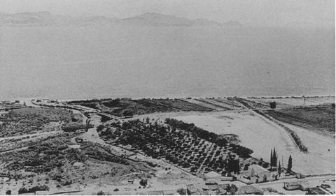
The Lernaean marshes, the Amymone stream and the excavation site seen from Mt Pontinos, with houses of Myloi, the railway and orchards. J. L. Caskey / ASCSA Lerna excavation
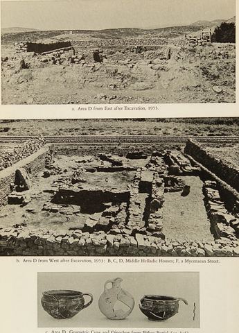
Hesperia plate showing excavation Area D at Lerna, with the Argos–Myloi railway right beside the trench, plus pottery. J. L. Caskey / ASCSA Lerna excavation
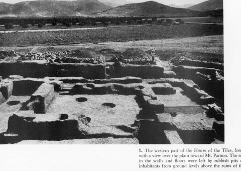
The western part of the House of the Tiles at Lerna from the north, with a view over the plain with olive groves, a dirt road and the mountains, and an excavation worker on the edge. J.L. Caskey, Archaeology 8.2 (1955) p. 116, fig. 1
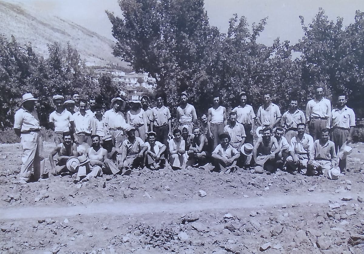
The staff who worked on the excavation at Lerna with the American School of Classical Studies in 1954: some forty people, standing and kneeling on bare ground below the trees and the hill. George Kondis
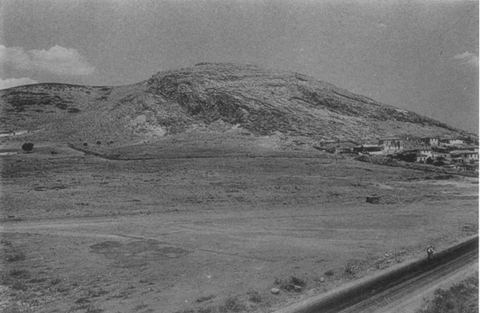
Mt Pontinos and the area of the Geometric cemetery from the south-east, with houses of Myloi and the road/railway. J. L. Caskey / ASCSA Lerna excavation