
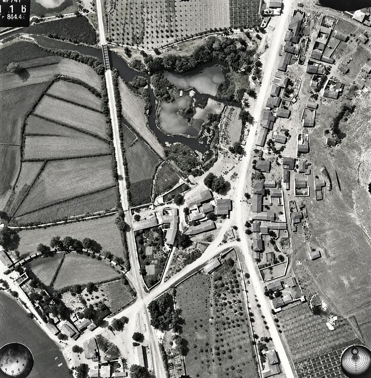
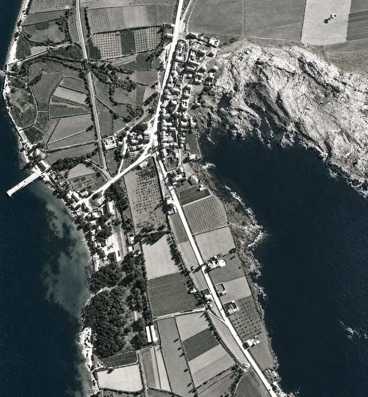
In the archive of the German Archaeological Institute in Athens lies a set of photographs taken from an aeroplane above Myloi on a summer morning in 1941. They were meant for archaeologists studying Lerna. They also give us the clearest picture we have of our village at one of the most dramatic moments in its history.
This is a story about two aircraft over the bay of Myloi in 1941. The first was a British flying boat, which carried a general away from the pier on 26 April. The second was a German reconnaissance plane, which took the photographs eleven weeks later. We also show two photographs taken on the beach in 1945. Together they tell the story of a small village by the sea, and of a pier that is still there.
Aircraft 1: the general's flying boat
25–26 April 1941. At the end of April 1941 the Allied defence of mainland Greece was collapsing. For one long day, the war was run from an olive grove at Myloi.
On 24 April the evacuation of Greece was in full swing. Thousands of soldiers waited at Nafplio and Tolo for the ships that came in at night. Myloi had a different role. It lay on the road from the plain of Argos to Tripoli and Kalamata, which made it a natural place to gather troops, park vehicles under the trees and direct traffic south.
Early on 25 April, Major-General Bernard Freyberg of the New Zealand Division was already on his way to “a new headquarters near Miloi”. A large Australian column spent that day dispersed around the village and left at eight in the evening for Tripoli and Kalamata.
In the night of 25 to 26 April, General Henry Maitland Wilson, commander of all British and Commonwealth forces in Greece, left Athens by car. He crossed the bridge over the Corinth Canal about two hours before dawn and drove on to Myloi.
“Wilson's and Freyberg's headquarters, both now at Miloi.”
Gavin Long, Australian official history, on the morning of 26 April 1941
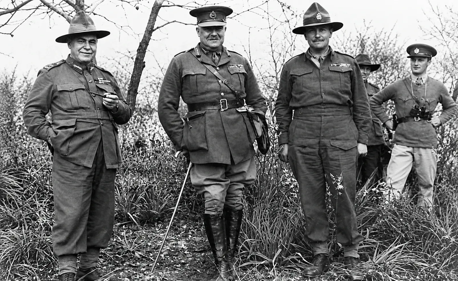
The report of the British rear admiral H. T. Baillie-Grohman describes what he found when he arrived at half past five that Saturday morning. The headquarters was hidden in an olive grove, where the trees gave cover from the German dive bombers that now ruled the sky. Wilson, his staff and several British and Greek dignitaries were already there. Among them, according to later accounts, was Prince Peter of Greece.
It was a bad day. German aircraft were active all morning and the radio connections kept failing. Shortly after seven, German paratroopers landed at the Corinth Canal and seized the crossing. The headquarters at Myloi was suddenly cut off from everything north of the canal. Freyberg reorganised the defence: one New Zealand battalion north of Argos, one at Tripoli, and the 25th Battalion at the western approaches to Myloi.
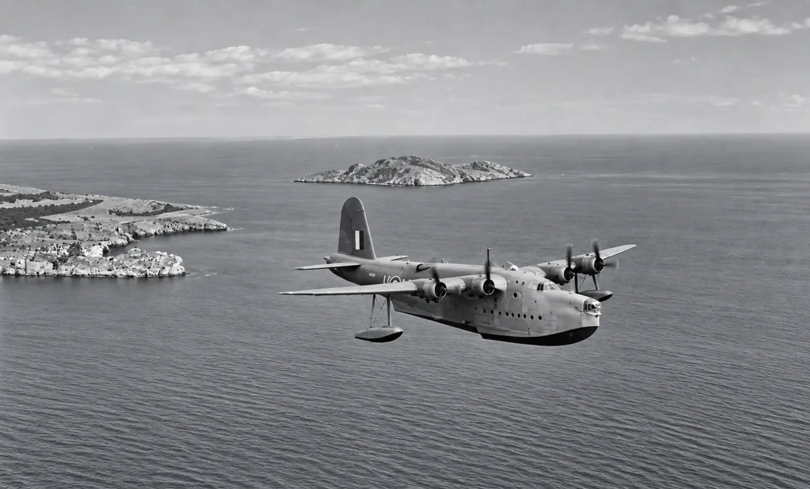
Later that day Wilson told Freyberg that he would leave that night and that Freyberg would take command of all troops left in the Peloponnese. At sunset the command post was abandoned. The party walked down to the pier at Myloi, where a flying boat, a Short Sunderland, had landed in the bay. Wilson went aboard and flew to Souda Bay on Crete. When the destroyer HMS Nubian called at “Myli” during the night to collect him, the general had already gone.
The last days of April
- 24 April: evacuation from Nafplio and Tolo; more than 6,000 men leave in one night.
- 25 April: Freyberg sets up a headquarters near Myloi; an Australian column of about 600 vehicles waits in and around the village.
- 25/26 April: Wilson drives from Athens to Myloi through the night.
- 26 April, 05:30: Baillie-Grohman arrives at the headquarters in the olive grove.
- 26 April, 07:15: German paratroopers land at the Corinth Canal.
- 26 April, sunset: Wilson leaves from the pier by Sunderland flying boat for Crete.
- 26/27 April: HMS Nubian reaches Myloi and finds him gone.
26 or 27 April? Many books say Wilson left Myloi “on 27 April”. British naval records date a night operation as one event, “night 26/27 April”. The sources point to departure on the evening of 26 April.
Aircraft 2: the camera over Myloi
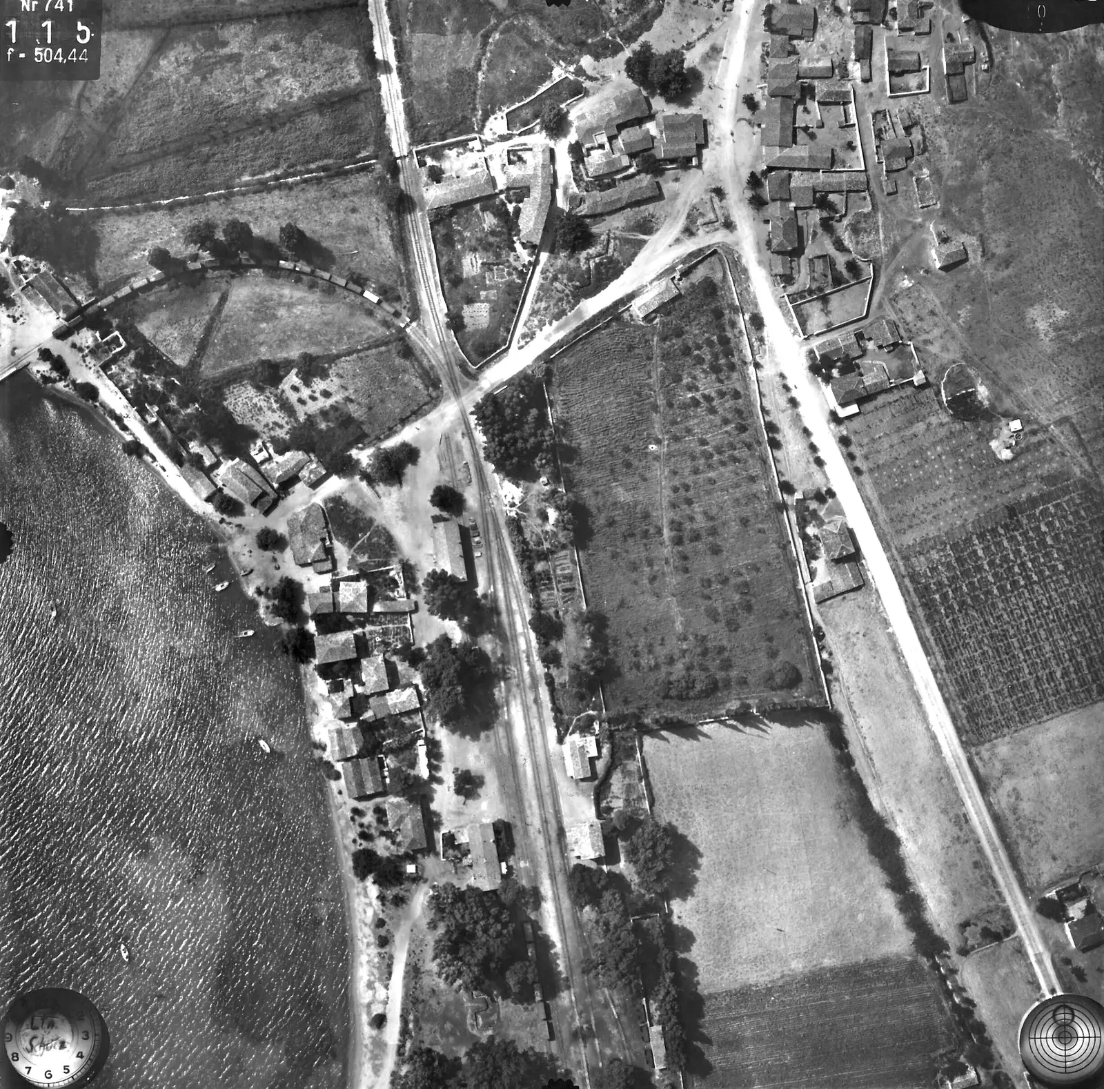
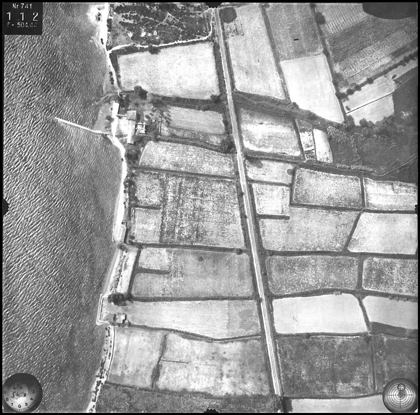
13 July 1941, between 10 and 12 o'clock. On the morning of 13 July 1941 a German aircraft flew low over Myloi, its camera pointing straight down. By then the region had been under occupation for more than two months.
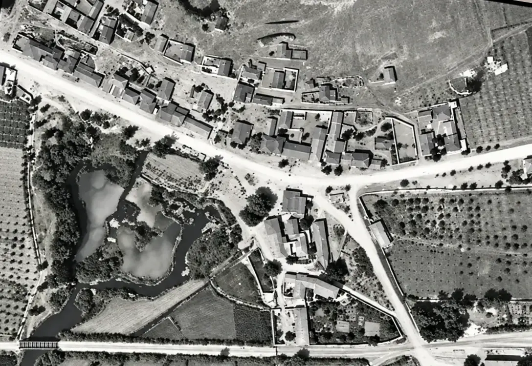
The photographs were taken by a special aerial survey unit of the Reichsluftfahrtministerium, the German air ministry, from about a thousand metres up. The same camera, number 741, photographed Mycenae and Nemea on the same flight. The prints were classified, but a stamp on the back shows that they were released, with restrictions, to the Archaeological Institute in Berlin. The archaeologists were interested in Lerna, the prehistoric site at the southern edge of the village.
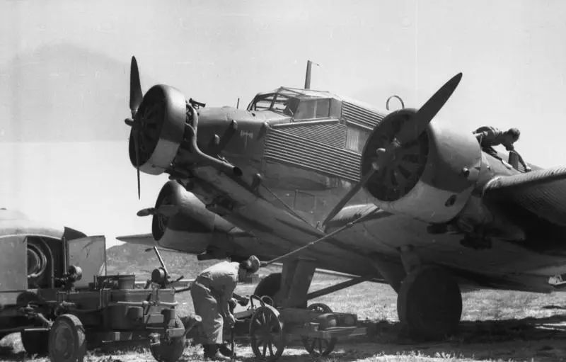
In July 1941 Myloi lay in the Italian zone of occupation. Italy was responsible for most of the Peloponnese and began to fortify the coast of the Argolid against possible Allied landings. German soldiers were still present in the region: German administrative offices were based in Argos, and the airfield at Koutsopodi was in German hands.
Eleven weeks earlier General Wilson had left from the pier here. Now a German camera looked down on the same village, the same olive groves and the same pier.
Where the railway met the sea
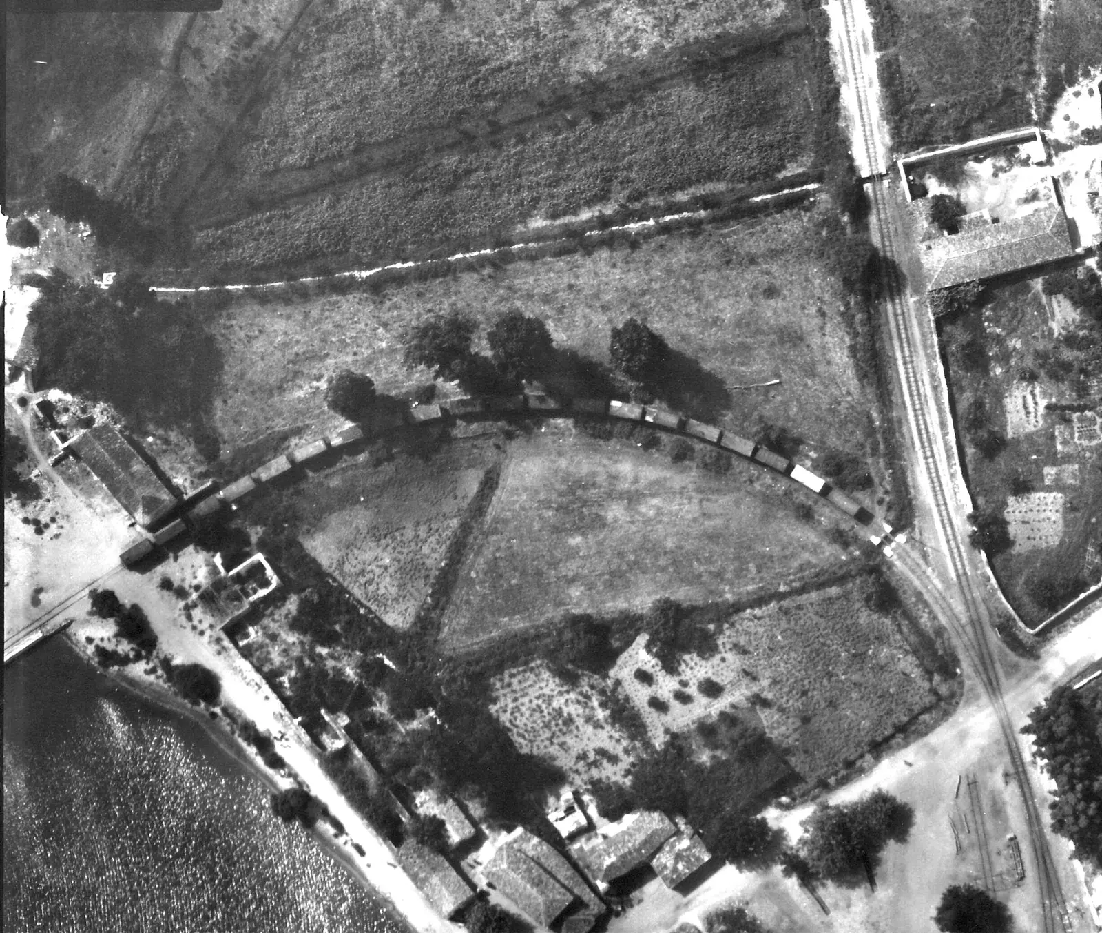
When the railway from Argos reached Myloi in 1886, the tracks ran all the way to the pier of the small harbour. Goods and passengers changed here between boat and train, and for a few years travellers from Nafplio to Tripoli came across the bay by boat to catch the train. In 1947, with the bridge at Corinth still destroyed, new railcars for the Peloponnese were landed at this pier straight from a navy landing craft.
In 1941 this pier was the obvious place to bring a small boat alongside, close to the road, the station and the olive groves. It is the most likely place where Wilson's party went aboard. A second, smaller jetty further north, which still exists today, is the other candidate.
A village among fields
Anyone walking through Myloi today sees a seaside village of houses, roads, orchards and tavernas. The 1941 photographs show a different landscape, yet much of today's village is already there.
A small village
What strikes you first is how small Myloi was. The houses stand mainly along the main road and in small groups near the coast. There are no residential neighbourhoods. Right behind the houses the farmland begins: long rectangular plots, smaller fields and rows of trees. Where houses and gardens stand today, there were fields and orchards in 1941.
The railway
The railway runs through the landscape as a sharp straight line, beside the main road to Argos and the interior of the Peloponnese. On one frame a row of wagons curves from the station towards the harbour. For a farming village the train was a lifeline to carry produce to market. Trains stopped running in 2010, but the old line and the station buildings are still there.
Lerna and the springs
Directly south of the village lie the springs of Lerna: open water, wet meadows and irregular vegetation, crossed by the railway on a small iron bridge. The famous prehistoric site does not yet look the way visitors know it. The American excavations that uncovered the House of the Tiles only began in 1952. These photographs show the ground before it was dug.
An empty coast
Along much of the shore there are hardly any buildings. Small roads and paths link the scattered houses to the main road. Fields and natural vegetation run almost down to the sea in several places. Beach bars, hotels and holiday homes came only in the decades after the war.
Coming back to the beach
In May 1945, four years after the evacuation, an Australian war photographer travelled through the Peloponnese to record the places where Australian soldiers had fought and waited in 1941. In Myloi a local resident showed him the beach and the row of eucalyptus trees under which the soldiers had sheltered.
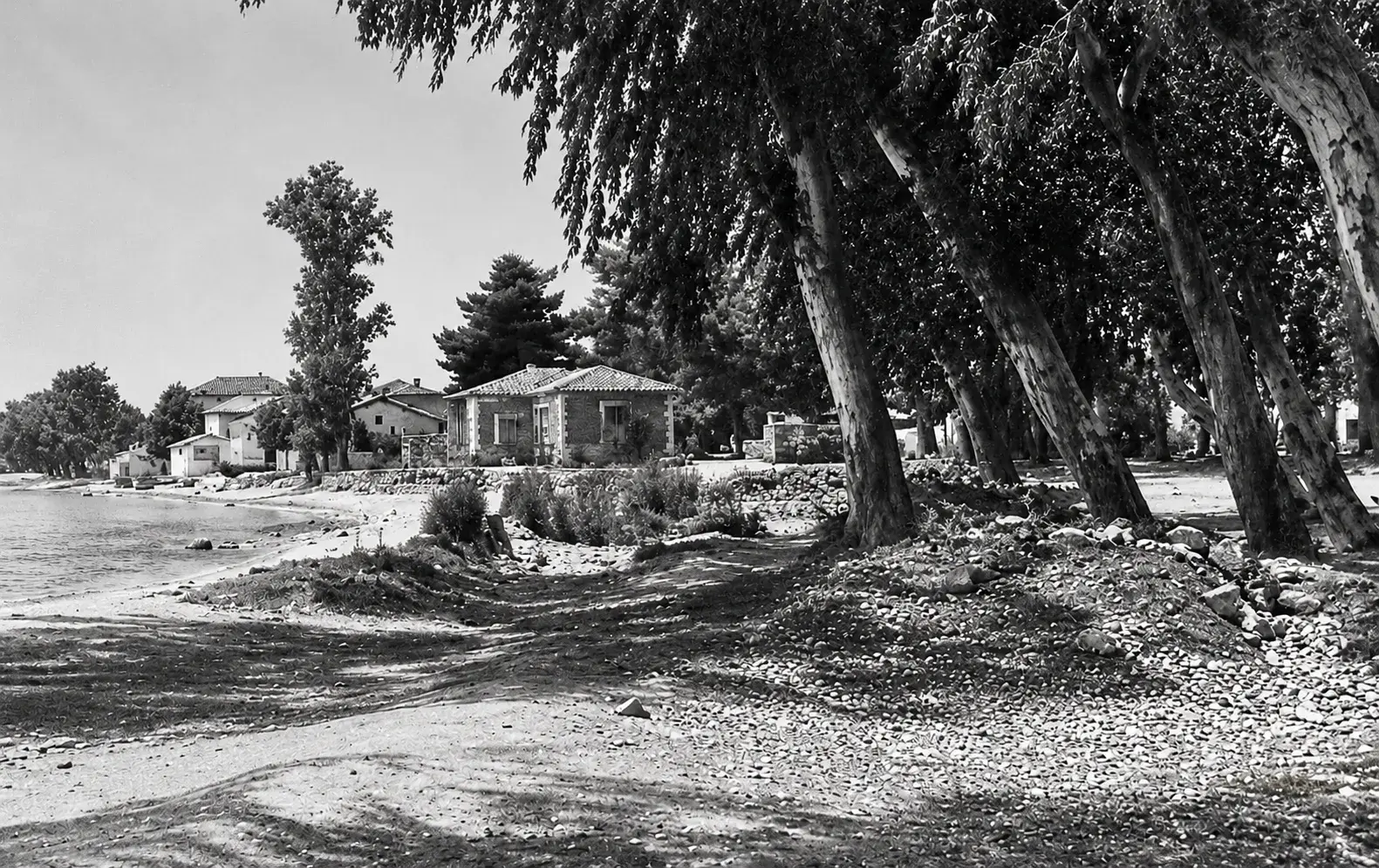
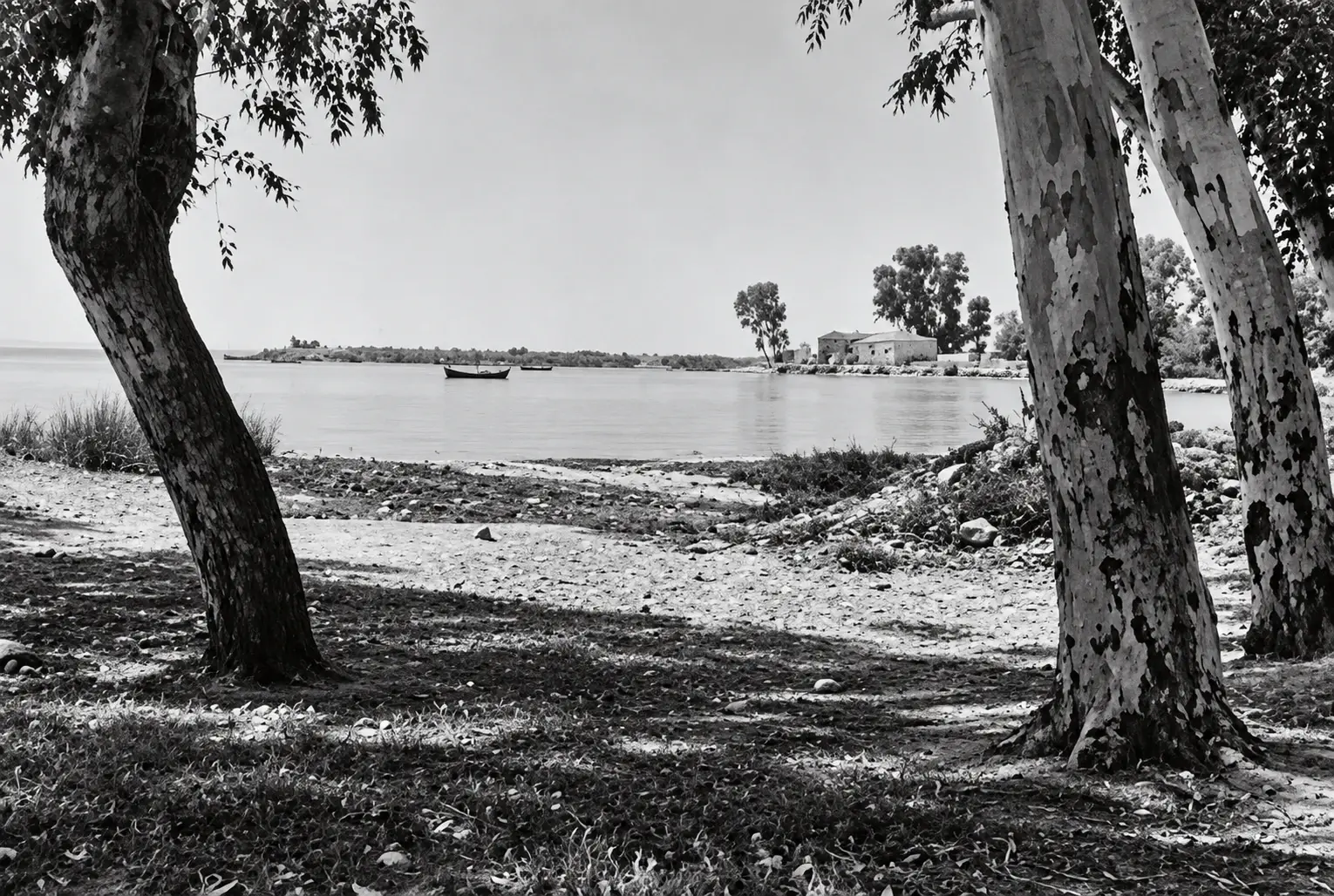
The pictures are quiet. A dusty road, a small house, tall trees by the water. Nothing tells you what happened here, except the caption. No ruins, no monument: a beach, a row of trees and a story told by someone from the village.
What you can still see
Put the old photographs next to a modern satellite image and the village turns out not to have been built on a blank sheet. The coastline, the main road, the railway line, the pier and many field boundaries are still where they were in 1941. Old farm tracks have become village streets and open fields have become gardens. Walk from the station to the pier and you follow the same route as Wilson's party on the evening of 26 April 1941.
The exact location of the olive grove is still unknown. Perhaps a reader can help.
Sources and credits
- Aerial photographs 1941: reproduced with kind permission of the German Archaeological Institute, Athens (D-DAI-ATH-Archiv): Film 14, LB-RLM-EB-5-11-004, -010, -017. Also film 14, exposures 015 and 116 (detail), and the strip flight of 1941–1942, film 93, exposure 042.
- Beach, 1945: Australian War Memorial 130831 and 130887, photographer V. J. Krauth. Public domain.
- April 1941: Gavin Long, Greece, Crete and Syria (Australian official history), ch. 7; report of Rear Admiral H. T. Baillie-Grohman; C. Shores, B. Cull and N. Malizia, Air War for Yugoslavia, Greece and Crete.
- Railway and harbour: Ephorate of Antiquities of Argolida, Acquaintance with the history of Myloi: Myloi Railway Station.
All photographs remain the property of the holding archives; please contact them before any reuse.
Do you have old photographs of Myloi? Family pictures, school photos, the harbour, the station, the beach: we would love to see them and add them to the village's story.