
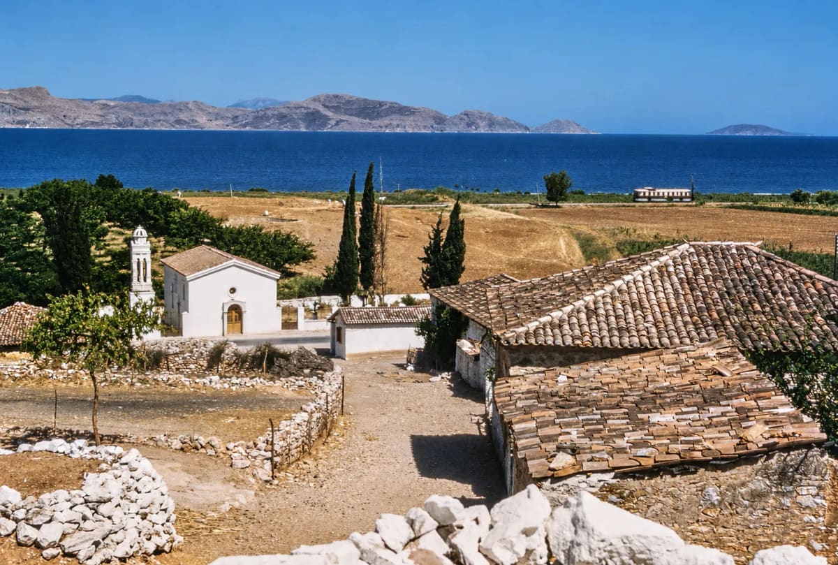
Zdjęcie: Courtesy of Harvard Fine Arts Library, Digital Images & Slides Collection
Opowieści
Dawne zdjęcia Myloi
Pocztówki, rodzinne fotografie, zdjęcia szkolne i lotnicze: wieś taka, jaka była kiedyś.
Zdjęcia: 219 · Daty z „ok.” są szacunkowe. Wiesz coś więcej o zdjęciu albo masz stare fotografie Myloi? Daj nam znać.
Przed 1940 (33)
-
Powiększ:
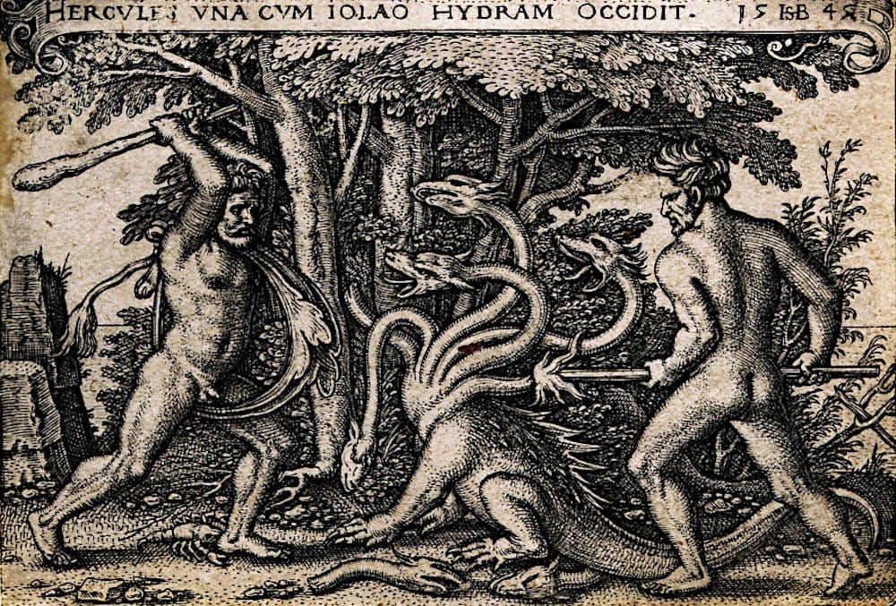
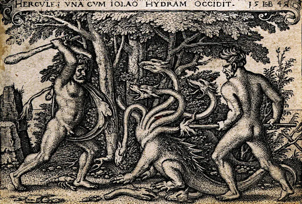
1545
Szesnastowieczna rycina przedstawiająca Heraklesa i Iolaosa walczących z wielogłową Hydrą
Źródło: Public domain
-
Powiększ:
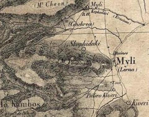
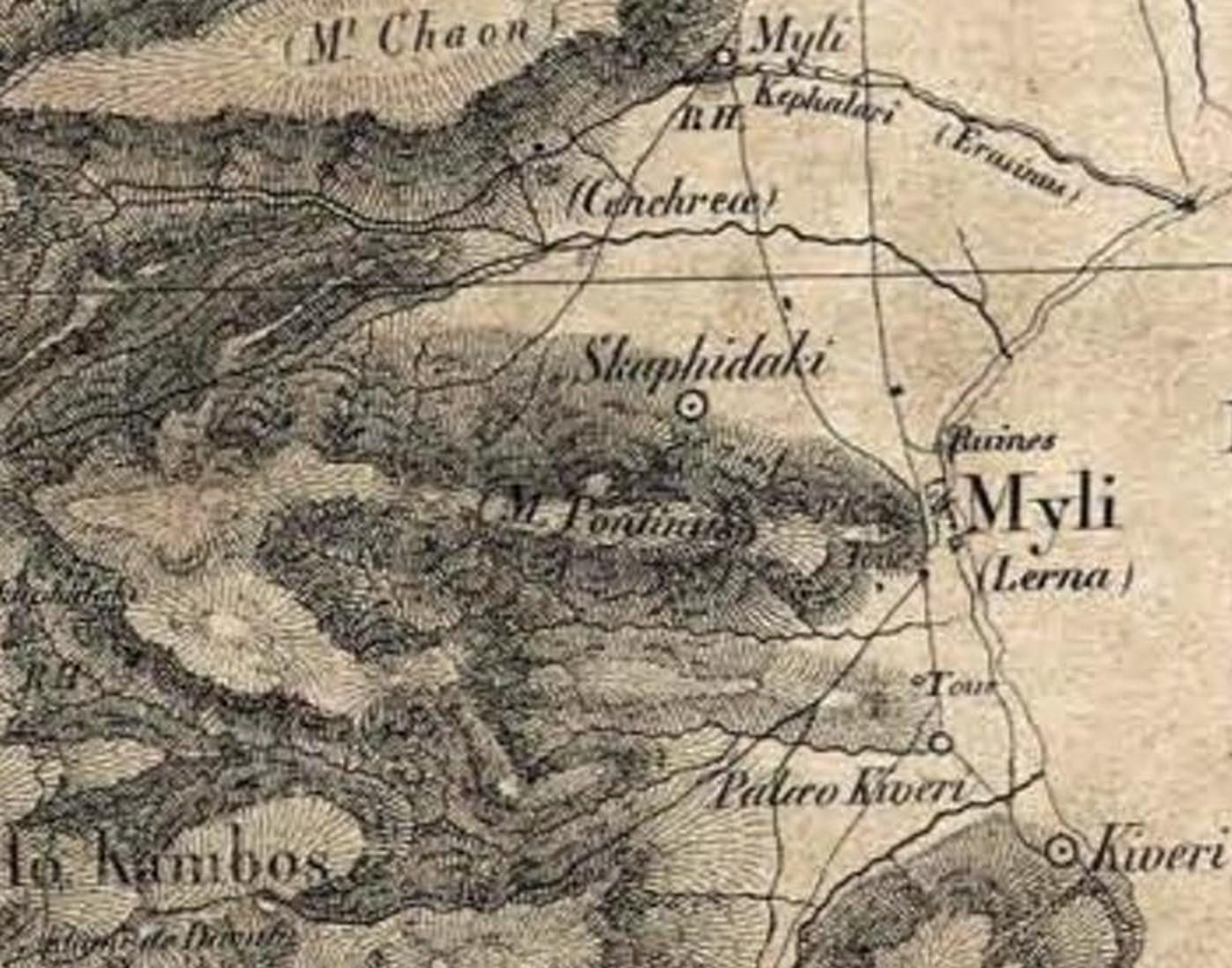
1832
Crop of the Expédition de Morée map showing Myli (Lerna), Mt Pontinos, Skafidaki and Kiveri.
Źródło: Expédition scientifique de Morée (atlas)
-
Powiększ:
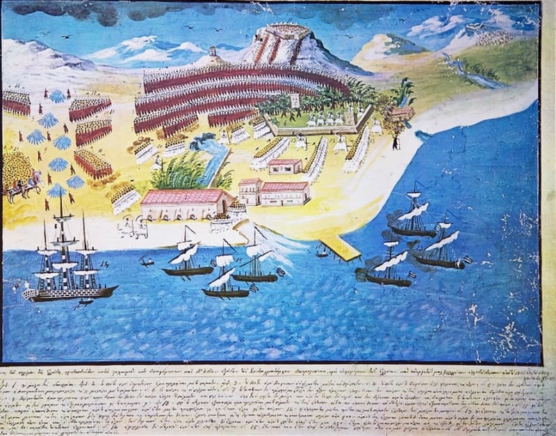
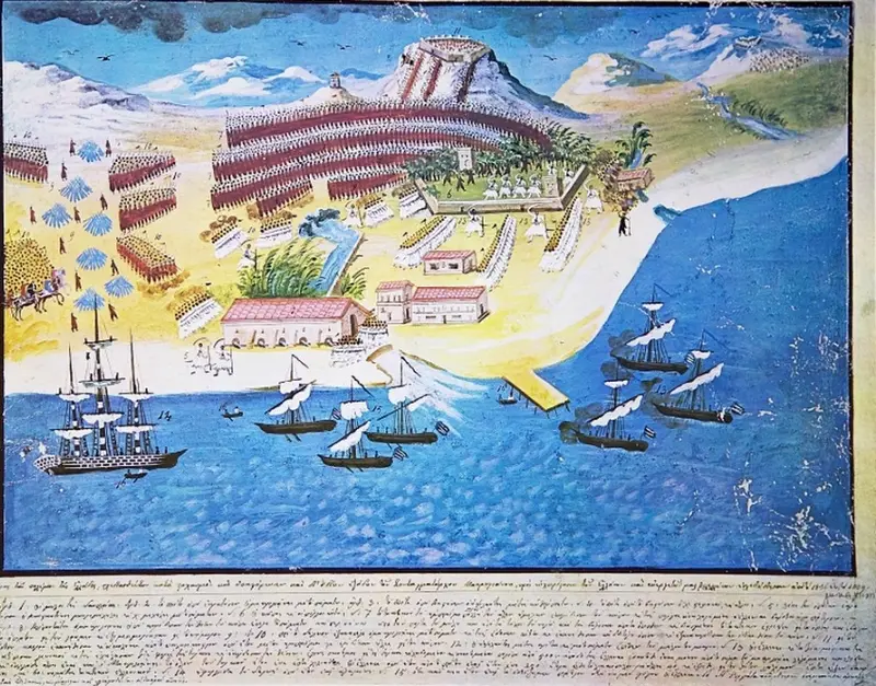
ok. 1836–1839
Naiwny obraz bitwy pod Myloi w 1825 roku, z młynami, brzegiem i statkami w zatoce
Źródło: Public domain
-
Powiększ:
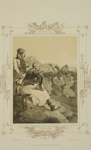
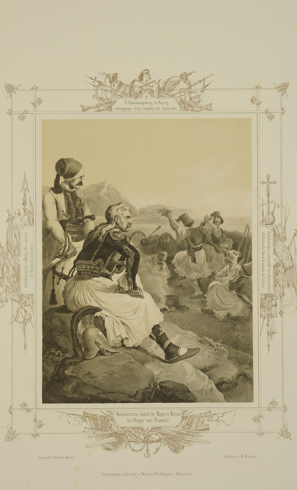
1852
Lithograph "Kolokotronis gathers the victors over Dramalis at Lerna" (1822 camp scene) with a four-language caption; idealised landscape.
Źródło: Peter von Hess (painter), H. Kohler (lithographer), Mey & Widmayer, Munich; National Historical Museum, Athens
-
Powiększ:
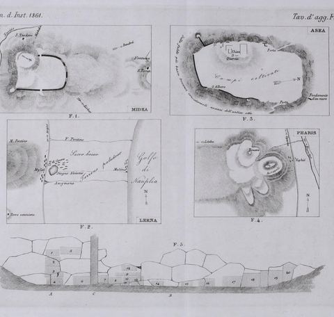
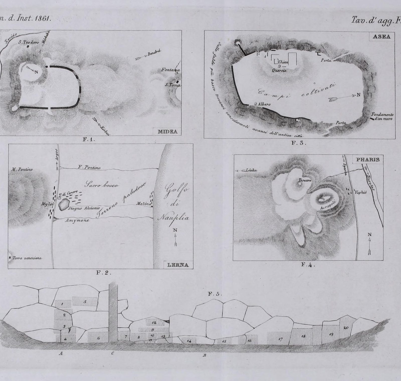
1861
Plate of sketch plans by Conze & Michaelis, including a plan of the Lerna area with Mt Pontinos and the gulf.
Źródło: A. Conze & A. Michaelis
-
Powiększ:
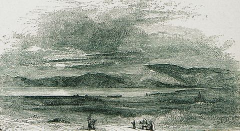
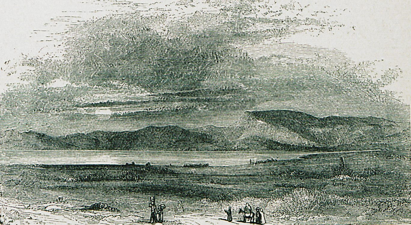
1882 (druk; projekt prawdopodobnie ok. 1839)
Wood engraving 'Lernæan Marsh': the marsh of Lerna with water, plain and mountains, and travellers with a mule in the foreground.
Źródło: Christopher Wordsworth, 'Greece: Pictorial, Descriptive, and Historical' (John Murray, London)
-
Powiększ:
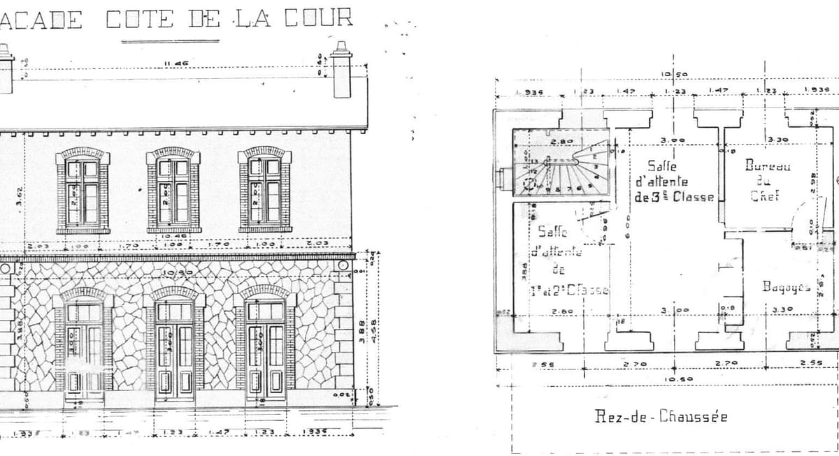
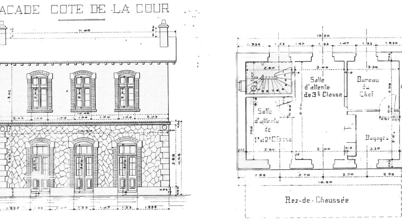
ok. 1886
Oryginalny rysunek budynku dworca: fasada i rzut parteru z poczekalniami, biurem zawiadowcy stacji i przechowalnią bagażu
Źródło: Railway archive (supplied by Visit Myloi)
-
Powiększ:
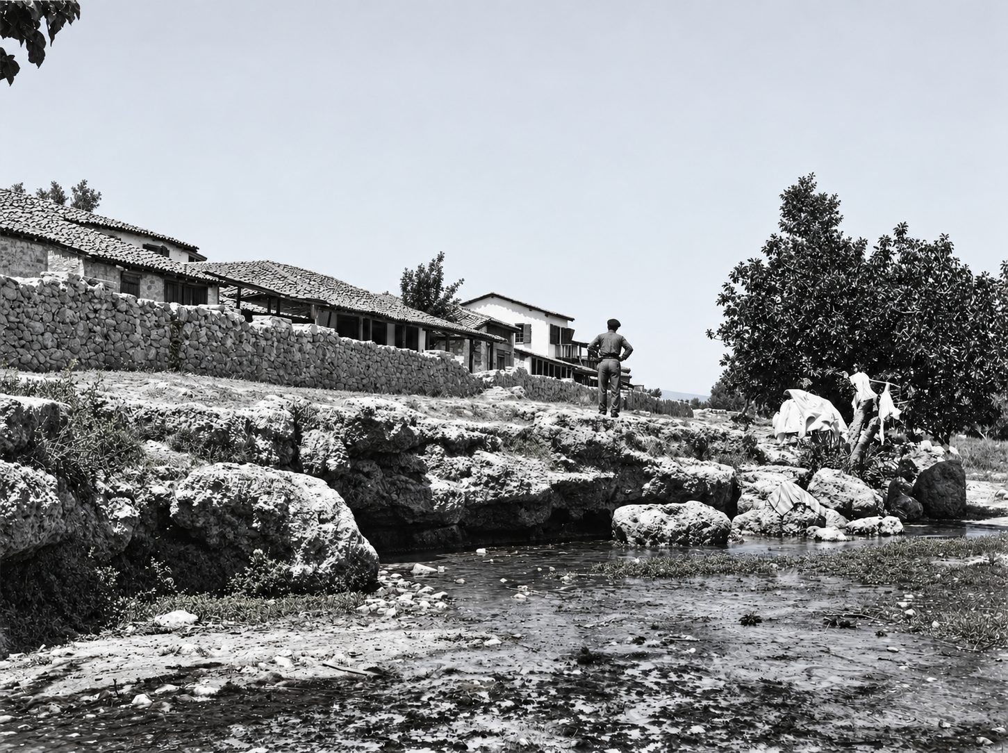
ok. 1890–1935?
Black-and-white photograph of a spring-fed stream bed with large rocks, a man standing by a wall and low stone houses behind.
Źródło: Woodhouse archive, Chau Chak Wing Museum (University of Sydney), NM2007.43.10 "Spring (Sema?) at Myli"
-
Powiększ:
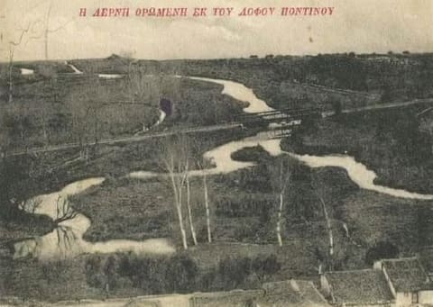
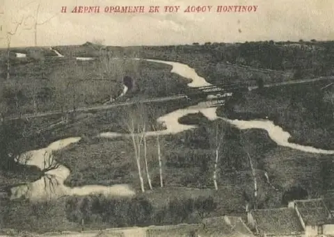
ok. 1900–1920
Pocztówka „Η Λέρνη ορωμένη εκ του λόφου Ποντίνου” (Lerna widziana ze wzgórza Pontinos): strumienie wijące się przez mokradła
Źródło: Visit Myloi collection
-
Powiększ:
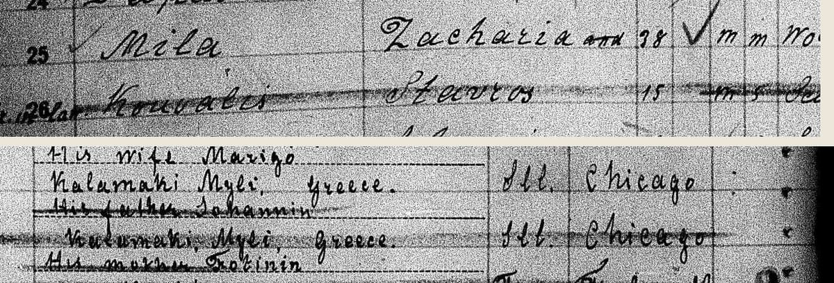
1911-04-24
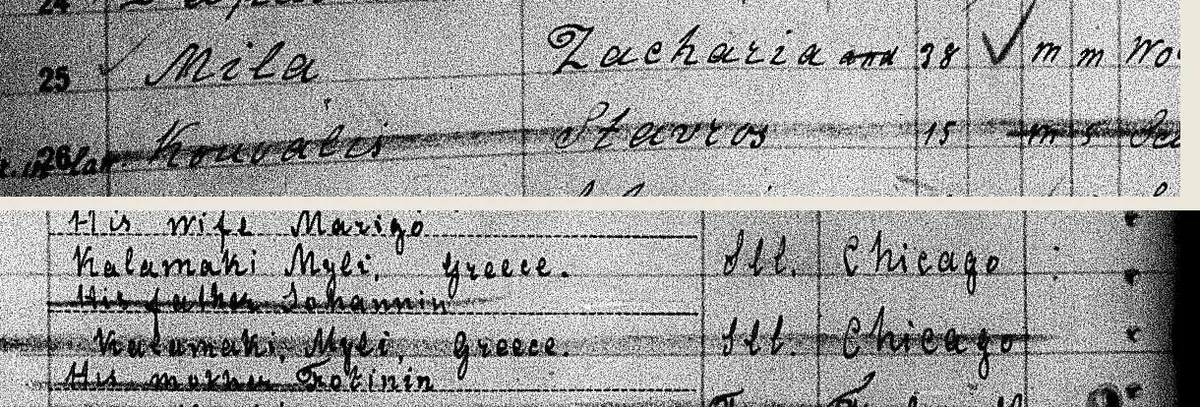
Lista pasażerów statku Patris, kwiecień 1911, wiersze 25–26: „Mila, Zacharia, 38” i „Kouvalis, Stavros, 15”. Poniżej ich rodziny w domu, „his wife Marigo” i „his father Johannis”, oboje w „Kalamaki, Myli, Greece”, oraz cel podróży: „Ill. Chicago”.
Źródło: NARA T715, via FamilySearch
-
Powiększ:

1911-04-24
Odwrotna strona tego samego arkusza. Mila był już wcześniej w Ameryce („yes, 1902–1906, Chicago, Ill.”) i jechał do „his brother-in-law Angelos Kouvalis, 417 N. Wells, Chicago Ill.”. Przy Stavrosie: „the same, as above”.
Źródło: NARA T715, via FamilySearch
-
Powiększ:
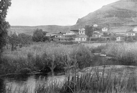
1912 (wg przesyłającego; publikacja 1914)
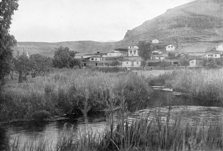
Plate 67 'Der lernäische Sumpf': water and reeds of the Lerna springs/marsh in the foreground, with the houses of Myloi at the foot of Mt Pontinos behind.
Źródło: Julia Ponten-von Broich, in Josef Ponten, 'Griechische Landschaften' (Stuttgart 1914)
-
Powiększ:
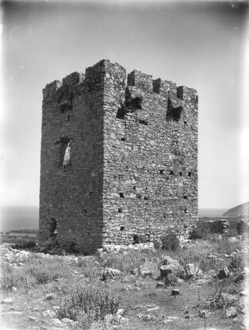
ok. 1890–1935
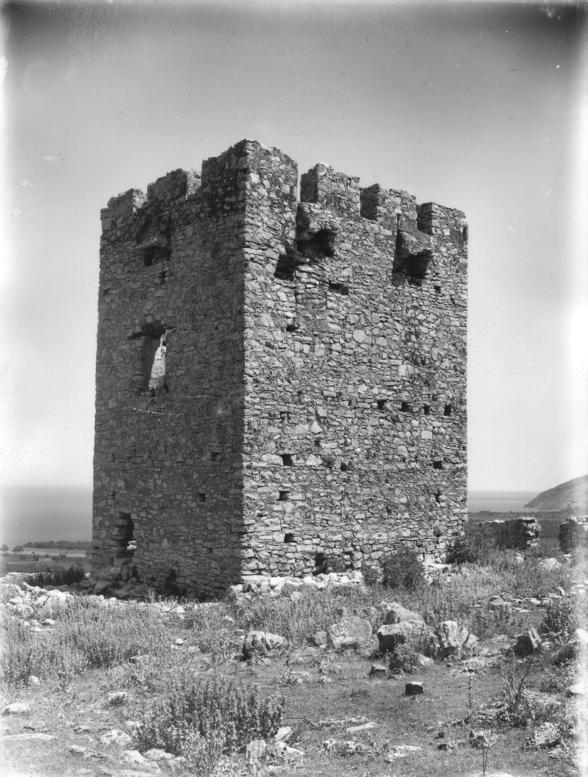
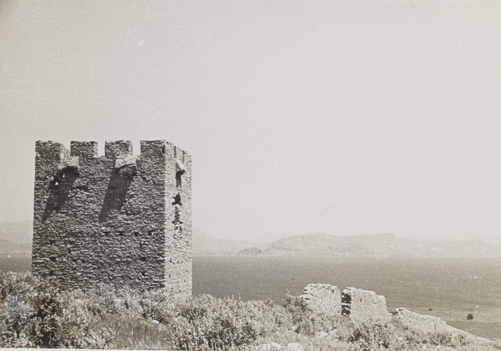
Glass-negative photograph of the Tower of the Vasilopoula (Pyrgos Vasilopoulas) between Myloi and Kiveri, crenellated and still fairly intact, with the sea and a cape at right.
Źródło: William J. Woodhouse; Woodhouse Archive, Chau Chak Wing Museum (NM2007.100.1)
-
Powiększ:
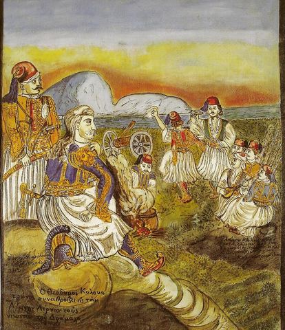
1912
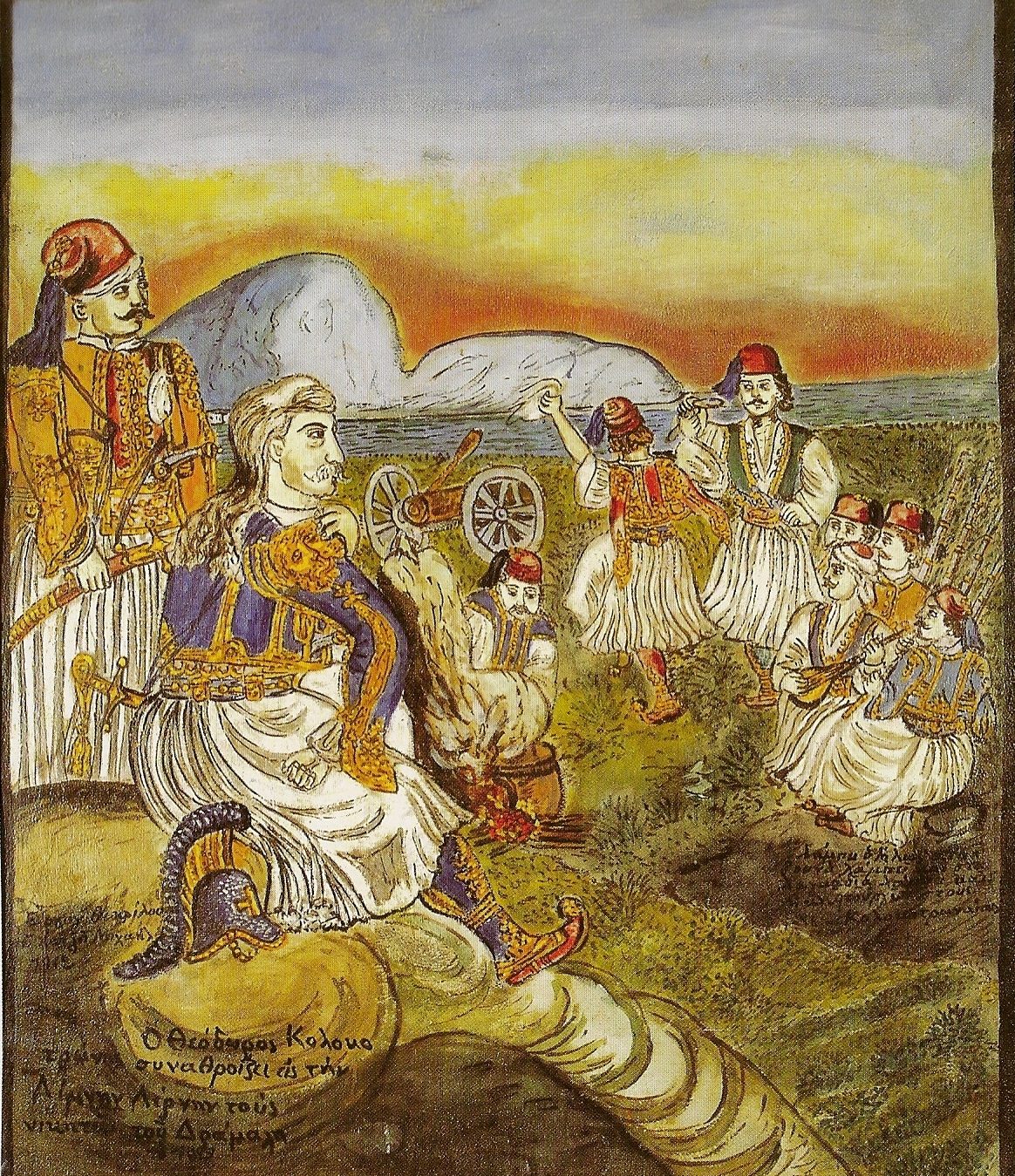
Fresco by Theofilos of Kolokotronis gathering the victors over Dramalis at Lerna (1822), with an imaginary landscape.
Źródło: Theofilos Hatzimichail; Theophilos Museum, Anakasia (Volos)
-
Powiększ:

1914-06-16
Pannonia, czerwiec 1914, wiersz 10: „Antoniou, Zacharias, 24, workman”, miejsce zamieszkania „Mylous”, najbliższy krewny „his father C. Antoniou, Mylous, Greece”.
Źródło: NARA T715, via FamilySearch
-
Powiększ:
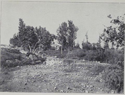
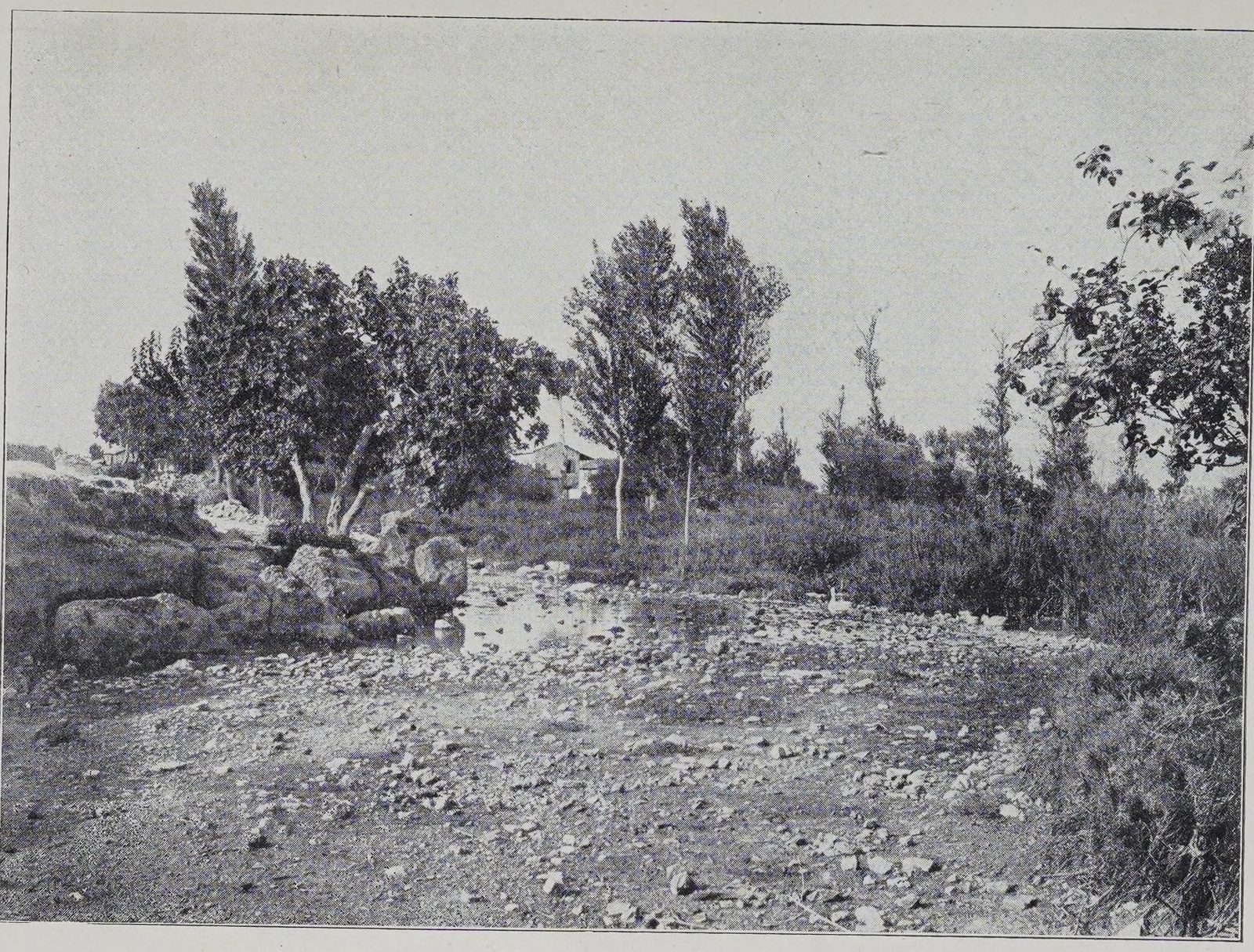
przed październikiem 1923 (prawdopodobnie początek lat 20.)
"LERNE": the spring pool (Amymone) with a triple-trunked olive tree, poplars, reeds and a low tiled house behind.
Źródło: Photographer not named (probably G. G.-Toudouze)
-
Powiększ:
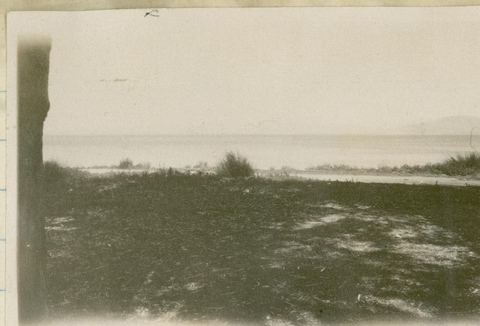
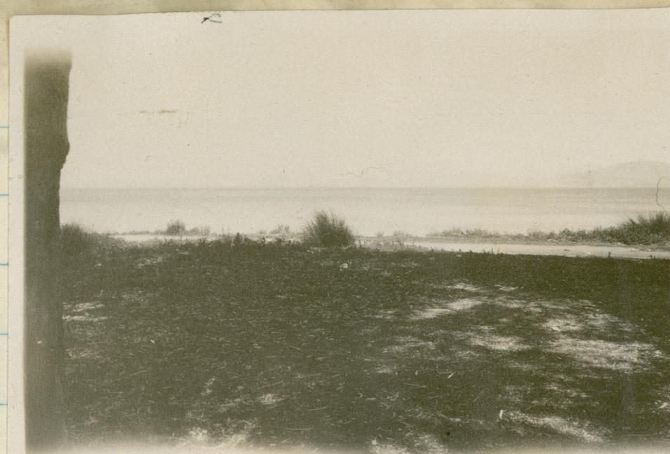
12–14 grudnia 1927
"Gulf of Nauplia from Myli station": view over the gulf from Myloi station.
Źródło: John Pendlebury; British School at Athens Archive, PEN/2/2/1/108
-
Powiększ:
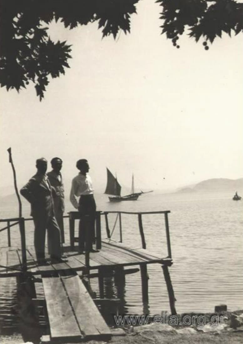
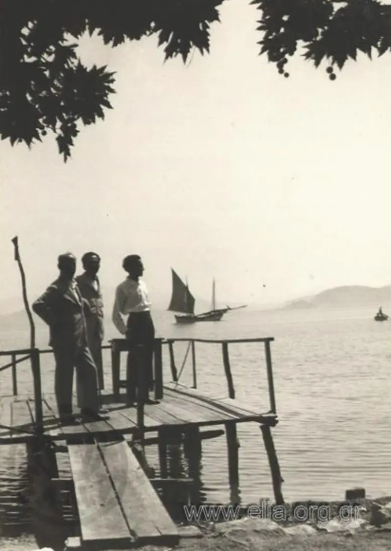
24 lipca 1927
Nikos Kazantzakis z dwoma przyjaciółmi na drewnianym pomoście w Myloi w 1927 roku
Źródło: ELIA/MIET 03.4.1.72 · CC BY 4.0
-
Powiększ:
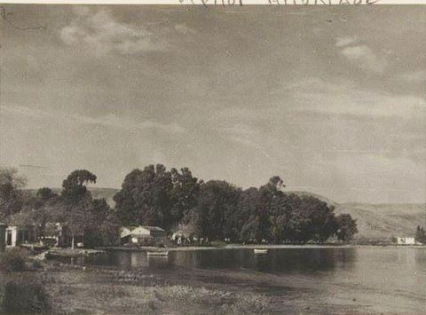
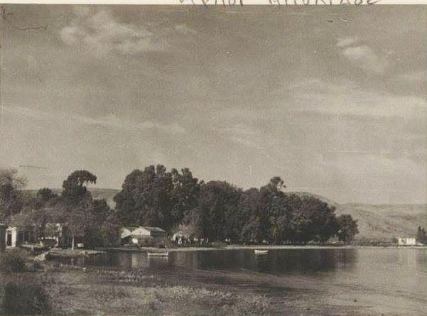
ok. 1930–50?
Black-and-white photo postcard marked "ΜΥΛΟΙ ΑΡΓΟΛΙΔΟΣ": a stretch of coast with a dense group of trees and low houses.
Źródło: Visit Myloi collection (photographer not recorded)
-
Powiększ:
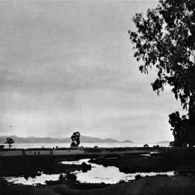
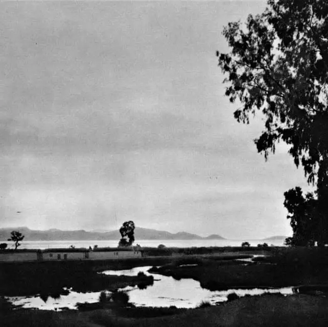
1930
Czarno-biały widok rozlewisk na mokradłach, niskich budynków, eukaliptusa i zatoki w oddali
Źródło: Antoine Bon (1901–1972)
-
Powiększ:
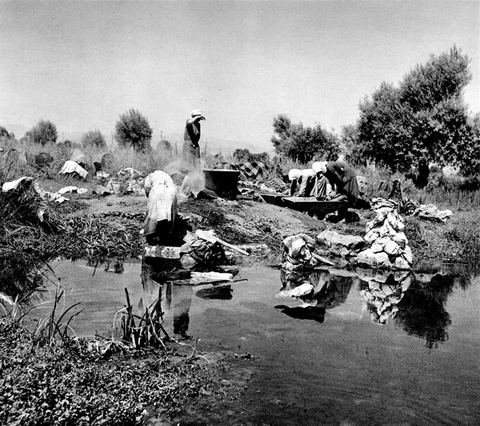
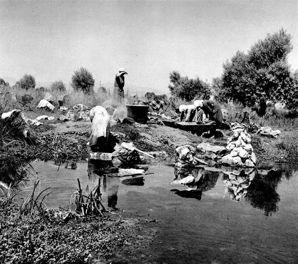
lata 30.
Women washing laundry in the spring water at Lerna, among reeds and trees, in the 1930s.
Źródło: Anna Riwkin(-Brick)
-
Powiększ:
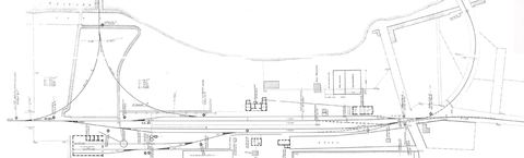
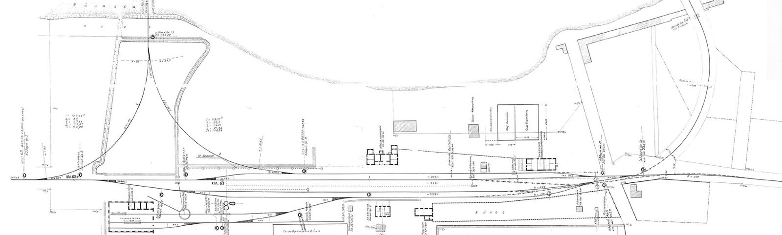
lata 30.
Topographic plan of the whole Myloi station complex from the OSE archive: tracks at km 62–63, the pier with siding and triangle, the engine shed with turntable/water point, coal store, station buildings, garden, signals and points.
Źródło: OSE (Hellenic Railways) archive; reproduced in Lymperopoulou & Kossyfa, NTUA thesis 2022
-
Powiększ:
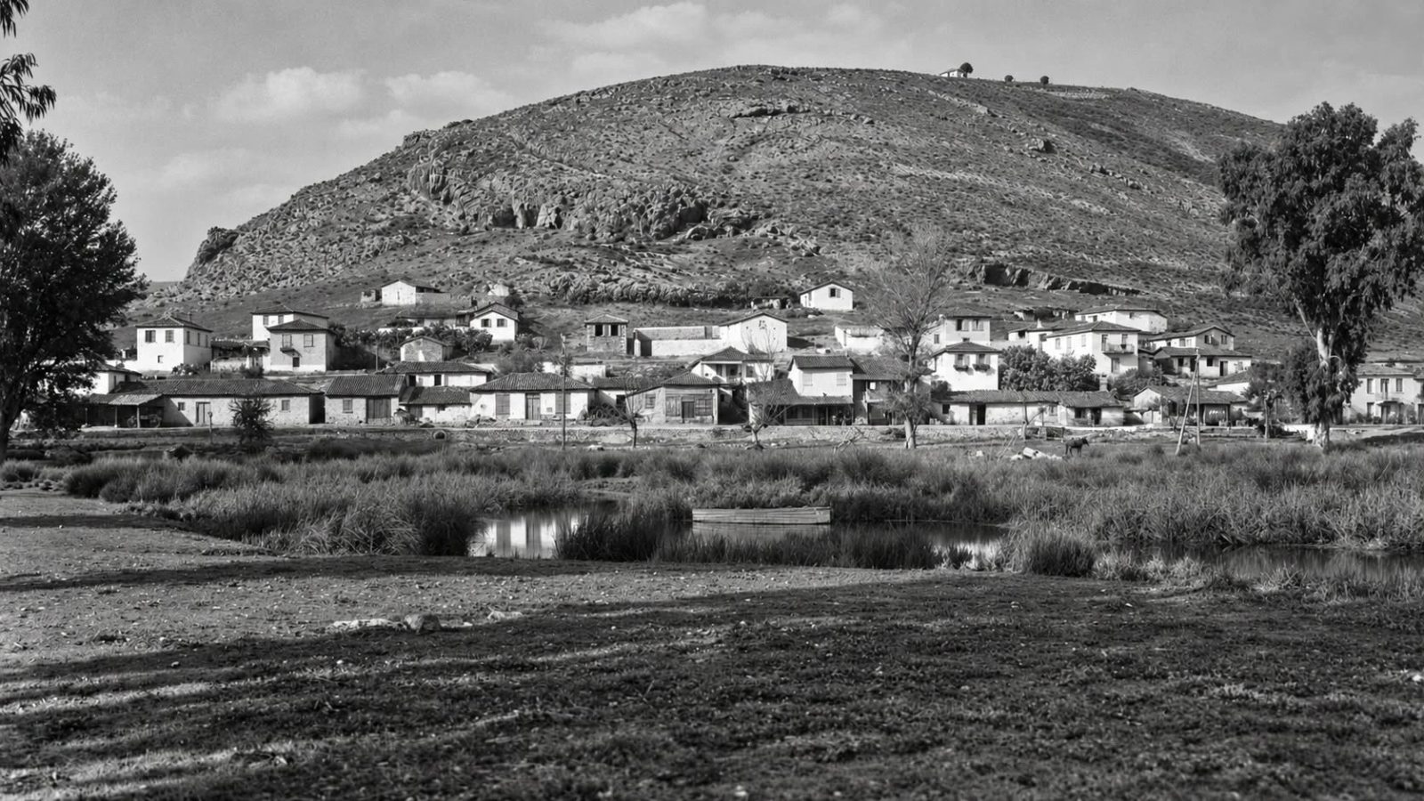
1936
'Ansicht des Ortes': the village of Myloi at the foot of Mt Pontinos seen across the spring ponds of Lerna, with Profitis Ilias chapel and the Frankish tower on the summit, tiled houses, a eucalyptus and a horse by the water.
Źródło: Walther Wrede; DAI Athens photo archive (D-DAI-ATH-Argolis-0451) · cyfrowo odnowione
-
Powiększ:
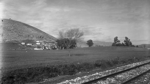
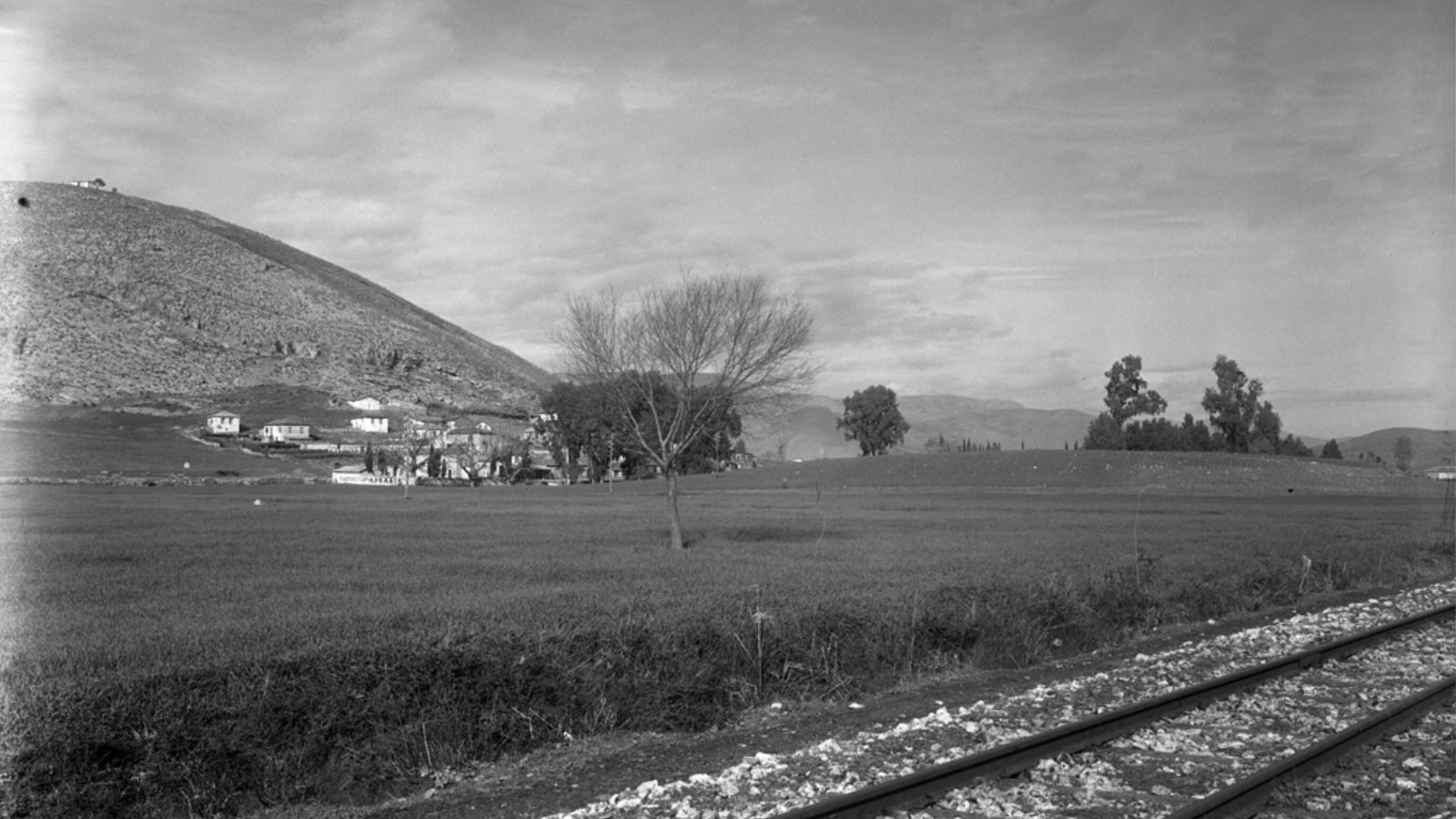
1936
The prehistoric mound of Lerna from the south-east with metre-gauge rails in the foreground, Pontinos and the southern houses of Myloi, and eucalyptus trees.
Źródło: Walther Wrede; DAI Athens, D-DAI-ATH-Argolis-0450
-
Powiększ:
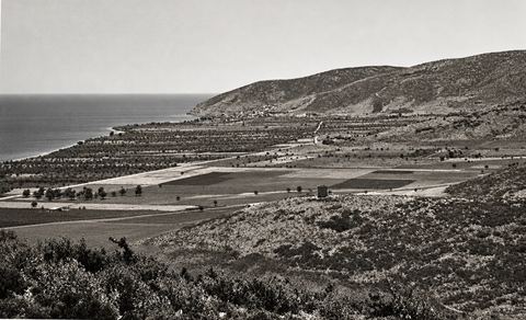
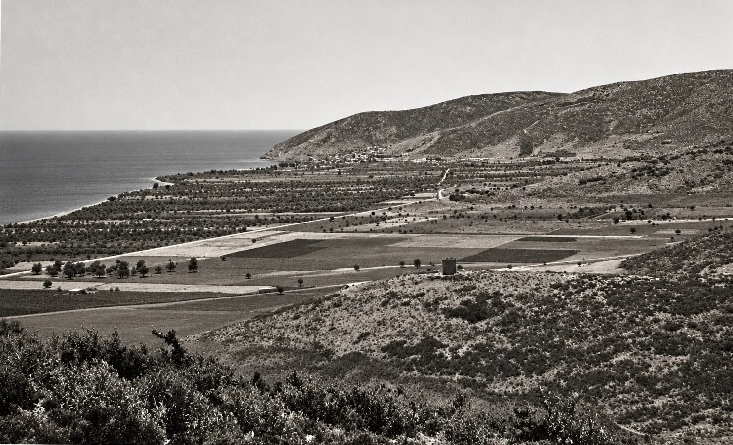
ok. 1937–1940
Looking south over the open coastal plain between Myloi and Kiveri, with the road to Tripolis rising on the right and the Vasilopoula tower on a mound.
Źródło: D. J. Wallace; Courtauld Conway Library 437894 · cyfrowo odnowione
-
Powiększ:
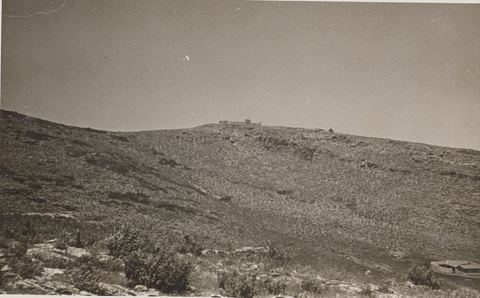
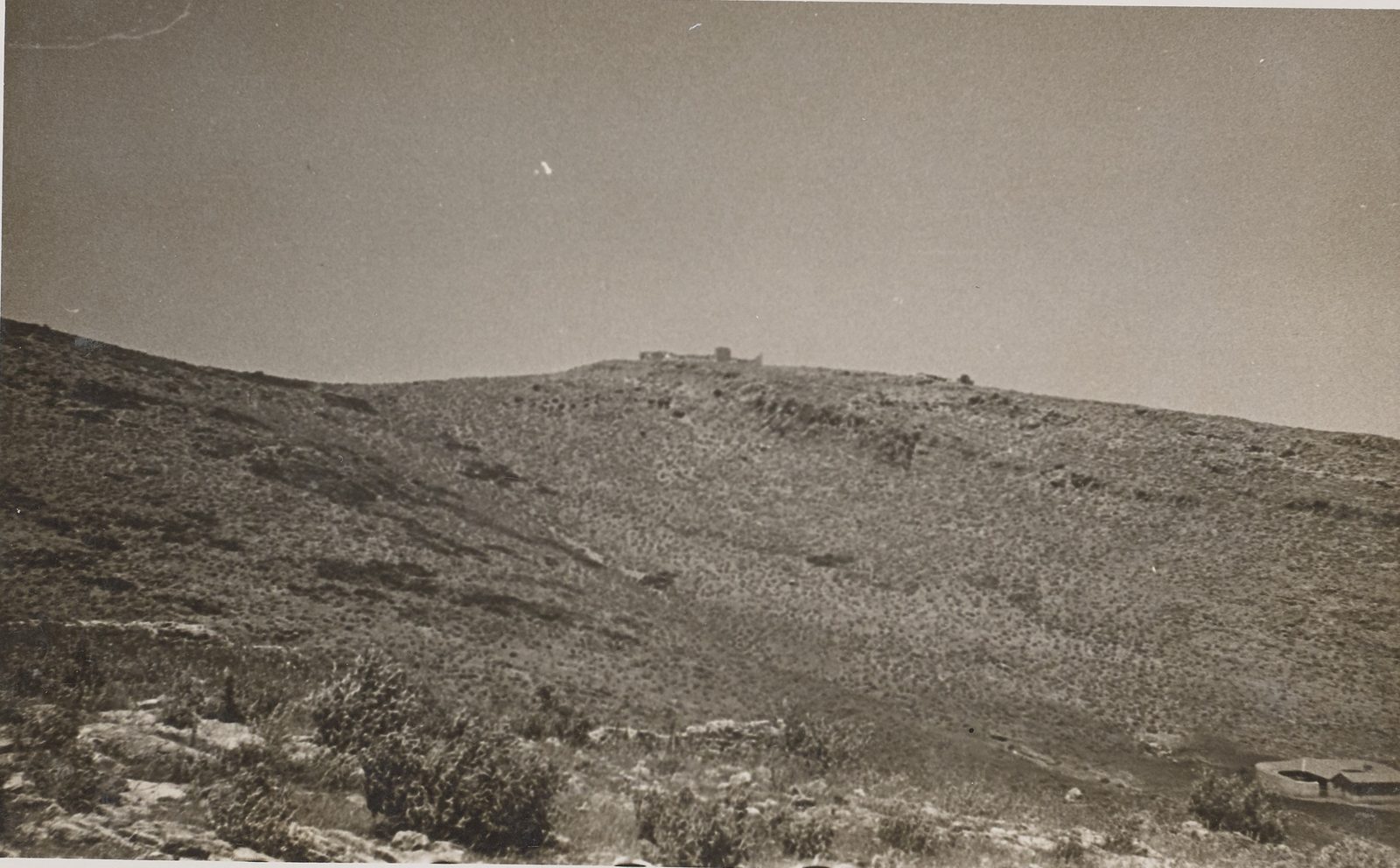
ok. 1937–1940
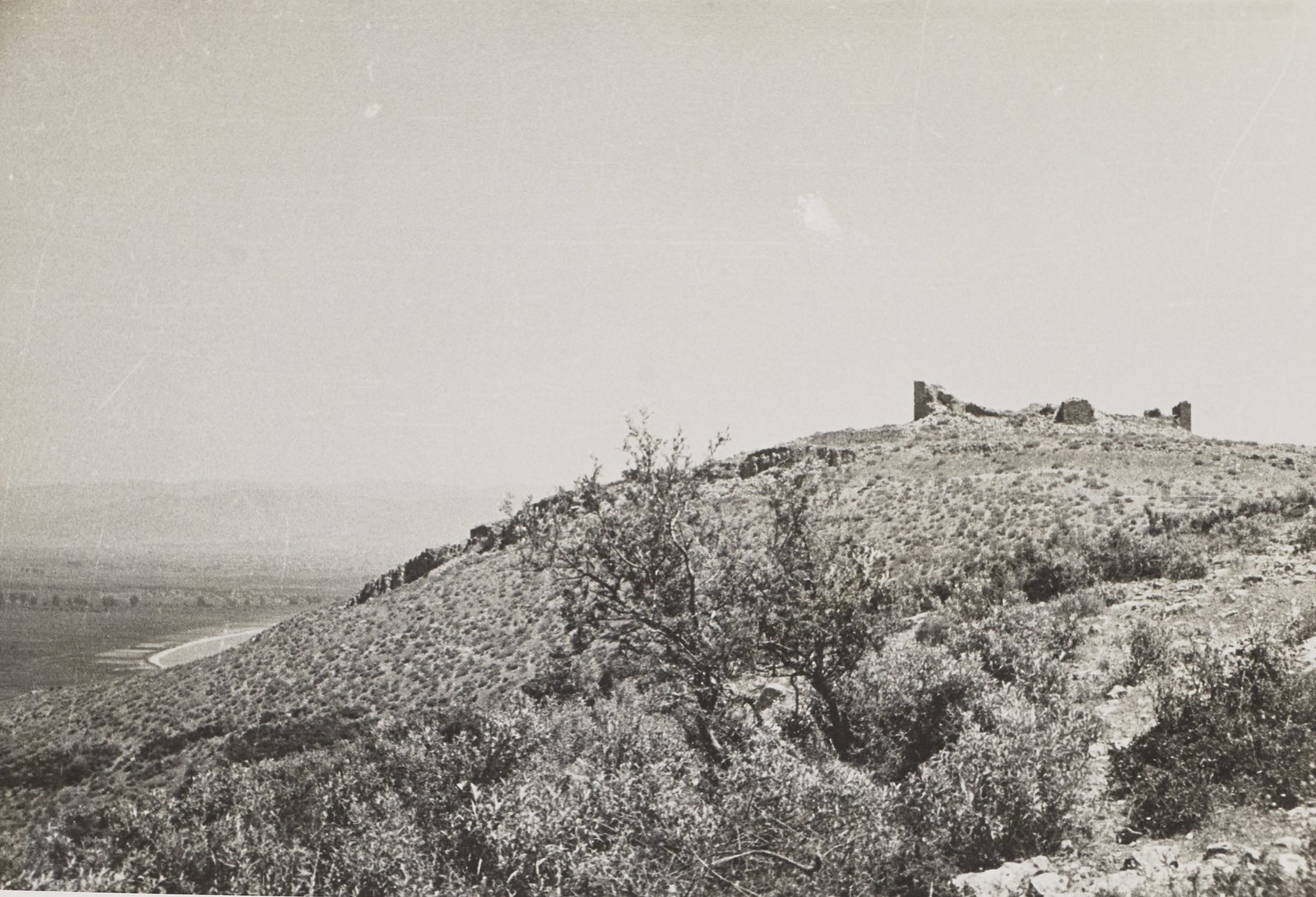
The castle on Pontinos hill seen from the lower tower.
Źródło: D. J. Wallace; Courtauld Conway Library 437895
-
Powiększ:
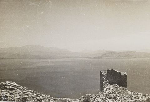
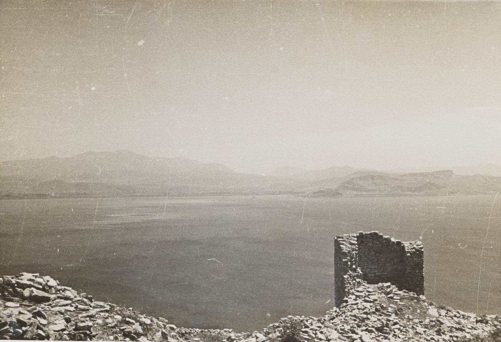
ok. 1937–1940
Ruined tower of the Pontinos castle looking east across the gulf to Nafplio and the Palamidi.
Źródło: D. J. Wallace; Courtauld Conway Library 437896
-
Powiększ:
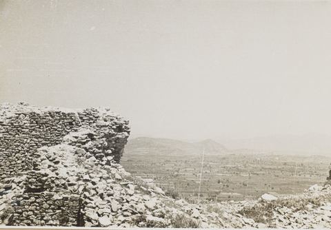
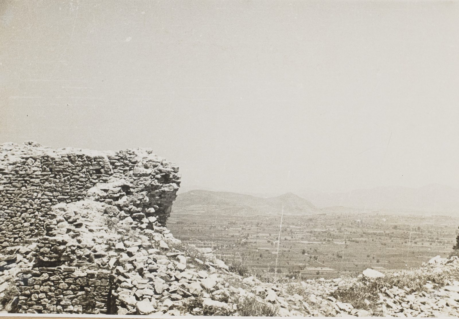
ok. 1937–1940
View north from the keep of the Pontinos castle over its masonry towards the Argos plain and mountains.
Źródło: D. J. Wallace; Courtauld Conway Library 437897
-
Powiększ:
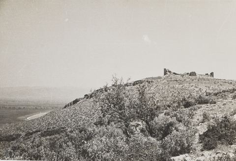
ok. 1937–1940
Towers of the keep of the Pontinos castle from the west, with the plain and the shore near Myloi below.
Źródło: D. J. Wallace; Courtauld Conway Library 437898
-
Powiększ:
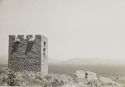
ok. 1937–1940
"Venetian Tower": the crenellated Vasilopoula tower between Myloi and Kiveri, with the gulf behind.
Źródło: D. J. Wallace; Courtauld Conway Library 437899
-
Powiększ:
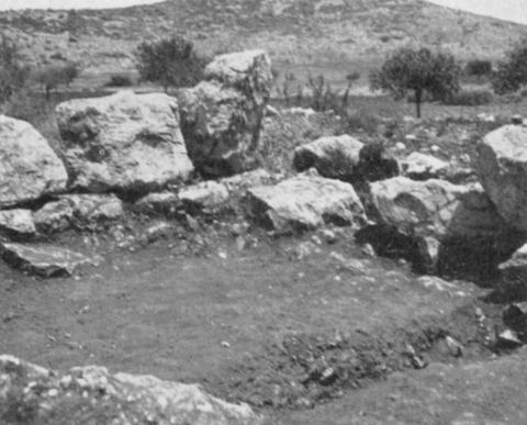
sierpień 1939
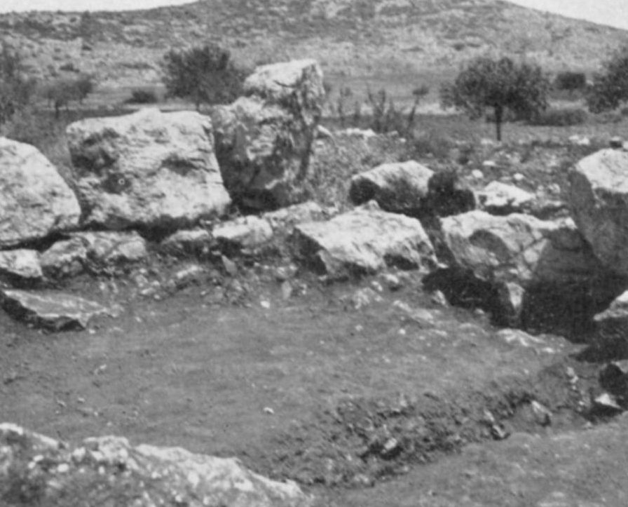
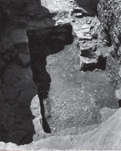
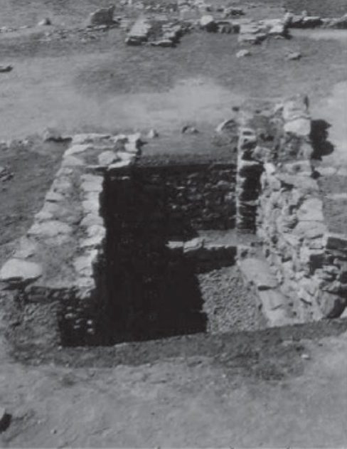
Fig. 22 'Blockhouse Near Lerna, N.E. Corner, Showing Entrance': excavated wall corner of the late-antique blockhouse c. 3 km beyond the spring of Lerna, with bare hills and olive trees behind.
Źródło: Excavation by Alison Frantz and Carl A. Roebuck (ASCSA); photos almost certainly by them
-
Powiększ:
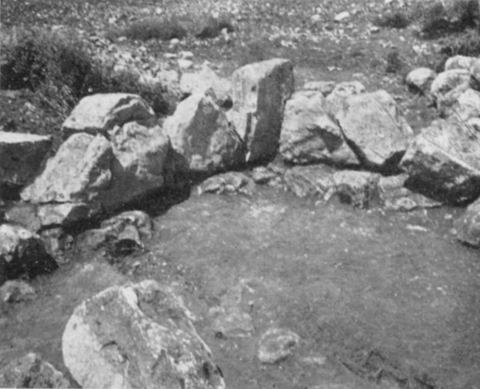
sierpień 1939
Fig. 23 'Blockhouse Near Lerna, Floor Level, N.W. Corner': floor level of the excavated blockhouse.
Źródło: Excavation by Alison Frantz and Carl A. Roebuck (ASCSA); photos almost certainly by them
-
Powiększ:
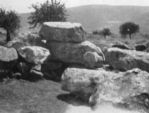
sierpień 1939
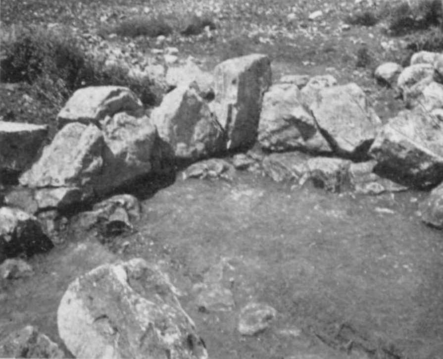
Fig. 24 'Blockhouse Near Lerna, S.E. Corner': wall corner with olive trees and a ridge of hills behind.
Źródło: Excavation by Alison Frantz and Carl A. Roebuck (ASCSA); photos almost certainly by them


Lata 40. (36)
-
Powiększ:
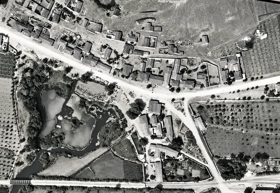
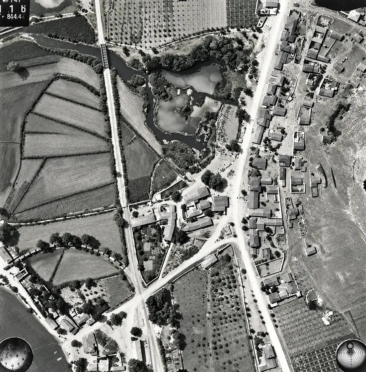
13 lipca 1941
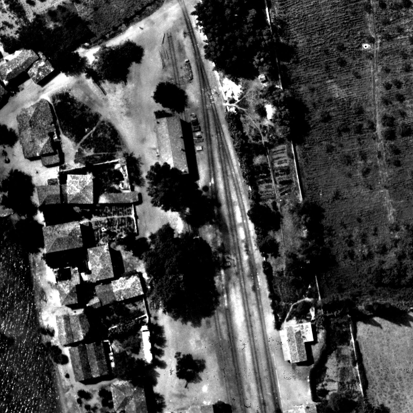
Detail of a German aerial photograph of 13 July 1941: the heart of Myloi, with the houses along the main road, the spring ponds of Lerna, the orchards and the railway with its bridge.
Źródło: Reichsluftfahrtministerium (Sonderluftbildabteilung); DAI Athens Archive · cyfrowo odnowione
-
Powiększ:
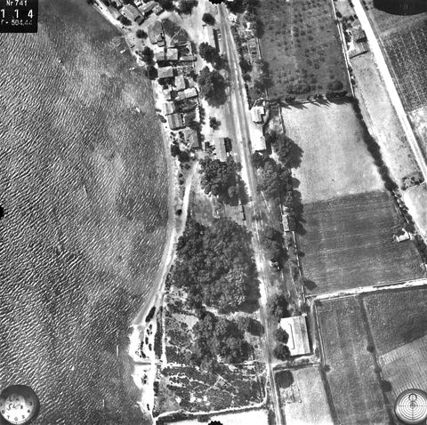
13 lipca 1941
Vertical aerial photo (c. 1000 m) of the Myloi station yard: tracks, buildings on both sides, eucalyptus wood and the large engine shed.
Źródło: Reichsluftfahrtministerium (Sonderluftbildabteilung); DAI Athens Archive
-
Powiększ:
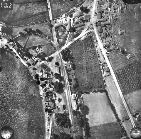
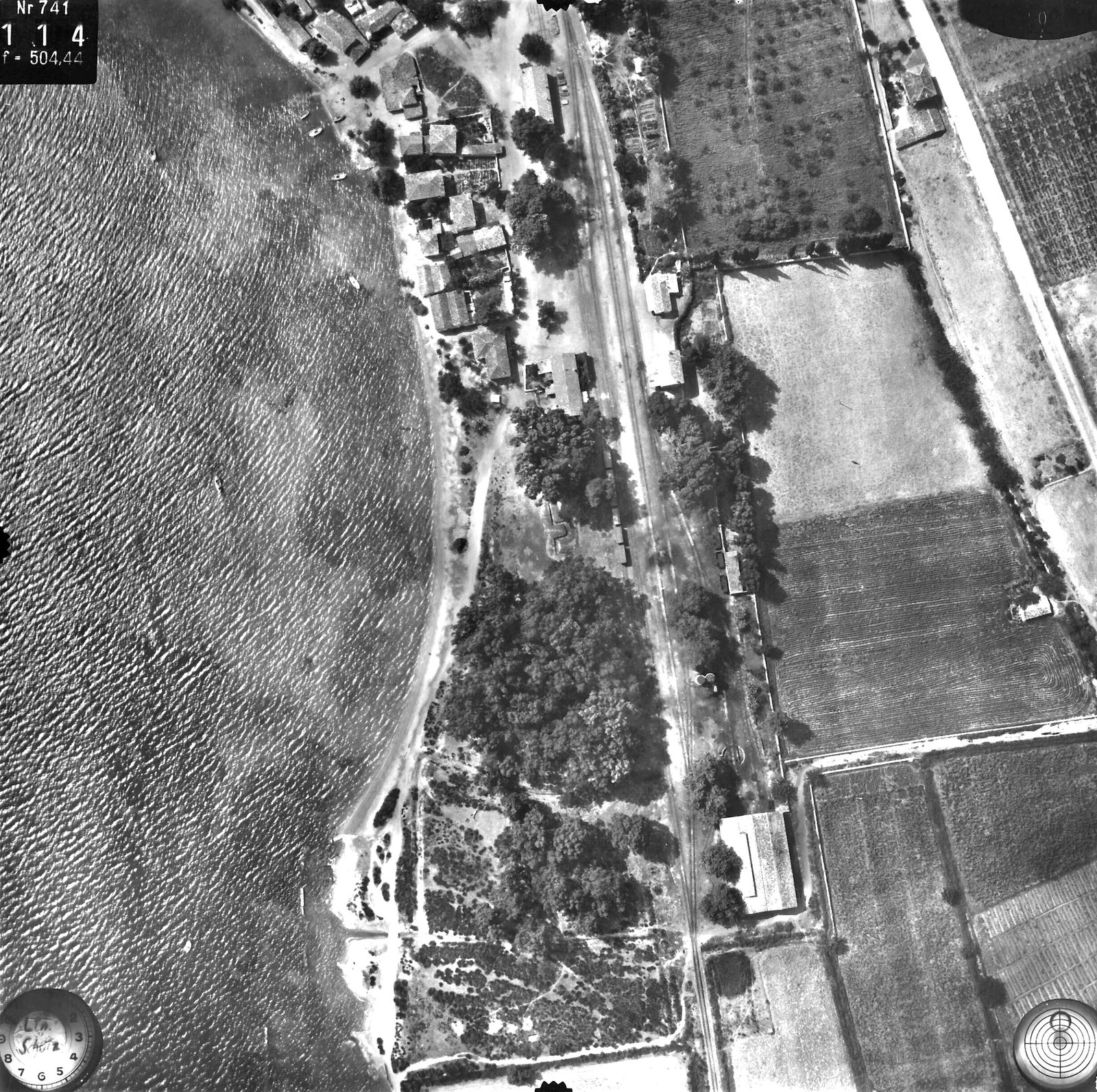
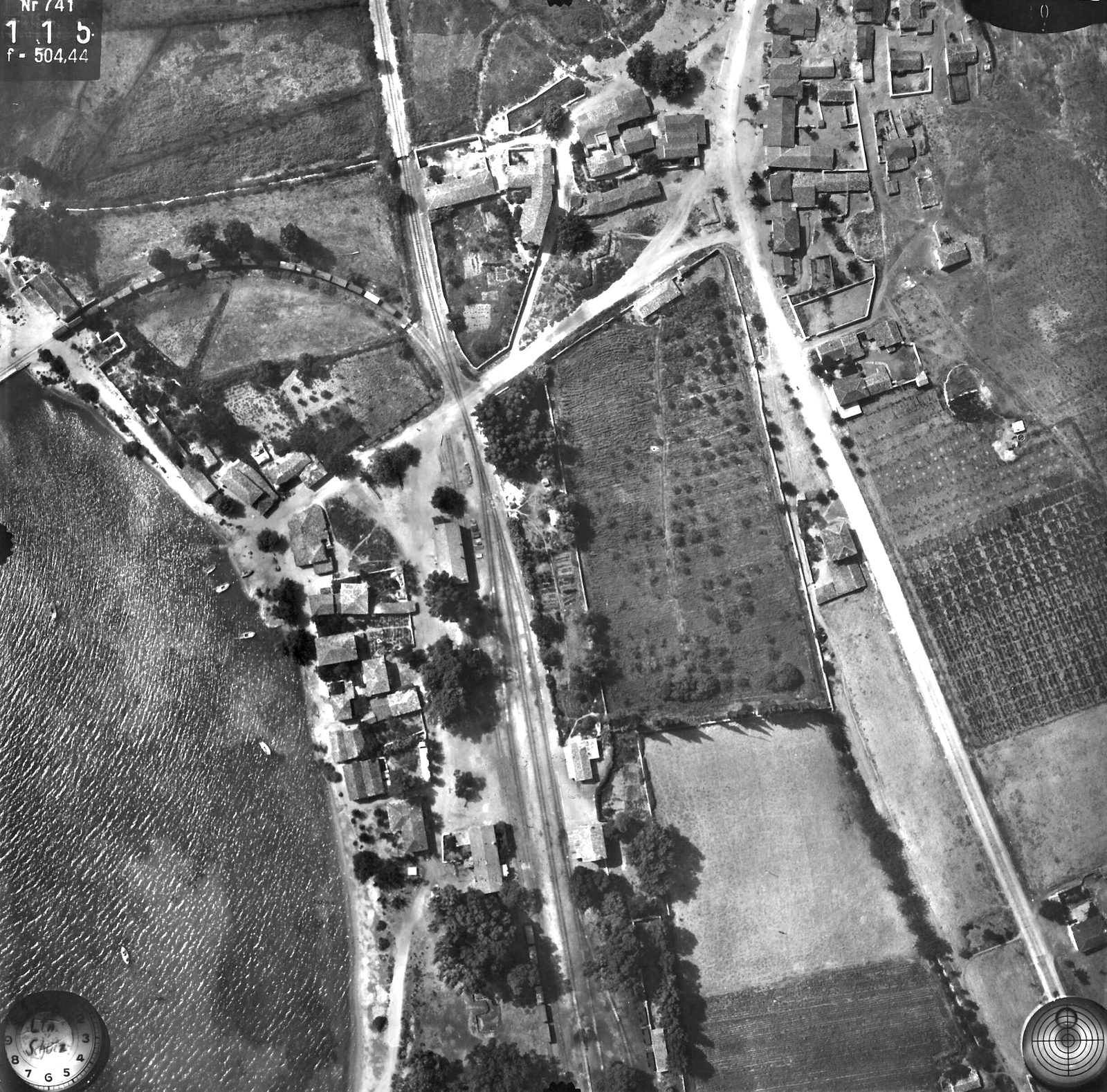
13 lipca 1941
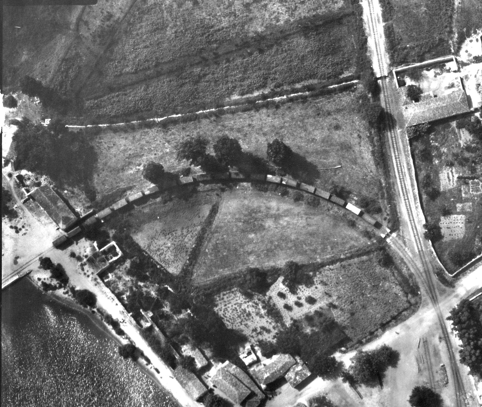
Vertical aerial photo of Myloi station, the village, the road crossing and the curved siding to the pier with a long goods train.
Źródło: Reichsluftfahrtministerium (Sonderluftbildabteilung); DAI Athens Archive
-
Powiększ:
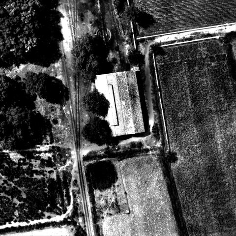
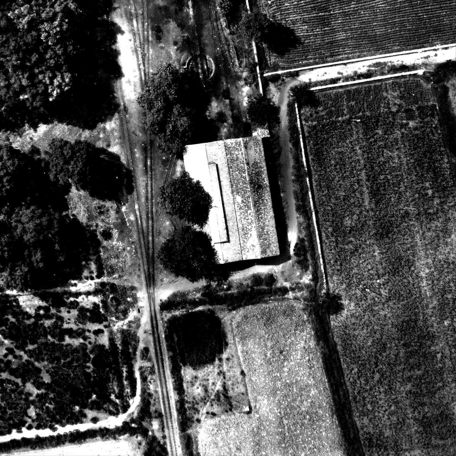
13 lipca 1941
Full-resolution crop of the 1941 aerial photo showing the double locomotive shed: two parallel tiled gabled roofs, one with a long roof lantern, tracks entering from the turntable side.
Źródło: Reichsluftfahrtministerium (Sonderluftbildabteilung); DAI Athens Archive
-
Powiększ:
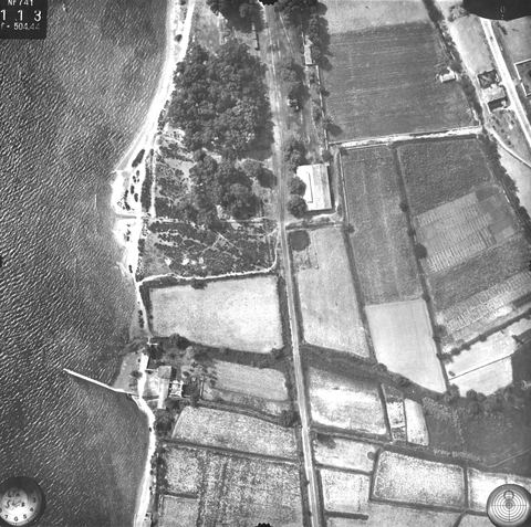
13 lipca 1941
Vertical aerial photo: railway line with eucalyptus wood, a large building beside the track and the pier.
Źródło: Reichsluftfahrtministerium (Sonderluftbildabteilung); DAI Athens Archive
-
Powiększ:
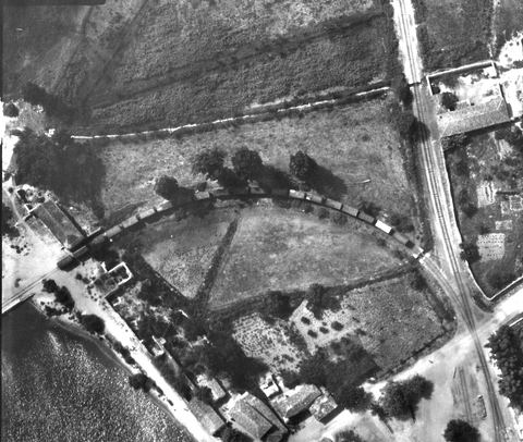
13 lipca 1941
Crop of the 1941 aerial photo: a goods train of about 25 wagons on the curved siding from the main line to the pier, a level crossing, village houses and the start of the pier.
Źródło: Reichsluftfahrtministerium (Sonderluftbildabteilung); DAI Athens Archive
-
Powiększ:
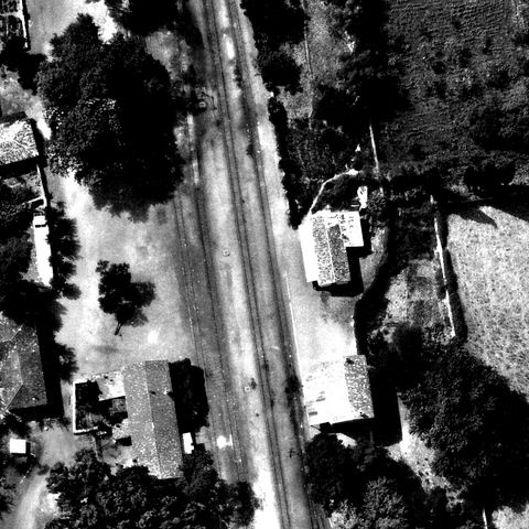
13 lipca 1941
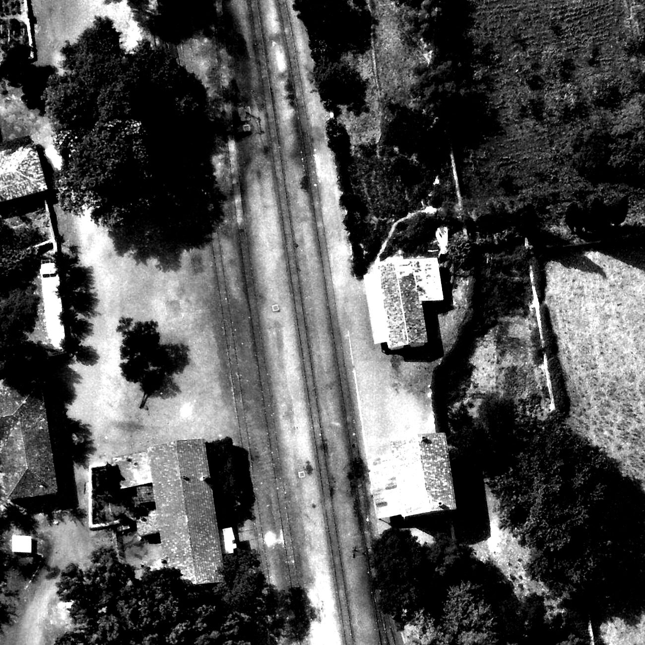
Full-resolution detail of the 1941 aerial photo: platform and tracks with two detached tiled houses on one side and a long tiled building with walled courtyard and a small white building on the other.
Źródło: Reichsluftfahrtministerium (Sonderluftbildabteilung); DAI Athens Archive
-
Powiększ:
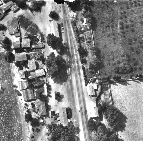
13 lipca 1941
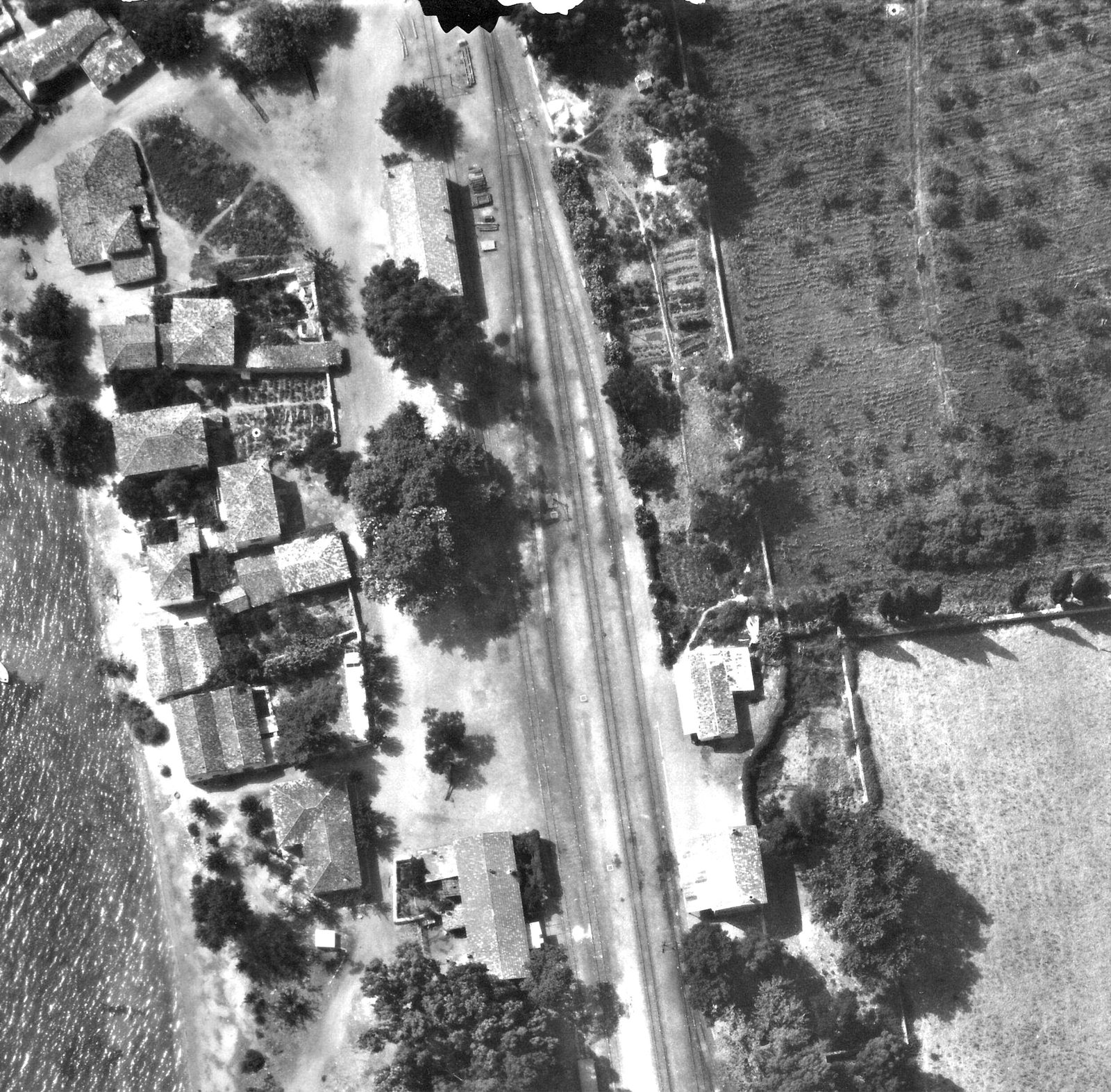
Crop of the 1941 aerial photo of the station core: double track and sidings, a long gabled building by the track with wagons (probably the goods shed), detached tiled buildings opposite, and village houses along the beach.
Źródło: Reichsluftfahrtministerium (Sonderluftbildabteilung); DAI Athens Archive
-
Powiększ:
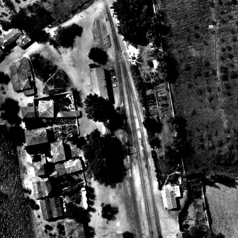
13 lipca 1941
Crop of the 1941 aerial photo showing the station grounds with the shed.
Źródło: Reichsluftfahrtministerium (Sonderluftbildabteilung); DAI Athens Archive
-
Powiększ:
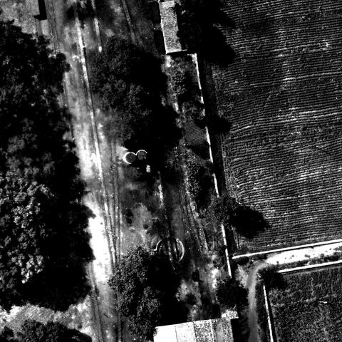
13 lipca 1941
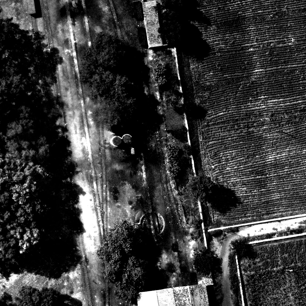
Full-resolution detail of the 1941 aerial photo: two round water reservoirs between the tracks, a turntable in front of the locomotive shed, a small building with wagons and a long boundary wall.
Źródło: Reichsluftfahrtministerium (Sonderluftbildabteilung); DAI Athens Archive
-
Powiększ:
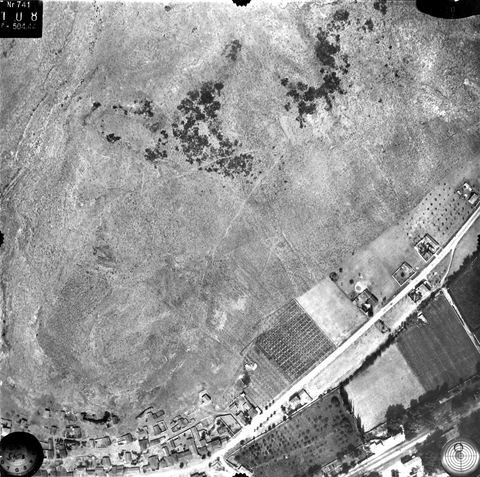
13 lipca 1941
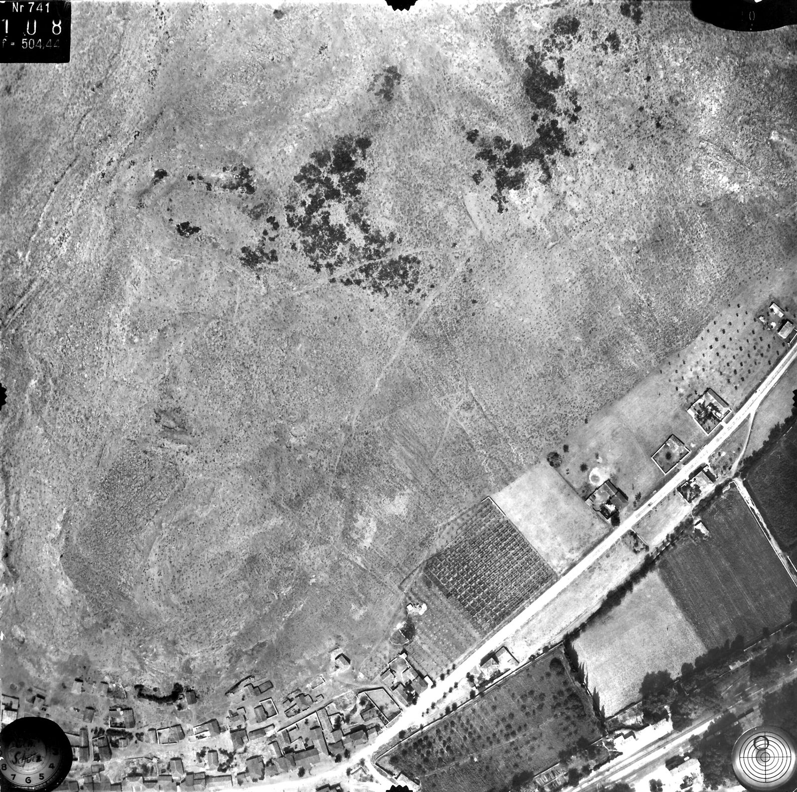
Vertical aerial photo of the slopes of Pontinos hill with the road and railway and buildings at the northern edge of Myloi.
Źródło: Reichsluftfahrtministerium (Sonderluftbildabteilung); DAI Athens archive, LB-RLM-EB-5-11-001
-
Powiększ:
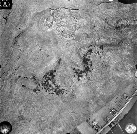
13 lipca 1941
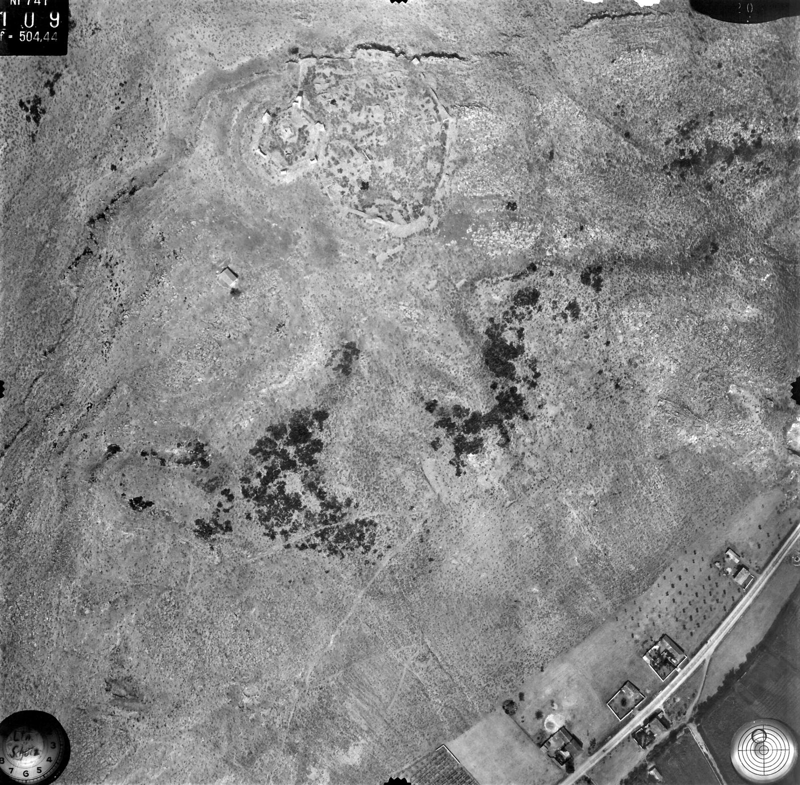
Vertical aerial photo of the summit of Pontinos with the Frankish castle ("Burg der Franken").
Źródło: Reichsluftfahrtministerium (Sonderluftbildabteilung); DAI Athens archive, LB-RLM-EB-5-11-004
-
Powiększ:
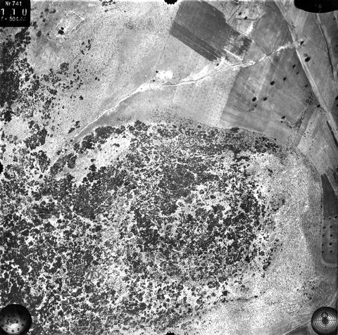
13 lipca 1941
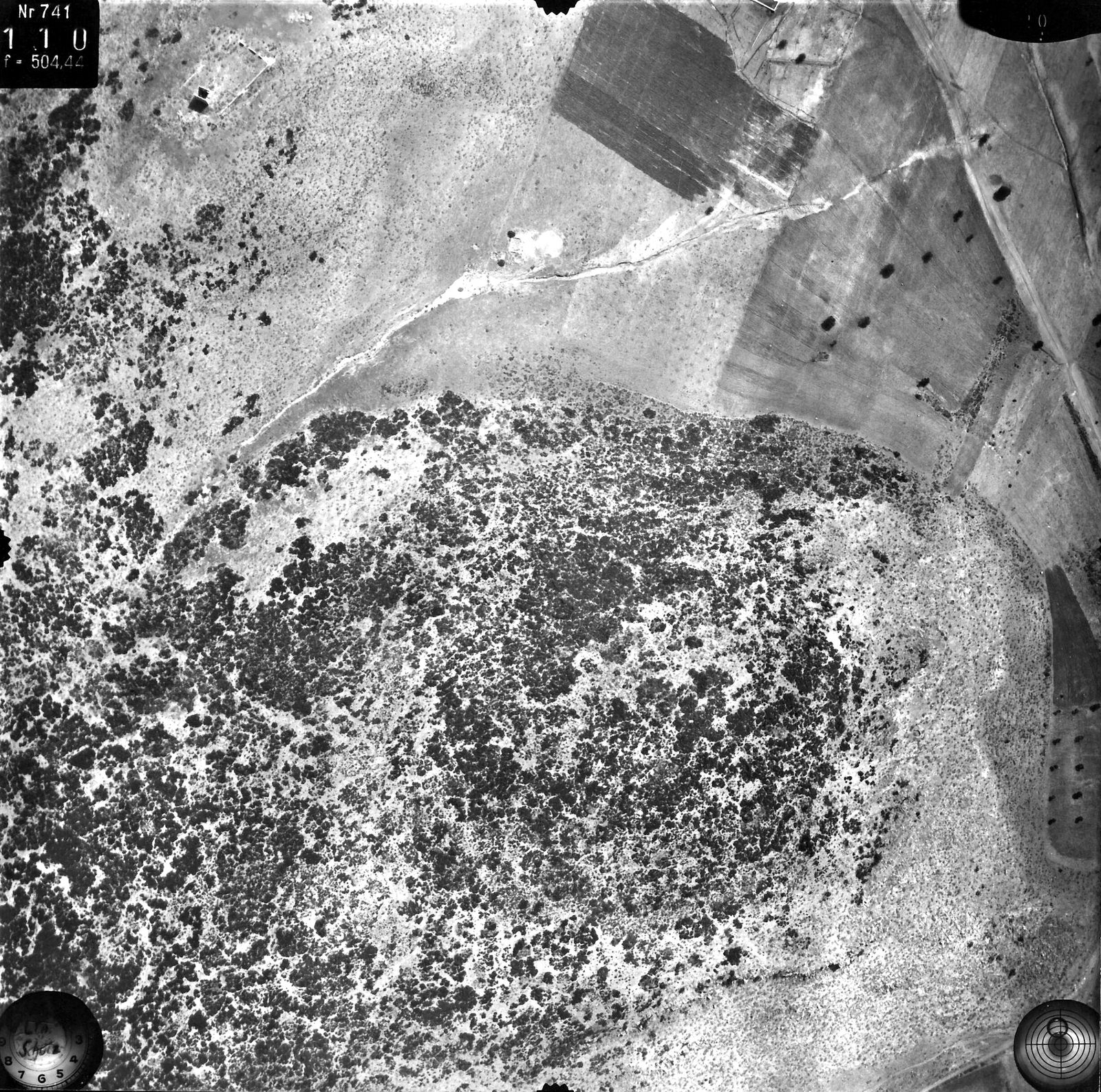
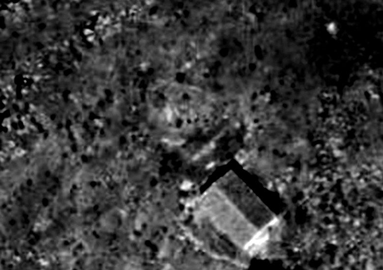
Vertical aerial photo of a scrub-covered hill and fields, annotated "Turm" (tower), south of Myloi.
Źródło: Reichsluftfahrtministerium (Sonderluftbildabteilung); DAI Athens archive, LB-RLM-EB-5-11-005
-
Powiększ:
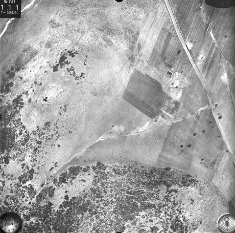
13 lipca 1941
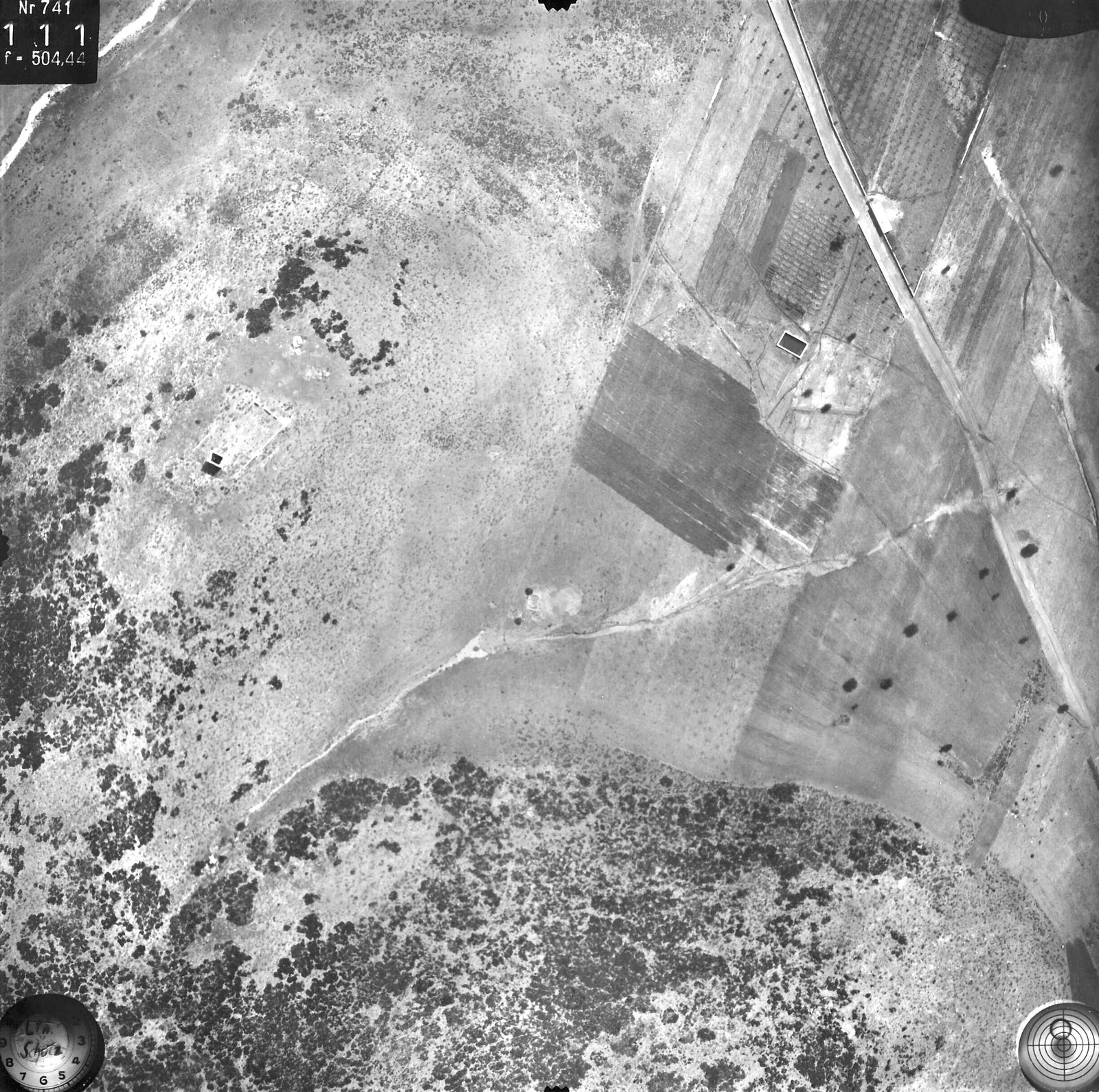
Vertical aerial photo of fields, road and hillside annotated "Turm" (tower).
Źródło: Reichsluftfahrtministerium (Sonderluftbildabteilung); DAI Athens archive, LB-RLM-EB-5-11-007
-
Powiększ:
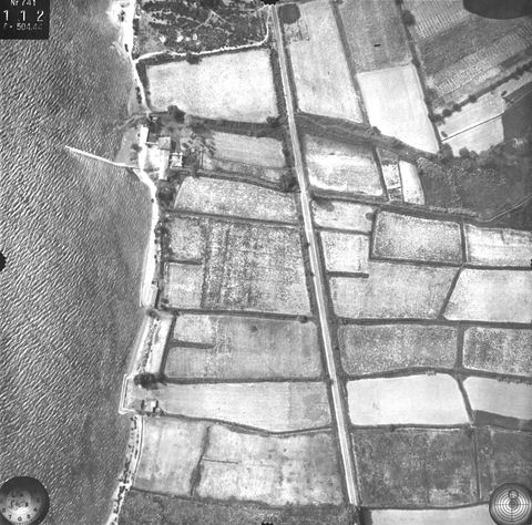
13 lipca 1941
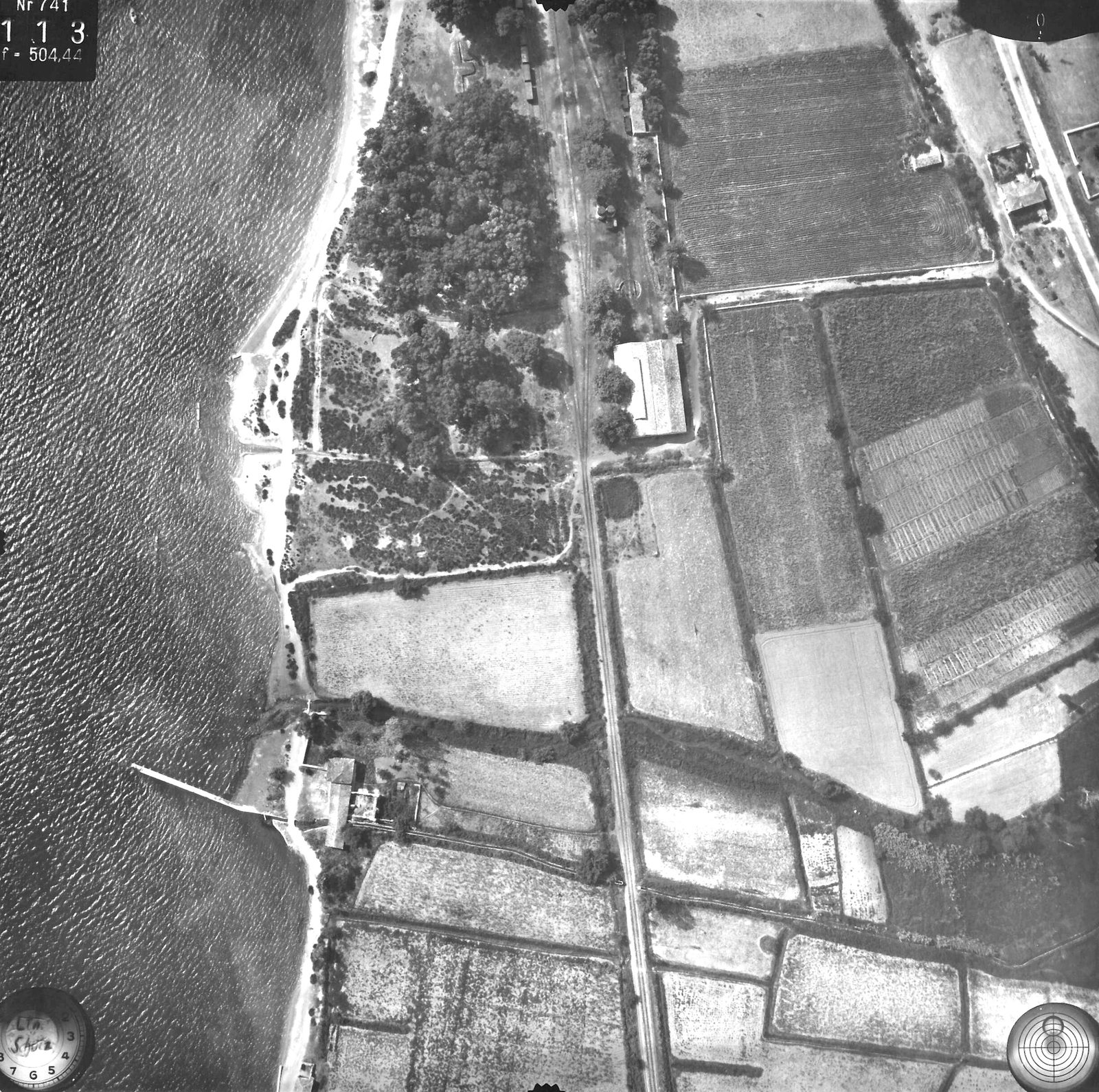
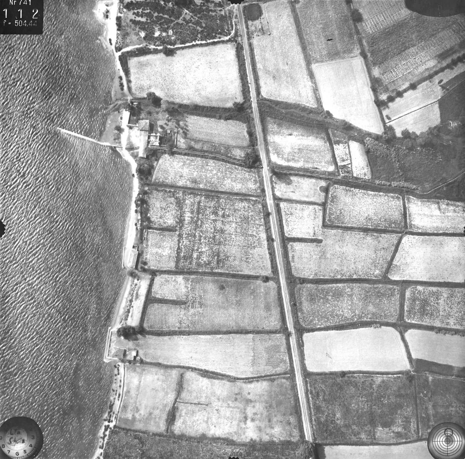
Vertical aerial photo (exposure 112) of the coast at Myloi with the long jetty, fields, road and railway.
Źródło: Reichsluftfahrtministerium (Sonderluftbildabteilung); DAI Athens archive, LB-RLM-EB-5-11-010
-
Powiększ:
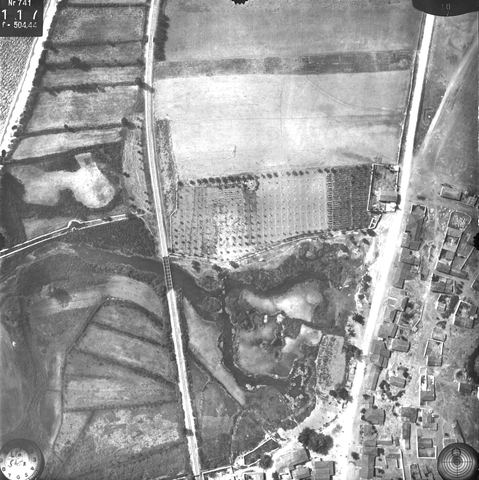
13 lipca 1941
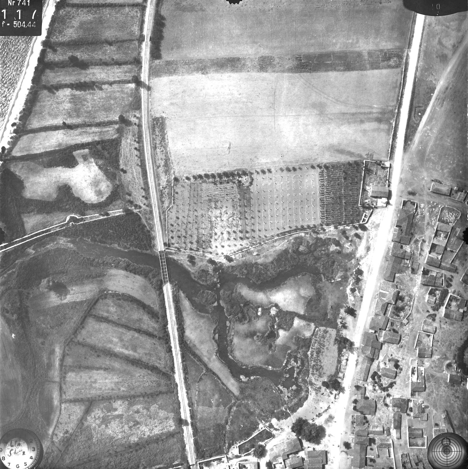
Vertical aerial photo annotated "Lerna": fields, orchards, the spring area and houses along the road.
Źródło: Reichsluftfahrtministerium (Sonderluftbildabteilung); DAI Athens archive, LB-RLM-EB-5-11-019
-
Powiększ:
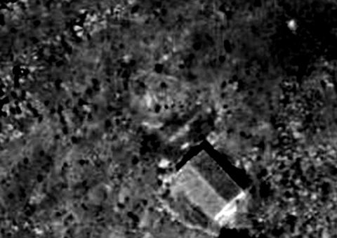
13 lipca 1941
Crop of a 1941 vertical aerial photo showing the small gabled Profitis Ilias chapel next to the castle on Pontinos.
Źródło: Reichsluftfahrtministerium; DAI Athens archive, LB-RLM-EB-5-11-003
-
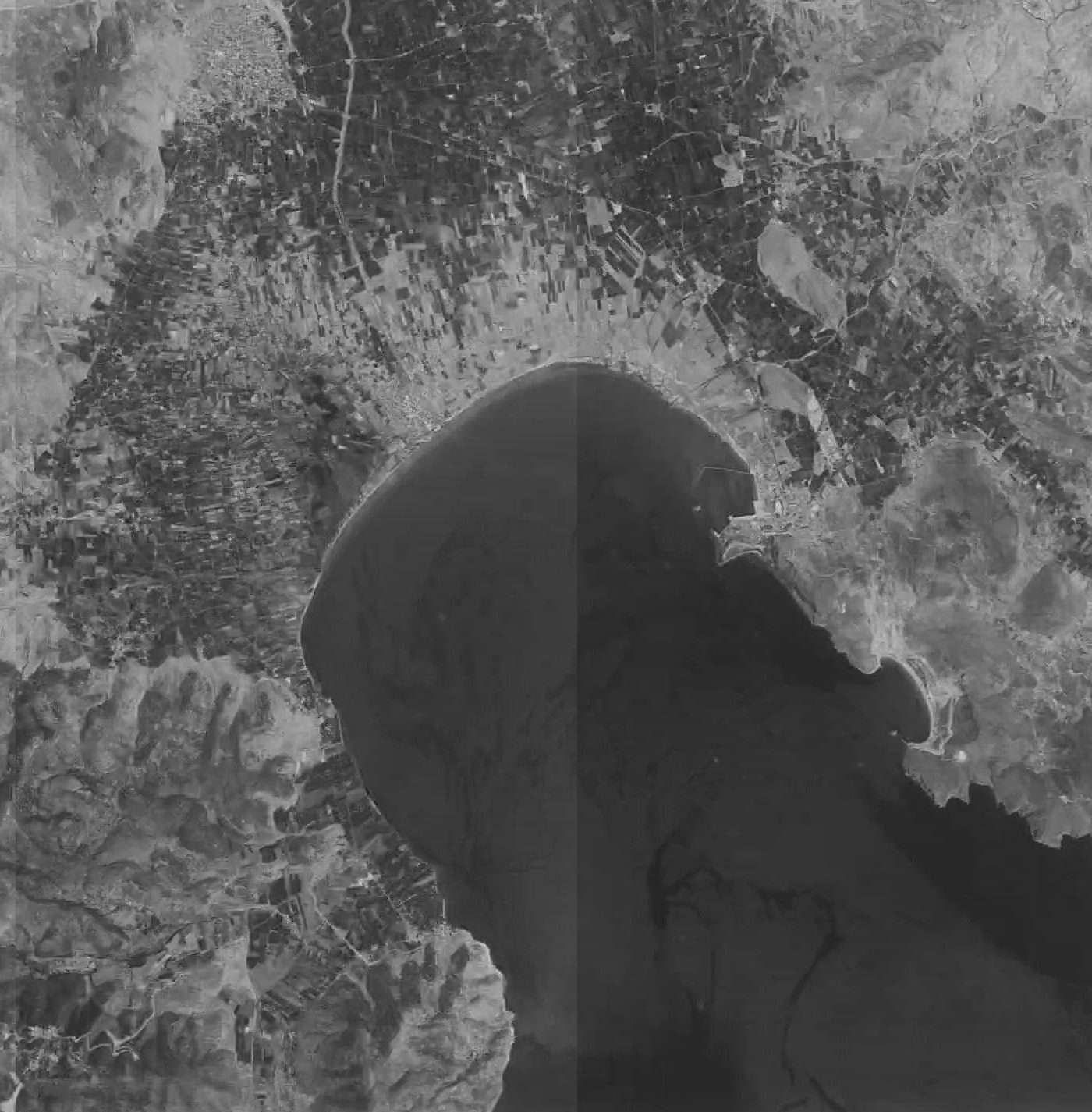
Powiększ:
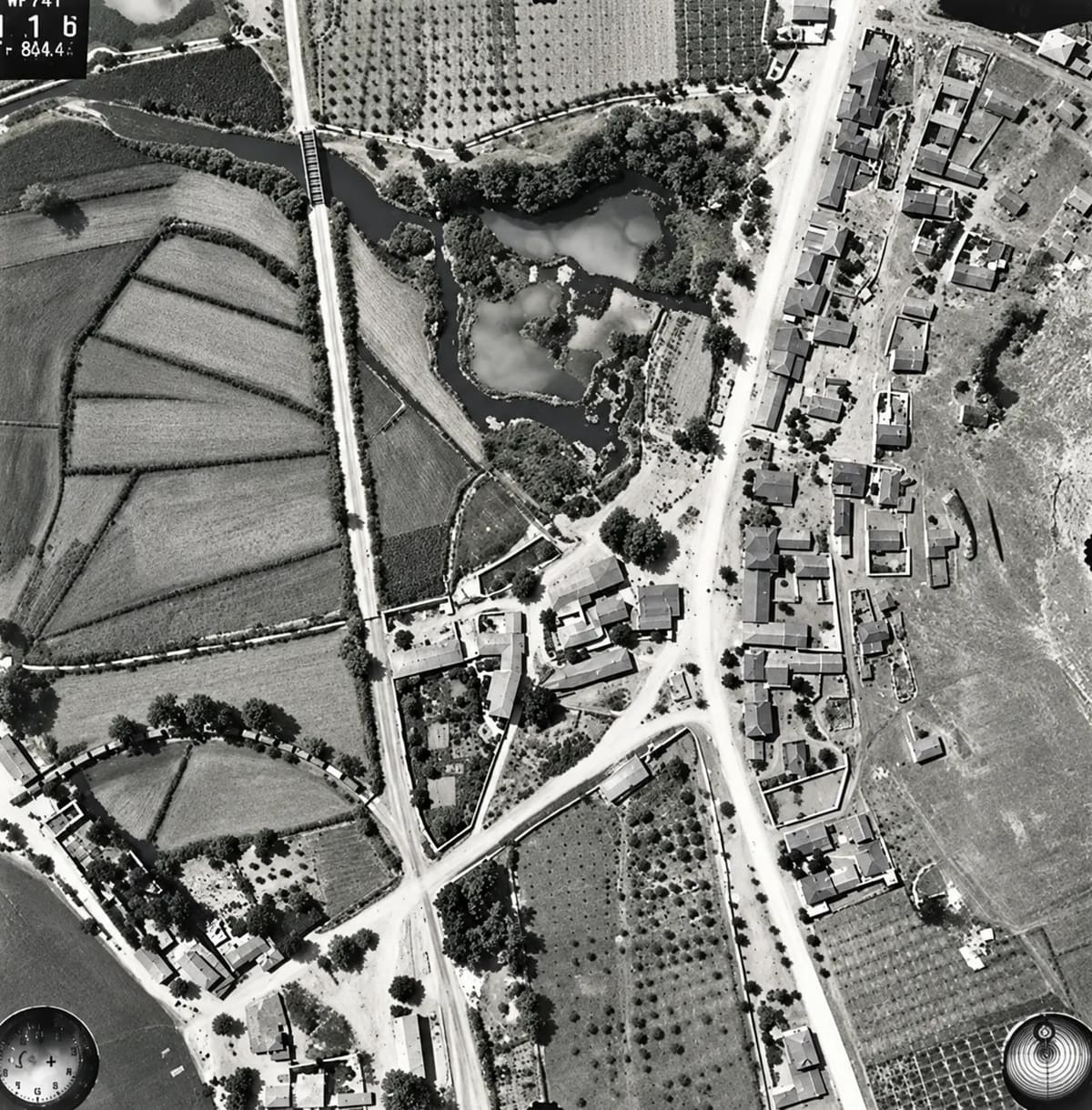
13 lipca 1941
Zdjęcie lotnicze Myloi z 13 lipca 1941: wioska, pola i wybrzeże z wysokości około 1000 metrów (cyfrowo odnowione)
Źródło: © D-DAI-ATH-Archiv, LB-RLM-EB-5-11-017, courtesy of the German Archaeological Institute, Athens
-
Powiększ:
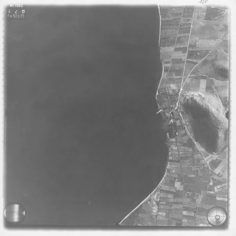
1941–1942
Strip-flight aerial photo (Aufnahme 042): Myloi village at the foot of Mt Pontinos, the long pier, the coastal railway, the station grounds and a shed with two parallel roofs among eucalyptus trees.
Źródło: Reichsluftfahrtministerium (Sonderluftbildabteilung); DAI Athens Archive
-
Powiększ:
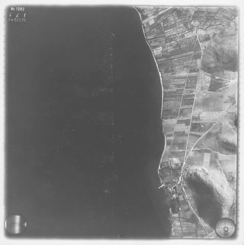
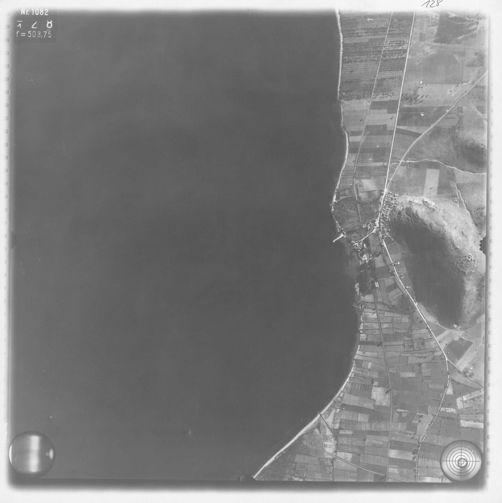
1941–1942
Strip-flight aerial photo (Aufnahme 043): Myloi with the pier and Mt Pontinos at lower right, and the railway and road running north towards Nea Kios/Argos.
Źródło: Reichsluftfahrtministerium (Sonderluftbildabteilung); DAI Athens Archive
-
Powiększ:
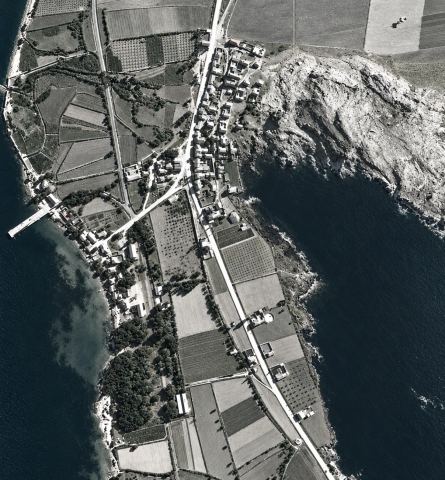
1941–1942
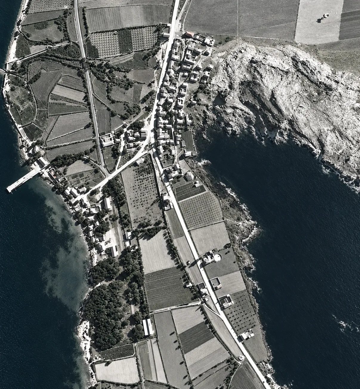
Myloi from a German reconnaissance flight: the village along the main road, the pier, the station, the orchards and the rocks of Pontinos.
Źródło: Reichsluftfahrtministerium (Sonderluftbildabteilung); DAI Athens Archive · cyfrowo odnowione
-
Powiększ:
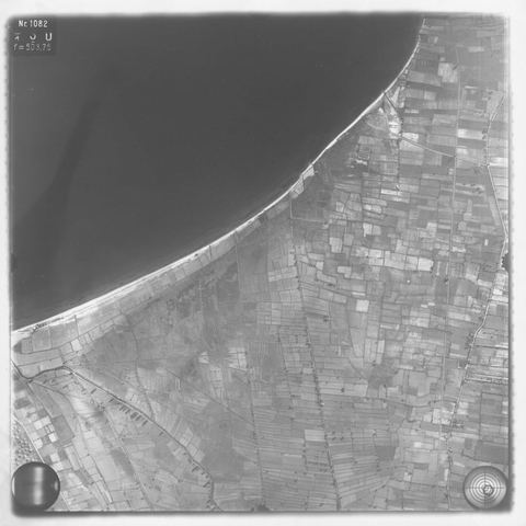
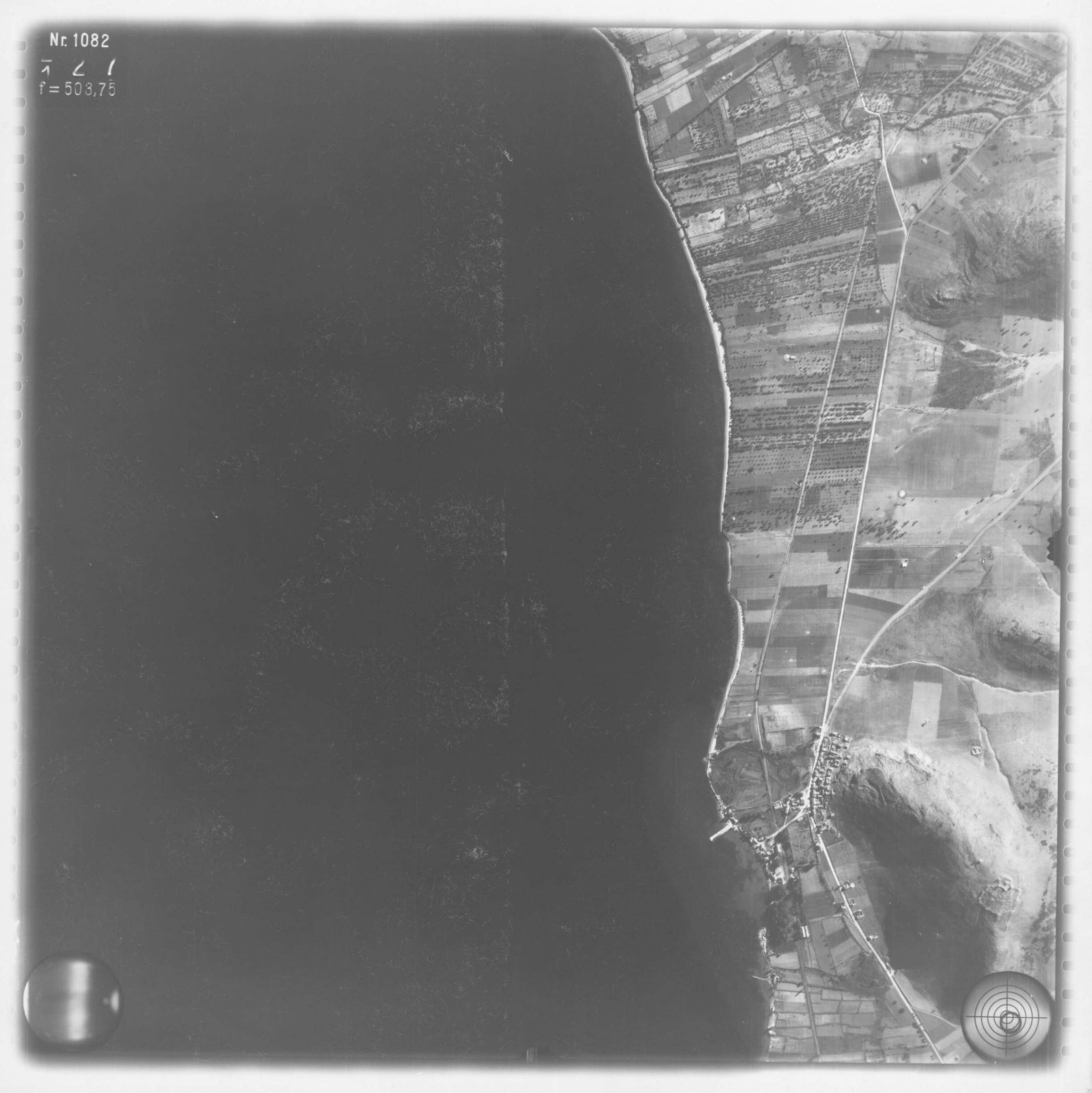
1941–1942
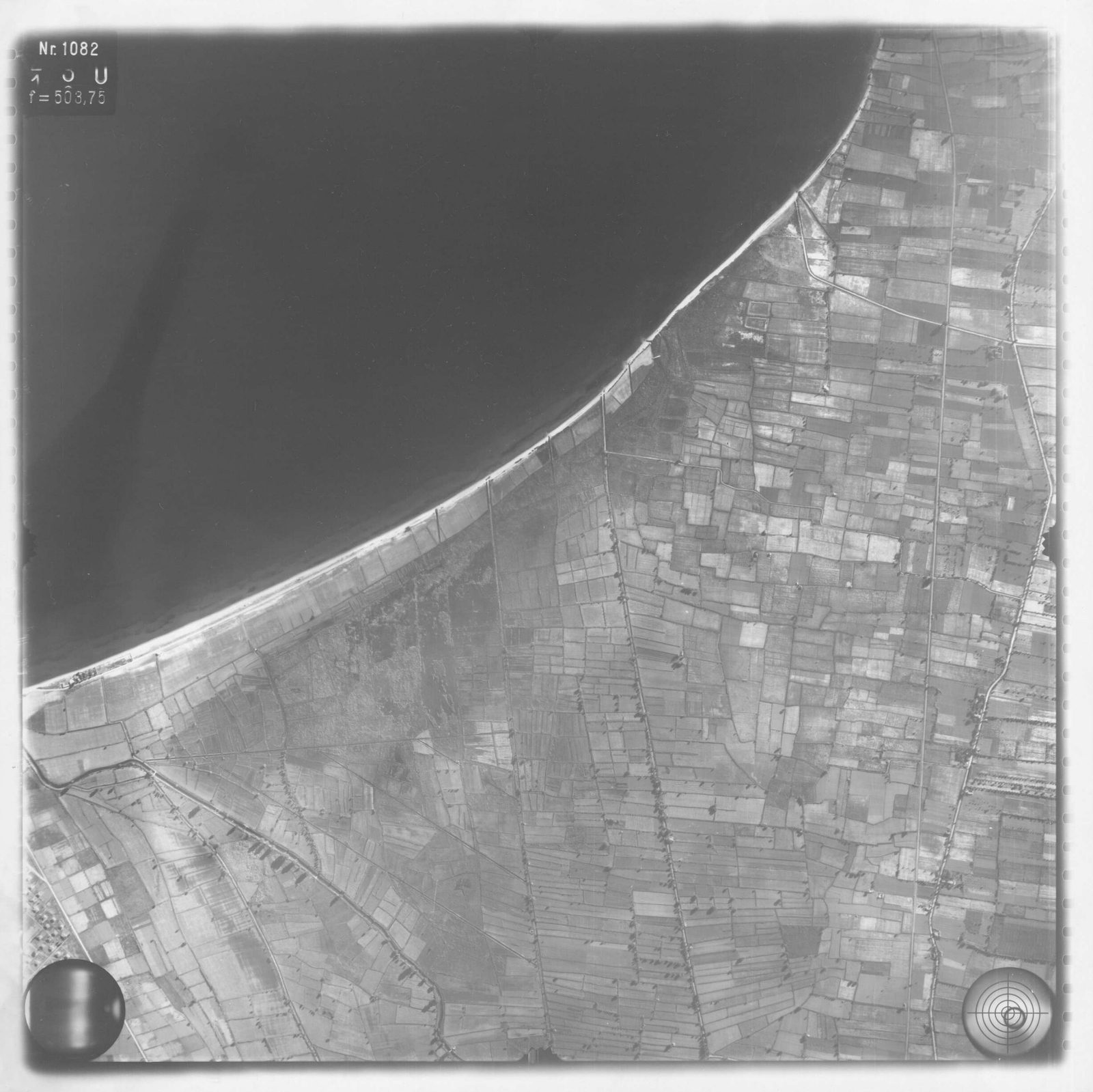
Strip-flight aerial photo of the coastal plain and shore at the head of the Argolic Gulf near Myloi.
Źródło: Reichsluftfahrtministerium; DAI Athens archive, LB-RLM-SF-3-05-040
-
Powiększ:
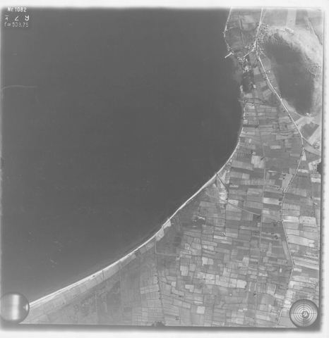
1941–1942
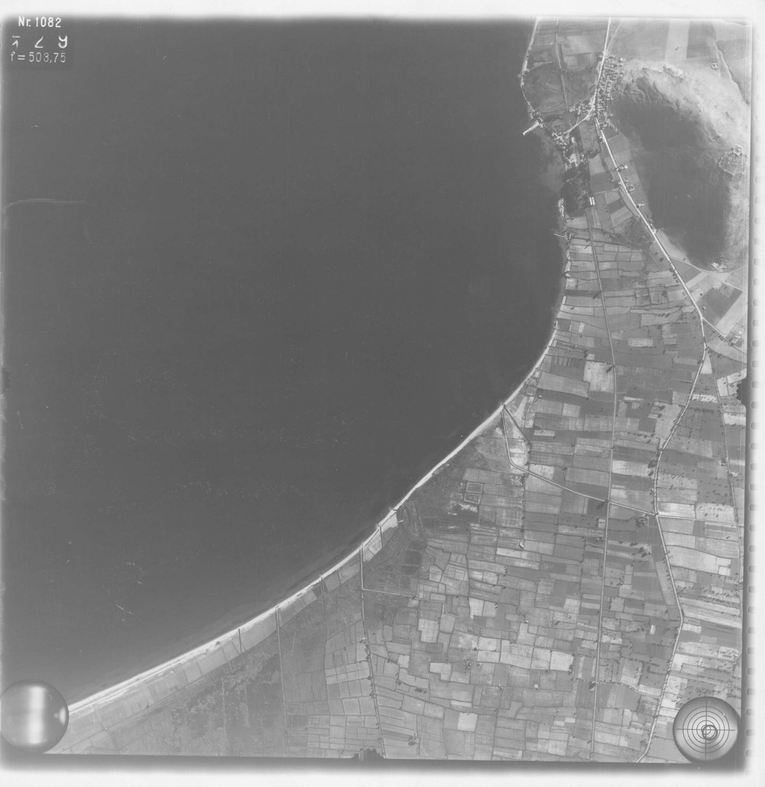
Strip-flight aerial photo of the coast and plain annotated "Myli", with the village at the edge of the frame.
Źródło: Reichsluftfahrtministerium; DAI Athens archive, LB-RLM-SF-3-05-041
-
Powiększ:
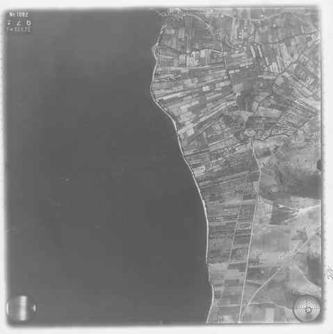
1941–1942
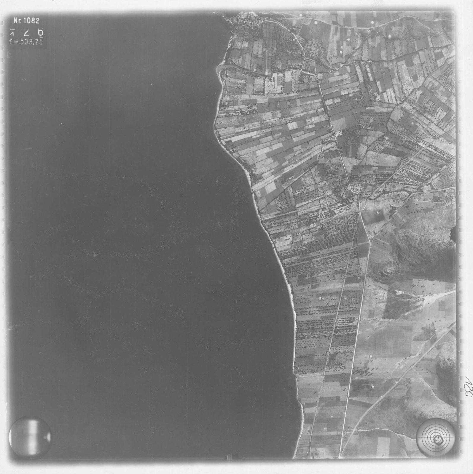
Strip-flight aerial photo of the narrow coastal plain south of Myloi towards Kiveri, with fields and a road.
Źródło: Reichsluftfahrtministerium; DAI Athens, Film 93 exposure 044
-
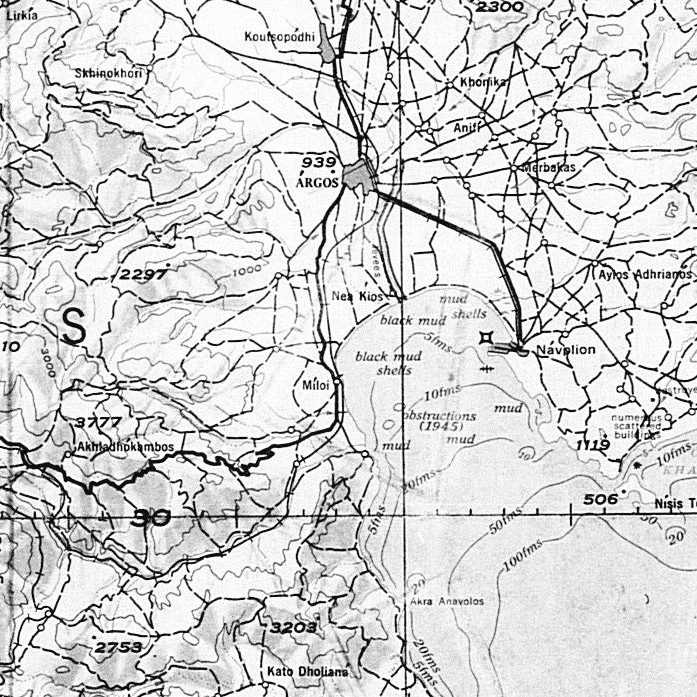
Powiększ:
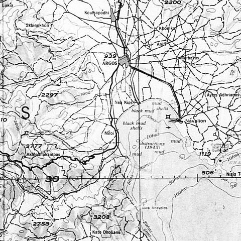
1940–1945
Detail of the base map (USAF 343 CI, 1:250,000) used for the aerial-photo overlay index, showing 'Mili', Argos and Navplion.
Źródło: US National Archives (NARA), Record Group 373
-
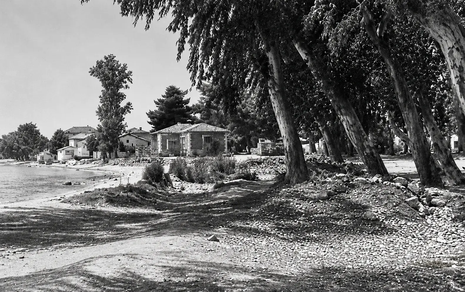
Powiększ:
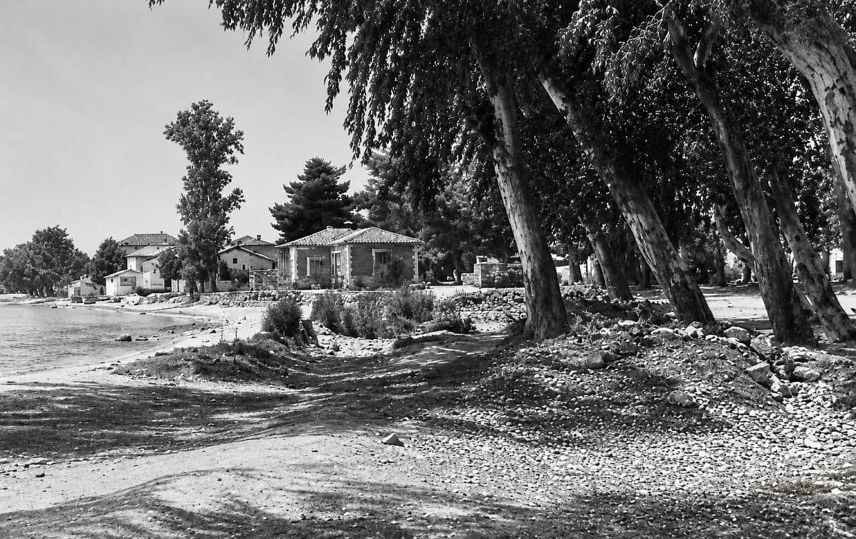
maj 1945
Wysokie eukaliptusy nad wodą w Myloi, sfotografowane w maju 1945 (cyfrowo odnowione)
Źródło: Australian War Memorial 130831, photo V. J. Krauth · public domain
-
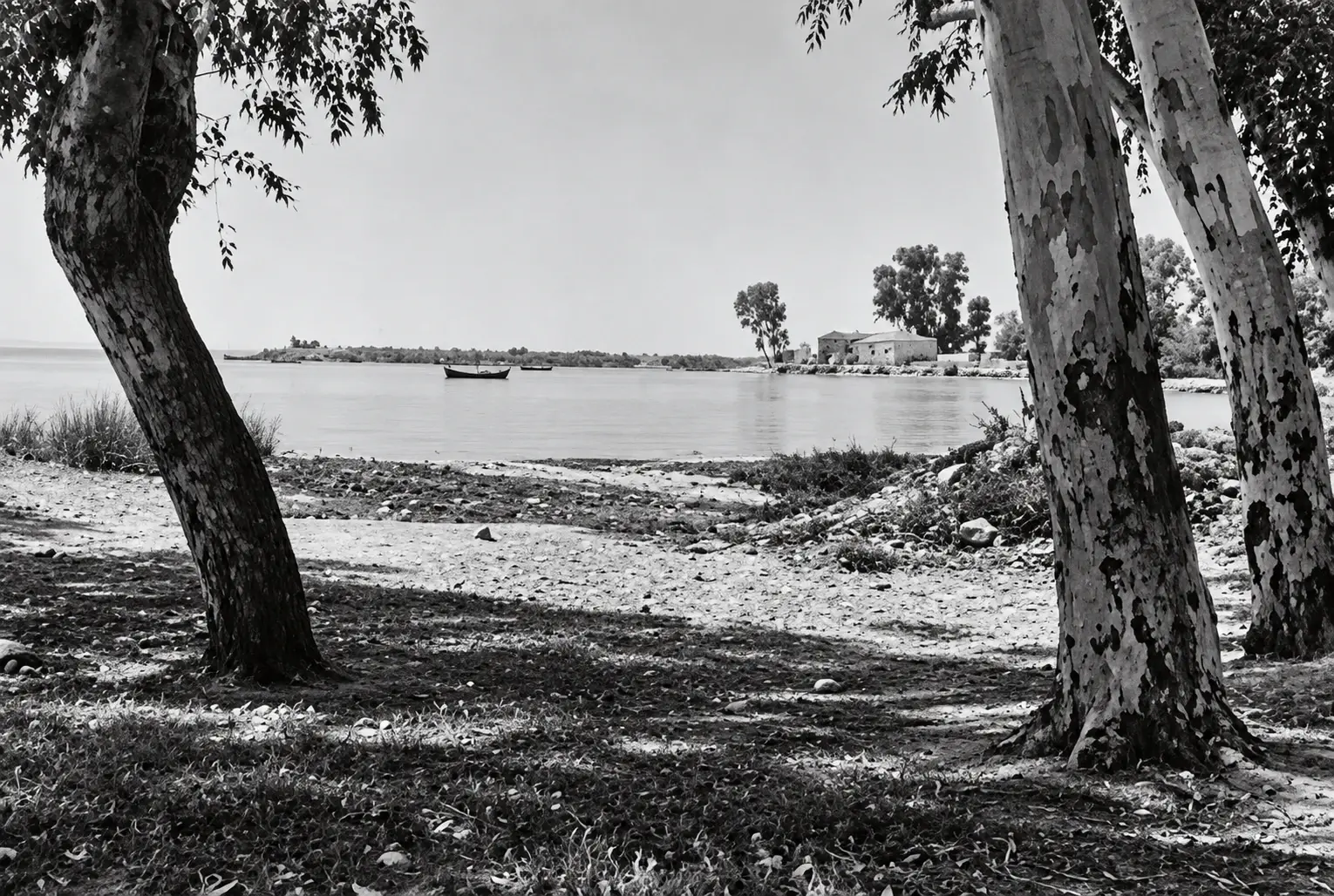
Powiększ:
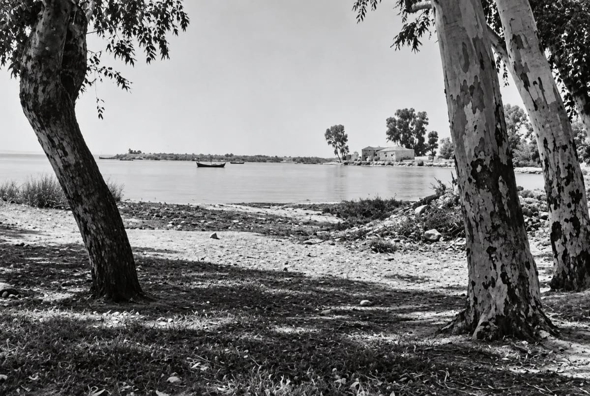
maj 1945
Plaża w Myloi w maju 1945: pnie eukaliptusów na brzegu, spokojna zatoka z dwiema łodziami i domy na cyplu (cyfrowo odnowione)
Źródło: Australian War Memorial 130887, photo V. J. Krauth · public domain
-
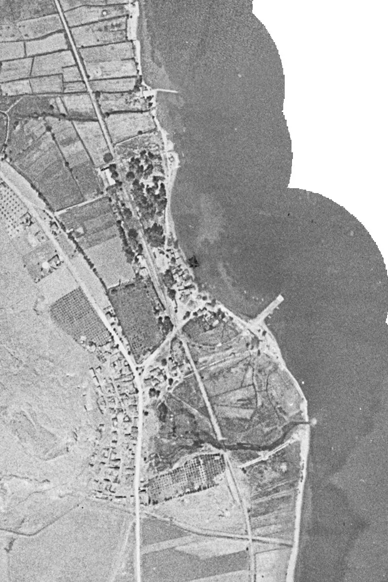
Powiększ:
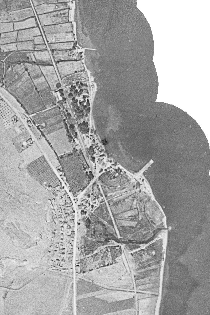
1945 lub 1960
Historyczna ortofotomapa Myloi z molem, linią kolejową i sadami
Źródło: Hellenic Cadastre, historic orthophoto layer 1945/60
-
Powiększ:
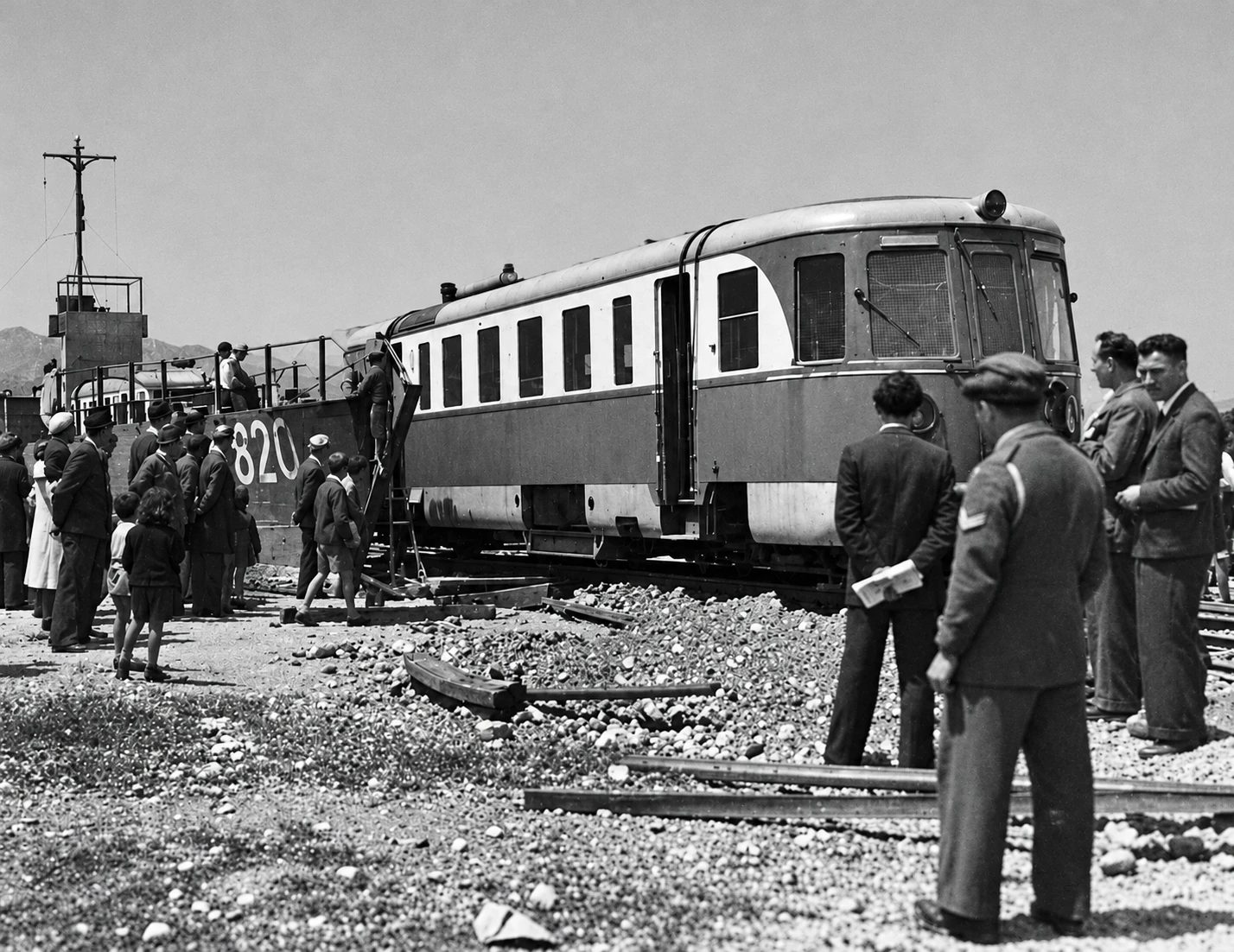
1947
Port of Myloi, 1947: an Uerdingen railcar ('motraki') disembarks from a Navy landing craft (no. 820) while another waits in its hold; crowd and men in uniform watch.
Źródło: Unknown photographer; reproduced by the Ephorate of Antiquities of Argolida · cyfrowo odnowione
-
Powiększ:
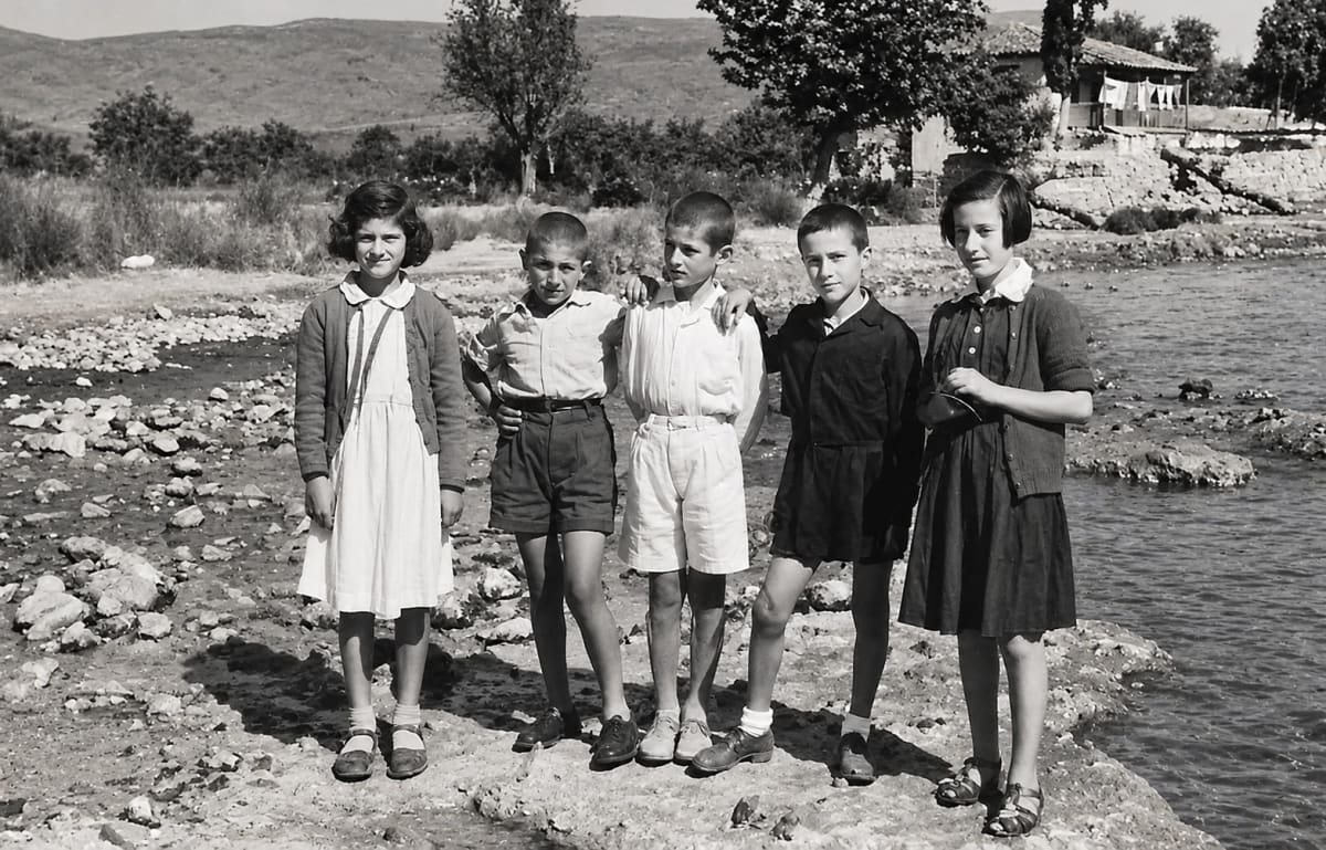
ok. 1940–1955
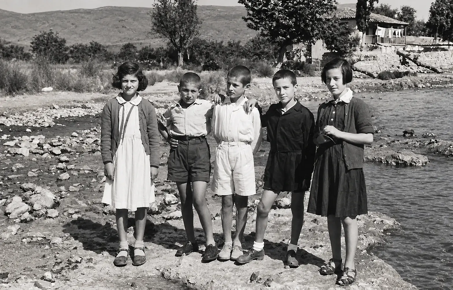
Pięcioro dzieci stoi obok siebie na kamienistym brzegu wody (cyfrowo odnowione)
Źródło: Visit Myloi collection
-
Powiększ:
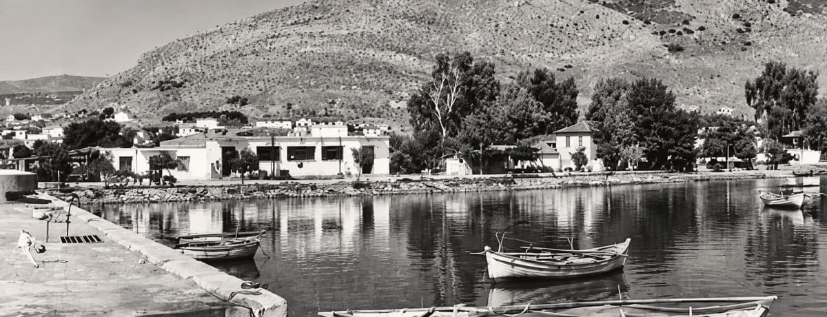
koniec lat 40.
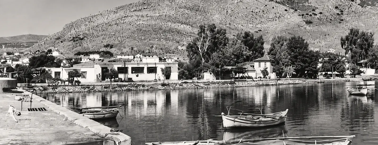
Czarno-biały widok nabrzeża portowego z łódkami, białymi budynkami i wzgórzem Pontinos w tle (cyfrowo odnowione)
Źródło: Visit Myloi collection
-
Powiększ:
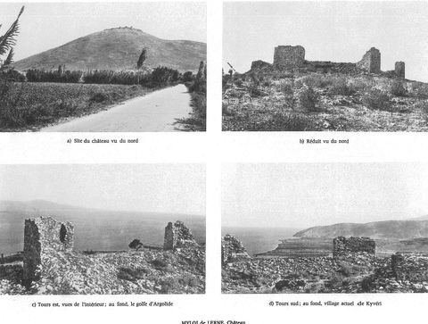
ok. 1938–1960
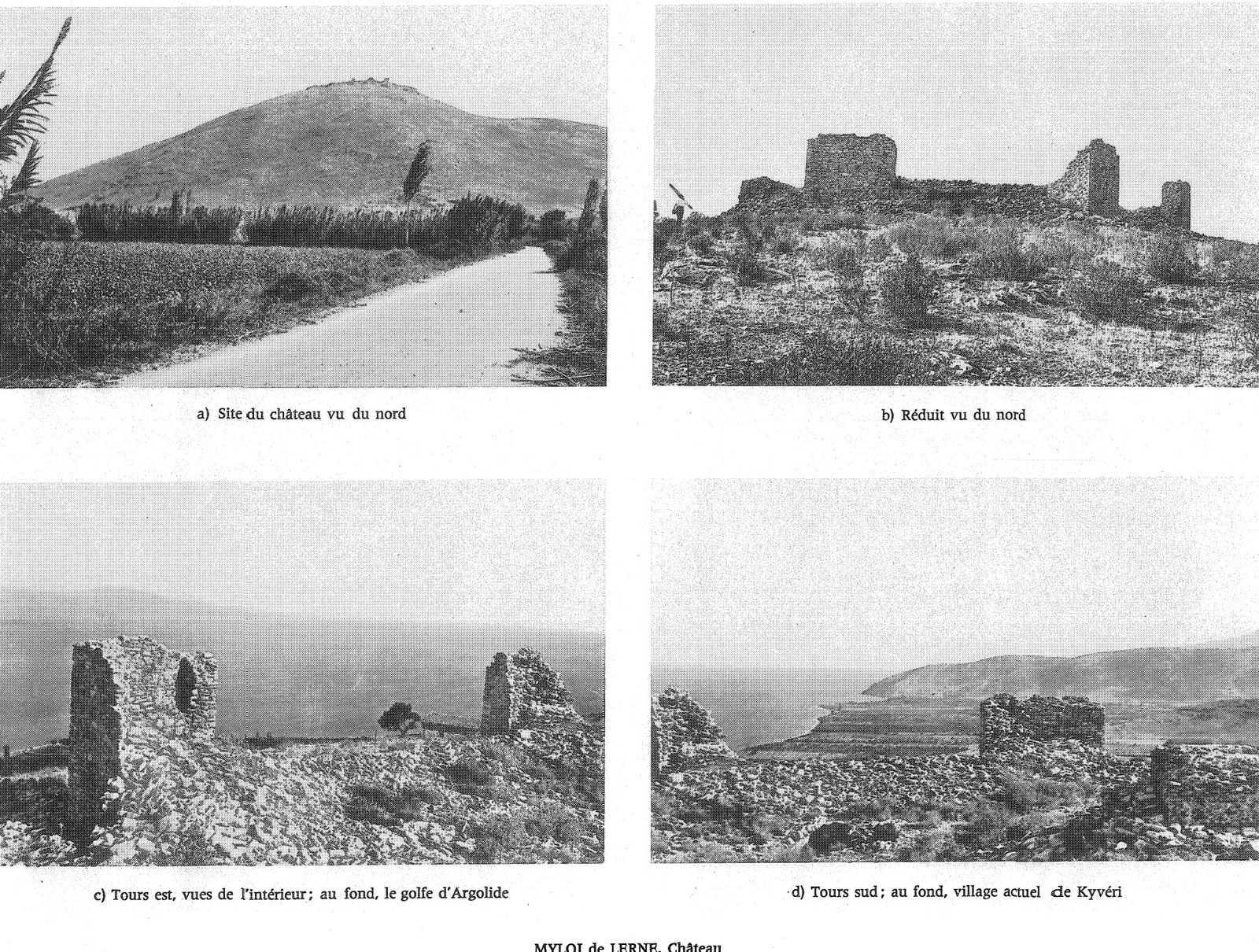
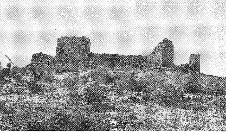
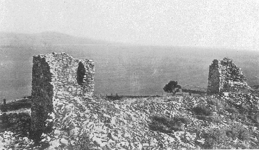
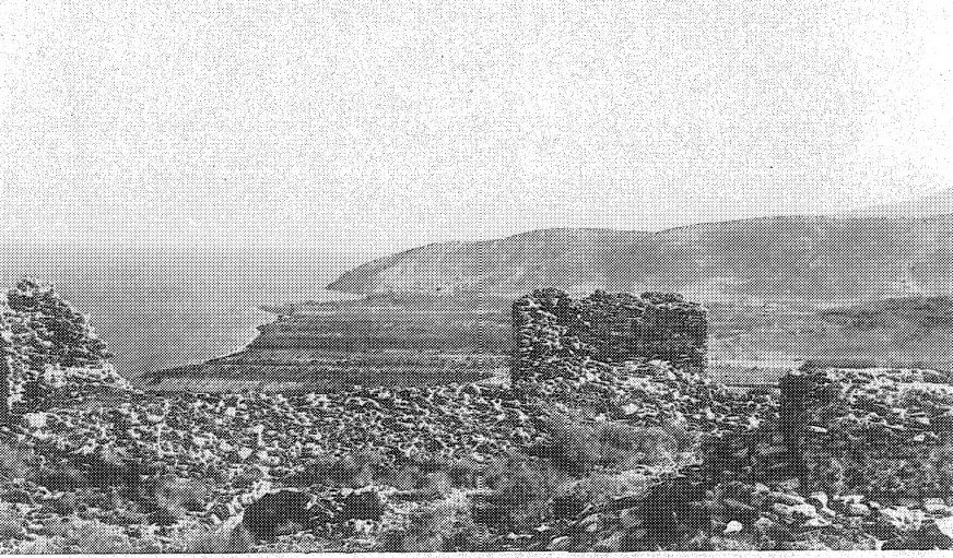
Full plate 140 'MYLOI de LERNE. Château' with four photos of the castle on Mt Pontinos.
Źródło: Antoine Bon
-
Powiększ:
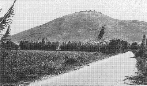
ok. 1938–1960
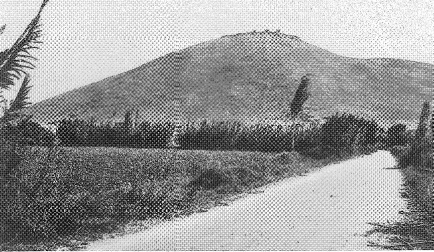
Pl. 140a 'Site du château vu du nord': Mt Pontinos with the castle seen from the north, with a dirt road, reeds and cypresses along fields at its foot.
Źródło: Antoine Bon
-
Powiększ:
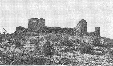
ok. 1938–1960
Pl. 140b 'Réduit vu du nord': the inner keep of the Myloi castle seen from the north.
Źródło: Antoine Bon
-
Powiększ:
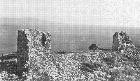
ok. 1938–1960
Pl. 140c 'Tours est, vues de l'intérieur': the east towers of the Myloi castle from inside, with the Argolic Gulf behind.
Źródło: Antoine Bon
-
Powiększ:
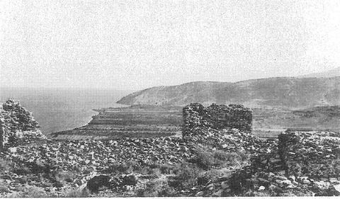
ok. 1938–1960
Pl. 140d 'Tours sud': the south towers of the Myloi castle, with the village of Kiveri in the background.
Źródło: Antoine Bon
Lata 50.: wykopaliska w Lernie (106)
-
Powiększ:
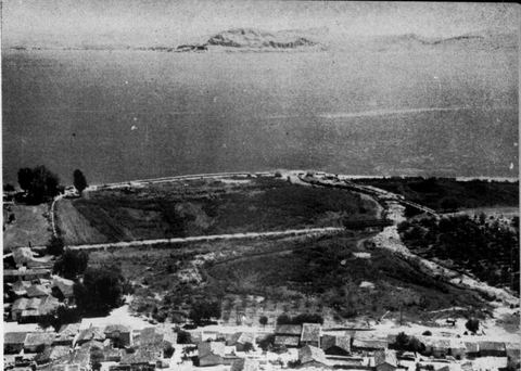
1952 (prawdopodobnie wrzesień)
View east from Mt Pontinos over the roofs of Myloi towards the springs and marshes of Lerna, the gulf and Nafplio.
Źródło: J. L. Caskey excavation (photographer not named)
-
Powiększ:
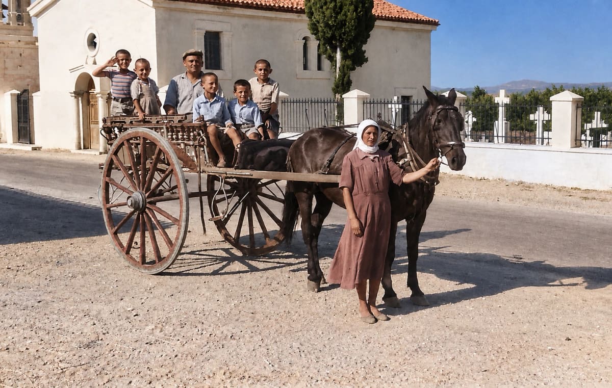
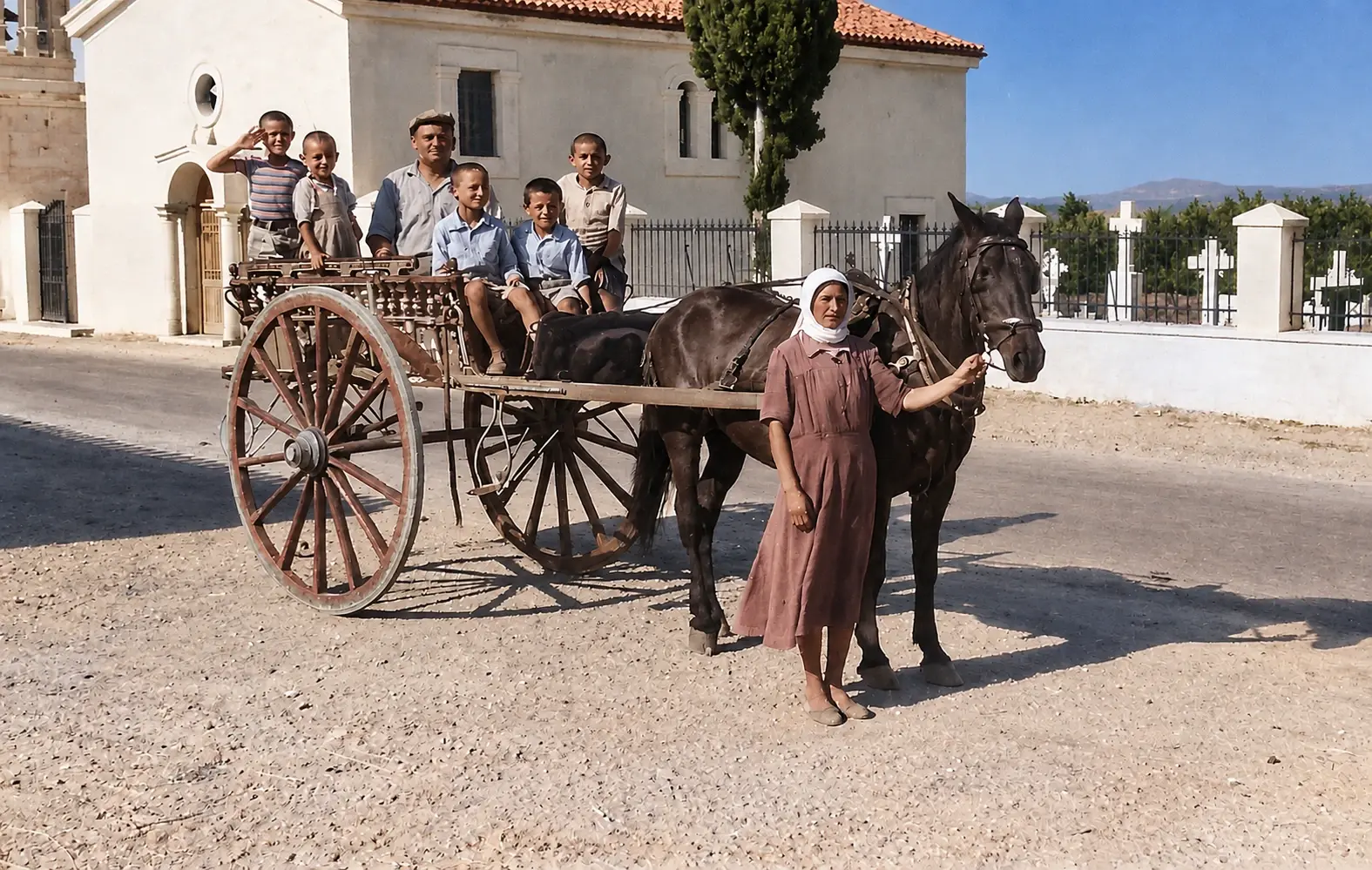
ok. 1952–1958
Pokolorowane później: rodzina pozuje z wozem zaprzężonym w konia przed cerkwią Agios Dimitrios i otoczonym murem cmentarzem, w latach 50., gdy Amerykanie prowadzili wykopaliska w Lernie
Źródło: George Kondis
-
Powiększ:
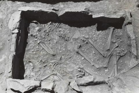
1953
Lerna excavation: cist grave in the area of House M.
Źródło: Lerna excavation team (J.L. Caskey), ASCSA Lerna Excavations Archive; reproduced by the Ephorate of Antiquities of Argolida
-
Powiększ:
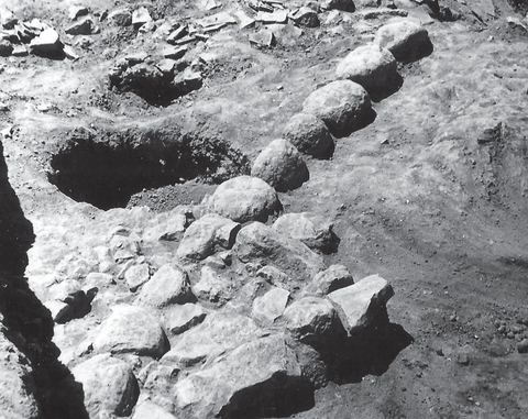
1953
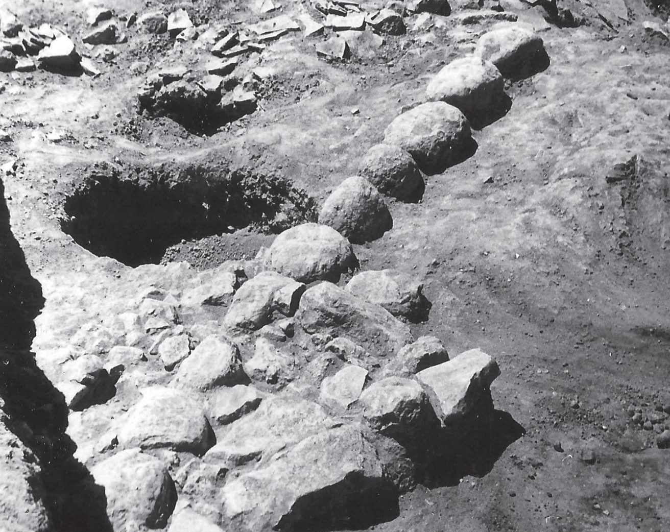
Lerna excavation: part of the southern edge of the tumulus during excavation.
Źródło: Lerna excavation team (J.L. Caskey), ASCSA Lerna Excavations Archive; reproduced by the Ephorate of Antiquities of Argolida
-
Powiększ:
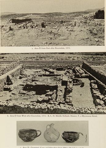
1953
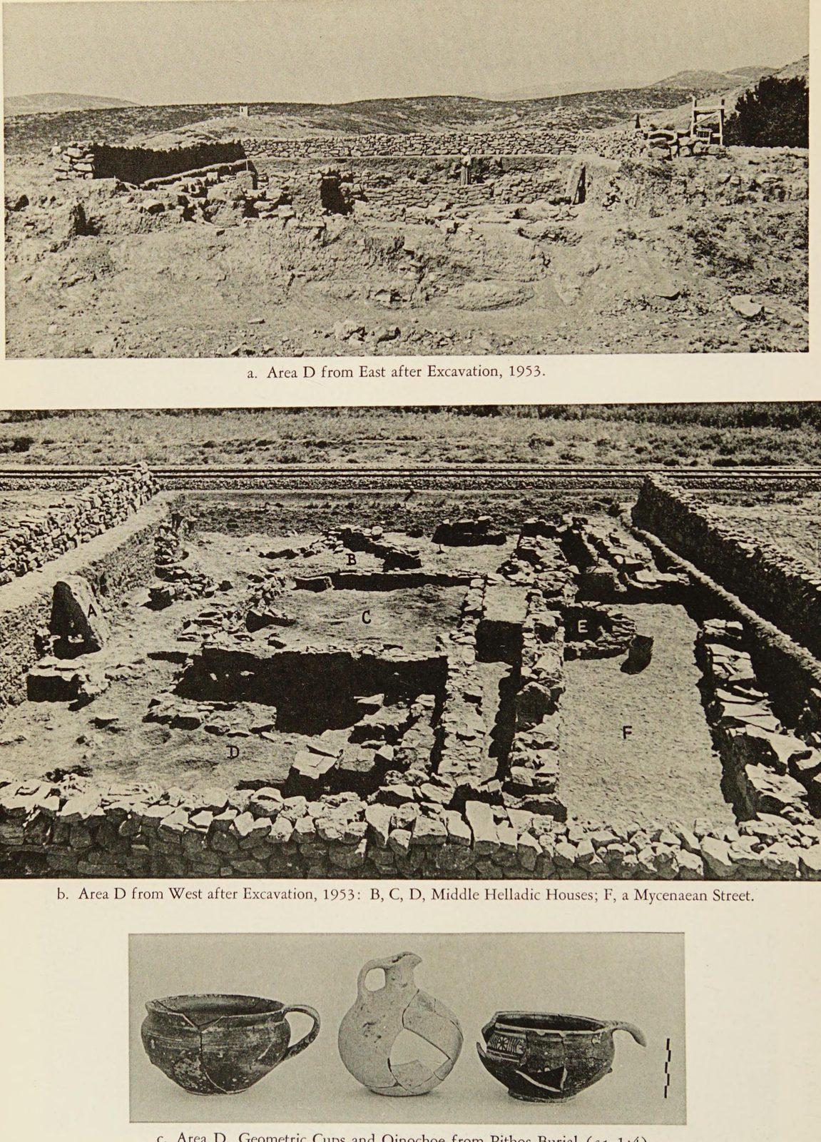
Hesperia plate showing excavation Area D at Lerna, with the Argos–Myloi railway right beside the trench, plus pottery.
Źródło: J. L. Caskey / ASCSA Lerna excavation
-
Powiększ:
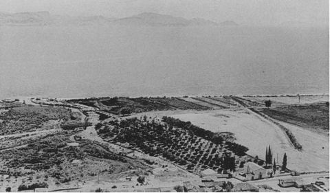
1952–1953
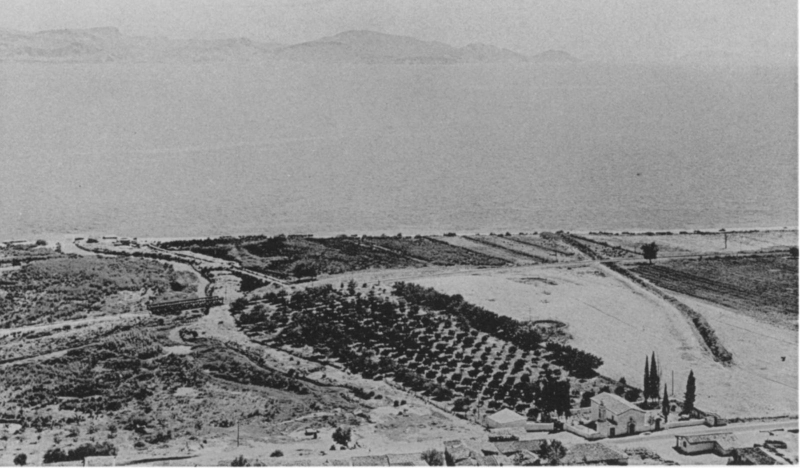
The Lernaean marshes, the Amymone stream and the excavation site seen from Mt Pontinos, with houses of Myloi, the railway and orchards.
Źródło: J. L. Caskey / ASCSA Lerna excavation
-
Powiększ:
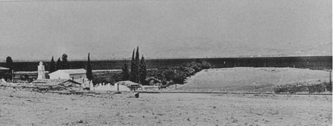
1952–1953
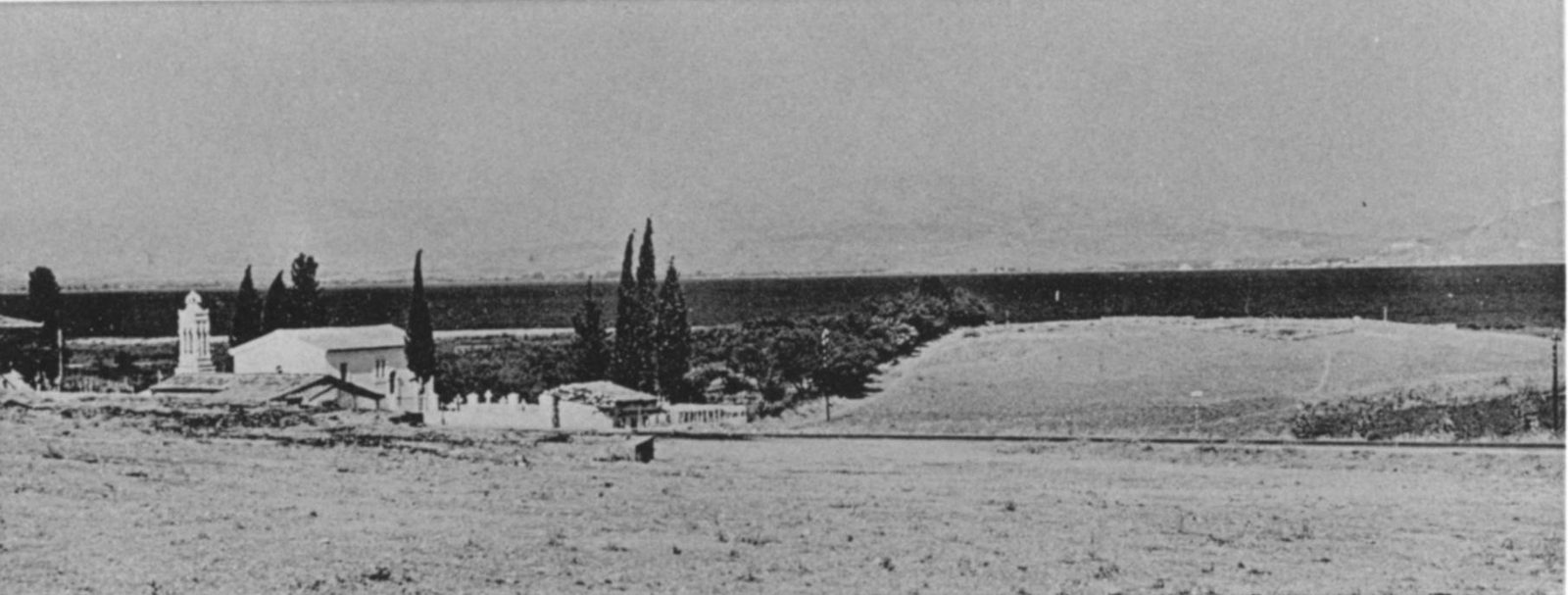
The Lerna mound from the west, with a small church and white buildings among cypresses.
Źródło: J. L. Caskey / ASCSA Lerna excavation
-
Powiększ:
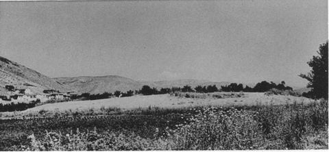
1952–1953
The Lerna mound from the south-east, with houses of Myloi at the foot of Mt Pontinos on the left.
Źródło: J. L. Caskey / ASCSA Lerna excavation
-
Powiększ:
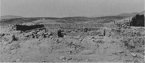
1953
Excavation Area D at Lerna from the east, with the surrounding landscape and hills.
Źródło: J. L. Caskey / ASCSA Lerna excavation
-
Powiększ:
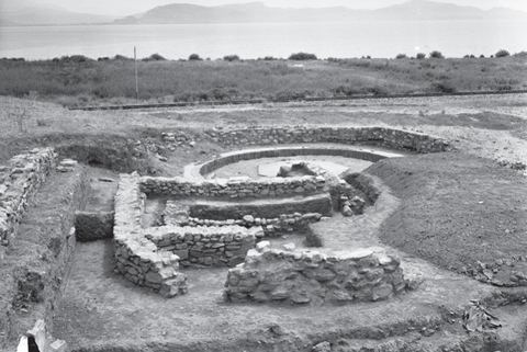
1954
Lerna excavation: the successive apsidal houses D and M seen from the west, with a Second World War machine-gun post in the background, the Myloi–Argos railway, a telegraph pole, the coastal plain and the Argolic Gulf.
Źródło: Lerna excavation team (J.L. Caskey), ASCSA Lerna Excavations Archive; reproduced by the Ephorate of Antiquities of Argolida
-
Powiększ:
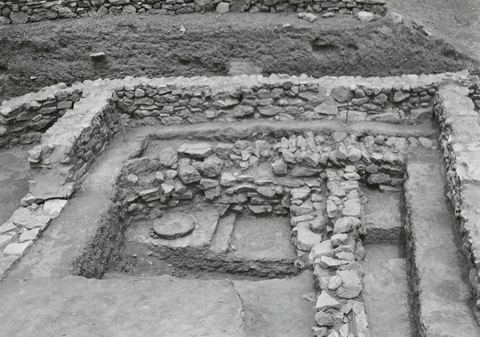
1954
Lerna excavation: part of House D beneath the later House M, seen from the south.
Źródło: Lerna excavation team (J.L. Caskey), ASCSA Lerna Excavations Archive; reproduced by the Ephorate of Antiquities of Argolida
-
Powiększ:
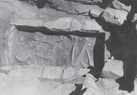
1953 lub 1955
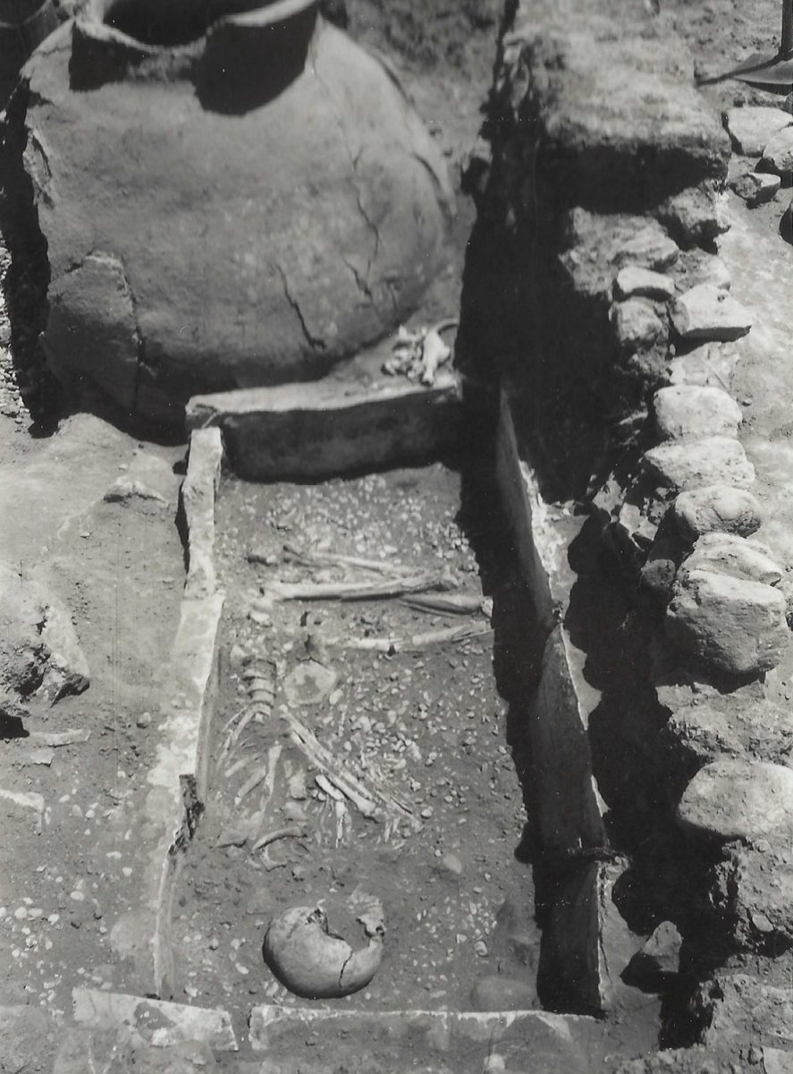
Lerna excavation: cist grave D.9.
Źródło: Lerna excavation team (J.L. Caskey), ASCSA Lerna Excavations Archive; reproduced by the Ephorate of Antiquities of Argolida
-
Powiększ:
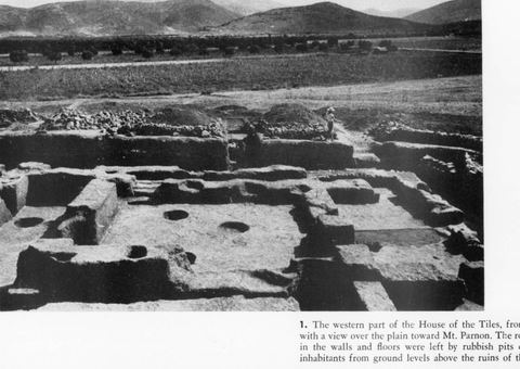
lato 1954
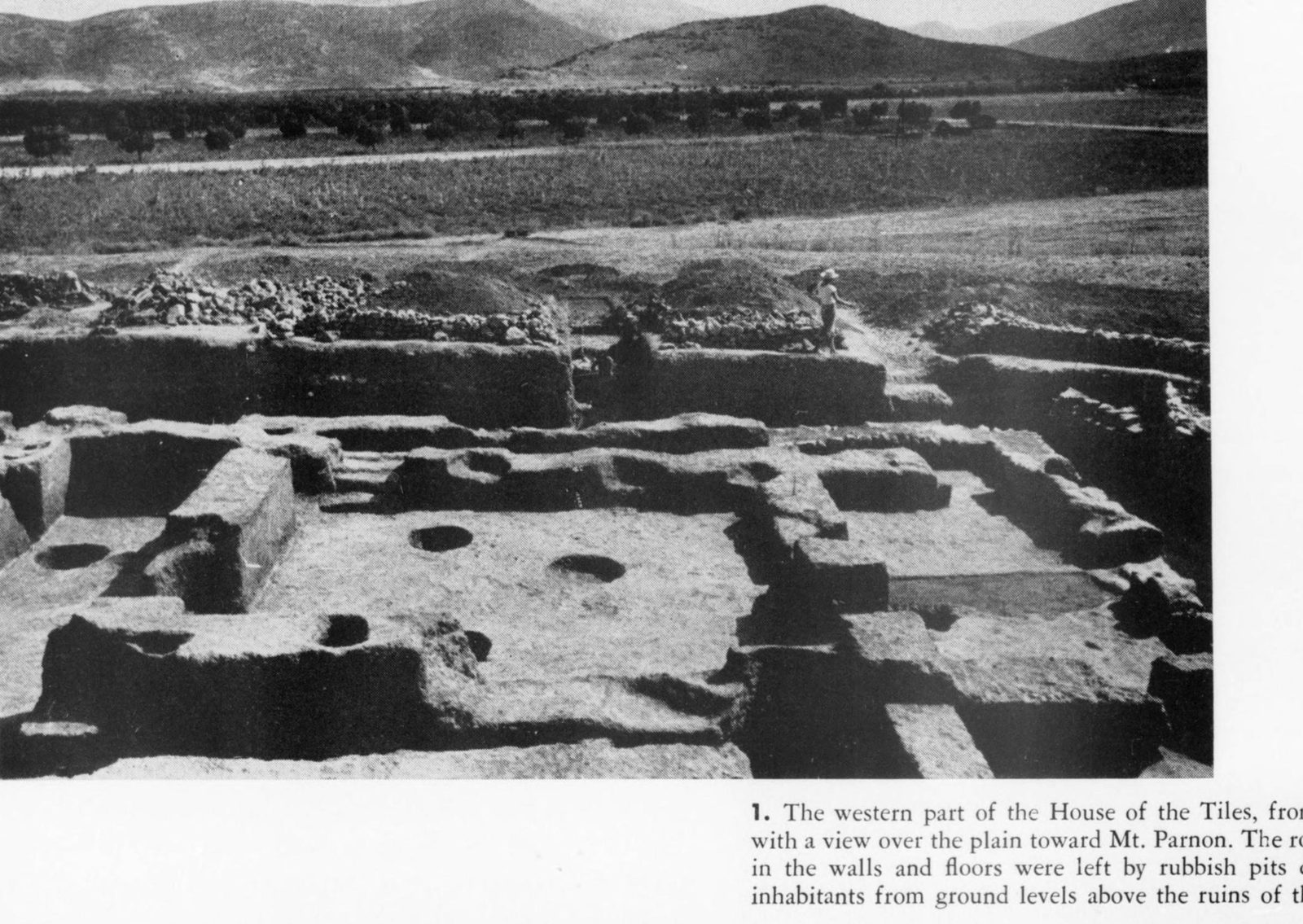
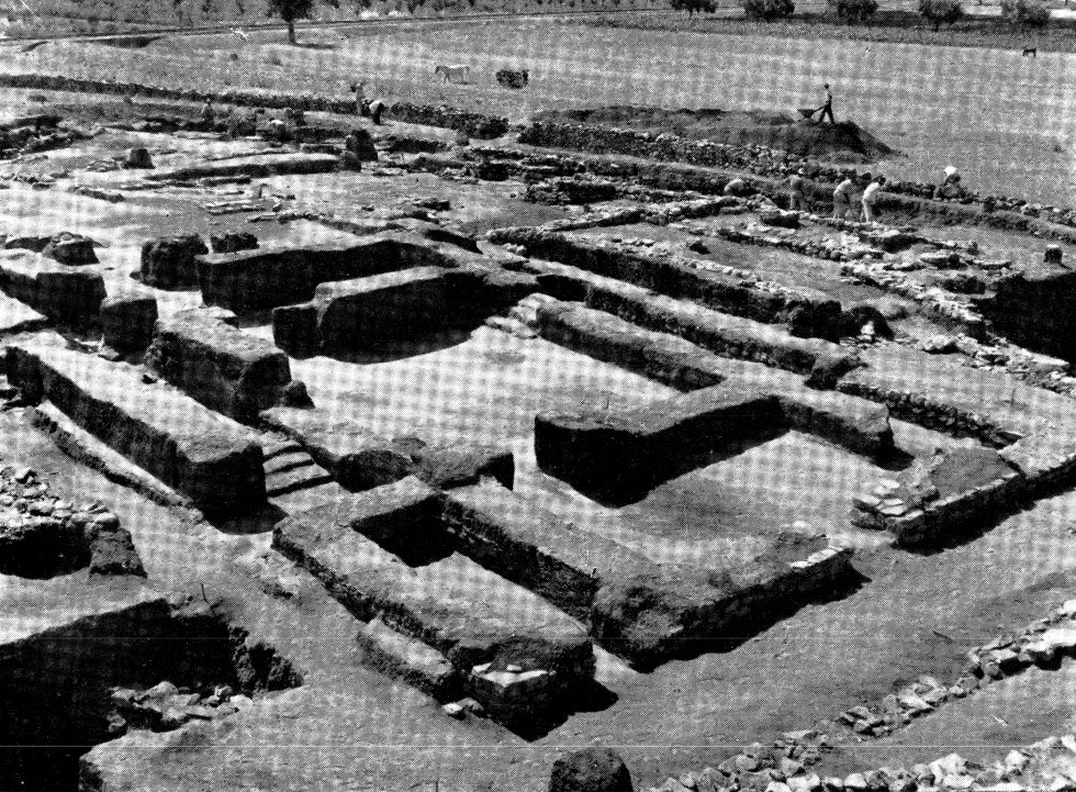
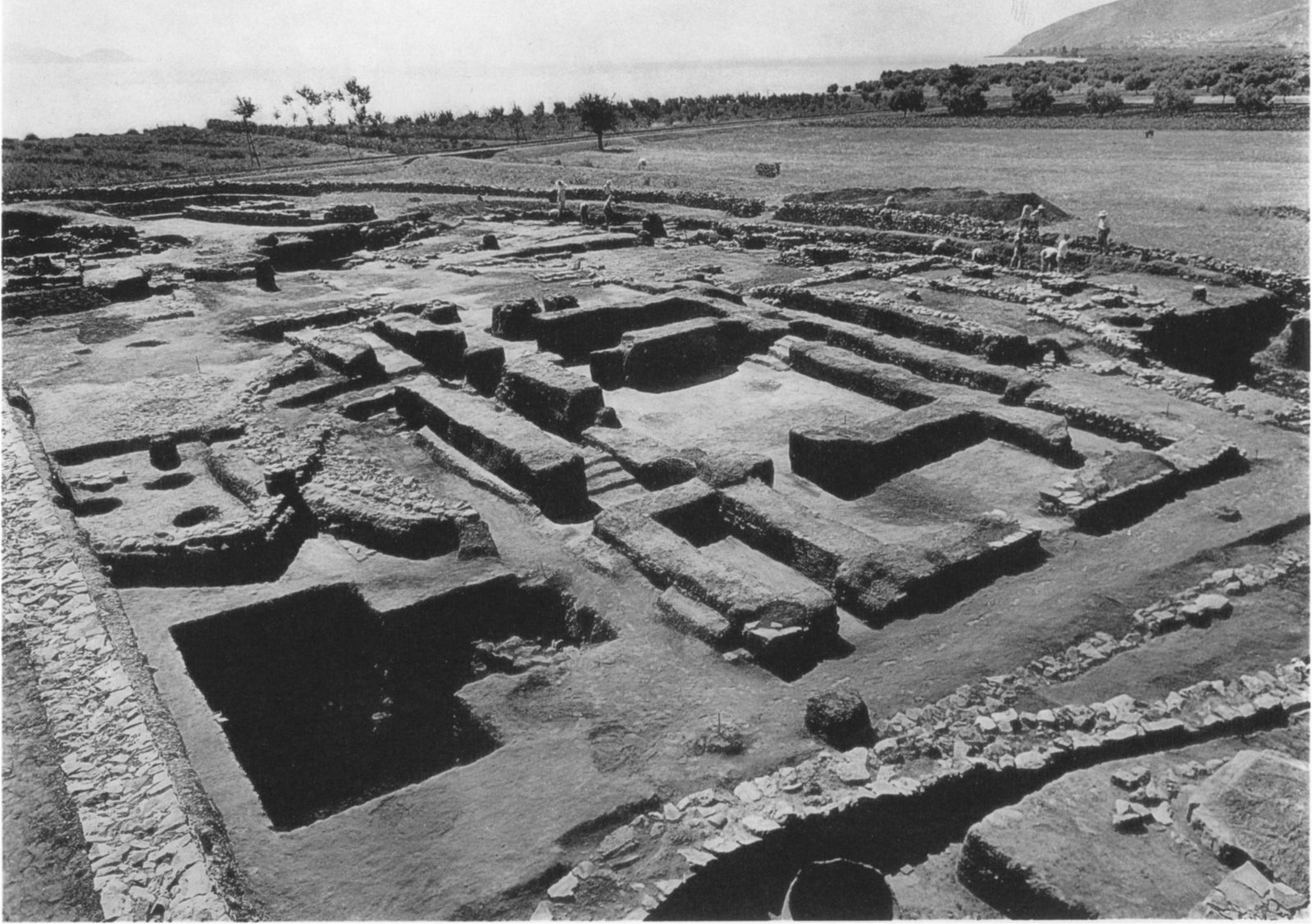
The western part of the House of the Tiles at Lerna from the north, with a view over the plain with olive groves, a dirt road and the mountains, and an excavation worker on the edge.
Źródło: J.L. Caskey, Archaeology 8.2 (1955) p. 116, fig. 1
-
Powiększ:
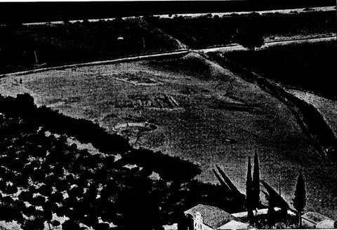
1954
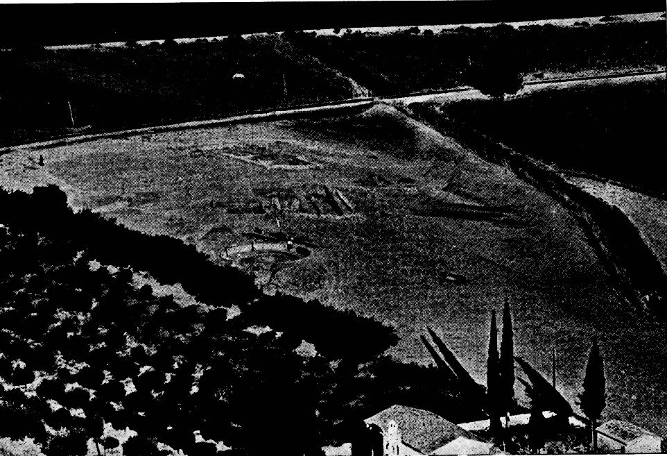
Telephoto view from Mt Pontinos onto the Lerna excavation, with in the foreground a small church with bell tower and cypresses and roofs of Myloi, an olive grove, the road/railway and the WWII tank trap.
Źródło: Bulletin de Correspondance Hellénique, Chronique des fouilles (photos probably supplied by ASCSA/Caskey)
-
Powiększ:
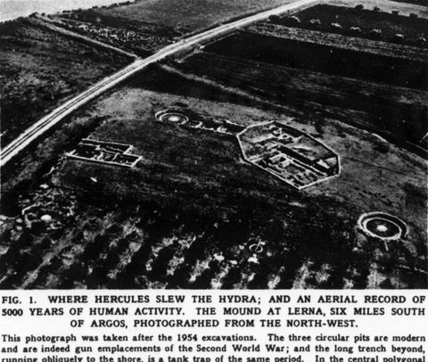
po lecie 1954
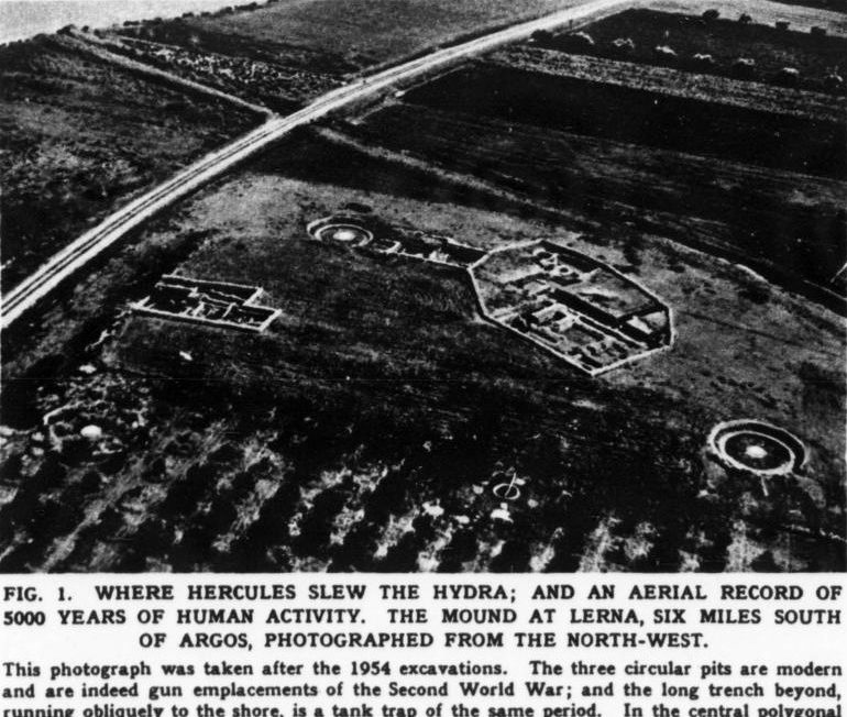
Oblique aerial photo of the mound of Lerna from the northwest after the 1954 season, showing three Second World War gun emplacements, a WWII tank trap running to the shore, the House of Tiles and an orchard.
Źródło: Lerna excavation (J.L. Caskey, ASCSA), published in ILN
-
Powiększ:
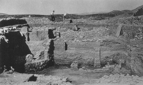
1954
Excavation Area D at Lerna from the west, with workmen (probably villagers).
Źródło: J. L. Caskey / ASCSA Lerna excavation
-
Powiększ:
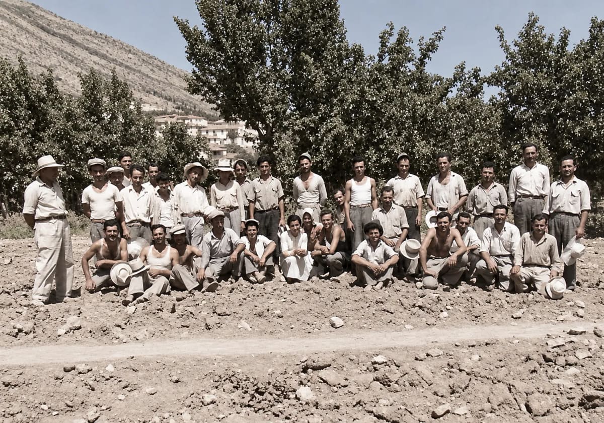
1954
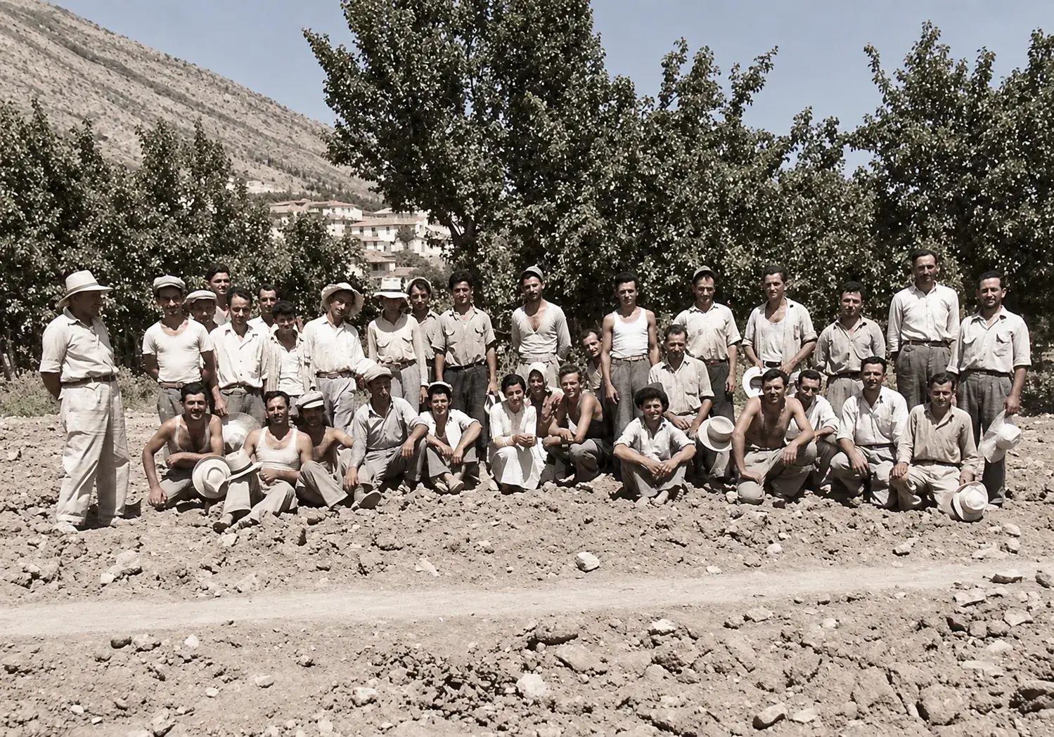
Pokolorowane później: ekipa, która w 1954 roku pracowała przy wykopaliskach w Lernie razem z Amerykańską Szkołą Studiów Klasycznych
Źródło: George Kondis
-
Powiększ:
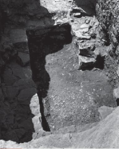
1954–1955
Lerna excavation: one of the two shaft graves of Lerna.
Źródło: Lerna excavation team (J.L. Caskey), ASCSA Lerna Excavations Archive; reproduced by the Ephorate of Antiquities of Argolida
-
Powiększ:
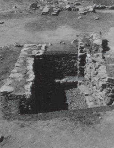
1954–1955
Lerna excavation: the other of the two shaft graves of Lerna.
Źródło: Lerna excavation team (J.L. Caskey), ASCSA Lerna Excavations Archive; reproduced by the Ephorate of Antiquities of Argolida
-
Powiększ:
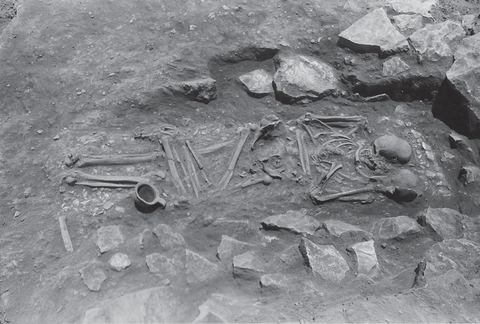
ok. 1952–1958
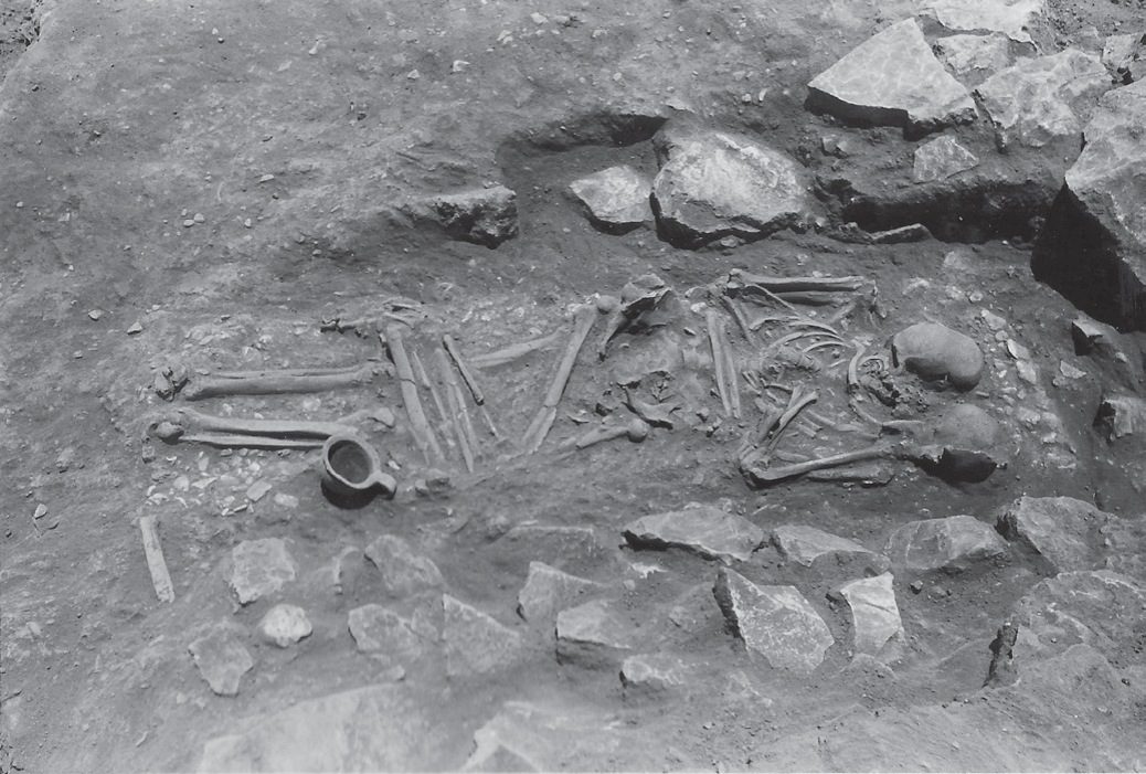
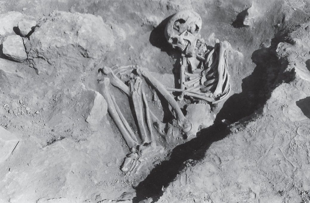
Lerna excavation: an extended Middle Helladic burial.
Źródło: Lerna excavation team (J.L. Caskey), ASCSA Lerna Excavations Archive; reproduced by the Ephorate of Antiquities of Argolida
-
Powiększ:
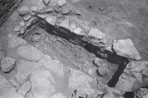
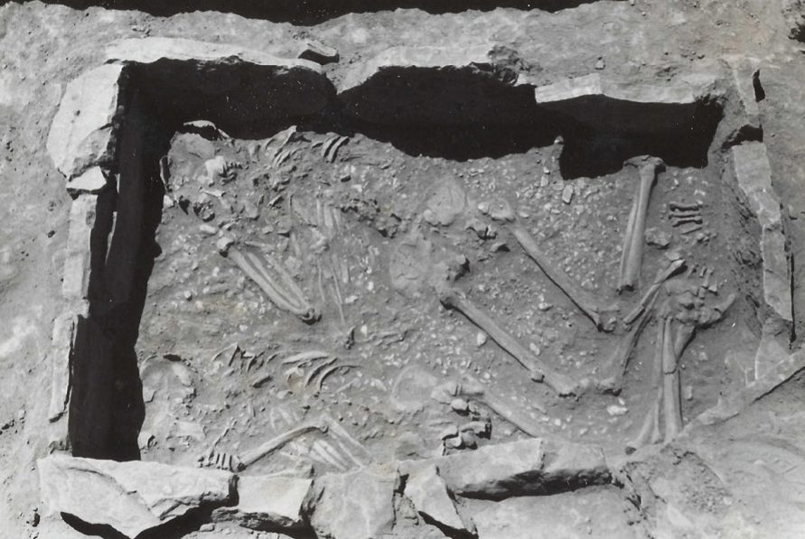
ok. 1952–1958
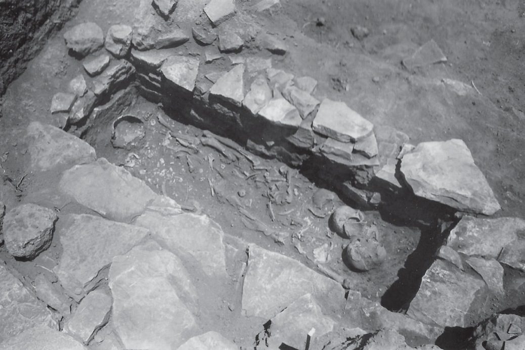
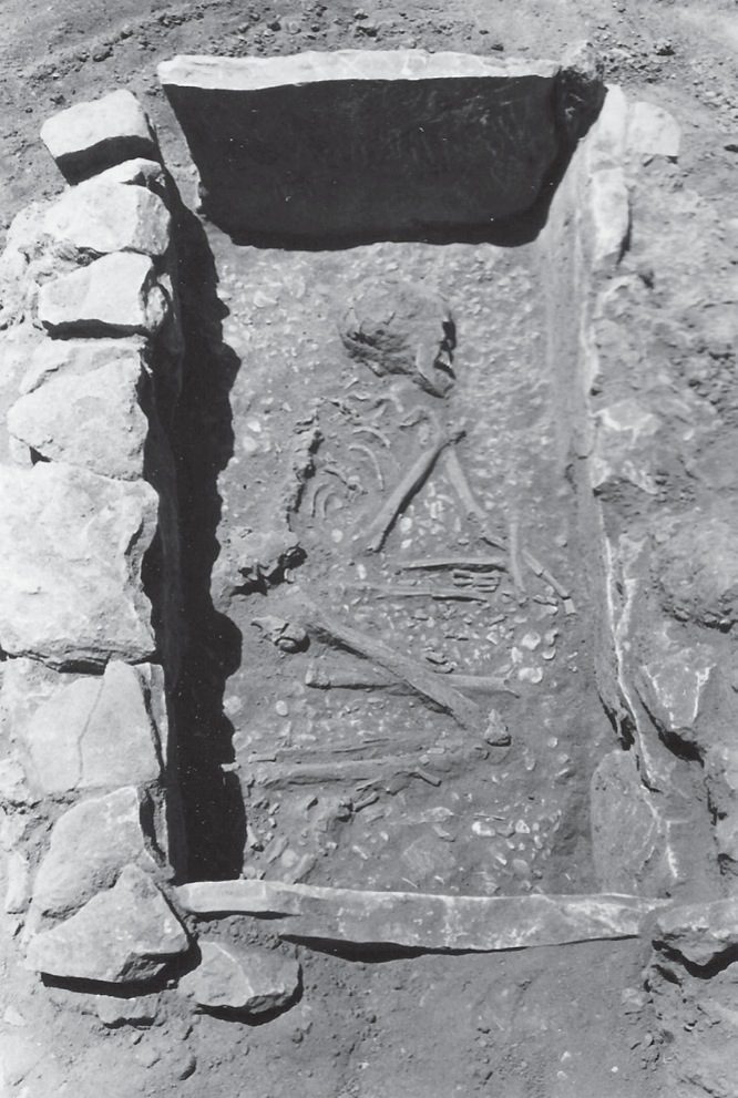
Lerna excavation: a built cist grave (c. 1700 BC).
Źródło: Lerna excavation team (J.L. Caskey), ASCSA Lerna Excavations Archive; reproduced by the Ephorate of Antiquities of Argolida
-
Powiększ:
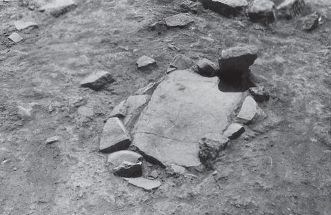
ok. 1952–1958
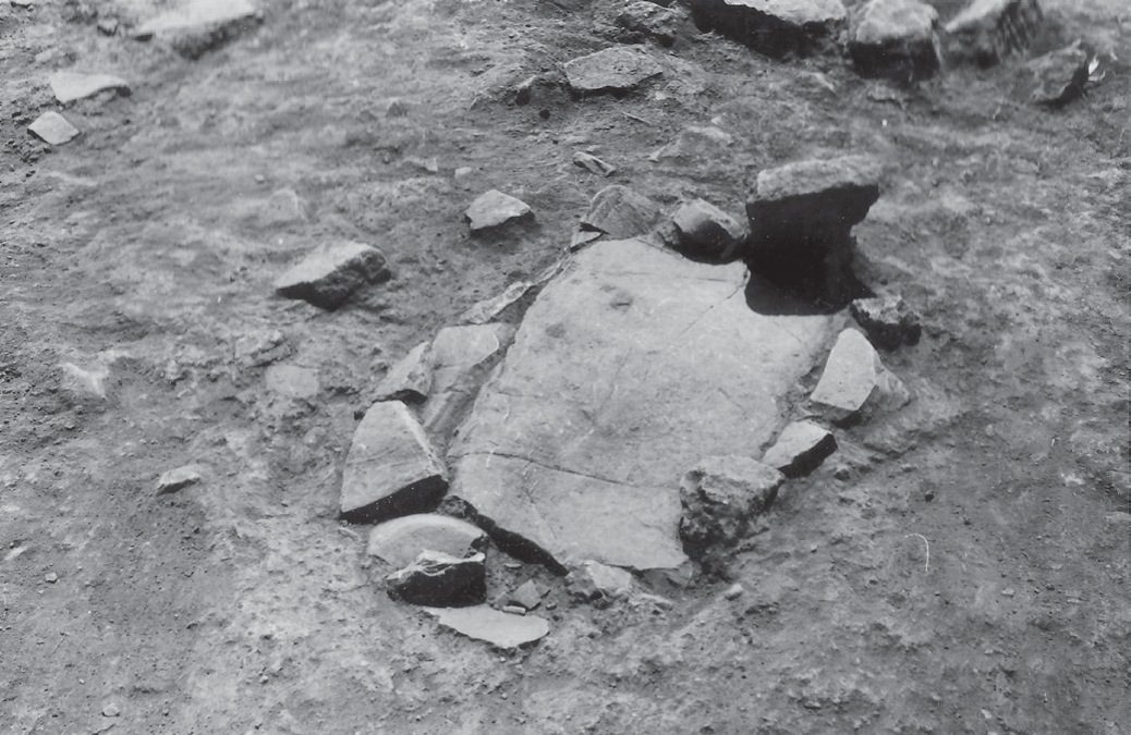
Lerna excavation: a Mycenaean cist grave, closed.
Źródło: Lerna excavation team (J.L. Caskey), ASCSA Lerna Excavations Archive; reproduced by the Ephorate of Antiquities of Argolida
-
Powiększ:
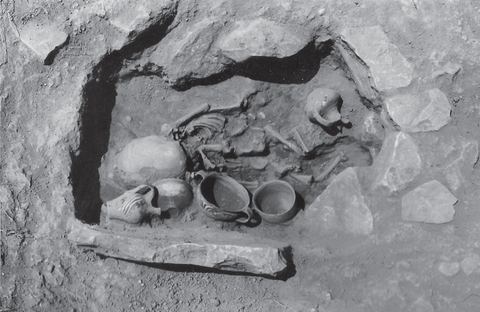
ok. 1952–1958
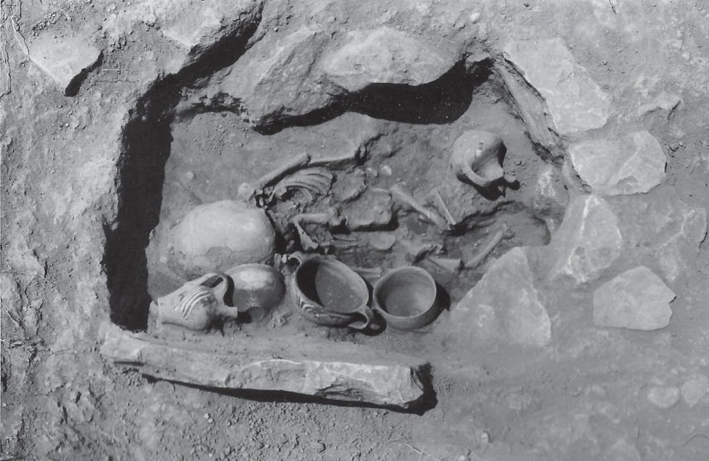
Lerna excavation: the same Mycenaean cist grave, opened.
Źródło: Lerna excavation team (J.L. Caskey), ASCSA Lerna Excavations Archive; reproduced by the Ephorate of Antiquities of Argolida
-
Powiększ:
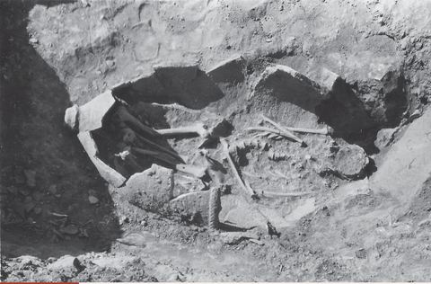
ok. 1952–1958
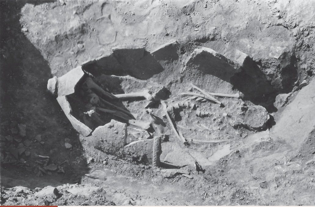
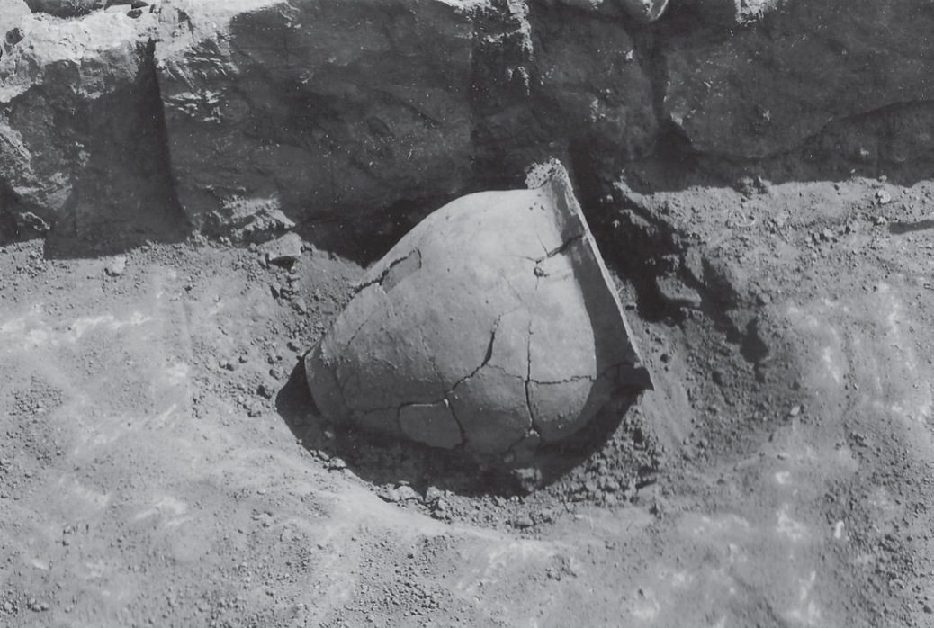
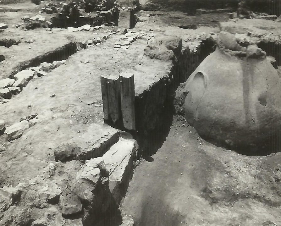
Middle Geometric pithos burial from the cemetery at the foot of Mt Pontinos.
Źródło: Lerna excavation team (J.L. Caskey), ASCSA Lerna Excavations Archive; reproduced by the Ephorate of Antiquities of Argolida
-
Powiększ:
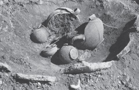
ok. 1952–1958
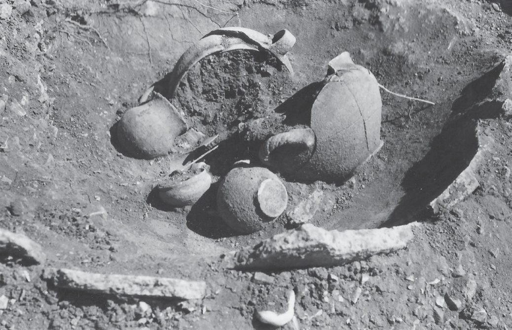
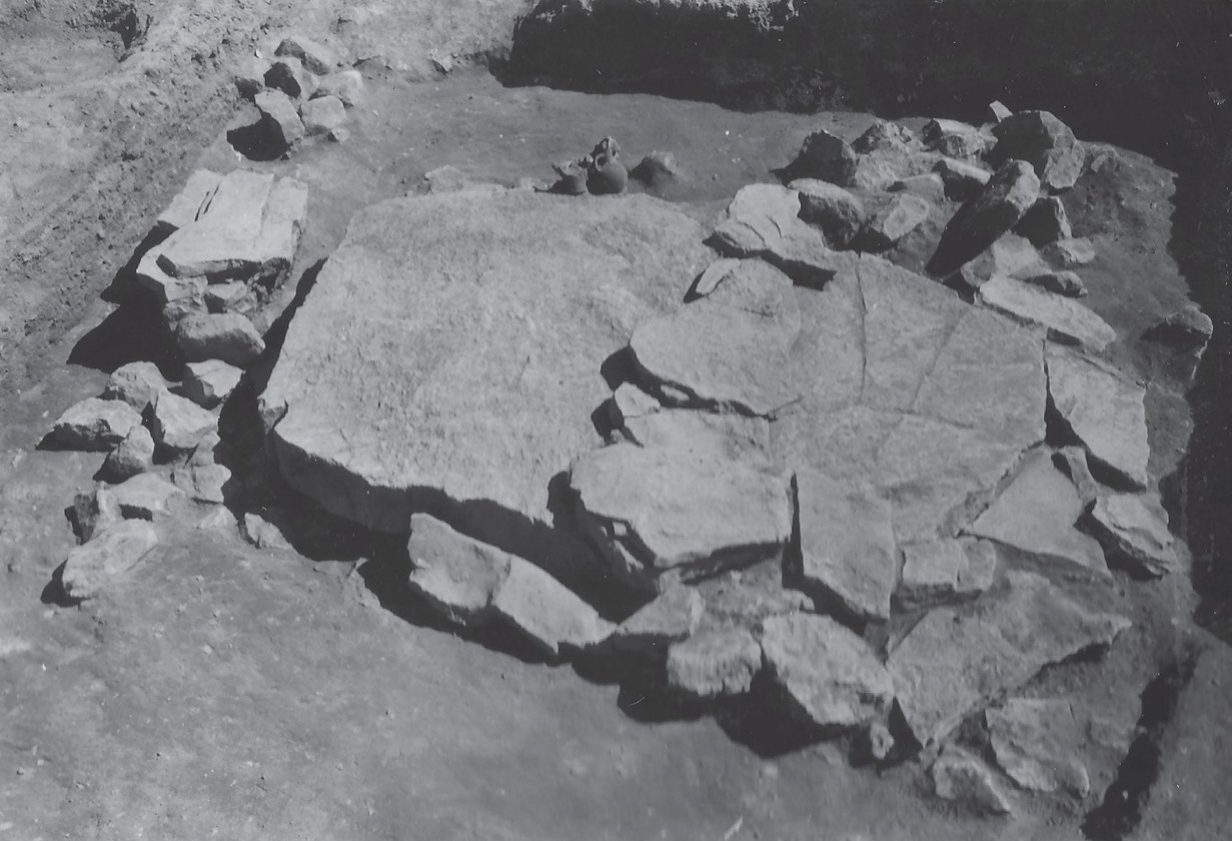
Geometric burial with grave goods from the cemetery at the foot of Mt Pontinos.
Źródło: Lerna excavation team (J.L. Caskey), ASCSA Lerna Excavations Archive; reproduced by the Ephorate of Antiquities of Argolida
-
Powiększ:
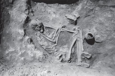
ok. 1952–1958
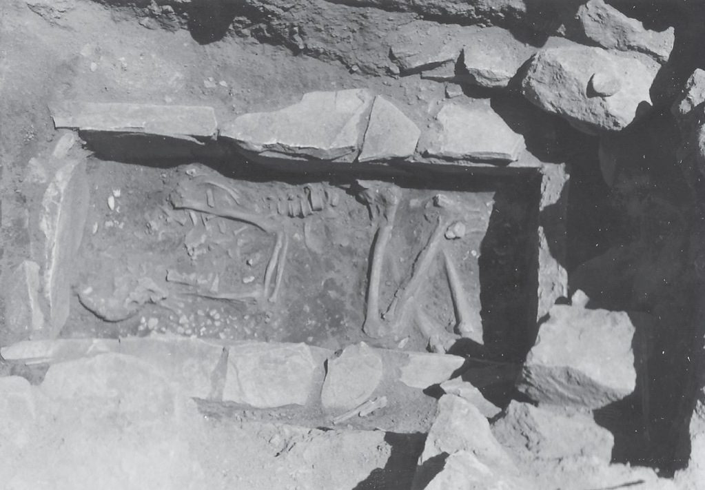
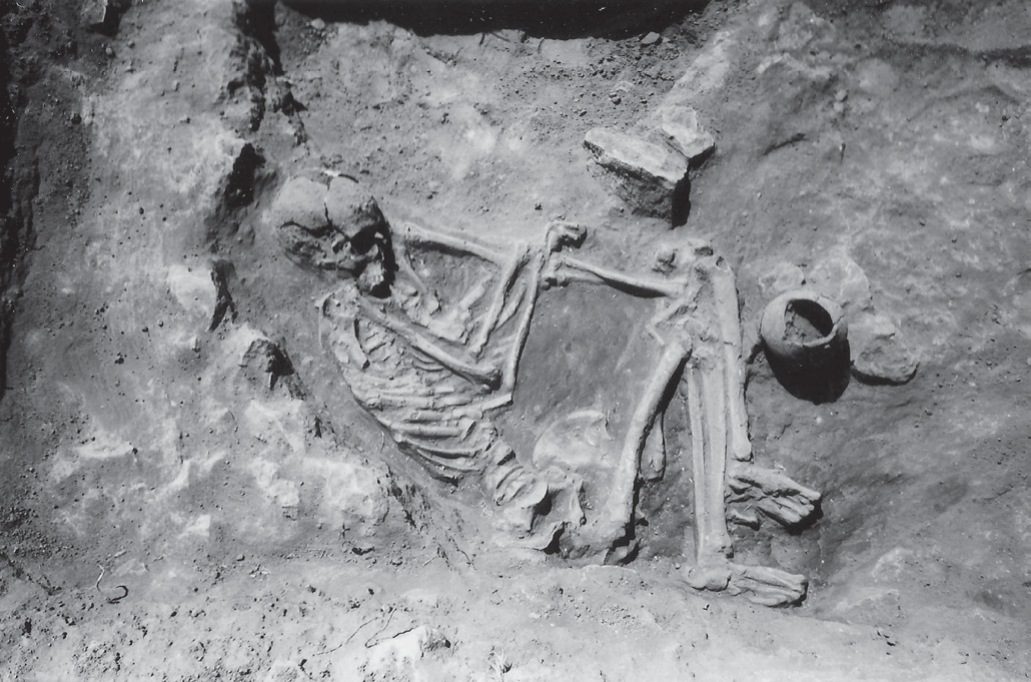
Lerna excavation: a Final Neolithic female burial.
Źródło: Lerna excavation team (J.L. Caskey), ASCSA Lerna Excavations Archive; reproduced by the Ephorate of Antiquities of Argolida
-
Powiększ:
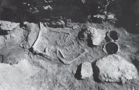
ok. 1952–1958
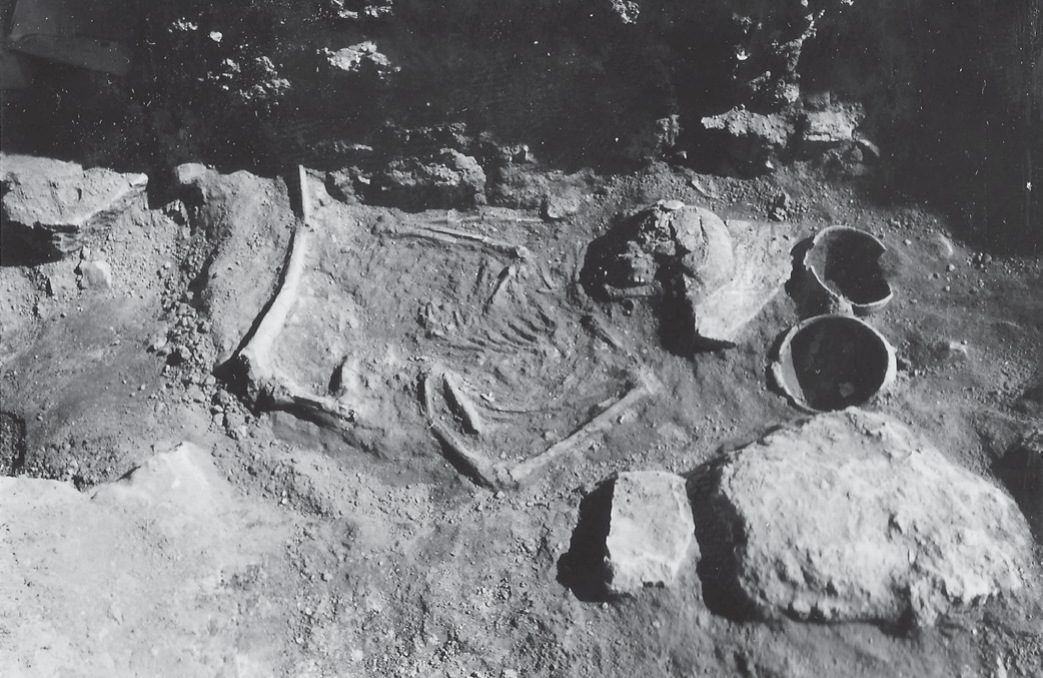
Lerna excavation: a Final Neolithic female burial (second view).
Źródło: Lerna excavation team (J.L. Caskey), ASCSA Lerna Excavations Archive; reproduced by the Ephorate of Antiquities of Argolida
-
Powiększ:
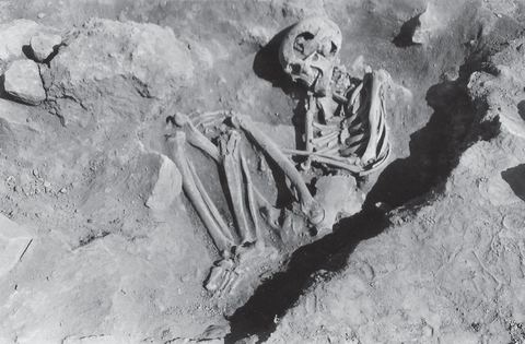
ok. 1952–1958
Lerna excavation: a Middle Helladic pit grave.
Źródło: Lerna excavation team (J.L. Caskey), ASCSA Lerna Excavations Archive; reproduced by the Ephorate of Antiquities of Argolida
-
Powiększ:
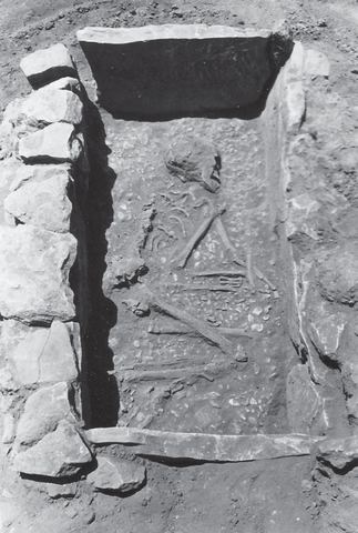
ok. 1952–1958
Lerna excavation: a Middle Helladic cist grave.
Źródło: Lerna excavation team (J.L. Caskey), ASCSA Lerna Excavations Archive; reproduced by the Ephorate of Antiquities of Argolida
-
Powiększ:
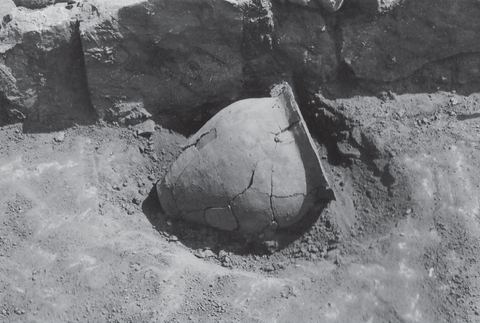
ok. 1952–1958
Lerna excavation: a Middle Helladic pithos burial.
Źródło: Lerna excavation team (J.L. Caskey), ASCSA Lerna Excavations Archive; reproduced by the Ephorate of Antiquities of Argolida
-
Powiększ:
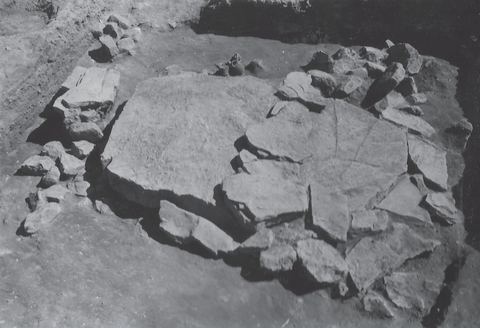
1955
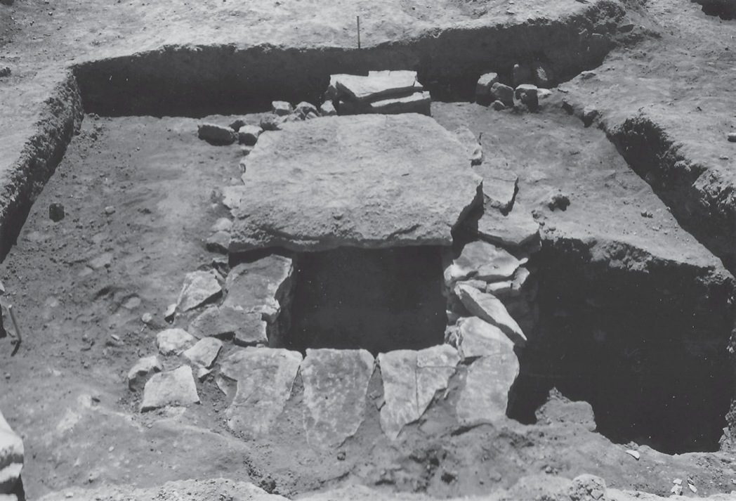
Lerna excavation: cist grave BC.3 with its cover slabs.
Źródło: Lerna excavation team (J.L. Caskey), ASCSA Lerna Excavations Archive; reproduced by the Ephorate of Antiquities of Argolida
-
Powiększ:
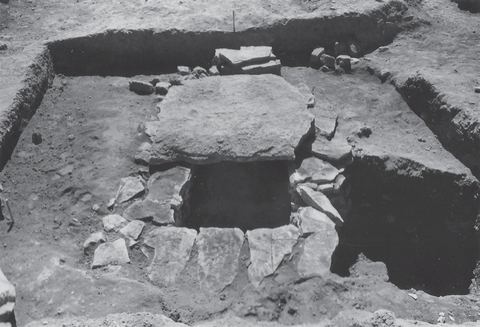
1955
Lerna excavation: cist grave BC.3 after removal of the western cover slab.
Źródło: Lerna excavation team (J.L. Caskey), ASCSA Lerna Excavations Archive; reproduced by the Ephorate of Antiquities of Argolida
-
Powiększ:
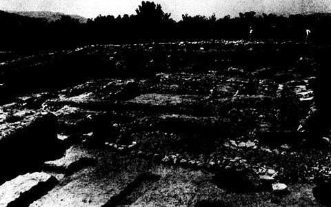
1955
Part of the stone circle around the remains of the House of the Tiles at Lerna, with trees and hills behind.
Źródło: Bulletin de Correspondance Hellénique, Chronique des fouilles (photos probably supplied by ASCSA/Caskey)
-
Powiększ:
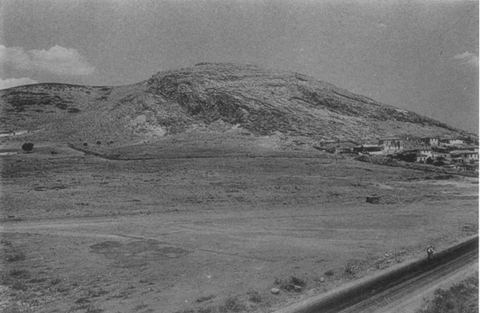
1955
Mt Pontinos and the area of the Geometric cemetery from the south-east, with houses of Myloi and the road/railway.
Źródło: J. L. Caskey / ASCSA Lerna excavation
-
Powiększ:
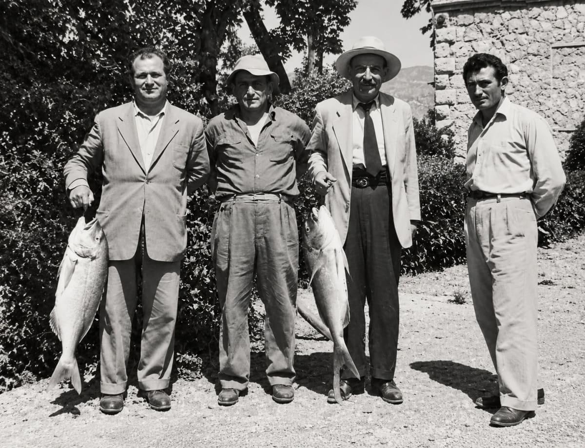
ok. 1950–1960
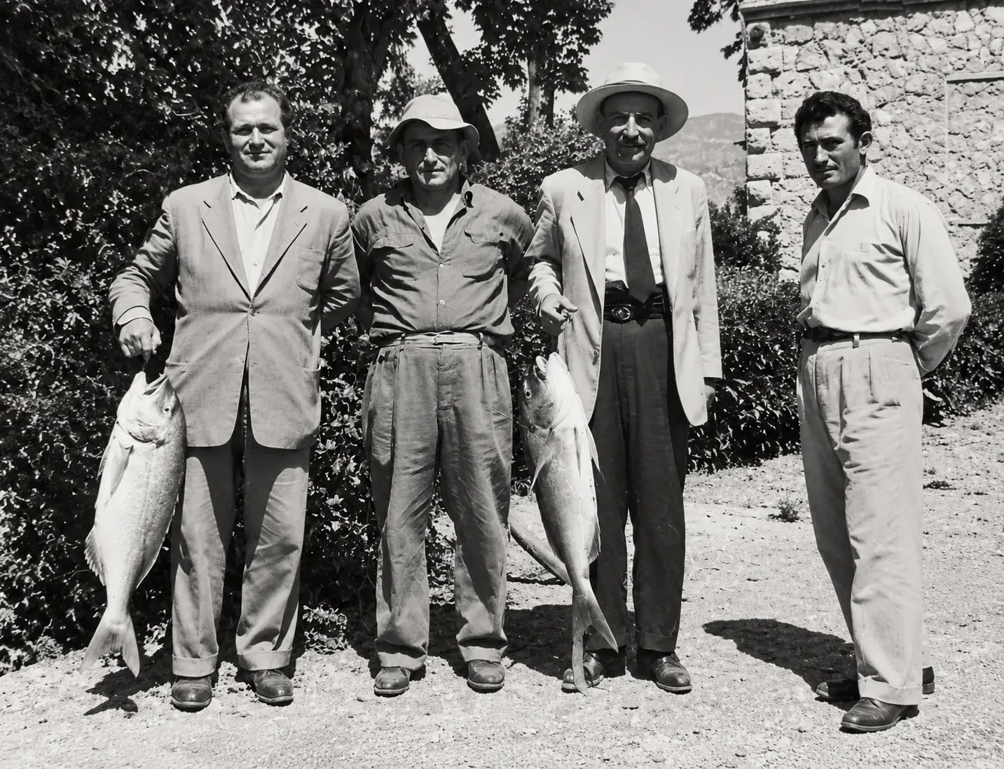
„Dawni rybacy z Myloi”: czterech mężczyzn przed kamiennym budynkiem, dwóch trzyma duże ryby (cyfrowo odnowione)
Źródło: Lykos family, Myloi
-
Powiększ:
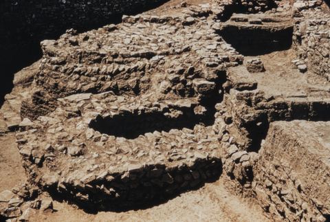
lata 50.
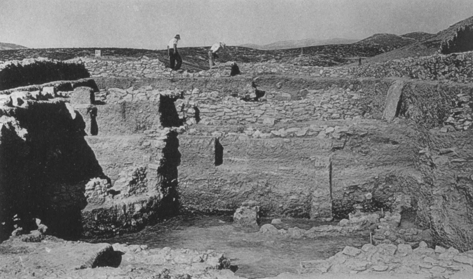
Lerna fortifications: projecting towers V and U seen from the north-east.
Źródło: George M. A. Hanfmann (photographer per Harvard record; slides may have been donated rather than shot by him) / Harvard Fine Arts Library
-
Powiększ:
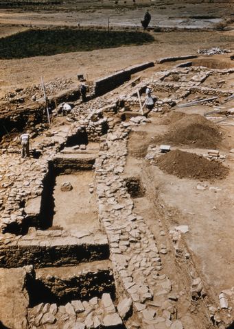
lata 50.
Lerna fortifications: the Early Helladic circuit wall in the excavation.
Źródło: George M. A. Hanfmann (photographer per Harvard record; slides may have been donated rather than shot by him) / Harvard Fine Arts Library
-
Powiększ:
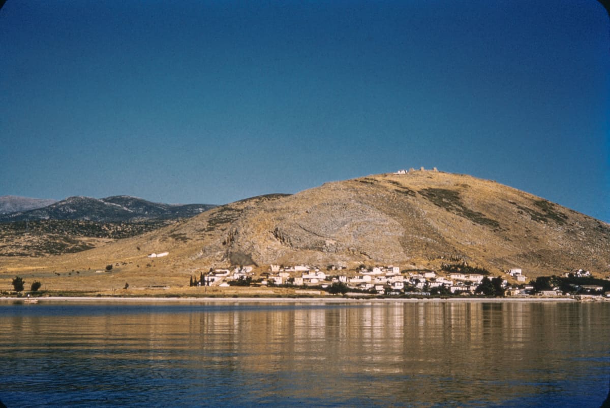
lata 50.
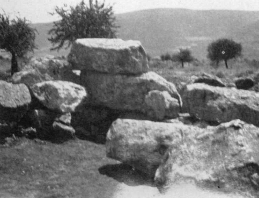
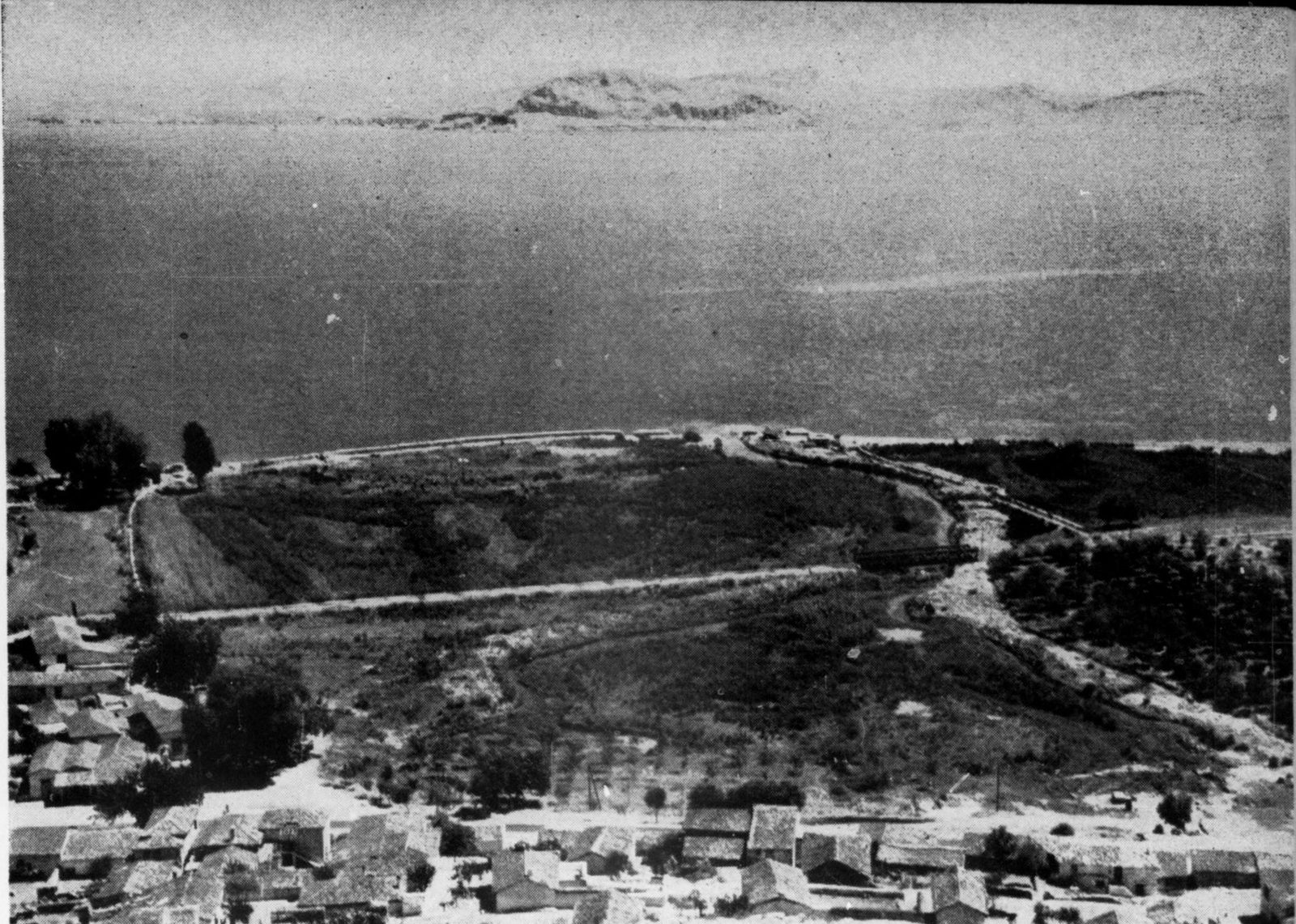
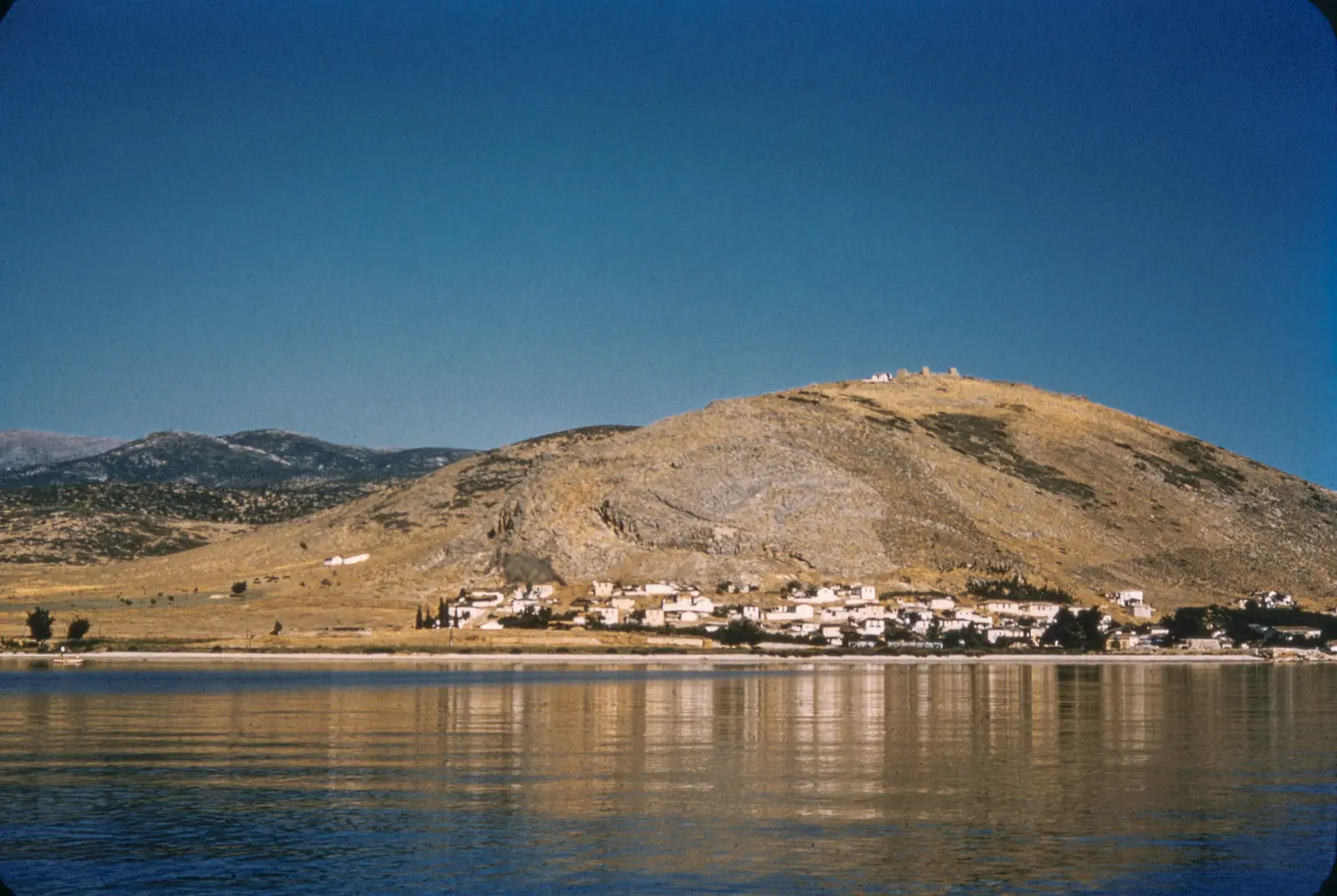
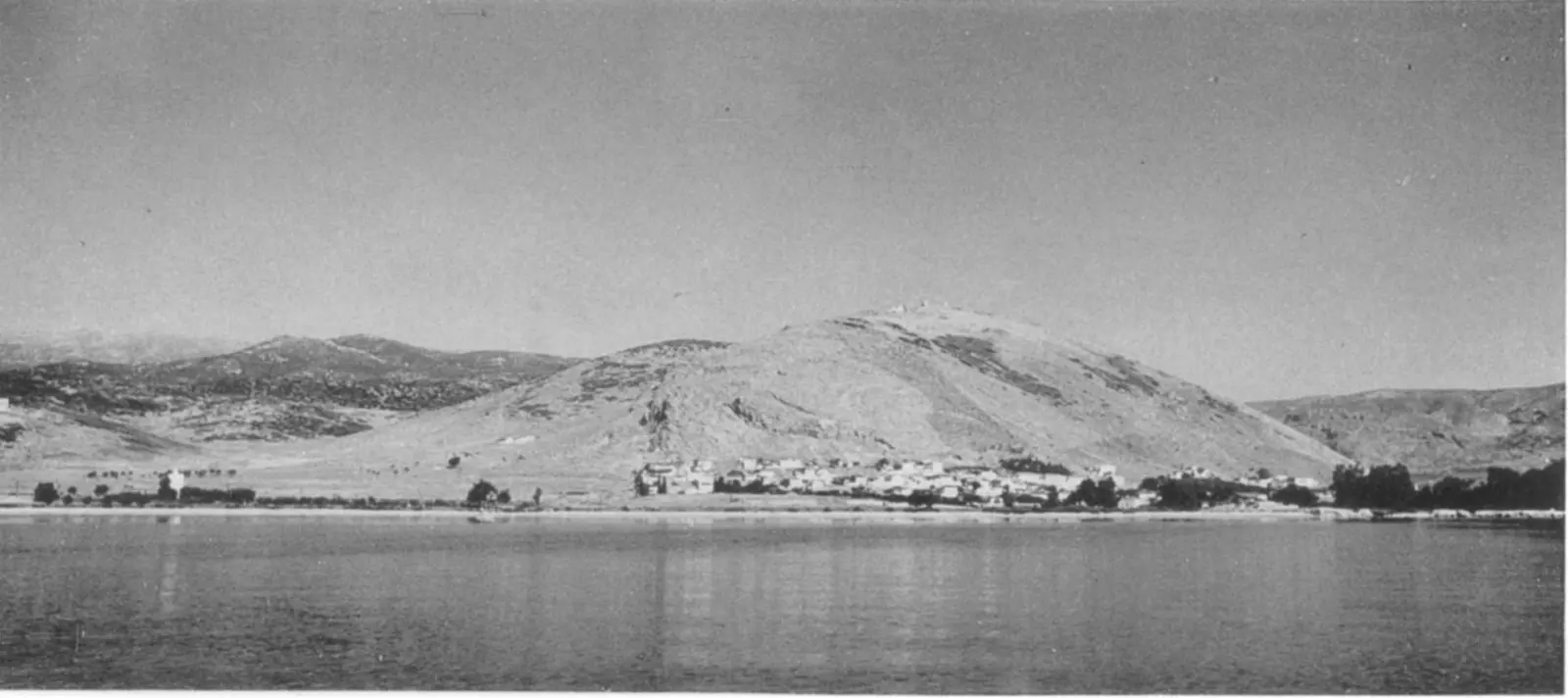
Myloi w latach 50. widziane od strony wody: białe domy wzdłuż brzegu u stóp nagiego wzgórza Pontinos z ruinami zamku na szczycie, odbite w spokojnej zatoce
Źródło: Courtesy of Harvard Fine Arts Library, Digital Images & Slides Collection
-
Powiększ:
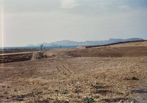
lata 50.
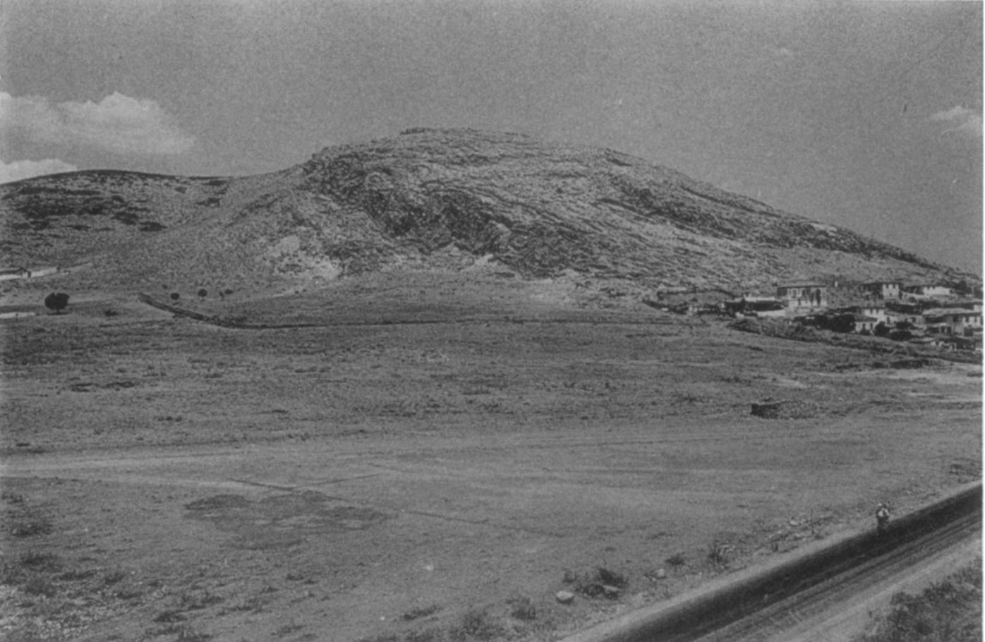
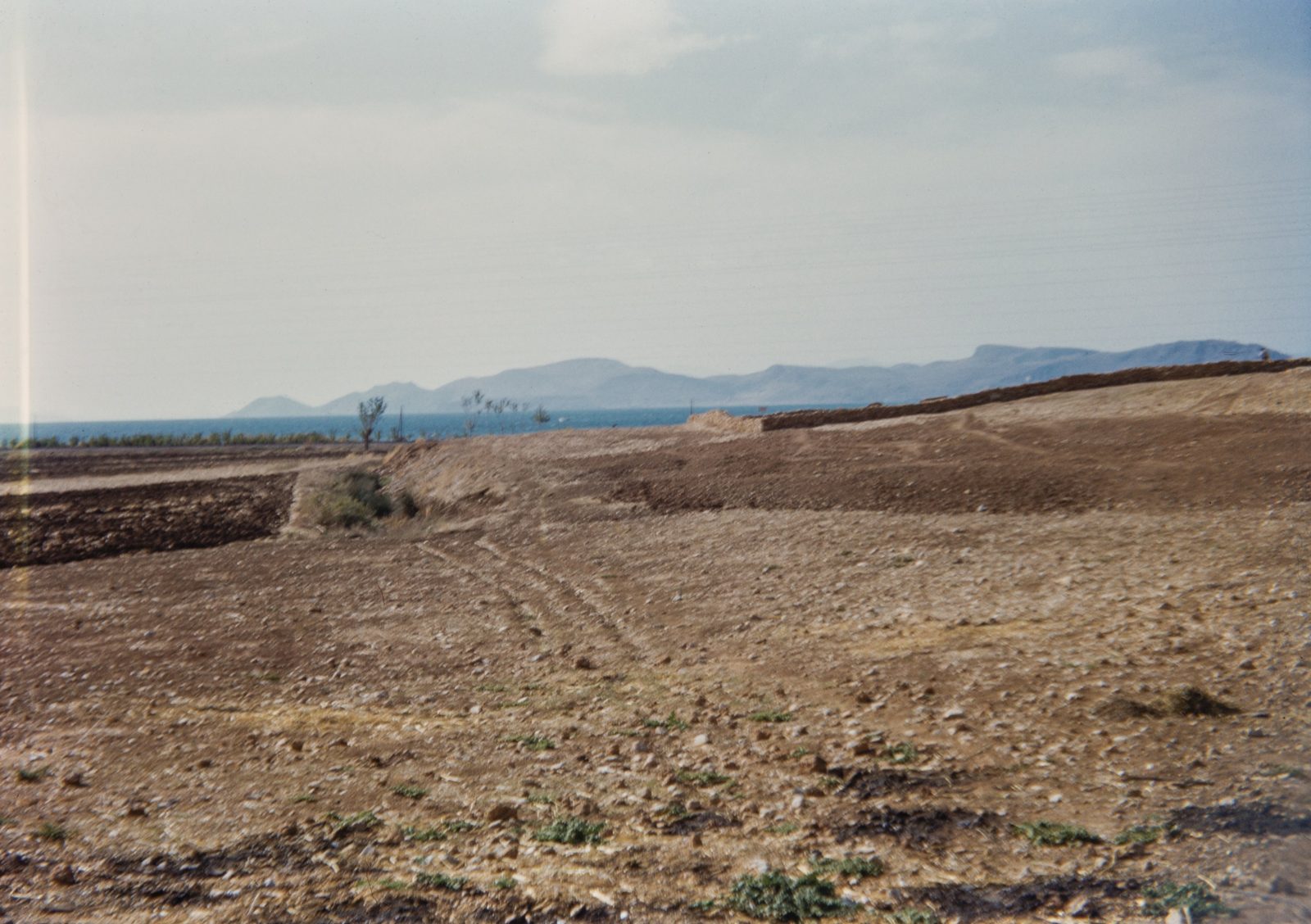
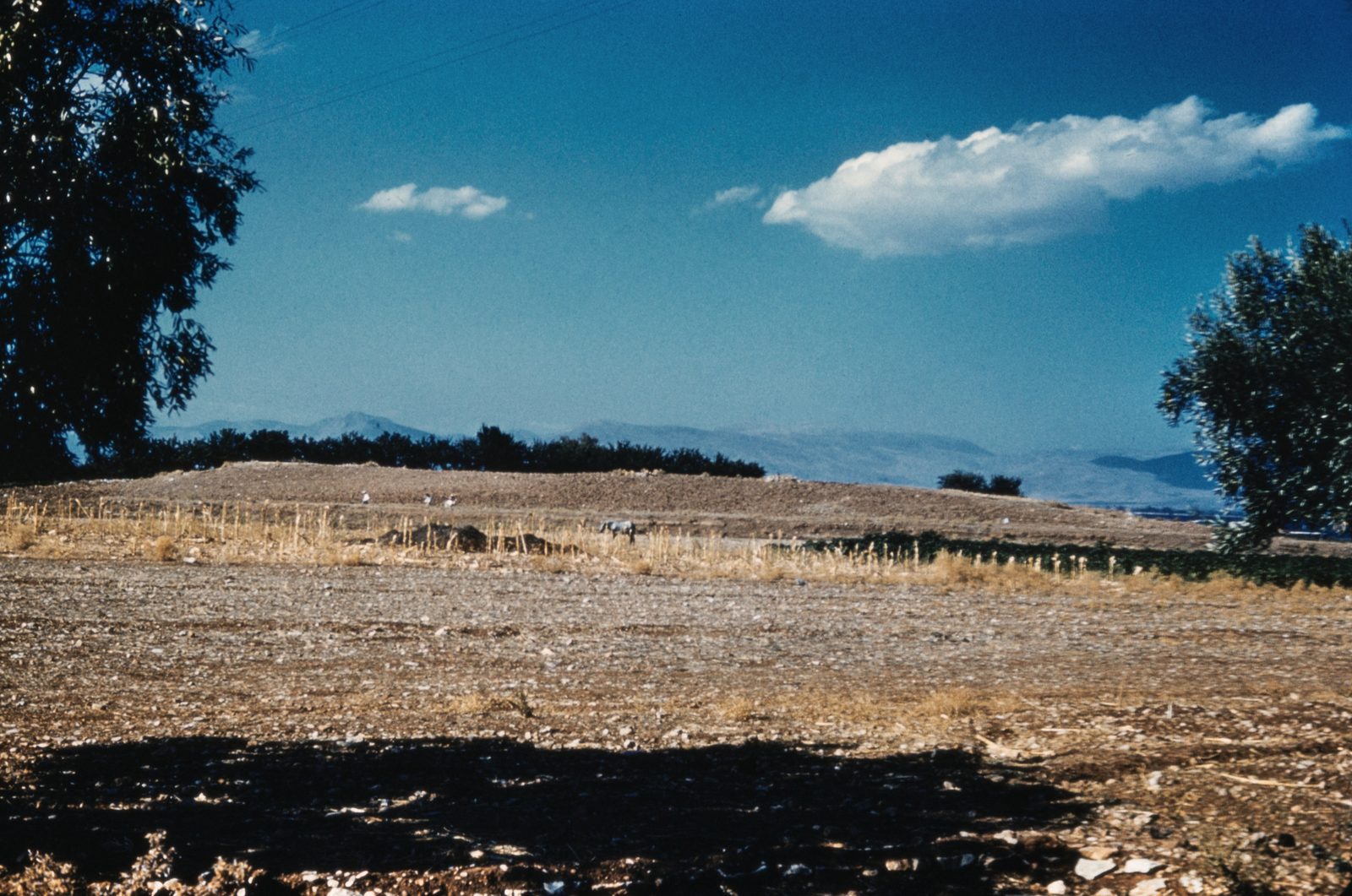
Distant view of the Lerna site across dry fields, with the bay beyond.
Źródło: George M. A. Hanfmann (photographer per Harvard record; slides may have been donated rather than shot by him) / Harvard Fine Arts Library
-
Powiększ:
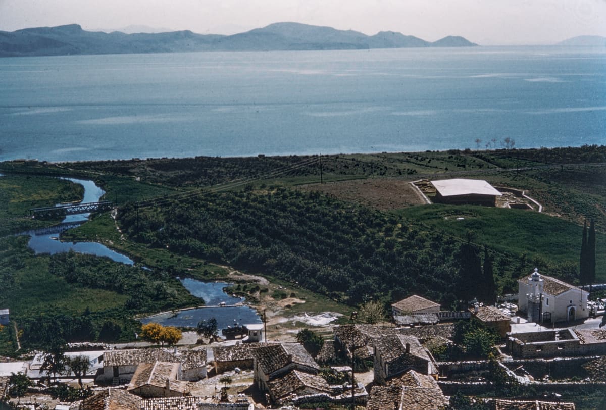
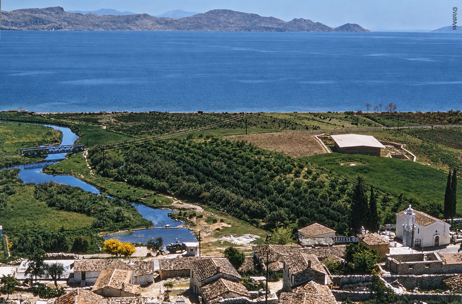
lata 50.
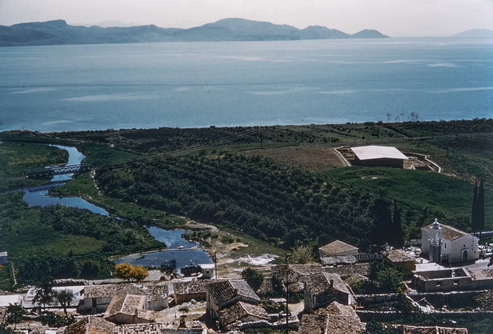
Widok na Myloi w latach 50.: dachy z dachówki i kościół z dzwonnicą na pierwszym planie, kręty strumień ze źródeł Lerny, nowy dach nad wykopaliskami wśród pól, a w tle zatoka
Źródło: Courtesy of Harvard Fine Arts Library, Digital Images & Slides Collection
-
Powiększ:
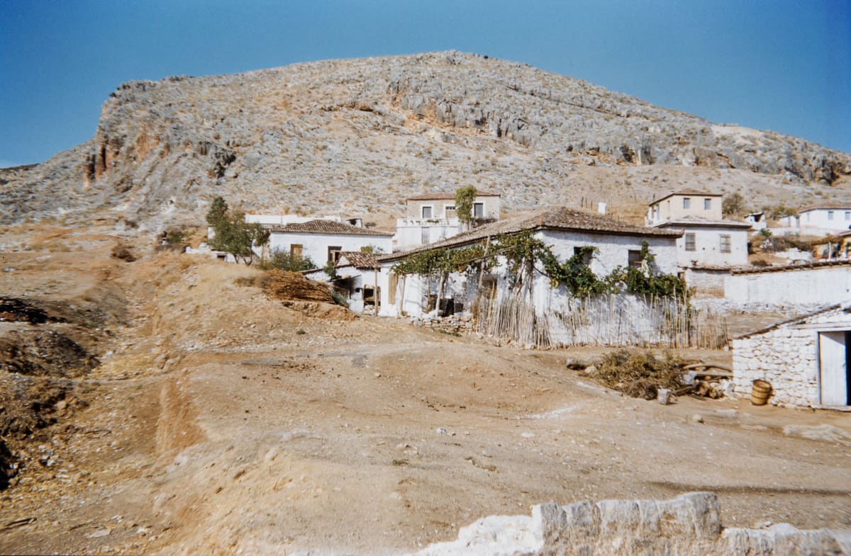
lata 50.
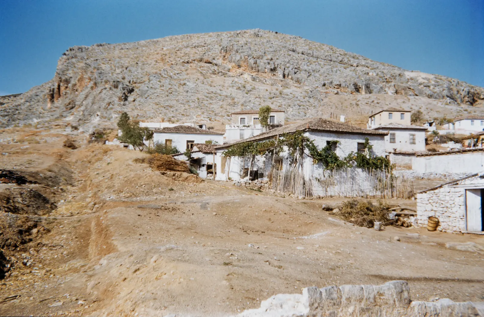
Bielone domy we wsi z pergolą porośniętą winoroślą i płotem z trzciny u stóp skalistego wzgórza w Myloi, lata 50.
Źródło: Courtesy of Harvard Fine Arts Library, Digital Images & Slides Collection
-
Powiększ:
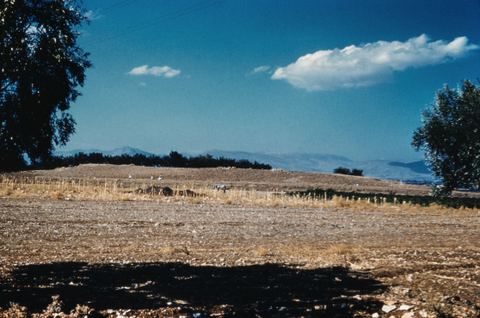
lata 50.
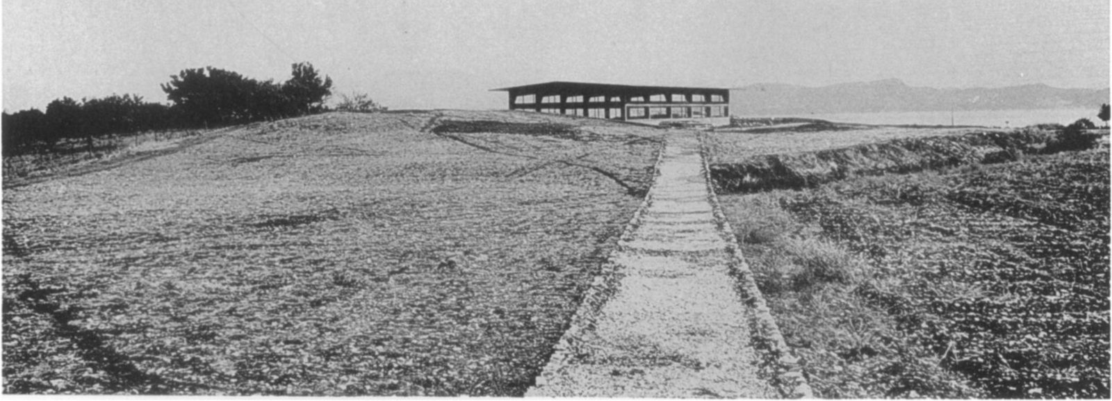
View of the Lerna site from the south-west before the construction of the shelter, framed by trees, with the sea behind.
Źródło: George M. A. Hanfmann (photographer per Harvard record; slides may have been donated rather than shot by him) / Harvard Fine Arts Library
-
Powiększ:
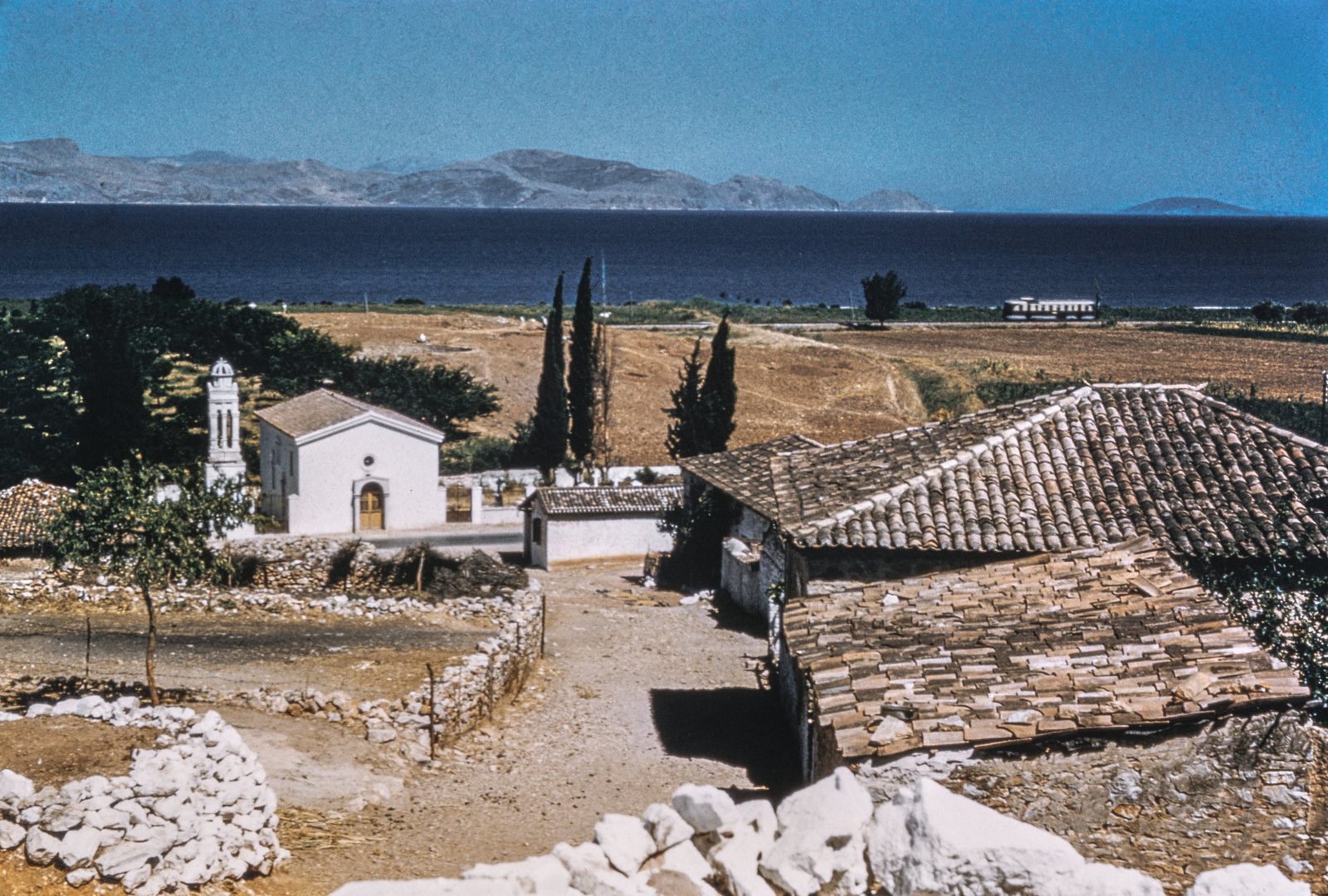
lata 50.
View of the Lerna site and the bay from the village: the church of Agios Dimitrios with cypresses, tiled roofs and dry-stone walls in front.
Źródło: George M. A. Hanfmann (photographer per Harvard record; slides may have been donated rather than shot by him) / Harvard Fine Arts Library
-
Powiększ:
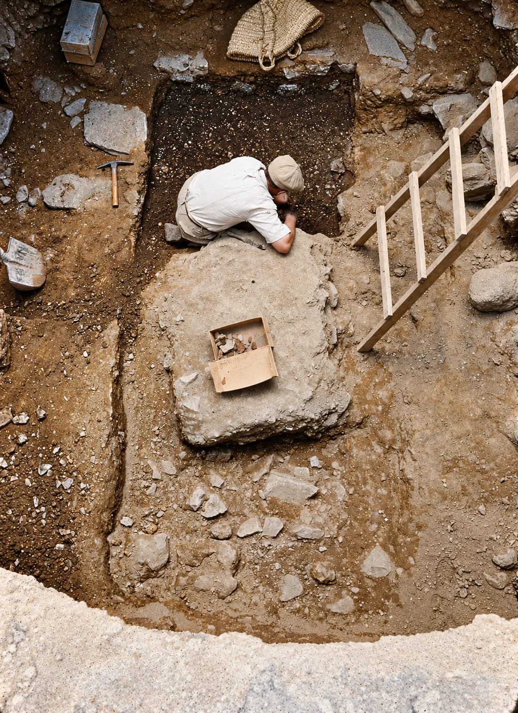
lata 50.
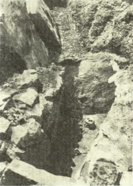
Lerna, Shaft Grave II during excavation, with a worker in the shaft and a ladder.
Źródło: George M. A. Hanfmann (photographer per Harvard record; slides may have been donated rather than shot by him) / Harvard Fine Arts Library · cyfrowo odnowione
-
Powiększ:
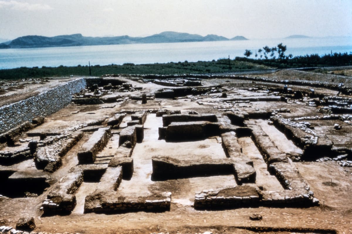
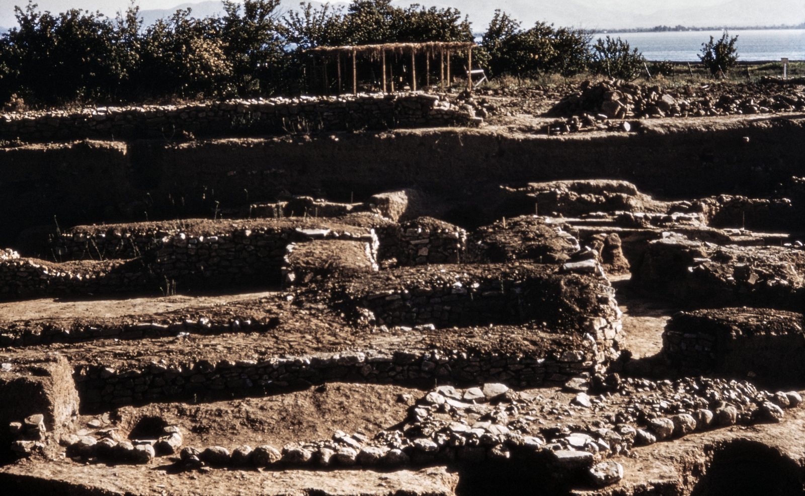
lata 50.
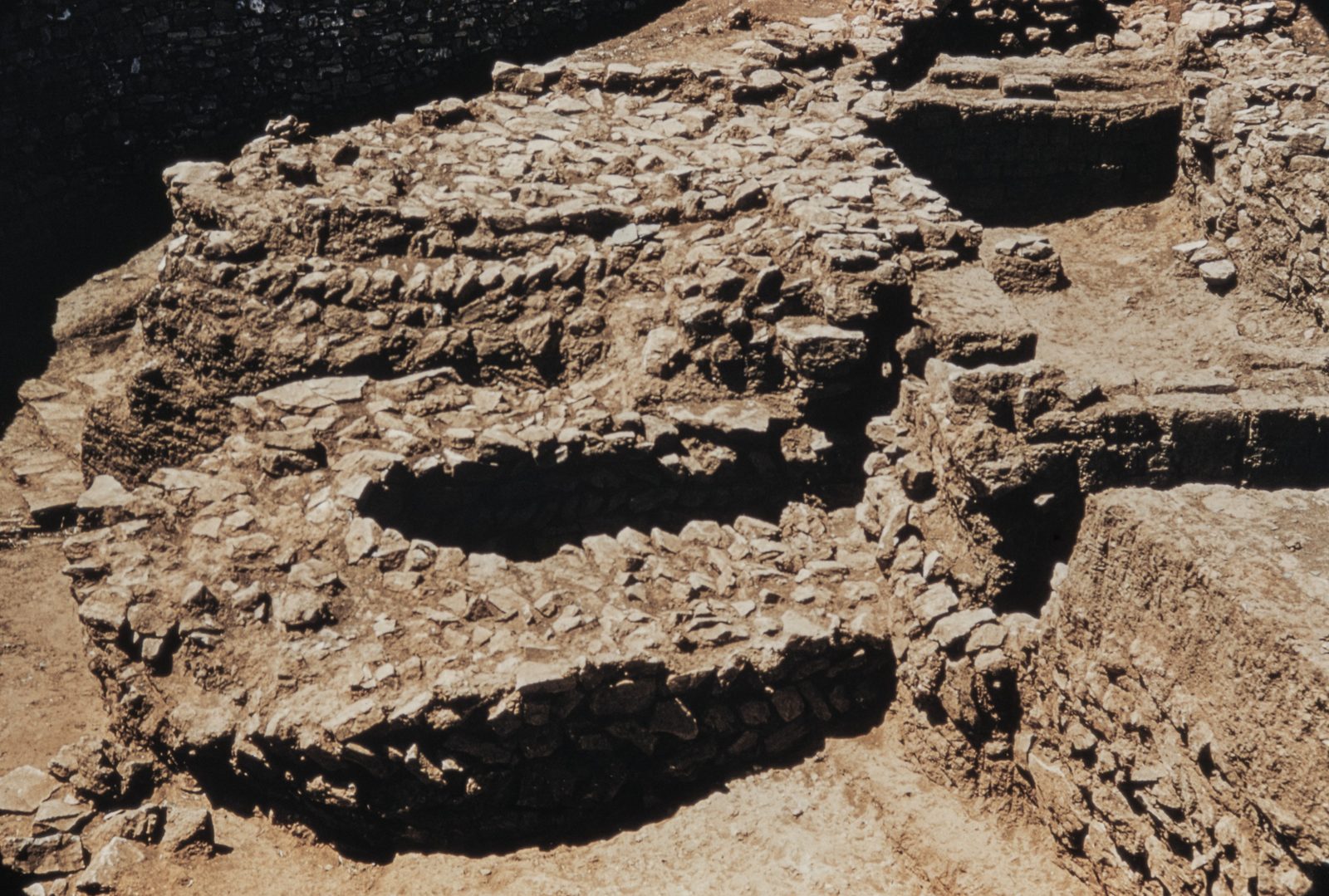
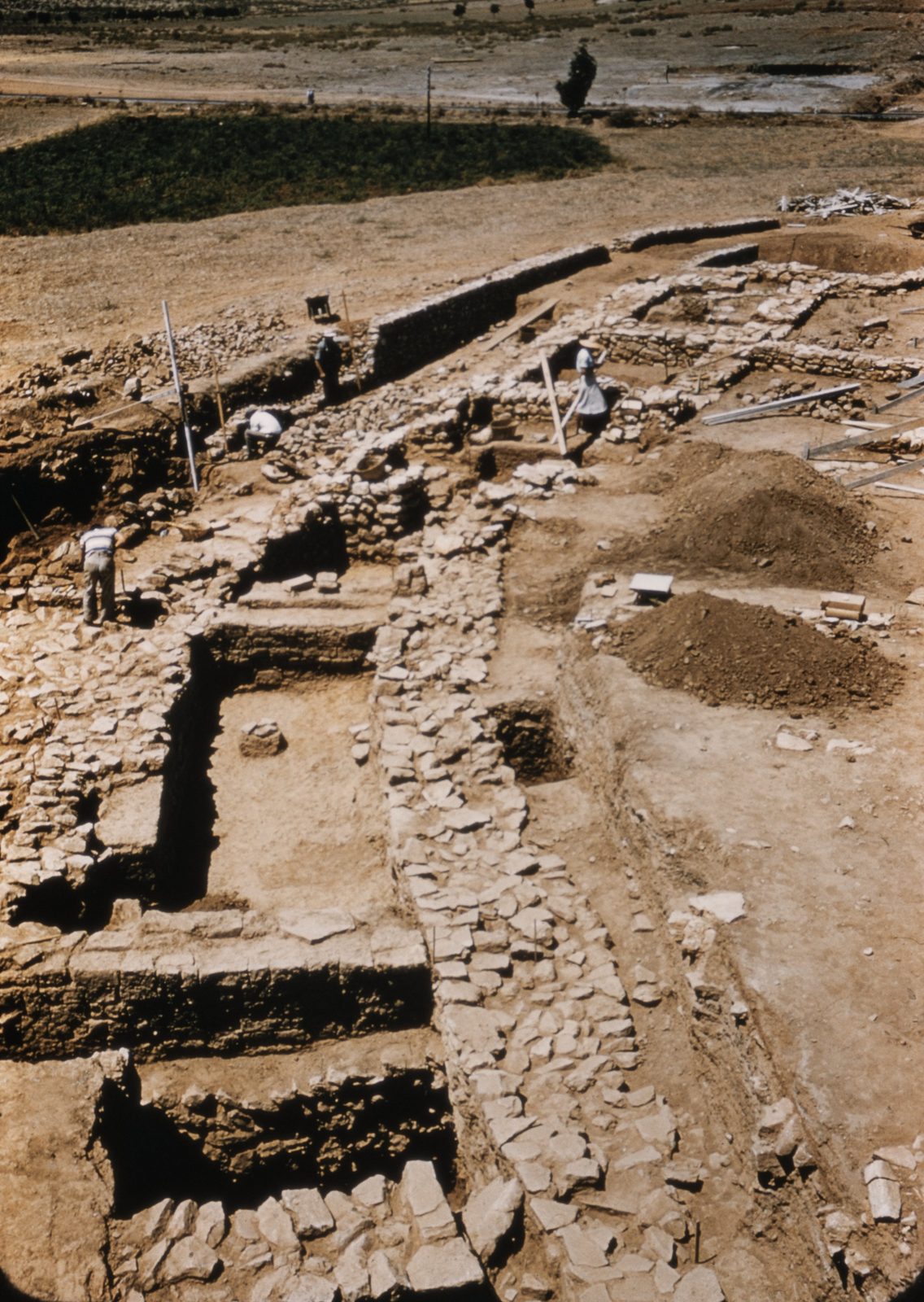
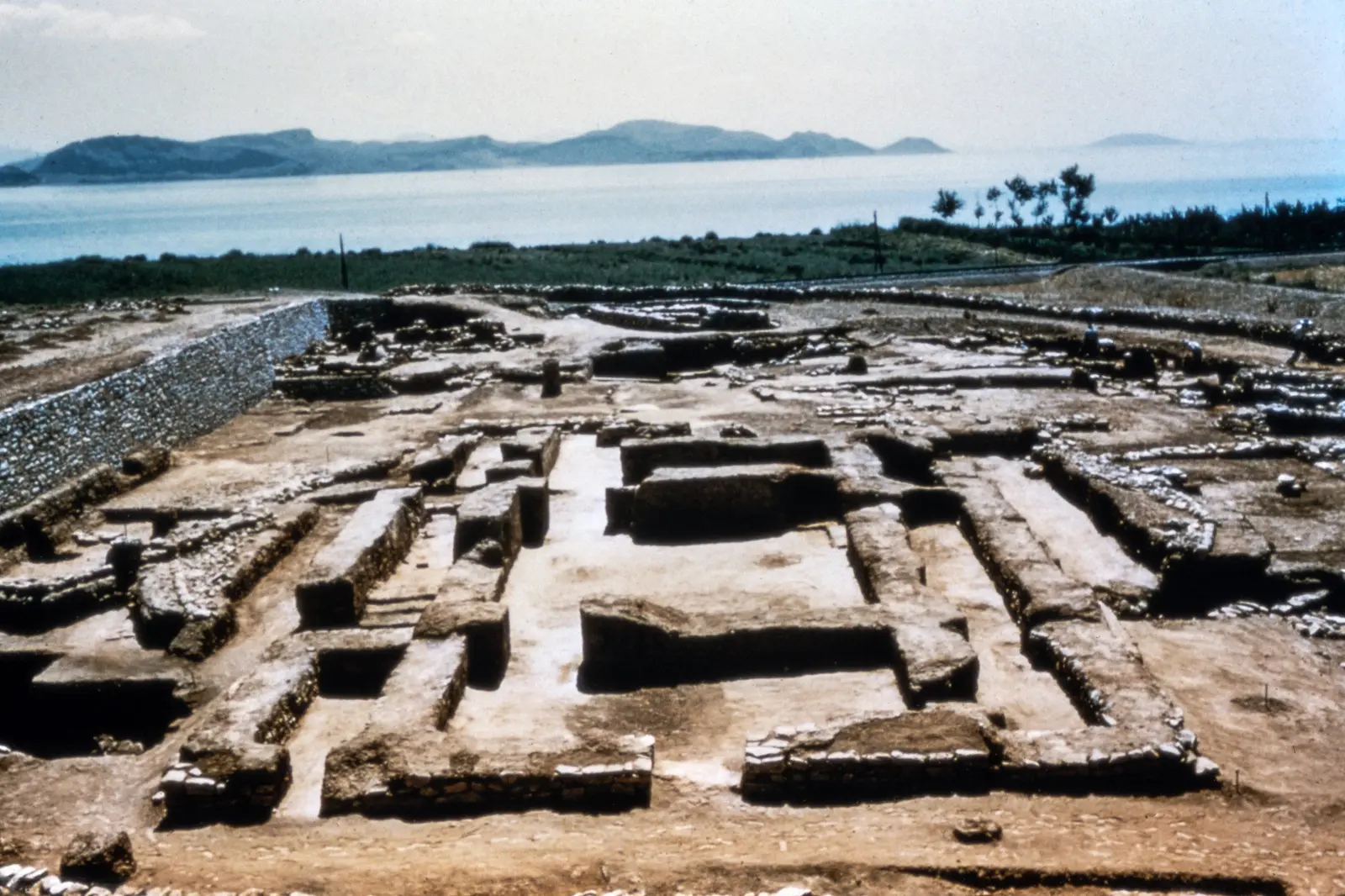
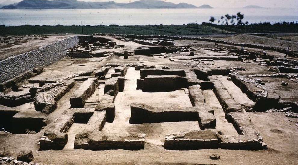
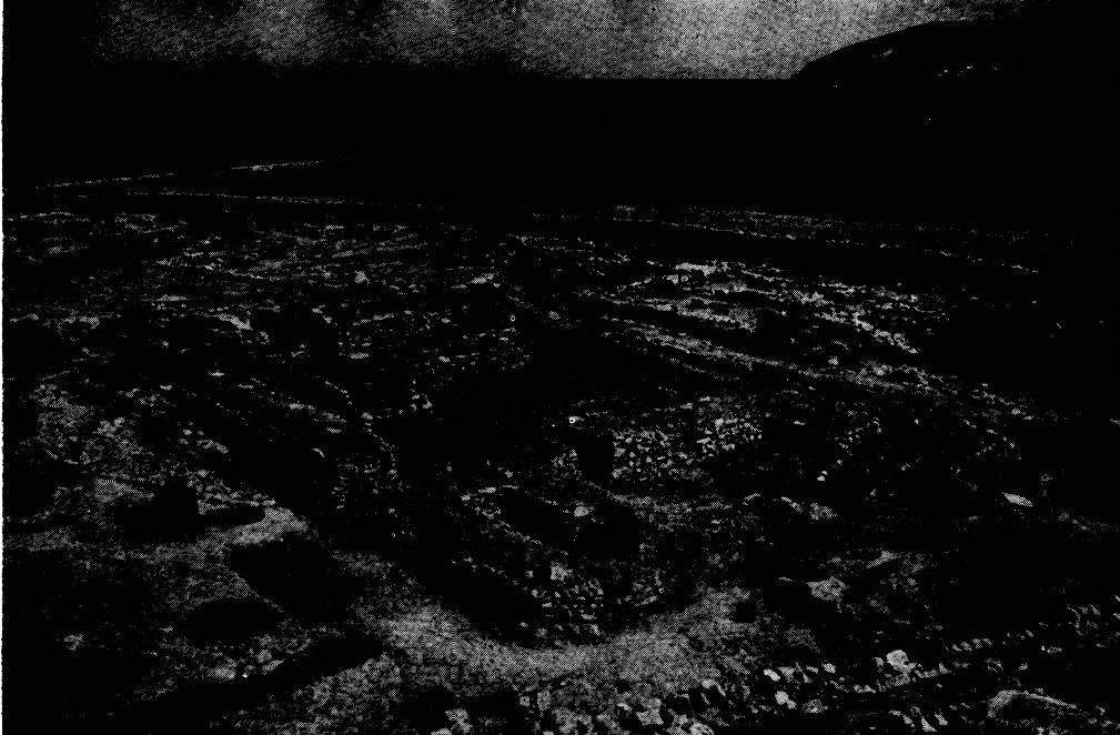
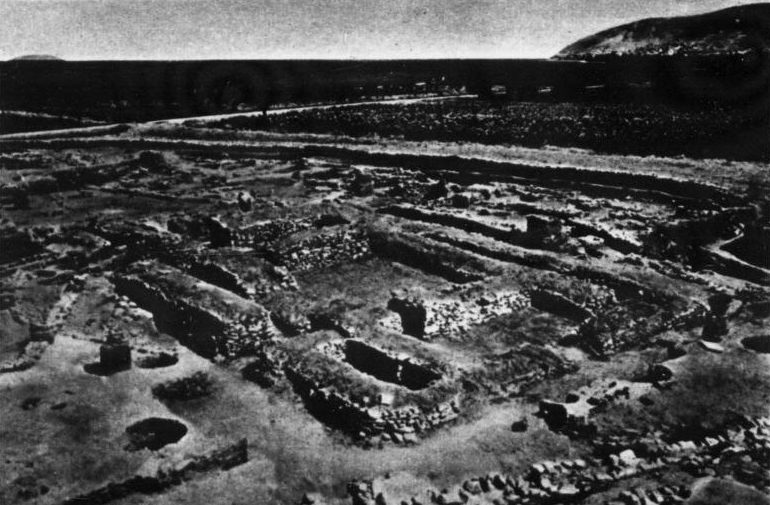
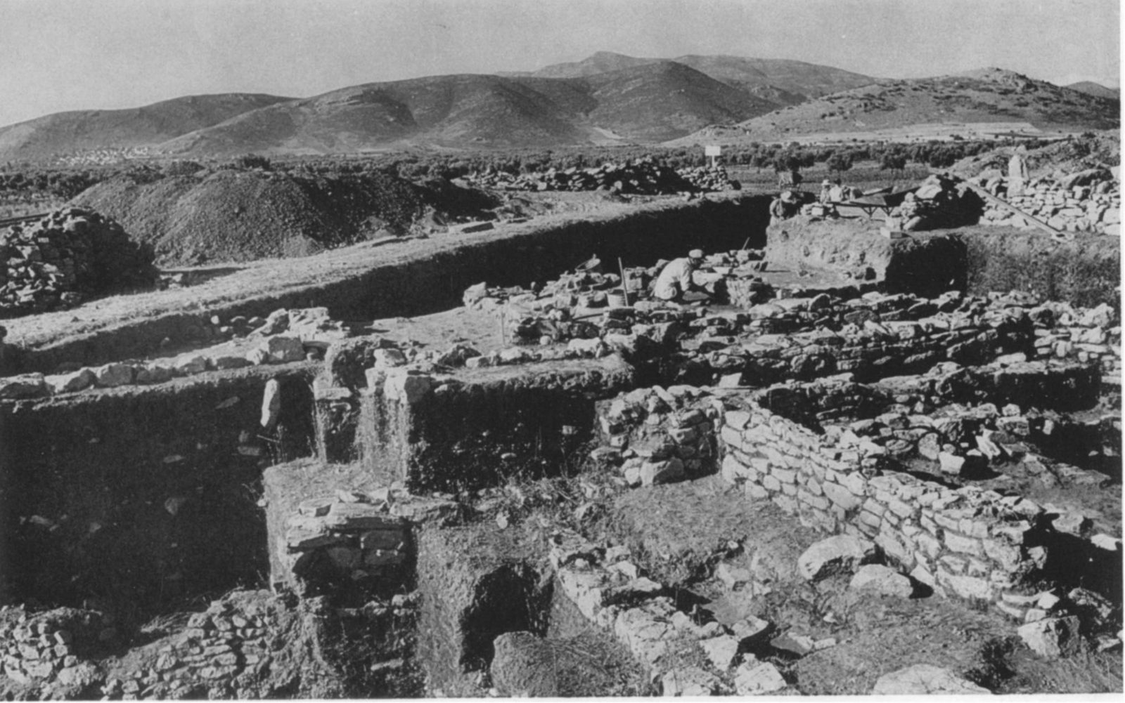
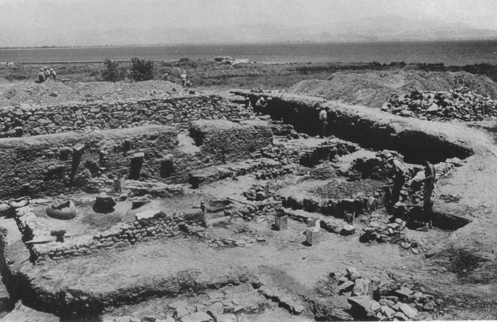
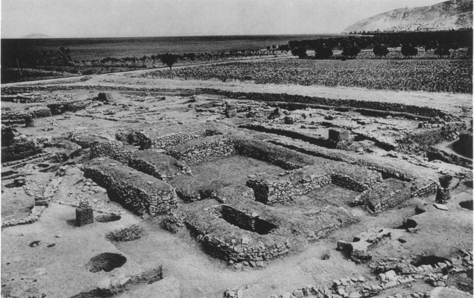
Odkopane kamienne mury prehistorycznej Lerny w latach 50., ułożone w prostokąty, w tle Zatoka Argolidzka i góry
Źródło: Courtesy of Harvard Fine Arts Library, Digital Images & Slides Collection
-
Powiększ:
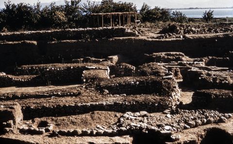
lata 50.
House of the Tiles, Lerna: border of the tumulus that covered the house, from the south.
Źródło: George M. A. Hanfmann (photographer per Harvard record; slides may have been donated rather than shot by him) / Harvard Fine Arts Library
-
Powiększ:
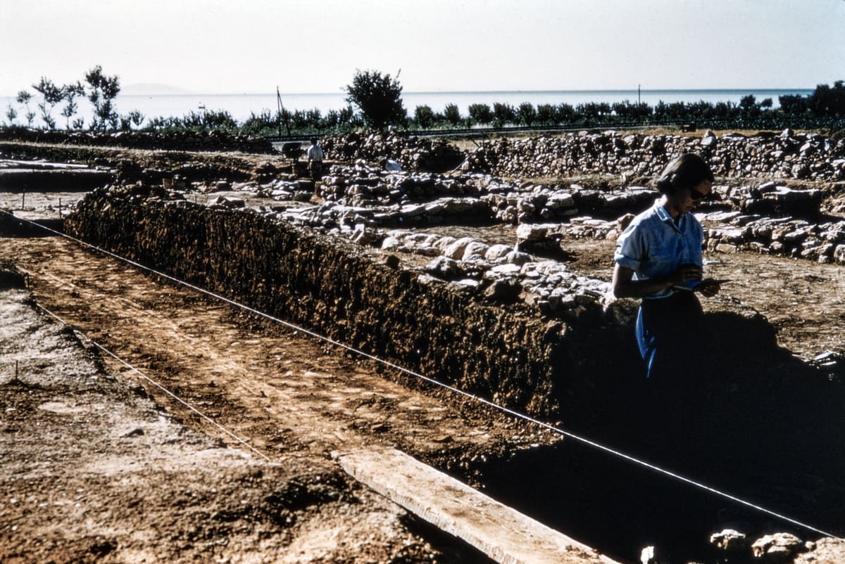
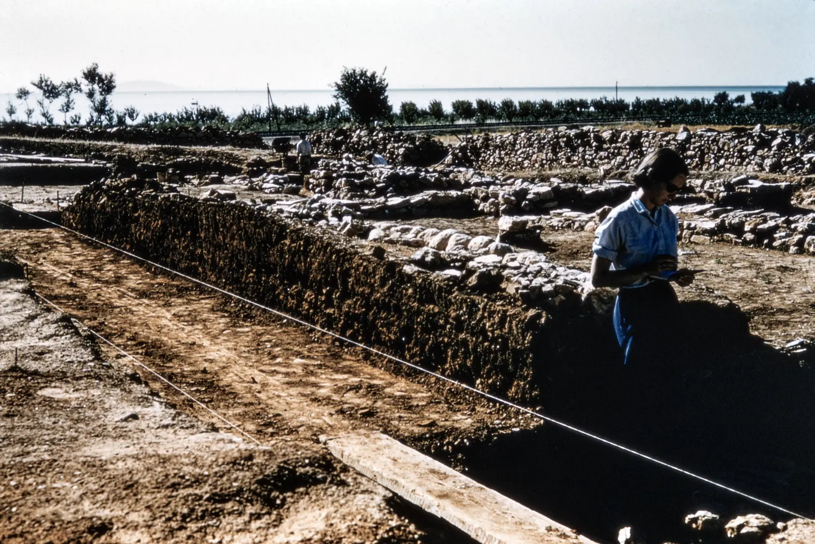
lata 50.
Członek zespołu wykopaliskowego z lat 50. stoi w wykopie w Lernie i robi notatki; w tle sznurek pomiarowy, kamienne mury i zatoka
Źródło: Courtesy of Harvard Fine Arts Library, Digital Images & Slides Collection
-
Powiększ:
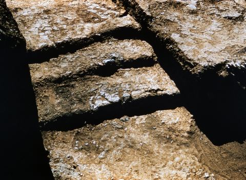
lata 50.
House of the Tiles, Lerna: the stairs in the north corridor.
Źródło: George M. A. Hanfmann (photographer per Harvard record; slides may have been donated rather than shot by him) / Harvard Fine Arts Library
-
Powiększ:
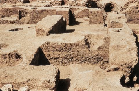
lata 50.
House of the Tiles, Lerna: room XI and other parts from the south.
Źródło: George M. A. Hanfmann (photographer per Harvard record; slides may have been donated rather than shot by him) / Harvard Fine Arts Library
-
Powiększ:
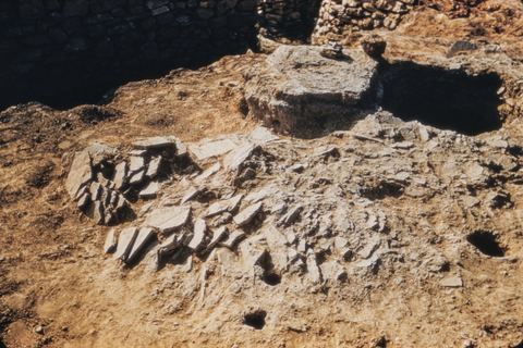
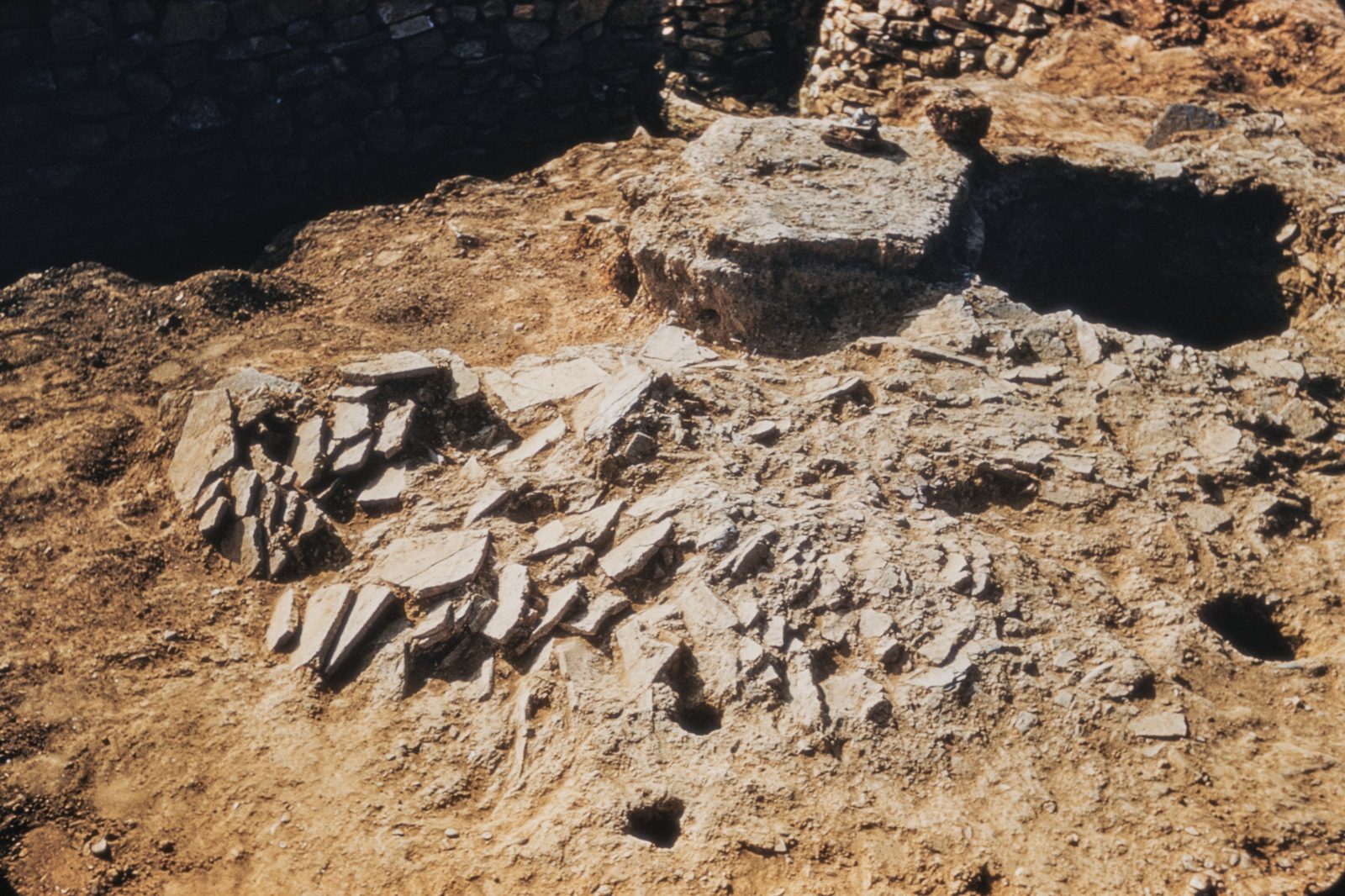
lata 50.
House of the Tiles, Lerna: fallen roof tiles as found.
Źródło: George M. A. Hanfmann (photographer per Harvard record; slides may have been donated rather than shot by him) / Harvard Fine Arts Library
-
Powiększ:
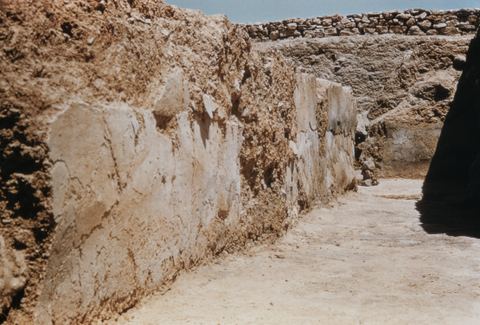
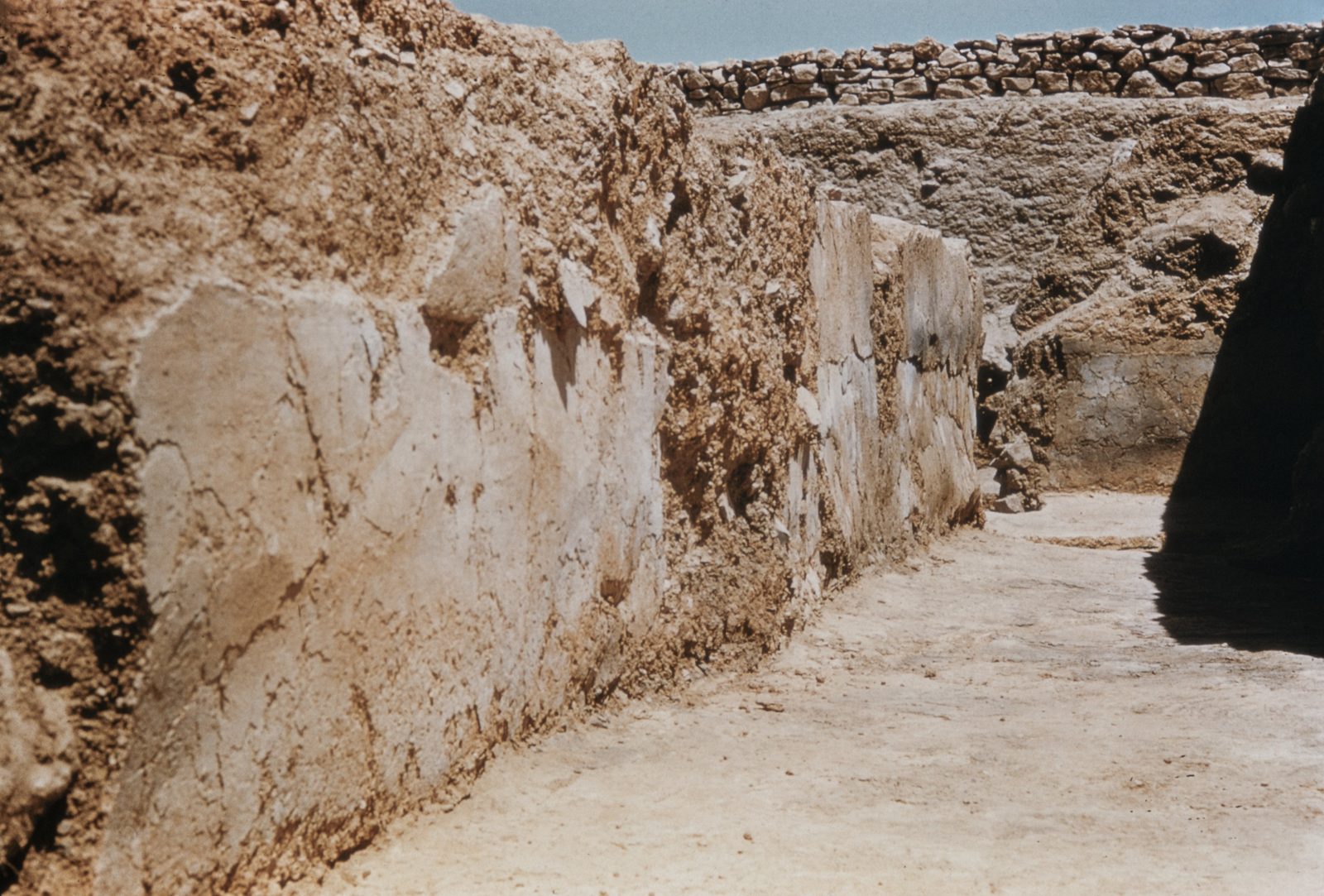
lata 50.
House of the Tiles, Lerna: plaster on the west wall of room XII.
Źródło: George M. A. Hanfmann (photographer per Harvard record; slides may have been donated rather than shot by him) / Harvard Fine Arts Library
-
Powiększ:
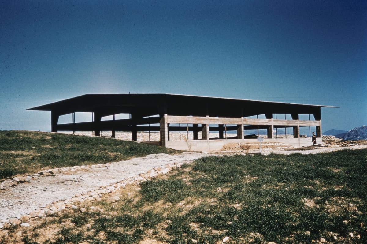
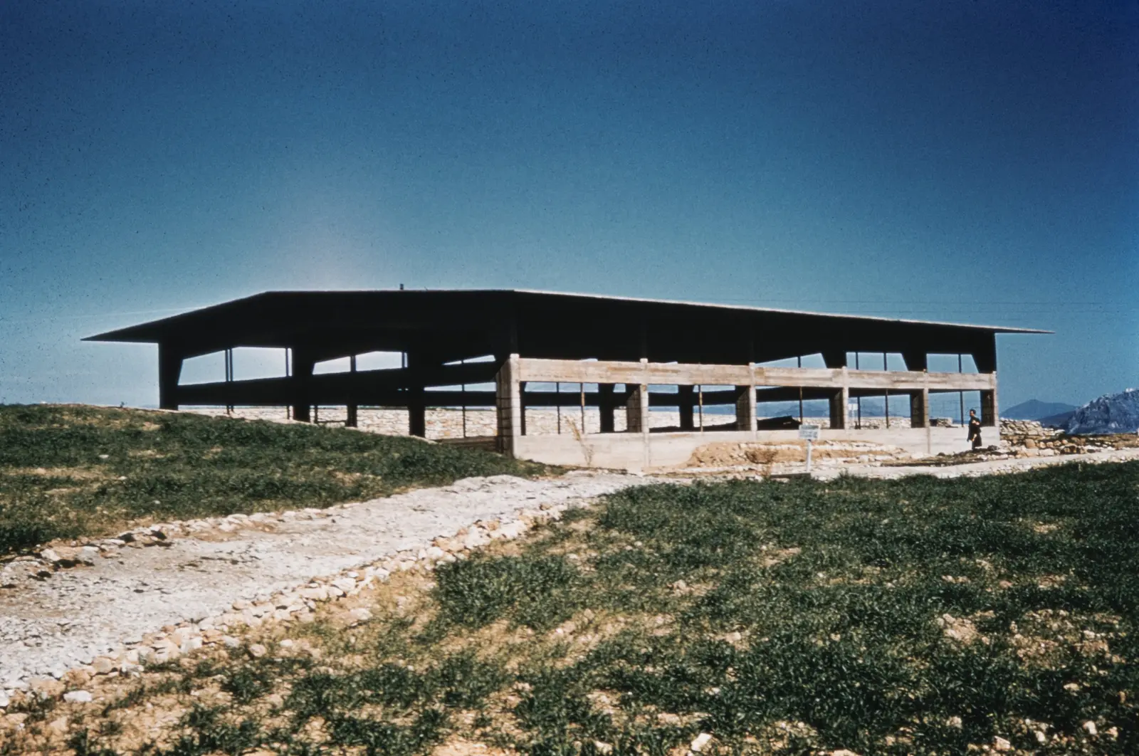
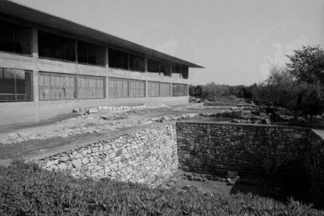
lata 50.
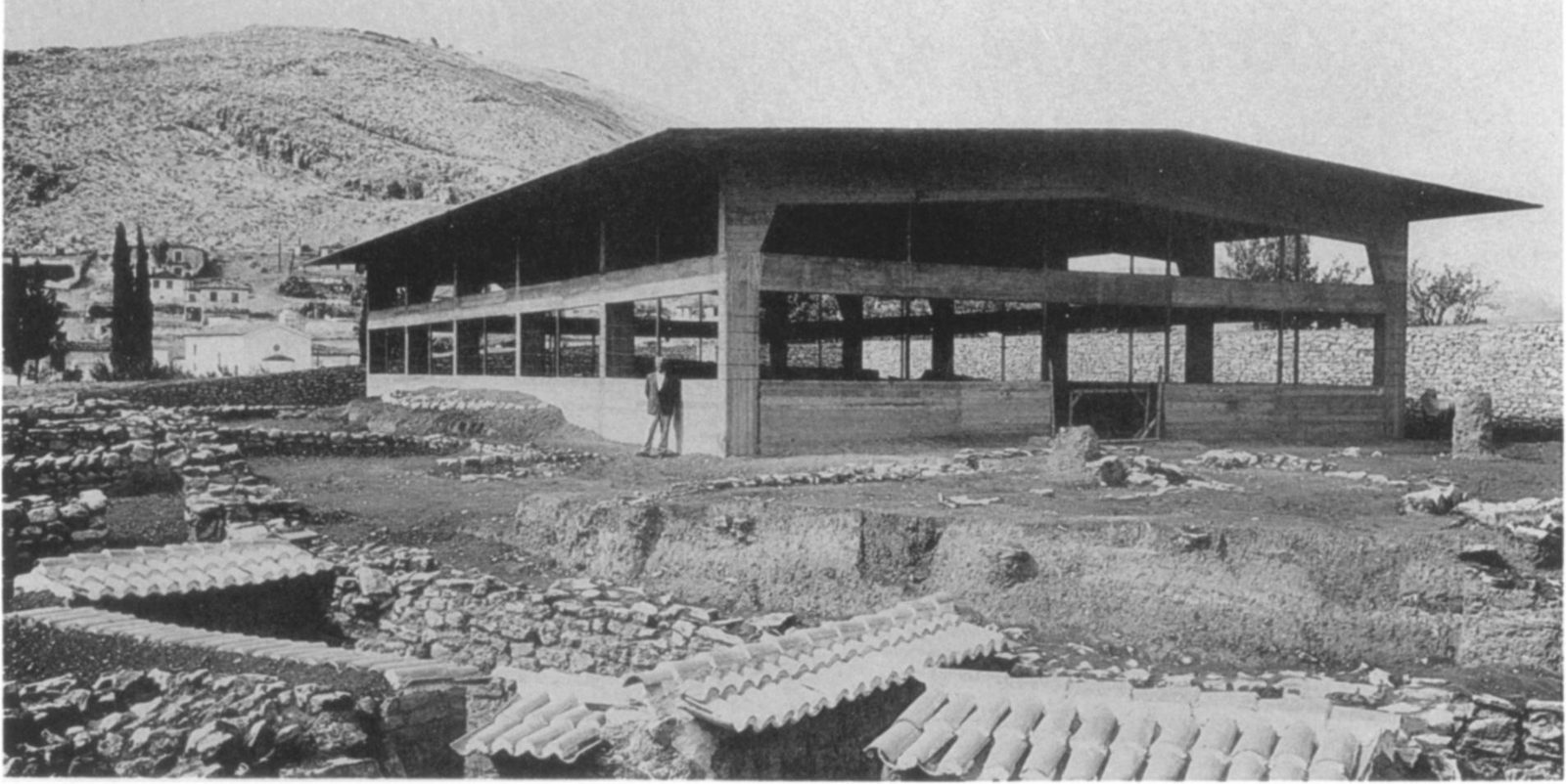
Nowo wybudowany betonowy dach ochronny nad wykopaliskami w Lernie pod ciemnoniebieskim niebem, na pierwszym planie żwirowa ścieżka i trawa, lata 50.
Źródło: Courtesy of Harvard Fine Arts Library, Digital Images & Slides Collection
-
Powiększ:
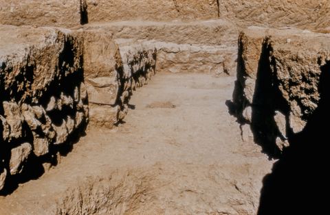
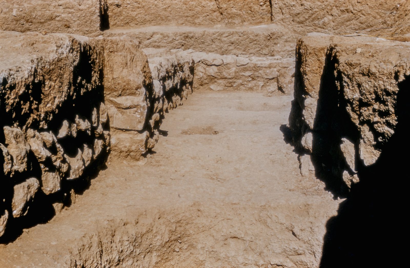
lata 50.
House of the Tiles, Lerna: the south corridor from the east.
Źródło: George M. A. Hanfmann (photographer per Harvard record; slides may have been donated rather than shot by him) / Harvard Fine Arts Library
-
Powiększ:
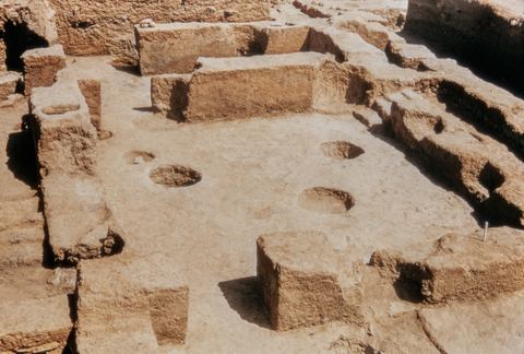
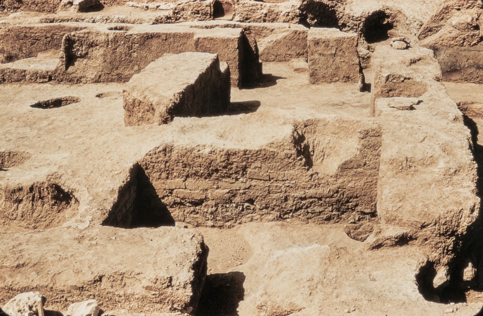
lata 50.
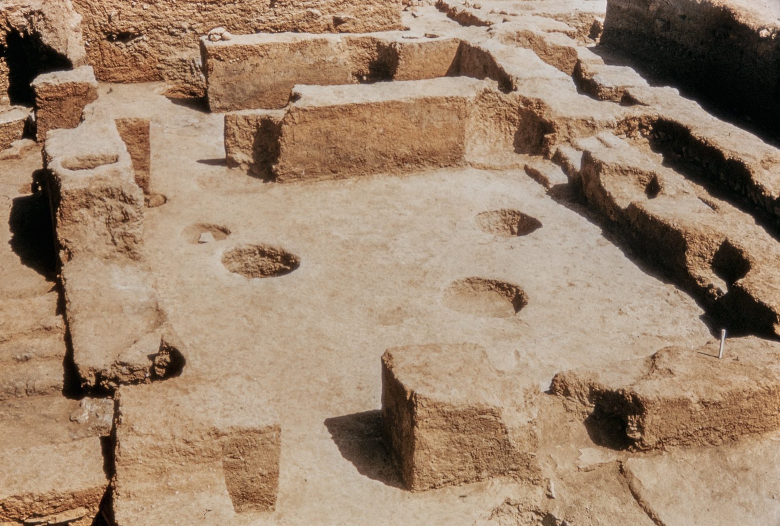
House of the Tiles, Lerna: the west section with storage pits.
Źródło: George M. A. Hanfmann (photographer per Harvard record; slides may have been donated rather than shot by him) / Harvard Fine Arts Library
-
Powiększ:
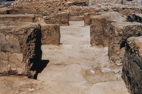
lata 50.
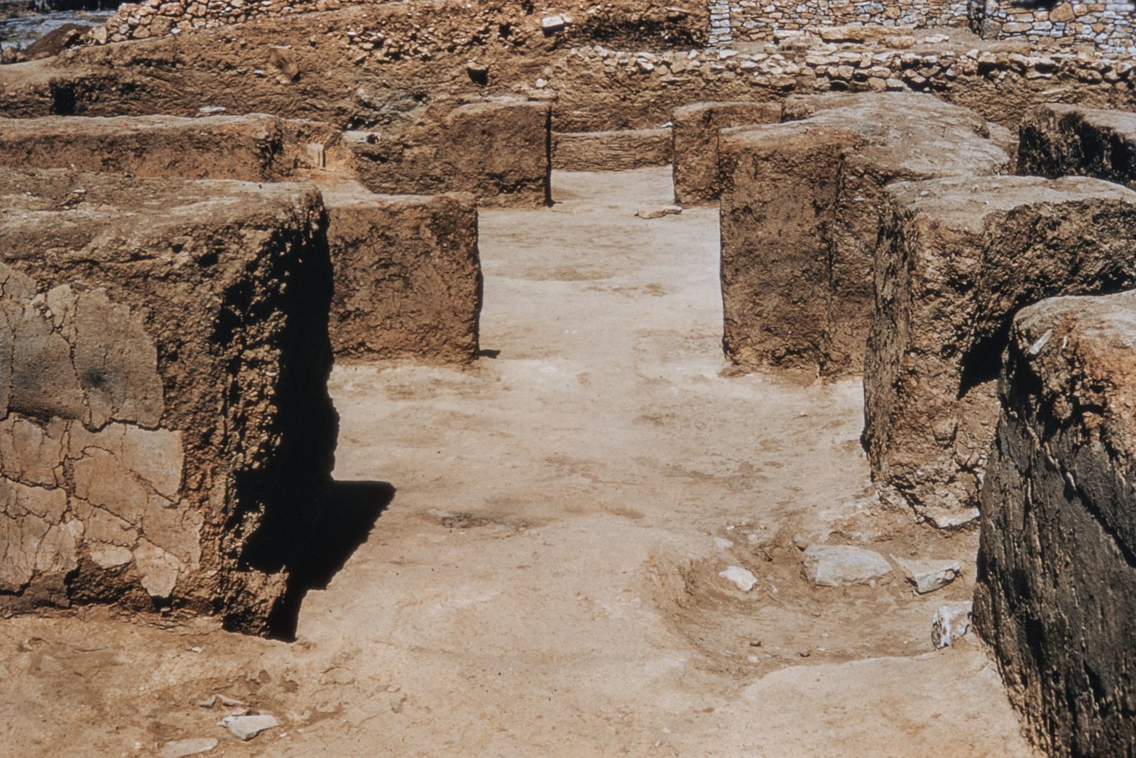
House of the Tiles, Lerna: the interior doorways from the east.
Źródło: George M. A. Hanfmann (photographer per Harvard record; slides may have been donated rather than shot by him) / Harvard Fine Arts Library
-
Powiększ:
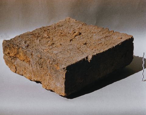
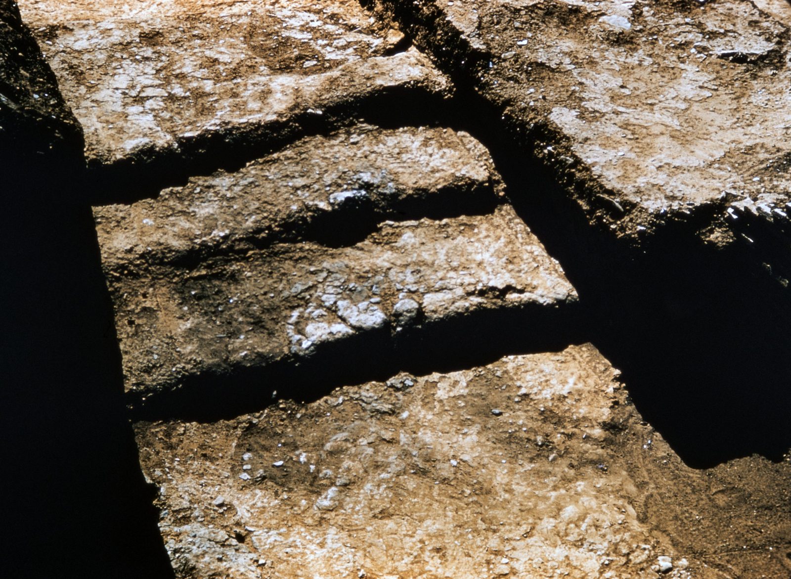
lata 50.
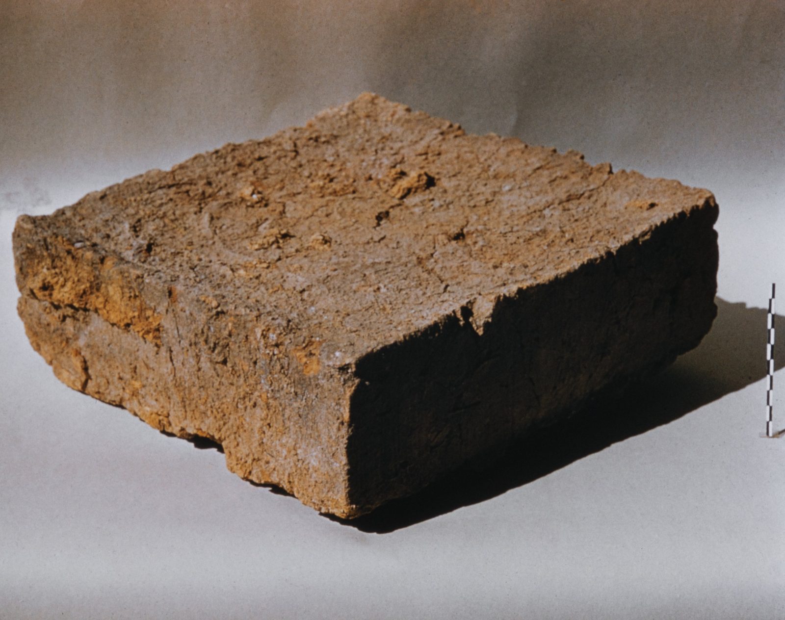
A mud brick from the House of the Tiles at Lerna, photographed as an object.
Źródło: George M. A. Hanfmann (photographer per Harvard record; slides may have been donated rather than shot by him) / Harvard Fine Arts Library
-
Powiększ:
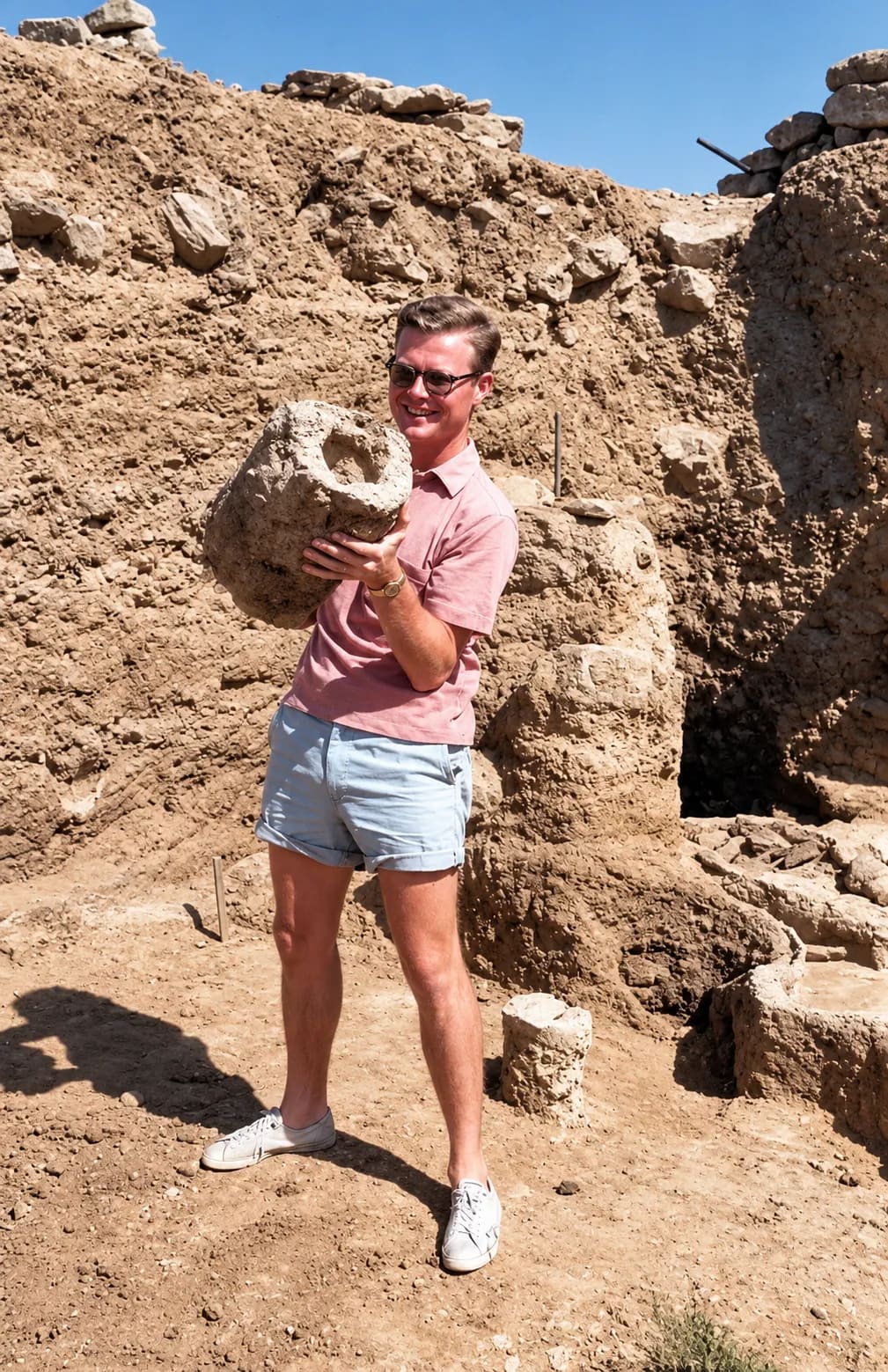
lata 50.
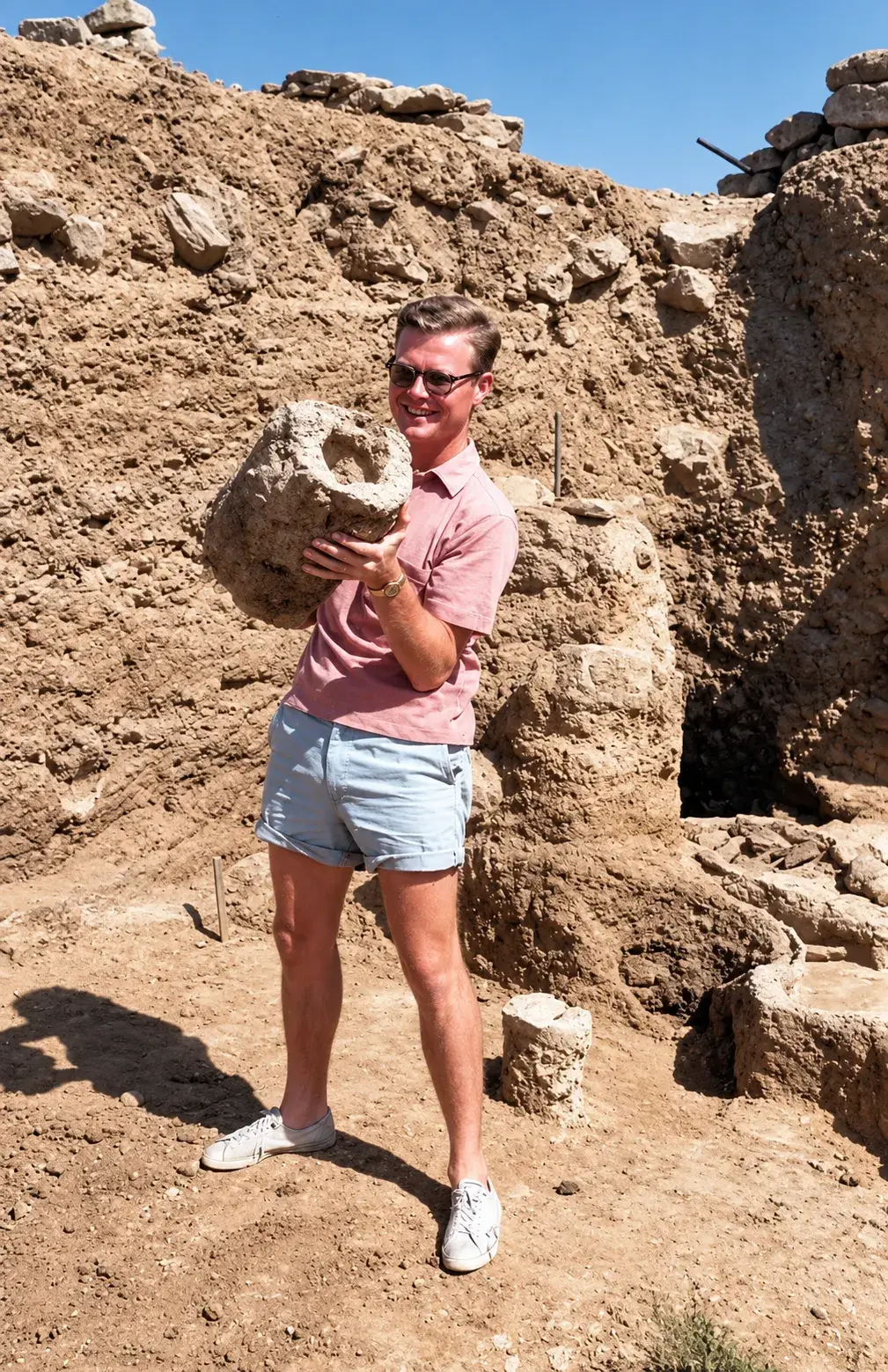
Badacz w okularach przeciwsłonecznych, różowej koszuli i szortach trzyma duży gliniany dzban w wykopie w Lernie (cyfrowo odnowione)
Źródło: Visit Myloi collection
-
Powiększ:
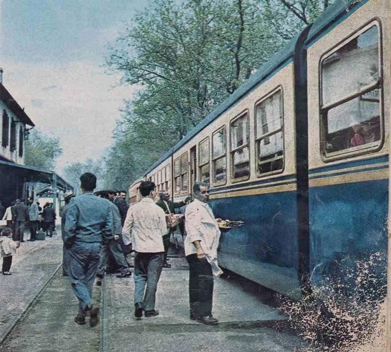
lata 50.
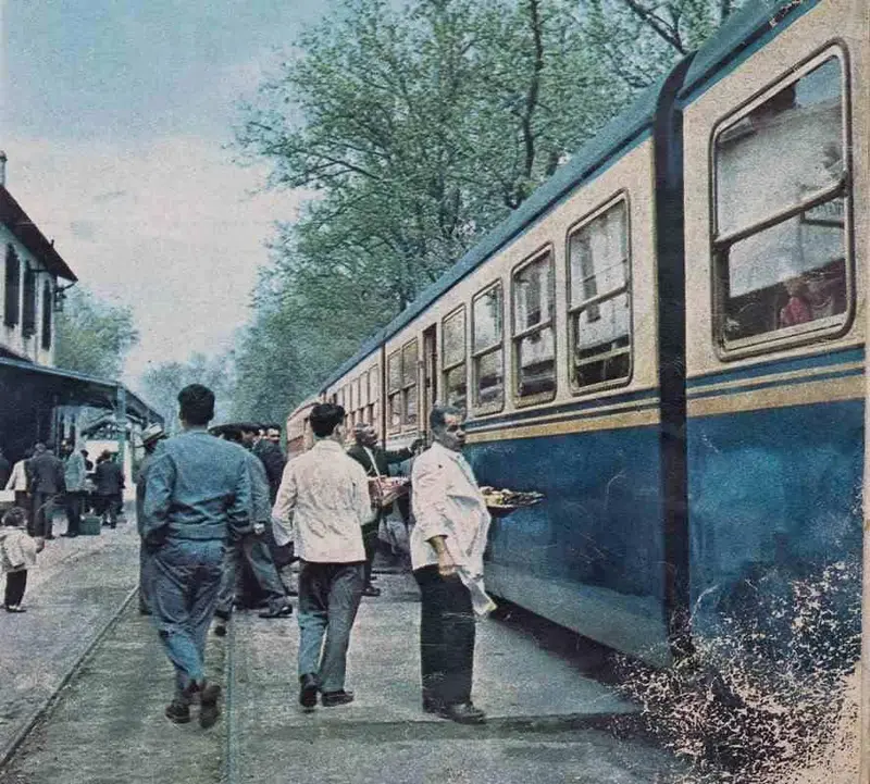
Kelnerzy w białych marynarkach niosą tace z souvlaki wzdłuż niebieskiego pociągu na stacji Myloi
Źródło: Magazine scan, 1960s (Visit Myloi collection)
-
Powiększ:
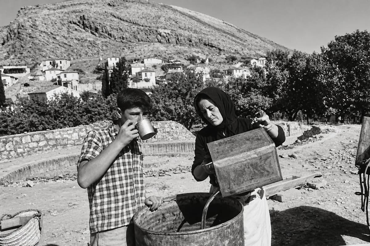
lata 50.
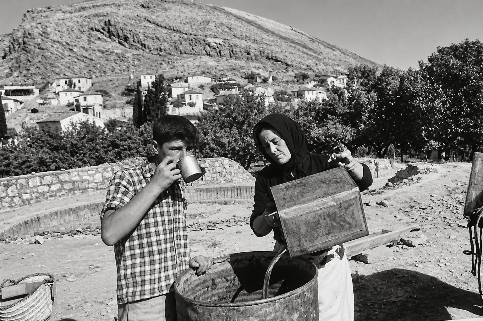
Członkowie ekipy wykopaliskowej w Lernie w latach 50.: chłopiec pije z blaszanego kubka, a kobieta w chuście wlewa wodę do beczki; w tle domy Myloi i Pontinos (cyfrowo odnowione)
Źródło: Visit Myloi collection
-
Powiększ:
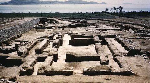
ok. 1954–1957 (szacunkowo)
Faded colour slide of the House of Tiles at Lerna seen from the west, still without its shelter, with a stone retaining wall, the railway with poles, the coastal plain, trees and the gulf.
Źródło: University of Texas at Austin, Classics Department (slide collection)
-
Powiększ:
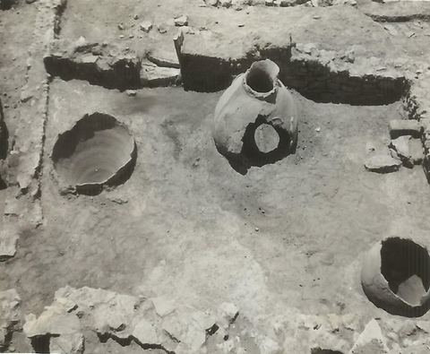
1956
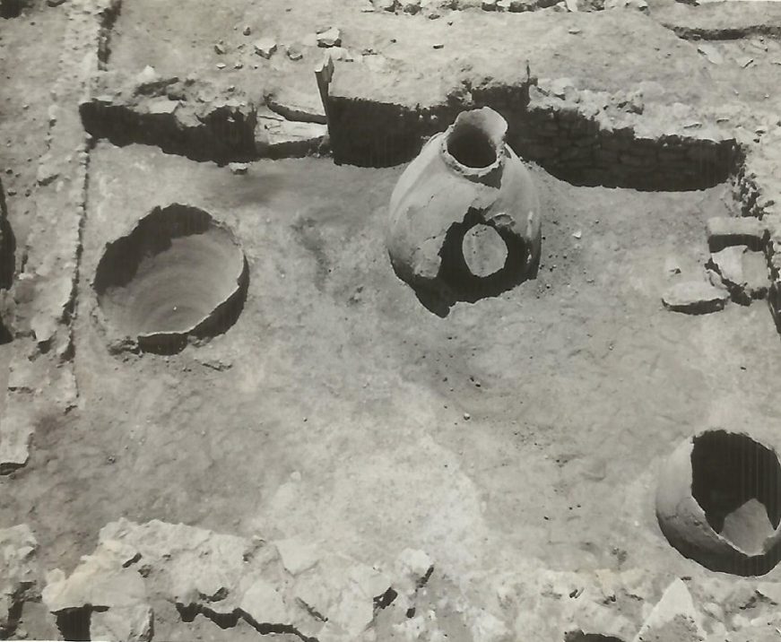
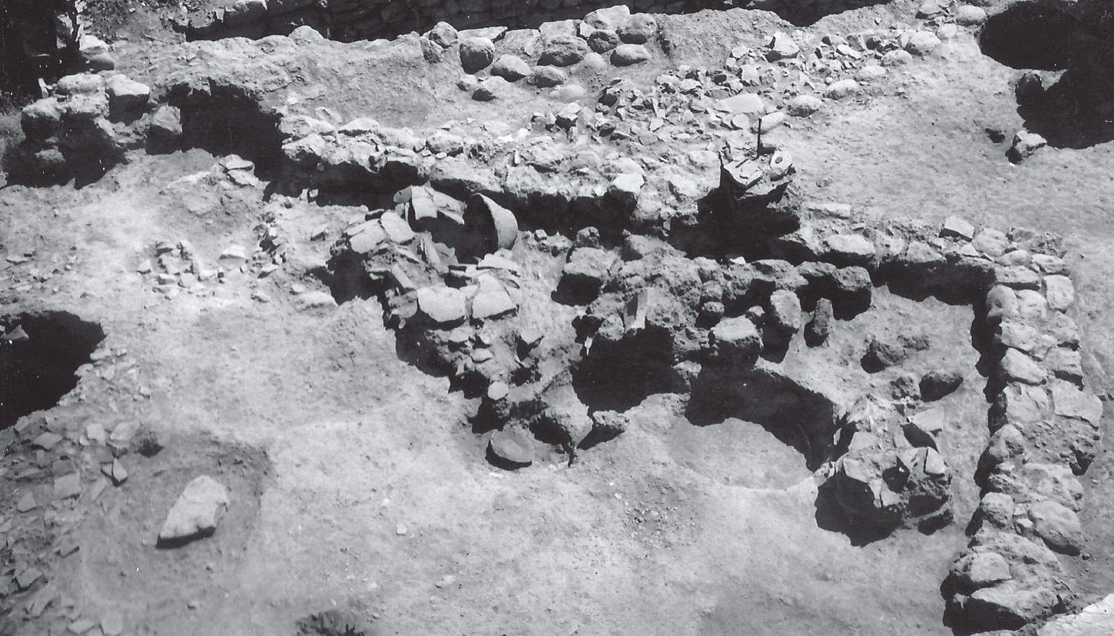
Lerna excavation: Room 45, a Middle Helladic food storeroom with pithoi.
Źródło: Lerna excavation team (J.L. Caskey), ASCSA Lerna Excavations Archive; reproduced by the Ephorate of Antiquities of Argolida
-
Powiększ:
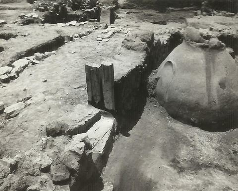
1956
Lerna excavation: entrance of Room 45 with the partly restored wooden door post.
Źródło: Lerna excavation team (J.L. Caskey), ASCSA Lerna Excavations Archive; reproduced by the Ephorate of Antiquities of Argolida
-
Powiększ:
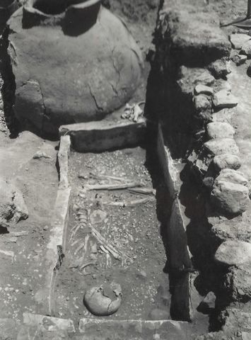
1956
Lerna excavation: cist grave later than Room 45.
Źródło: Lerna excavation team (J.L. Caskey), ASCSA Lerna Excavations Archive; reproduced by the Ephorate of Antiquities of Argolida
-
Powiększ:
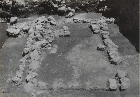
1956
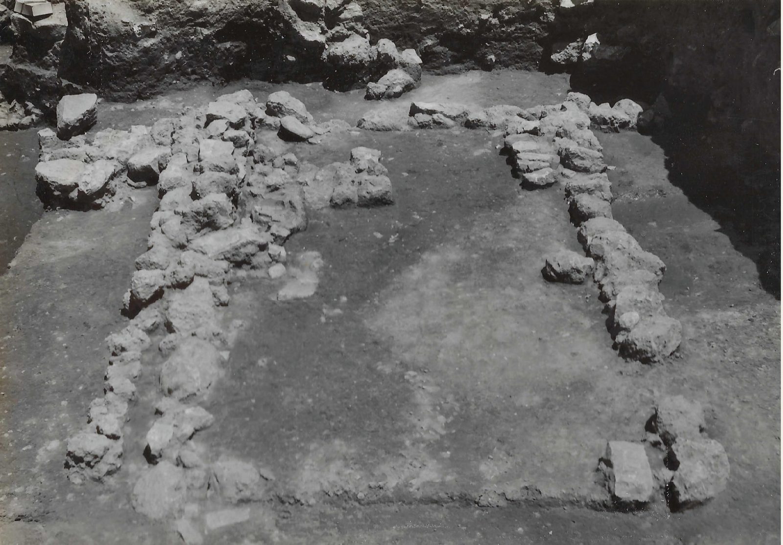
Lerna excavation: the Neolithic house W-5 seen from the south.
Źródło: Lerna excavation team (J.L. Caskey), ASCSA Lerna Excavations Archive; reproduced by the Ephorate of Antiquities of Argolida
-
Powiększ:
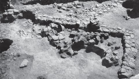
1956
Lerna excavation: the Early Helladic III Building W-84 during excavation.
Źródło: Lerna excavation team (J.L. Caskey), ASCSA Lerna Excavations Archive; reproduced by the Ephorate of Antiquities of Argolida
-
Powiększ:
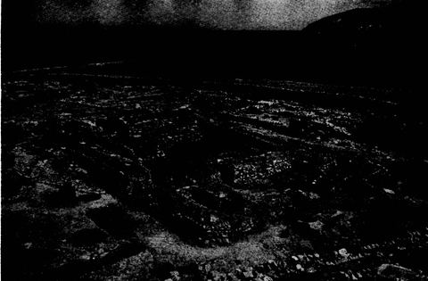
1956
The House of the Tiles at Lerna from the northwest, its mud-brick walls temporarily protected with small stones, with the Pontinos ridge behind.
Źródło: Bulletin de Correspondance Hellénique, Chronique des fouilles (photos probably supplied by ASCSA/Caskey)
-
Powiększ:
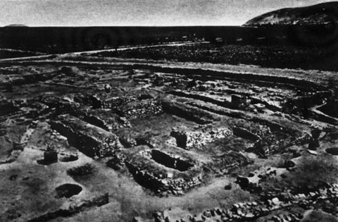
jesień 1956
The House of Tiles at Lerna after the 1956 season, walls covered with earth and stones, with Mt Pontinos and the plain behind.
Źródło: Lerna excavation (J.L. Caskey, ASCSA), published in ILN
-
Powiększ:
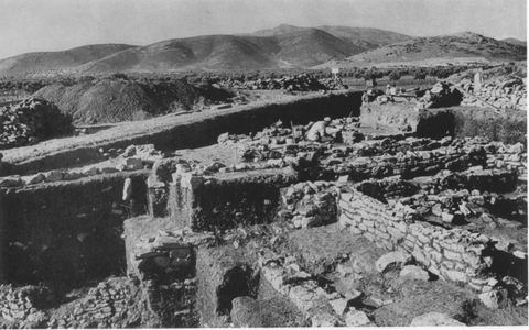
1956
Overview of the Lerna excavation from the north, with hills behind.
Źródło: J. L. Caskey / ASCSA Lerna excavation
-
Powiększ:
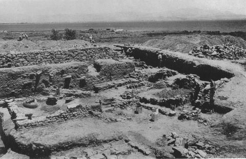
1956
The Lerna excavation from the south-west with the gulf and workmen.
Źródło: J. L. Caskey / ASCSA Lerna excavation
-
Powiększ:
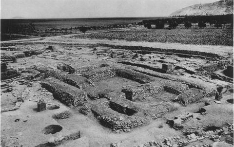
1956
The House of the Tiles at Lerna from the north-west, with Mt Pontinos and an olive grove.
Źródło: J. L. Caskey / ASCSA Lerna excavation
-
Powiększ:
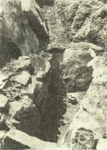
sierpień 1956
Stone cist grave A after cleaning, found on the plot of K. Bompos at the entrance of Myloi from Argos.
Źródło: E. Protonotariou (excavation); Αρχαιολογική Εφημερίς 1955 (printed 1961)
-
Powiększ:
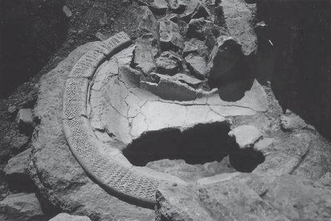
1957
Lerna excavation: the hearth of Building BG as found in situ.
Źródło: Lerna excavation team (J.L. Caskey), ASCSA Lerna Excavations Archive; reproduced by the Ephorate of Antiquities of Argolida
-
Powiększ:
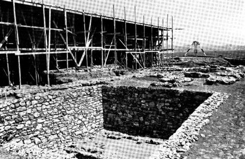
czerwiec–wrzesień 1957
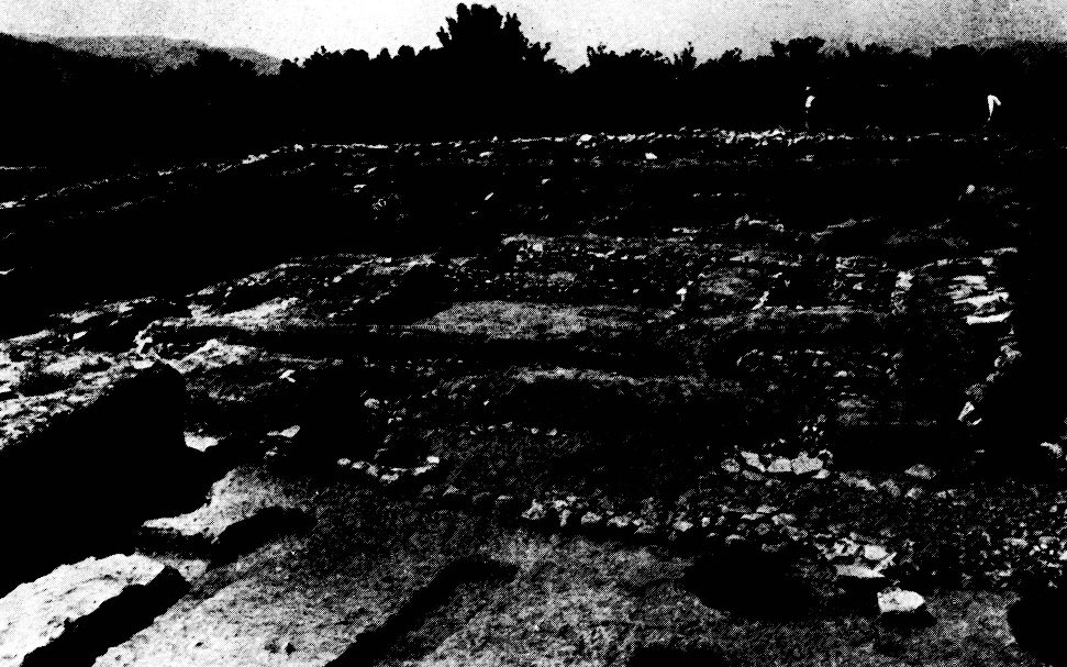
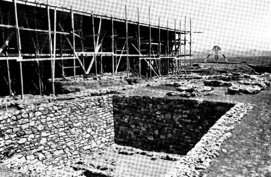
Lerna: a Neolithic house in the foreground and, at left behind, the shelter for the House of the Tiles under construction with wooden scaffolding.
Źródło: Bulletin de Correspondance Hellénique, Chronique des fouilles (photos probably supplied by ASCSA/Caskey)
-
Powiększ:
1957
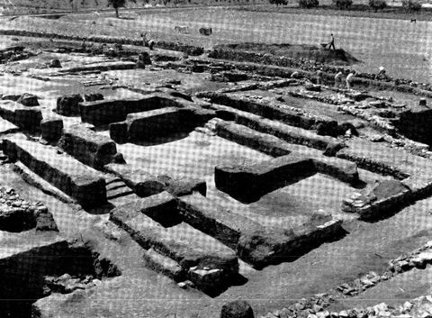
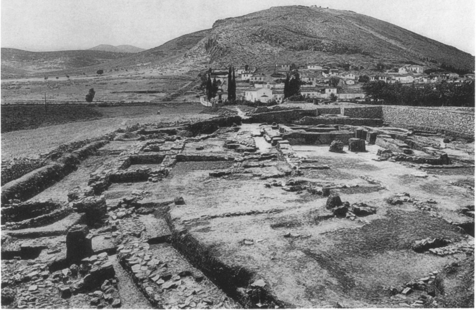
The House of the Tiles at Lerna seen from the northwest, with the plain, trees and some workers behind.
Źródło: Bulletin de Correspondance Hellénique, Chronique des fouilles (photos probably supplied by ASCSA/Caskey)
-
Powiększ:
1957 (publikacja; zdjęcia 1954 i 1956)
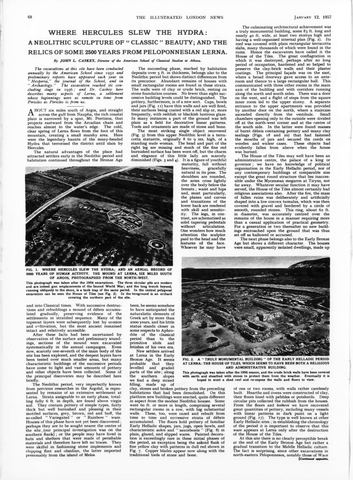
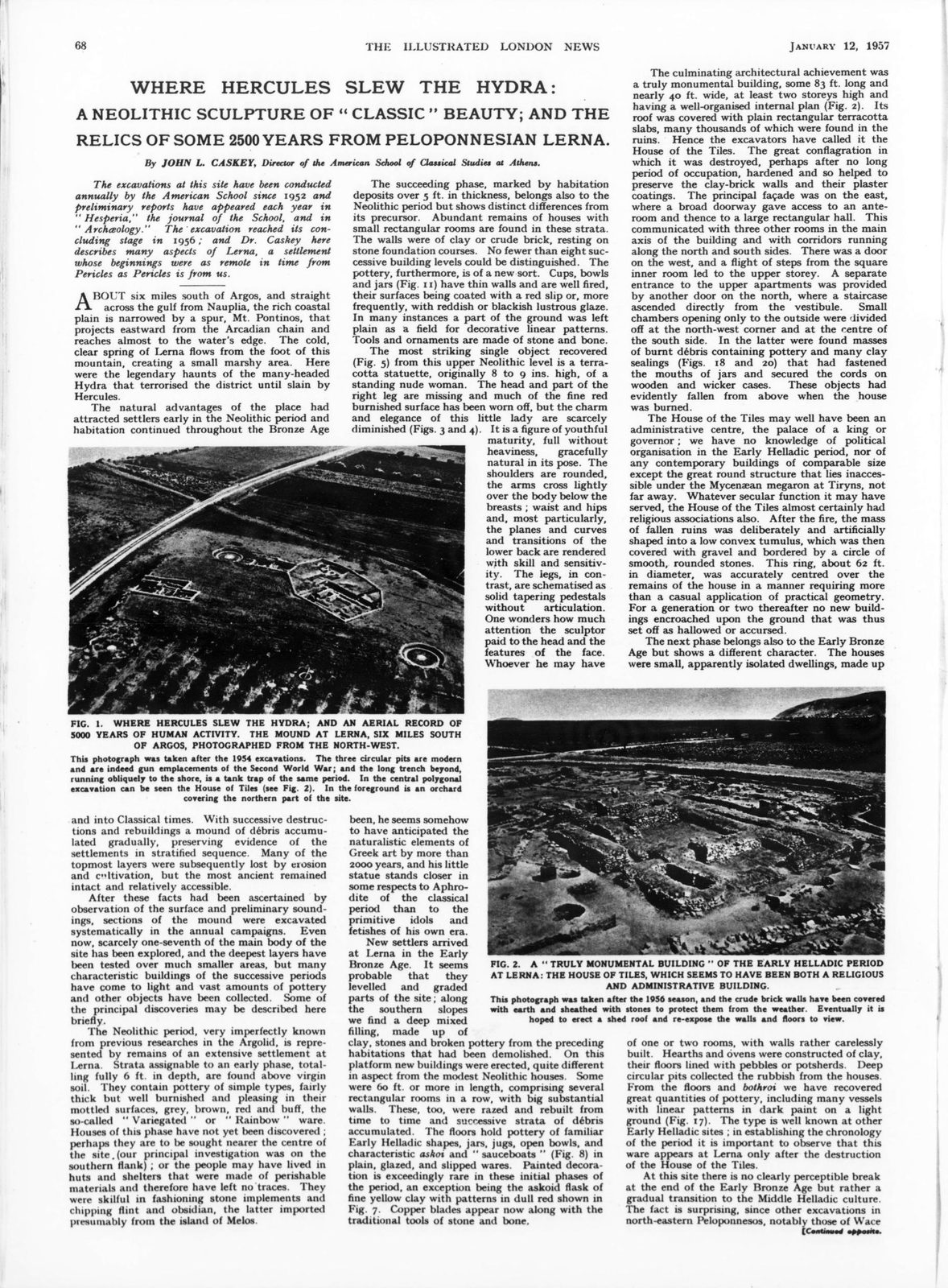
Full page 68 of the Illustrated London News of 12 January 1957 with Caskey's article on Lerna and its two photos.
Źródło: Illustrated London News; J.L. Caskey
-
Powiększ:
lipiec 1957
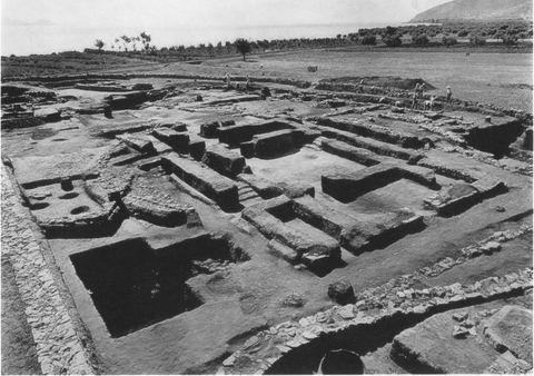
The Lerna excavation from the north-west, with the railway and the sea in the background.
Źródło: Alison Frantz (photographer) / ASCSA
-
Powiększ:
1957
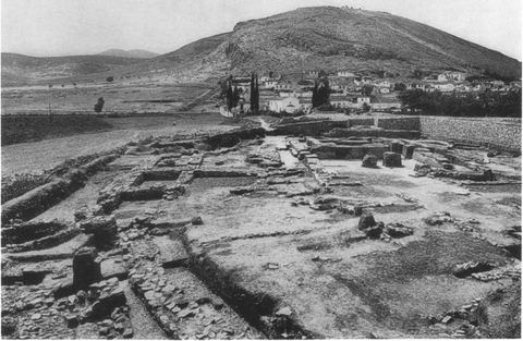
The Lerna excavation from the east, with the village of Myloi and Mt Pontinos in the background.
Źródło: Alison Frantz (photographer) / ASCSA
-
Powiększ:
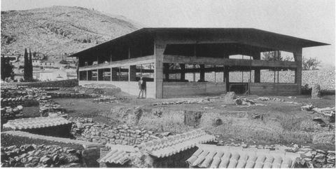
1957
The new protective shelter over the House of the Tiles, with houses of Myloi and Mt Pontinos behind.
Źródło: J. L. Caskey / ASCSA Lerna excavation
-
Powiększ:
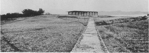
wrzesień 1957
The Lerna site from the south-west, with the shelter and the gulf.
Źródło: J. L. Caskey / ASCSA Lerna excavation
-
Powiększ:
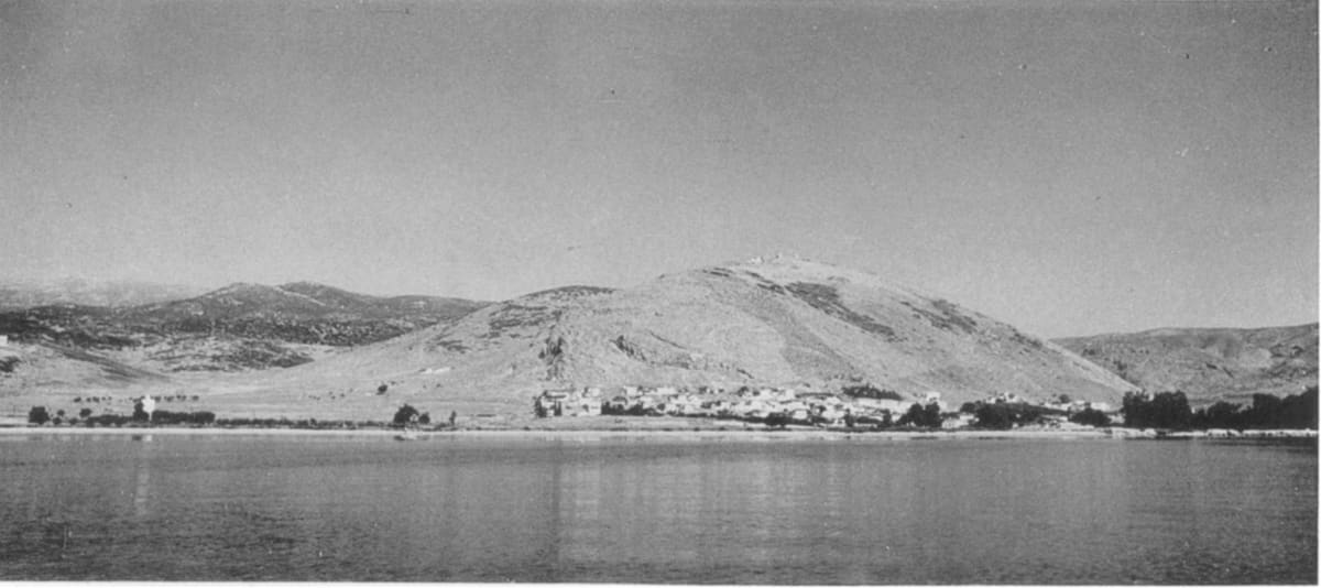
1957
Myloi widziane od strony morza w 1957: niski rząd białych domów u podnóża wzgórza Pontinos
Źródło: American School of Classical Studies at Athens · Hesperia 27 (1958), pl. 40c
-
Powiększ:
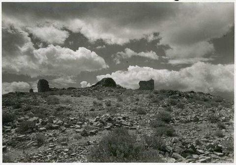
1957
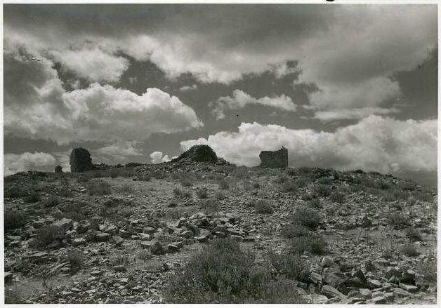
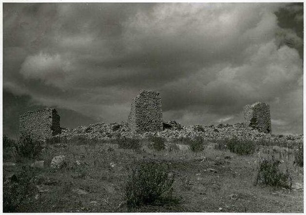
"Kastell Kiveri": castle ruins with scattered towers on the hilltop under clouds.
Źródło: Wulf Schaefer; DAI Athens, NL-Schaefer-W-1-A-07-004
-
Powiększ:
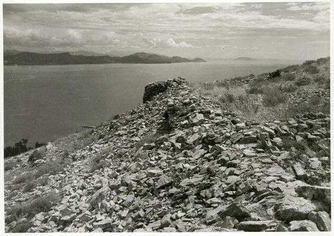
1957
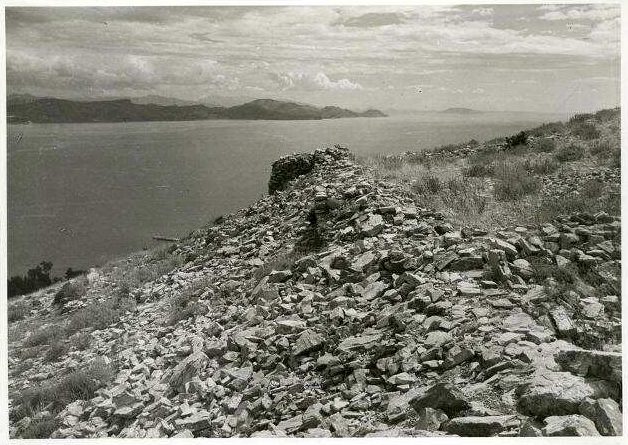
"Kastell Kiveri": rubble of the castle walls with a tower stump and the gulf behind.
Źródło: Wulf Schaefer; DAI Athens, NL-Schaefer-W-1-A-07-005
-
Powiększ:
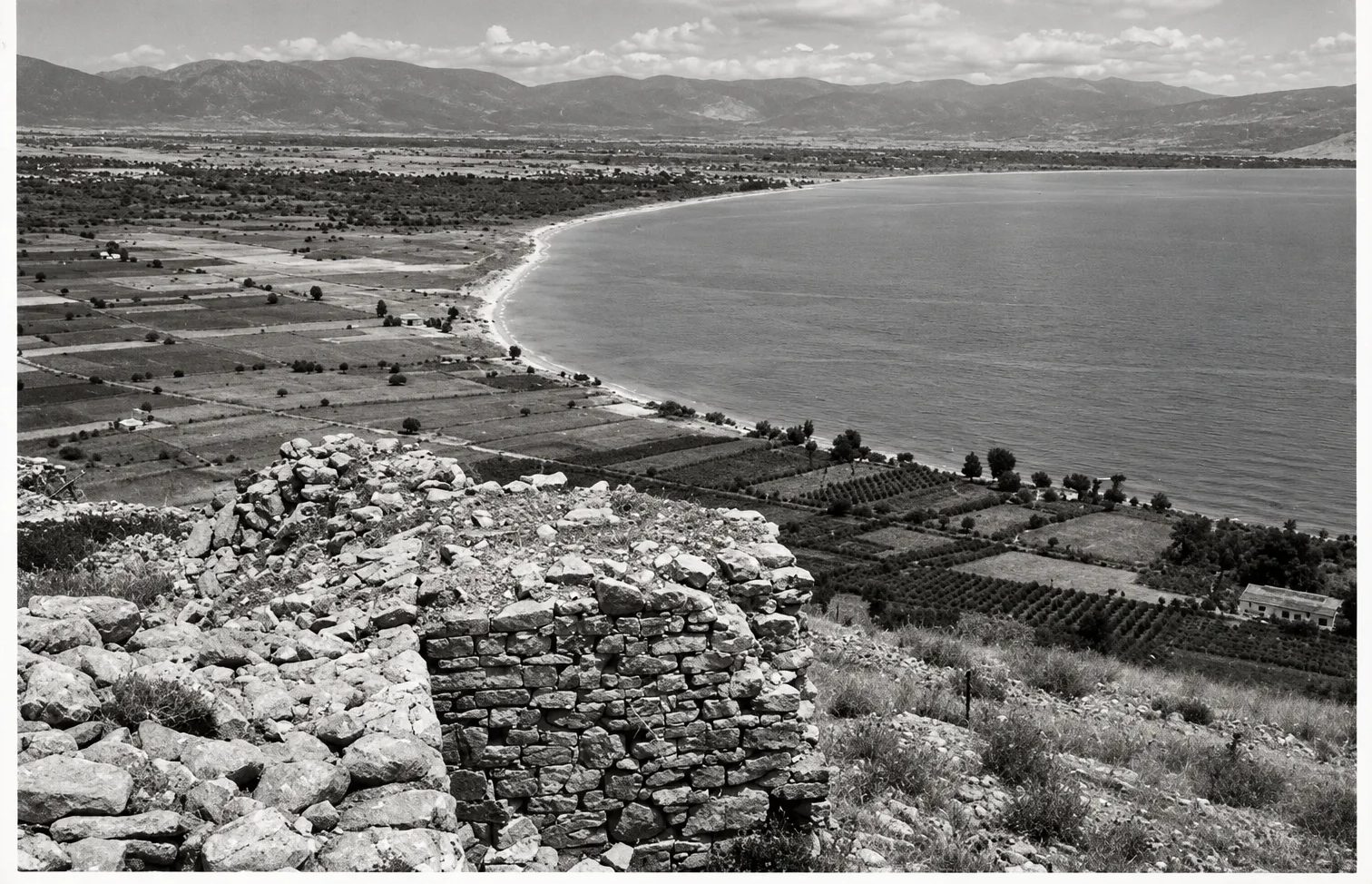
1957
"Kastell Kiveri": corner of the castle wall with a view down to the coastal plain, fields and a curving beach.
Źródło: Wulf Schaefer; DAI Athens, NL-Schaefer-W-1-A-07-006 · cyfrowo odnowione
-
Powiększ:
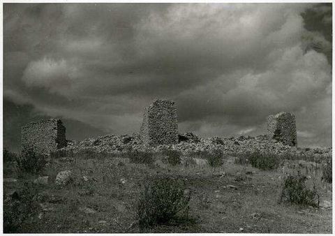
1957
"Kastell Kiveri": towers and walls of the castle on the hilltop.
Źródło: Wulf Schaefer; DAI Athens, NL-Schaefer-W-1-A-07-007
-
Powiększ:
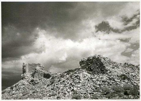
1957
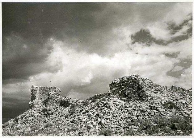
"Kastell Kiveri": ruined towers on the rocky hilltop under clouds.
Źródło: Wulf Schaefer; DAI Athens, NL-Schaefer-W-1-A-07-008
-
Powiększ:
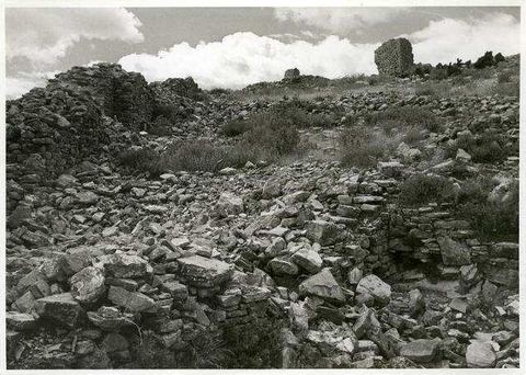
1957
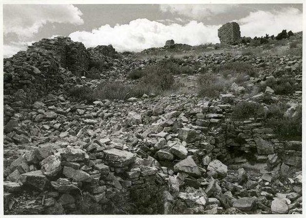
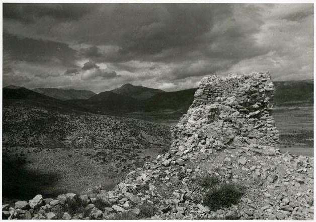
"Kastell Kiveri": rubble-filled interior of the castle with a tower in the background.
Źródło: Wulf Schaefer; DAI Athens, NL-Schaefer-W-1-A-07-009
-
Powiększ:
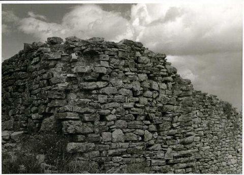
1957
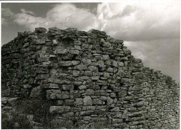
"Kastell Kiveri": rubble masonry of a castle tower.
Źródło: Wulf Schaefer; DAI Athens, NL-Schaefer-W-1-A-07-011
-
Powiększ:
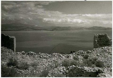
1957
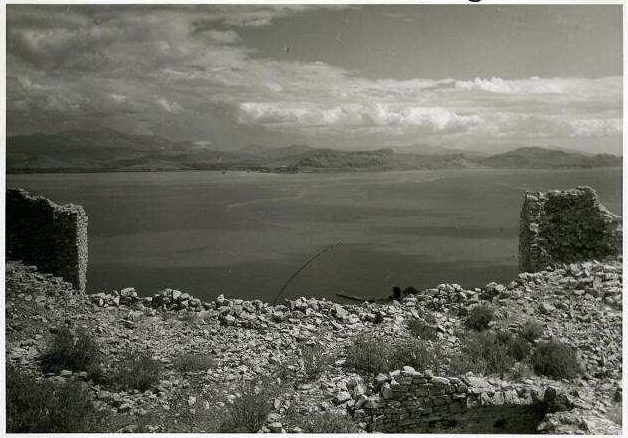
"Kastell Kiveri": wall remains framing a view over the gulf.
Źródło: Wulf Schaefer; DAI Athens, NL-Schaefer-W-1-A-07-012
-
Powiększ:
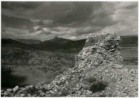
1957
"Kastell Kiveri": ruined wall with mountains behind.
Źródło: Wulf Schaefer; DAI Athens, NL-Schaefer-W-1-A-07-013
-
Powiększ:
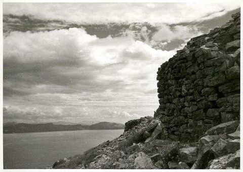
1957
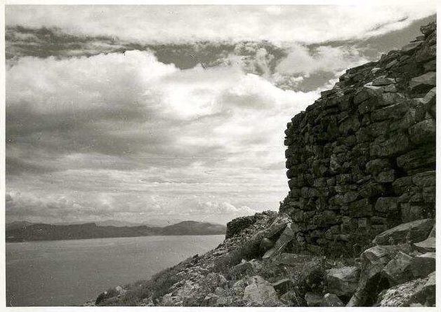
"Kastell Kiveri": rubble masonry tower above the gulf.
Źródło: Wulf Schaefer; DAI Athens, NL-Schaefer-W-1-A-07-014
-
Powiększ:
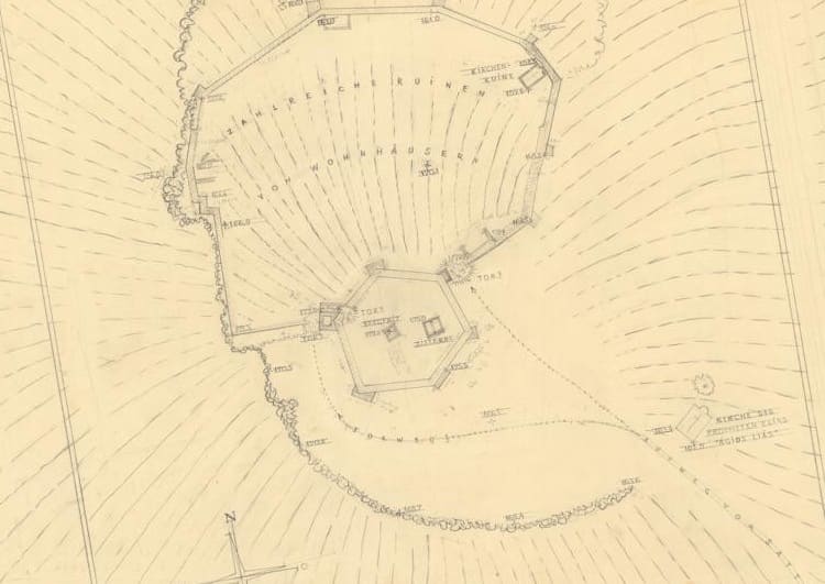
6 września 1957
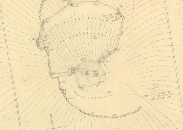
Ołówkowy plan pomiarowy zamku na Pontinos, z ruiną kościoła zaznaczoną przy murze wschodnim
Źródło: D-DAI-ATH-Archiv, Nachlass Schaefer, W-1-Z-07-002
-
Powiększ:
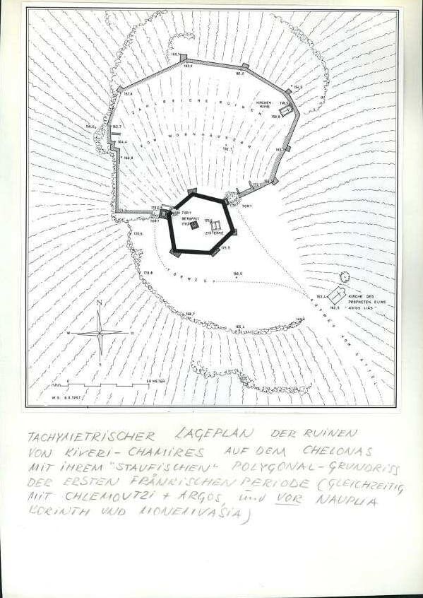
5 sierpnia 1957
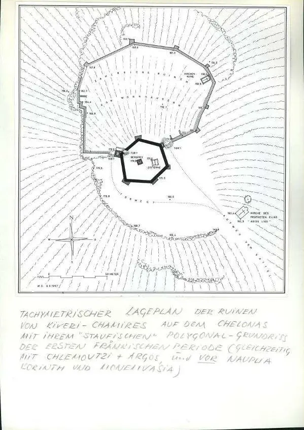
Wykonany tuszem plan ruin zamku Kiveri–Chamires z 1957 roku, z ruiną kościoła i kaplicą Profitis Ilias
Źródło: Plan W.S., 5.8.1957 (Schaefer papers, German Archaeological Institute, Athens; supplied by Visit Myloi)
-
Powiększ:
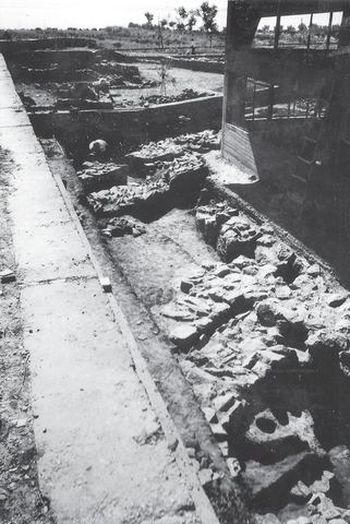
1958
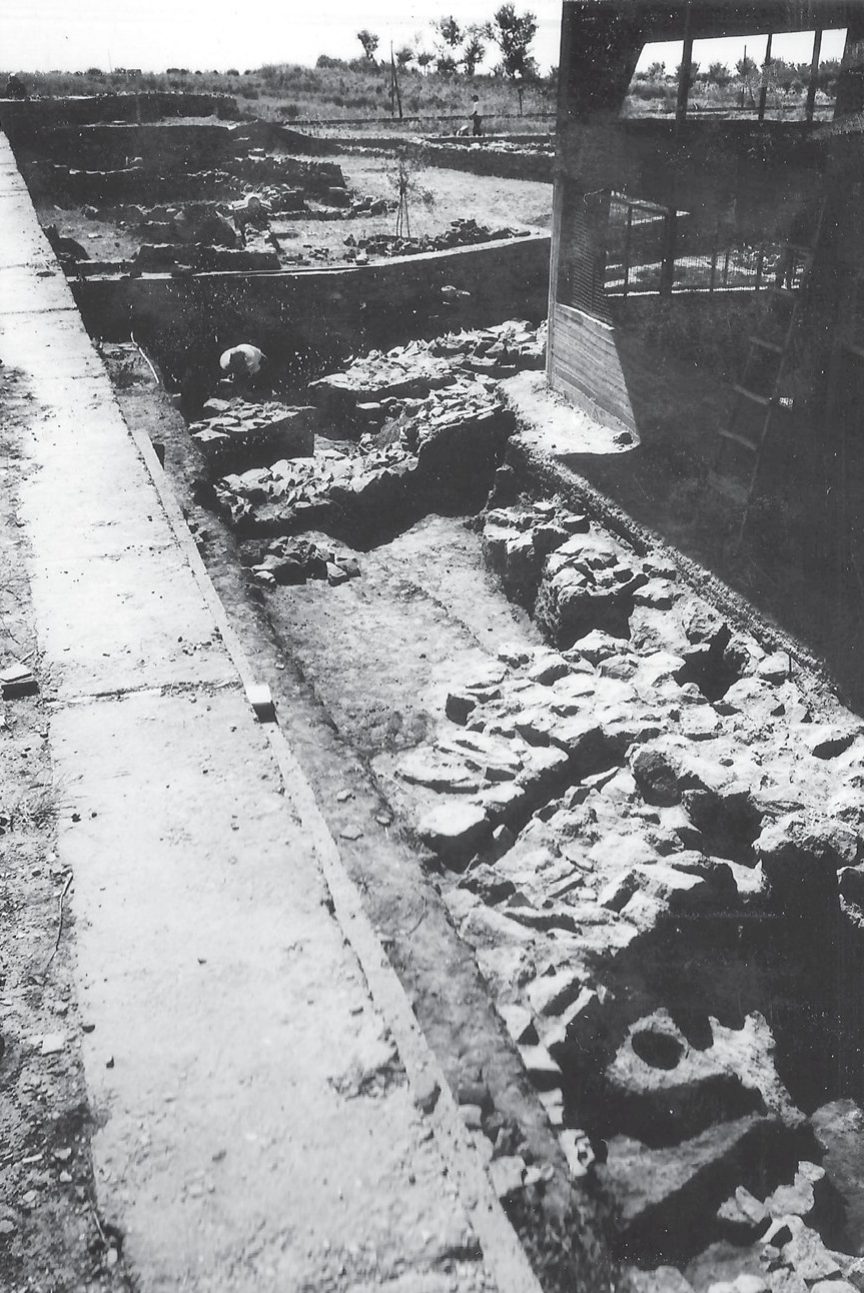
Lerna excavation: the excavated northern part of Building BG seen from the northwest, with the newly built shelter over the House of Tiles, a worker, trees and a telegraph pole.
Źródło: Lerna excavation team (J.L. Caskey), ASCSA Lerna Excavations Archive; reproduced by the Ephorate of Antiquities of Argolida
-
Powiększ:
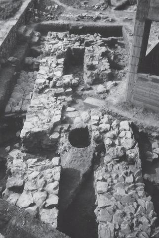
1958
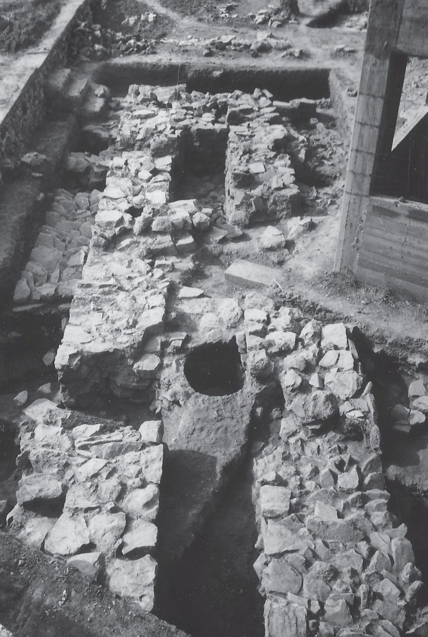
Lerna excavation: the southeast corridor of Building BG seen from the north, with the shelter visible.
Źródło: Lerna excavation team (J.L. Caskey), ASCSA Lerna Excavations Archive; reproduced by the Ephorate of Antiquities of Argolida
-
Powiększ:
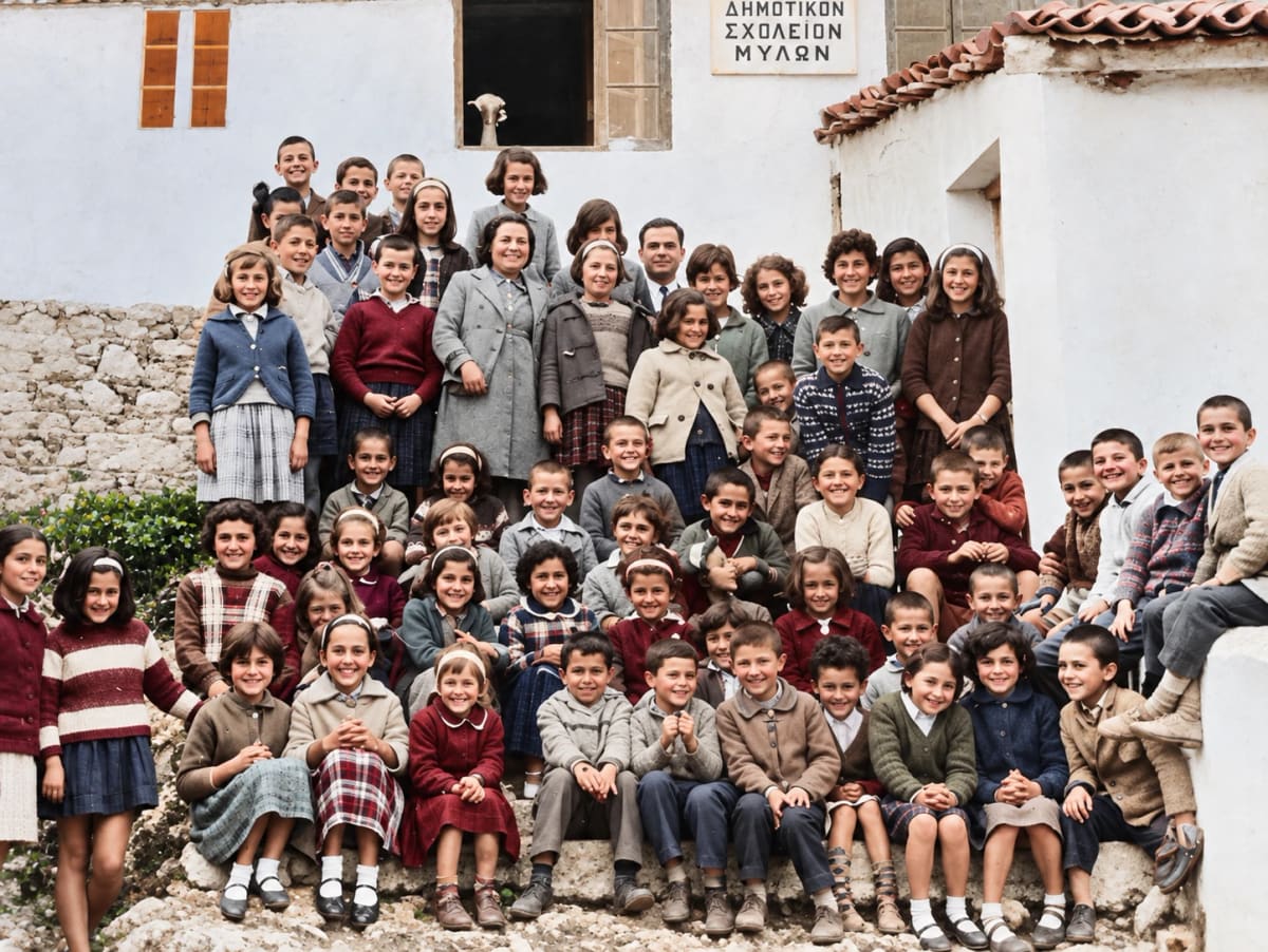
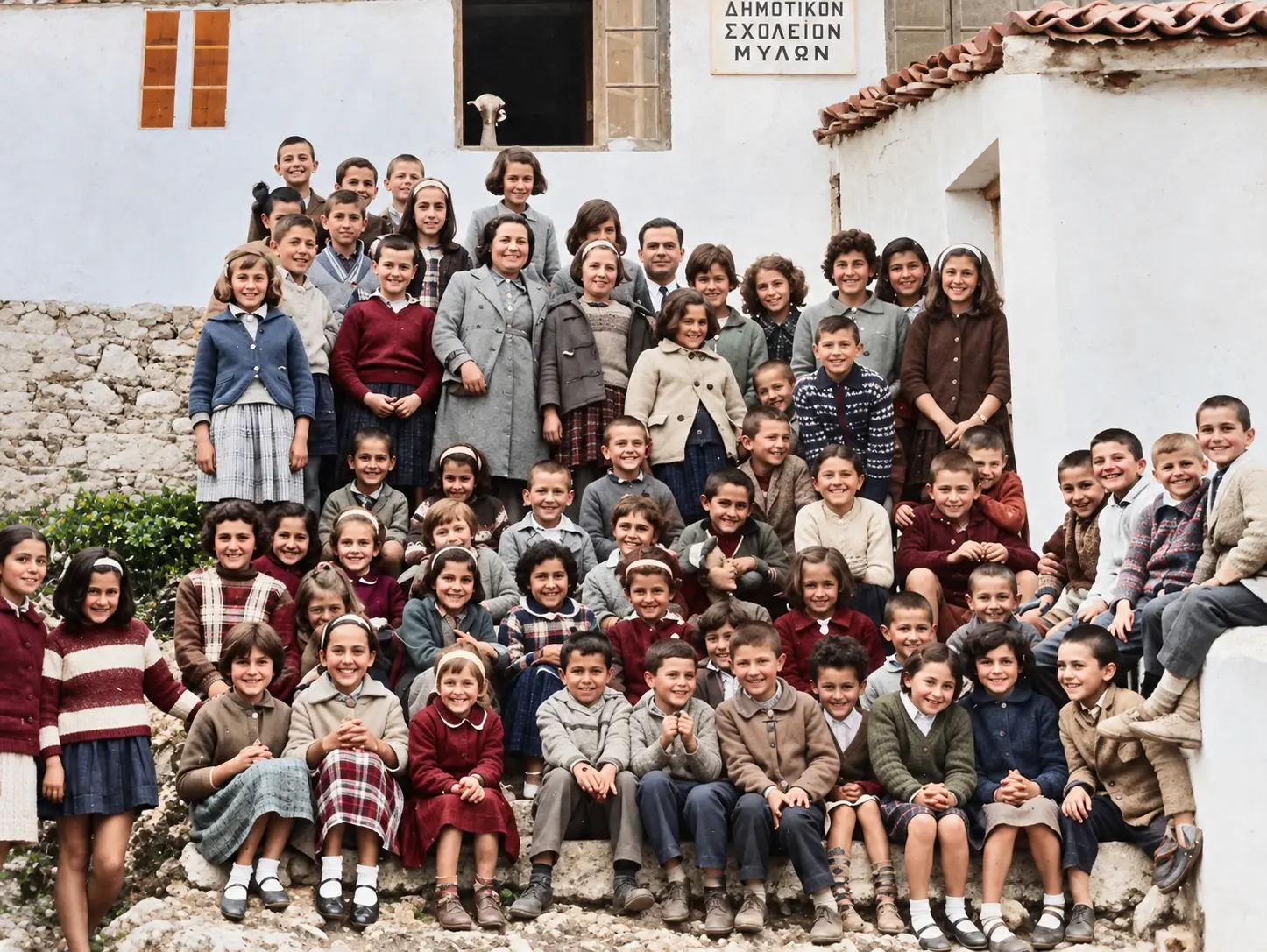
ok. 1955–1965
Ręcznie kolorowane zdjęcie uczniów i nauczycieli przed Dimotikon Scholeion Mylon, szkołą podstawową w Myloi (cyfrowo odnowione)
Źródło: Visit Myloi collection
-
Powiększ:
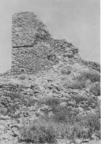
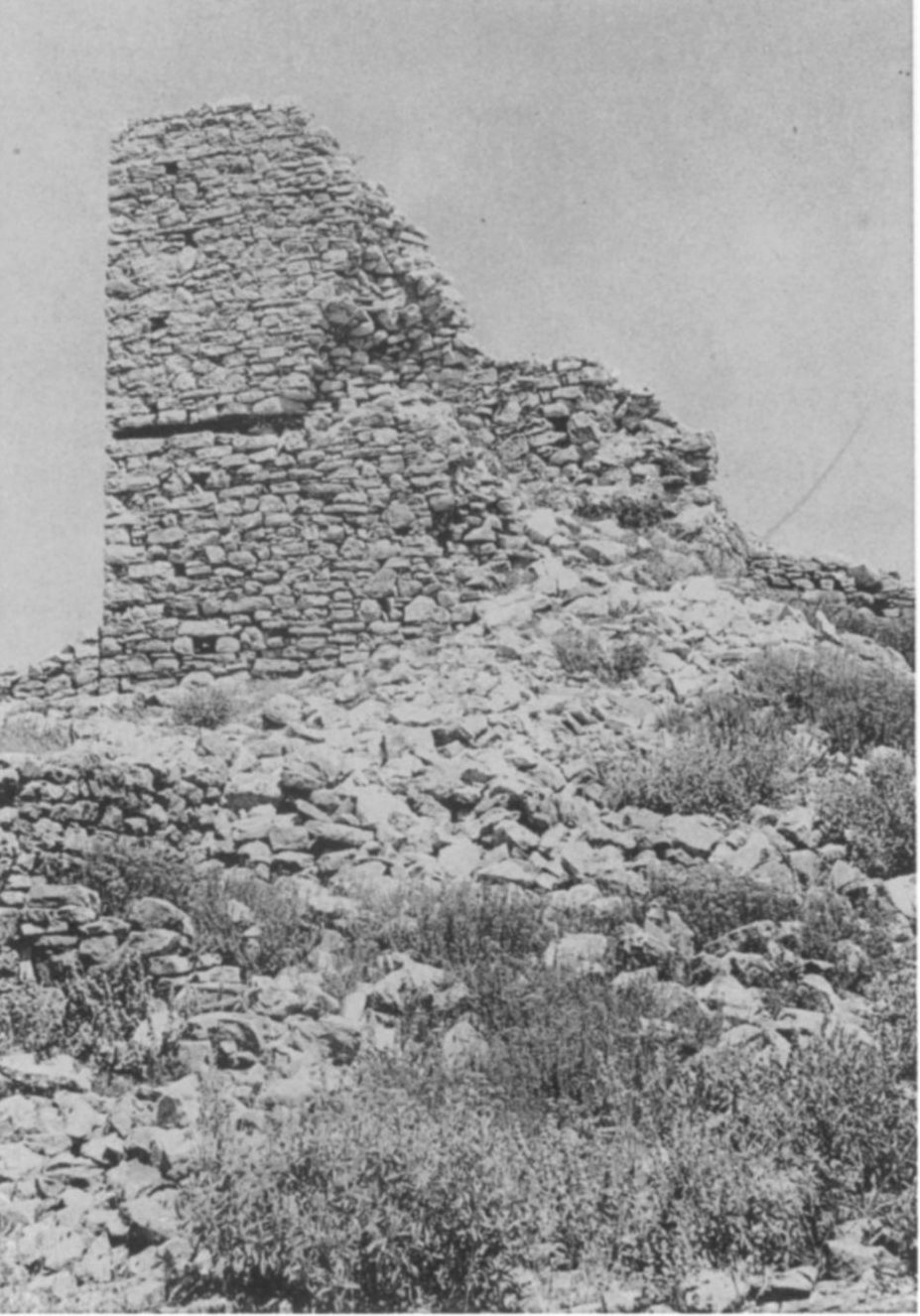
ok. 1958–1960
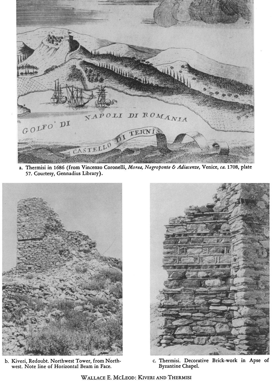
Pl. 114b 'Kiveri, Redoubt. Northwest Tower, from Northwest': the northwest tower of the redoubt of the castle on Mt Pontinos above Myloi, showing the line of a horizontal beam.
Źródło: Probably W.E. McLeod
-
Powiększ:
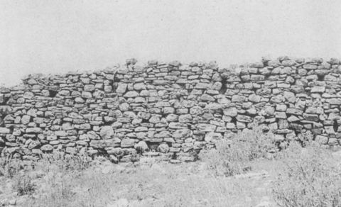
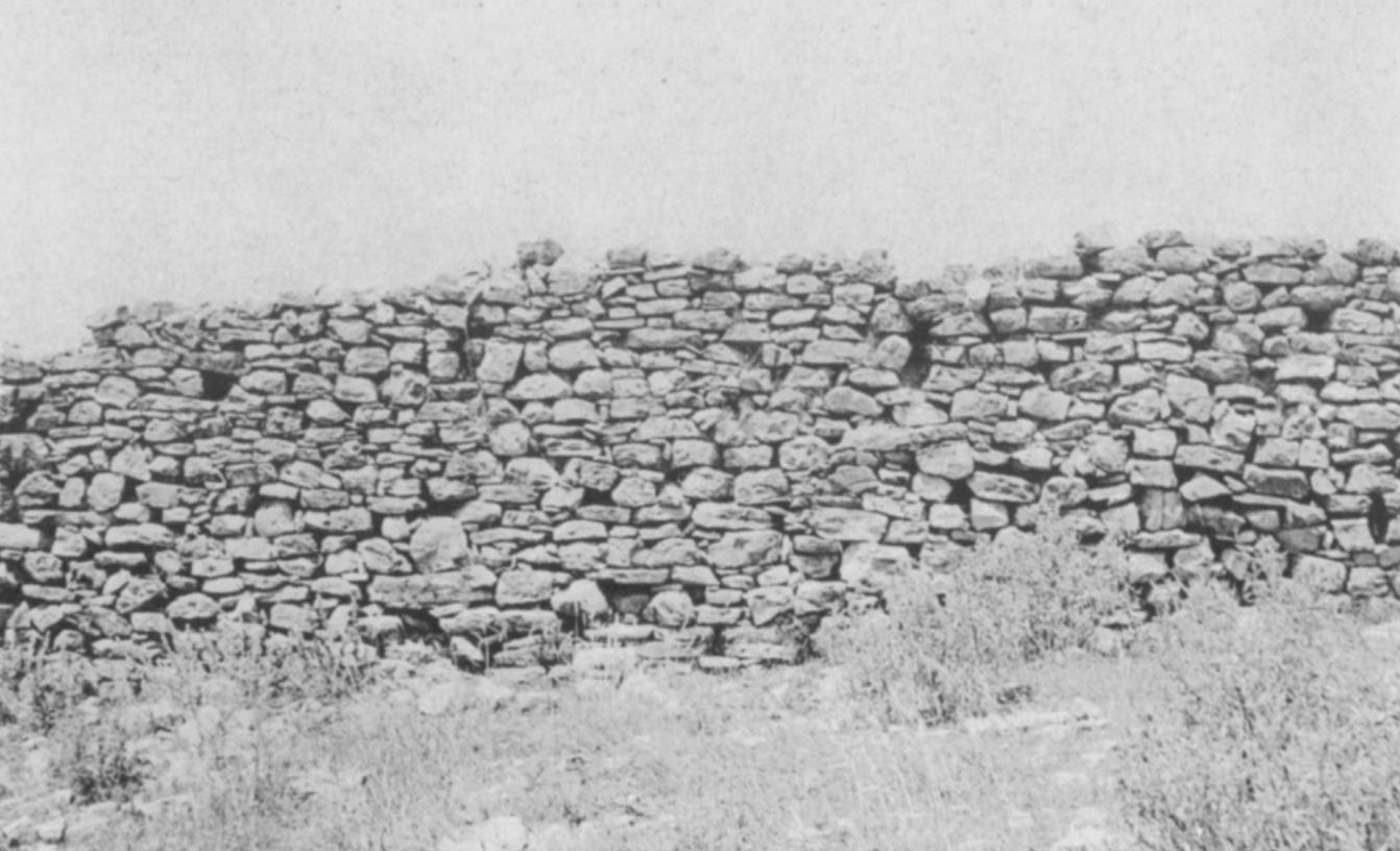
ok. 1958–1960
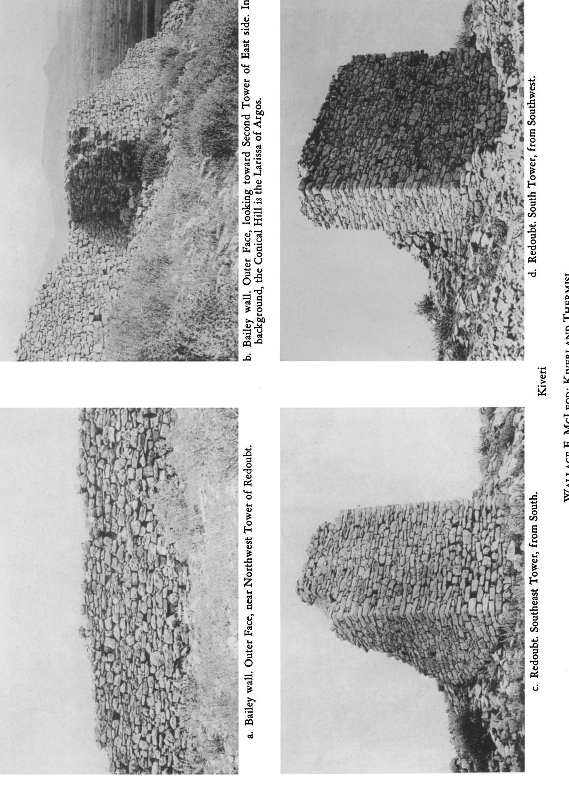
Pl. 115a 'Bailey wall. Outer Face, near Northwest Tower of Redoubt': outer face of the bailey wall of the Pontinos castle.
Źródło: Probably W.E. McLeod
-
Powiększ:
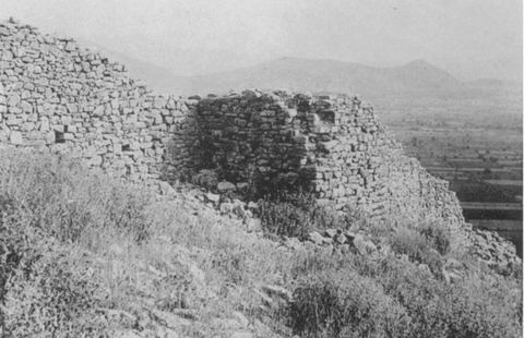
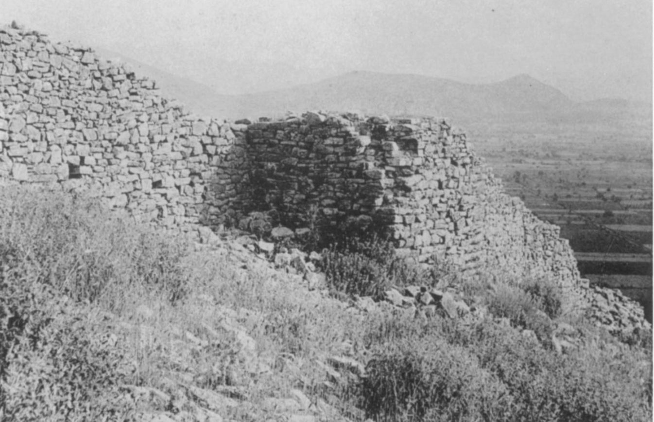
ok. 1958–1960
Pl. 115b: outer face of the bailey wall of the Pontinos castle looking toward the second tower of the east side, with the plain of Argos and the Larissa hill in the background.
Źródło: Probably W.E. McLeod
-
Powiększ:
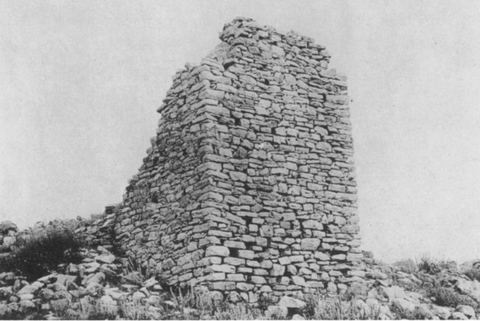
ok. 1958–1960
Pl. 115c 'Redoubt. Southeast Tower, from South' of the castle on Mt Pontinos.
Źródło: Probably W.E. McLeod
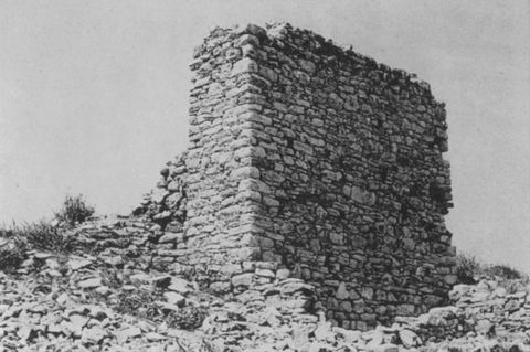
-
Powiększ:
ok. 1958–1960
Pl. 115d 'Redoubt. South Tower, from Southwest' of the castle on Mt Pontinos.
Źródło: Probably W.E. McLeod
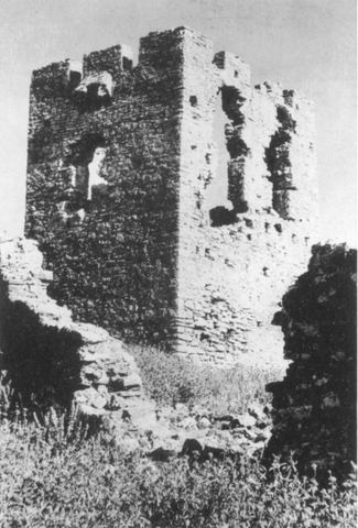
-
Powiększ:
ok. 1958–1960
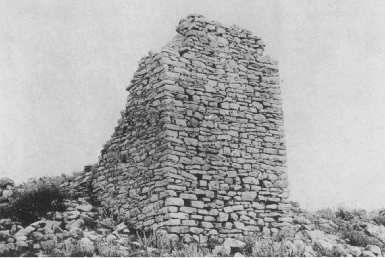
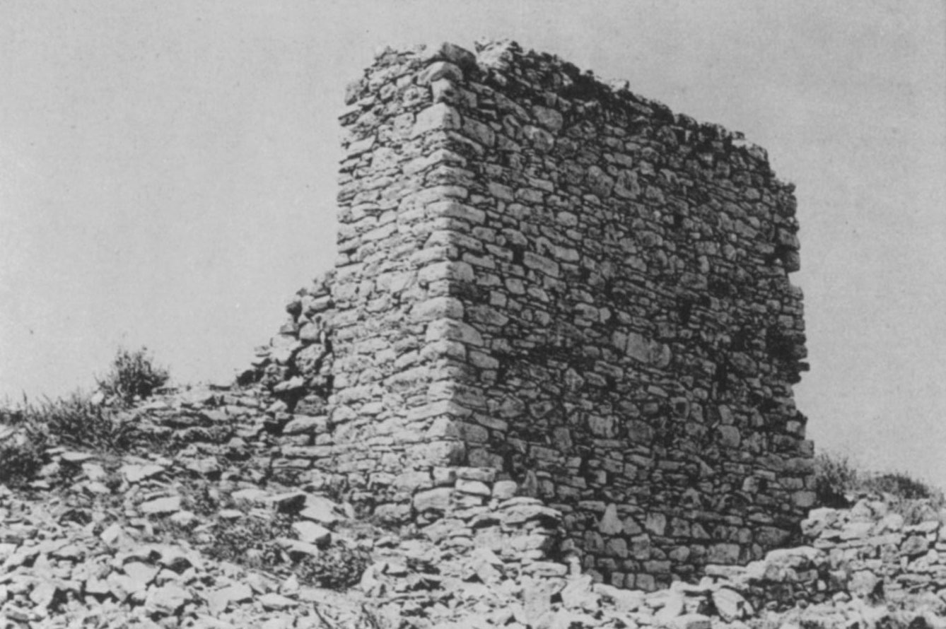
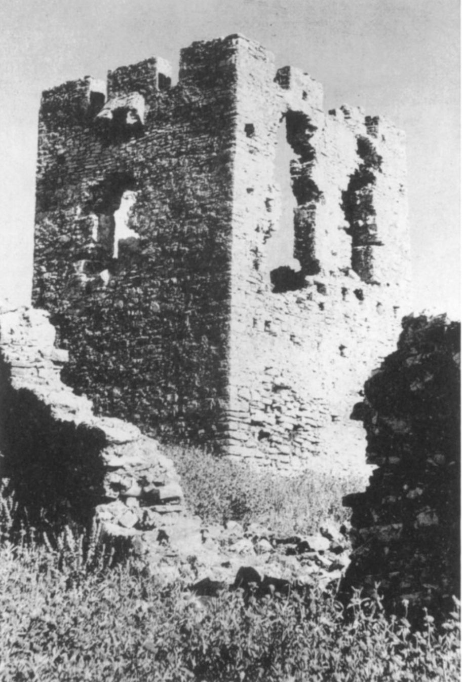
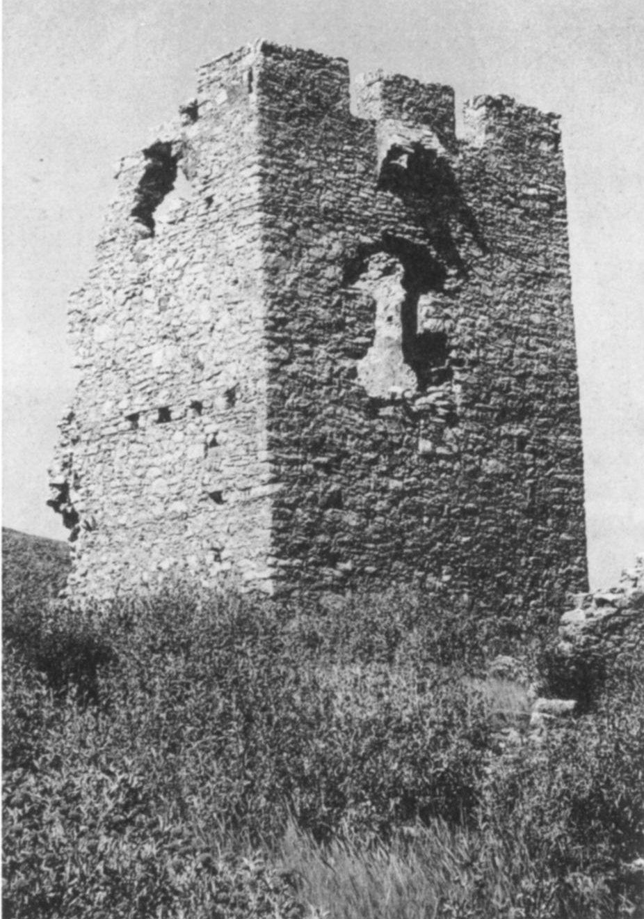
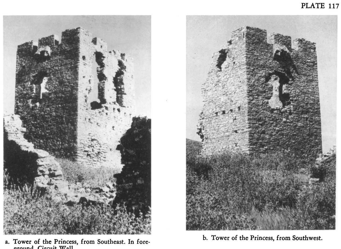
Pl. 117a 'Tower of the Princess, from Southeast': the Pyrgos Vasilopoulas tower about 500 m south of the Pontinos castle, with the circuit wall in the foreground.
Źródło: Probably W.E. McLeod
-
Powiększ:
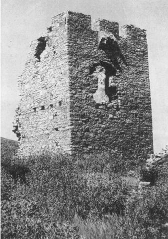
ok. 1958–1960
Pl. 117b 'Tower of the Princess, from Southwest' (Pyrgos Vasilopoulas).
Źródło: Probably W.E. McLeod
-
Powiększ:
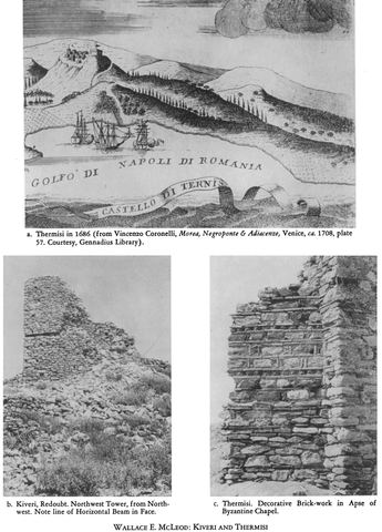
ok. 1959 (zdjęcie); 1686 (rycina)
Full Hesperia 31 plate 114: (a) Coronelli's 1686 engraving of Thermisi and (b) the northwest tower of the redoubt of the Pontinos castle ('Kiveri').
Źródło: W.E. McLeod (photo); V. Coronelli (engraving)
-
Powiększ:
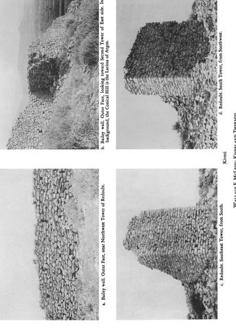
ok. 1959
Full Hesperia 31 plate 115 (a–d): bailey wall and redoubt towers of the Pontinos castle ('Kiveri'), one with the Larissa of Argos in the background.
Źródło: W.E. McLeod
-
Powiększ:
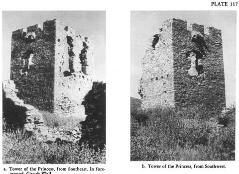
ok. 1959
Full Hesperia 31 plate 117: the Tower of the Princess (Pyrgos Vasilopoulas) from southeast and southwest.
Źródło: W.E. McLeod
-
Powiększ:
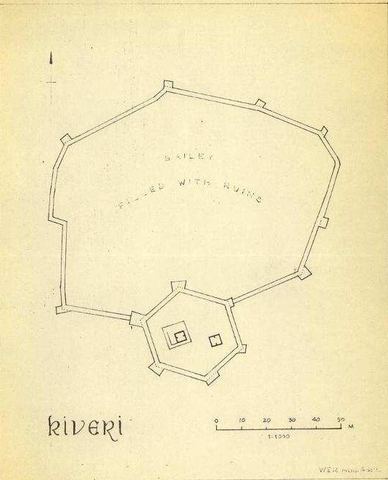
1959
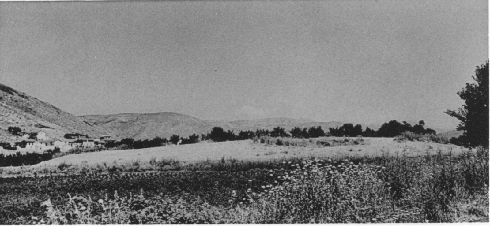
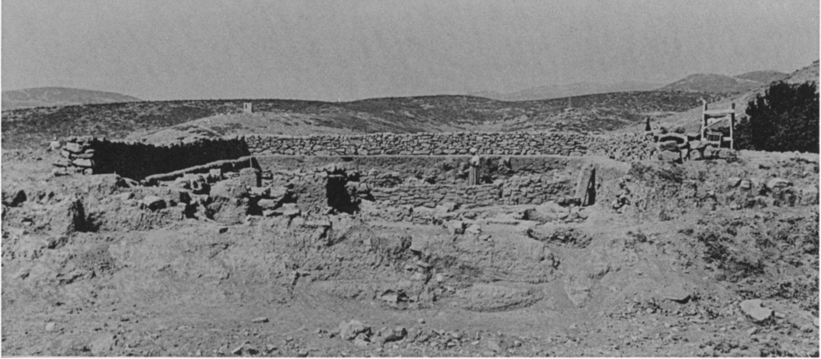
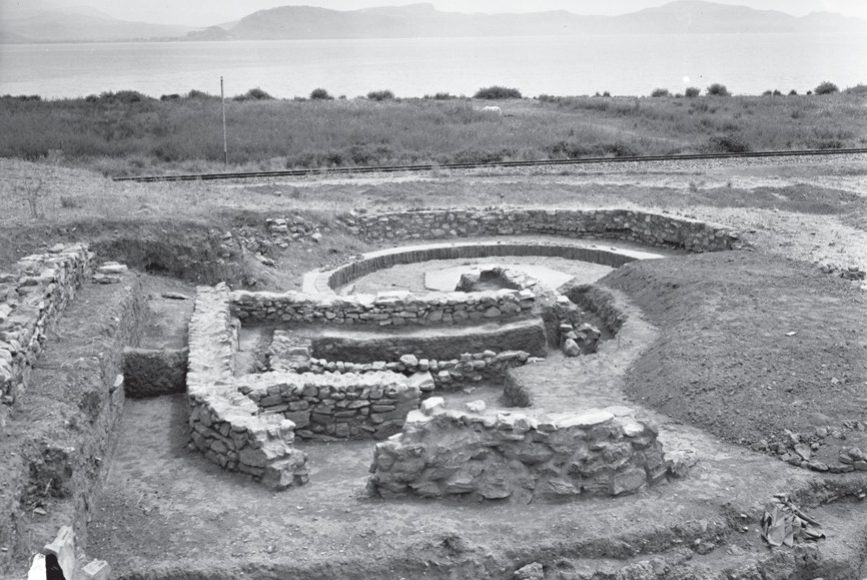
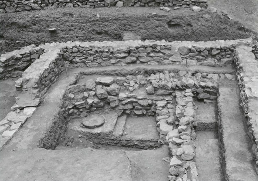
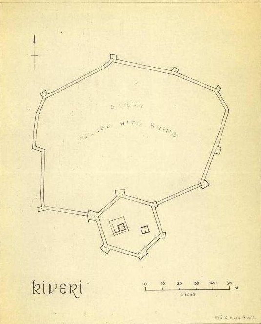
Plan of the castle "Kiveri": walled enclosure with a polygonal keep, interior "filled with ruins".
Źródło: Wulf Schaefer; DAI Athens, NL-Schaefer-K-1-08-008
1960–1979 (27)
-
Powiększ:
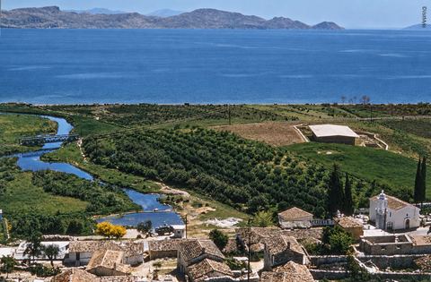
1960
Colour view from Pontinos over the roofs of Myloi, a church with a bell tower, the winding stream of the Lerna springs, the roofed excavation and the Argolic Gulf.
Źródło: Unknown photographer
-
Powiększ:
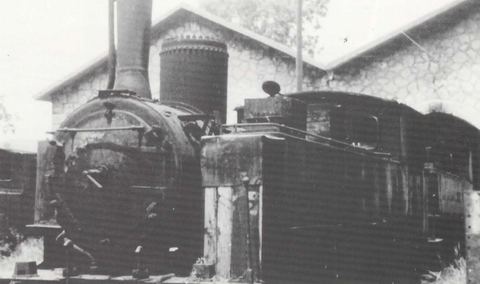
przed 1970
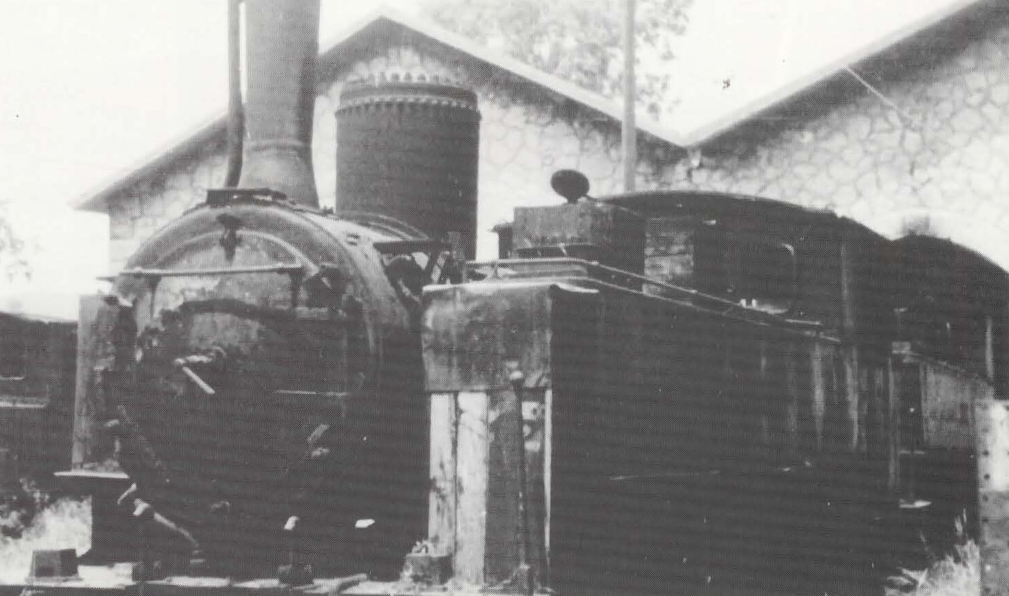
Steam locomotive "Ελληνίς" in front of the twin-gabled stone locomotive shed at Myloi.
Źródło: D. Koutelidis (photo); SFS magazine Σιδηροτροχιά (article by M. Konstantinidis, c. 1998)
-
Powiększ:
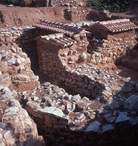
1966
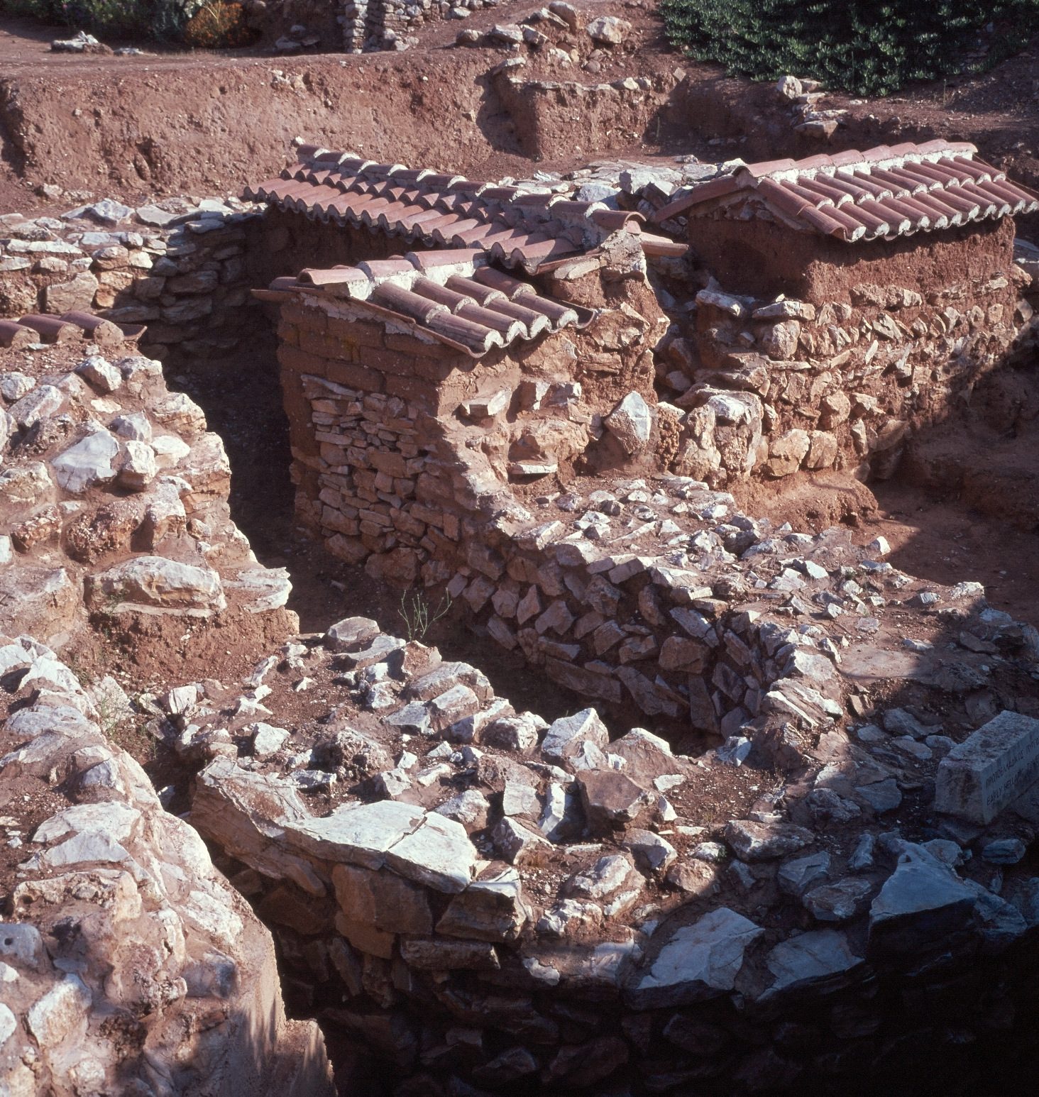
Lerna: the Early Helladic fortification wall (early 3rd millennium BC) topped with mud bricks, under protective roofs, on red earth.
Źródło: Konrad Helbig; Deutsche Fotothek (obj. 71479638)
-
Powiększ:
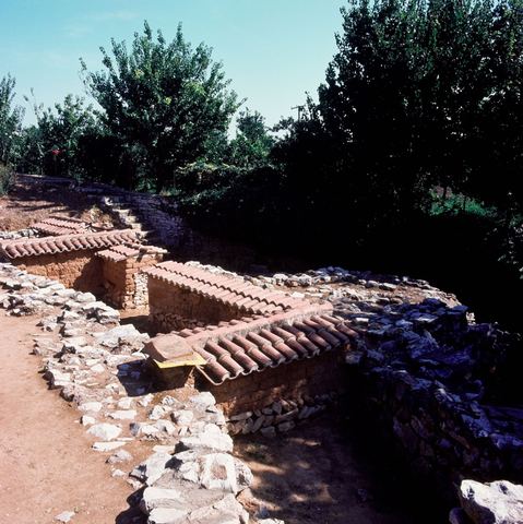
ok. 1966
Lerna excavation: walls under small protective roofs and an olive or citrus orchard.
Źródło: Konrad Helbig; Deutsche Fotothek (obj. 71497081)
-
Powiększ:
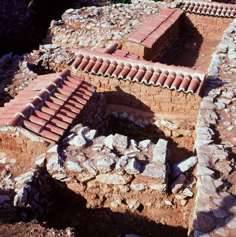
ok. 1966
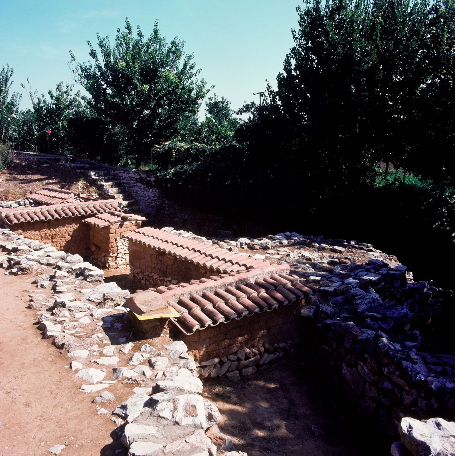
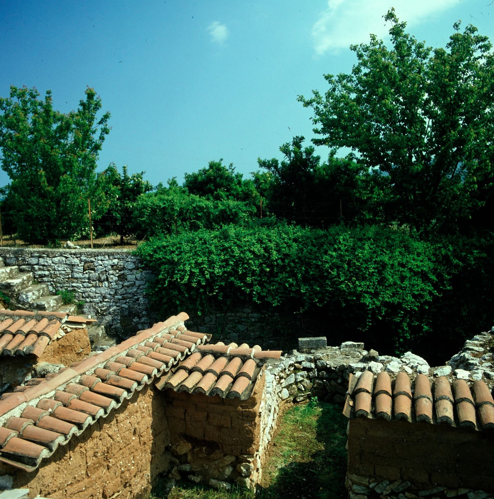
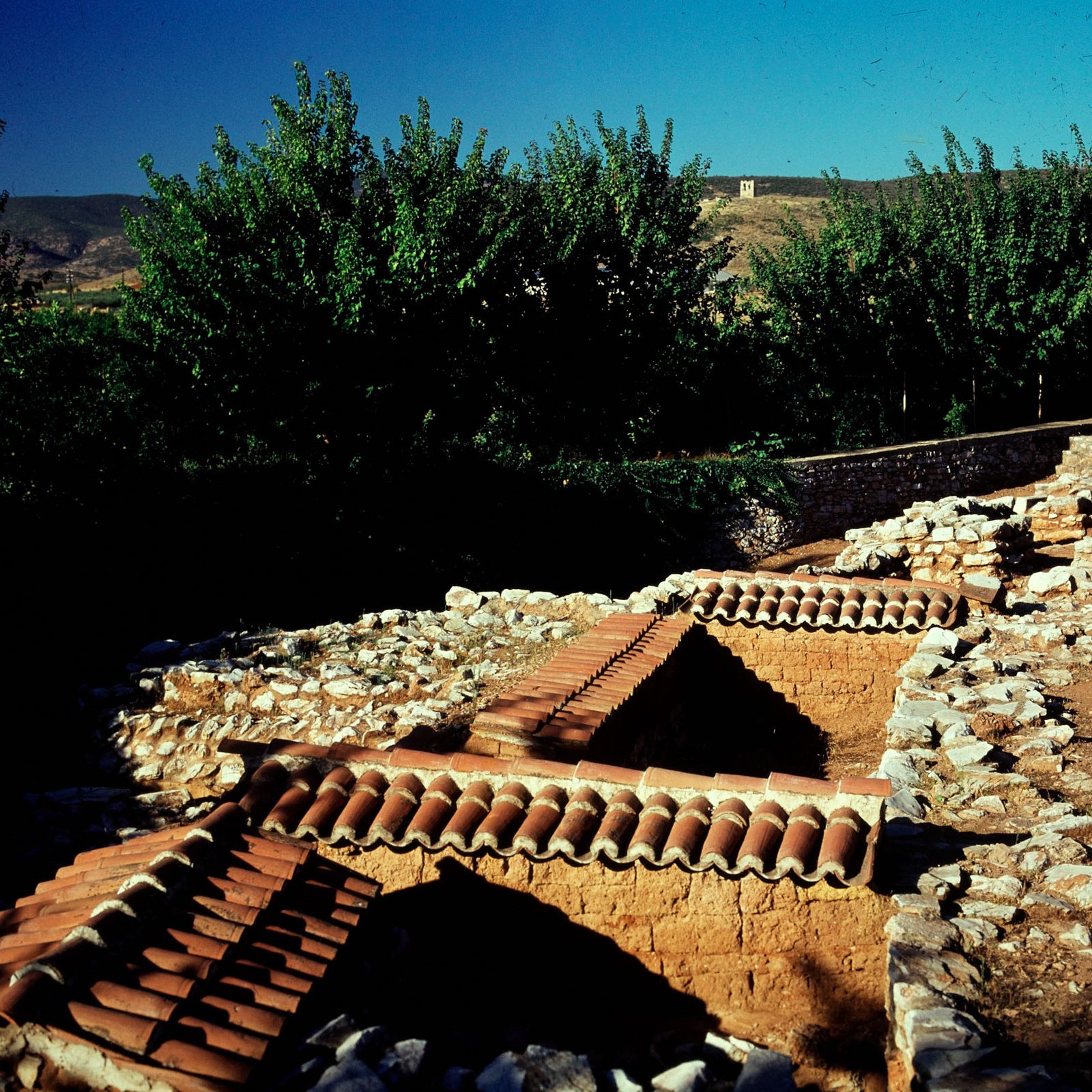
Lerna excavation: detail of walls with small tiled protective roofs, seen from above.
Źródło: Konrad Helbig; Deutsche Fotothek (obj. 71497083)
-
Powiększ:
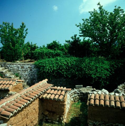
ok. 1966
Lerna excavation: walls under small tiled roofs, a dry-stone boundary wall and an orchard.
Źródło: Konrad Helbig; Deutsche Fotothek (obj. 71497084)
-
Powiększ:
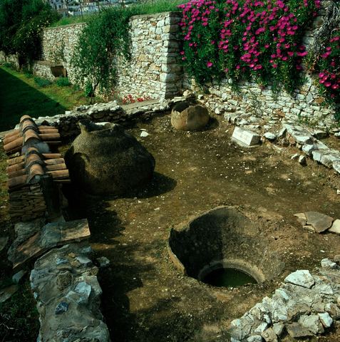
ok. 1966
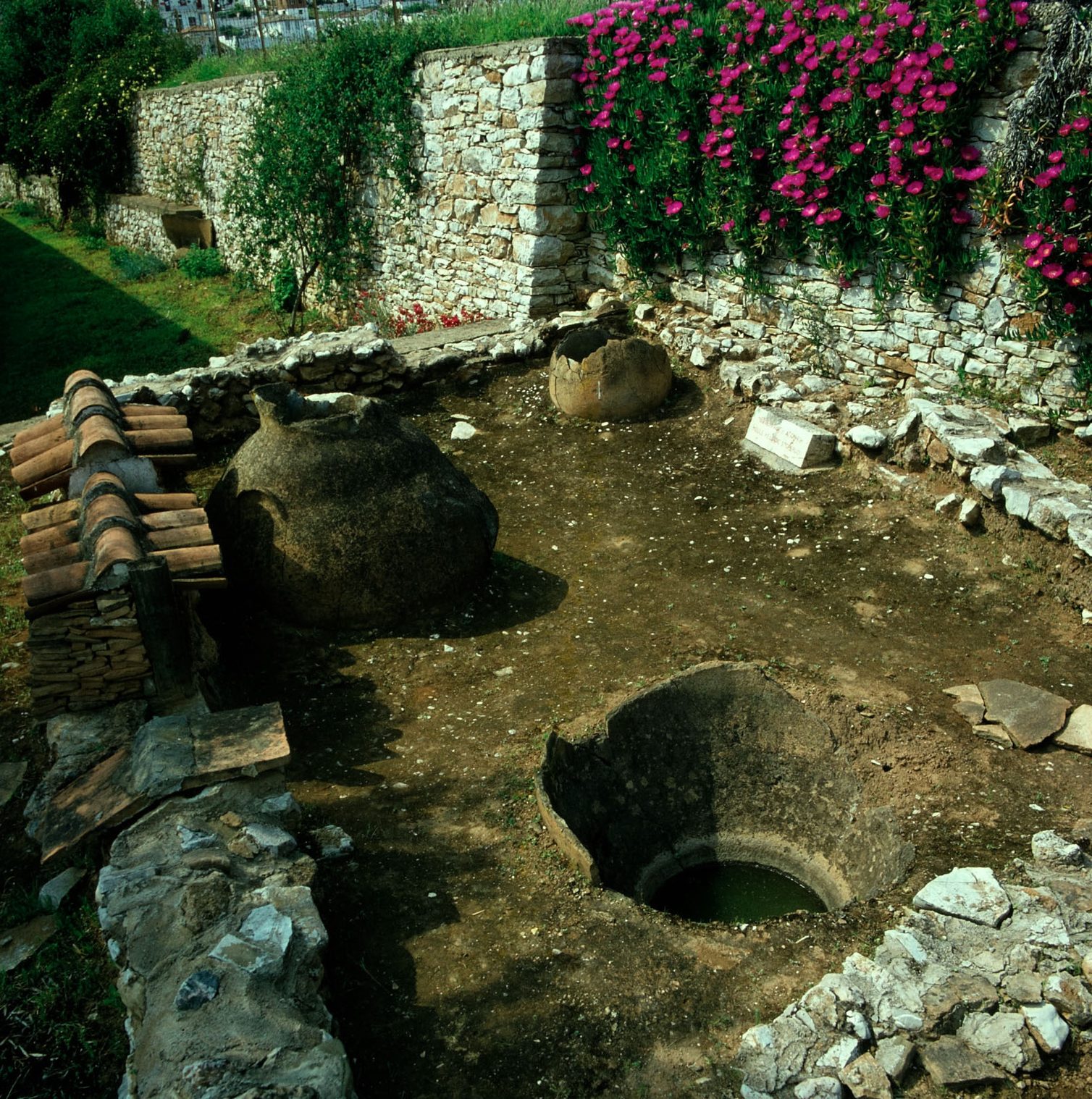
Lerna excavation: pithoi and a bothros, a dry-stone wall with flowering bougainvillea/oleander, and houses behind.
Źródło: Konrad Helbig; Deutsche Fotothek (obj. 71497086)
-
Powiększ:
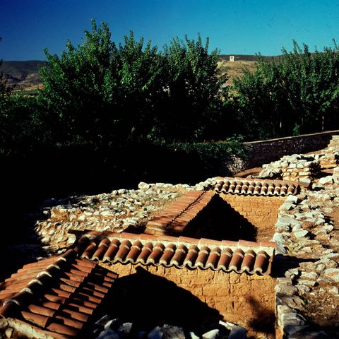
prawdopodobnie 1966
Colour slide of the Lerna excavation with its protective roofs, trees, hills and a building behind.
Źródło: Konrad Helbig
-
Powiększ:
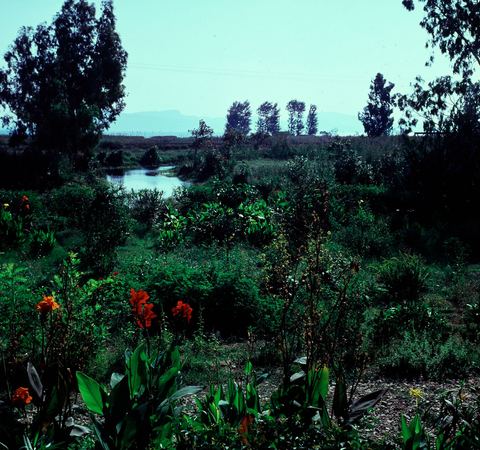
sierpień 1966
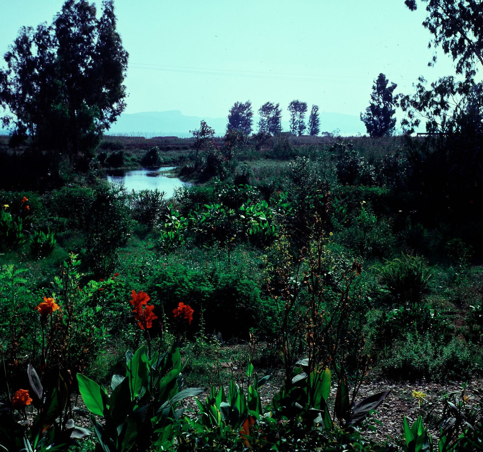
Colour slide of the marsh zone at Lerna.
Źródło: Konrad Helbig
-
Powiększ:
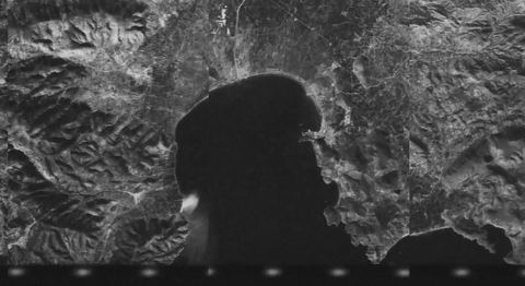
1 lutego 1968
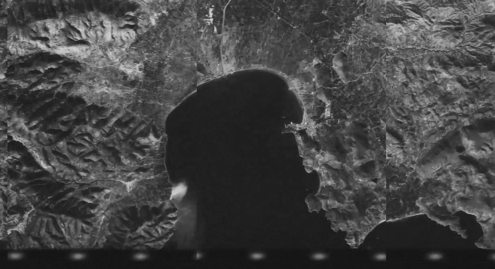
CORONA satellite image of the Argolic Gulf including Myloi (browse image crop).
Źródło: USGS EarthExplorer, KH-4B CORONA, DS1045-2120DF021
-
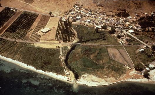
Powiększ:
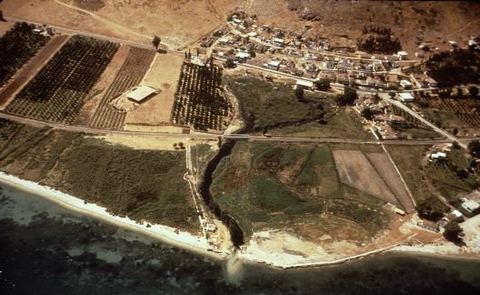
1968 (bardzo prawdopodobnie czerwiec 1968)
Oblique aerial view of Lerna and Myloi from the east: the excavation with the House of Tiles shelter, the village, railway and road, the spring stream reaching the sea, beach and orchards.
Źródło: Raymond V. Schoder SJ; Perseus Digital Library 1990.30.0068 (courtesy Bolchazy-Carducci)
-
Powiększ:
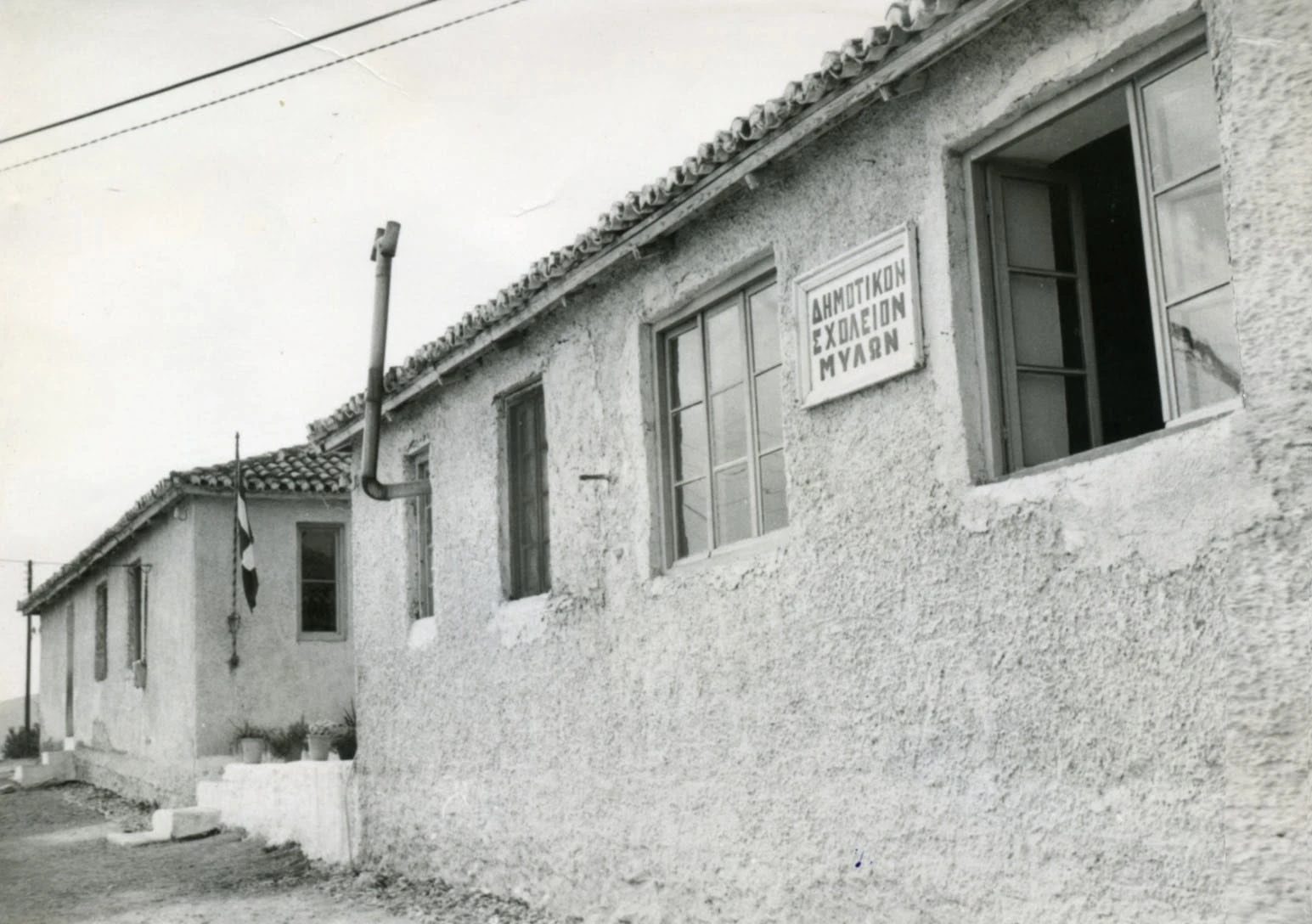
ok. 1960–1975
The primary school building of Myloi (Δημοτικόν Σχολείον Μύλων).
Źródło: Αργολική Αρχειακή Βιβλιοθήκη Ιστορίας & Πολιτισμού
-
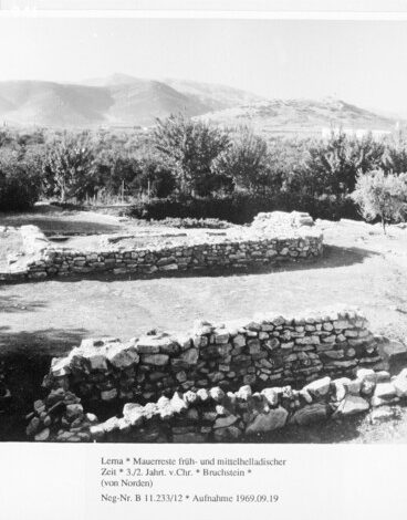
Powiększ:
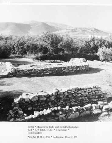
19 września 1969
Early and Middle Helladic wall remains at the Lerna excavation from the north, with trees and hills behind.
Źródło: Bildarchiv Foto Marburg, neg. B 11.233/12
-
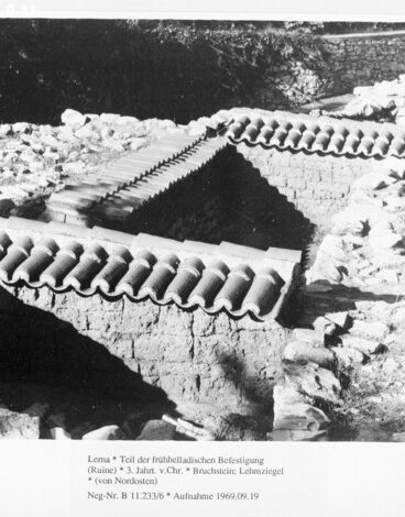
Powiększ:
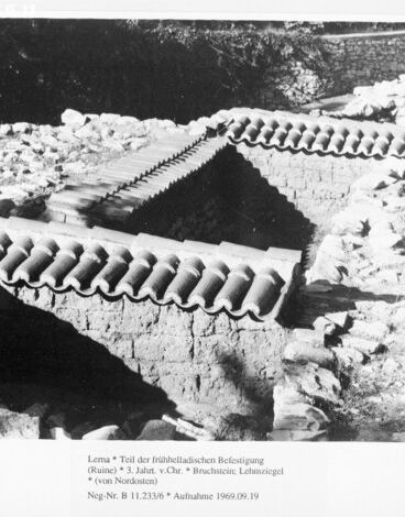
19 września 1969
Part of the Early Helladic fortification at Lerna under protective tiled roofs, from the north-east.
Źródło: Bildarchiv Foto Marburg, neg. B 11.233/6
-
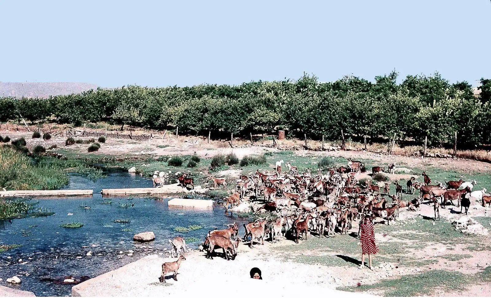
Powiększ:
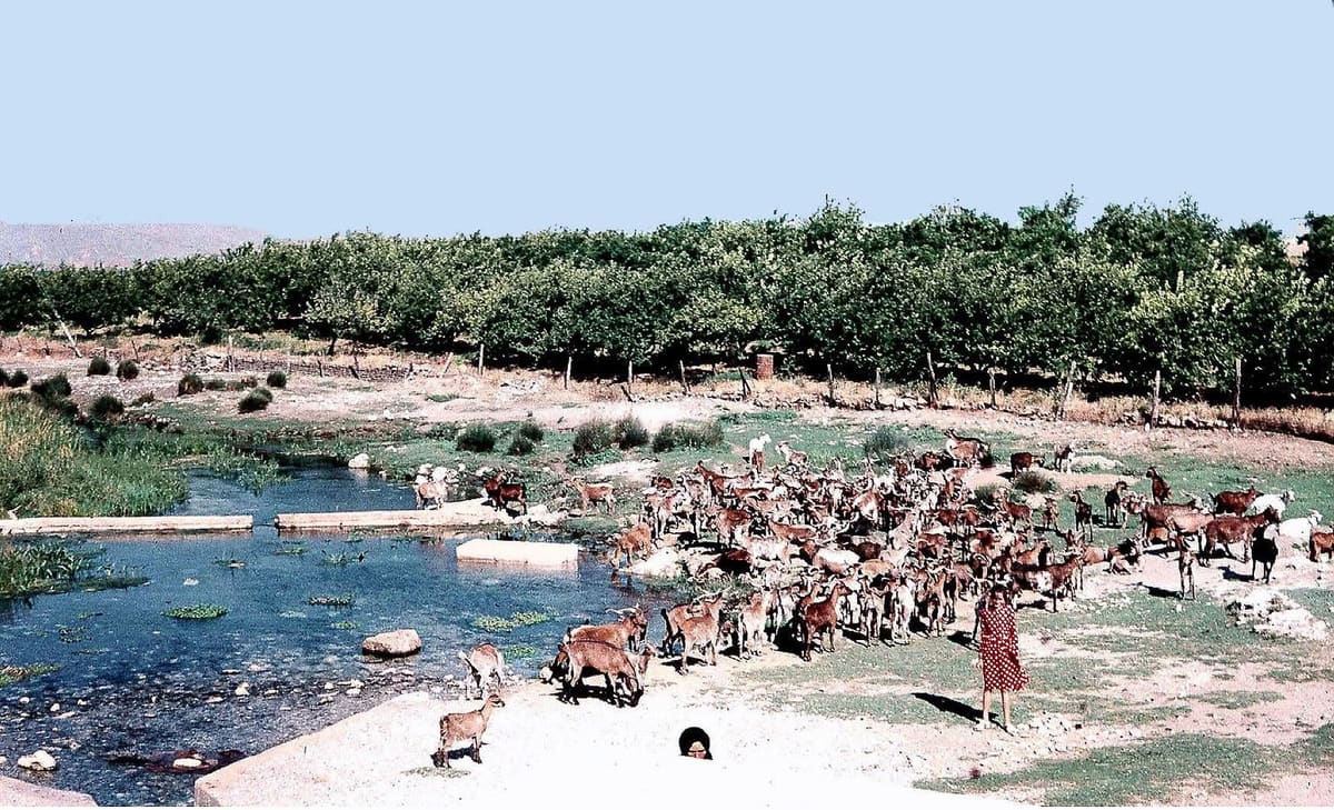
ok. 1965–1975
Kolorowy slajd: duże stado kóz przy wodzie źródeł, w tle sady
Źródło: Visit Myloi collection
-
Powiększ:
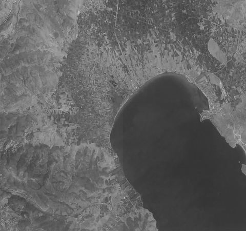
24 lipca 1973
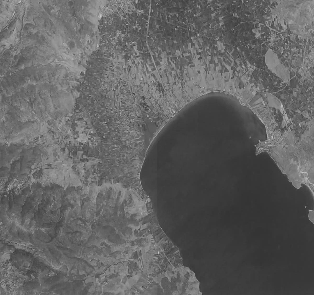
KH-9 Hexagon satellite image of the Argolic Gulf including Myloi (browse image crop).
Źródło: USGS EarthExplorer, KH-9 Hexagon, D3C1206-100131A018
-
Powiększ:
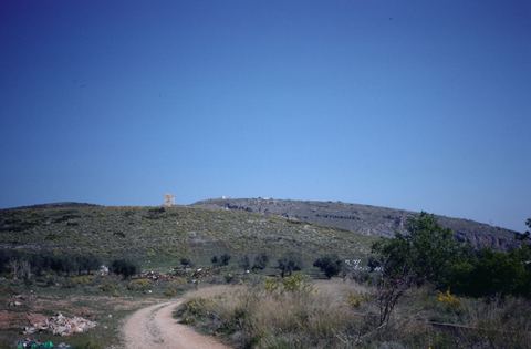
1960–1990
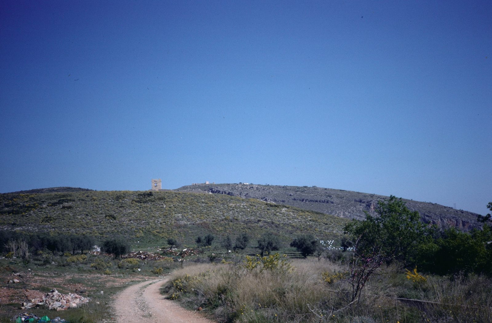
35 mm colour slide 'Myli; Castle of Lerna': dirt path leading up to the Frankish tower on Mt Pontinos.
Źródło: Paul Hetherington; Dumbarton Oaks Research Library and Collection
-
Powiększ:
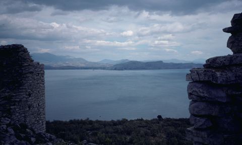
1960–1990
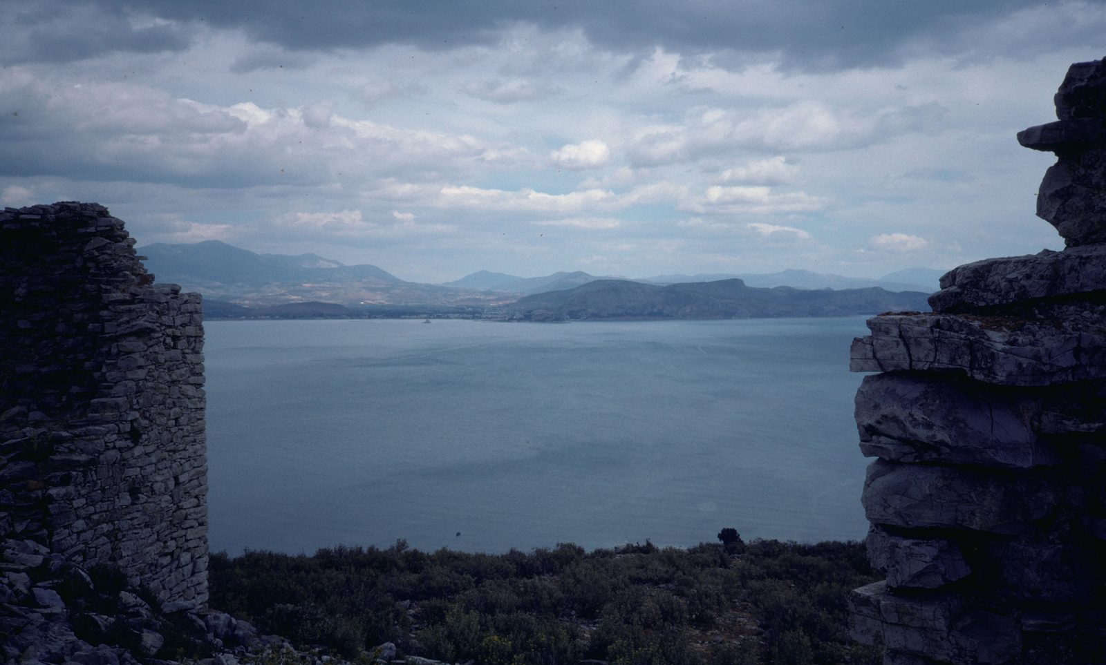
35 mm colour slide 'Myli; Castle of Lerna': the castle tower on Mt Pontinos with the gulf beyond.
Źródło: Paul Hetherington; Dumbarton Oaks Research Library and Collection
-
Powiększ:
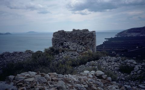
1960–1990
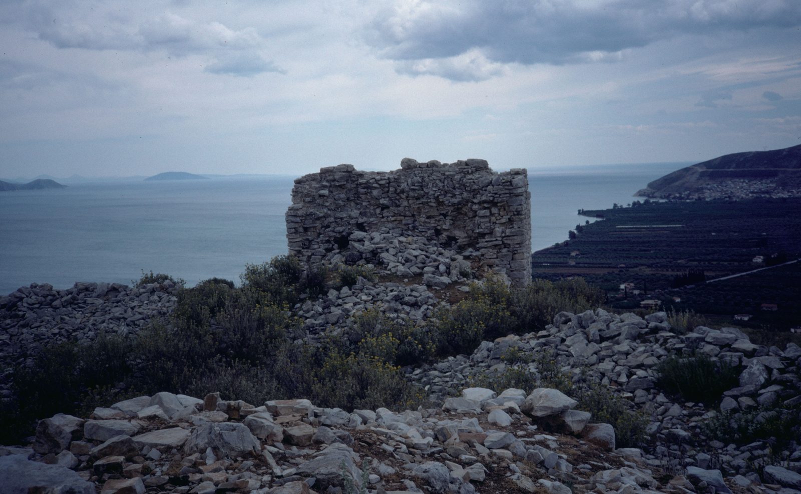
35 mm colour slide 'Myli; Castle of Lerna': wall remains of the castle with a view over the gulf and the plain with citrus groves.
Źródło: Paul Hetherington; Dumbarton Oaks Research Library and Collection
-
Powiększ:
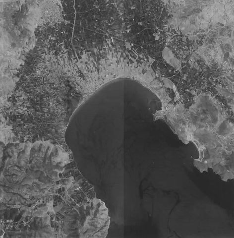
31 lipca 1977
KH-9 Hexagon satellite image of the Argolic Gulf including Myloi (browse image crop).
Źródło: USGS EarthExplorer, KH-9 Hexagon, D3C1213-100194A043
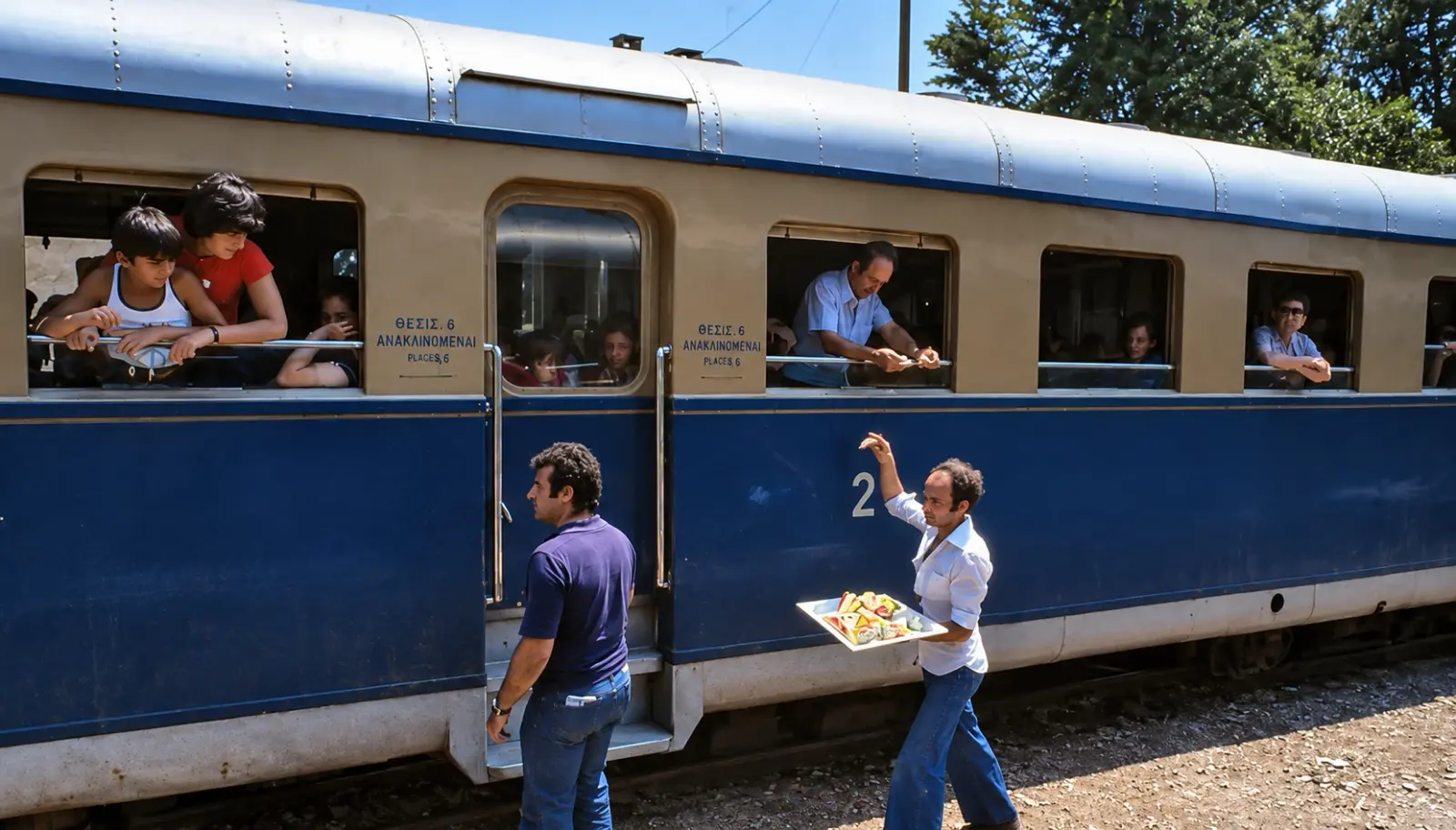
-
Powiększ:
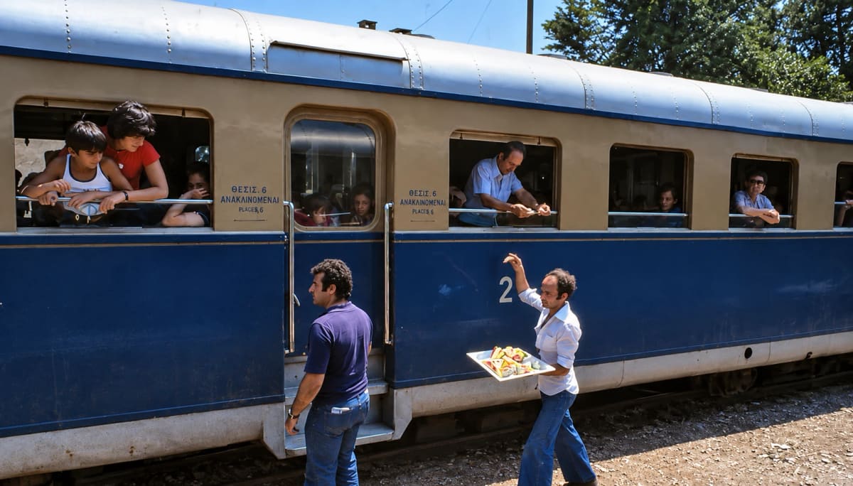
ok. 1975–1980
Sprzedawca souvlaki unosi tacę w stronę pasażerów wychylających się z okien pociągu w Myloi (cyfrowo odnowione)
Źródło: © Ole Holbech
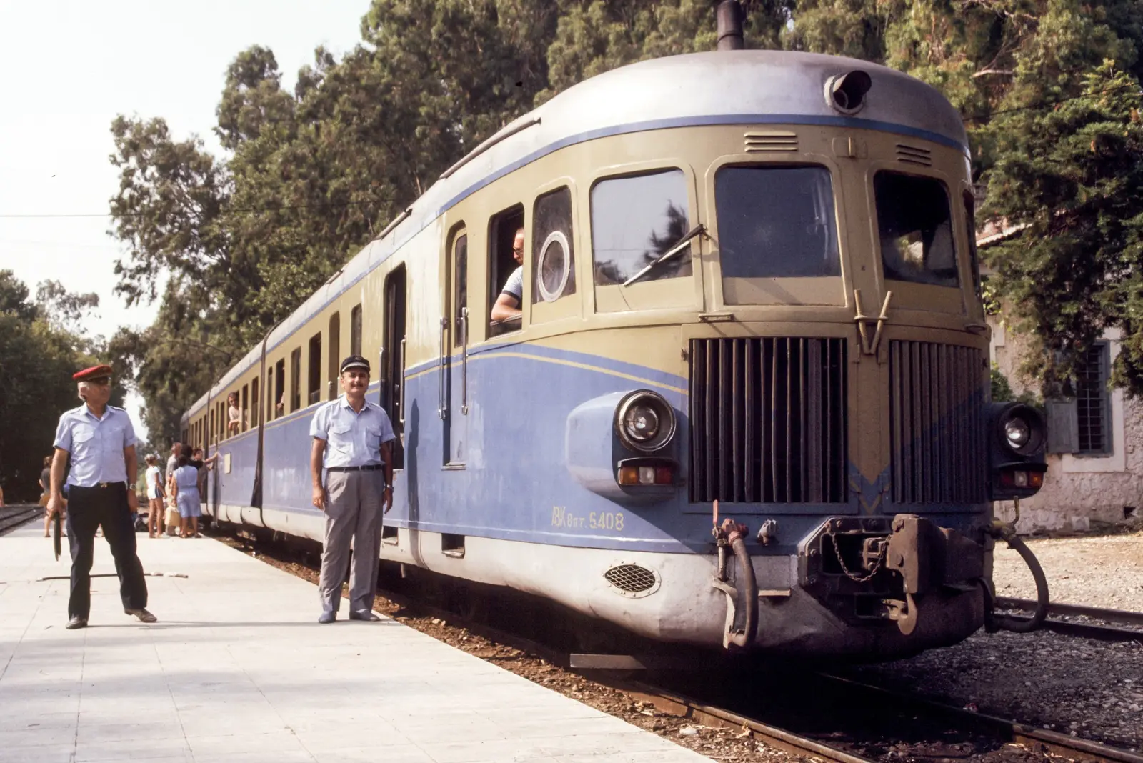
-
Powiększ:
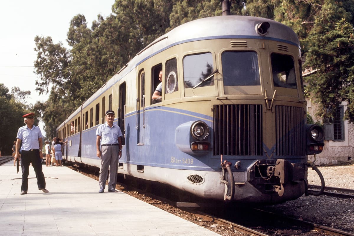
przed 1980
Przód niebiesko-beżowego wagonu motorowego w Myloi, z dwoma kolejarzami na peronie
Źródło: Visit Myloi collection
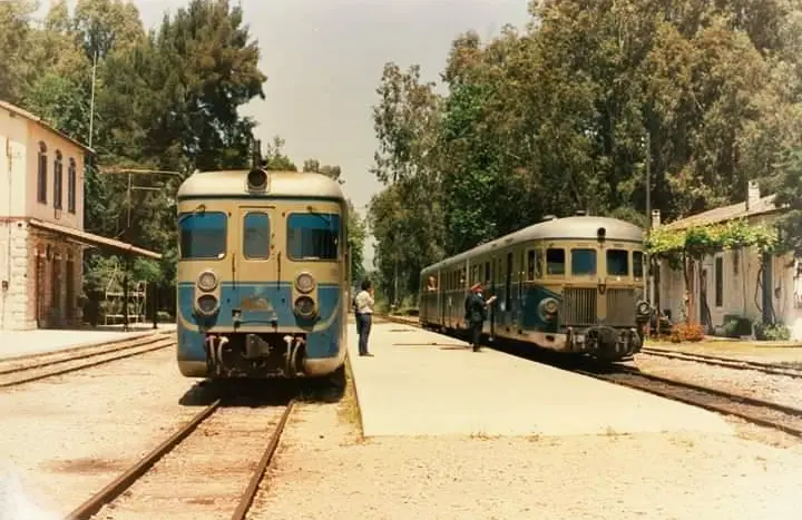
-
Powiększ:
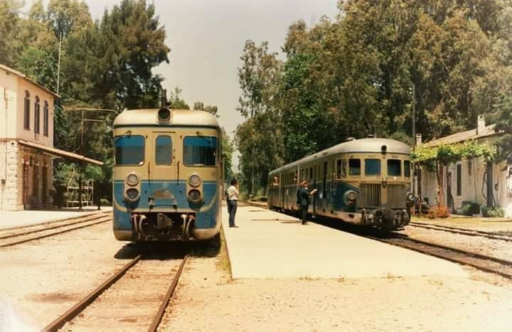
przed 1980
Dwa wagony motorowe obok siebie w Myloi, po lewej kamienny budynek dworca
Źródło: Visit Myloi collection
-
Powiększ:
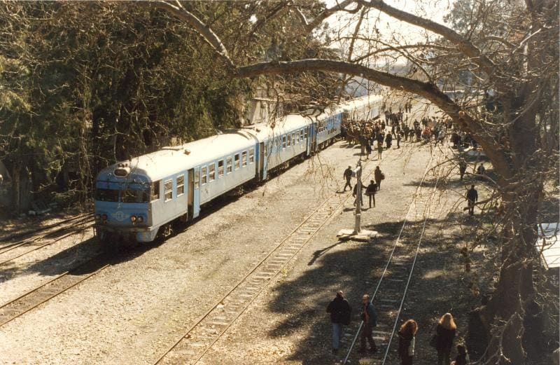
przed 1980
Pociąg wjeżdżający do Myloi pod drzewami, podczas gdy pasażerowie przechodzą przez tory
Źródło: Visit Myloi collection
-
Powiększ:
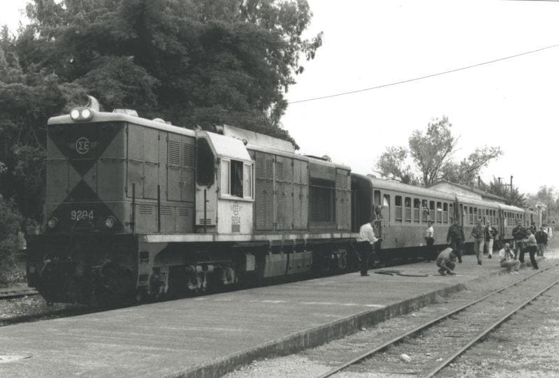
przed 1980
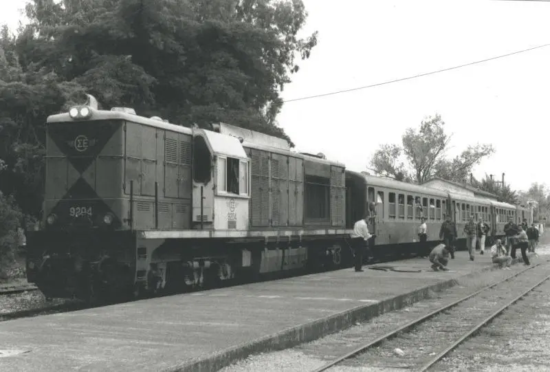
Czarno-białe zdjęcie lokomotywy spalinowej i pociągu pasażerskiego na stacji Myloi
Źródło: Visit Myloi collection
-
Powiększ:
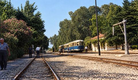
przed 1980
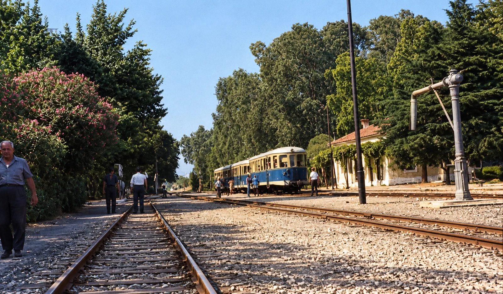
Colour print (colours restored) of the platform and tracks at Myloi station with a railcar under the trees.
Źródło: Visit Myloi collection (photographer not recorded) · cyfrowo odnowione
-
Powiększ:
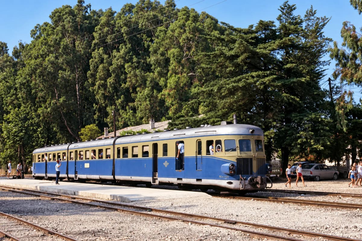
przed 1980
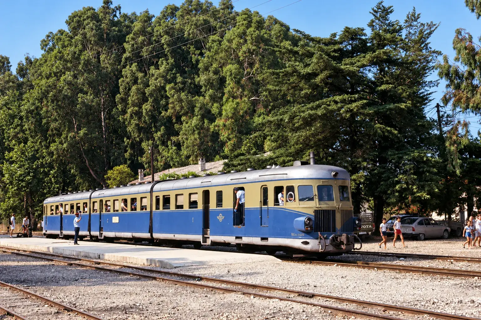
Niebiesko-beżowy wagon motorowy czeka przy peronie stacji Myloi pod wysokimi drzewami (cyfrowo odnowione)
Źródło: Visit Myloi collection

1980–1995 (17)
-
Powiększ:
15 grudnia 1980
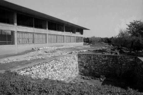
Neolithic house remains at the Lerna excavation, with the concrete House of Tiles shelter and an orchard.
Źródło: Steingräber; DAI Rom, photo 80.4292
-
Powiększ:
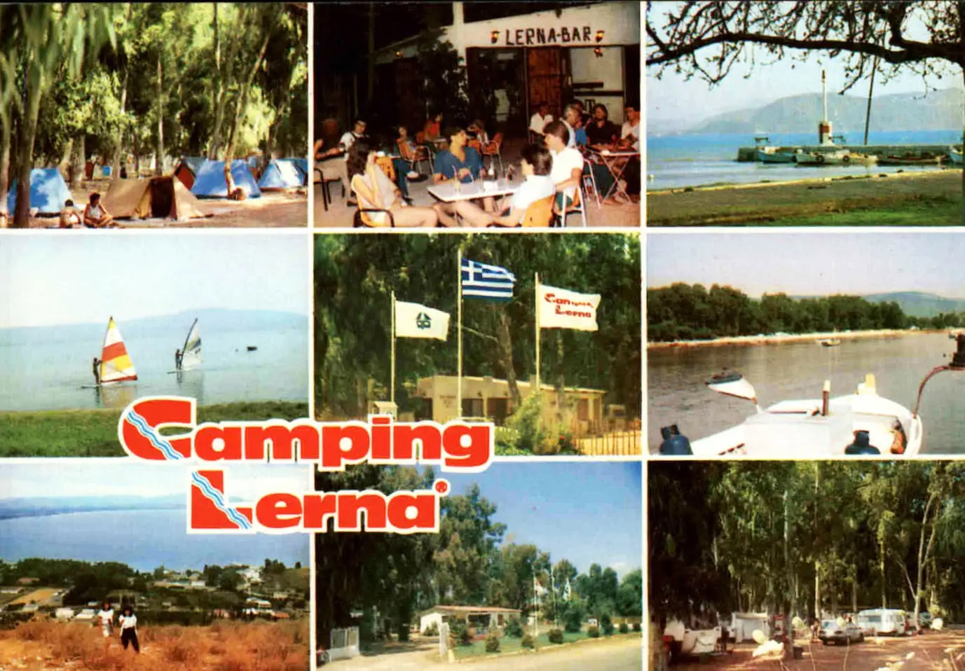
ok. 1980–1985 (szacunkowo)
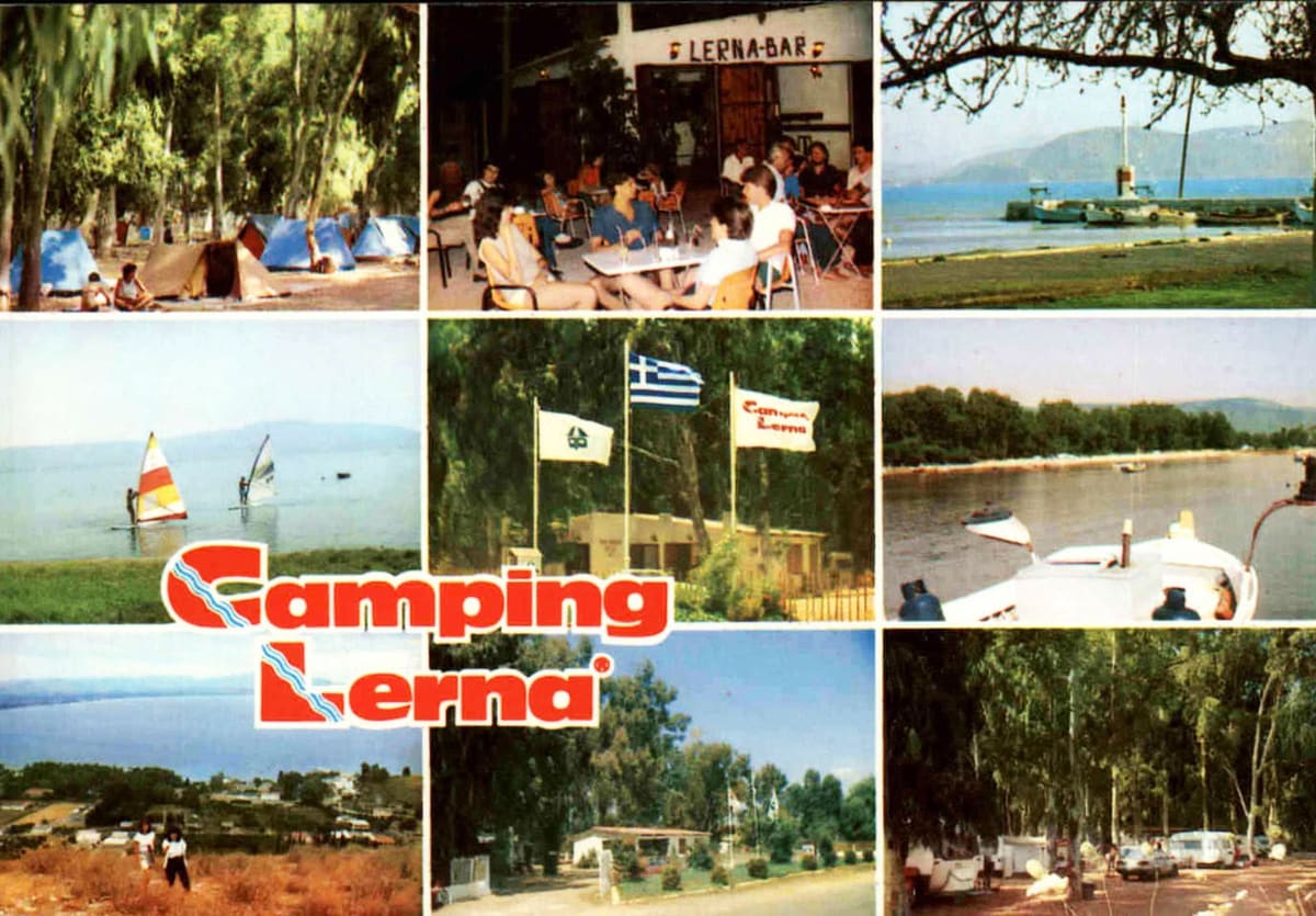
Wieloobrazkowa pocztówka Camping Lerna: namioty pod drzewami, taras, flagi, latarnia portowa i plaża
Źródło: Visit Myloi collection
-
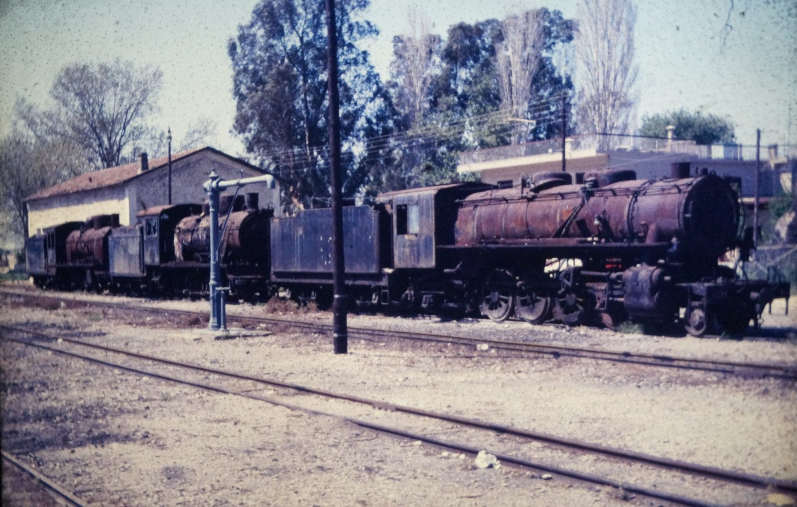
Powiększ:
marzec/kwiecień 1986
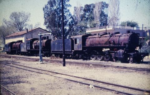
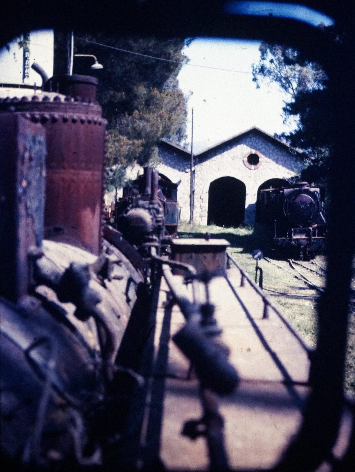
Graveyard of withdrawn metre-gauge steam locomotives at Myloi station.
Źródło: NearEMPTiness (Wikimedia Commons)
-
Powiększ:
marzec/kwiecień 1986
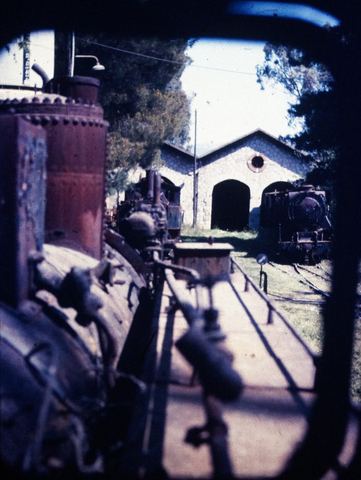
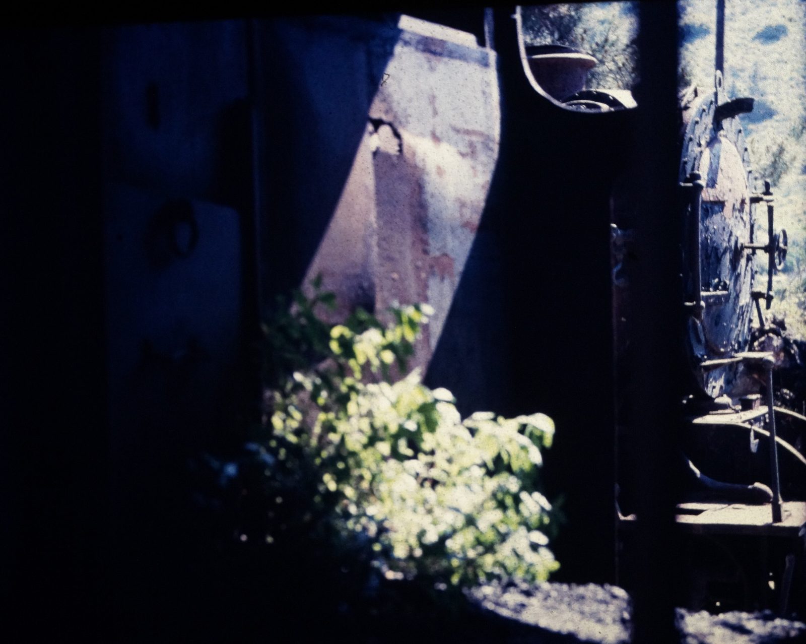
Graveyard of withdrawn metre-gauge steam locomotives at Myloi station.
Źródło: NearEMPTiness (Wikimedia Commons)
-
Powiększ:
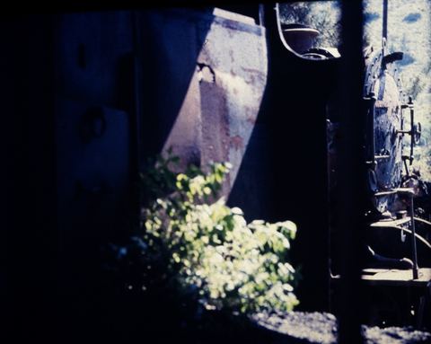
marzec/kwiecień 1986
Graveyard of withdrawn metre-gauge steam locomotives at Myloi station.
Źródło: NearEMPTiness (Wikimedia Commons)
-
Powiększ:
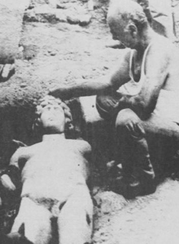
1986
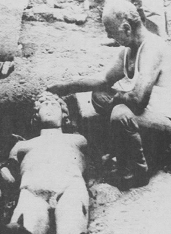
Black-and-white photograph of the marble statue of Antinoos lying in the earth at its find-spot near Myloi.
Źródło: Unknown photographer
-
Powiększ:
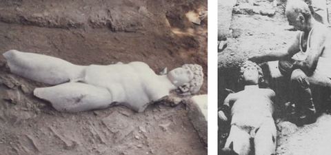
1986
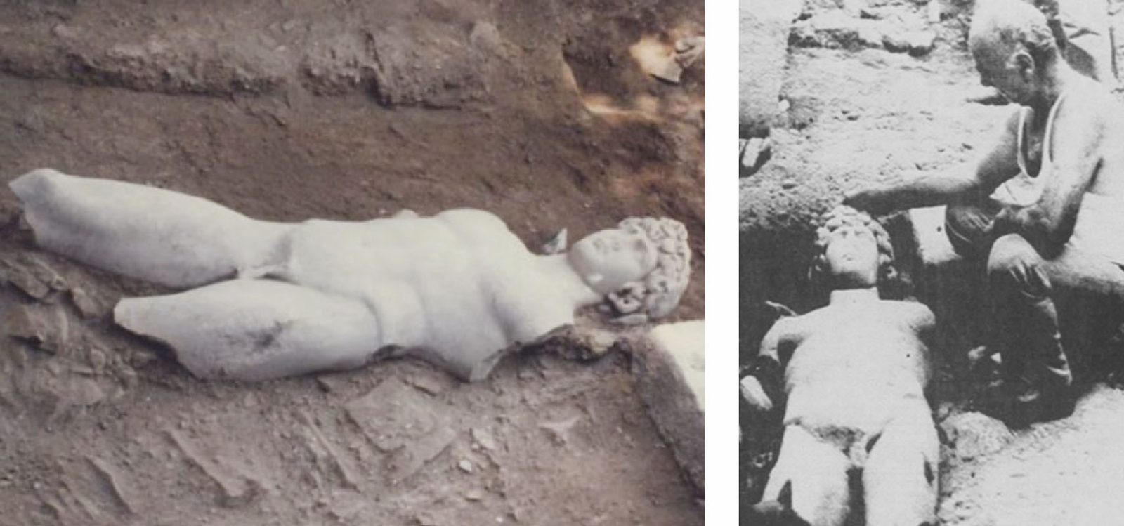
Two black-and-white photographs side by side of the marble statue of Antinoos at its find-spot near Myloi.
Źródło: Unknown photographer
-
Powiększ:
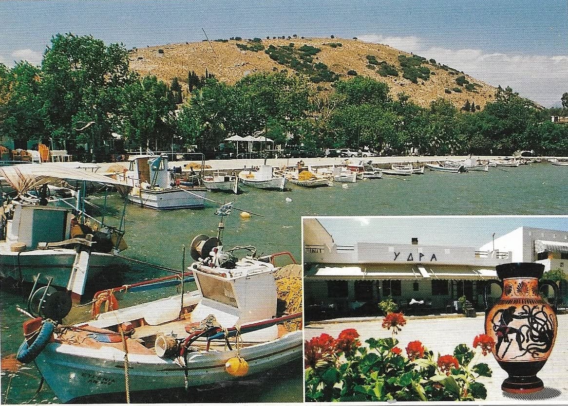
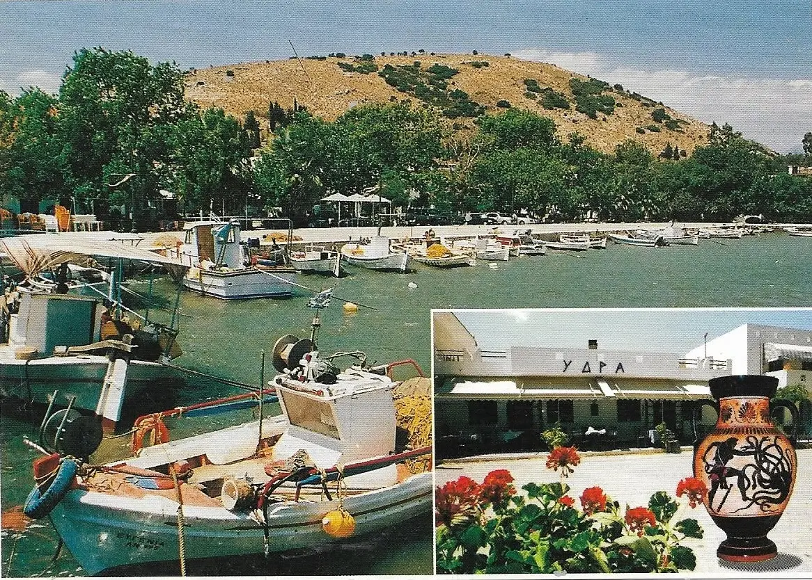
prawdopodobnie po 1985
Pocztówka z portem i łodziami rybackimi u stóp wzgórza Pontinos oraz wstawką z restauracją ΥΔΡΑ, kwiatami i amforą
Źródło: Visit Myloi collection
-
Powiększ:
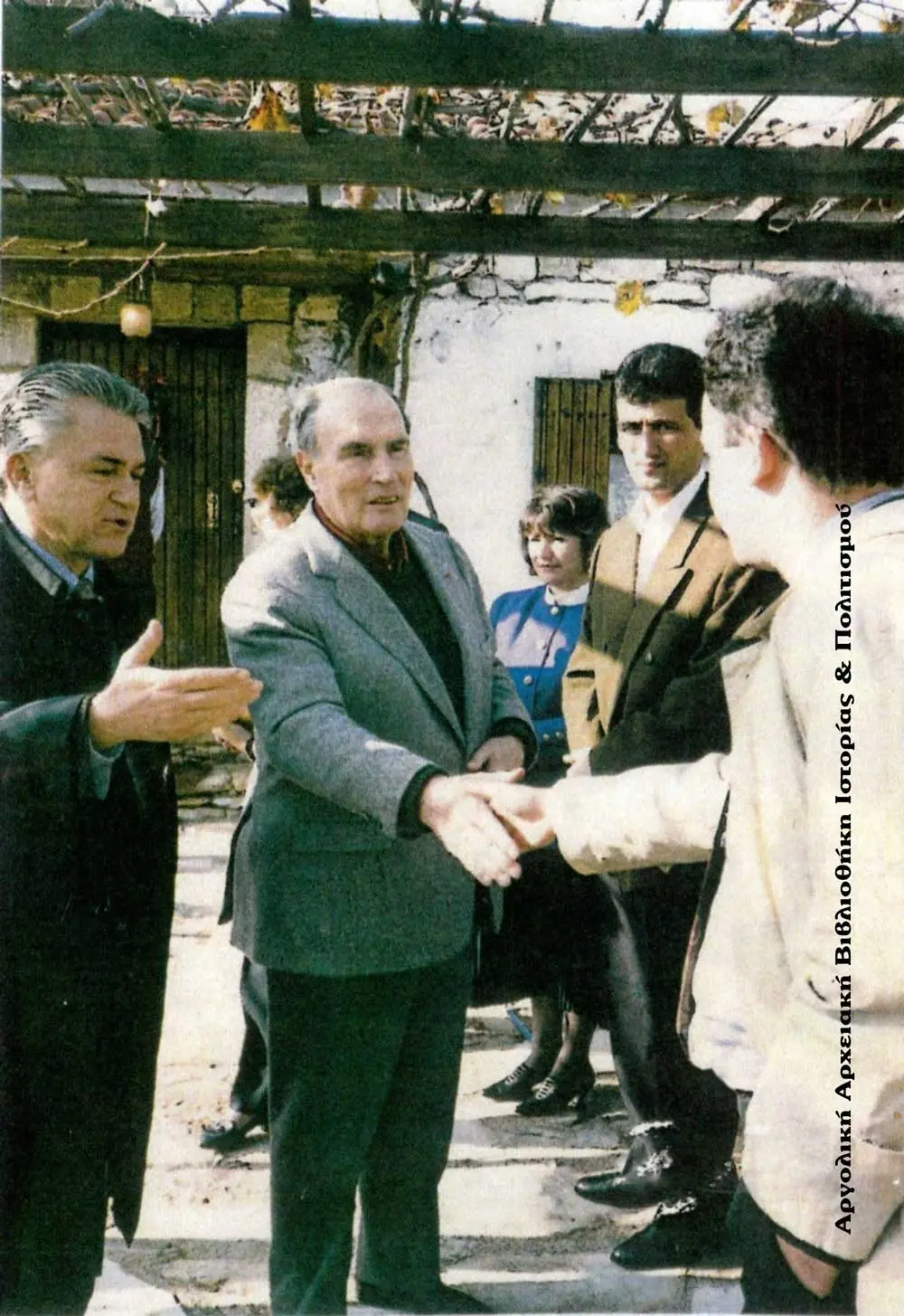
grudzień 1991
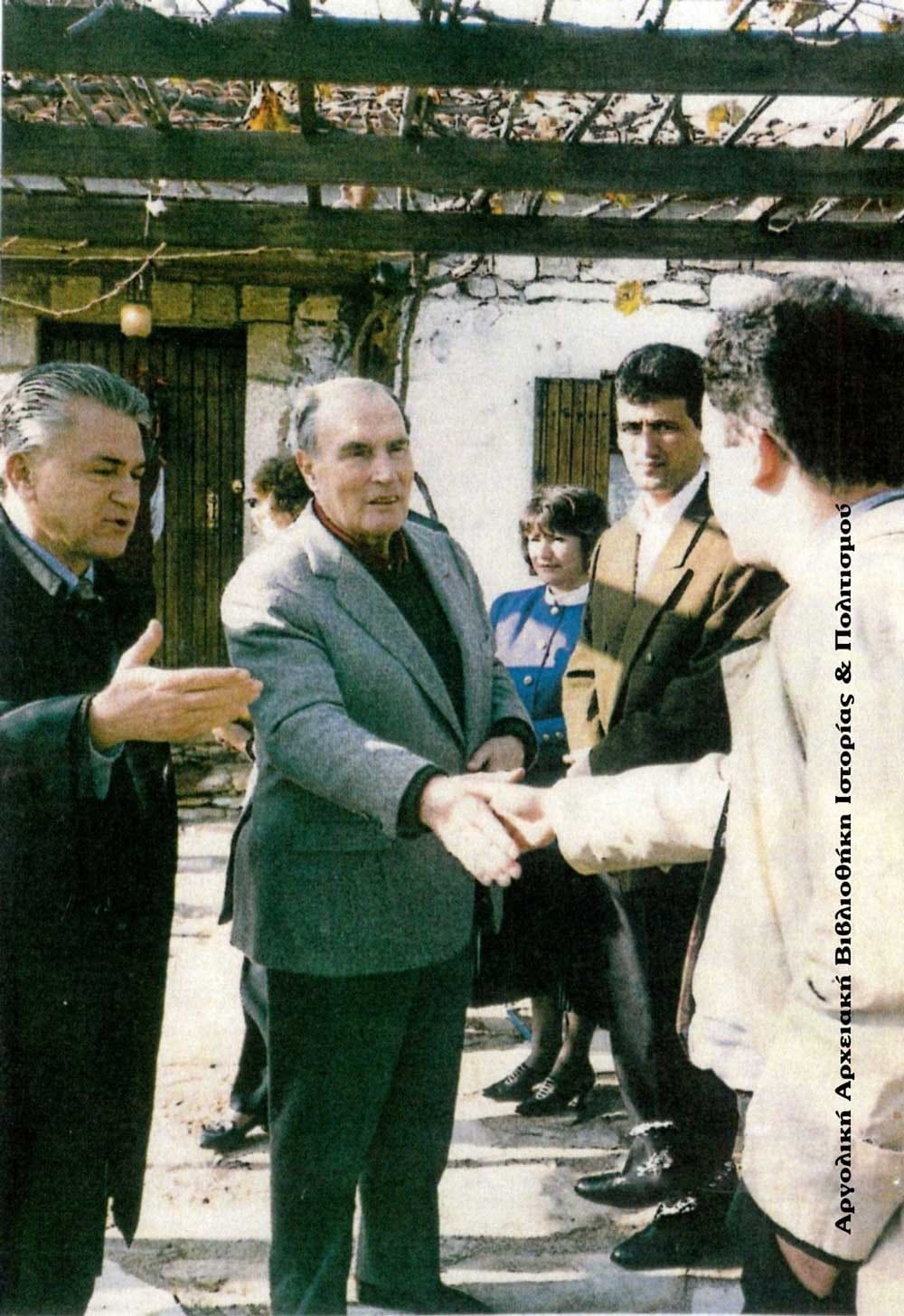
Pod pergolą domu Mitterrand wita się z mieszkańcami Myloi. Obok niego dyplomata Christos Machairitsas, który zorganizował podróż.
Źródło: Kotsonaros family collection, via the Argolic Archival Library of History and Culture (argolikivivliothiki.gr)
-
Powiększ:
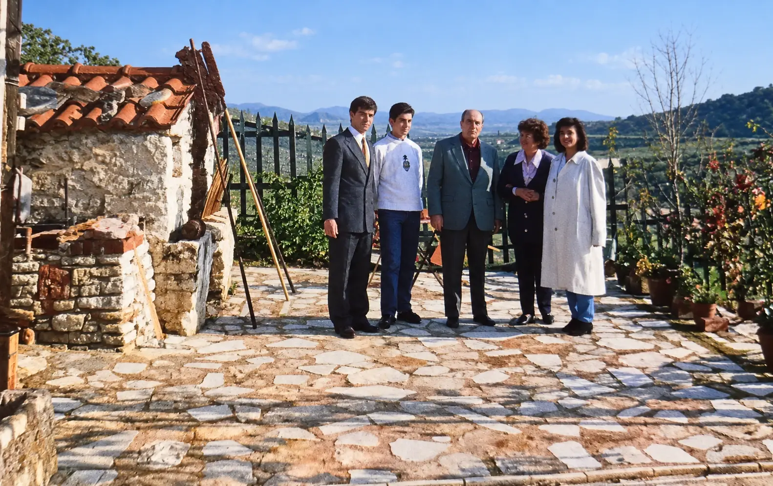
grudzień 1991
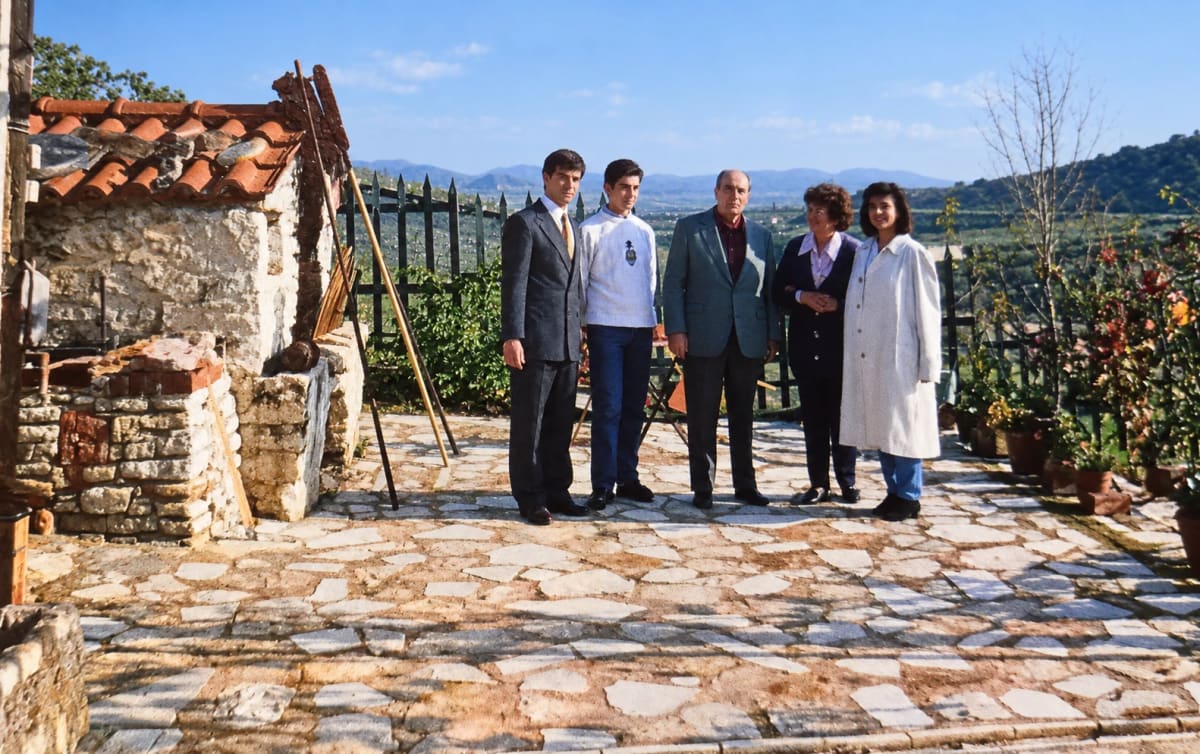
François Mitterrand (w środku) z rodziną Kotsonarosów na kamiennym tarasie ich domu, grudzień 1991.
Źródło: Kotsonaros family collection, published with permission
-
Powiększ:
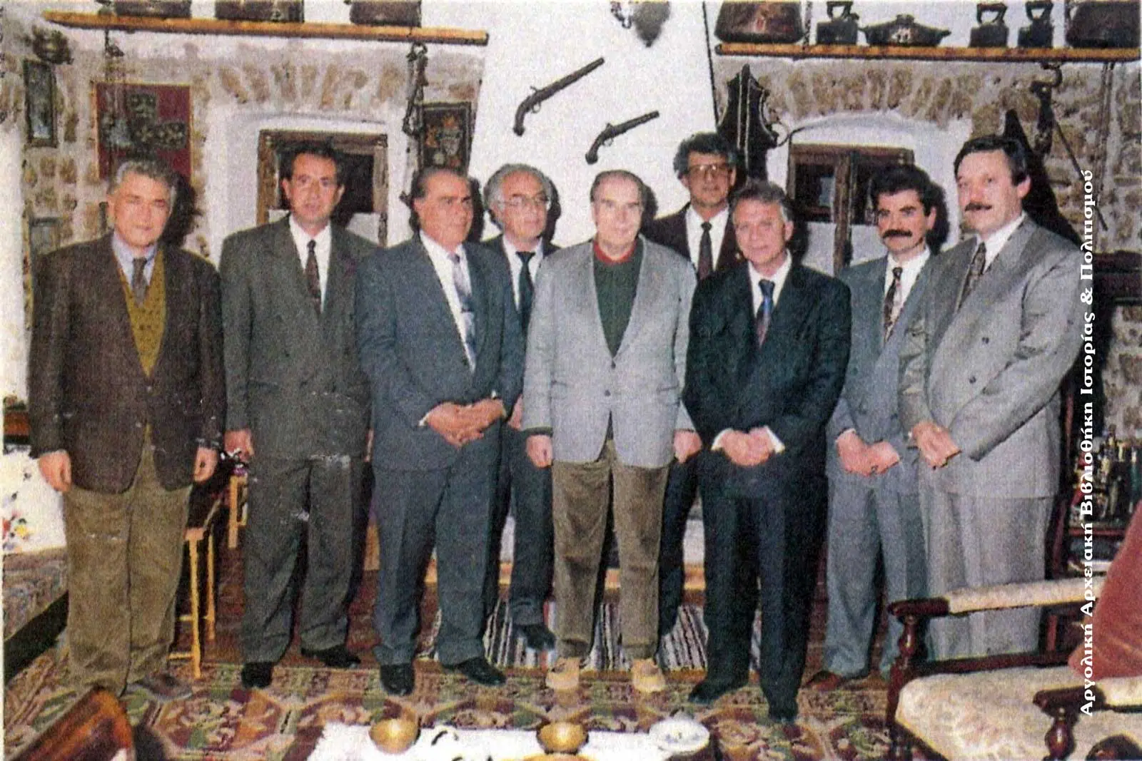
26 grudnia 1991
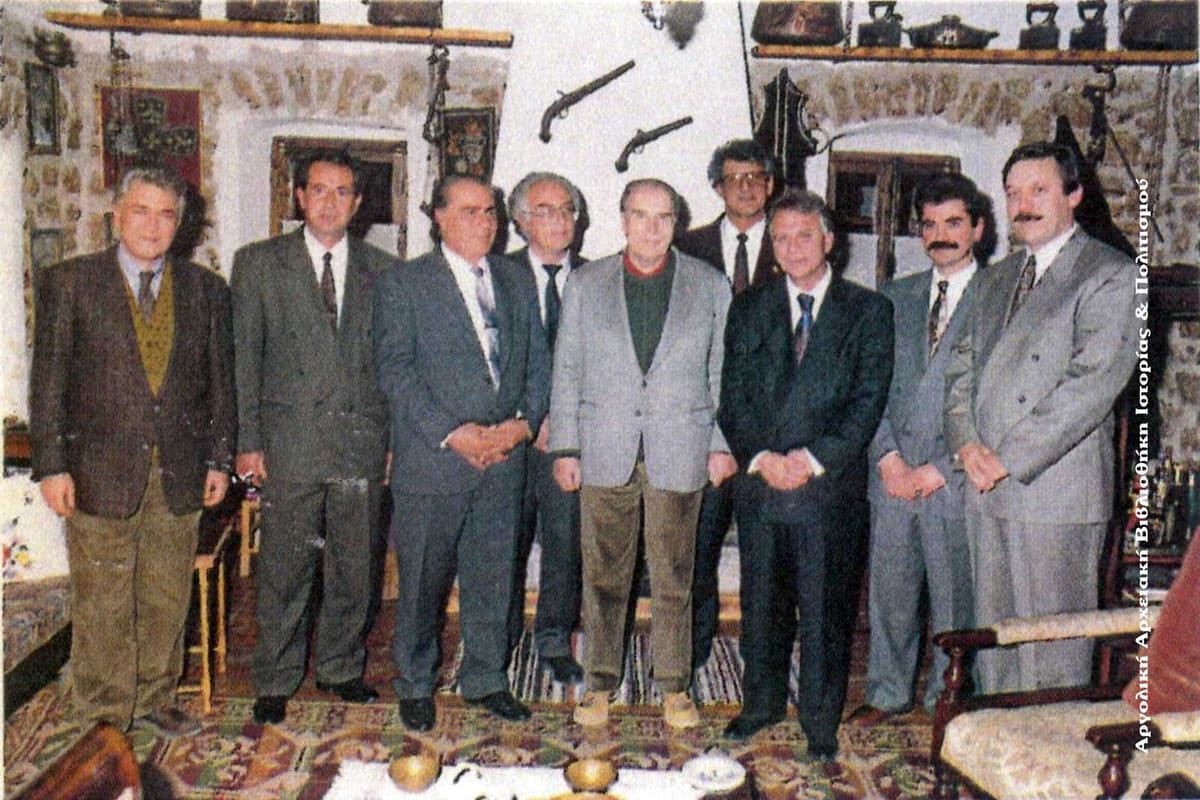
Przyjęcie w salonie w Myloi, 26 grudnia 1991. Od prawej: S. Kotsovos, P. Panagakis, burmistrz Argos D. Papanikolaou, P. Kotsonaros, François Mitterrand, N. Gkikopoulos, M. Koromichis (przewodniczący wspólnoty Myloi), N. Kodelas i Chr. Machairitsas.
Źródło: Kotsonaros family collection, via the Argolic Archival Library of History and Culture (argolikivivliothiki.gr)
-
Powiększ:
23 lutego 1995
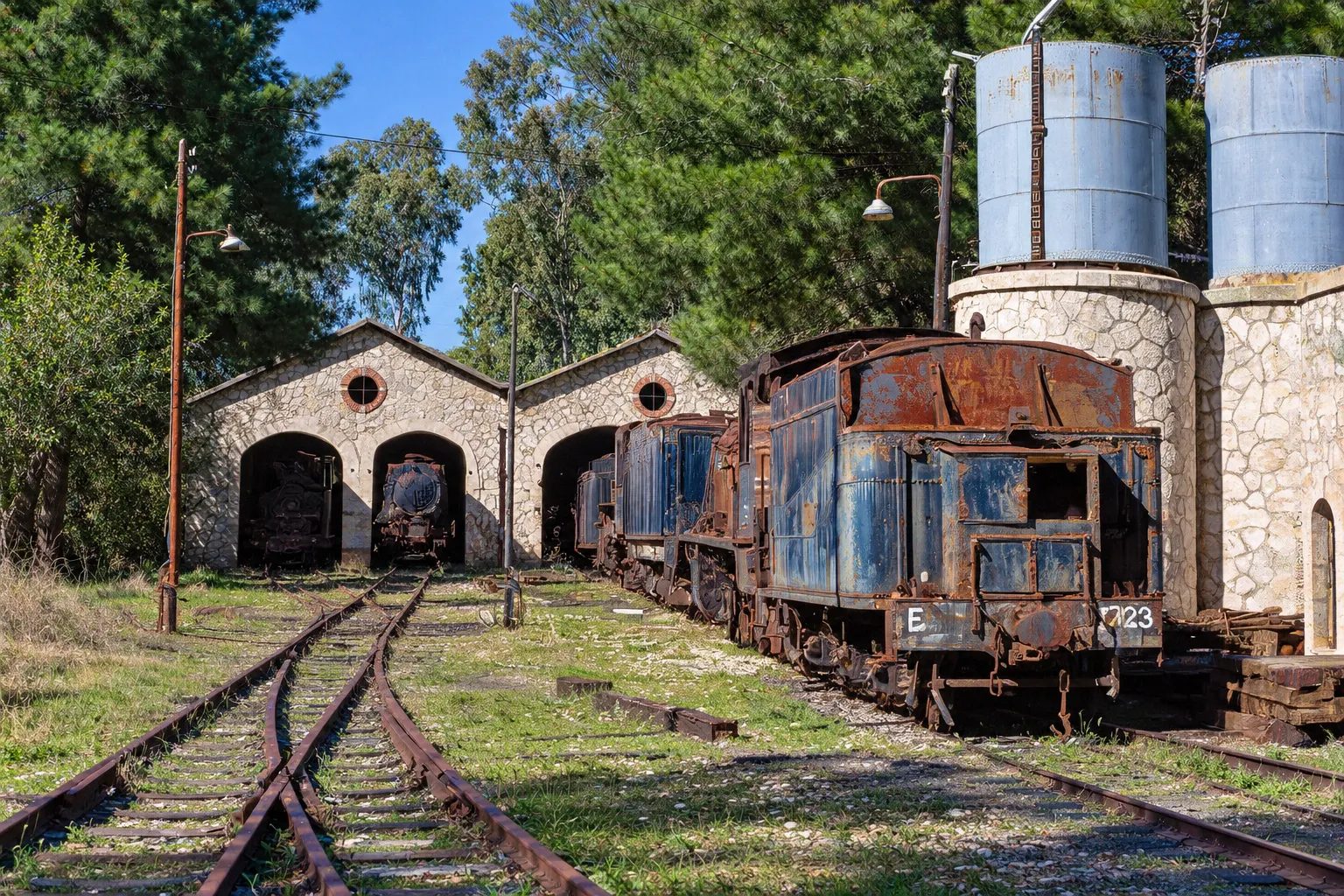
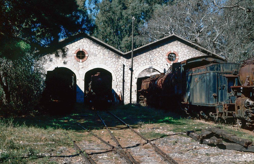
'Metre gauge graveyard. Mili Nafpliou Depot': the engine shed with arched doors at left, two water towers (stone base, blue tank) at right and tender locomotive 7723 in front.
Źródło: Adrian Nicholls (Flickr 'Marra Man') · cyfrowo odnowione
-
Powiększ:
23 lutego 1995
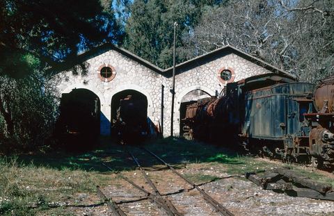
'Mili Nafpliou Depot. Greece. 1995.': the stone front of the double engine shed with two gables, three arched doors and two round brick-edged windows, with steam locomotives (Di 7112, 7118, Es 7728) in and beside the doors.
Źródło: Adrian Nicholls (Flickr 'Marra Man')
-
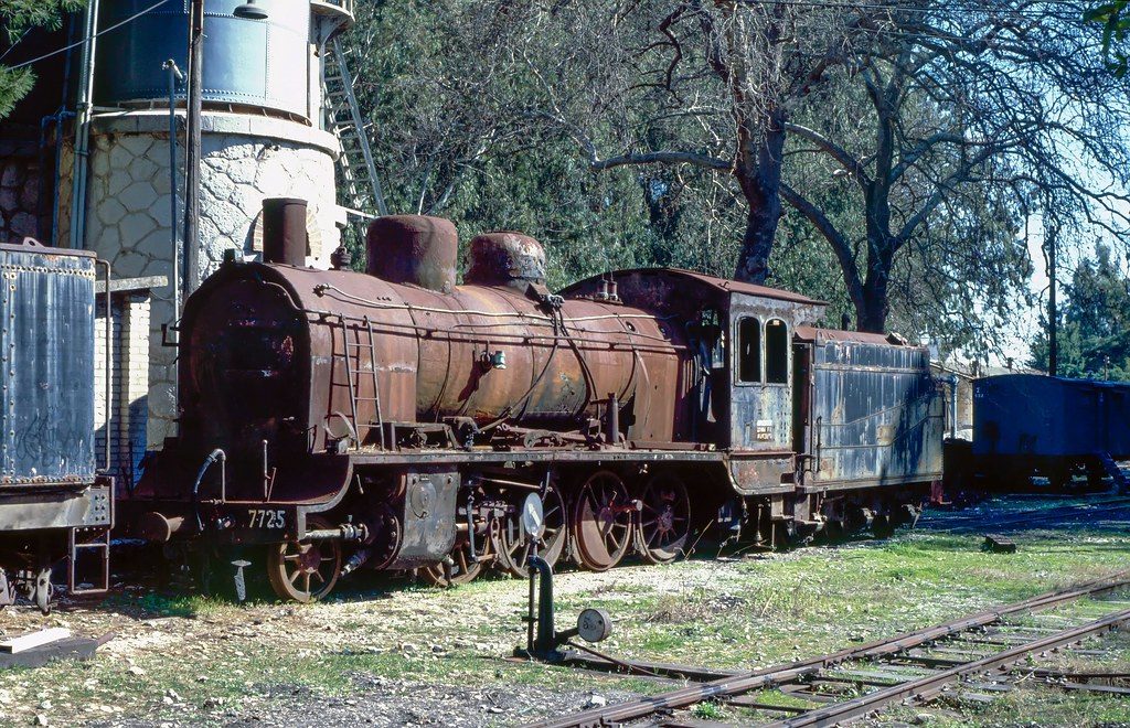
Powiększ:
23 lutego 1995
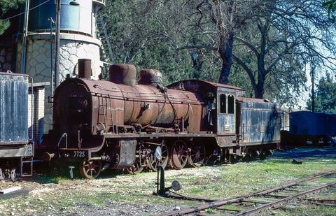
'Class Es no.7725 dumped at Mili Nafpliou depot': locomotive 7725 with a water tower behind and part of a stone building at left.
Źródło: Adrian Nicholls (Flickr 'Marra Man')
-
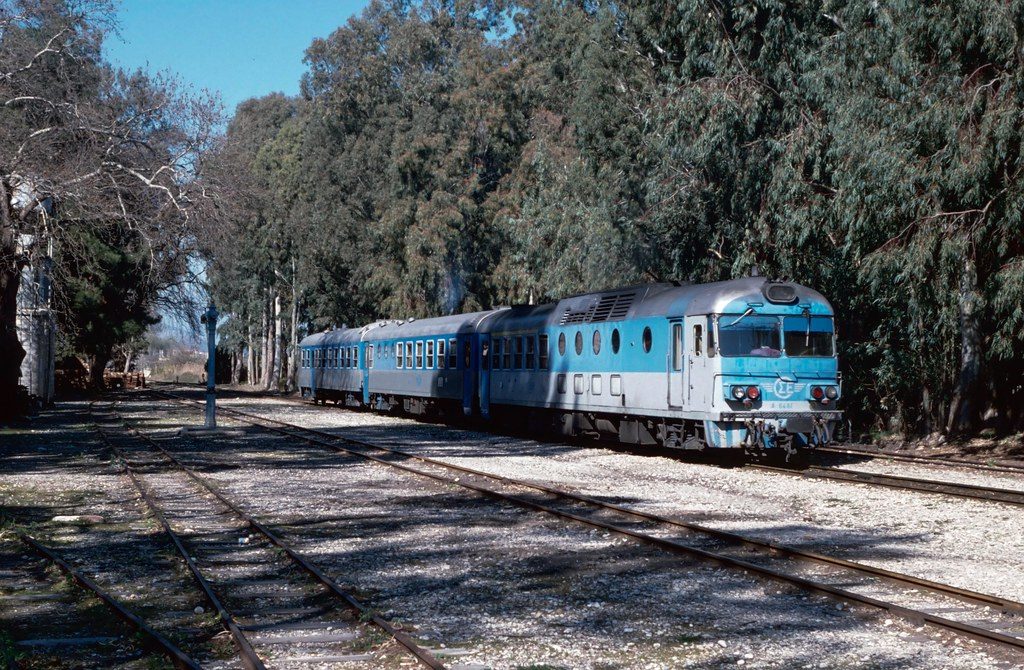
Powiększ:
23 lutego 1995
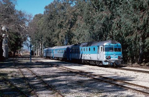
Myloi station yard under eucalyptus trees with blue OSE railcar A.6461, three coaches and a water crane.
Źródło: Adrian Nicholls (Flickr)
-
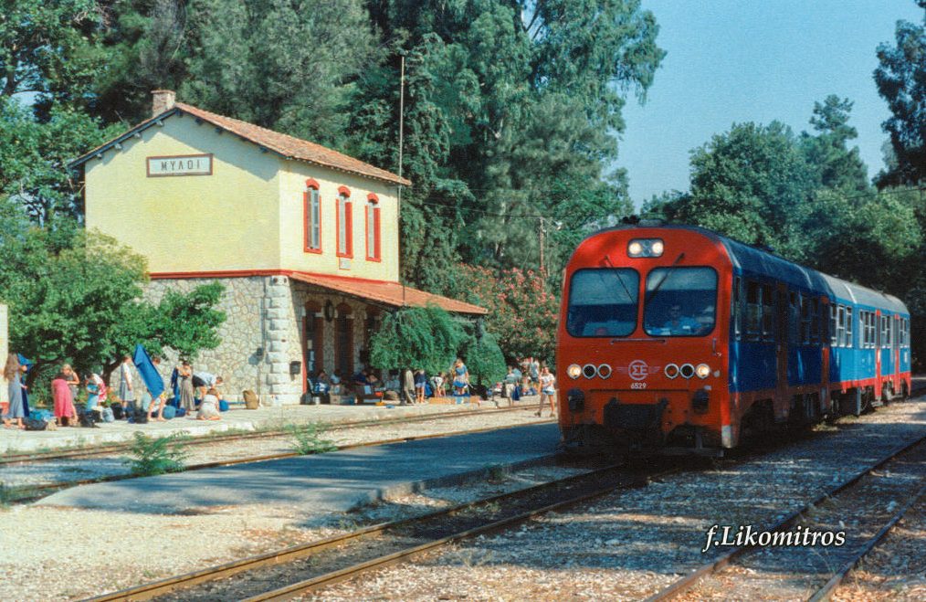
Powiększ:
ok. 1990–2005
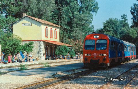
Colour photo of Myloi station in use: the SPAP station building with the ΜΥΛΟΙ sign and canopy, many passengers with luggage on the platform, and OSE railcar 6529 arriving.
Źródło: F. Likomitros; ΣΦΣ (Friends of the Railway Society)
-
Powiększ:
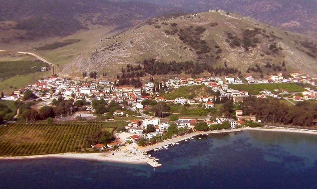
2005
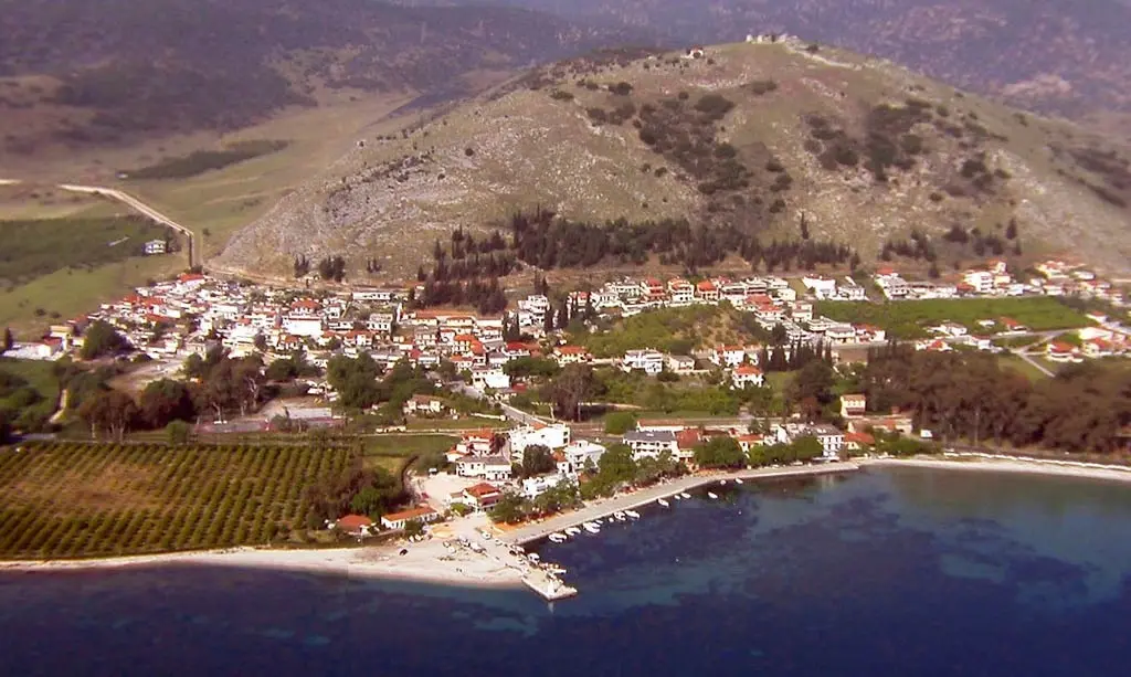
Kolorowe zdjęcie lotnicze wsi u stóp wzgórza Pontinos, z zatoką, plażą, molem i sadami
Źródło: Visit Myloi collection
Rozpoznajesz twarz, miejsce albo rok? A może masz własne dawne zdjęcia Myloi? Daj nam znać, a opowiemy ich historię.
Napisz do nas na Facebooku (otwiera się w nowej karcie)