
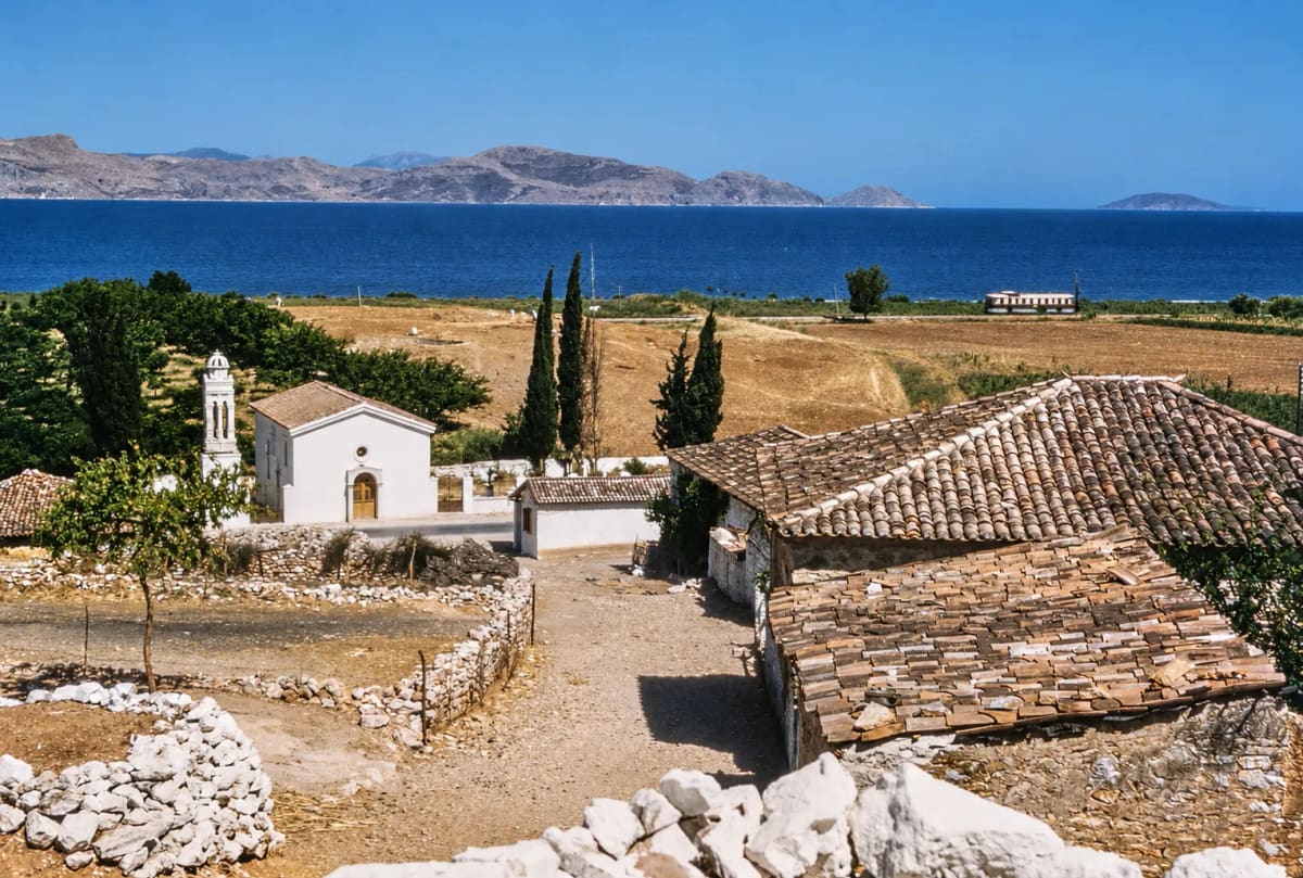
Foto: Courtesy of Harvard Fine Arts Library, Digital Images & Slides Collection
Verhalen
Oude foto's van Myloi
Ansichtkaarten, familiekiekjes, schoolfoto's en luchtfoto's: het dorp zoals het ooit was.
219 foto's · Jaartallen met “ca.” zijn schattingen. Weet u meer over een beeld, of heeft u oude foto's van Myloi? Laat het ons weten.
Vóór 1940 (33)
-
Vergroten:
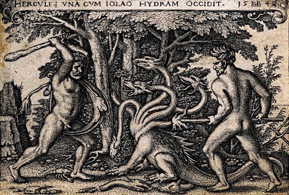
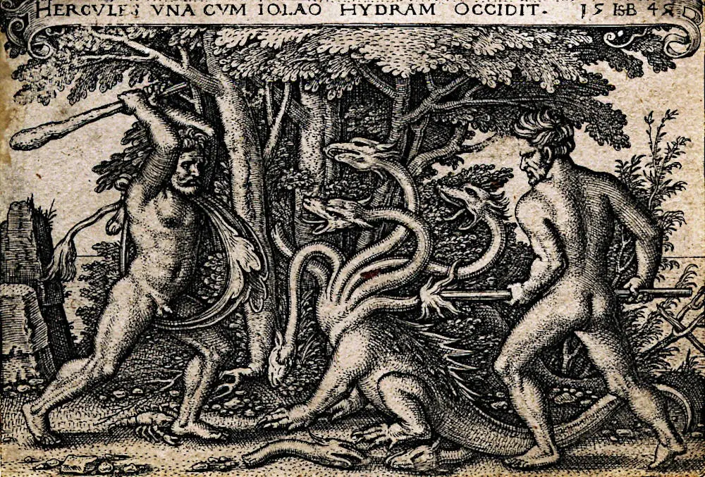
1545
Zestiende-eeuwse gravure van Herakles en Iolaos in gevecht met de veelkoppige Hydra
Bron: Public domain
-
Vergroten:
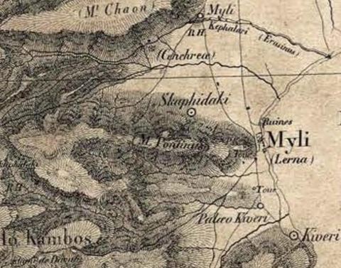
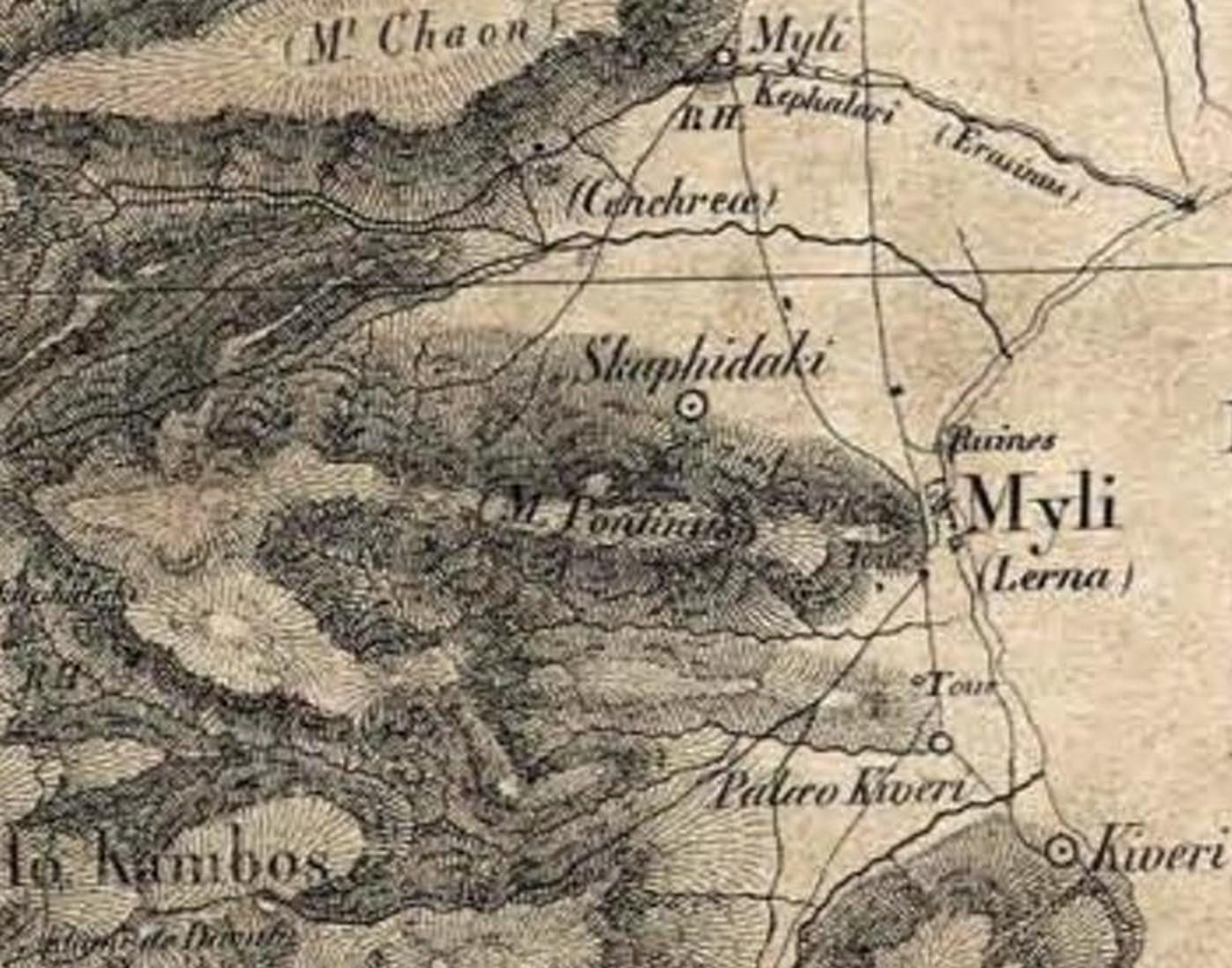
1832
Crop of the Expédition de Morée map showing Myli (Lerna), Mt Pontinos, Skafidaki and Kiveri.
Bron: Expédition scientifique de Morée (atlas)
-
Vergroten:
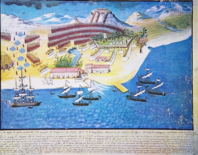
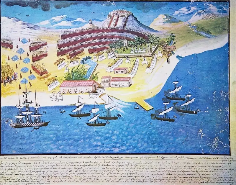
ca. 1836–1839
Naïef schilderij van de Slag bij Myloi in 1825, met de molens, de kust en schepen in de golf
Bron: Public domain
-
Vergroten:
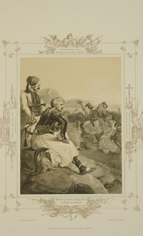
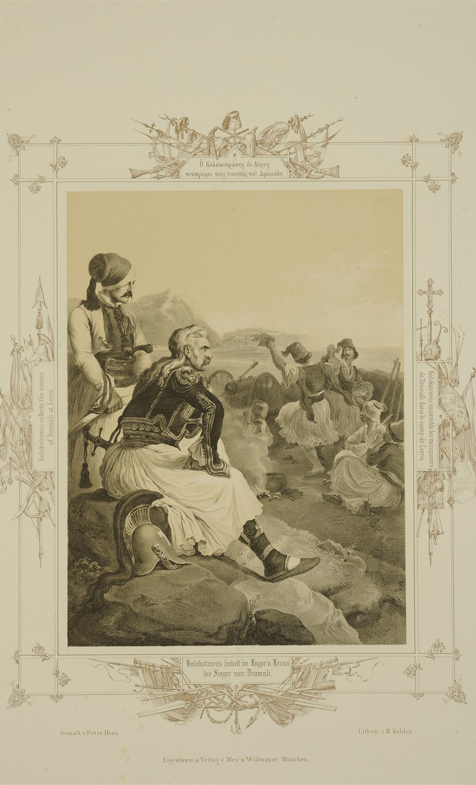
1852
Lithograph "Kolokotronis gathers the victors over Dramalis at Lerna" (1822 camp scene) with a four-language caption; idealised landscape.
Bron: Peter von Hess (painter), H. Kohler (lithographer), Mey & Widmayer, Munich; National Historical Museum, Athens
-
Vergroten:
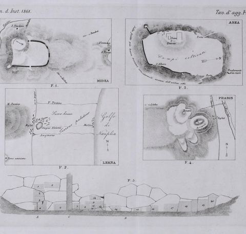
1861
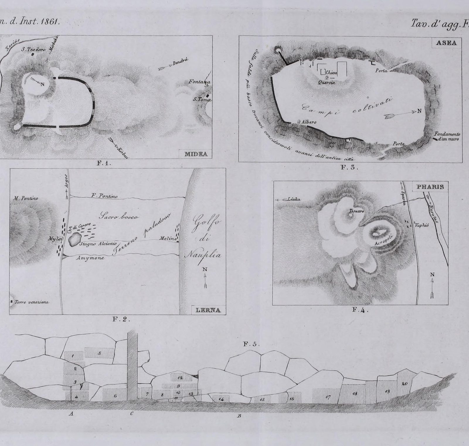
Plate of sketch plans by Conze & Michaelis, including a plan of the Lerna area with Mt Pontinos and the gulf.
Bron: A. Conze & A. Michaelis
-
Vergroten:
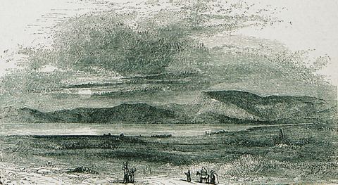
1882 (druk; ontwerp waarschijnlijk ca. 1839)
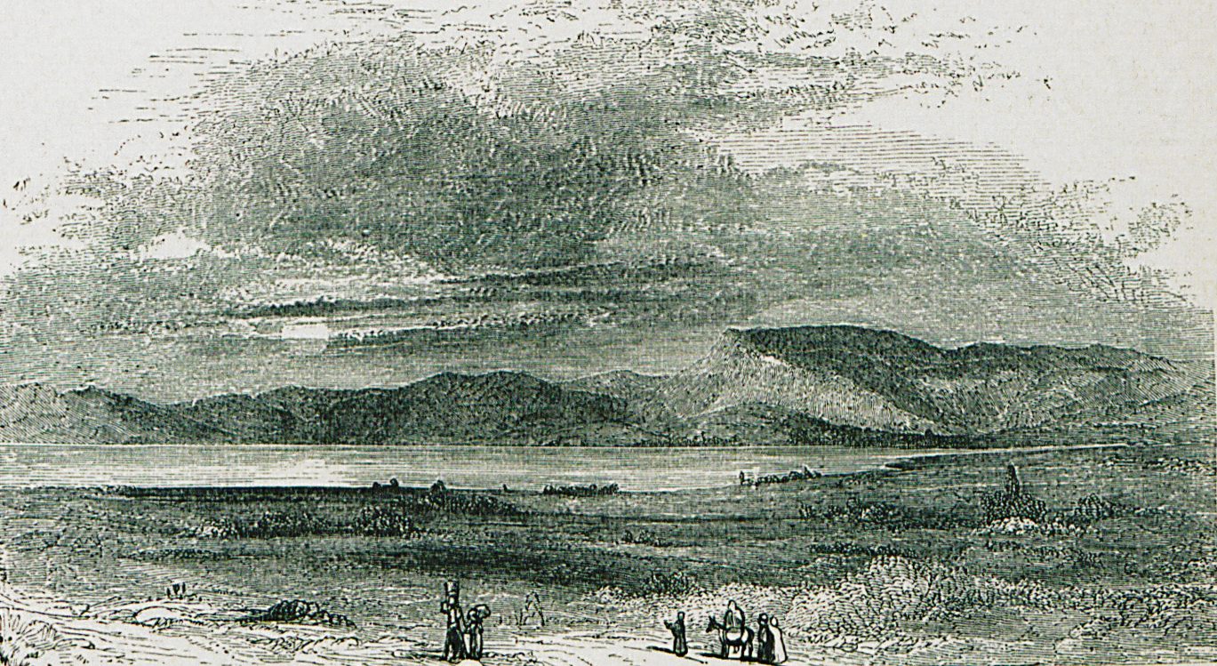
Wood engraving 'Lernæan Marsh': the marsh of Lerna with water, plain and mountains, and travellers with a mule in the foreground.
Bron: Christopher Wordsworth, 'Greece: Pictorial, Descriptive, and Historical' (John Murray, London)
-
Vergroten:
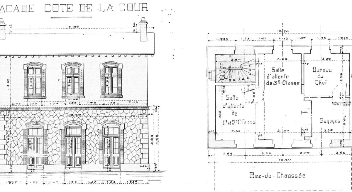
ca. 1886
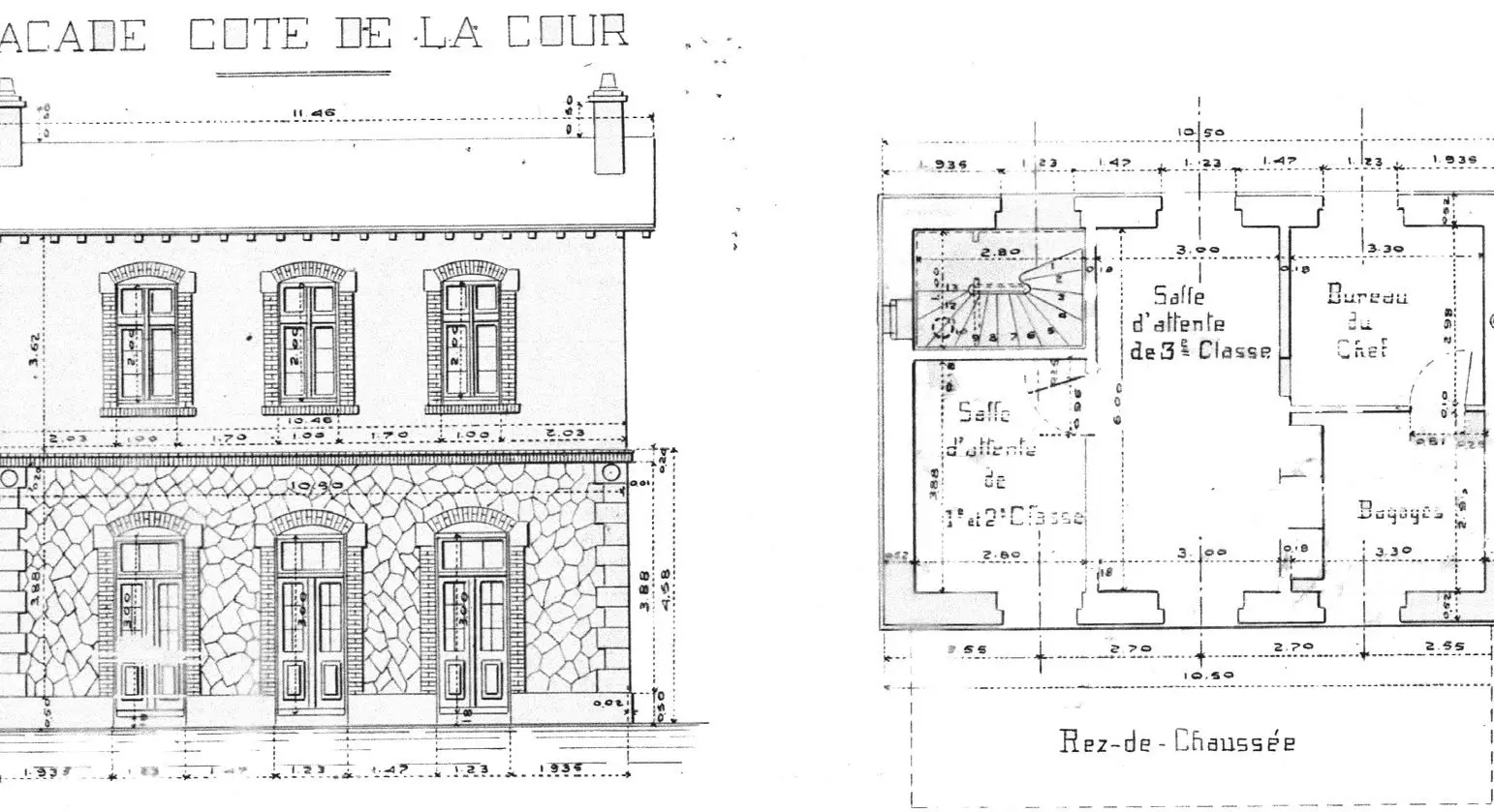
Originele tekening van het stationsgebouw: voorgevel en plattegrond met wachtkamers, kantoor van de stationschef en bagageruimte
Bron: Railway archive (supplied by Visit Myloi)
-
Vergroten:
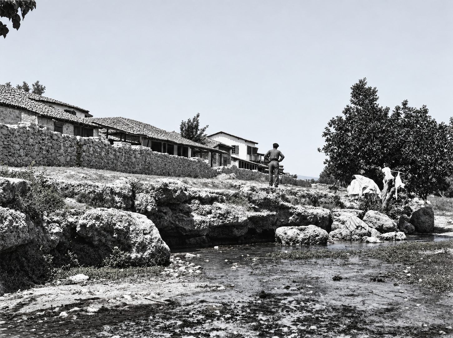
ca. 1890–1935?
Black-and-white photograph of a spring-fed stream bed with large rocks, a man standing by a wall and low stone houses behind.
Bron: Woodhouse archive, Chau Chak Wing Museum (University of Sydney), NM2007.43.10 "Spring (Sema?) at Myli"
-
Vergroten:
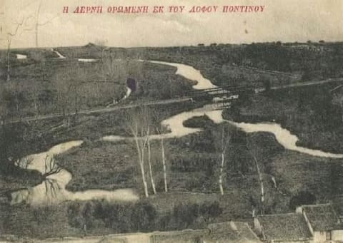
ca. 1900–1920
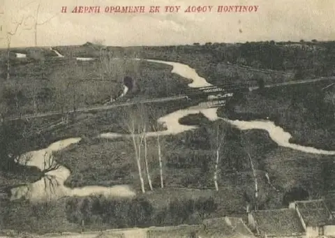
Ansichtkaart “Η Λέρνη ορωμένη εκ του λόφου Ποντίνου” (Lerna gezien vanaf de heuvel Pontinos): beekjes die door het moeras kronkelen
Bron: Visit Myloi collection
-
Vergroten:
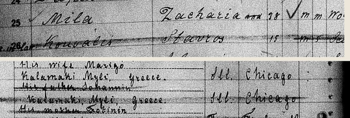
1911-04-24
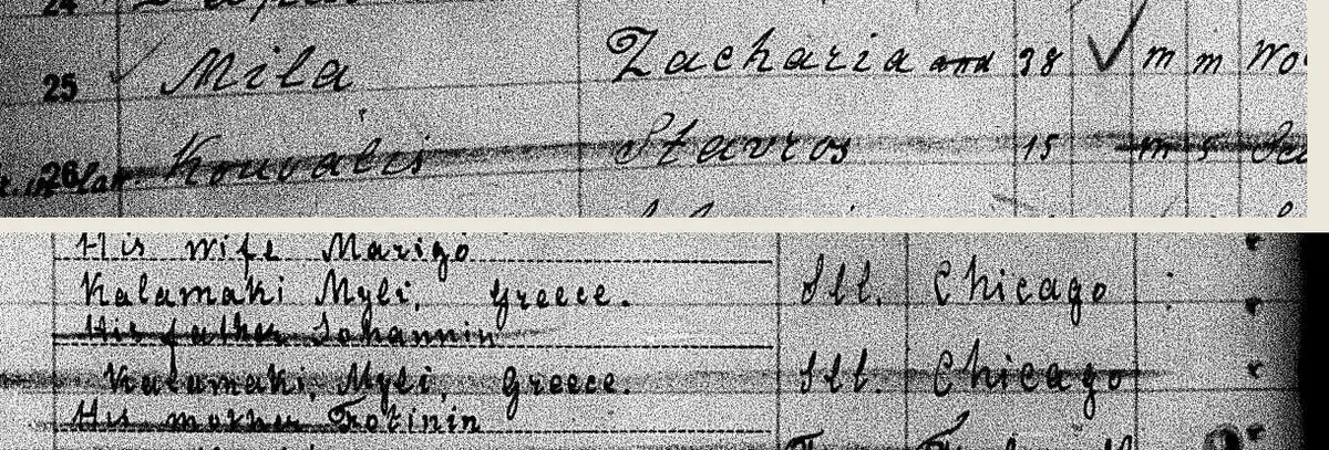
De passagierslijst van de Patris, april 1911, regels 25–26: "Mila, Zacharia, 38" en "Kouvalis, Stavros, 15". Daaronder hun familie thuis, "his wife Marigo" en "his father Johannis", allebei in "Kalamaki, Myli, Greece", en hun bestemming: "Ill. Chicago".
Bron: NARA T715, via FamilySearch
-
Vergroten:

1911-04-24
De achterzijde van hetzelfde blad. Mila was al eerder in Amerika geweest ("yes, 1902–1906, Chicago, Ill.") en ging naar "his brother-in-law Angelos Kouvalis, 417 N. Wells, Chicago Ill." Bij Stavros: "the same, as above".
Bron: NARA T715, via FamilySearch
-
Vergroten:
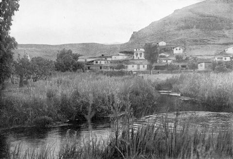
1912 (volgens uploader; gepubliceerd 1914)
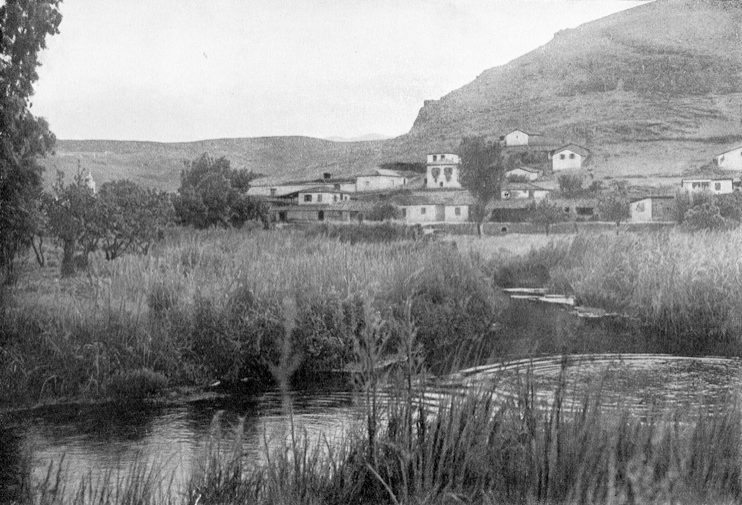
Plate 67 'Der lernäische Sumpf': water and reeds of the Lerna springs/marsh in the foreground, with the houses of Myloi at the foot of Mt Pontinos behind.
Bron: Julia Ponten-von Broich, in Josef Ponten, 'Griechische Landschaften' (Stuttgart 1914)
-
Vergroten:
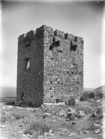
ca. 1890–1935
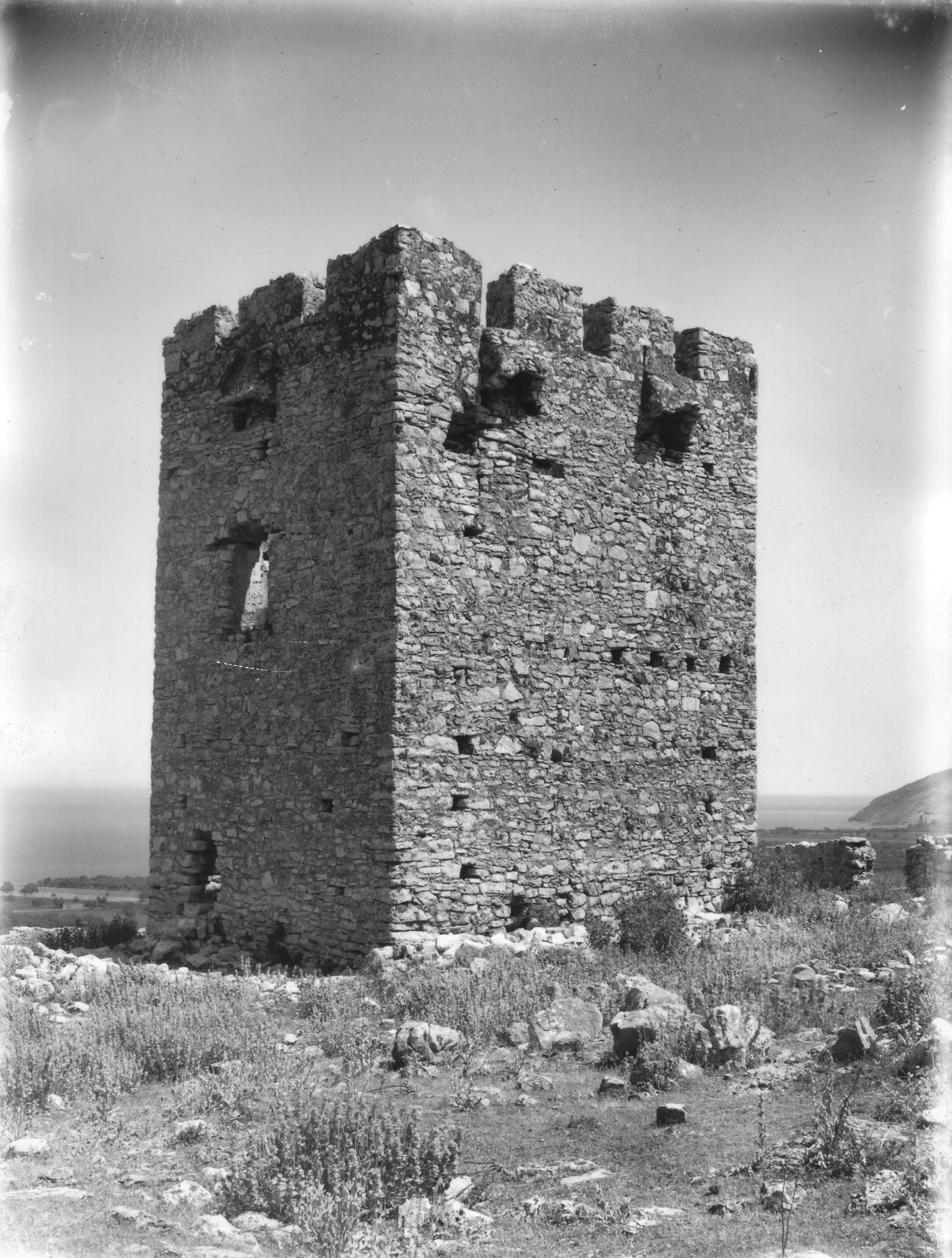
Glass-negative photograph of the Tower of the Vasilopoula (Pyrgos Vasilopoulas) between Myloi and Kiveri, crenellated and still fairly intact, with the sea and a cape at right.
Bron: William J. Woodhouse; Woodhouse Archive, Chau Chak Wing Museum (NM2007.100.1)
-
Vergroten:
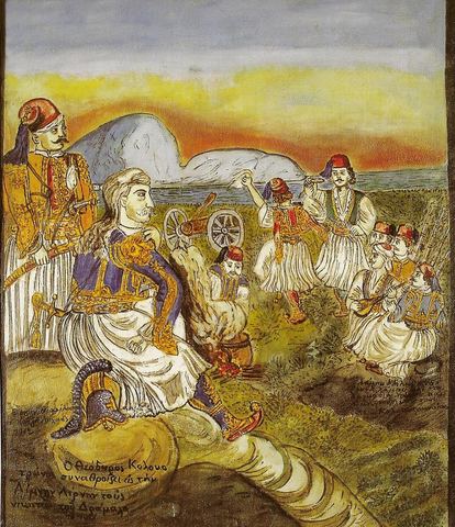
1912
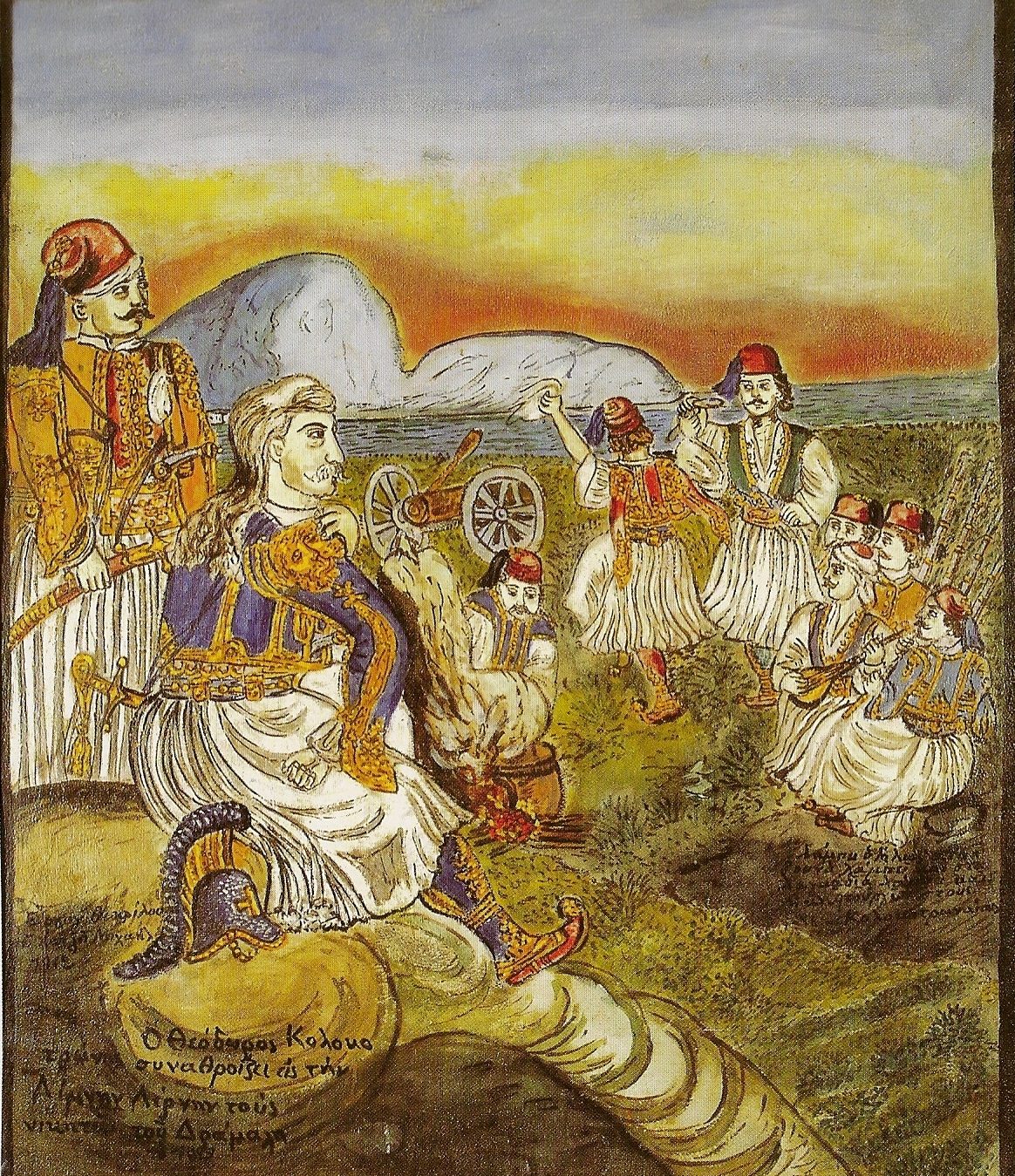
Fresco by Theofilos of Kolokotronis gathering the victors over Dramalis at Lerna (1822), with an imaginary landscape.
Bron: Theofilos Hatzimichail; Theophilos Museum, Anakasia (Volos)
-
Vergroten:

1914-06-16
De Pannonia, juni 1914, regel 10: "Antoniou, Zacharias, 24, workman", woonplaats "Mylous", naaste familielid "his father C. Antoniou, Mylous, Greece".
Bron: NARA T715, via FamilySearch
-
Vergroten:
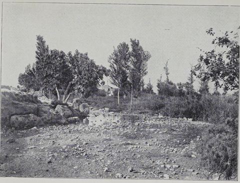
vóór oktober 1923 (waarschijnlijk begin jaren 20)
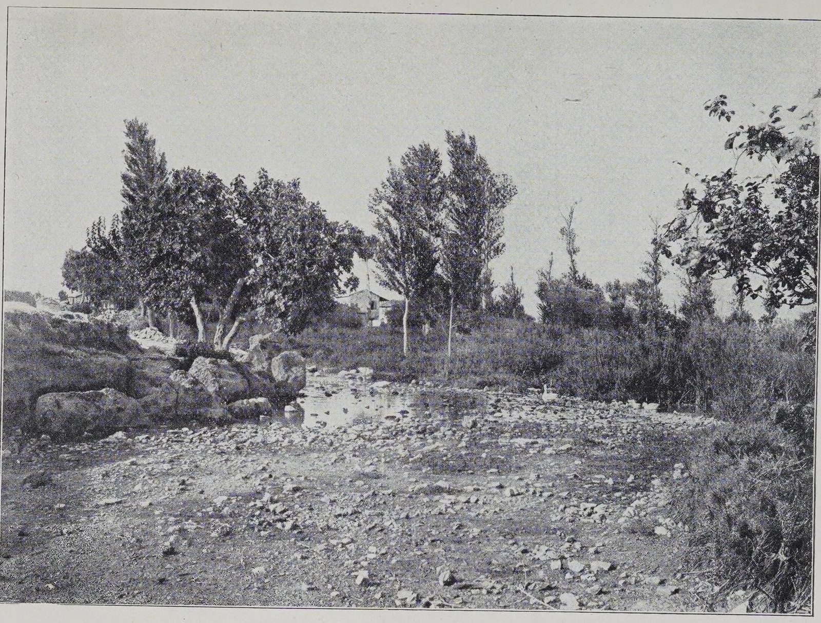
"LERNE": the spring pool (Amymone) with a triple-trunked olive tree, poplars, reeds and a low tiled house behind.
Bron: Photographer not named (probably G. G.-Toudouze)
-
Vergroten:
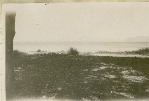
12–14 december 1927
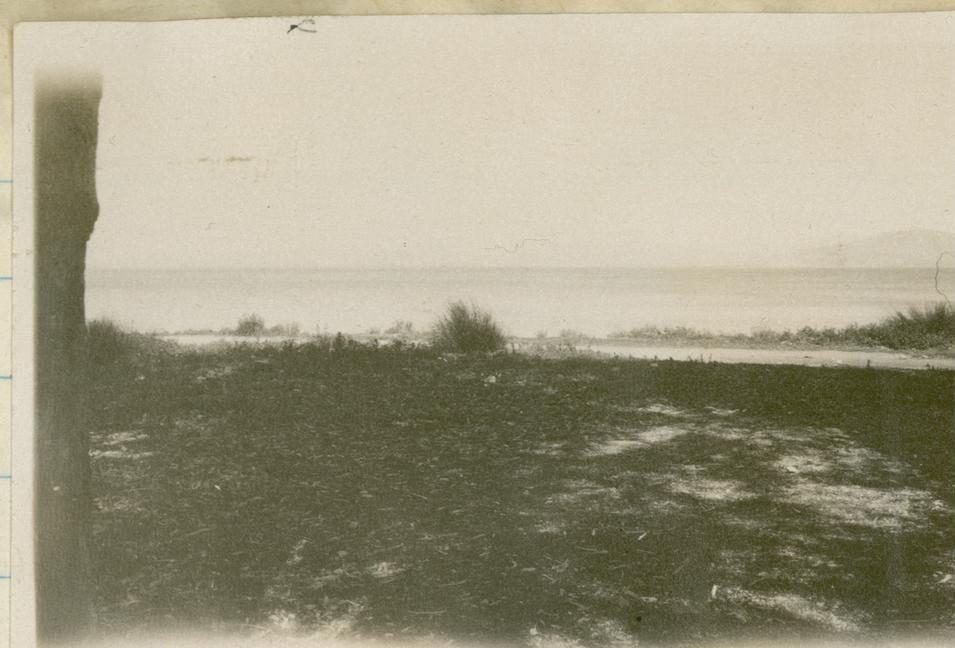
"Gulf of Nauplia from Myli station": view over the gulf from Myloi station.
Bron: John Pendlebury; British School at Athens Archive, PEN/2/2/1/108
-
Vergroten:
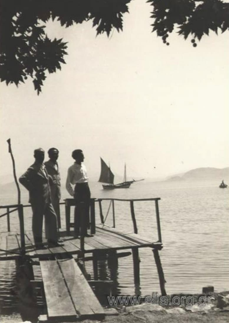
24 juli 1927
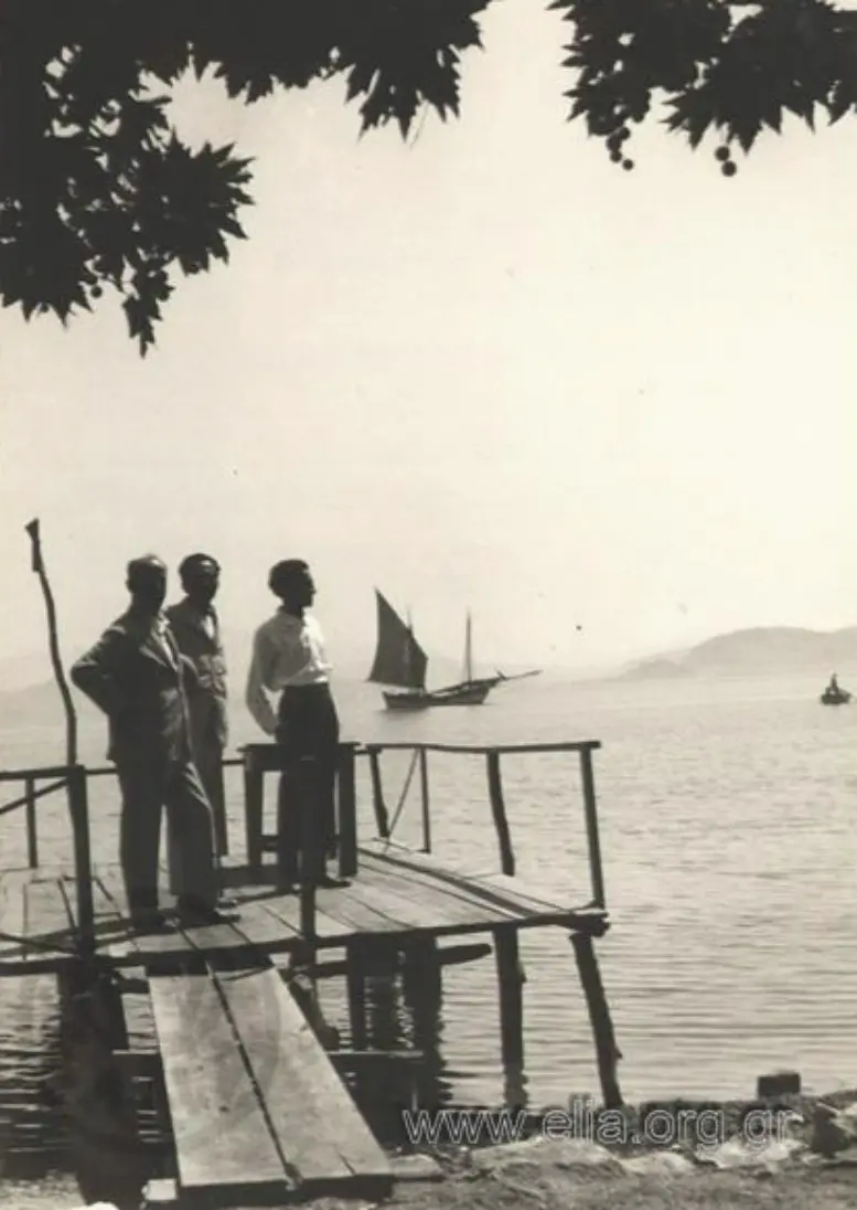
Nikos Kazantzakis en twee vrienden op de houten steiger van Myloi in 1927
Bron: ELIA/MIET 03.4.1.72 · CC BY 4.0
-
Vergroten:
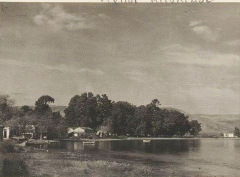
ca. 1930–50?
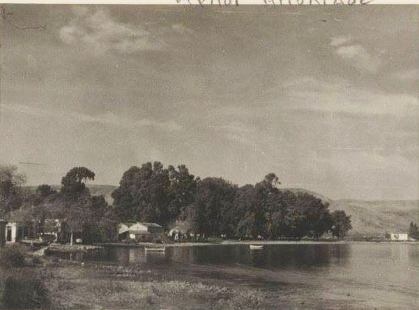
Black-and-white photo postcard marked "ΜΥΛΟΙ ΑΡΓΟΛΙΔΟΣ": a stretch of coast with a dense group of trees and low houses.
Bron: Visit Myloi collection (photographer not recorded)
-
Vergroten:
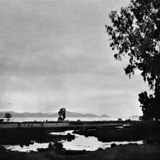
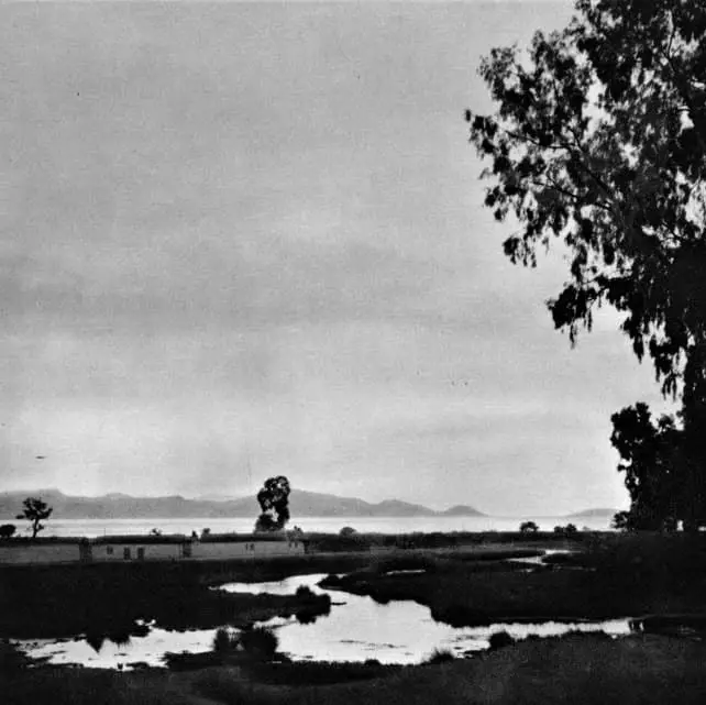
1930
Zwart-witbeeld van plassen in het moeras, lage gebouwen, een eucalyptus en in de verte de golf
Bron: Antoine Bon (1901–1972)
-
Vergroten:
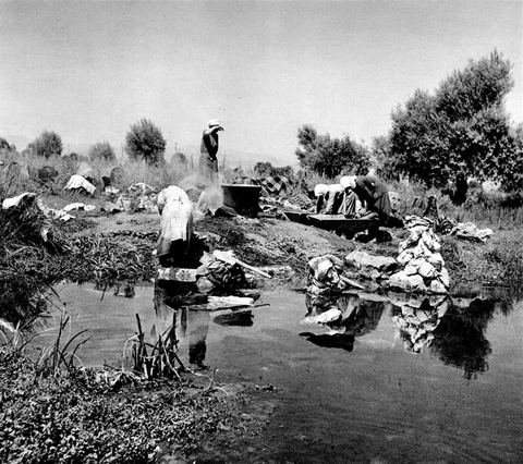
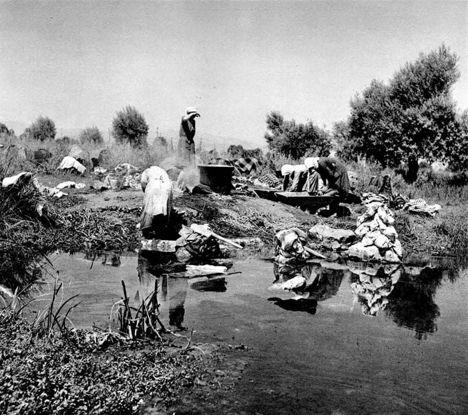
jaren 30
Women washing laundry in the spring water at Lerna, among reeds and trees, in the 1930s.
Bron: Anna Riwkin(-Brick)
-
Vergroten:
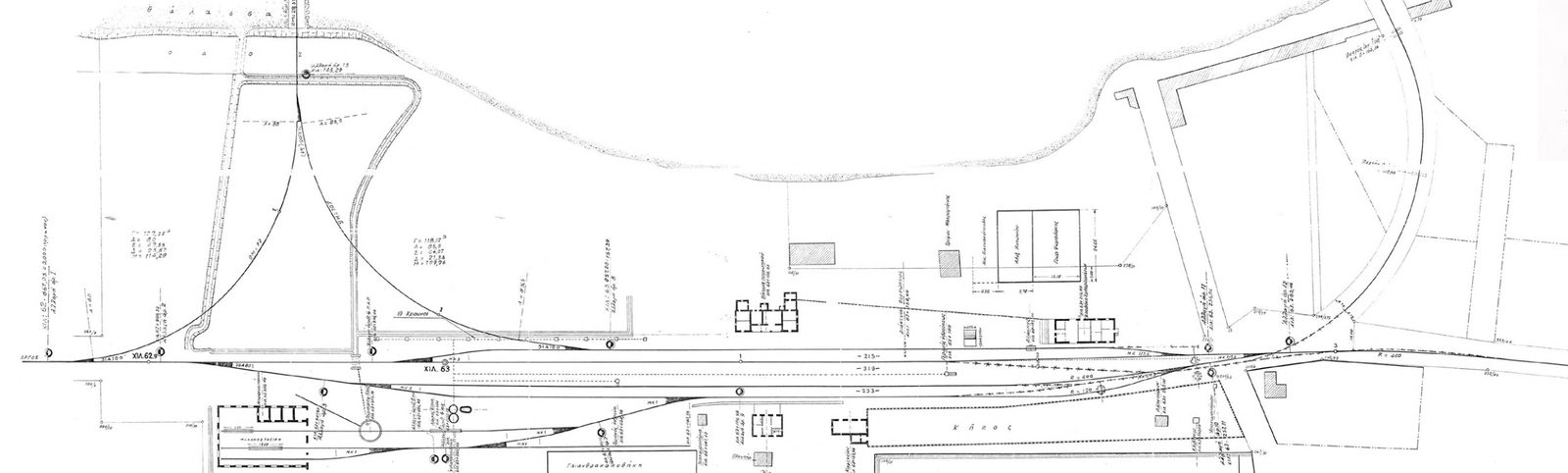
jaren 30
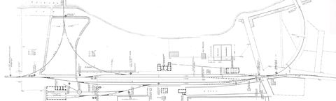
Topographic plan of the whole Myloi station complex from the OSE archive: tracks at km 62–63, the pier with siding and triangle, the engine shed with turntable/water point, coal store, station buildings, garden, signals and points.
Bron: OSE (Hellenic Railways) archive; reproduced in Lymperopoulou & Kossyfa, NTUA thesis 2022
-
Vergroten:
1936
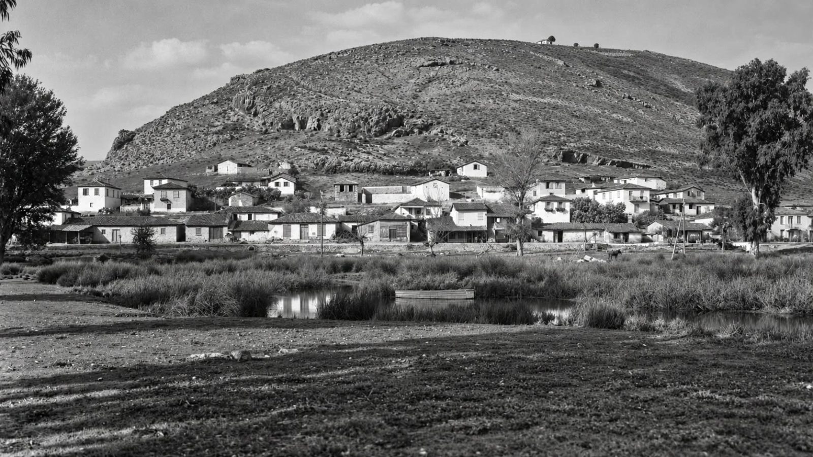
'Ansicht des Ortes': the village of Myloi at the foot of Mt Pontinos seen across the spring ponds of Lerna, with Profitis Ilias chapel and the Frankish tower on the summit, tiled houses, a eucalyptus and a horse by the water.
Bron: Walther Wrede; DAI Athens photo archive (D-DAI-ATH-Argolis-0451) · digitaal opgeknapt
-
Vergroten:
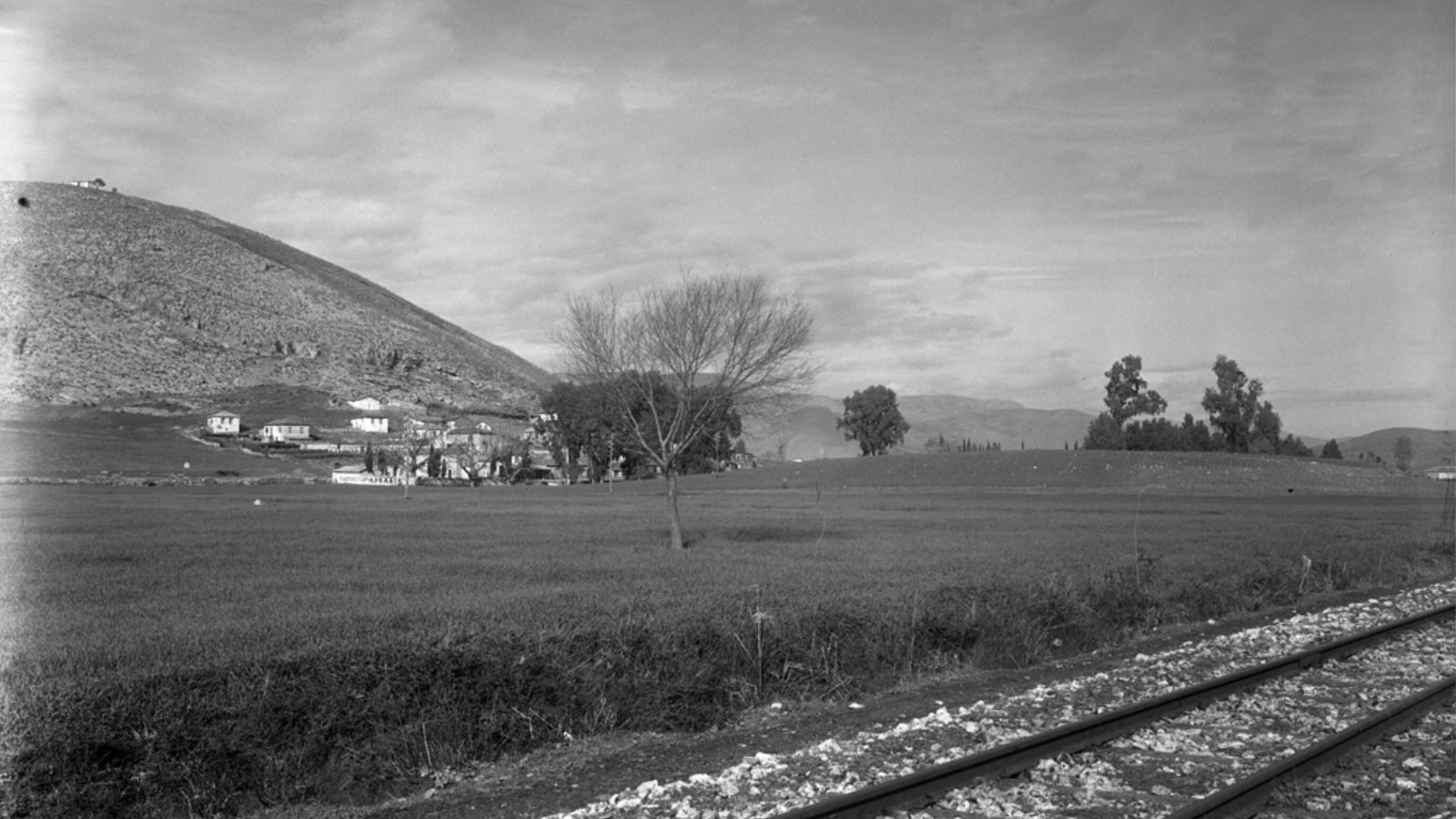
1936
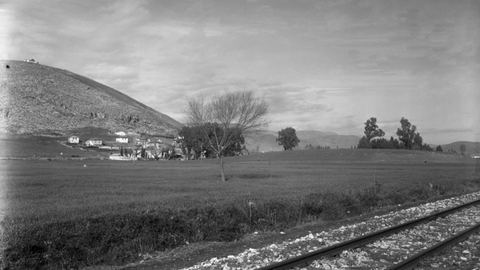
The prehistoric mound of Lerna from the south-east with metre-gauge rails in the foreground, Pontinos and the southern houses of Myloi, and eucalyptus trees.
Bron: Walther Wrede; DAI Athens, D-DAI-ATH-Argolis-0450
-
Vergroten:
ca. 1937–1940
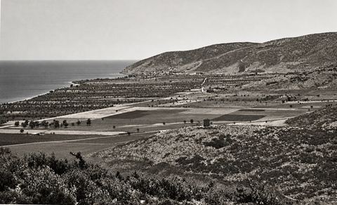
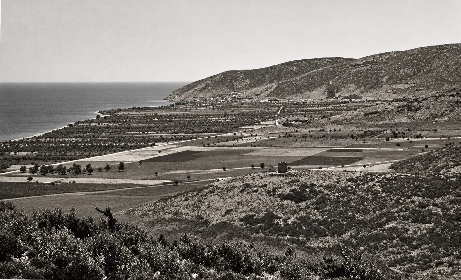
Looking south over the open coastal plain between Myloi and Kiveri, with the road to Tripolis rising on the right and the Vasilopoula tower on a mound.
Bron: D. J. Wallace; Courtauld Conway Library 437894 · digitaal opgeknapt
-
Vergroten:
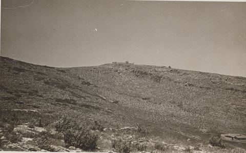
ca. 1937–1940
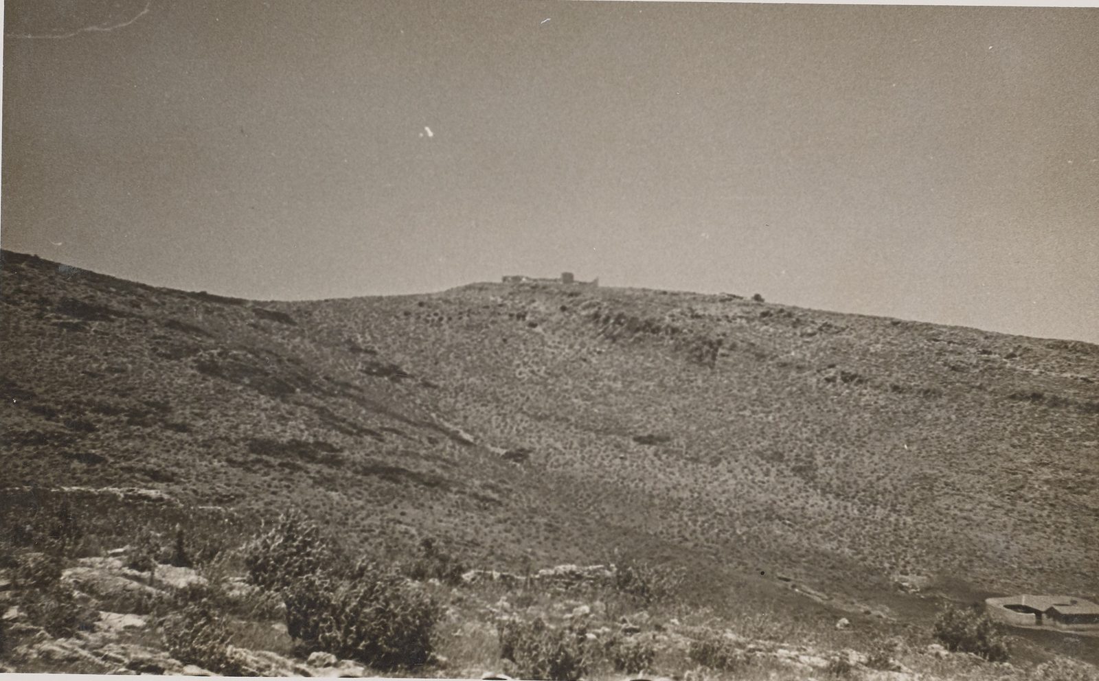
The castle on Pontinos hill seen from the lower tower.
Bron: D. J. Wallace; Courtauld Conway Library 437895
-
Vergroten:
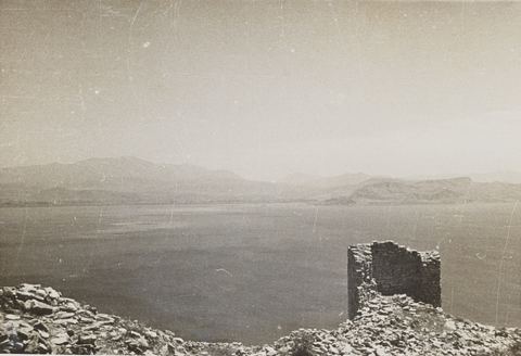
ca. 1937–1940
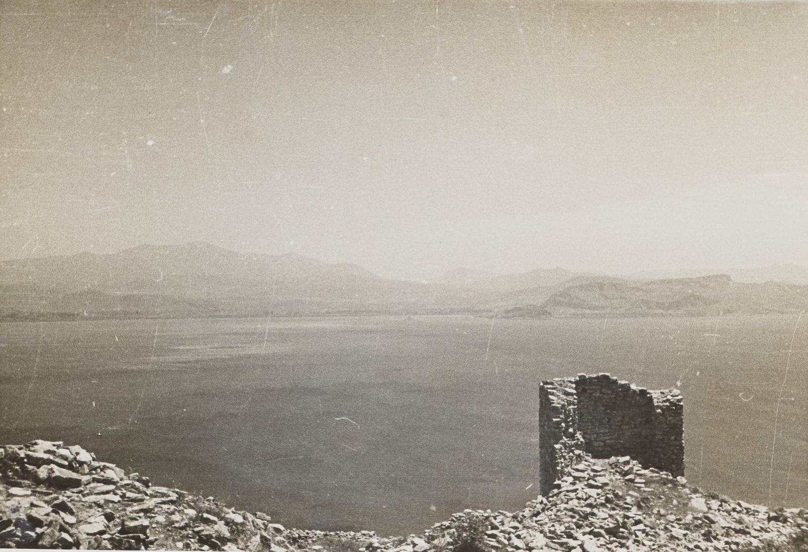
Ruined tower of the Pontinos castle looking east across the gulf to Nafplio and the Palamidi.
Bron: D. J. Wallace; Courtauld Conway Library 437896
-
Vergroten:
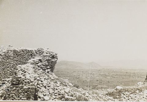
ca. 1937–1940
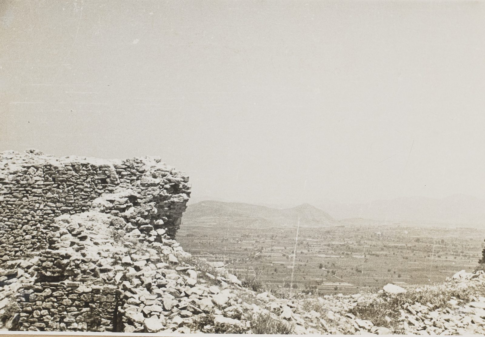
View north from the keep of the Pontinos castle over its masonry towards the Argos plain and mountains.
Bron: D. J. Wallace; Courtauld Conway Library 437897
-
Vergroten:
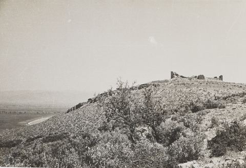
ca. 1937–1940
Towers of the keep of the Pontinos castle from the west, with the plain and the shore near Myloi below.
Bron: D. J. Wallace; Courtauld Conway Library 437898
-
Vergroten:
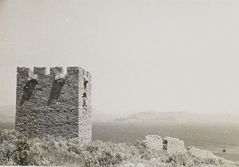
ca. 1937–1940
"Venetian Tower": the crenellated Vasilopoula tower between Myloi and Kiveri, with the gulf behind.
Bron: D. J. Wallace; Courtauld Conway Library 437899
-
Vergroten:
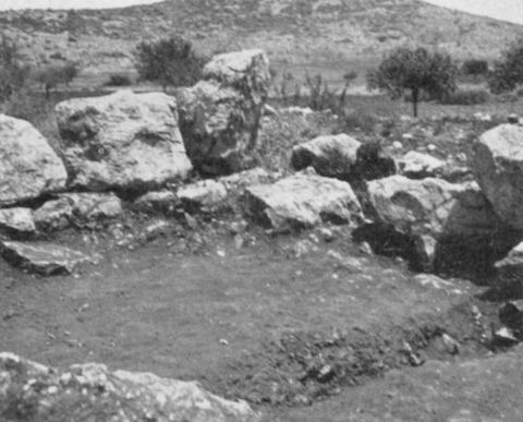
augustus 1939
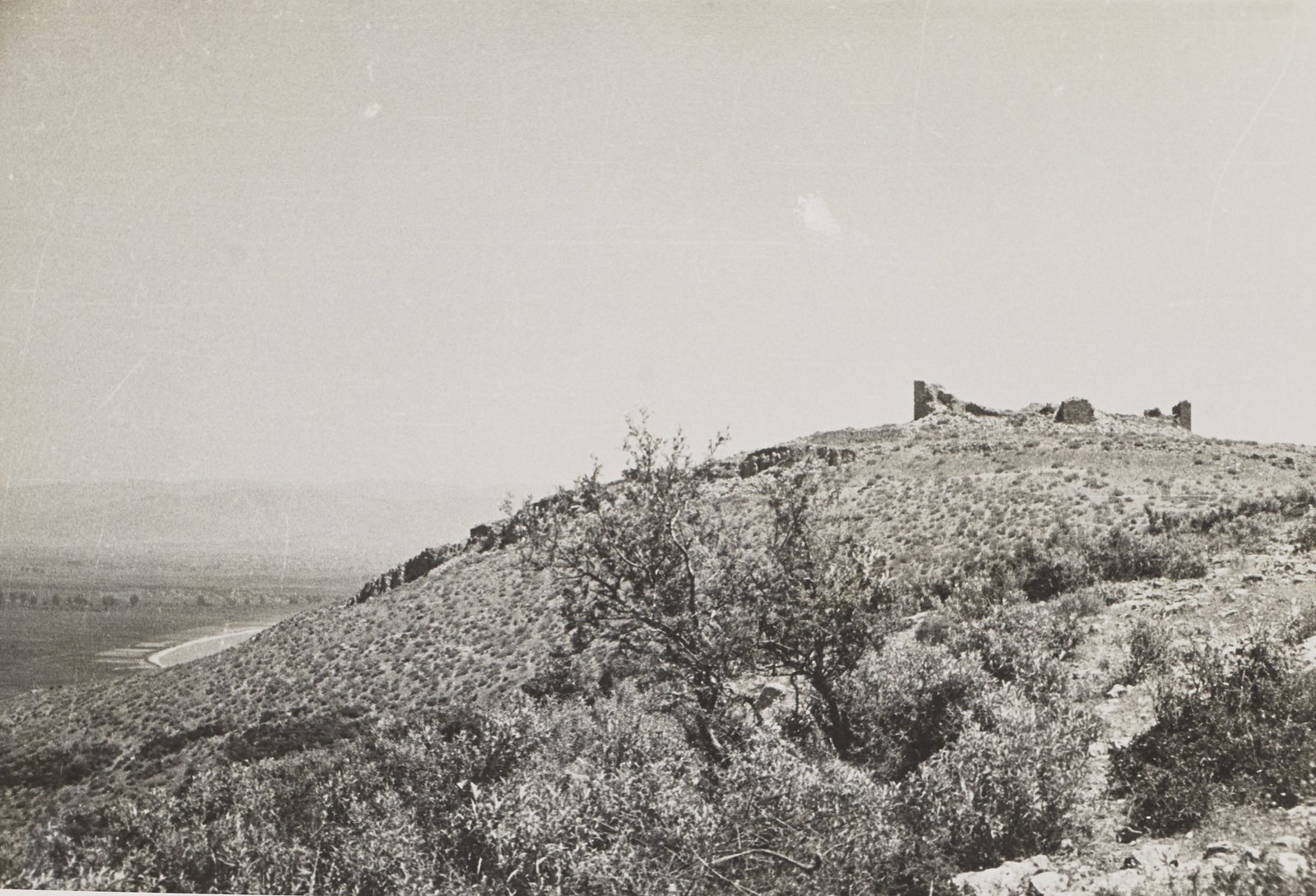
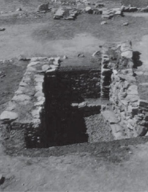
Fig. 22 'Blockhouse Near Lerna, N.E. Corner, Showing Entrance': excavated wall corner of the late-antique blockhouse c. 3 km beyond the spring of Lerna, with bare hills and olive trees behind.
Bron: Excavation by Alison Frantz and Carl A. Roebuck (ASCSA); photos almost certainly by them
-
Vergroten:
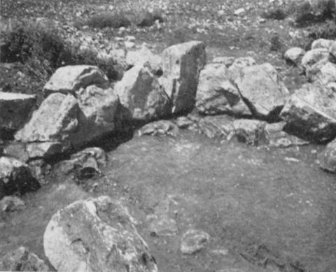
augustus 1939
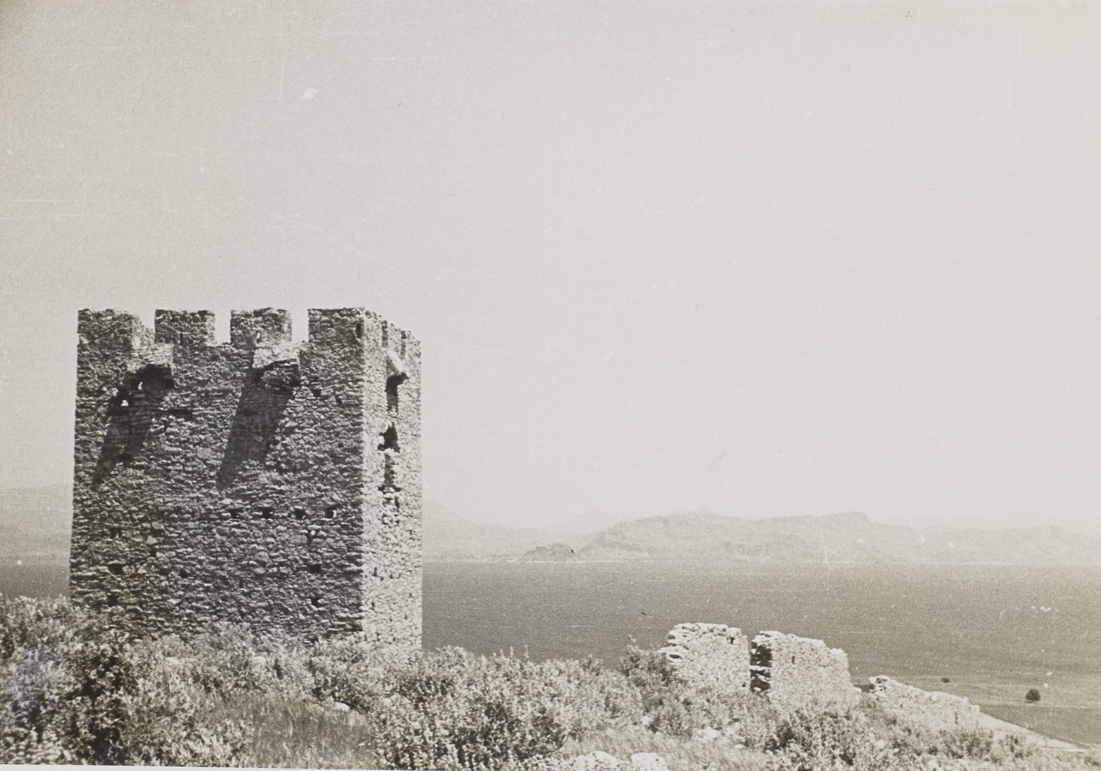
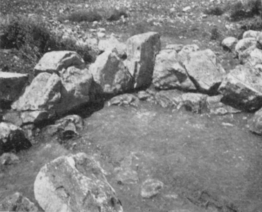
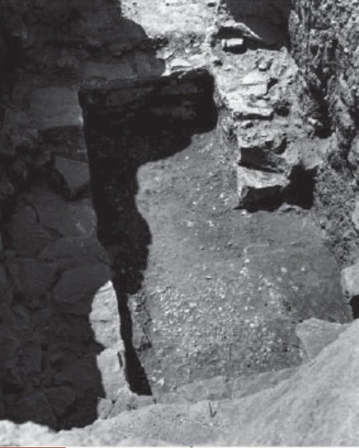
Fig. 23 'Blockhouse Near Lerna, Floor Level, N.W. Corner': floor level of the excavated blockhouse.
Bron: Excavation by Alison Frantz and Carl A. Roebuck (ASCSA); photos almost certainly by them
-
Vergroten:
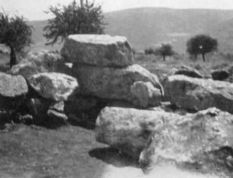
augustus 1939
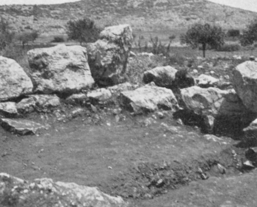
Fig. 24 'Blockhouse Near Lerna, S.E. Corner': wall corner with olive trees and a ridge of hills behind.
Bron: Excavation by Alison Frantz and Carl A. Roebuck (ASCSA); photos almost certainly by them


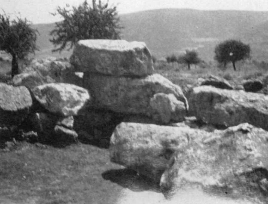
De jaren 40 (36)
-
Vergroten:
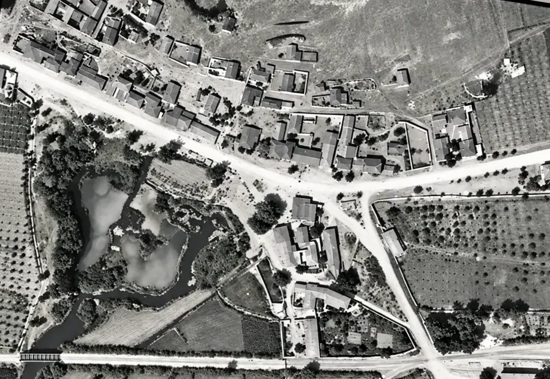
13 juli 1941
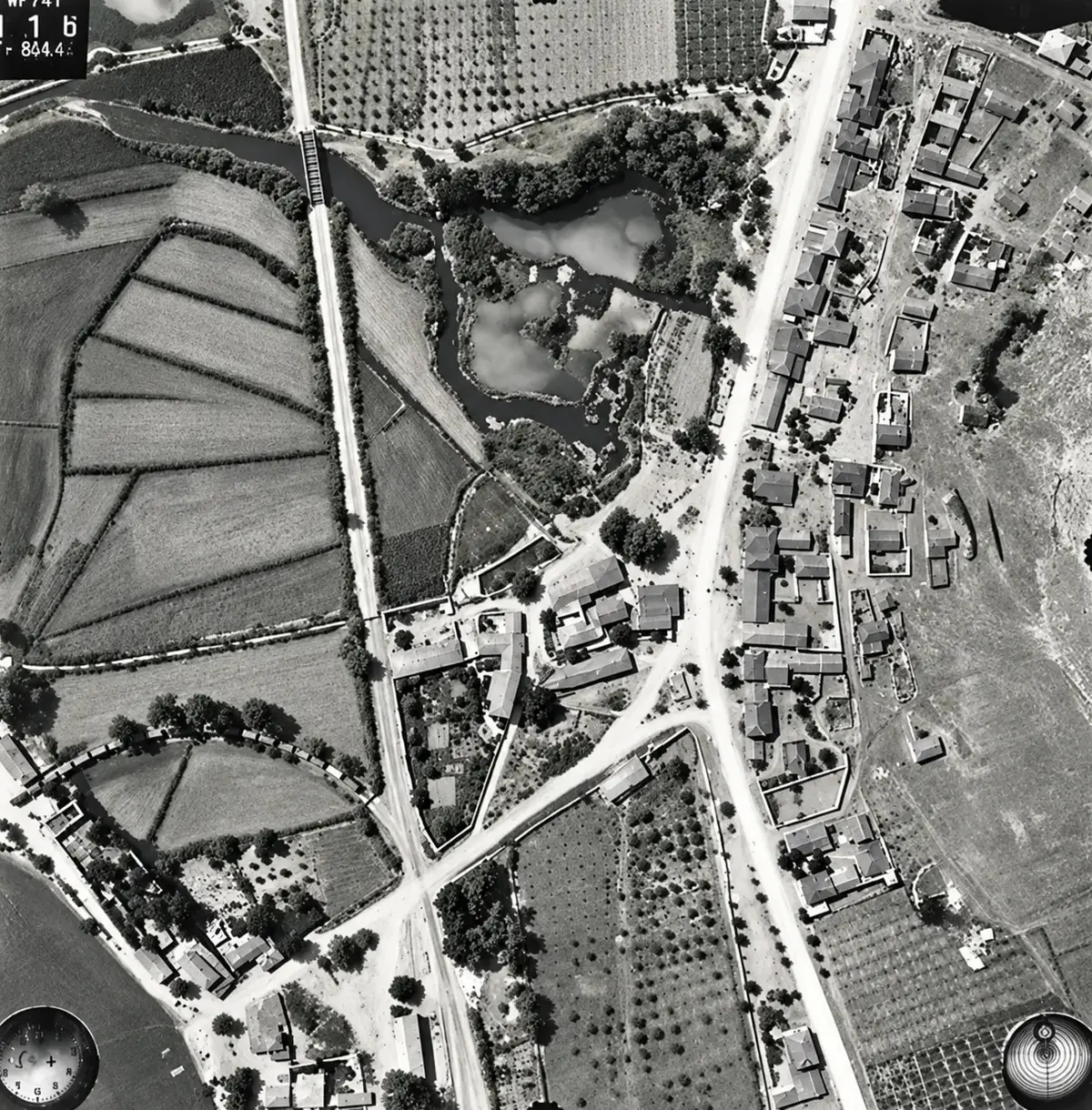
Detail of a German aerial photograph of 13 July 1941: the heart of Myloi, with the houses along the main road, the spring ponds of Lerna, the orchards and the railway with its bridge.
Bron: Reichsluftfahrtministerium (Sonderluftbildabteilung); DAI Athens Archive · digitaal opgeknapt
-
Vergroten:
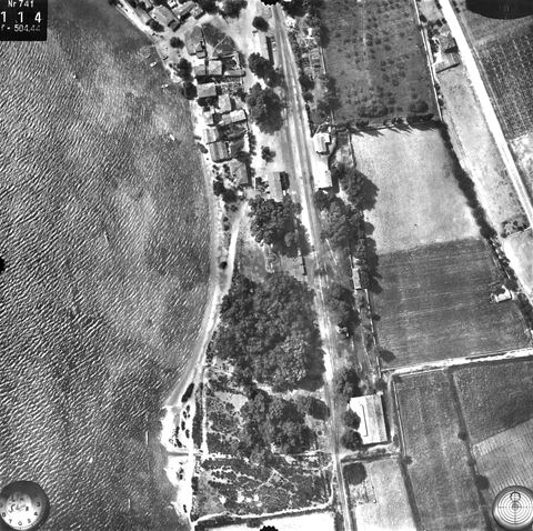
13 juli 1941
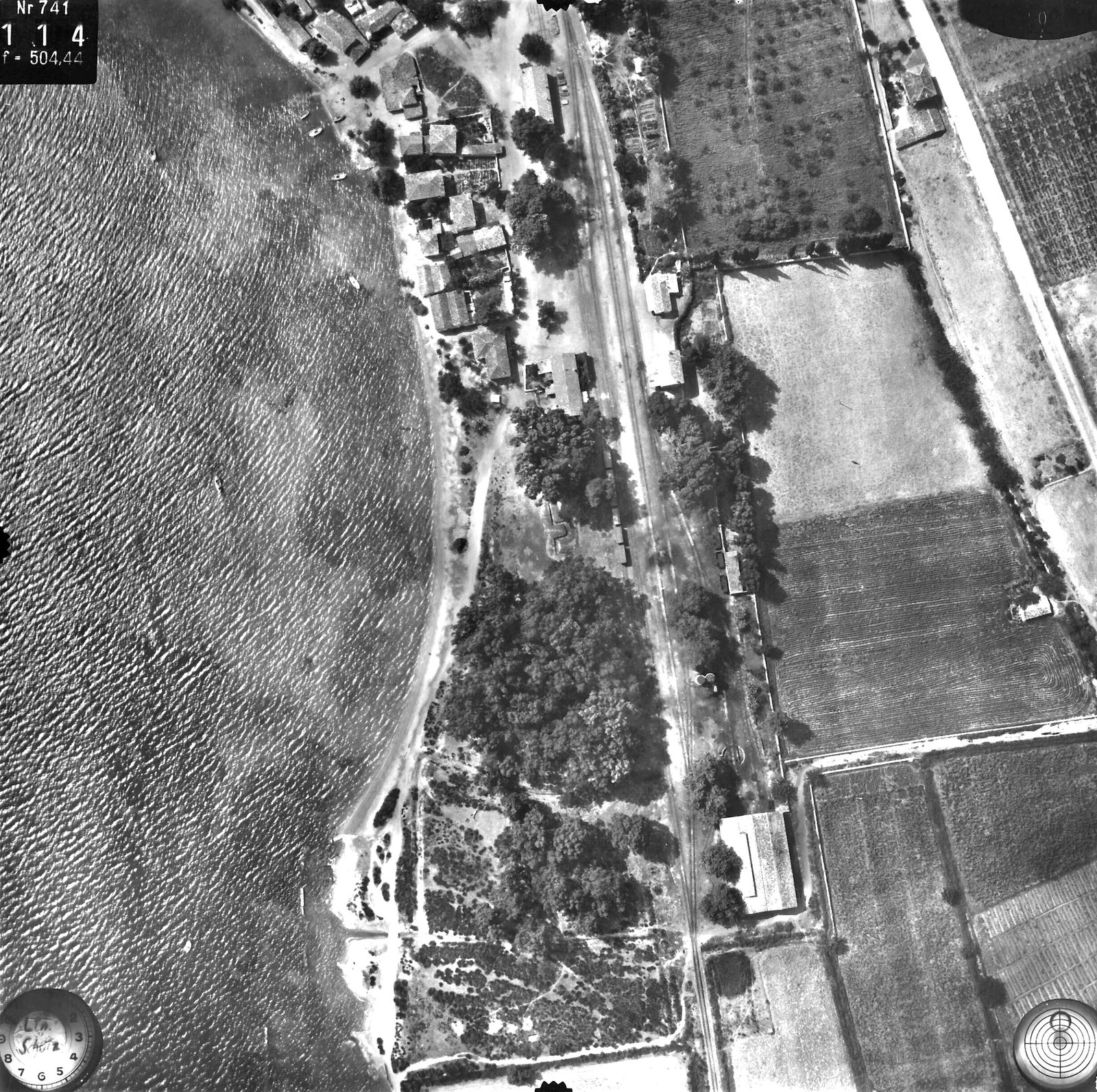
Vertical aerial photo (c. 1000 m) of the Myloi station yard: tracks, buildings on both sides, eucalyptus wood and the large engine shed.
Bron: Reichsluftfahrtministerium (Sonderluftbildabteilung); DAI Athens Archive
-
Vergroten:
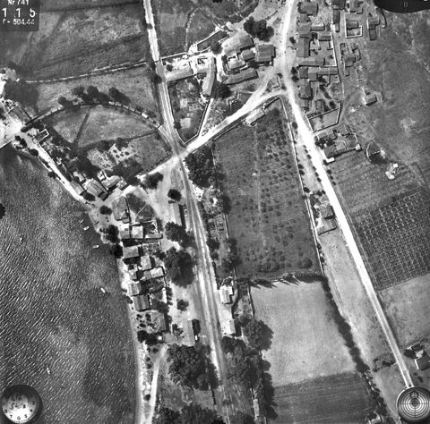
13 juli 1941
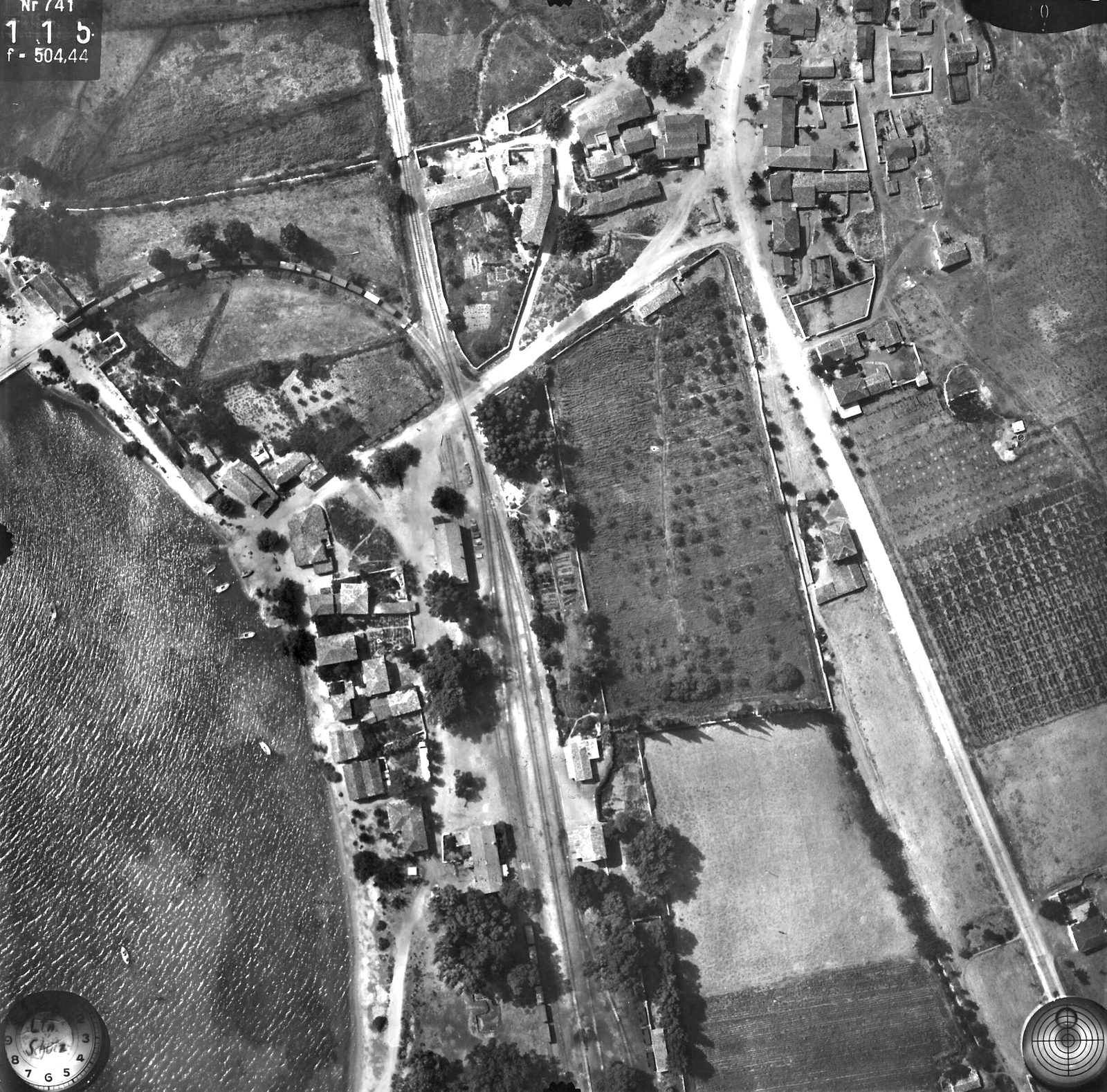
Vertical aerial photo of Myloi station, the village, the road crossing and the curved siding to the pier with a long goods train.
Bron: Reichsluftfahrtministerium (Sonderluftbildabteilung); DAI Athens Archive
-
Vergroten:
13 juli 1941
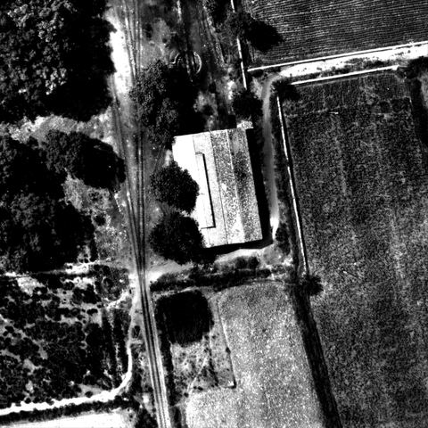
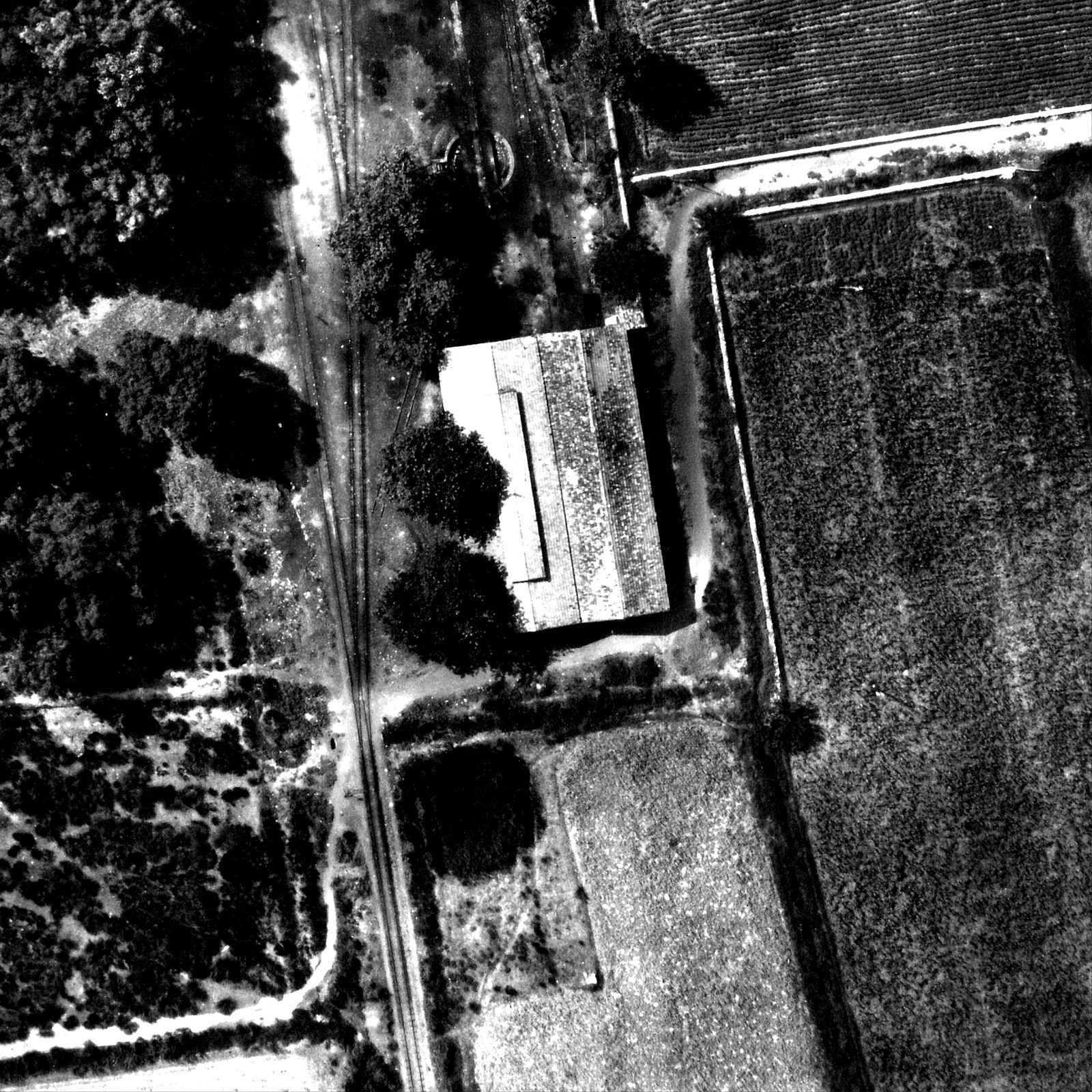
Full-resolution crop of the 1941 aerial photo showing the double locomotive shed: two parallel tiled gabled roofs, one with a long roof lantern, tracks entering from the turntable side.
Bron: Reichsluftfahrtministerium (Sonderluftbildabteilung); DAI Athens Archive
-
Vergroten:
13 juli 1941
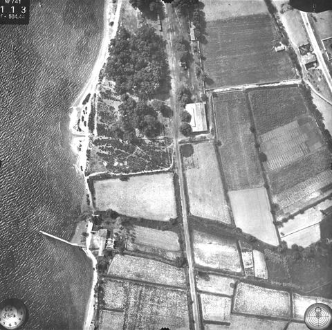
Vertical aerial photo: railway line with eucalyptus wood, a large building beside the track and the pier.
Bron: Reichsluftfahrtministerium (Sonderluftbildabteilung); DAI Athens Archive
-
Vergroten:
13 juli 1941
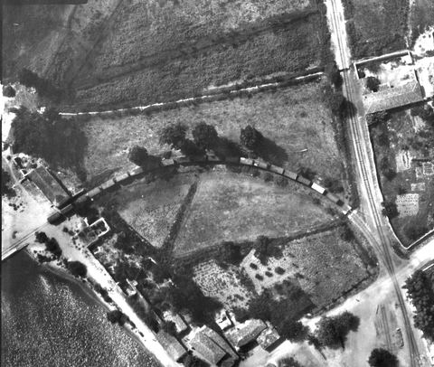
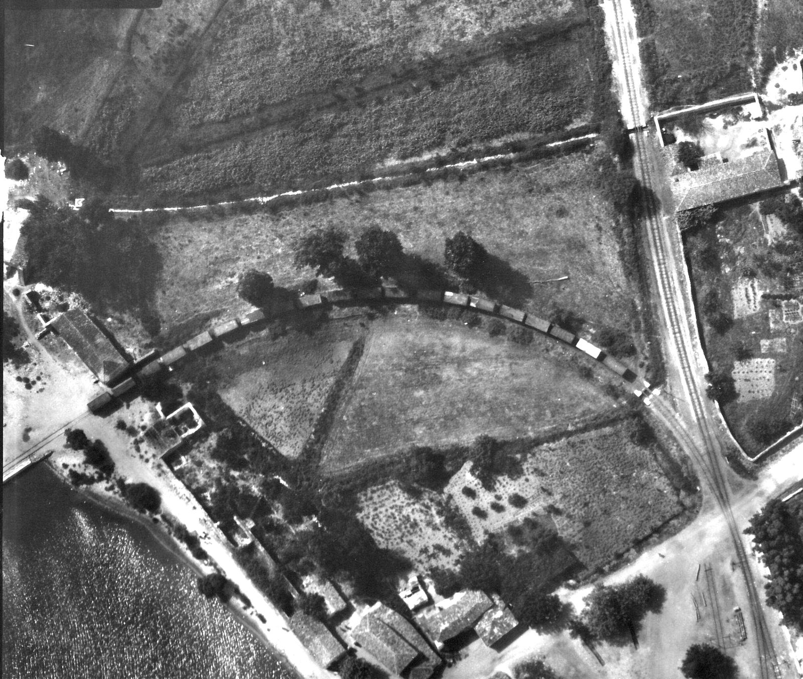
Crop of the 1941 aerial photo: a goods train of about 25 wagons on the curved siding from the main line to the pier, a level crossing, village houses and the start of the pier.
Bron: Reichsluftfahrtministerium (Sonderluftbildabteilung); DAI Athens Archive
-
Vergroten:
13 juli 1941
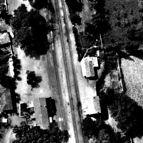
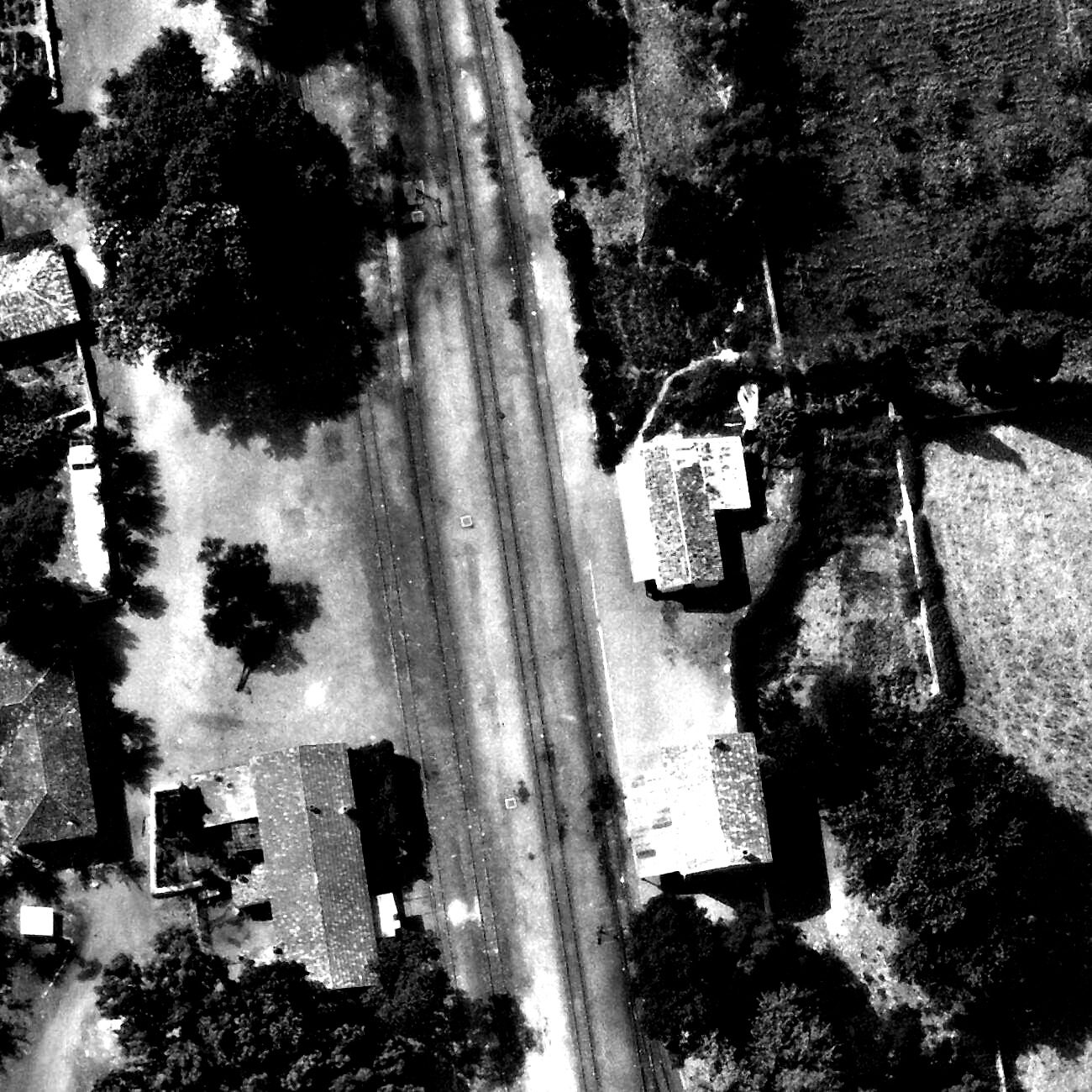
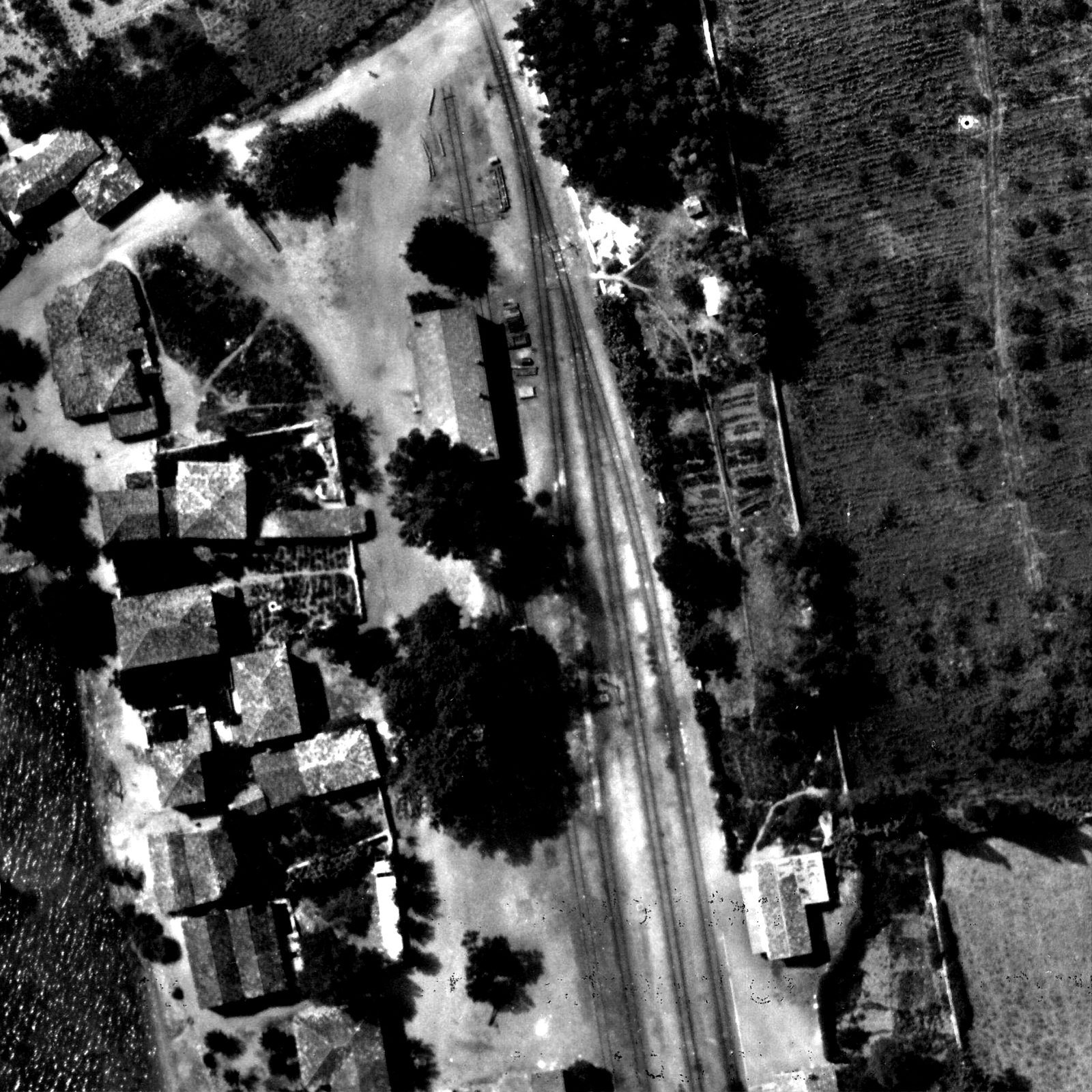
Full-resolution detail of the 1941 aerial photo: platform and tracks with two detached tiled houses on one side and a long tiled building with walled courtyard and a small white building on the other.
Bron: Reichsluftfahrtministerium (Sonderluftbildabteilung); DAI Athens Archive
-
Vergroten:
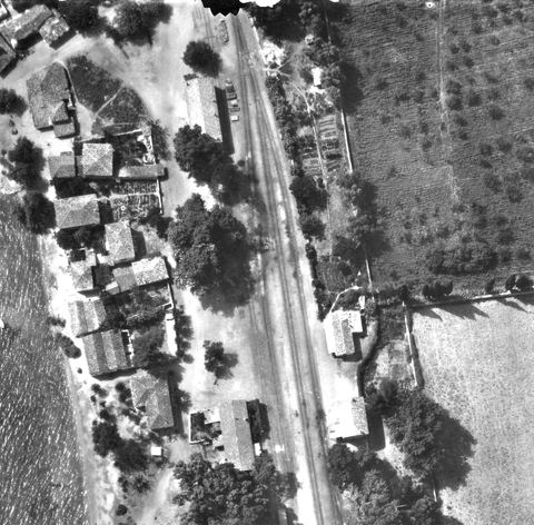
13 juli 1941
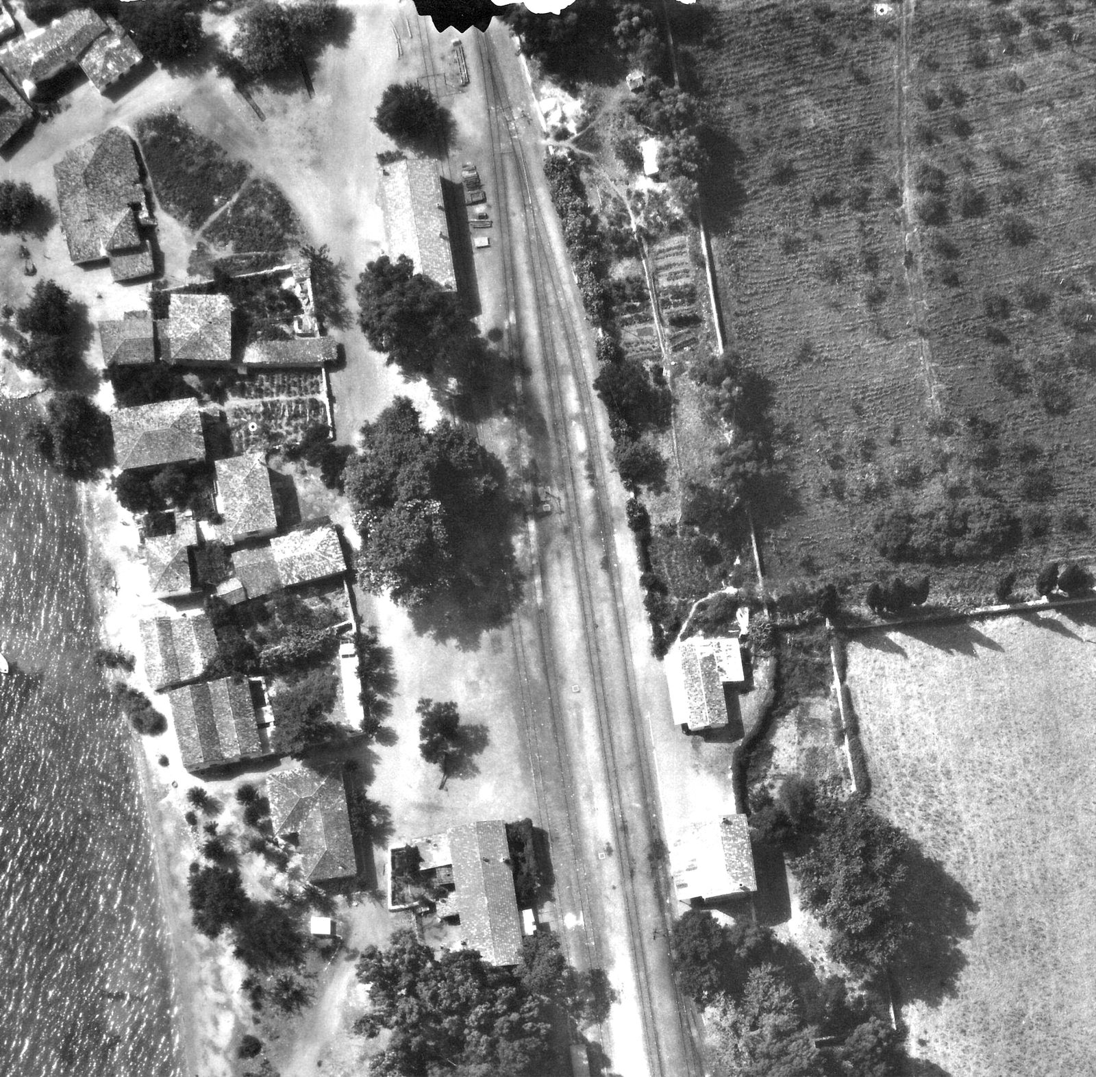
Crop of the 1941 aerial photo of the station core: double track and sidings, a long gabled building by the track with wagons (probably the goods shed), detached tiled buildings opposite, and village houses along the beach.
Bron: Reichsluftfahrtministerium (Sonderluftbildabteilung); DAI Athens Archive
-
Vergroten:
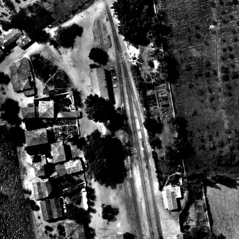
13 juli 1941
Crop of the 1941 aerial photo showing the station grounds with the shed.
Bron: Reichsluftfahrtministerium (Sonderluftbildabteilung); DAI Athens Archive
-
Vergroten:
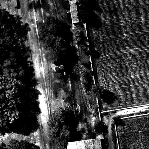
13 juli 1941
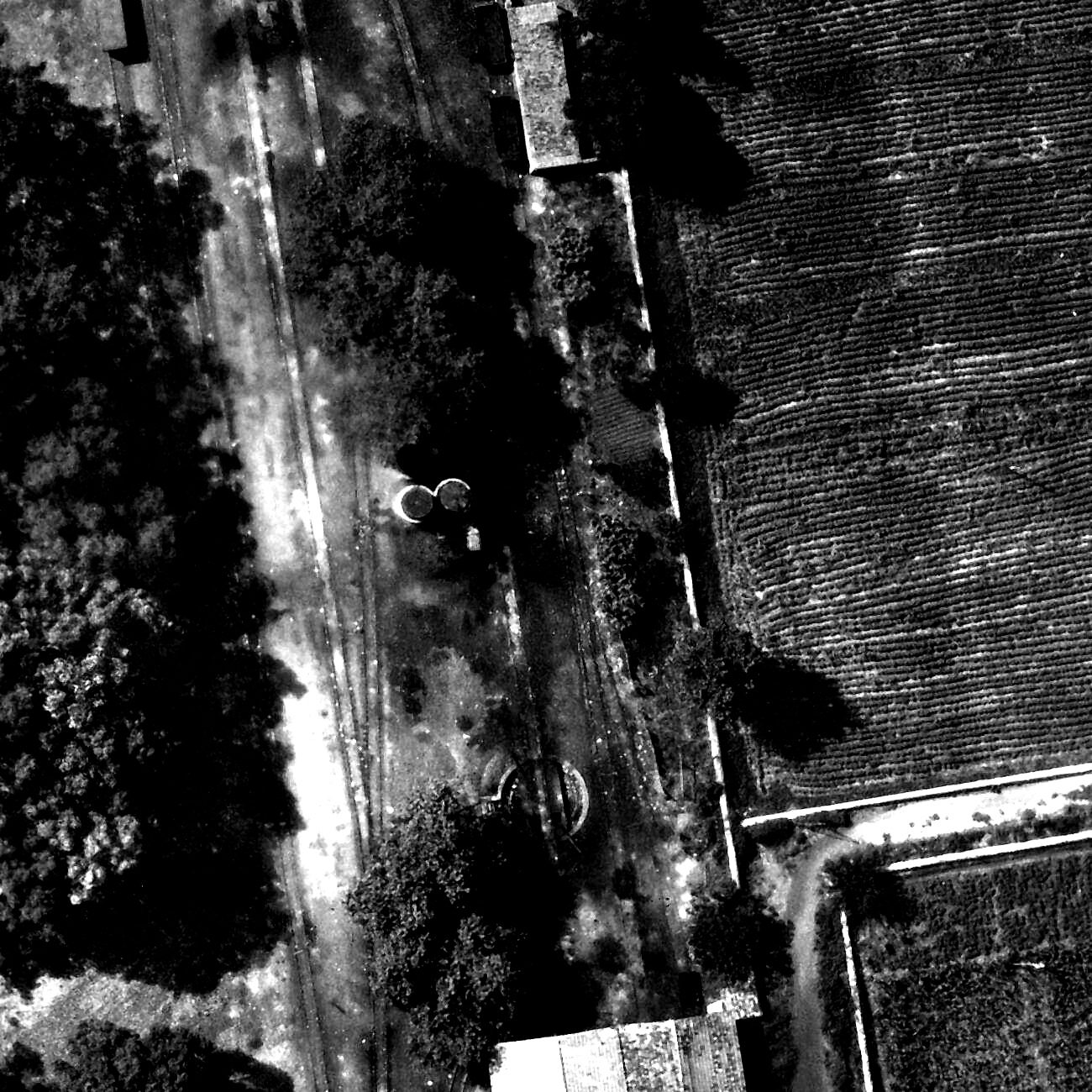
Full-resolution detail of the 1941 aerial photo: two round water reservoirs between the tracks, a turntable in front of the locomotive shed, a small building with wagons and a long boundary wall.
Bron: Reichsluftfahrtministerium (Sonderluftbildabteilung); DAI Athens Archive
-
Vergroten:
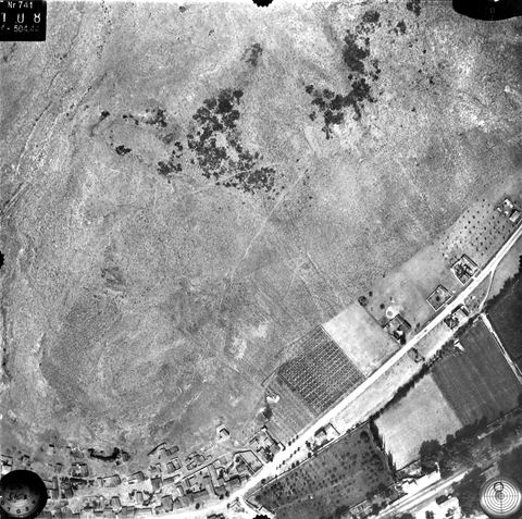
13 juli 1941
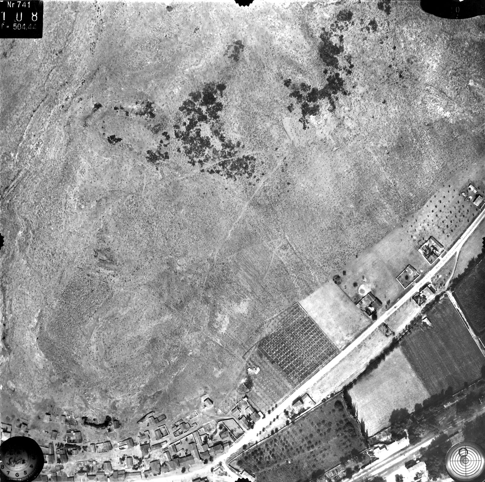
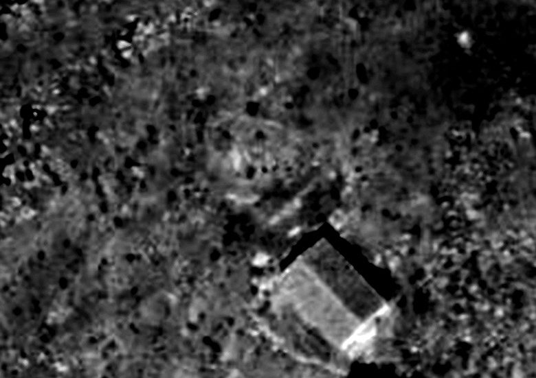
Vertical aerial photo of the slopes of Pontinos hill with the road and railway and buildings at the northern edge of Myloi.
Bron: Reichsluftfahrtministerium (Sonderluftbildabteilung); DAI Athens archive, LB-RLM-EB-5-11-001
-
Vergroten:
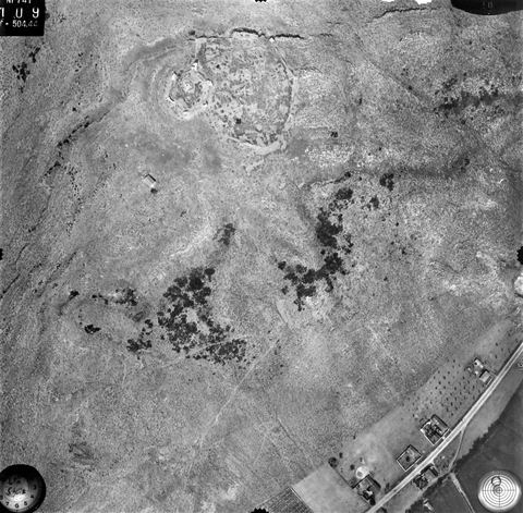
13 juli 1941
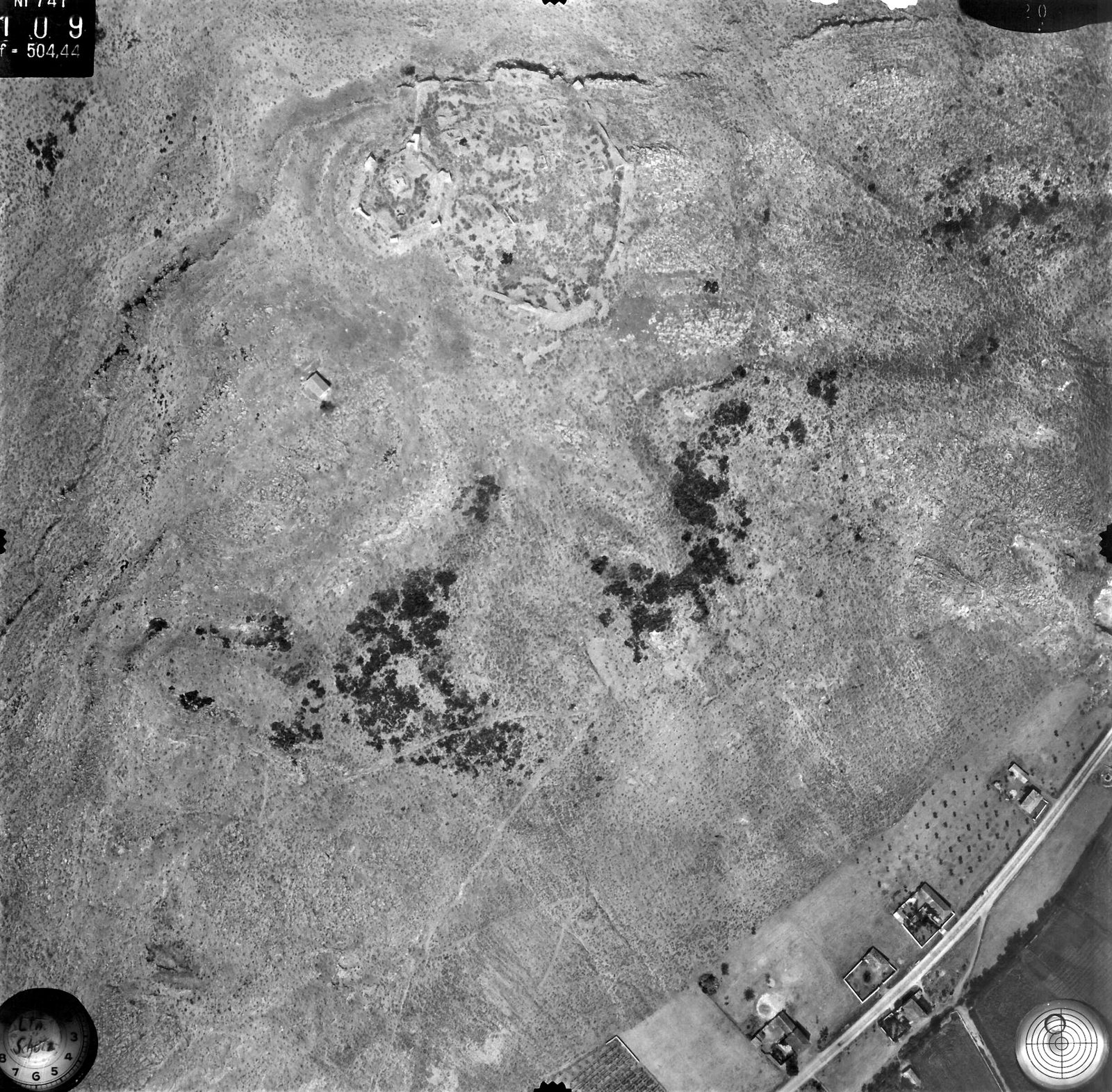
Vertical aerial photo of the summit of Pontinos with the Frankish castle ("Burg der Franken").
Bron: Reichsluftfahrtministerium (Sonderluftbildabteilung); DAI Athens archive, LB-RLM-EB-5-11-004
-
Vergroten:
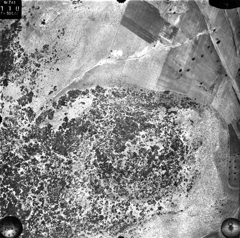
13 juli 1941
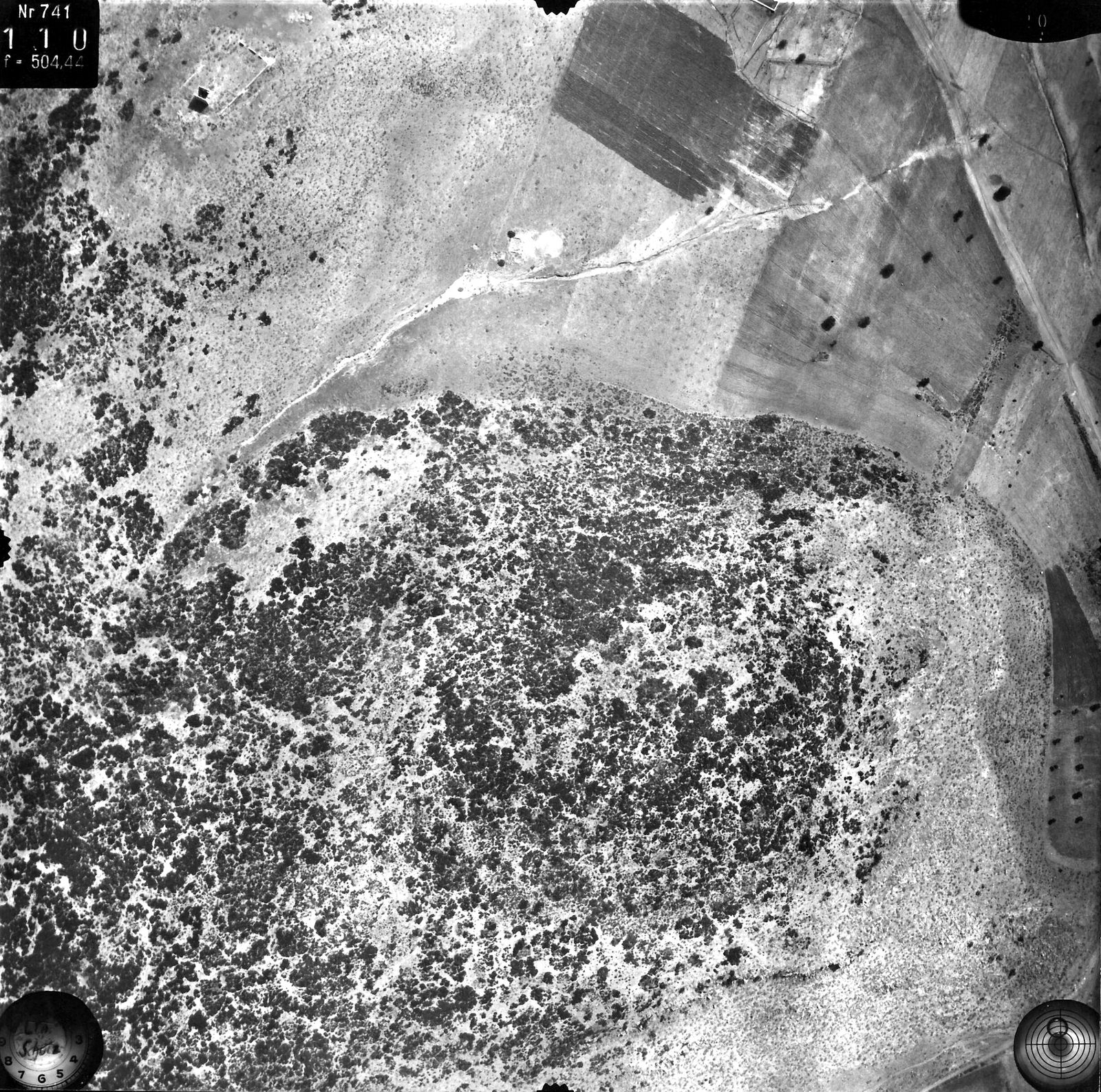
Vertical aerial photo of a scrub-covered hill and fields, annotated "Turm" (tower), south of Myloi.
Bron: Reichsluftfahrtministerium (Sonderluftbildabteilung); DAI Athens archive, LB-RLM-EB-5-11-005
-
Vergroten:
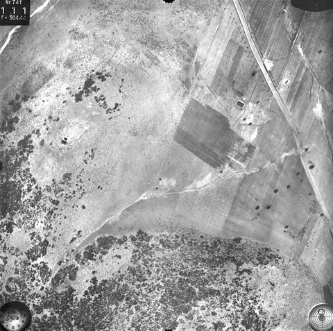
13 juli 1941
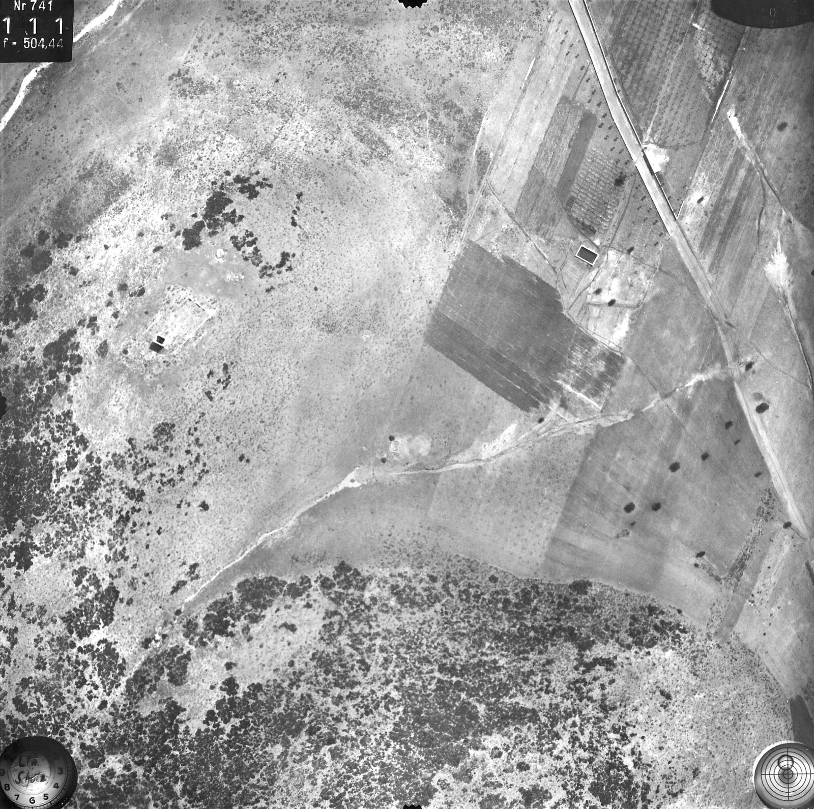
Vertical aerial photo of fields, road and hillside annotated "Turm" (tower).
Bron: Reichsluftfahrtministerium (Sonderluftbildabteilung); DAI Athens archive, LB-RLM-EB-5-11-007
-
Vergroten:
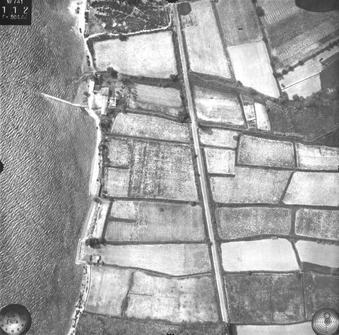
13 juli 1941
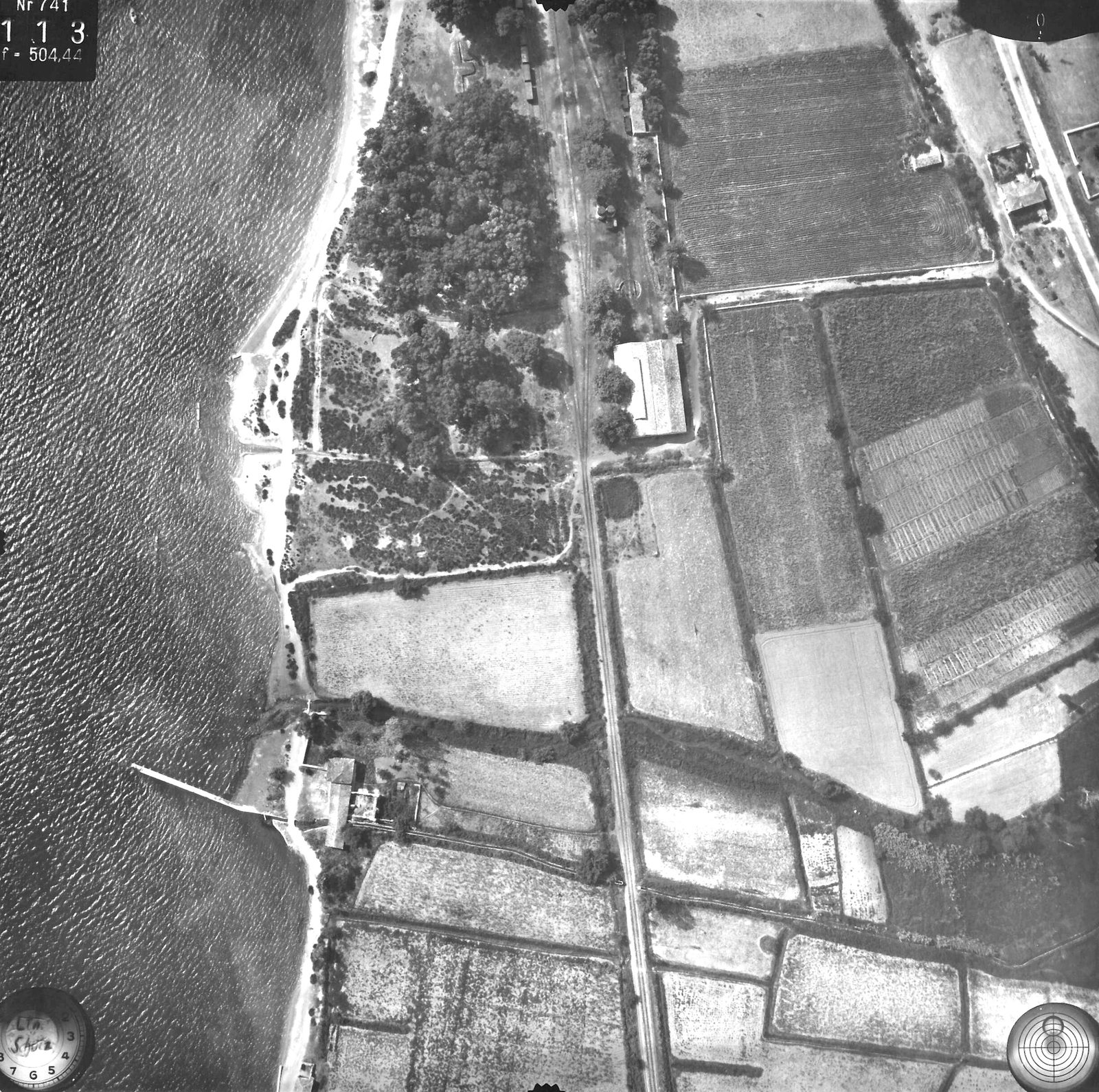
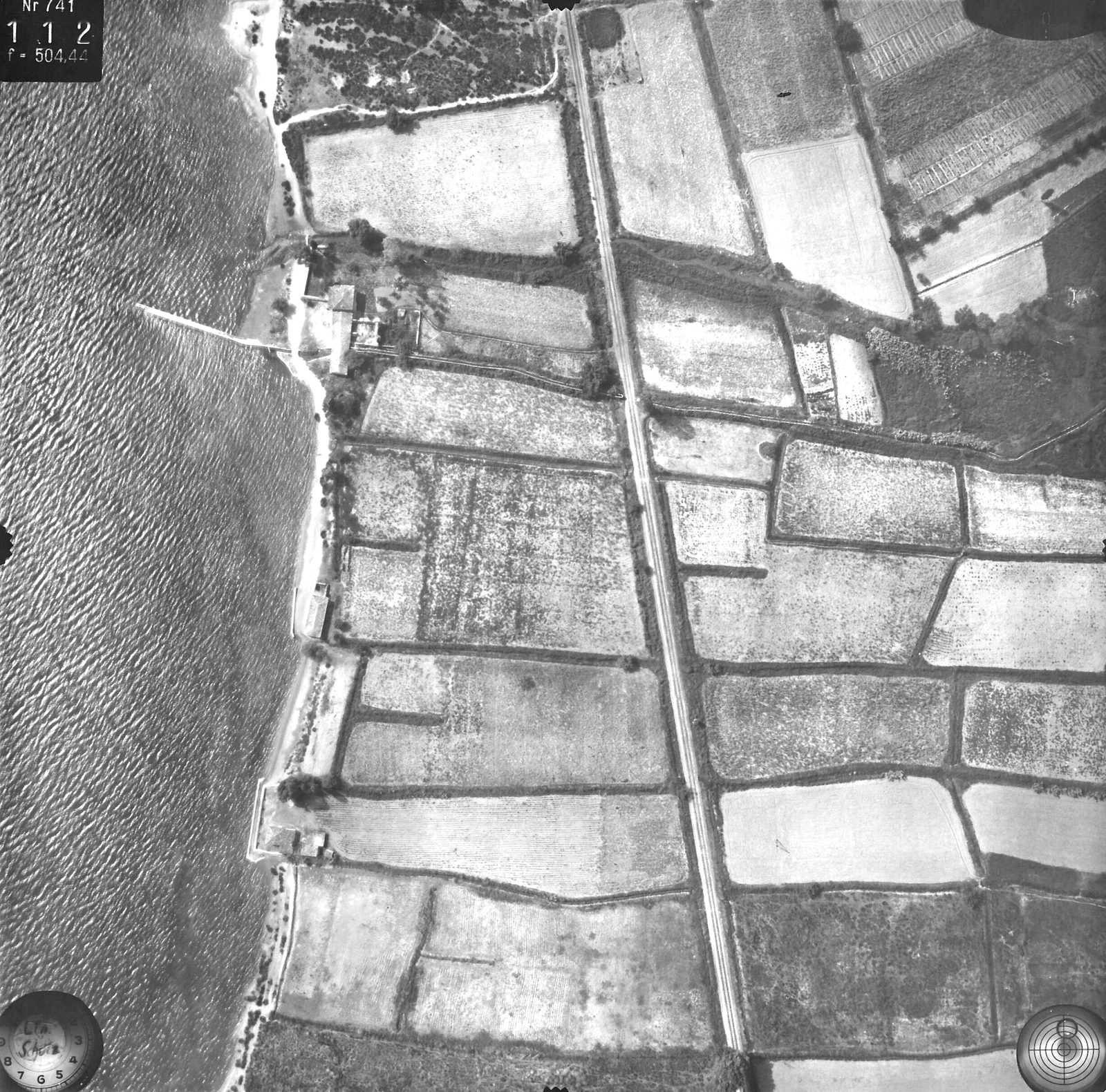
Vertical aerial photo (exposure 112) of the coast at Myloi with the long jetty, fields, road and railway.
Bron: Reichsluftfahrtministerium (Sonderluftbildabteilung); DAI Athens archive, LB-RLM-EB-5-11-010
-
Vergroten:
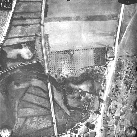
13 juli 1941
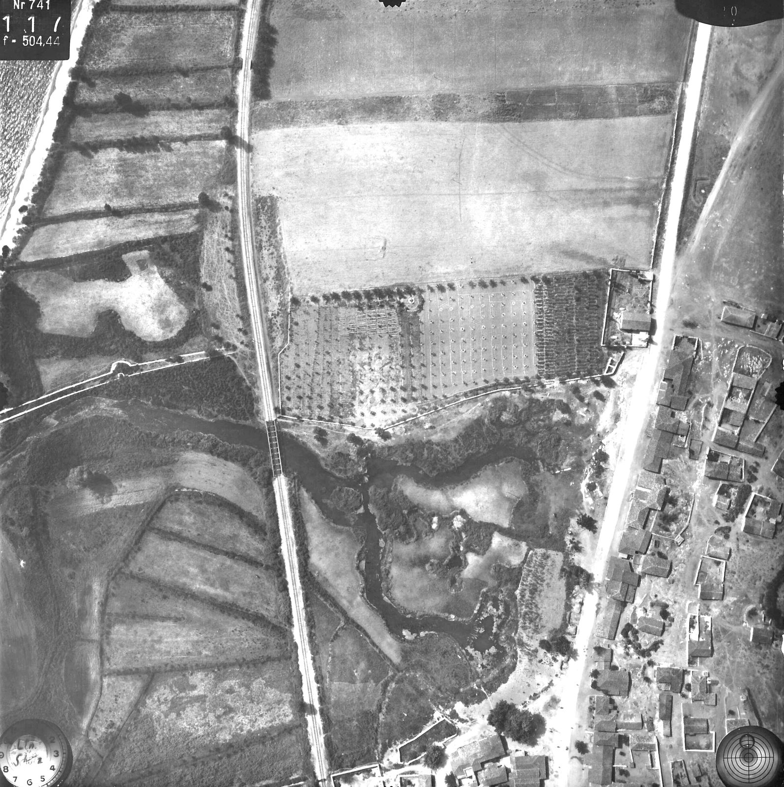
Vertical aerial photo annotated "Lerna": fields, orchards, the spring area and houses along the road.
Bron: Reichsluftfahrtministerium (Sonderluftbildabteilung); DAI Athens archive, LB-RLM-EB-5-11-019
-
Vergroten:
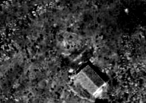
13 juli 1941
Crop of a 1941 vertical aerial photo showing the small gabled Profitis Ilias chapel next to the castle on Pontinos.
Bron: Reichsluftfahrtministerium; DAI Athens archive, LB-RLM-EB-5-11-003
-
Vergroten:
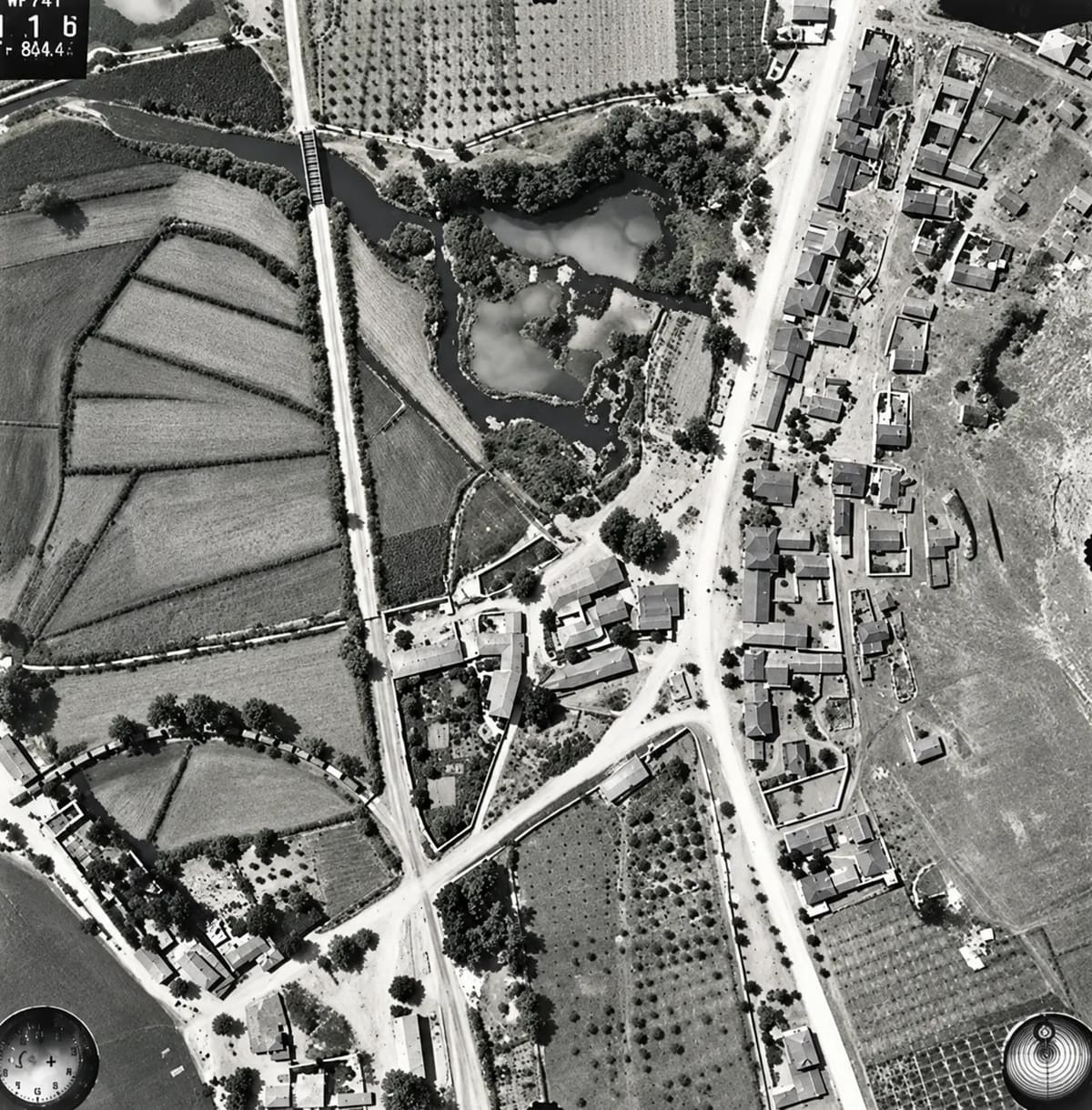
13 juli 1941
Luchtfoto van Myloi van 13 juli 1941: dorp, velden en kust gezien vanaf ongeveer 1.000 meter (digitaal opgeknapt)
Bron: © D-DAI-ATH-Archiv, LB-RLM-EB-5-11-017, courtesy of the German Archaeological Institute, Athens
-
Vergroten:
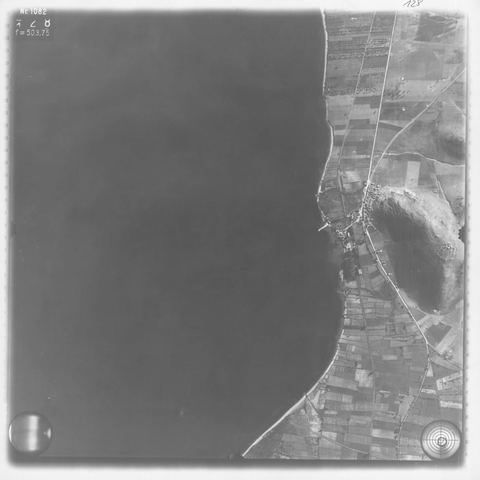
1941–1942
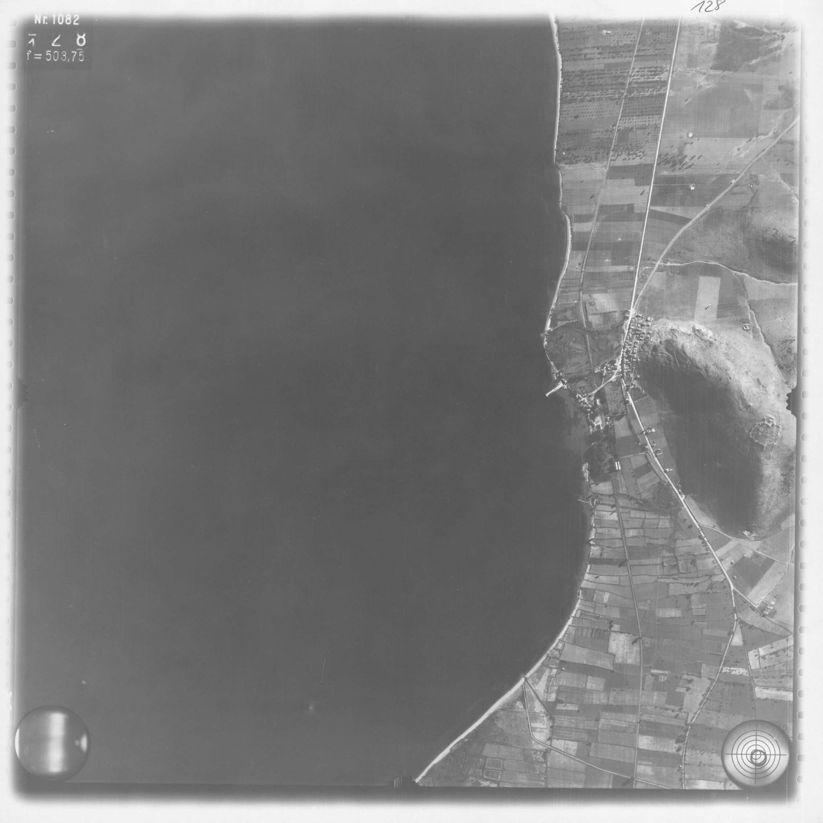
Strip-flight aerial photo (Aufnahme 042): Myloi village at the foot of Mt Pontinos, the long pier, the coastal railway, the station grounds and a shed with two parallel roofs among eucalyptus trees.
Bron: Reichsluftfahrtministerium (Sonderluftbildabteilung); DAI Athens Archive
-
Vergroten:
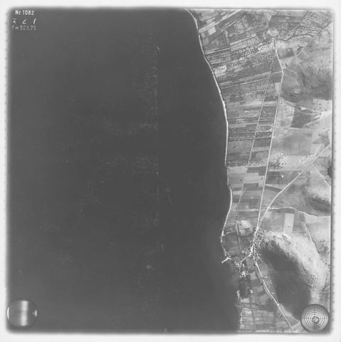
1941–1942
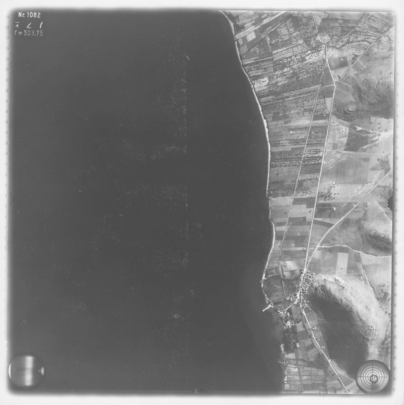
Strip-flight aerial photo (Aufnahme 043): Myloi with the pier and Mt Pontinos at lower right, and the railway and road running north towards Nea Kios/Argos.
Bron: Reichsluftfahrtministerium (Sonderluftbildabteilung); DAI Athens Archive
-
Vergroten:
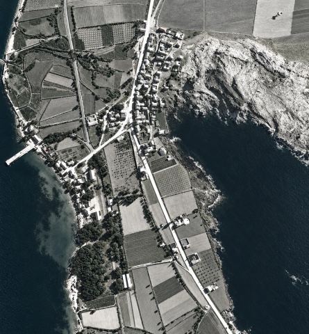
1941–1942
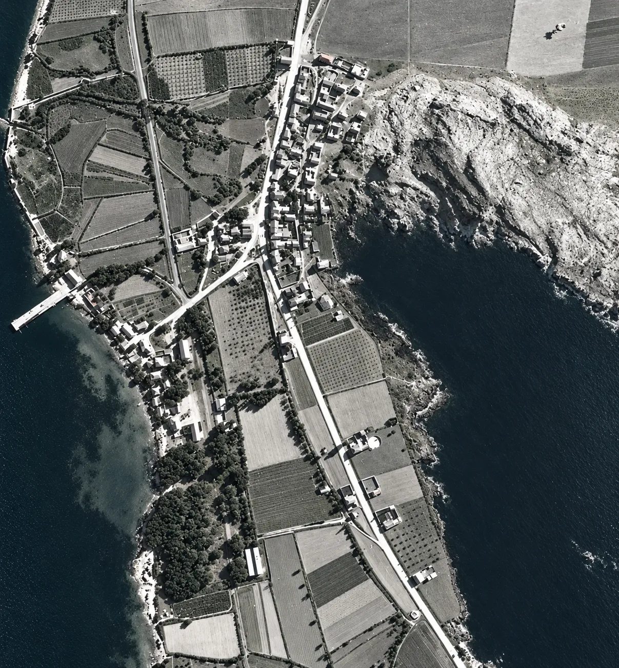
Myloi from a German reconnaissance flight: the village along the main road, the pier, the station, the orchards and the rocks of Pontinos.
Bron: Reichsluftfahrtministerium (Sonderluftbildabteilung); DAI Athens Archive · digitaal opgeknapt
-
Vergroten:
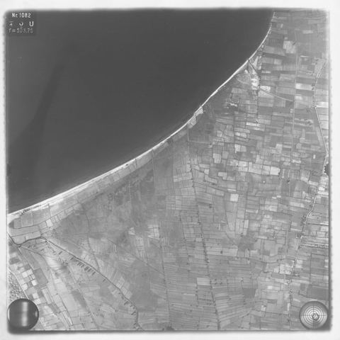
1941–1942
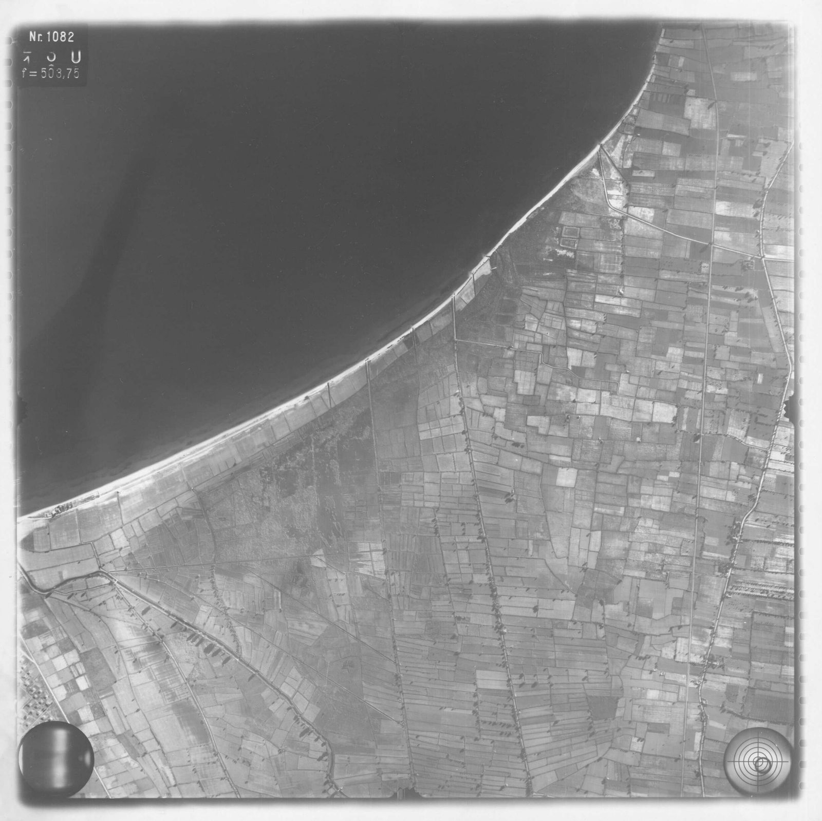
Strip-flight aerial photo of the coastal plain and shore at the head of the Argolic Gulf near Myloi.
Bron: Reichsluftfahrtministerium; DAI Athens archive, LB-RLM-SF-3-05-040
-
Vergroten:
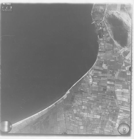
1941–1942
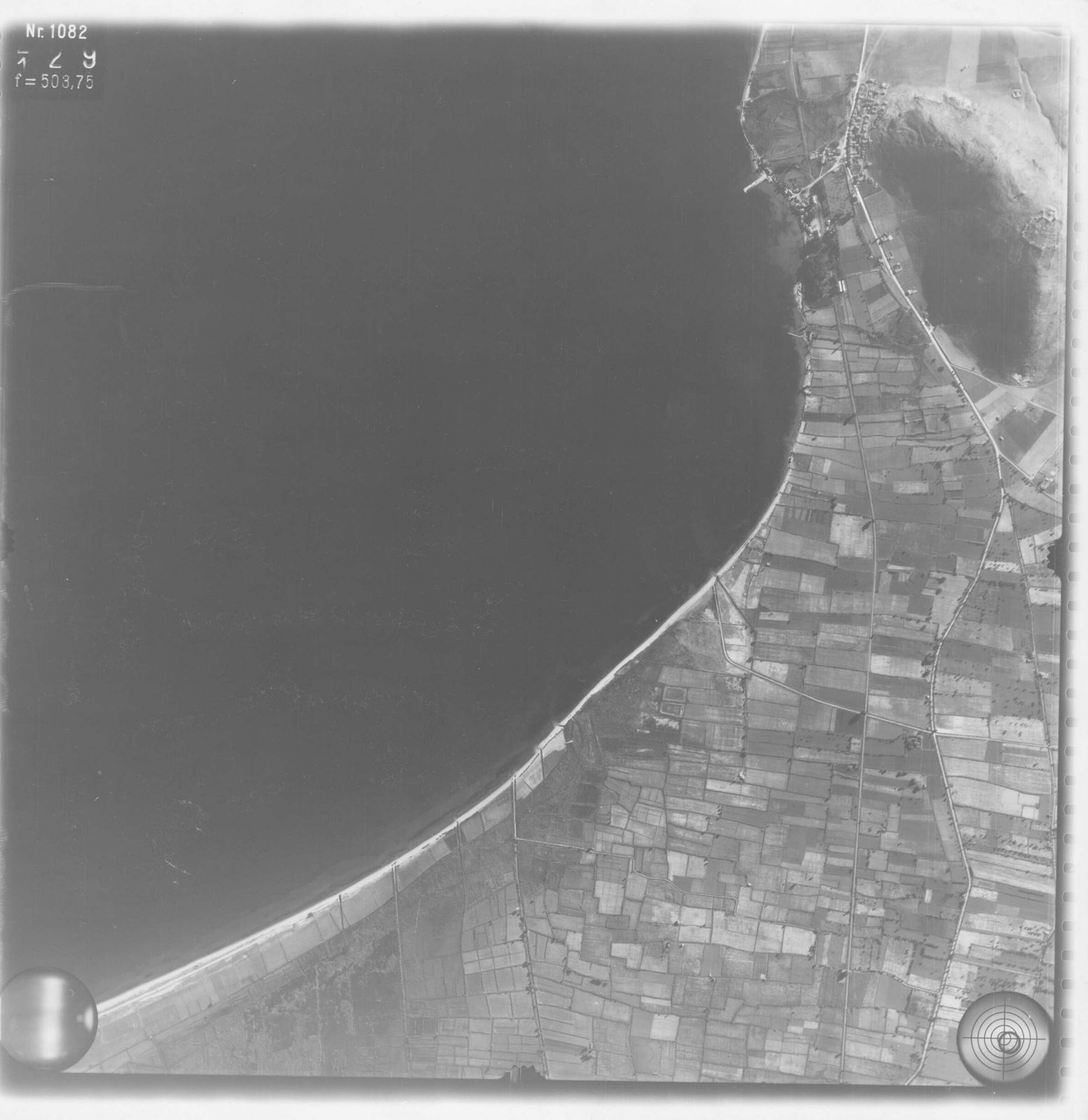
Strip-flight aerial photo of the coast and plain annotated "Myli", with the village at the edge of the frame.
Bron: Reichsluftfahrtministerium; DAI Athens archive, LB-RLM-SF-3-05-041
-
Vergroten:
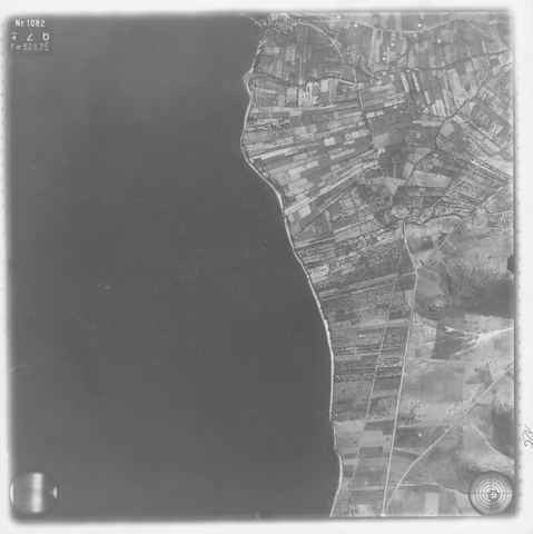
1941–1942
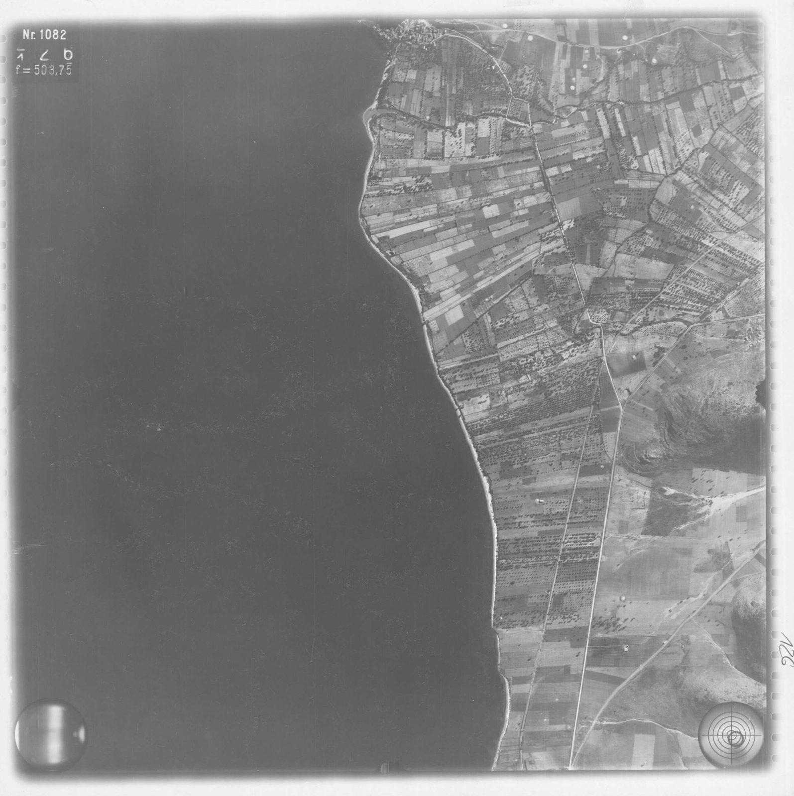
Strip-flight aerial photo of the narrow coastal plain south of Myloi towards Kiveri, with fields and a road.
Bron: Reichsluftfahrtministerium; DAI Athens, Film 93 exposure 044
-
Vergroten:
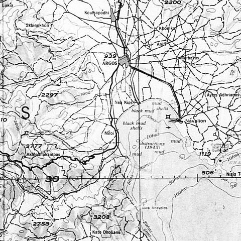
1940–1945
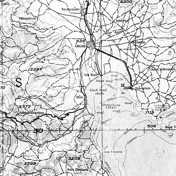
Detail of the base map (USAF 343 CI, 1:250,000) used for the aerial-photo overlay index, showing 'Mili', Argos and Navplion.
Bron: US National Archives (NARA), Record Group 373
-
Vergroten:
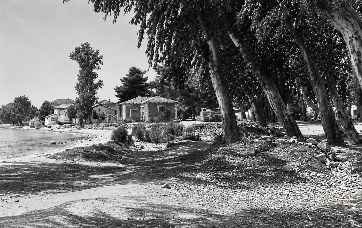
mei 1945
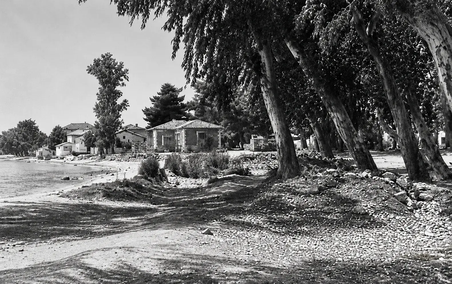
Hoge eucalyptusbomen aan het water in Myloi, gefotografeerd in mei 1945 (digitaal opgeknapt)
Bron: Australian War Memorial 130831, photo V. J. Krauth · public domain
-
Vergroten:
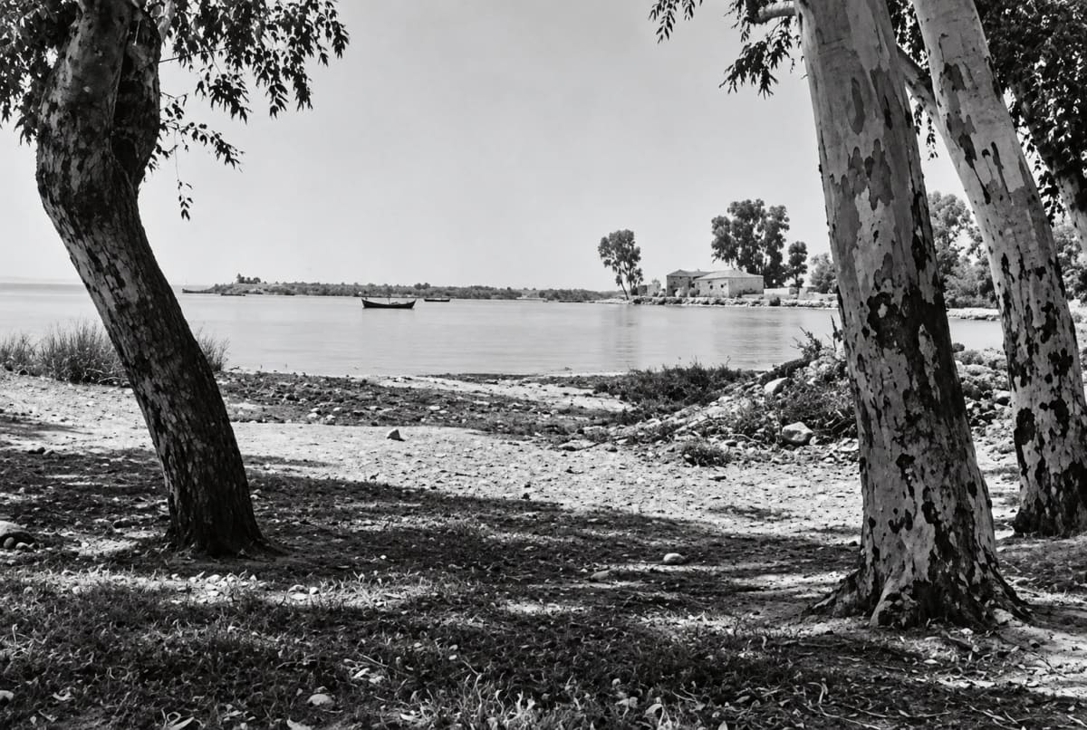
mei 1945
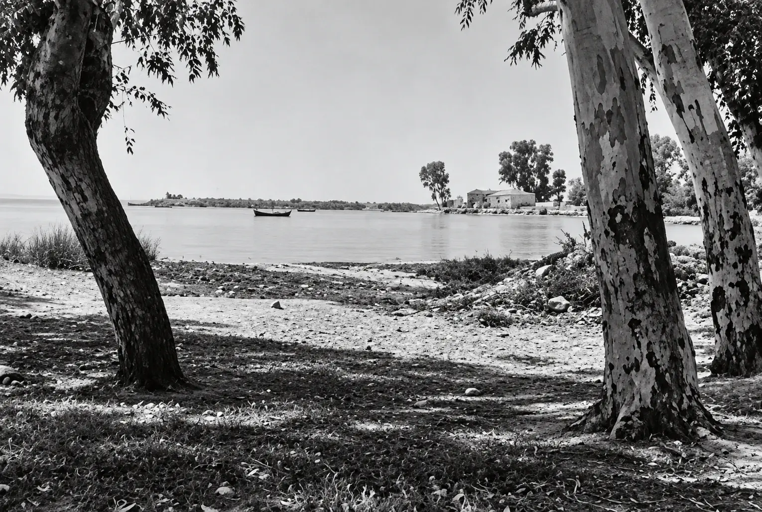
Het strand van Myloi in mei 1945: eucalyptusstammen aan de oever, de kalme baai met twee bootjes en huizen op de landtong (digitaal opgeknapt)
Bron: Australian War Memorial 130887, photo V. J. Krauth · public domain
-
Vergroten:
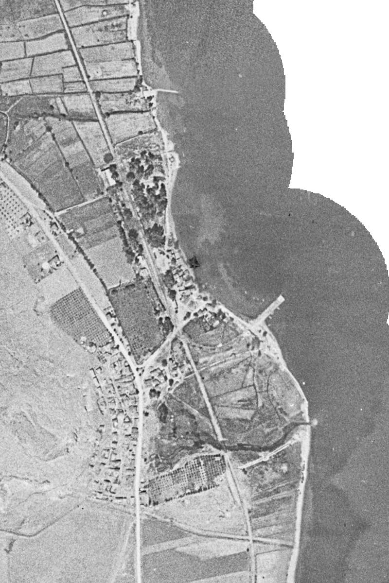
1945 of 1960
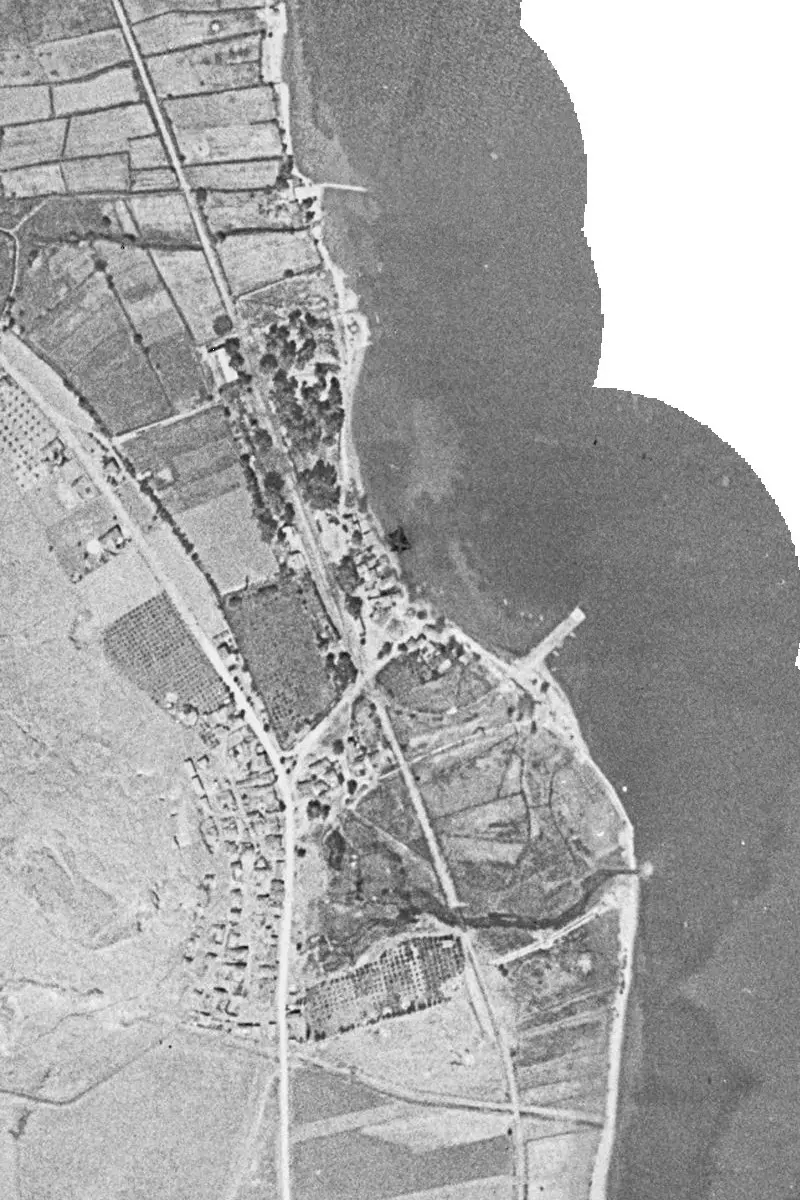
Historische orthofoto van Myloi met de pier, de spoorlijn en de boomgaarden
Bron: Hellenic Cadastre, historic orthophoto layer 1945/60
-
Vergroten:
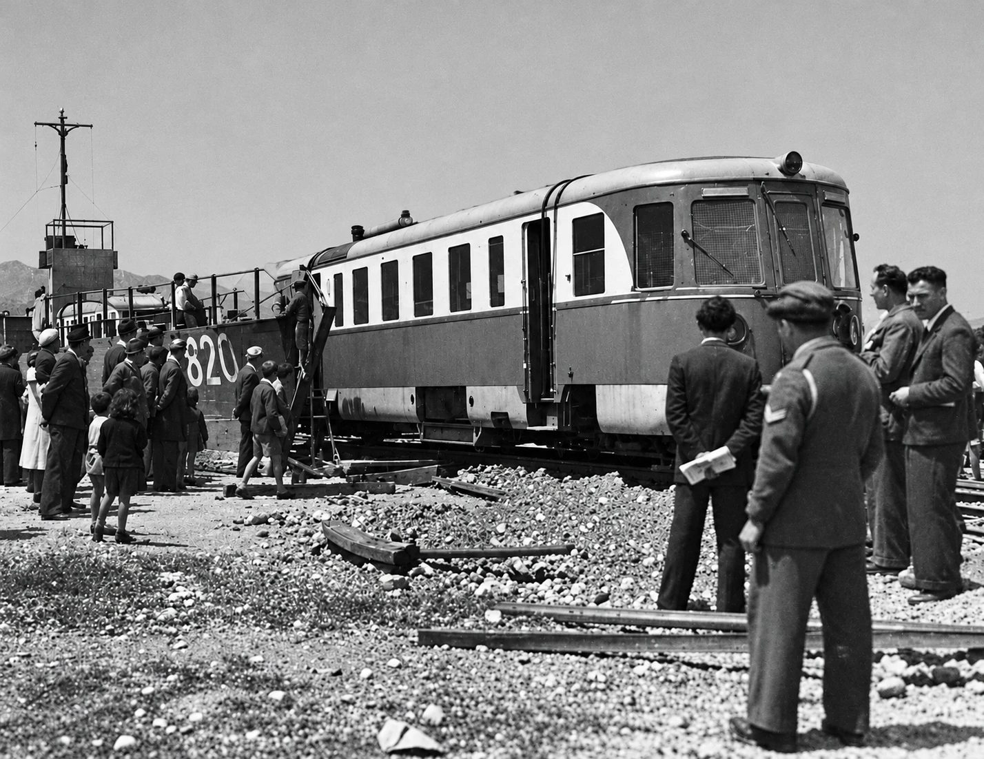
1947
Port of Myloi, 1947: an Uerdingen railcar ('motraki') disembarks from a Navy landing craft (no. 820) while another waits in its hold; crowd and men in uniform watch.
Bron: Unknown photographer; reproduced by the Ephorate of Antiquities of Argolida · digitaal opgeknapt
-
Vergroten:
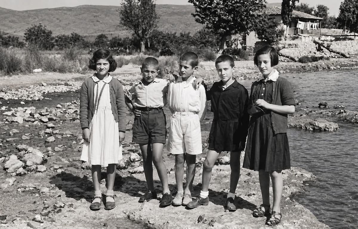
ca. 1940–1955
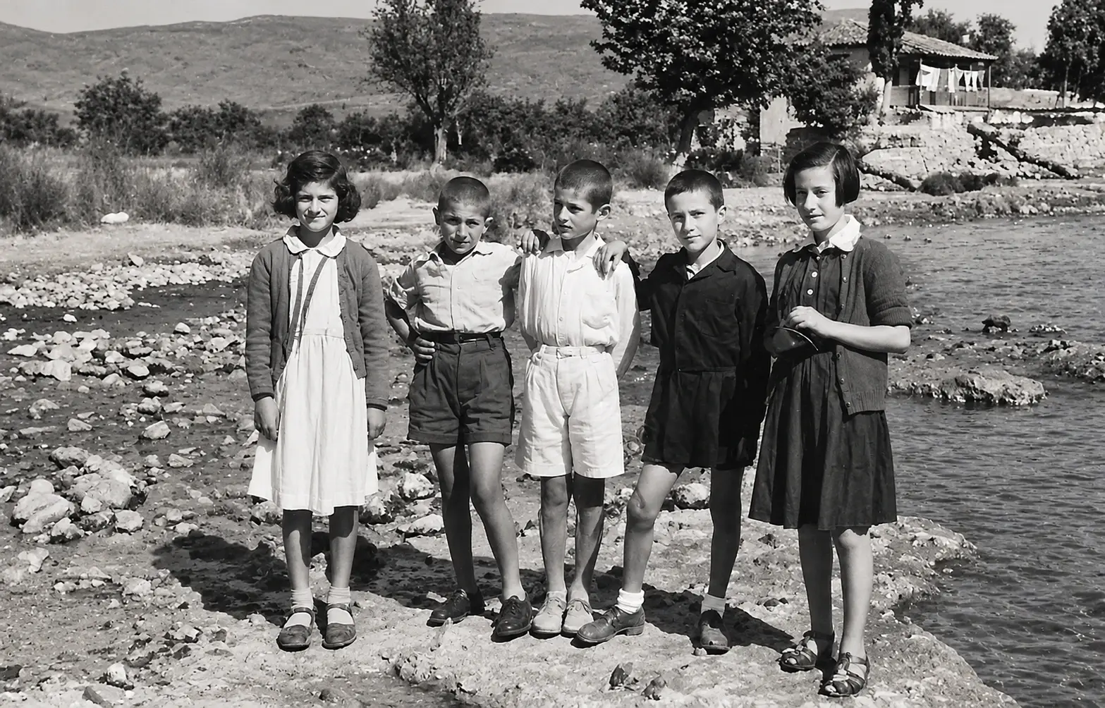
Vijf kinderen naast elkaar op de stenige oever van het water (digitaal opgeknapt)
Bron: Visit Myloi collection
-
Vergroten:
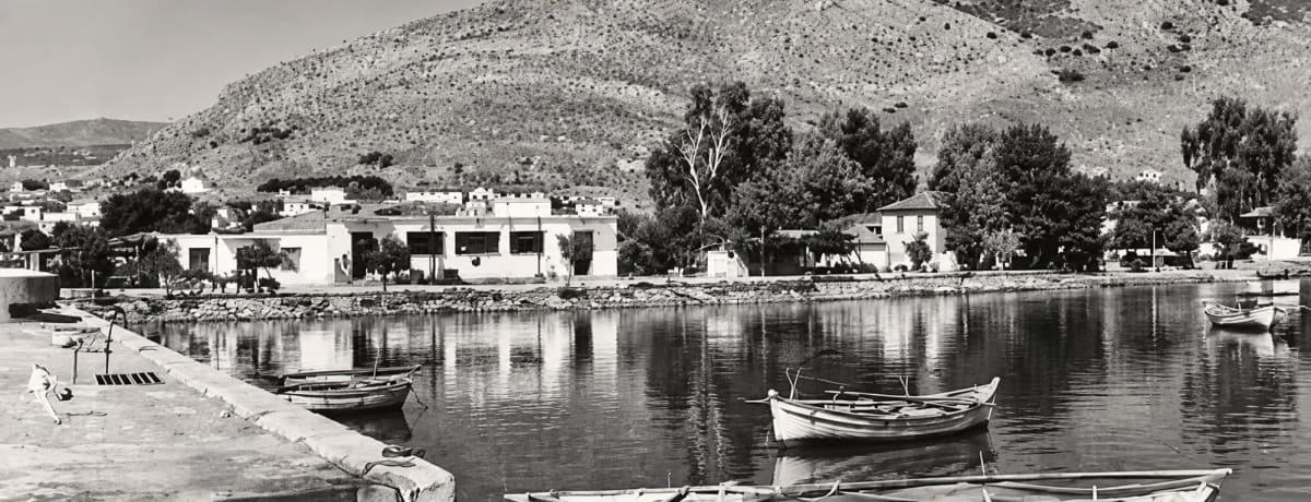
eind jaren 40
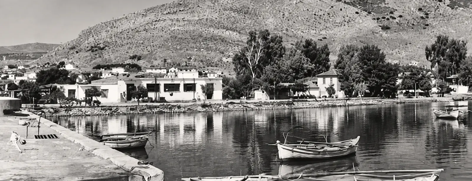
Zwart-witbeeld van de havenkade met roeiboten, witte gebouwen en de heuvel Pontinos erachter (digitaal opgeknapt)
Bron: Visit Myloi collection
-
Vergroten:
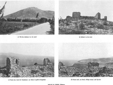
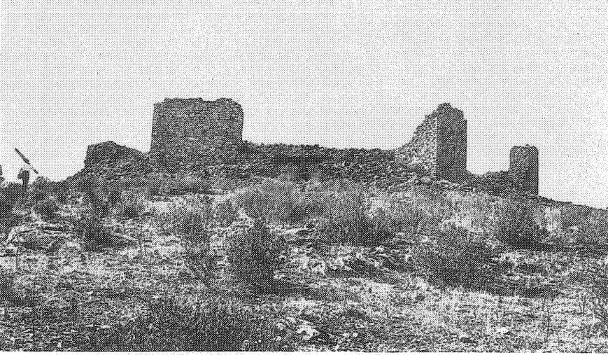
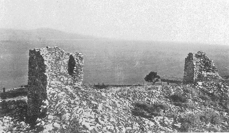
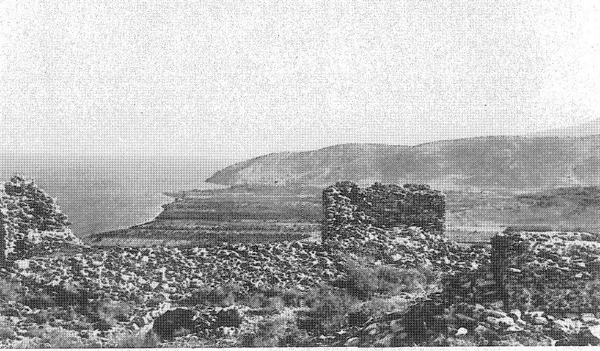
ca. 1938–1960
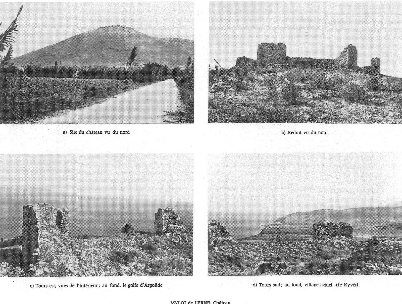
Full plate 140 'MYLOI de LERNE. Château' with four photos of the castle on Mt Pontinos.
Bron: Antoine Bon
-
Vergroten:
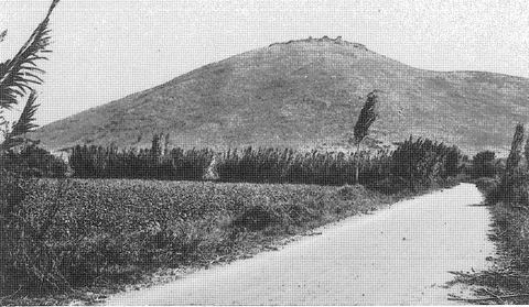
ca. 1938–1960
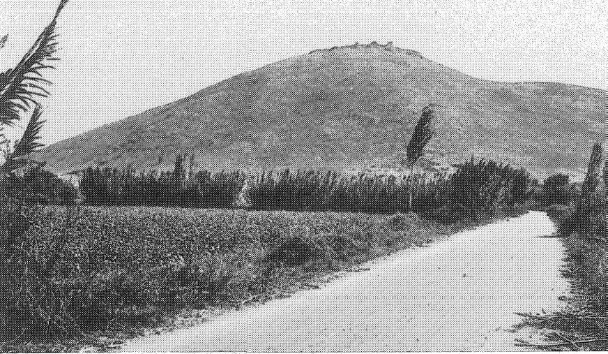
Pl. 140a 'Site du château vu du nord': Mt Pontinos with the castle seen from the north, with a dirt road, reeds and cypresses along fields at its foot.
Bron: Antoine Bon
-
Vergroten:
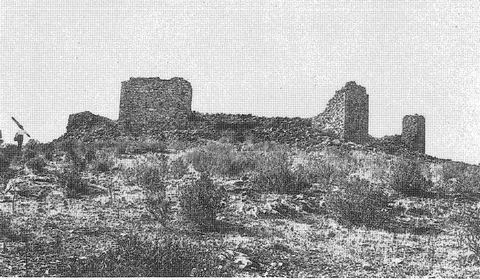
ca. 1938–1960
Pl. 140b 'Réduit vu du nord': the inner keep of the Myloi castle seen from the north.
Bron: Antoine Bon
-
Vergroten:
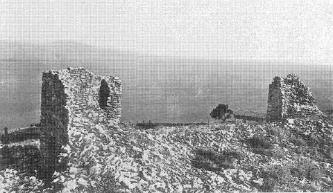
ca. 1938–1960
Pl. 140c 'Tours est, vues de l'intérieur': the east towers of the Myloi castle from inside, with the Argolic Gulf behind.
Bron: Antoine Bon
-
Vergroten:
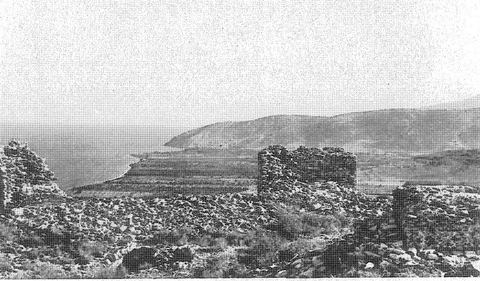
ca. 1938–1960
Pl. 140d 'Tours sud': the south towers of the Myloi castle, with the village of Kiveri in the background.
Bron: Antoine Bon
De jaren 50: de opgravingen in Lerna (106)
-
Vergroten:
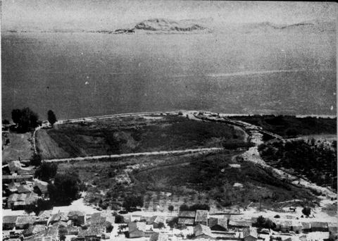
1952 (waarschijnlijk september)
View east from Mt Pontinos over the roofs of Myloi towards the springs and marshes of Lerna, the gulf and Nafplio.
Bron: J. L. Caskey excavation (photographer not named)
-
Vergroten:
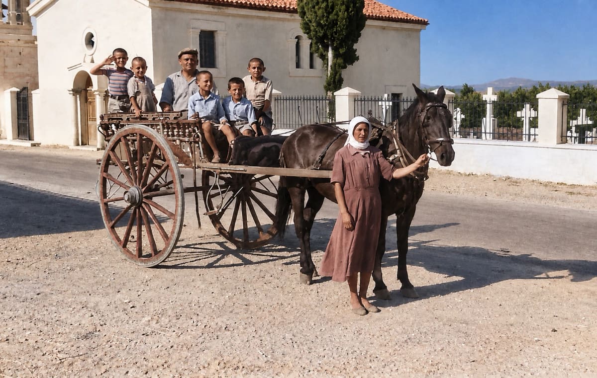
ca. 1952–1958
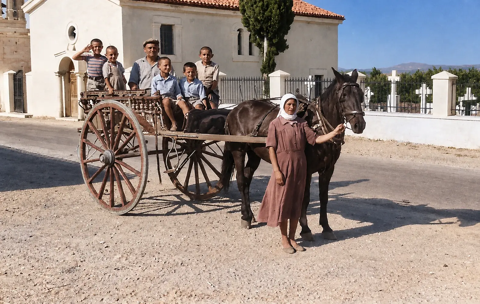
Achteraf ingekleurd: een gezin poseert met een paard-en-wagen voor de kerk van Agios Dimitrios en de ommuurde begraafplaats, in de jaren 50, toen de Amerikanen Lerna aan het opgraven waren
Bron: George Kondis
-
Vergroten:
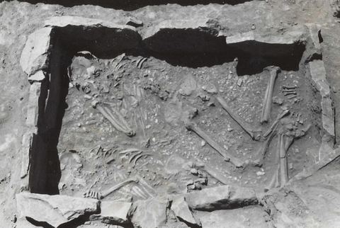
1953
Lerna excavation: cist grave in the area of House M.
Bron: Lerna excavation team (J.L. Caskey), ASCSA Lerna Excavations Archive; reproduced by the Ephorate of Antiquities of Argolida
-
Vergroten:
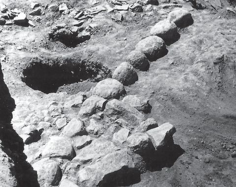
1953
Lerna excavation: part of the southern edge of the tumulus during excavation.
Bron: Lerna excavation team (J.L. Caskey), ASCSA Lerna Excavations Archive; reproduced by the Ephorate of Antiquities of Argolida
-
Vergroten:
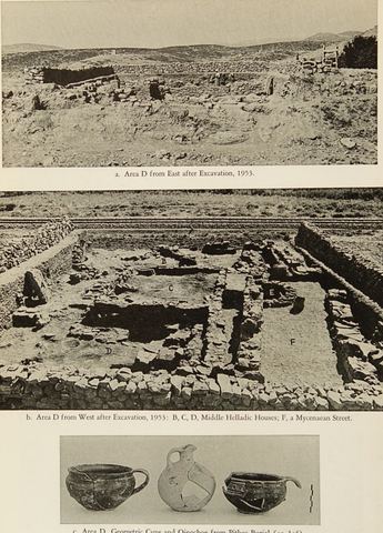
1953
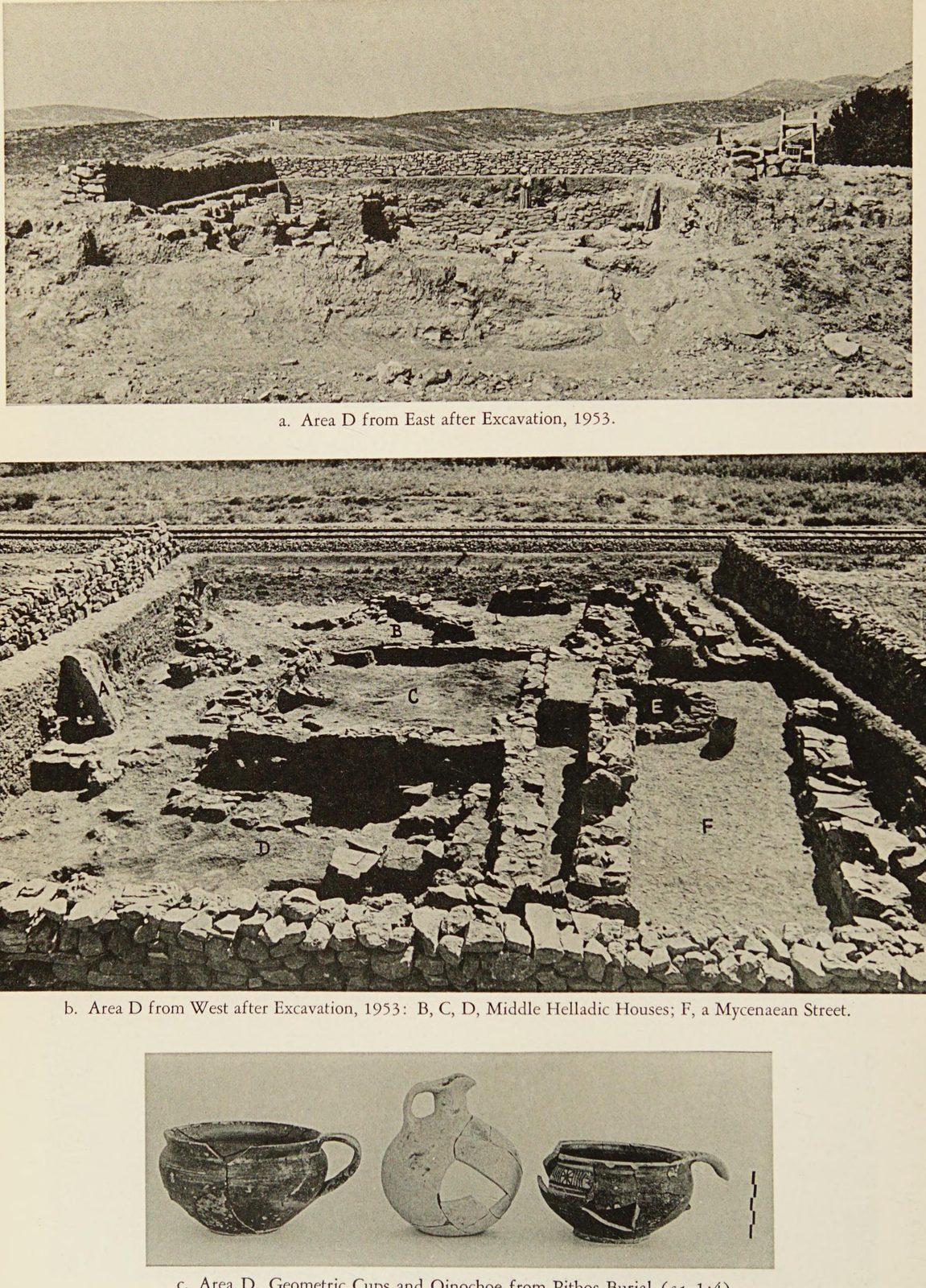
Hesperia plate showing excavation Area D at Lerna, with the Argos–Myloi railway right beside the trench, plus pottery.
Bron: J. L. Caskey / ASCSA Lerna excavation
-
Vergroten:
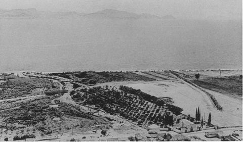
1952–1953
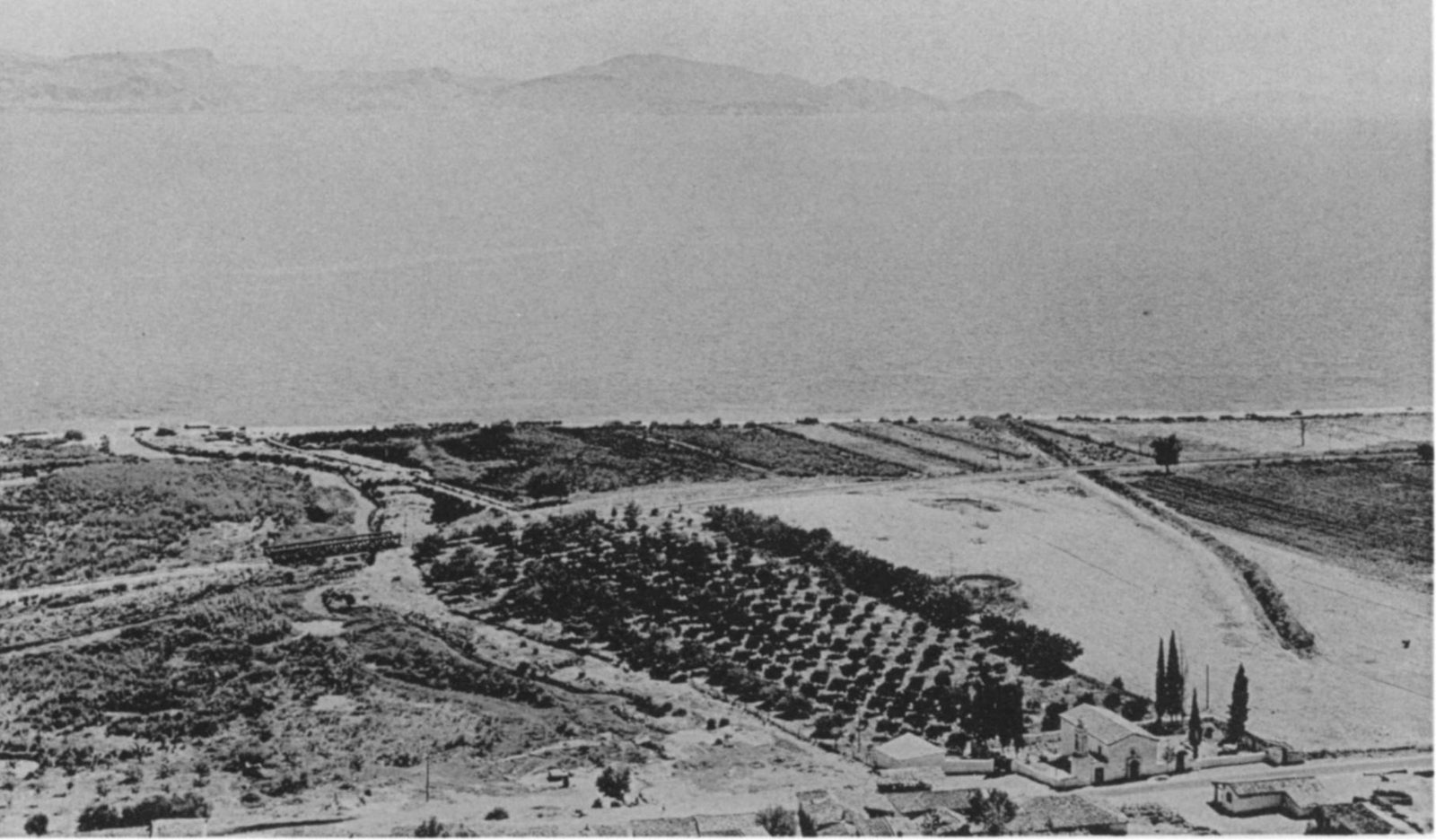
The Lernaean marshes, the Amymone stream and the excavation site seen from Mt Pontinos, with houses of Myloi, the railway and orchards.
Bron: J. L. Caskey / ASCSA Lerna excavation
-
Vergroten:
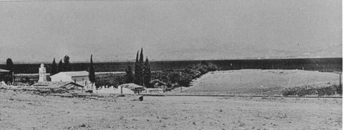
1952–1953
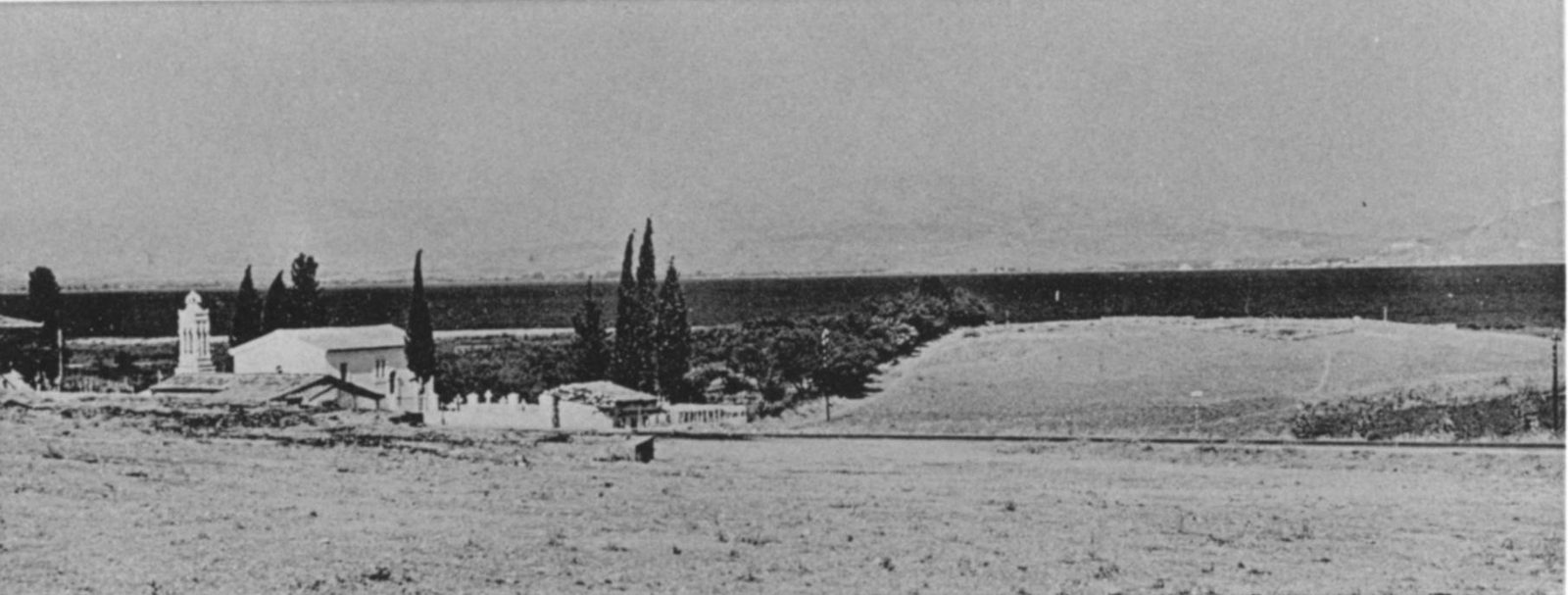
The Lerna mound from the west, with a small church and white buildings among cypresses.
Bron: J. L. Caskey / ASCSA Lerna excavation
-
Vergroten:
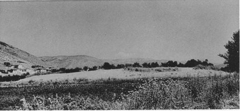
1952–1953
The Lerna mound from the south-east, with houses of Myloi at the foot of Mt Pontinos on the left.
Bron: J. L. Caskey / ASCSA Lerna excavation
-
Vergroten:
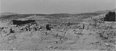
1953
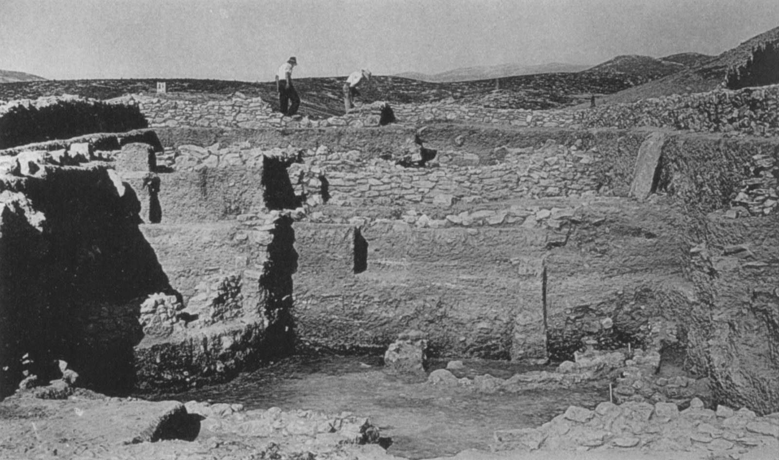
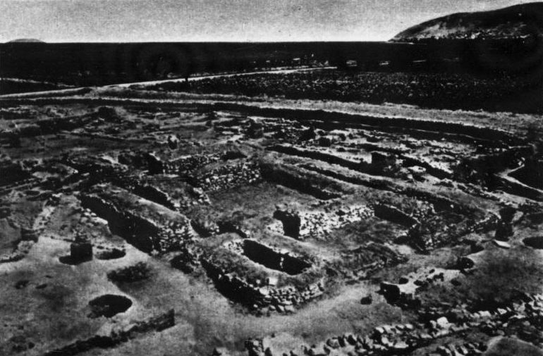
Excavation Area D at Lerna from the east, with the surrounding landscape and hills.
Bron: J. L. Caskey / ASCSA Lerna excavation
-
Vergroten:
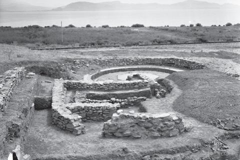
1954
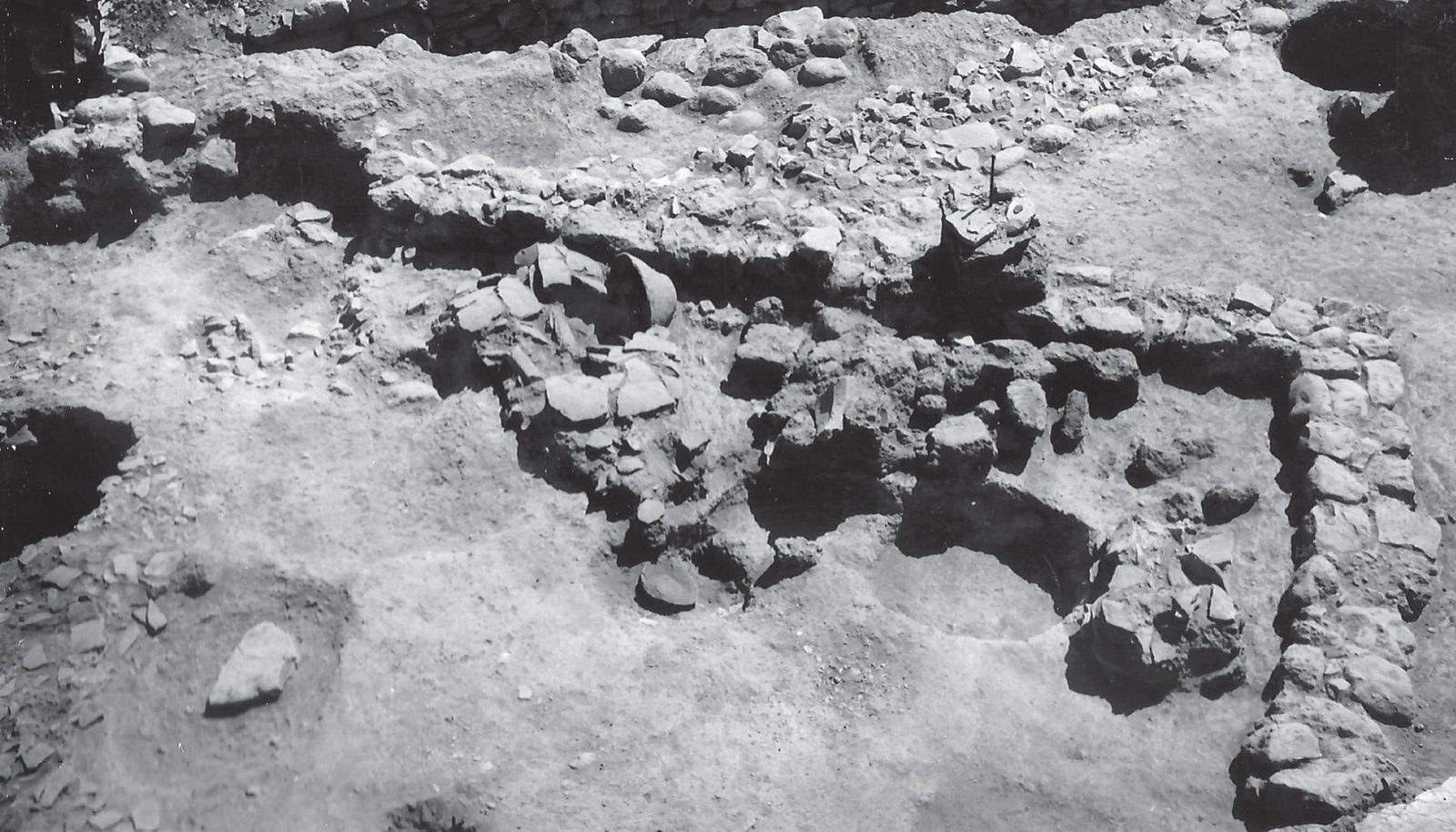
Lerna excavation: the successive apsidal houses D and M seen from the west, with a Second World War machine-gun post in the background, the Myloi–Argos railway, a telegraph pole, the coastal plain and the Argolic Gulf.
Bron: Lerna excavation team (J.L. Caskey), ASCSA Lerna Excavations Archive; reproduced by the Ephorate of Antiquities of Argolida
-
Vergroten:
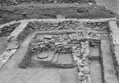
1954
Lerna excavation: part of House D beneath the later House M, seen from the south.
Bron: Lerna excavation team (J.L. Caskey), ASCSA Lerna Excavations Archive; reproduced by the Ephorate of Antiquities of Argolida
-
Vergroten:
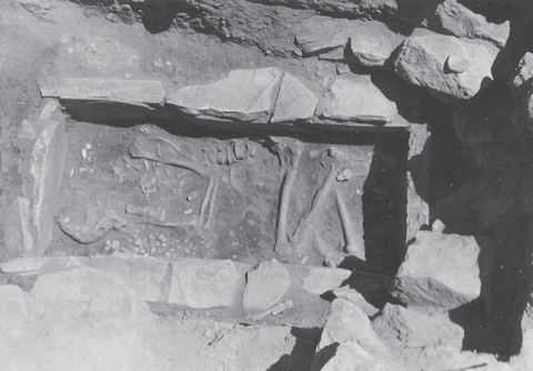
1953 of 1955
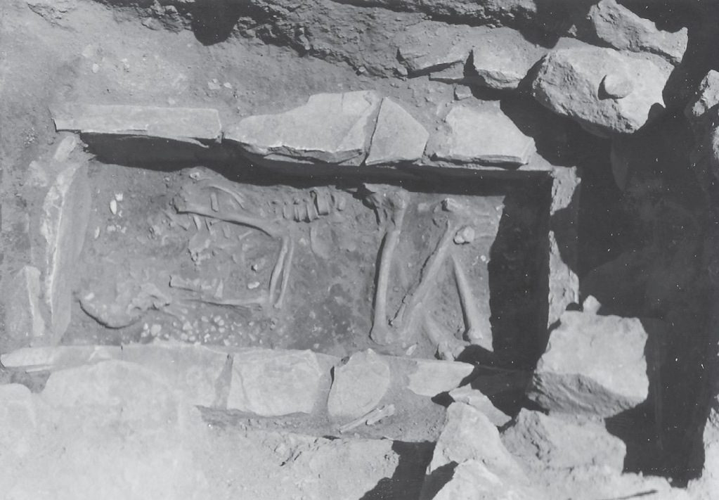
Lerna excavation: cist grave D.9.
Bron: Lerna excavation team (J.L. Caskey), ASCSA Lerna Excavations Archive; reproduced by the Ephorate of Antiquities of Argolida
-
Vergroten:
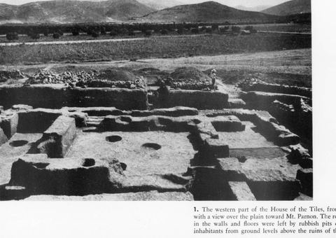
zomer 1954
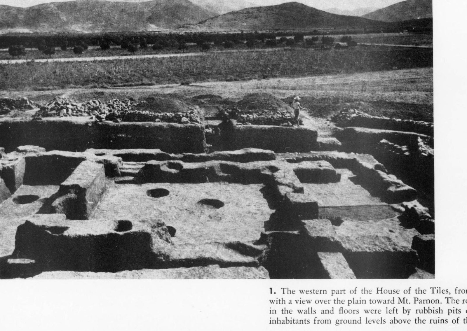
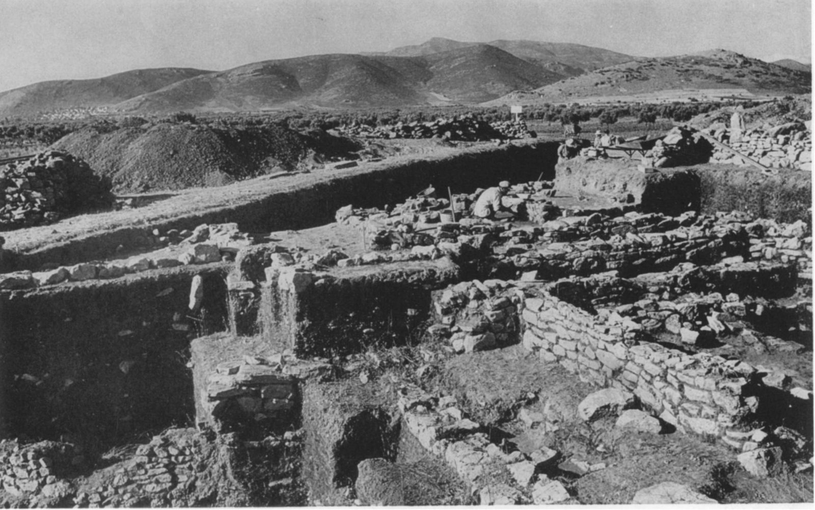
The western part of the House of the Tiles at Lerna from the north, with a view over the plain with olive groves, a dirt road and the mountains, and an excavation worker on the edge.
Bron: J.L. Caskey, Archaeology 8.2 (1955) p. 116, fig. 1
-
Vergroten:
1954
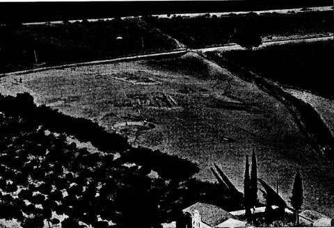
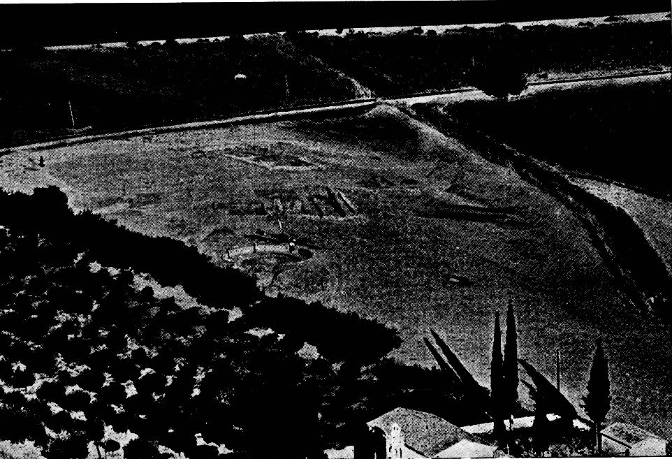
Telephoto view from Mt Pontinos onto the Lerna excavation, with in the foreground a small church with bell tower and cypresses and roofs of Myloi, an olive grove, the road/railway and the WWII tank trap.
Bron: Bulletin de Correspondance Hellénique, Chronique des fouilles (photos probably supplied by ASCSA/Caskey)
-
Vergroten:
na de zomer van 1954
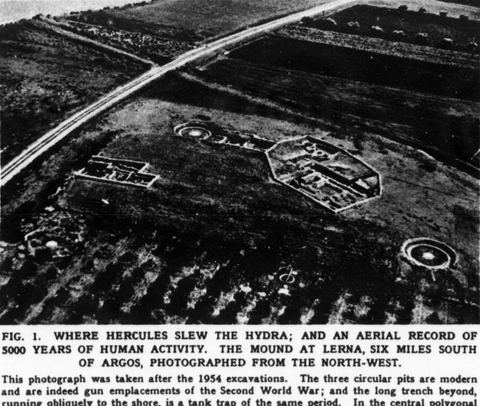
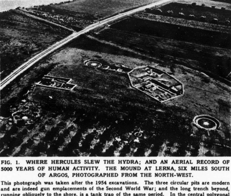
Oblique aerial photo of the mound of Lerna from the northwest after the 1954 season, showing three Second World War gun emplacements, a WWII tank trap running to the shore, the House of Tiles and an orchard.
Bron: Lerna excavation (J.L. Caskey, ASCSA), published in ILN
-
Vergroten:
1954
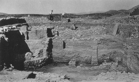
Excavation Area D at Lerna from the west, with workmen (probably villagers).
Bron: J. L. Caskey / ASCSA Lerna excavation
-
Vergroten:
1954
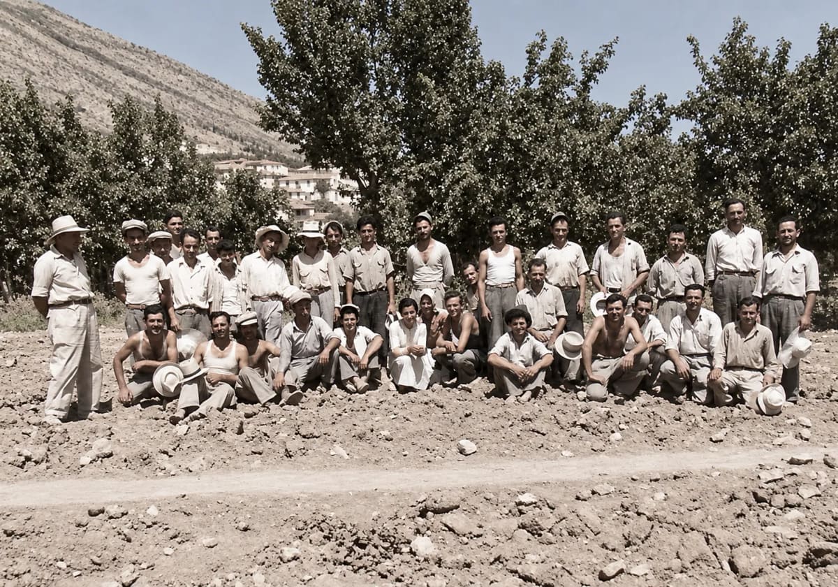
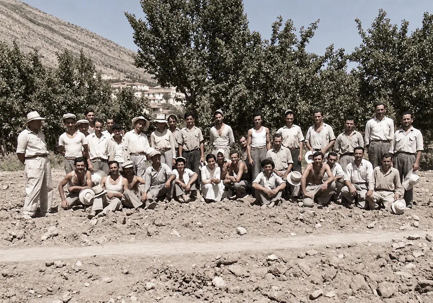
Achteraf ingekleurd: de mensen die in 1954 samen met de American School of Classical Studies aan de opgraving in Lerna werkten
Bron: George Kondis
-
Vergroten:
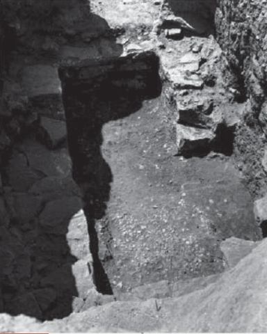
1954–1955
Lerna excavation: one of the two shaft graves of Lerna.
Bron: Lerna excavation team (J.L. Caskey), ASCSA Lerna Excavations Archive; reproduced by the Ephorate of Antiquities of Argolida
-
Vergroten:
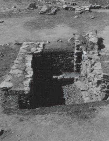
1954–1955
Lerna excavation: the other of the two shaft graves of Lerna.
Bron: Lerna excavation team (J.L. Caskey), ASCSA Lerna Excavations Archive; reproduced by the Ephorate of Antiquities of Argolida
-
Vergroten:
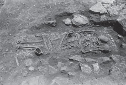
ca. 1952–1958
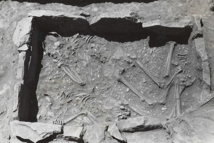
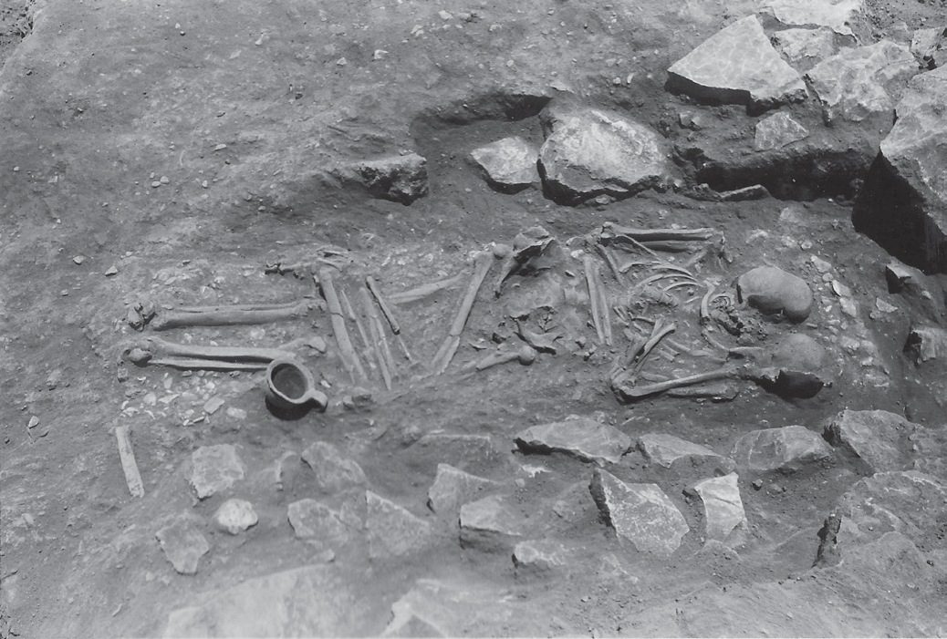
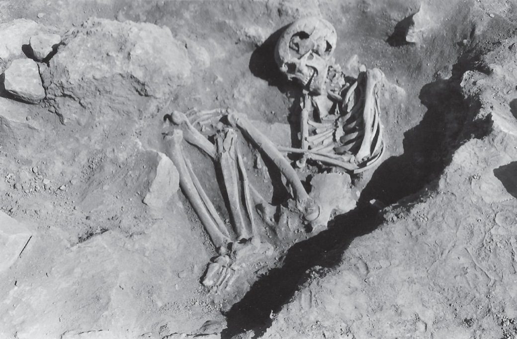
Lerna excavation: an extended Middle Helladic burial.
Bron: Lerna excavation team (J.L. Caskey), ASCSA Lerna Excavations Archive; reproduced by the Ephorate of Antiquities of Argolida
-
Vergroten:
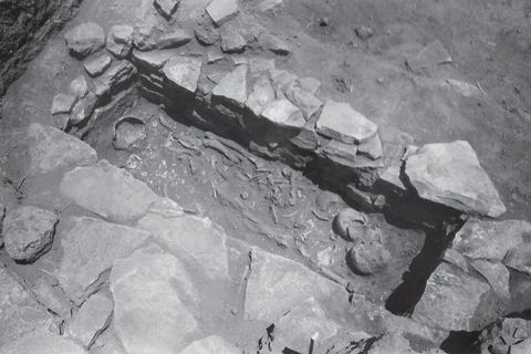
ca. 1952–1958
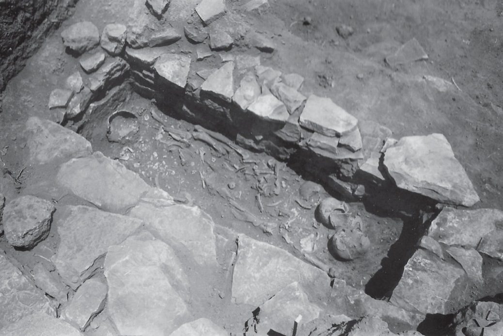
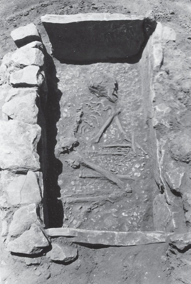
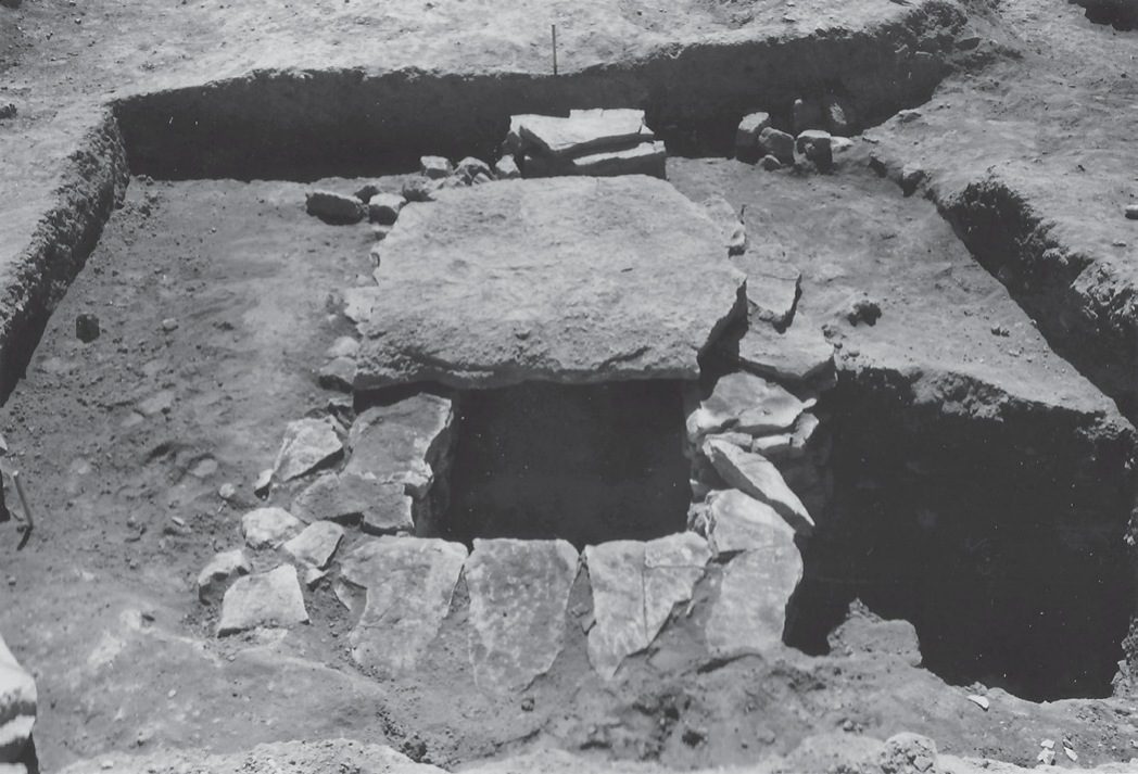
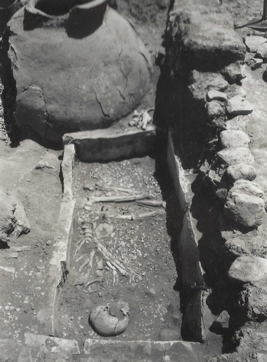
Lerna excavation: a built cist grave (c. 1700 BC).
Bron: Lerna excavation team (J.L. Caskey), ASCSA Lerna Excavations Archive; reproduced by the Ephorate of Antiquities of Argolida
-
Vergroten:
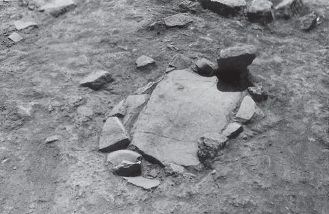
ca. 1952–1958
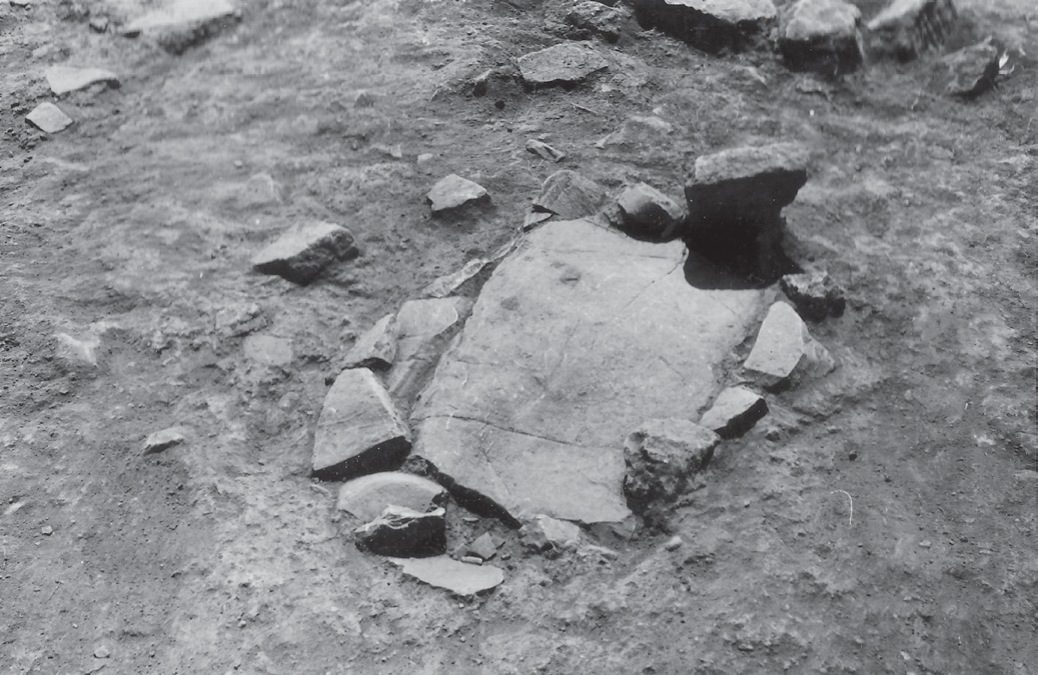
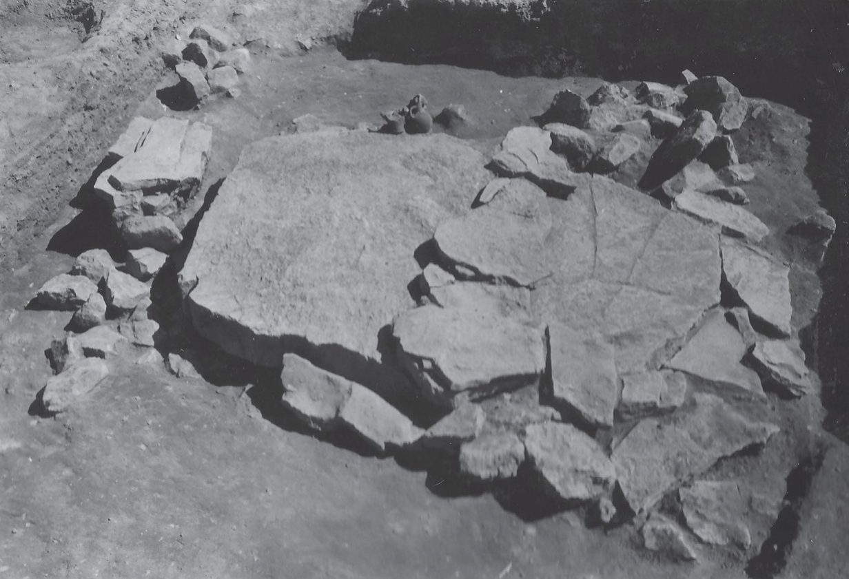
Lerna excavation: a Mycenaean cist grave, closed.
Bron: Lerna excavation team (J.L. Caskey), ASCSA Lerna Excavations Archive; reproduced by the Ephorate of Antiquities of Argolida
-
Vergroten:
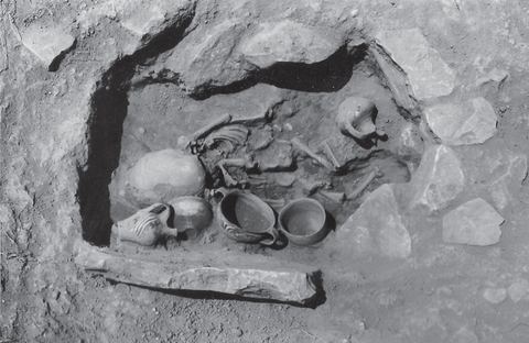
ca. 1952–1958
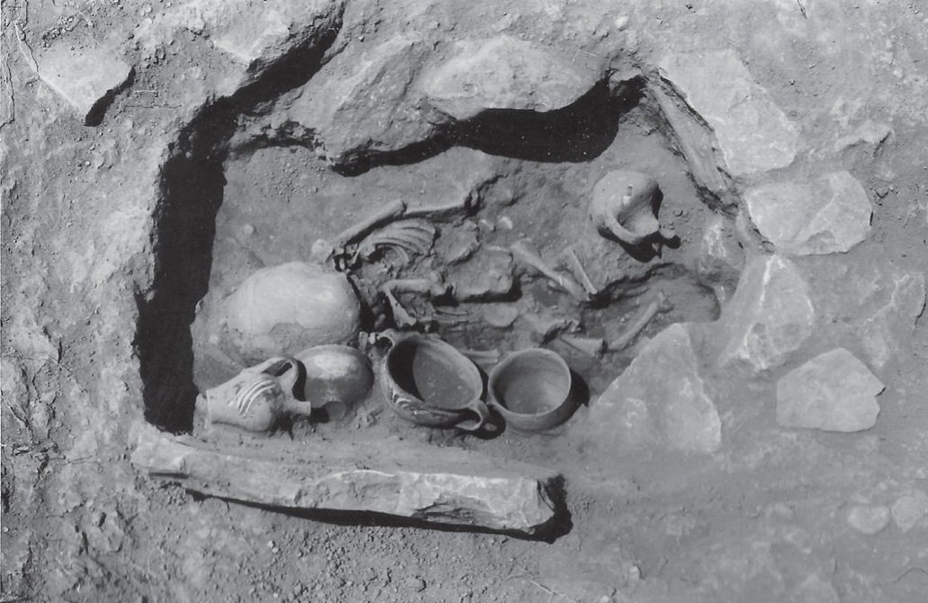
Lerna excavation: the same Mycenaean cist grave, opened.
Bron: Lerna excavation team (J.L. Caskey), ASCSA Lerna Excavations Archive; reproduced by the Ephorate of Antiquities of Argolida
-
Vergroten:
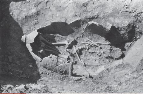
ca. 1952–1958
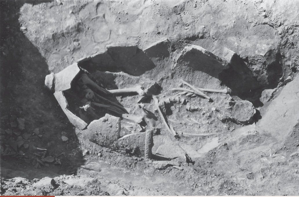
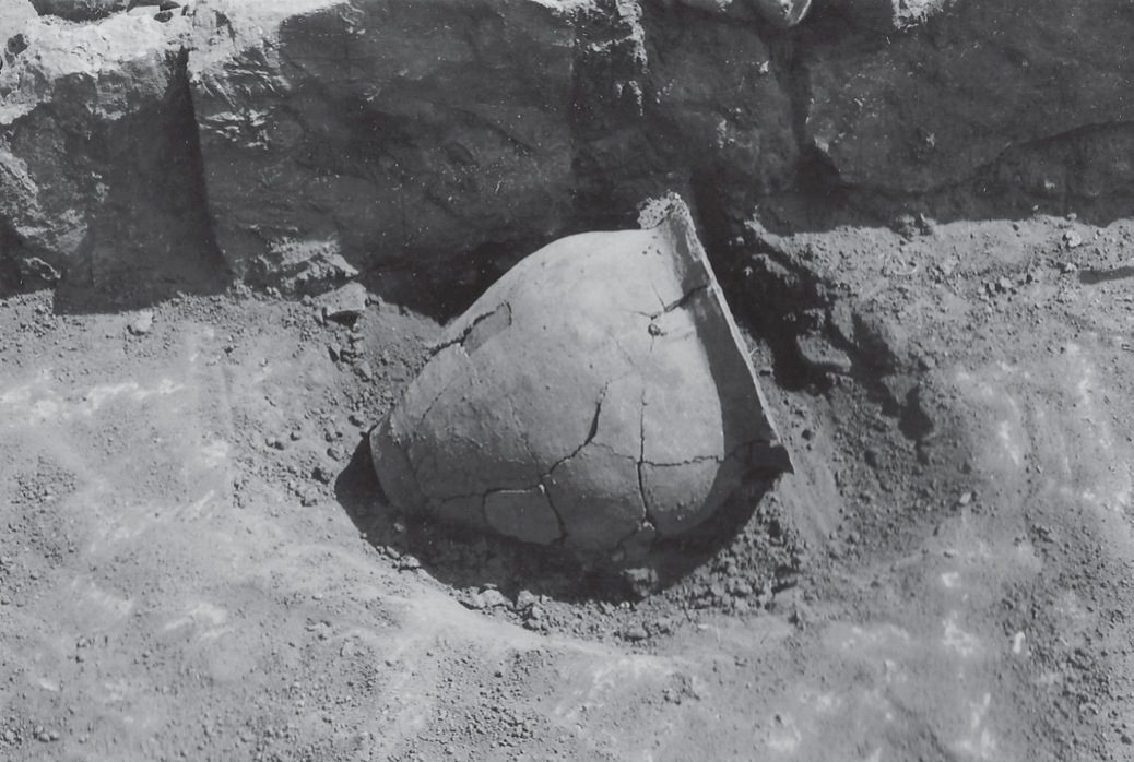
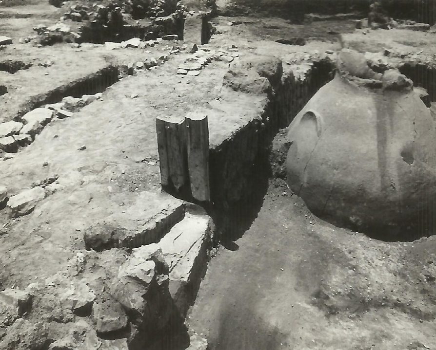
Middle Geometric pithos burial from the cemetery at the foot of Mt Pontinos.
Bron: Lerna excavation team (J.L. Caskey), ASCSA Lerna Excavations Archive; reproduced by the Ephorate of Antiquities of Argolida
-
Vergroten:
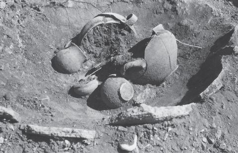
ca. 1952–1958
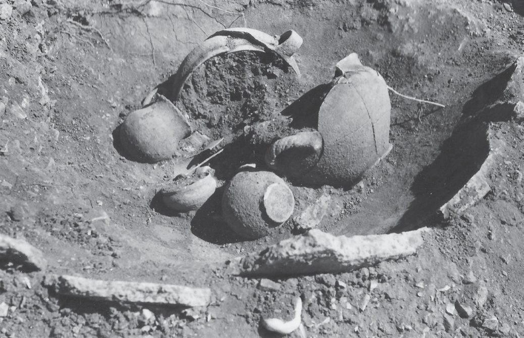
Geometric burial with grave goods from the cemetery at the foot of Mt Pontinos.
Bron: Lerna excavation team (J.L. Caskey), ASCSA Lerna Excavations Archive; reproduced by the Ephorate of Antiquities of Argolida
-
Vergroten:
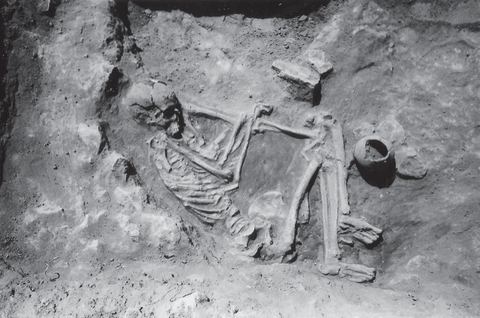
ca. 1952–1958
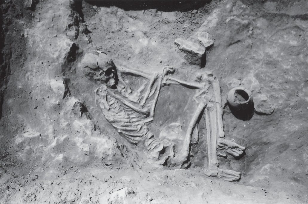
Lerna excavation: a Final Neolithic female burial.
Bron: Lerna excavation team (J.L. Caskey), ASCSA Lerna Excavations Archive; reproduced by the Ephorate of Antiquities of Argolida
-
Vergroten:
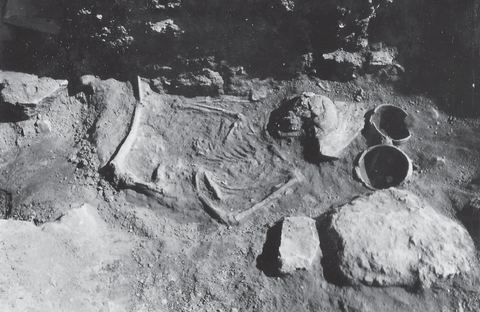
ca. 1952–1958
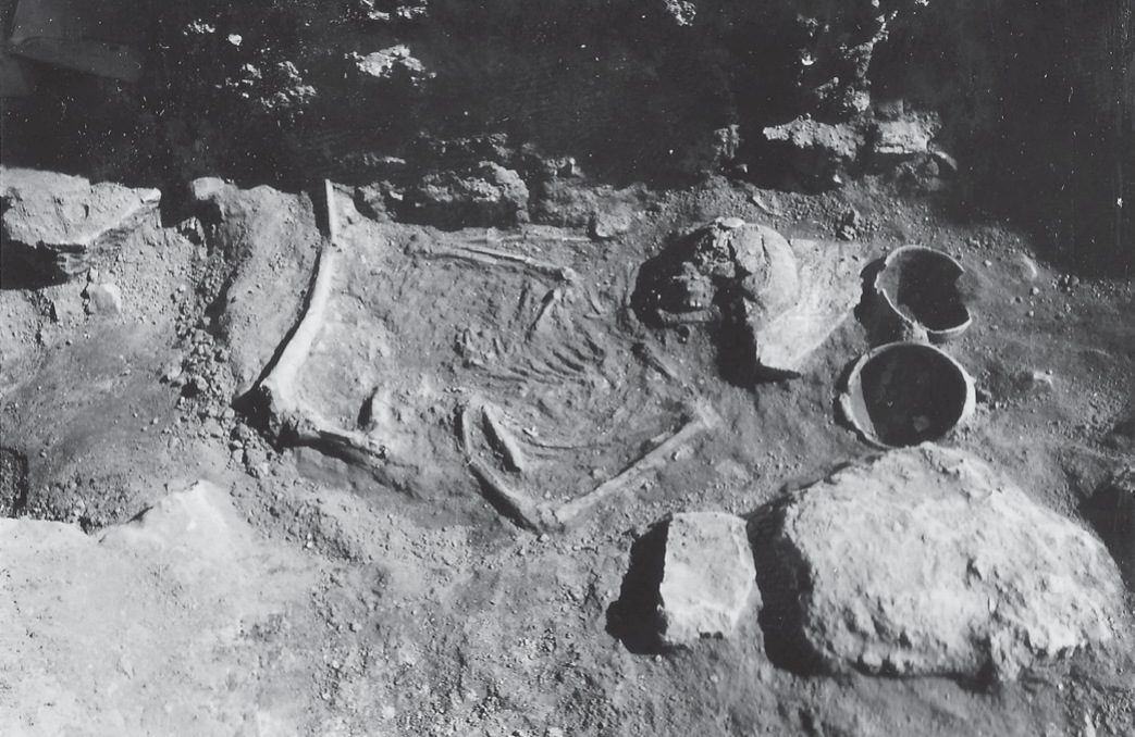
Lerna excavation: a Final Neolithic female burial (second view).
Bron: Lerna excavation team (J.L. Caskey), ASCSA Lerna Excavations Archive; reproduced by the Ephorate of Antiquities of Argolida
-
Vergroten:
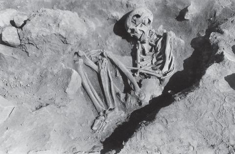
ca. 1952–1958
Lerna excavation: a Middle Helladic pit grave.
Bron: Lerna excavation team (J.L. Caskey), ASCSA Lerna Excavations Archive; reproduced by the Ephorate of Antiquities of Argolida
-
Vergroten:
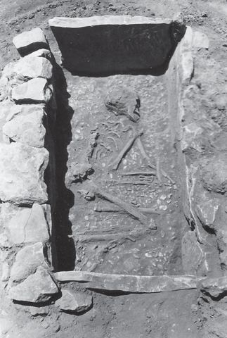
ca. 1952–1958
Lerna excavation: a Middle Helladic cist grave.
Bron: Lerna excavation team (J.L. Caskey), ASCSA Lerna Excavations Archive; reproduced by the Ephorate of Antiquities of Argolida
-
Vergroten:
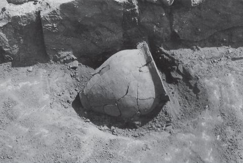
ca. 1952–1958
Lerna excavation: a Middle Helladic pithos burial.
Bron: Lerna excavation team (J.L. Caskey), ASCSA Lerna Excavations Archive; reproduced by the Ephorate of Antiquities of Argolida
-
Vergroten:
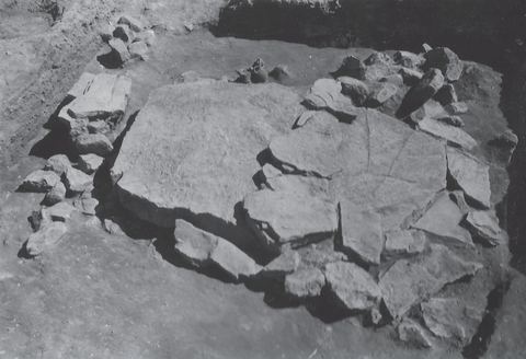
1955
Lerna excavation: cist grave BC.3 with its cover slabs.
Bron: Lerna excavation team (J.L. Caskey), ASCSA Lerna Excavations Archive; reproduced by the Ephorate of Antiquities of Argolida
-
Vergroten:
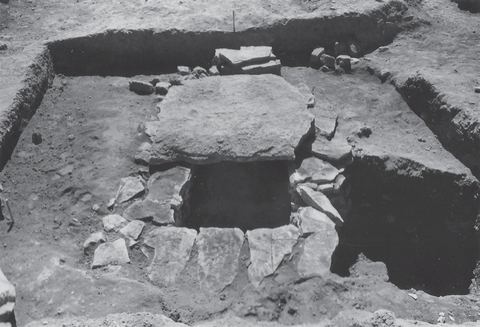
1955
Lerna excavation: cist grave BC.3 after removal of the western cover slab.
Bron: Lerna excavation team (J.L. Caskey), ASCSA Lerna Excavations Archive; reproduced by the Ephorate of Antiquities of Argolida
-
Vergroten:
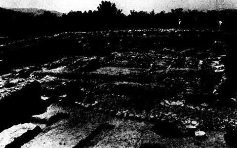
1955
Part of the stone circle around the remains of the House of the Tiles at Lerna, with trees and hills behind.
Bron: Bulletin de Correspondance Hellénique, Chronique des fouilles (photos probably supplied by ASCSA/Caskey)
-
Vergroten:
1955
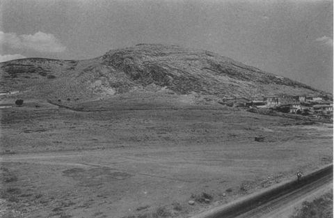
Mt Pontinos and the area of the Geometric cemetery from the south-east, with houses of Myloi and the road/railway.
Bron: J. L. Caskey / ASCSA Lerna excavation
-
Vergroten:
ca. 1950–1960
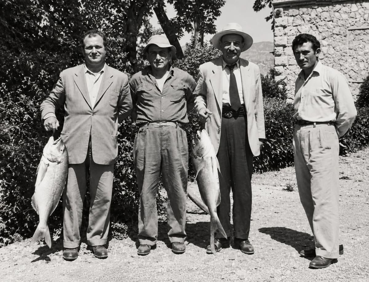
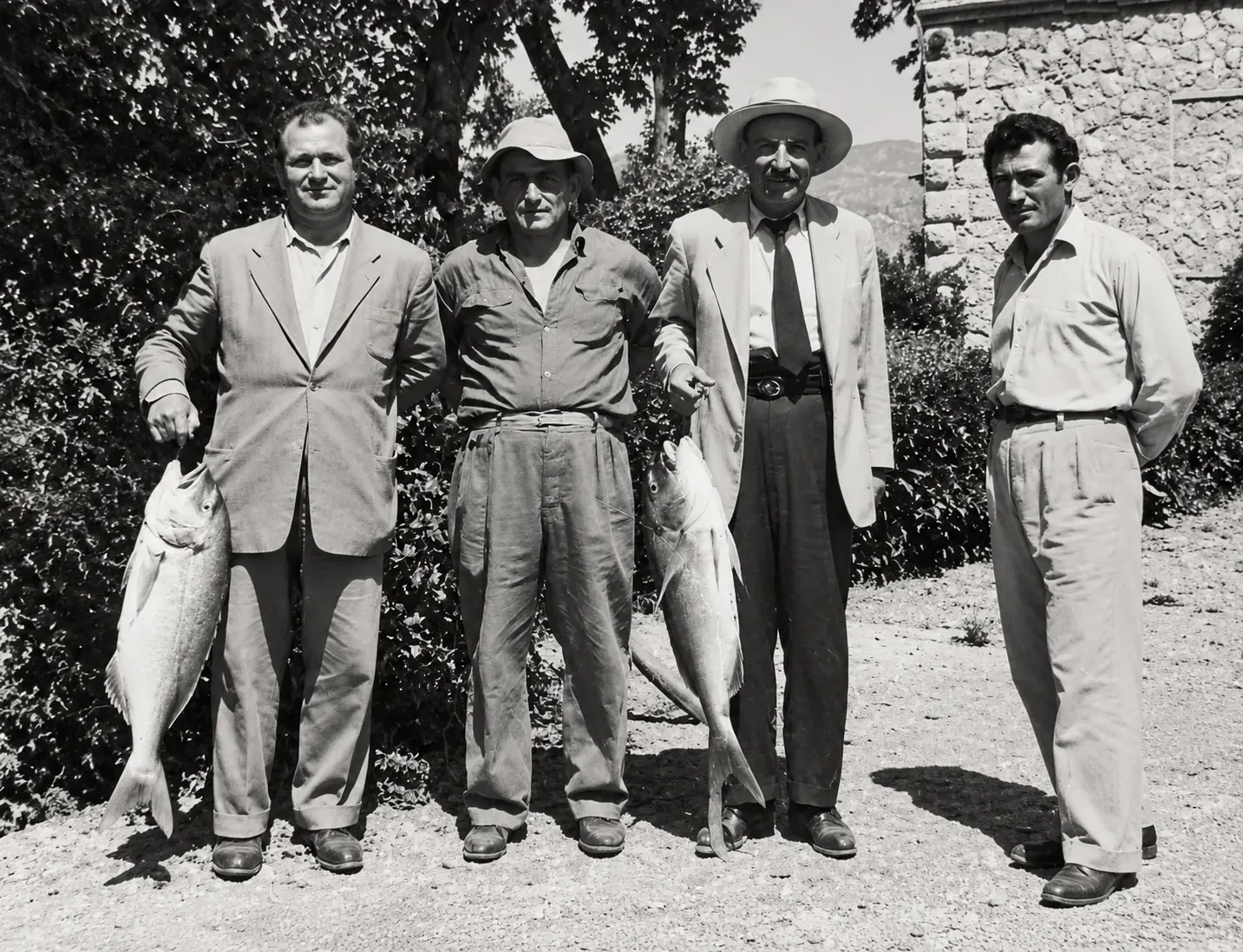
“De oude vissers van Myloi”: vier mannen voor een stenen gebouw, twee van hen houden grote vissen vast (digitaal opgeknapt)
Bron: Lykos family, Myloi
-
Vergroten:
jaren 50
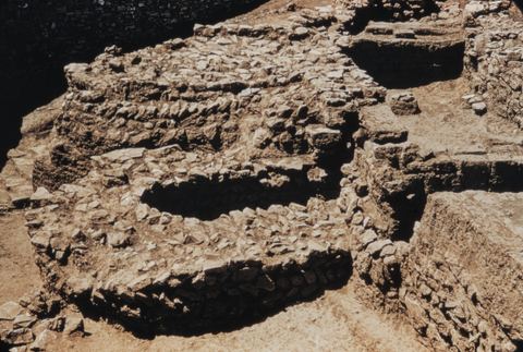
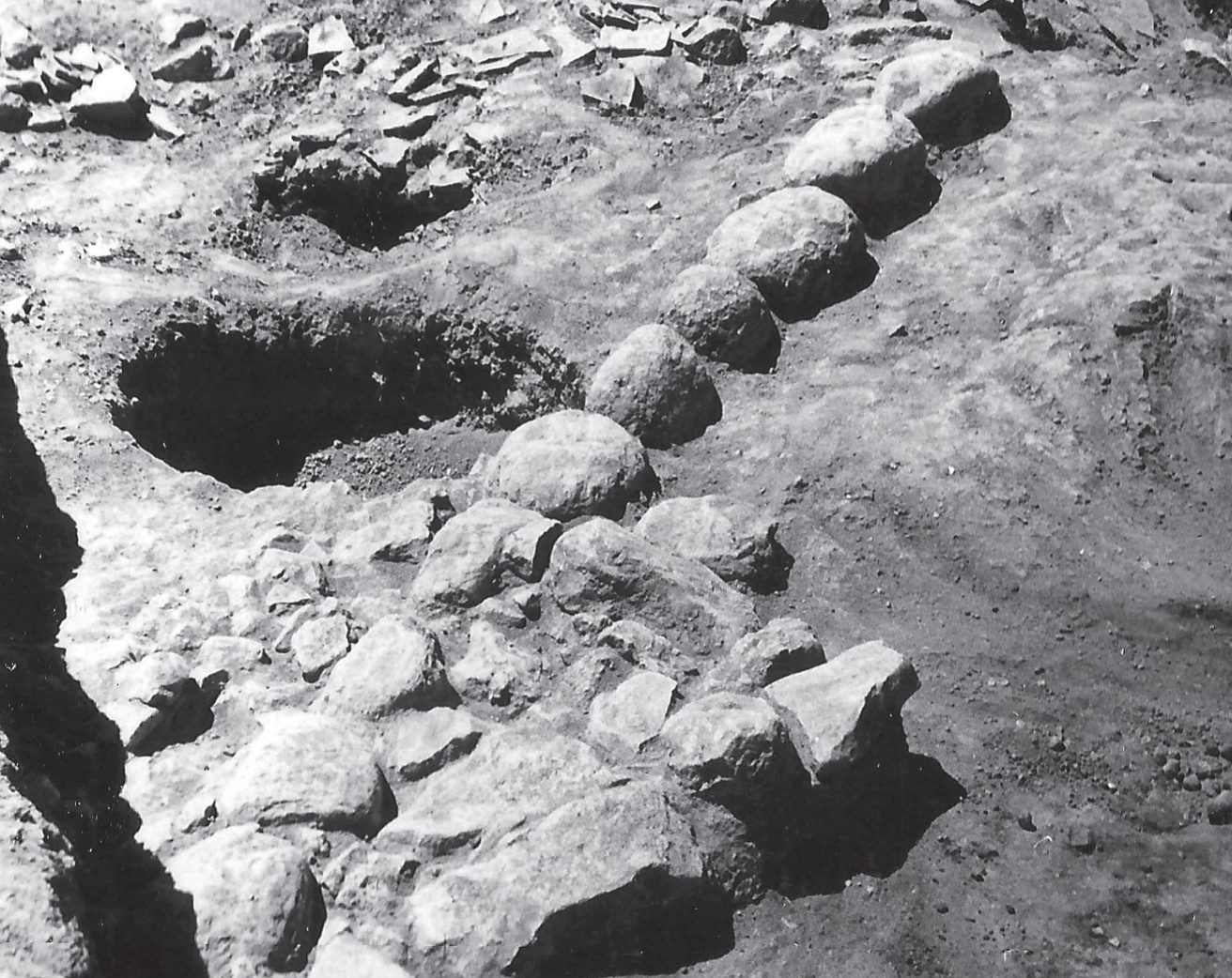
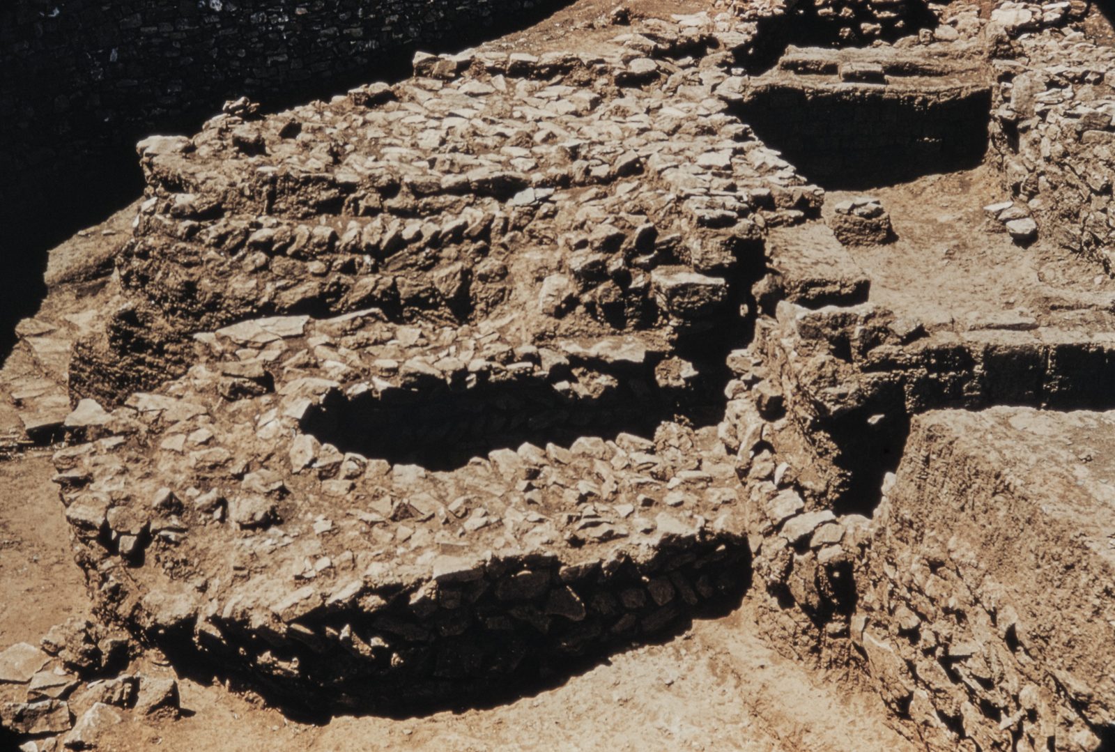
Lerna fortifications: projecting towers V and U seen from the north-east.
Bron: George M. A. Hanfmann (photographer per Harvard record; slides may have been donated rather than shot by him) / Harvard Fine Arts Library
-
Vergroten:
jaren 50
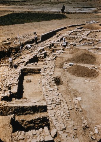
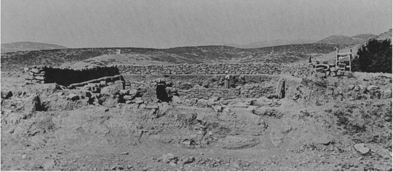
Lerna fortifications: the Early Helladic circuit wall in the excavation.
Bron: George M. A. Hanfmann (photographer per Harvard record; slides may have been donated rather than shot by him) / Harvard Fine Arts Library
-
Vergroten:
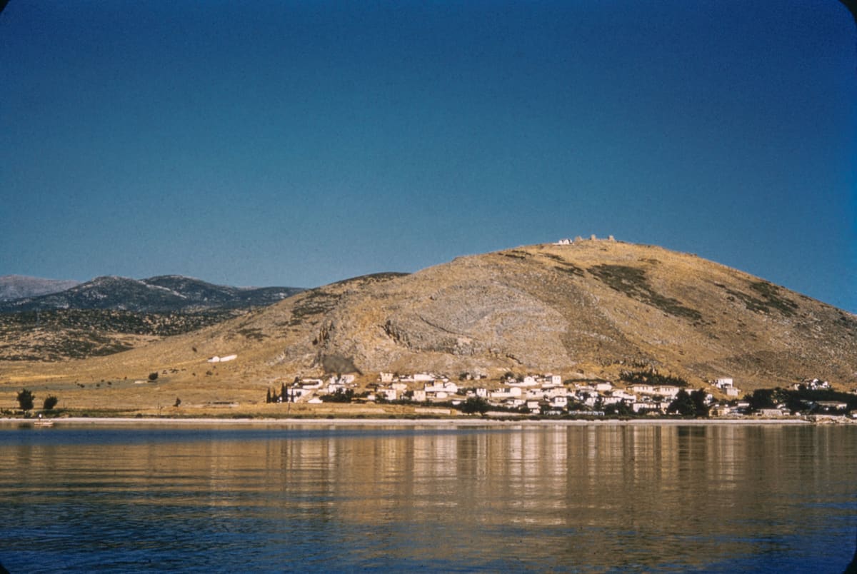
jaren 50
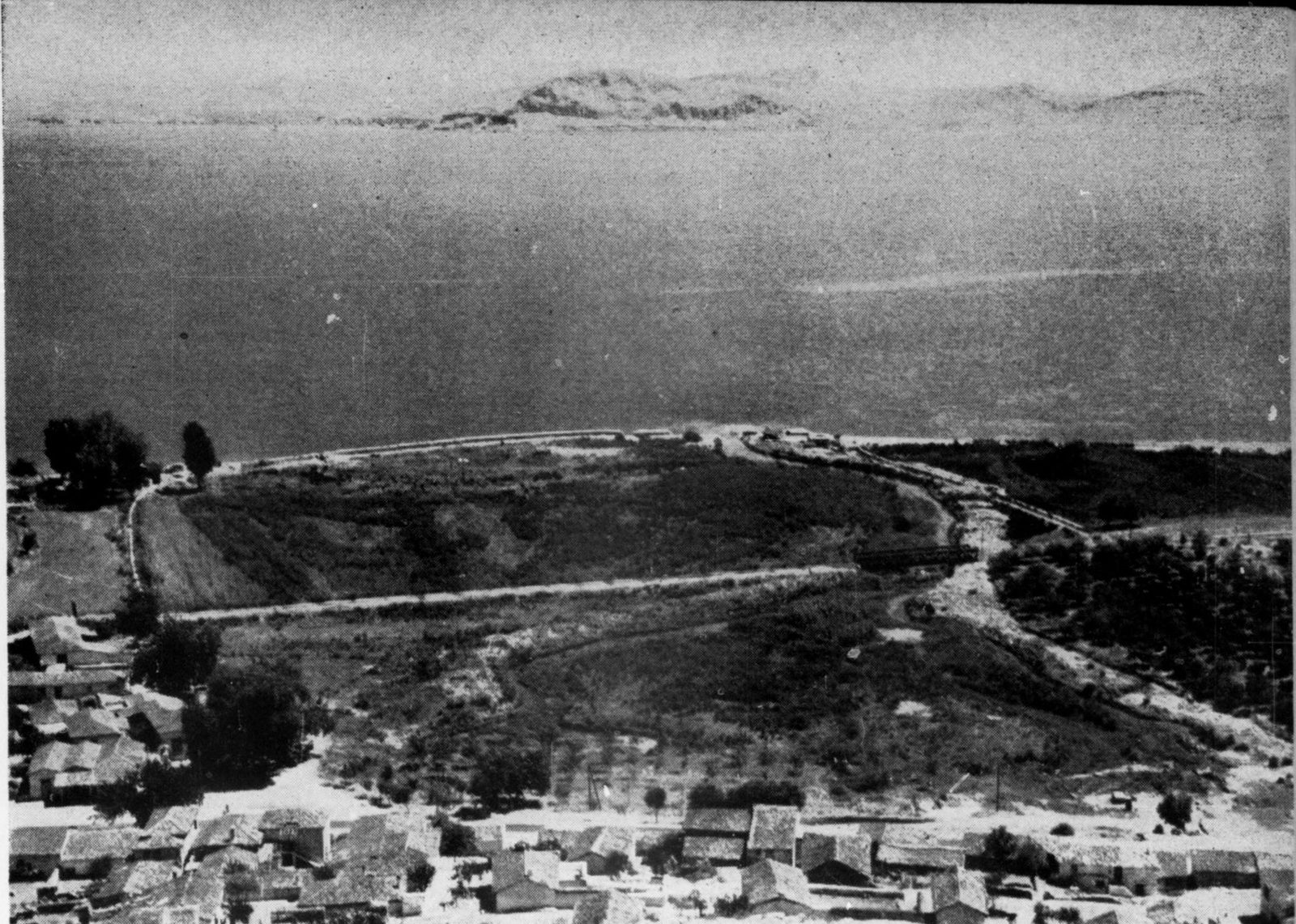
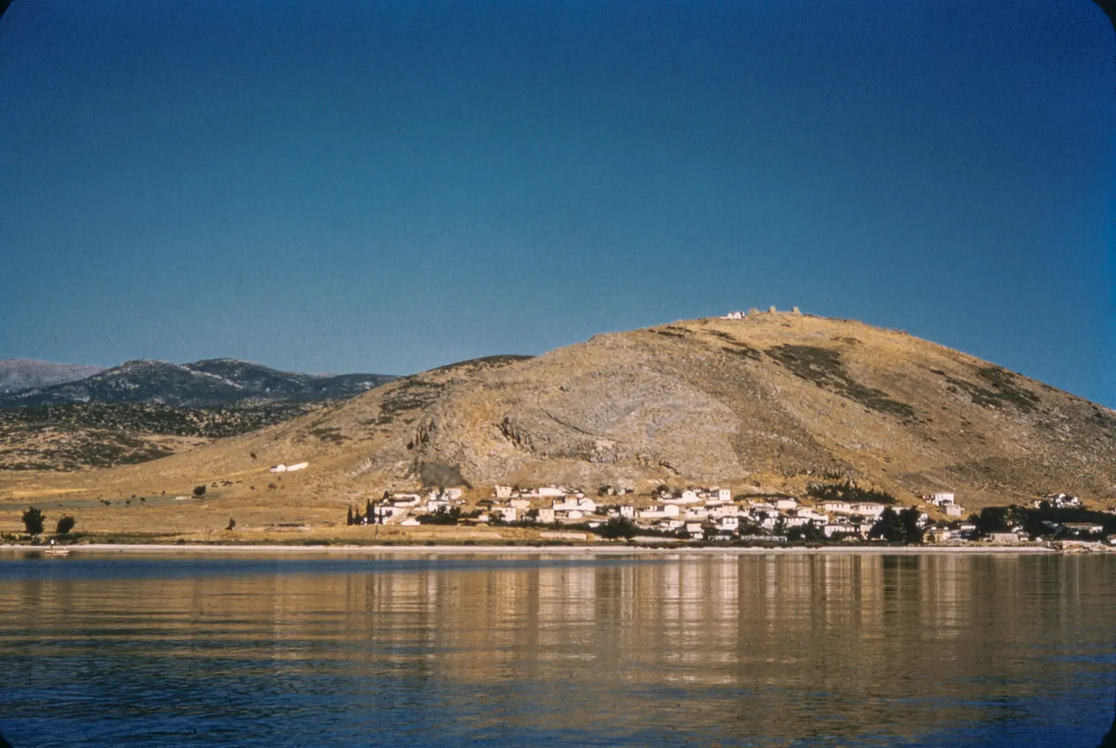
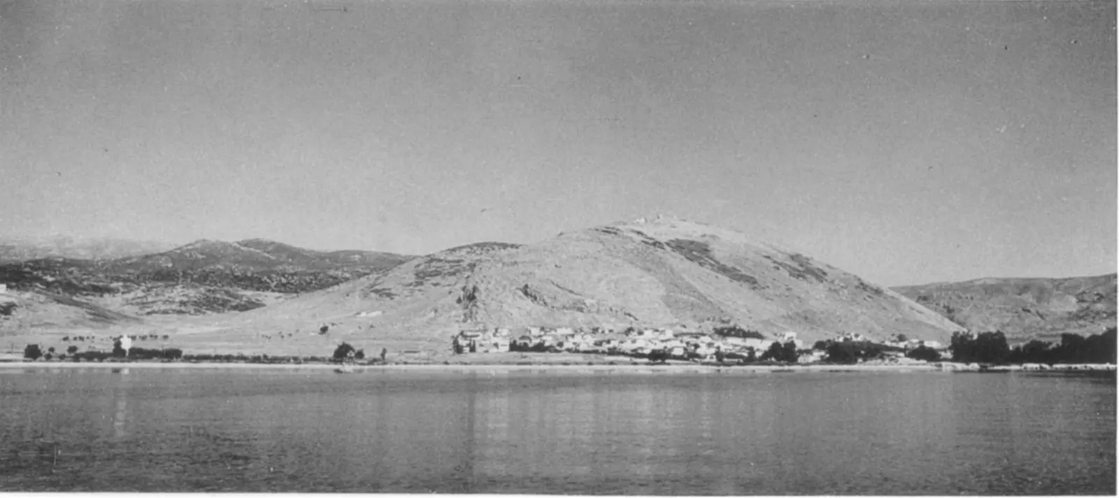
Myloi in de jaren 50 vanaf het water: witte huizen langs de kust aan de voet van de kale heuvel Pontinos, met de kasteelruïne op de top, weerspiegeld in de kalme golf
Bron: Courtesy of Harvard Fine Arts Library, Digital Images & Slides Collection
-
Vergroten:
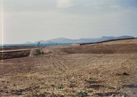
jaren 50
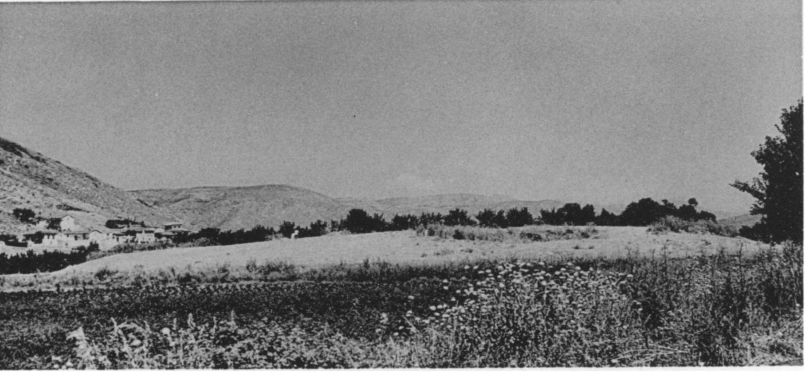
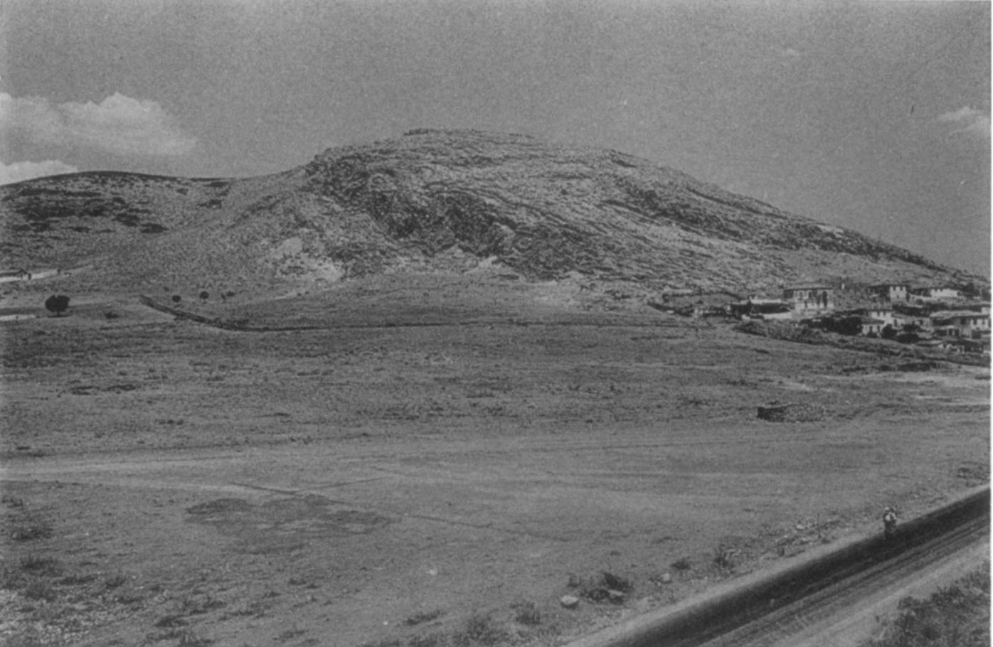
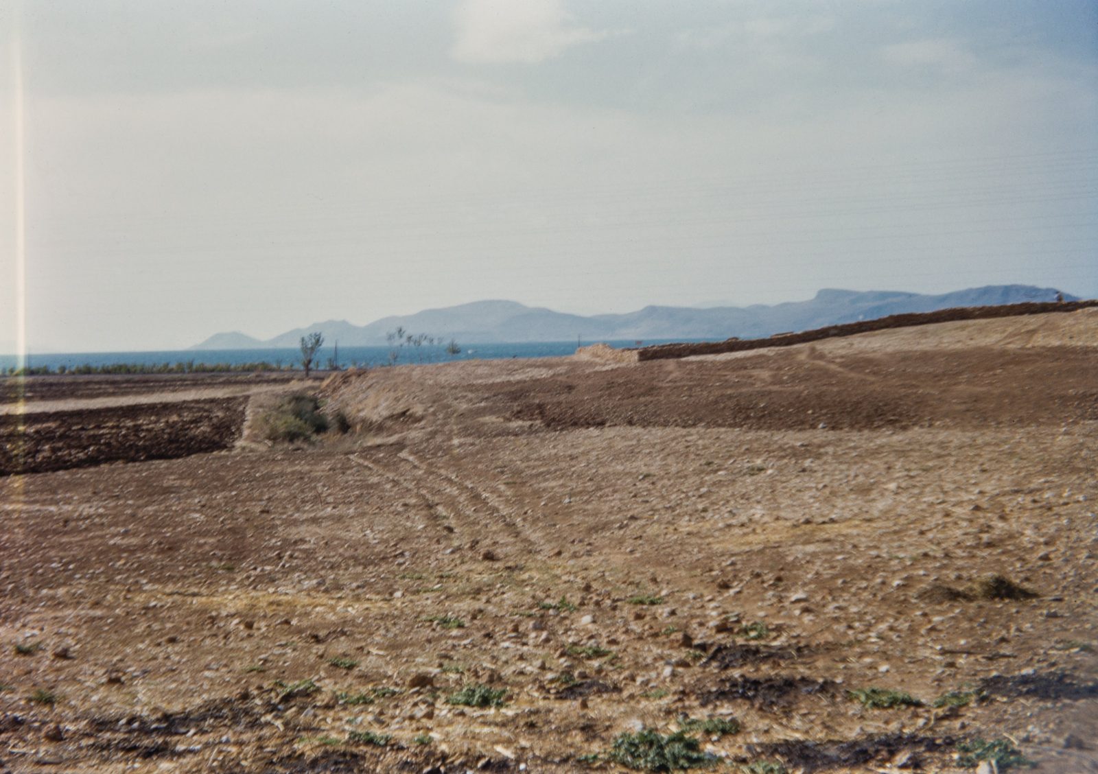
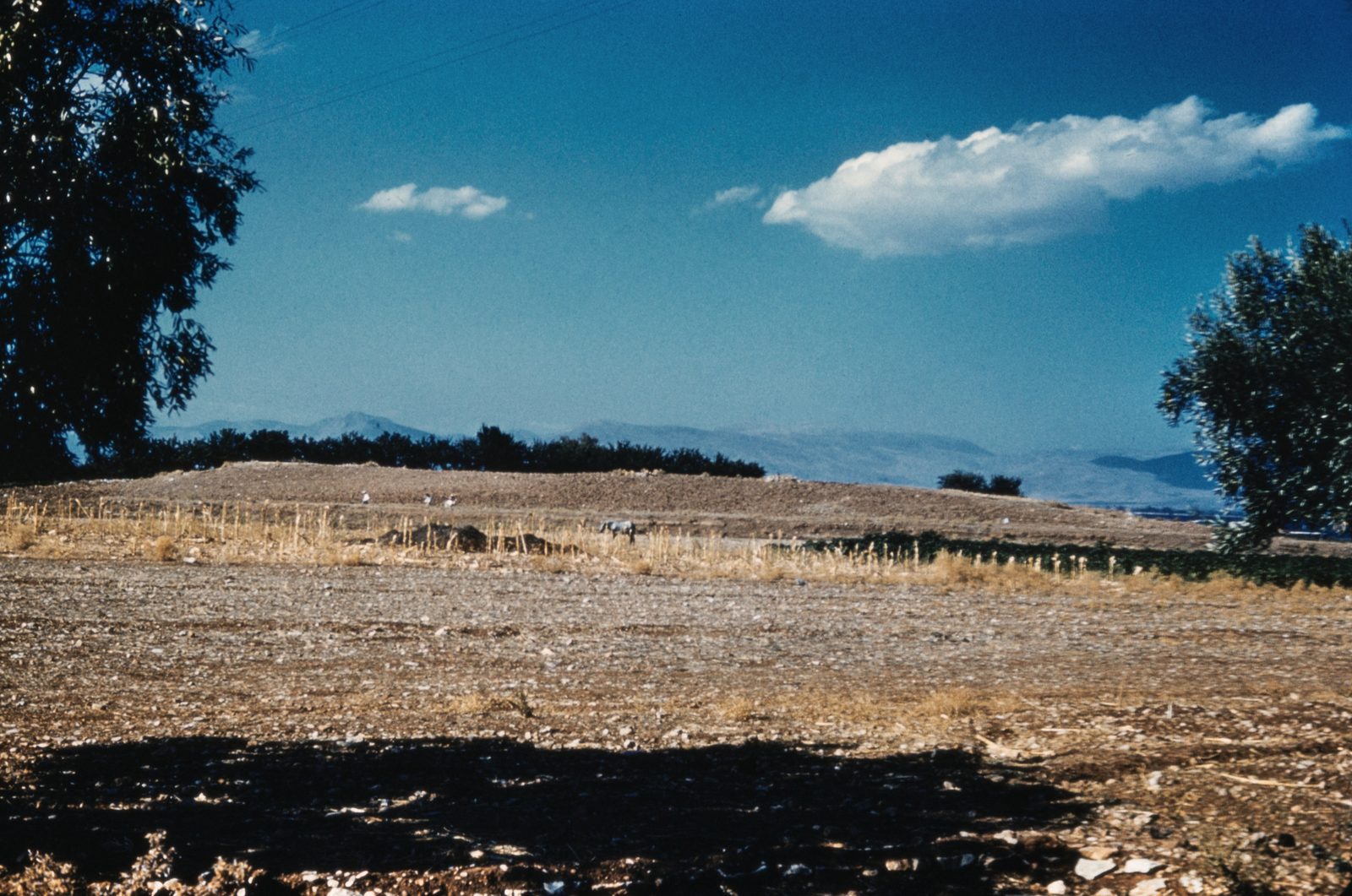
Distant view of the Lerna site across dry fields, with the bay beyond.
Bron: George M. A. Hanfmann (photographer per Harvard record; slides may have been donated rather than shot by him) / Harvard Fine Arts Library
-
Vergroten:
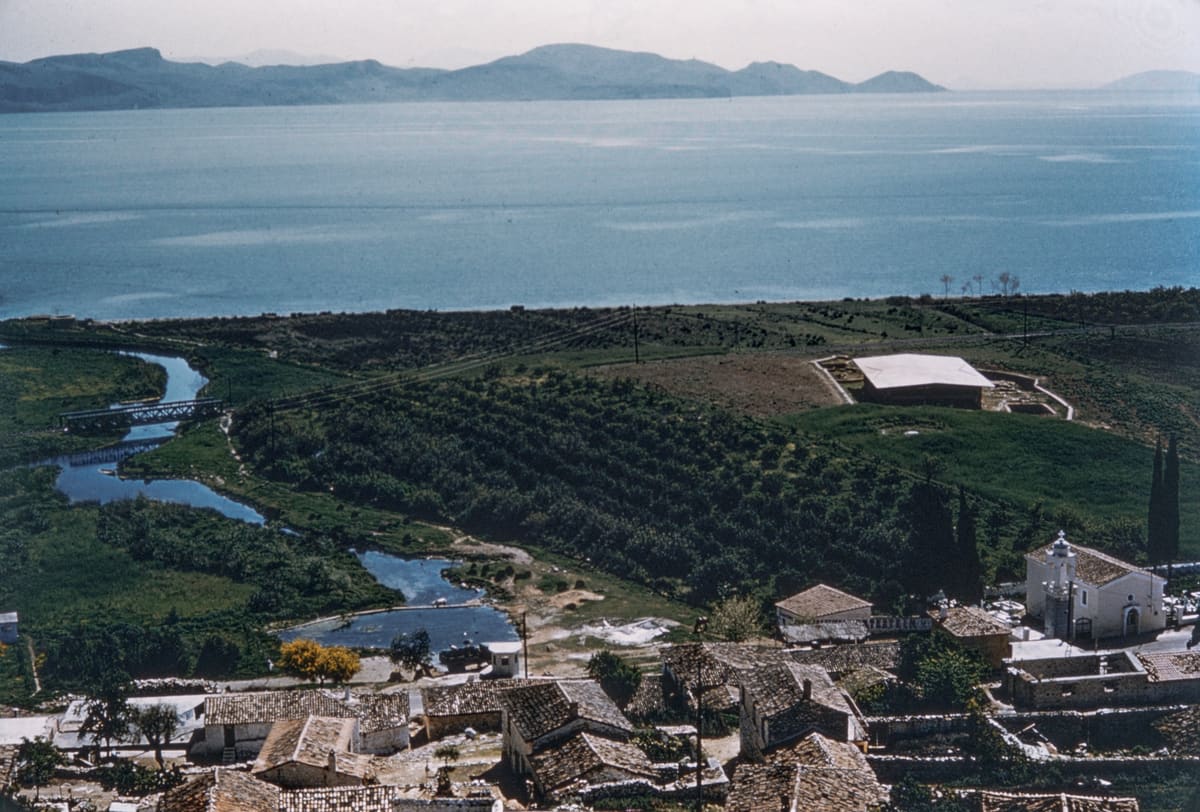
jaren 50
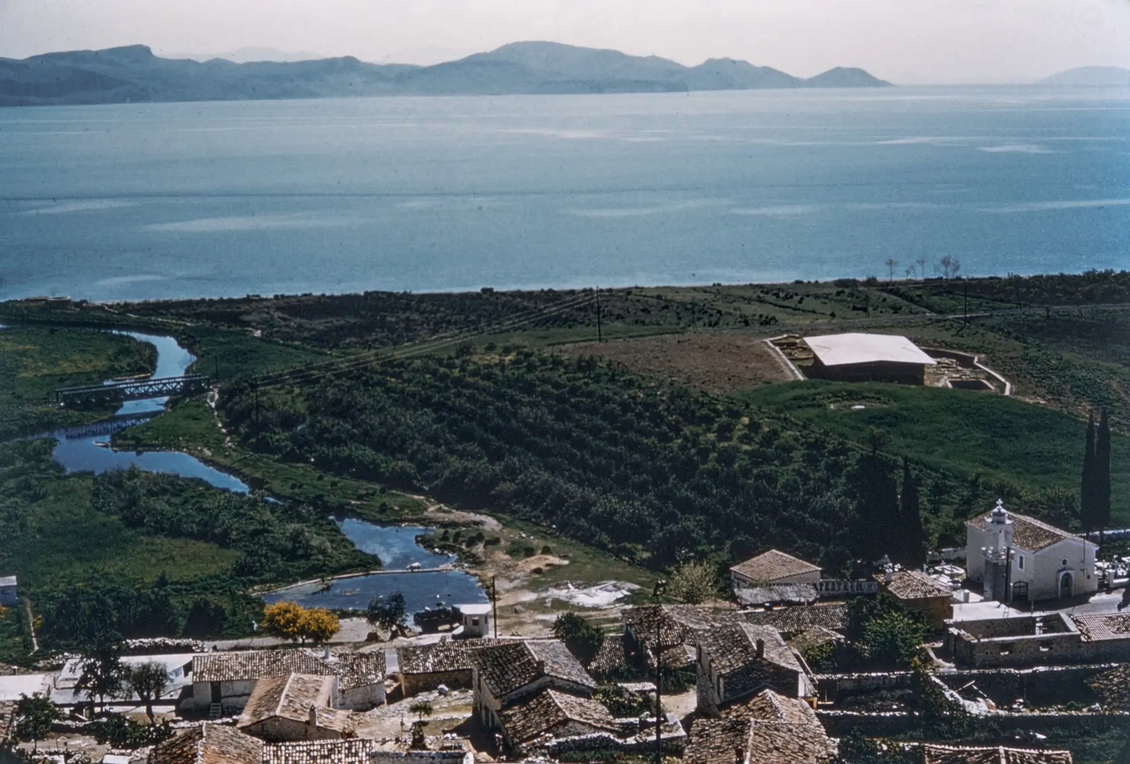
Uitzicht over Myloi in de jaren 50: pannendaken en een kerk met klokkentoren op de voorgrond, het kronkelende beekje van de bronnen van Lerna, het nieuwe dak boven de opgraving tussen de velden, en daarachter de golf
Bron: Courtesy of Harvard Fine Arts Library, Digital Images & Slides Collection
-
Vergroten:
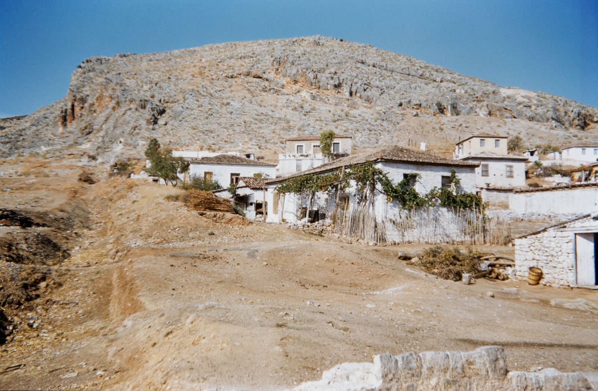
jaren 50
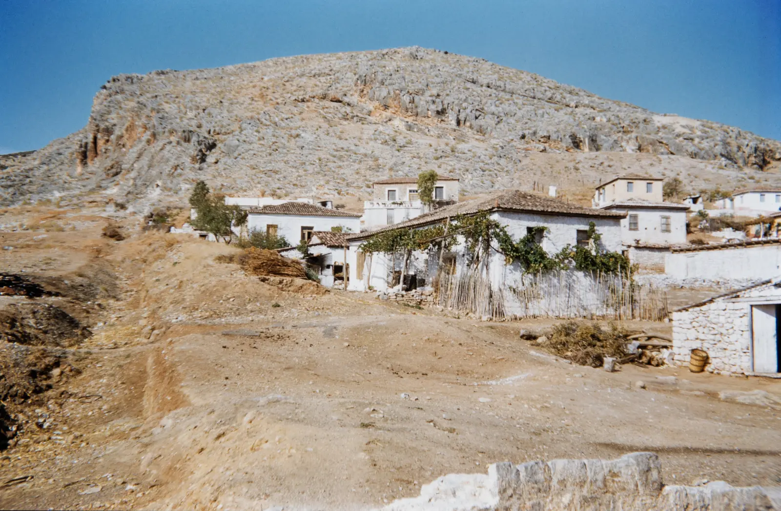
Witgekalkte dorpshuizen met een pergola vol wijnranken en een rieten schutting aan de voet van een rotsige heuvel in Myloi, jaren 50
Bron: Courtesy of Harvard Fine Arts Library, Digital Images & Slides Collection
-
Vergroten:
jaren 50
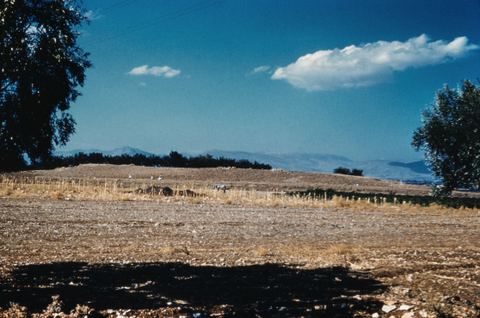
View of the Lerna site from the south-west before the construction of the shelter, framed by trees, with the sea behind.
Bron: George M. A. Hanfmann (photographer per Harvard record; slides may have been donated rather than shot by him) / Harvard Fine Arts Library
-
Vergroten:
jaren 50
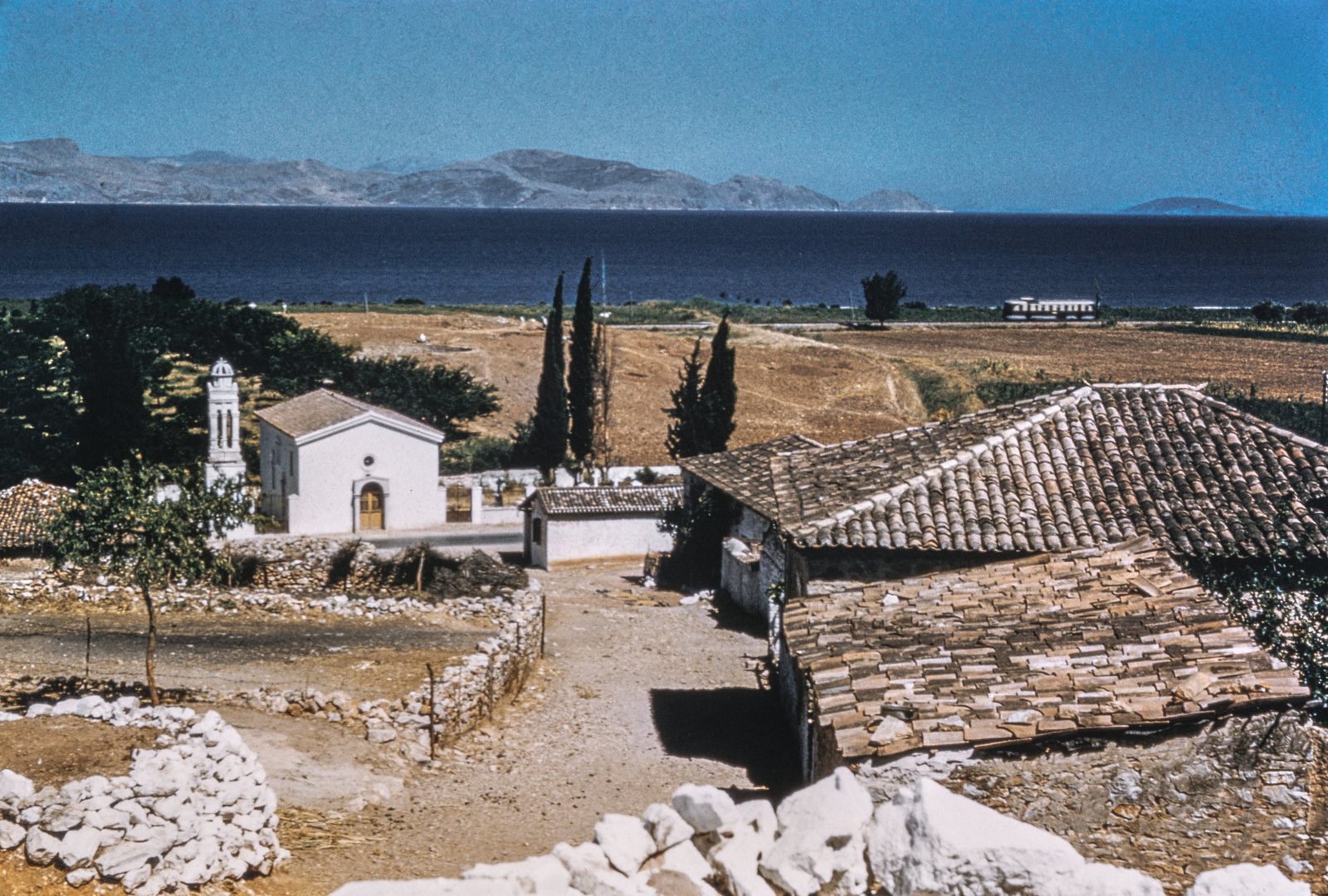
View of the Lerna site and the bay from the village: the church of Agios Dimitrios with cypresses, tiled roofs and dry-stone walls in front.
Bron: George M. A. Hanfmann (photographer per Harvard record; slides may have been donated rather than shot by him) / Harvard Fine Arts Library
-
Vergroten:
jaren 50
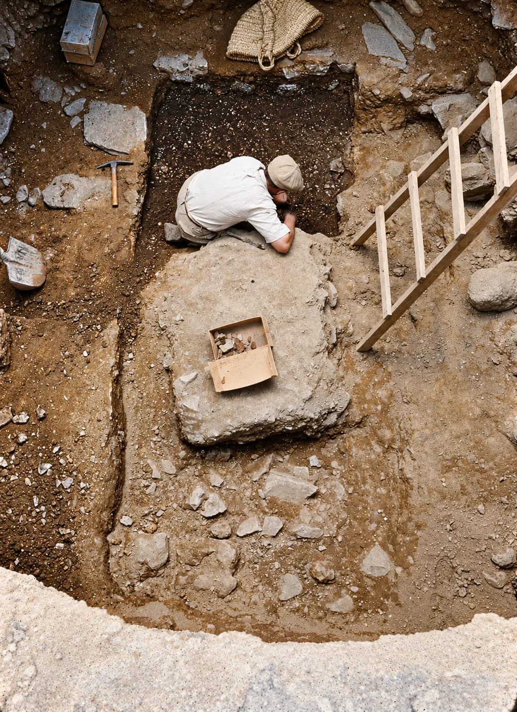
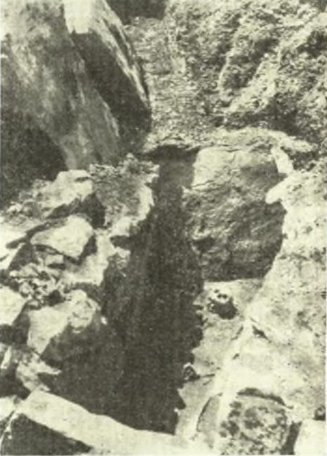
Lerna, Shaft Grave II during excavation, with a worker in the shaft and a ladder.
Bron: George M. A. Hanfmann (photographer per Harvard record; slides may have been donated rather than shot by him) / Harvard Fine Arts Library · digitaal opgeknapt
-
Vergroten:
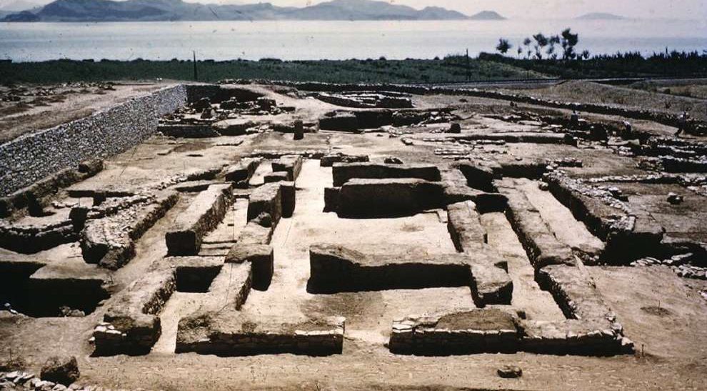
jaren 50
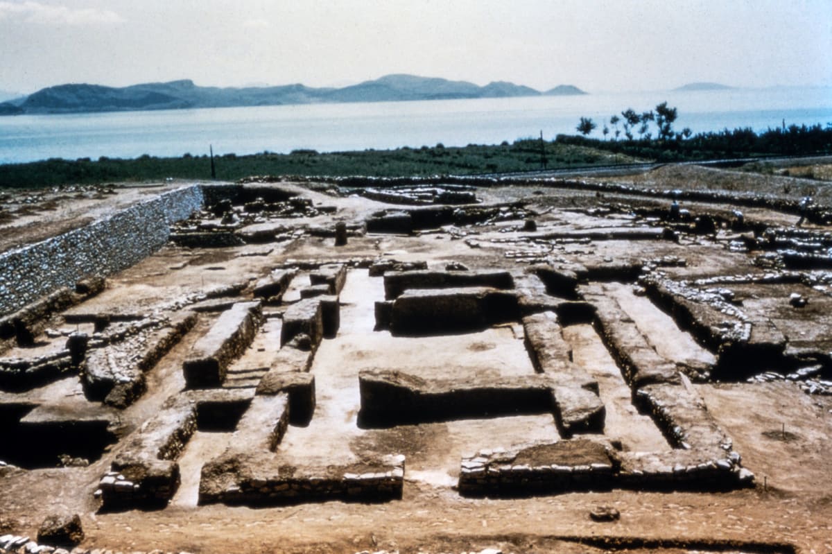
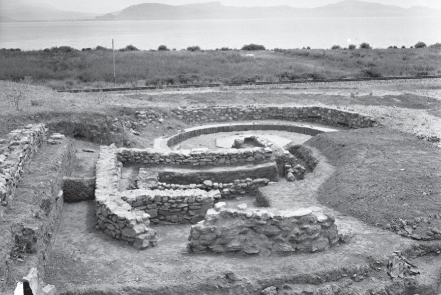
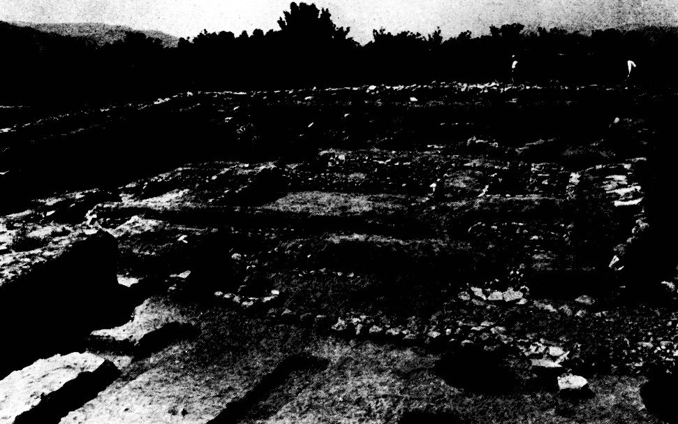
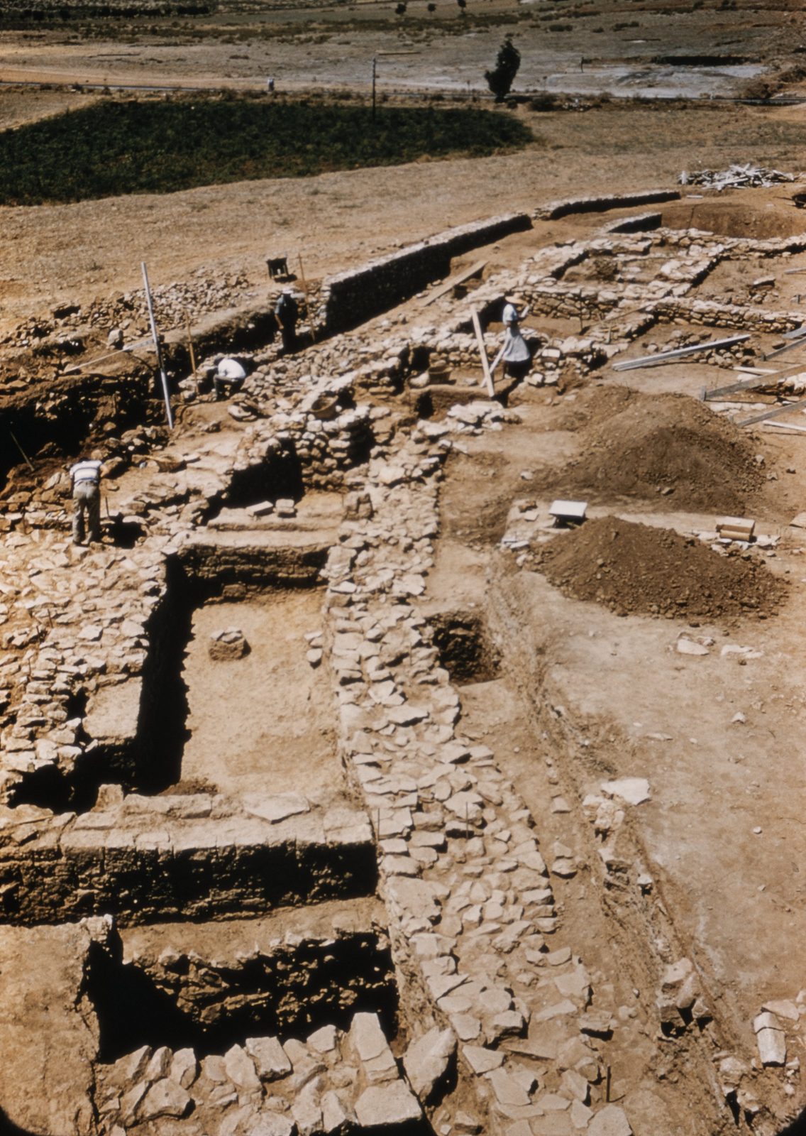
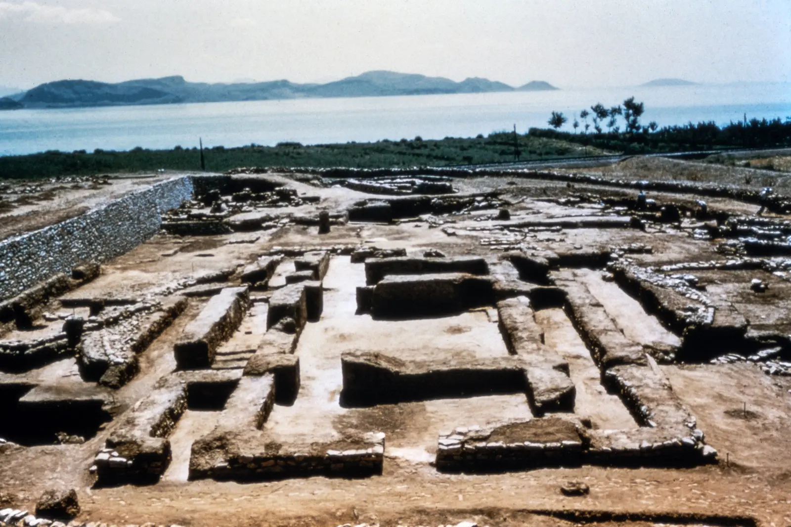
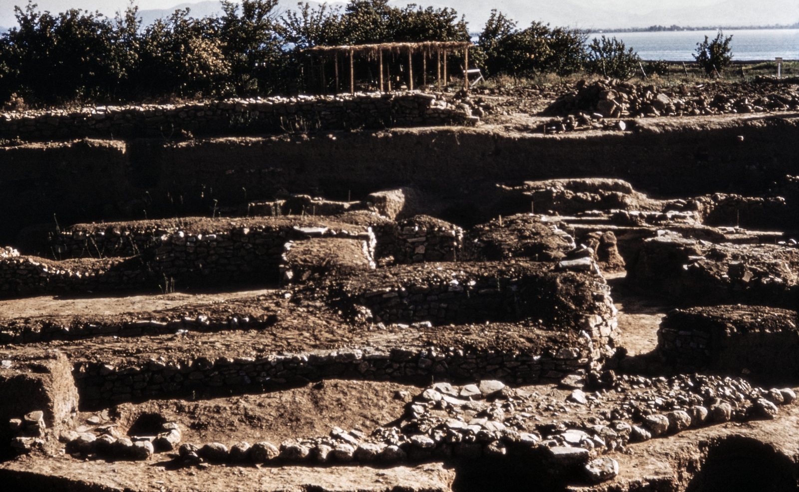
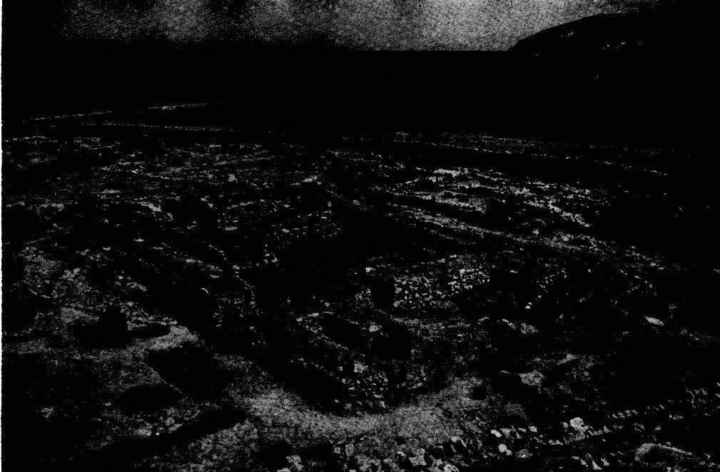
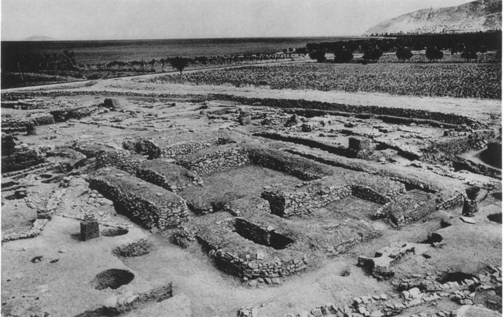
De opgegraven stenen muren van het prehistorische Lerna in de jaren 50, in rechthoeken, met de Argolische Golf en de bergen op de achtergrond
Bron: Courtesy of Harvard Fine Arts Library, Digital Images & Slides Collection
-
Vergroten:
jaren 50
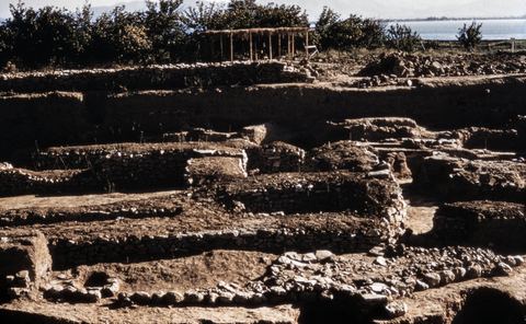
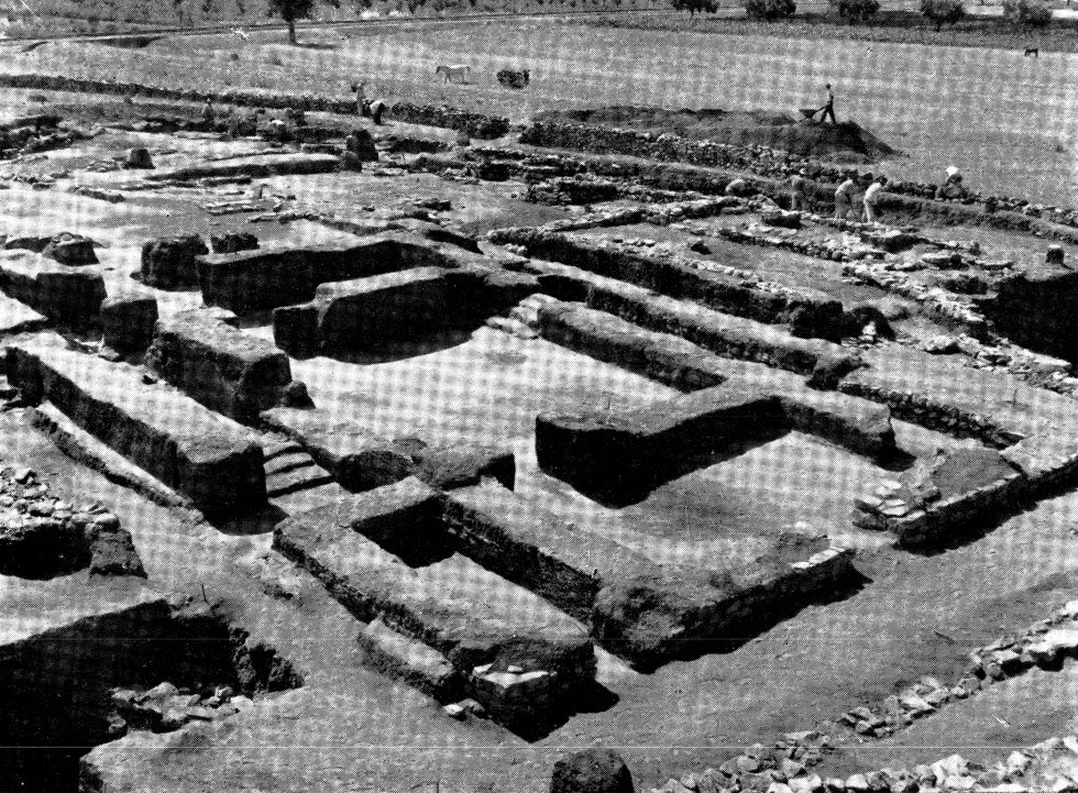
House of the Tiles, Lerna: border of the tumulus that covered the house, from the south.
Bron: George M. A. Hanfmann (photographer per Harvard record; slides may have been donated rather than shot by him) / Harvard Fine Arts Library
-
Vergroten:
jaren 50
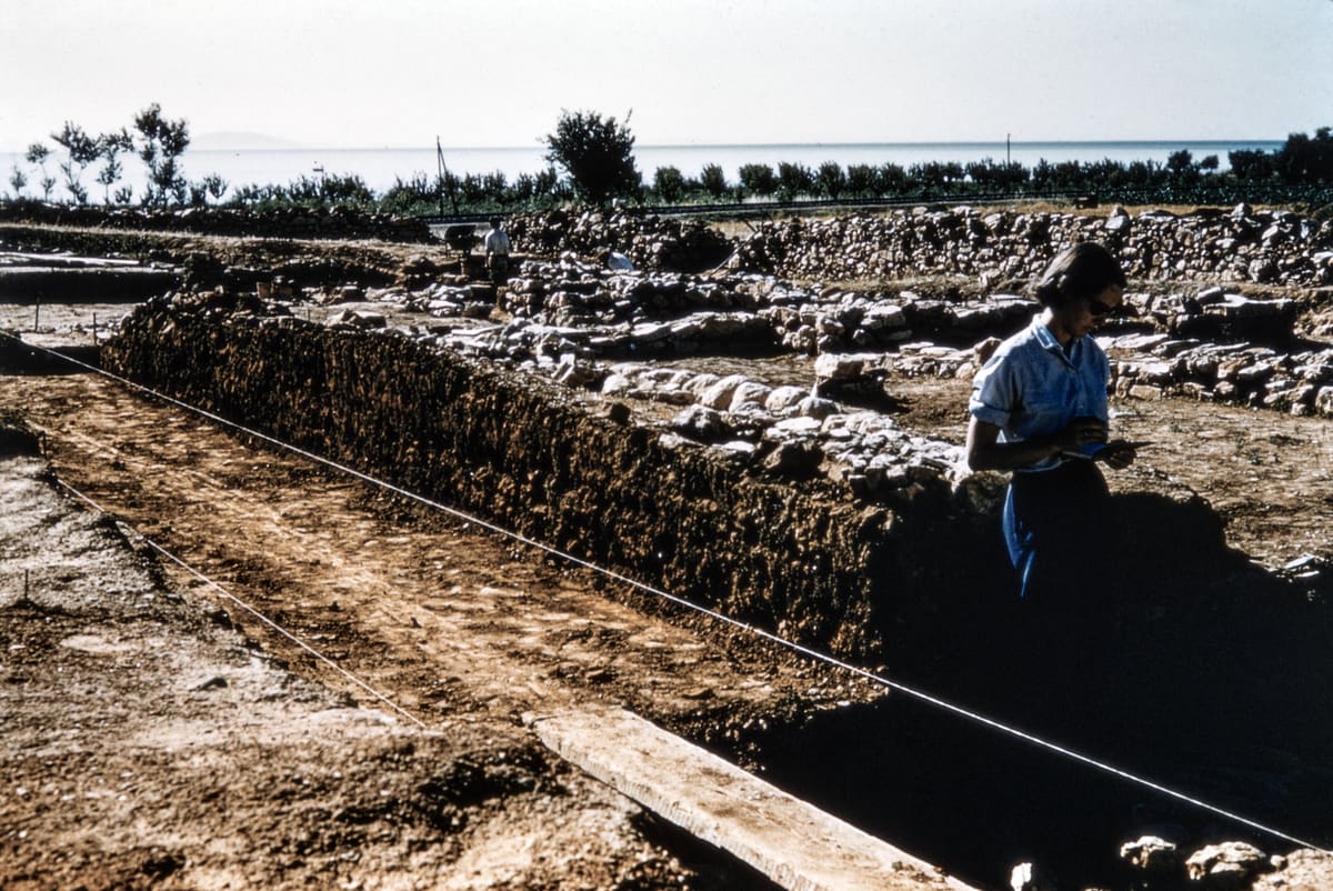
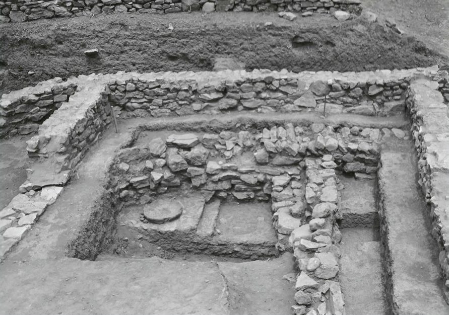
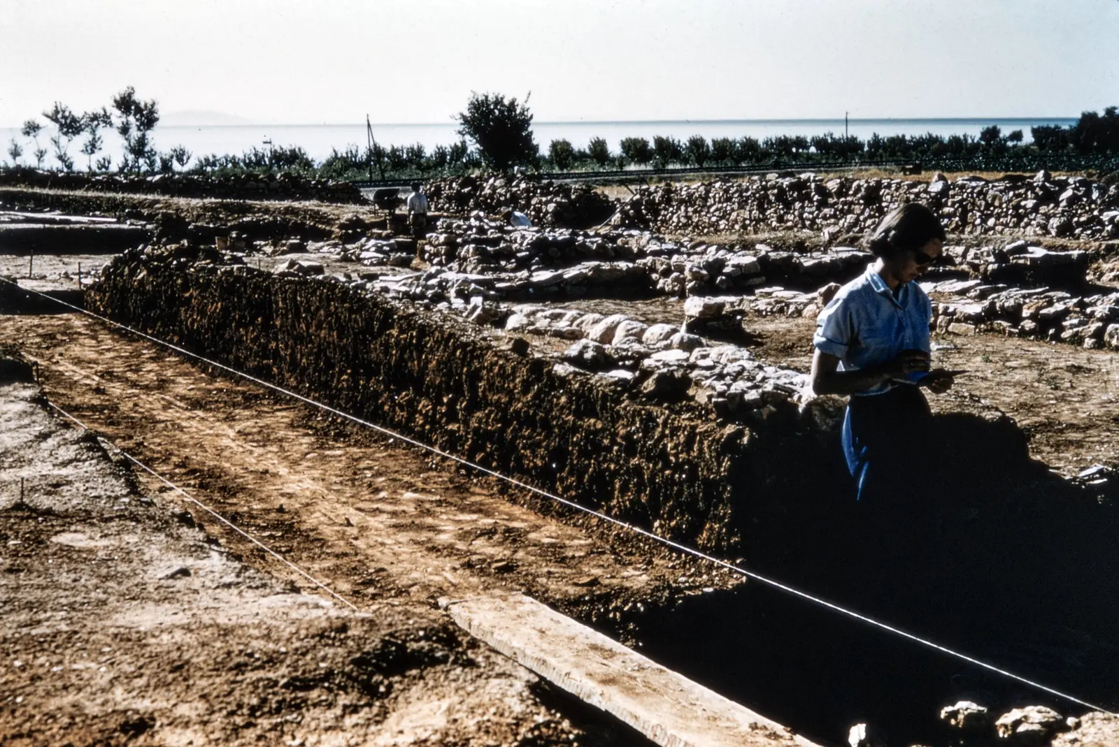
Een lid van het opgravingsteam uit de jaren 50 staat in een sleuf in Lerna en maakt aantekeningen, met een meetkoord, stenen muren en de golf erachter
Bron: Courtesy of Harvard Fine Arts Library, Digital Images & Slides Collection
-
Vergroten:
jaren 50
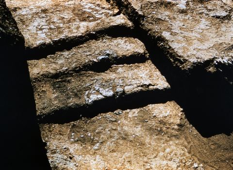
House of the Tiles, Lerna: the stairs in the north corridor.
Bron: George M. A. Hanfmann (photographer per Harvard record; slides may have been donated rather than shot by him) / Harvard Fine Arts Library
-
Vergroten:
jaren 50
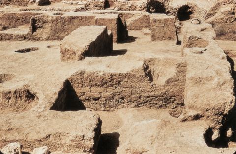
House of the Tiles, Lerna: room XI and other parts from the south.
Bron: George M. A. Hanfmann (photographer per Harvard record; slides may have been donated rather than shot by him) / Harvard Fine Arts Library
-
Vergroten:
jaren 50
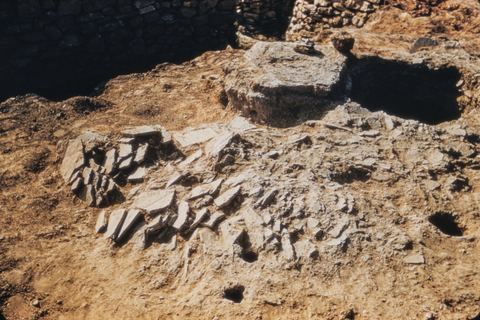
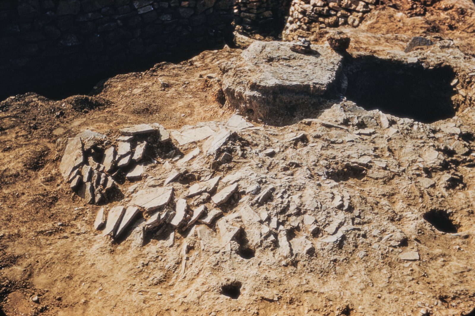
House of the Tiles, Lerna: fallen roof tiles as found.
Bron: George M. A. Hanfmann (photographer per Harvard record; slides may have been donated rather than shot by him) / Harvard Fine Arts Library
-
Vergroten:
jaren 50
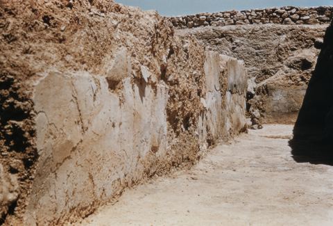
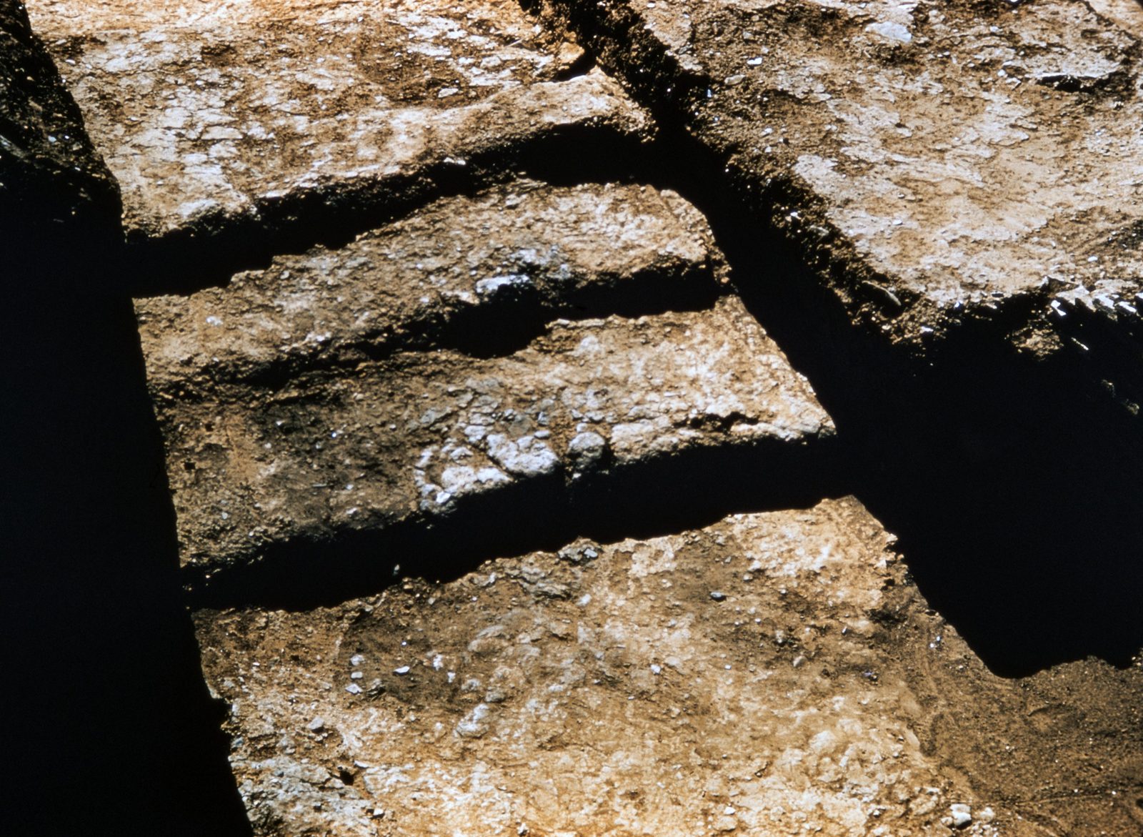
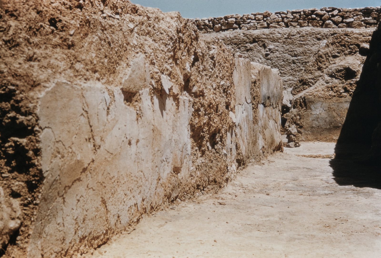
House of the Tiles, Lerna: plaster on the west wall of room XII.
Bron: George M. A. Hanfmann (photographer per Harvard record; slides may have been donated rather than shot by him) / Harvard Fine Arts Library
-
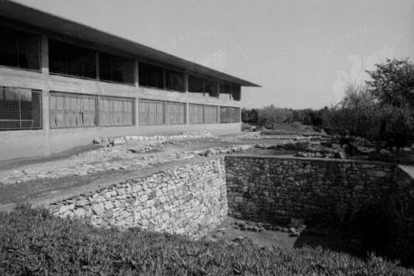
Vergroten:
jaren 50
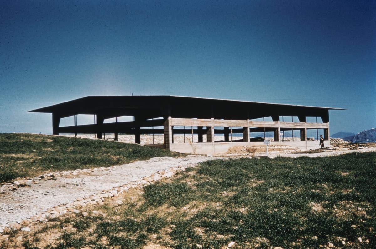
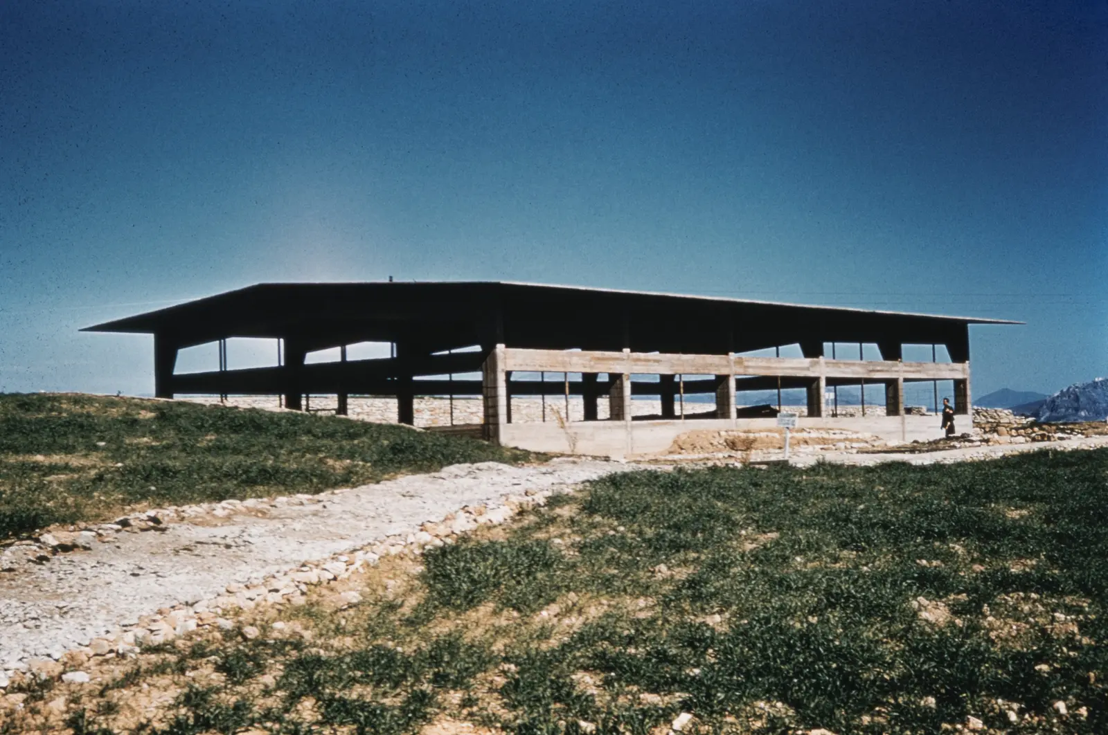
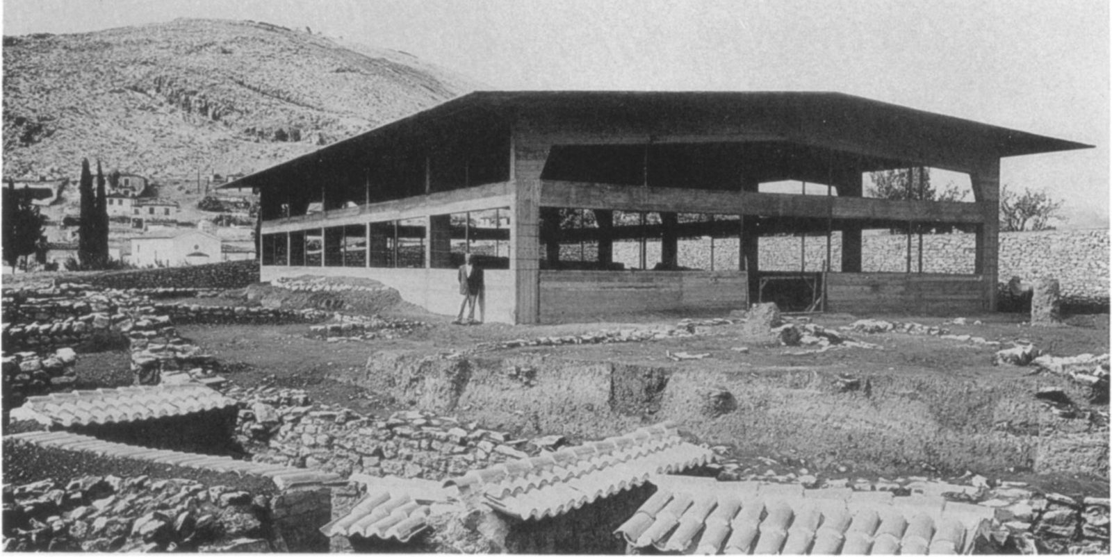
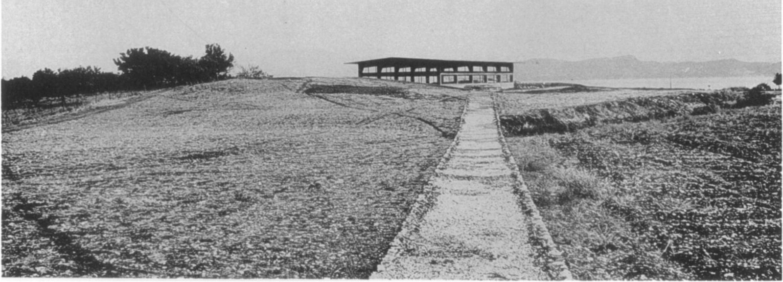
Het pas gebouwde betonnen beschermdak boven de opgraving in Lerna onder een diepblauwe lucht, met een grindpad en gras op de voorgrond, jaren 50
Bron: Courtesy of Harvard Fine Arts Library, Digital Images & Slides Collection
-
Vergroten:
jaren 50
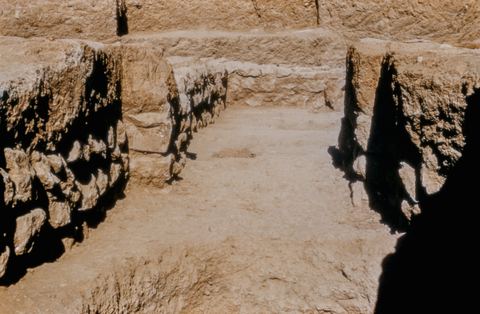
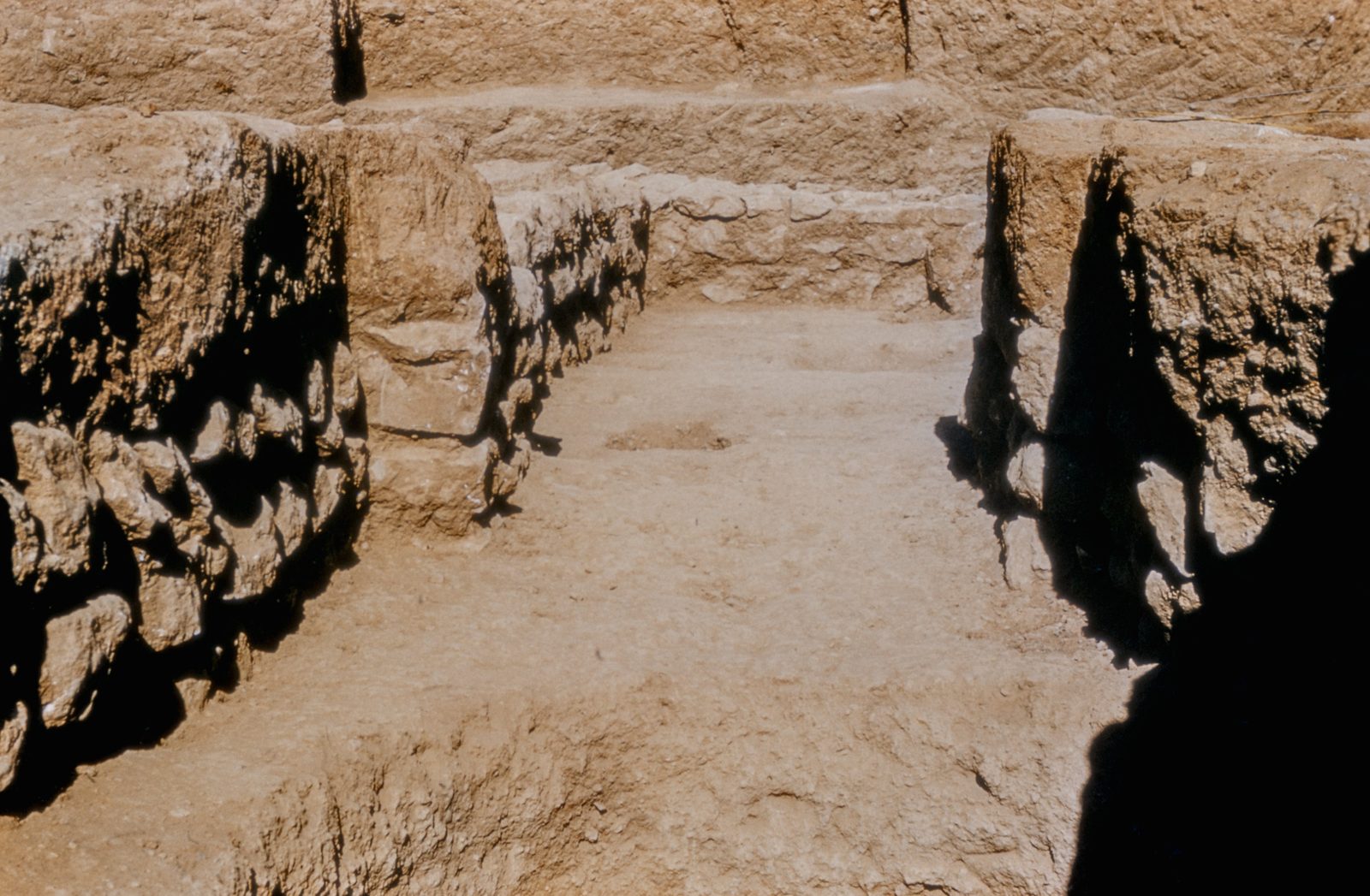
House of the Tiles, Lerna: the south corridor from the east.
Bron: George M. A. Hanfmann (photographer per Harvard record; slides may have been donated rather than shot by him) / Harvard Fine Arts Library
-
Vergroten:
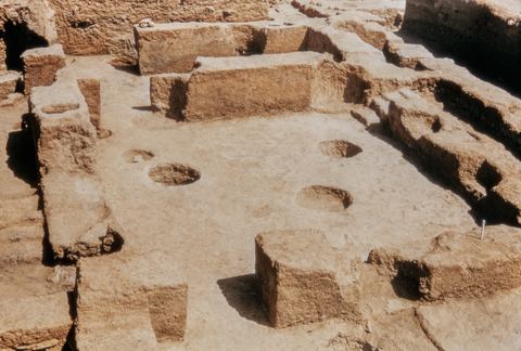
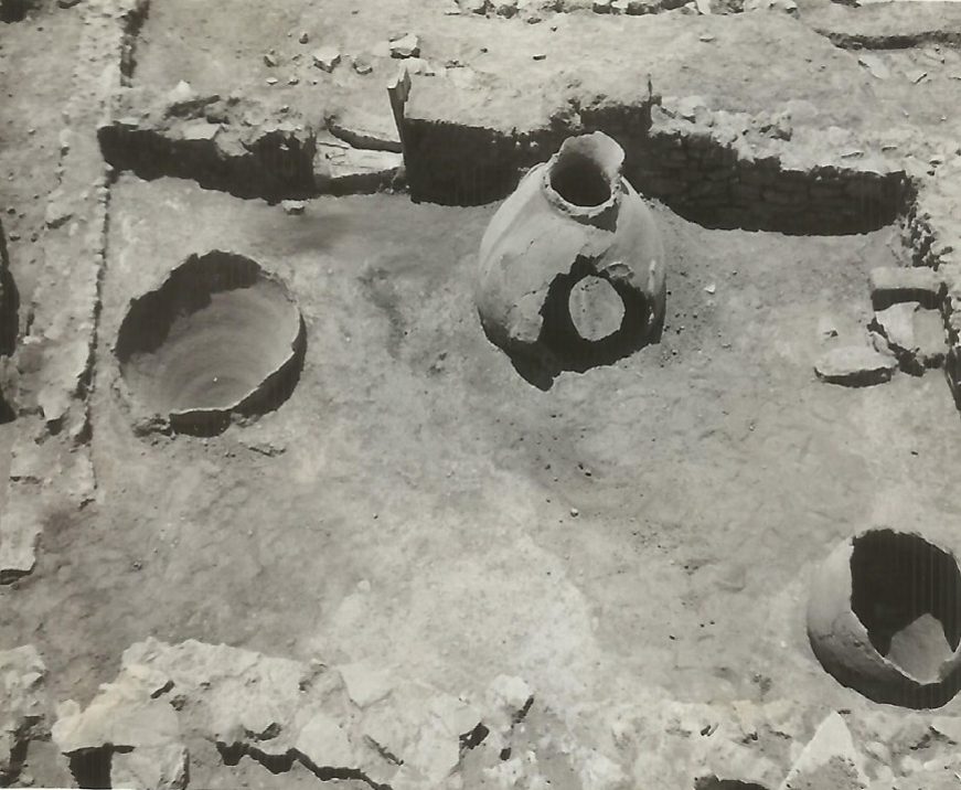
jaren 50
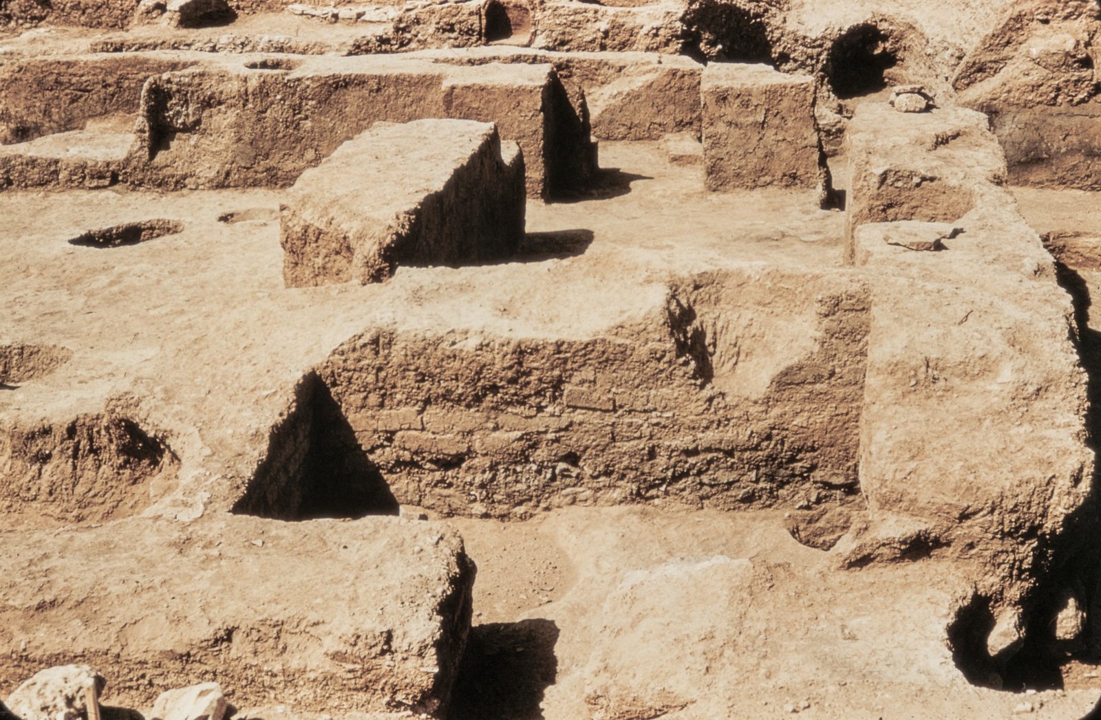
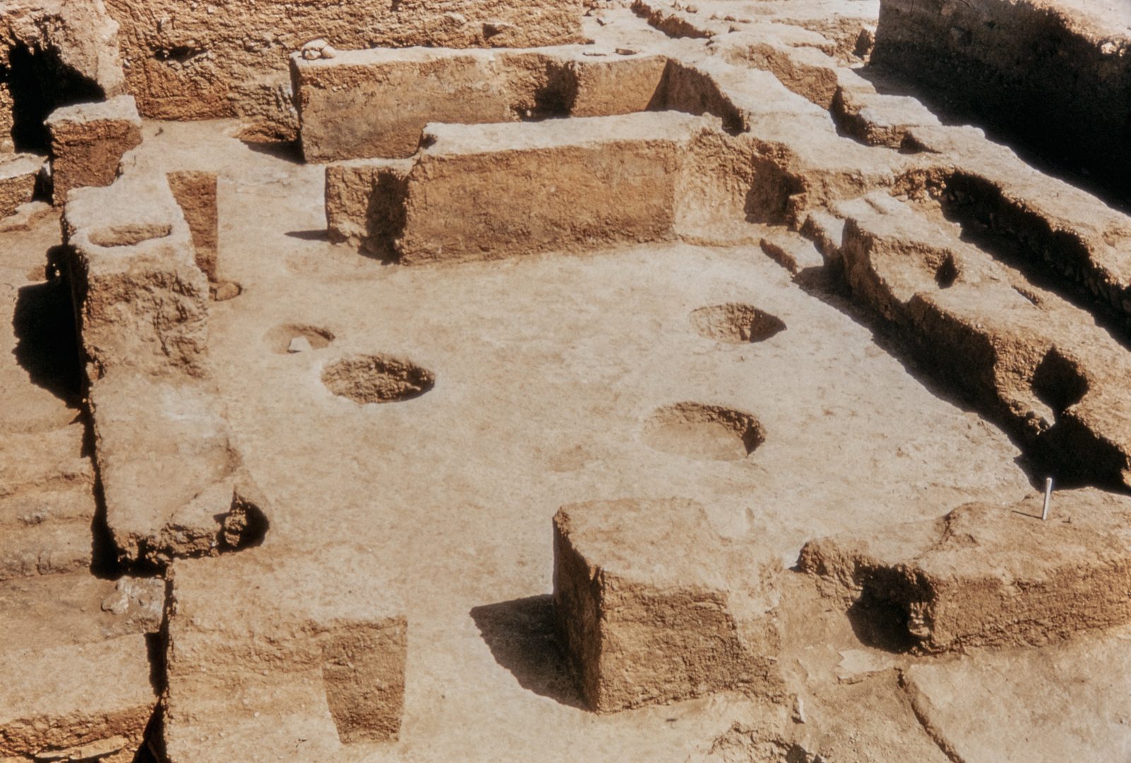
House of the Tiles, Lerna: the west section with storage pits.
Bron: George M. A. Hanfmann (photographer per Harvard record; slides may have been donated rather than shot by him) / Harvard Fine Arts Library
-
Vergroten:
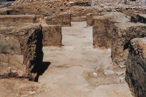
jaren 50
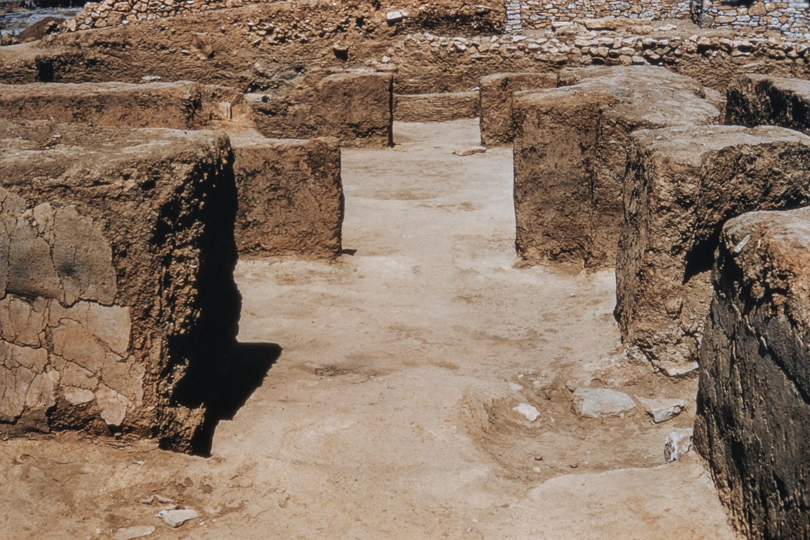
House of the Tiles, Lerna: the interior doorways from the east.
Bron: George M. A. Hanfmann (photographer per Harvard record; slides may have been donated rather than shot by him) / Harvard Fine Arts Library
-
Vergroten:
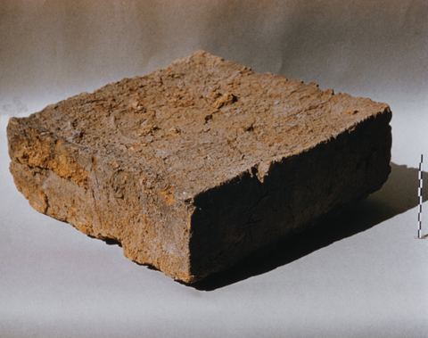
jaren 50
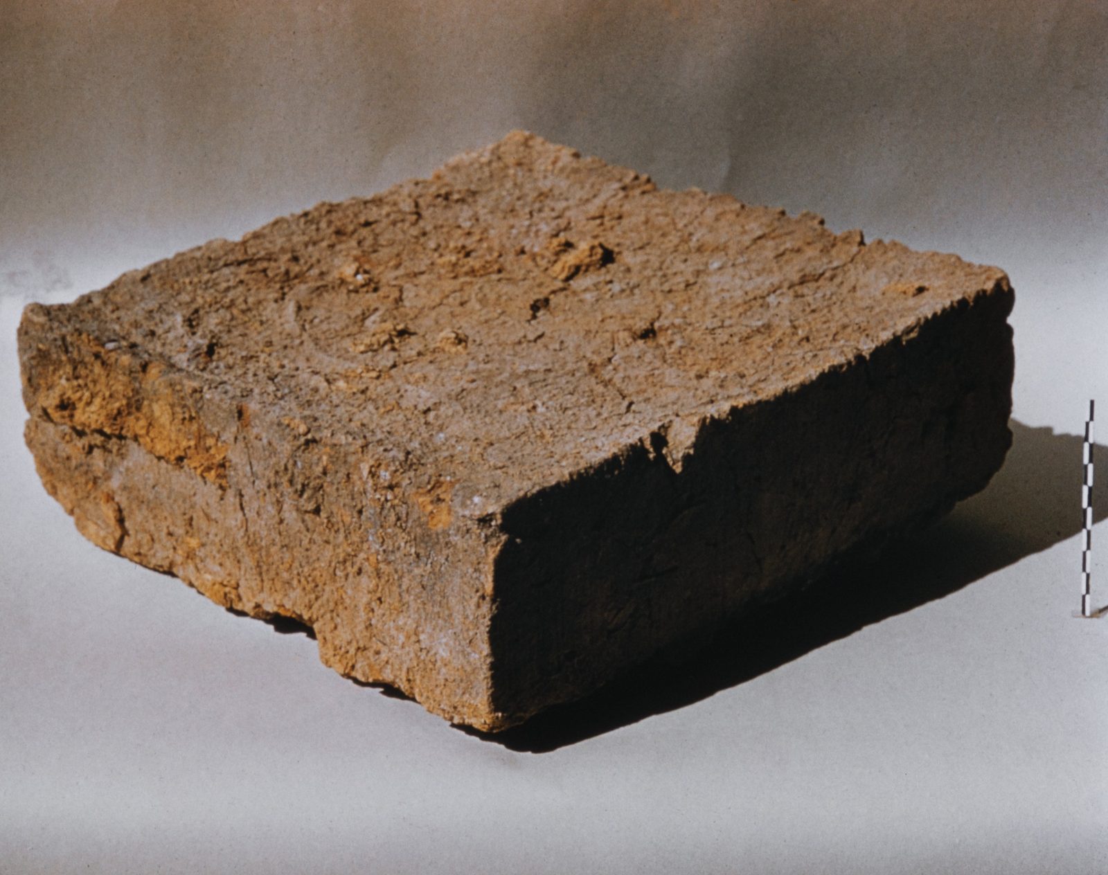
A mud brick from the House of the Tiles at Lerna, photographed as an object.
Bron: George M. A. Hanfmann (photographer per Harvard record; slides may have been donated rather than shot by him) / Harvard Fine Arts Library
-
Vergroten:
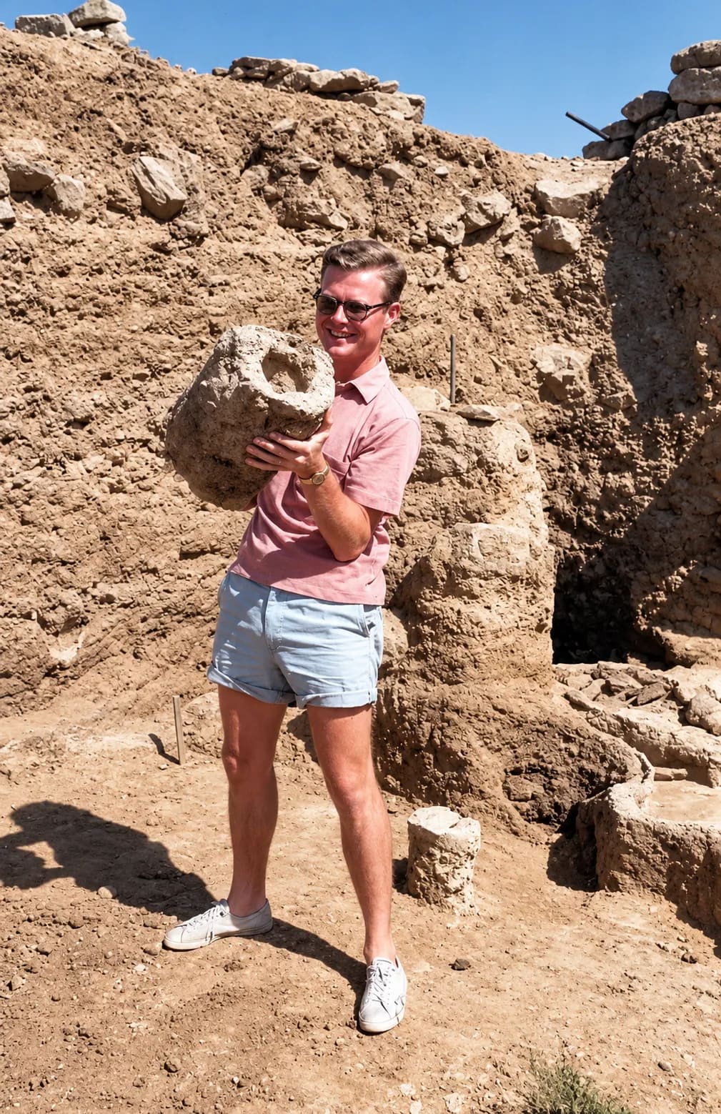
jaren 50
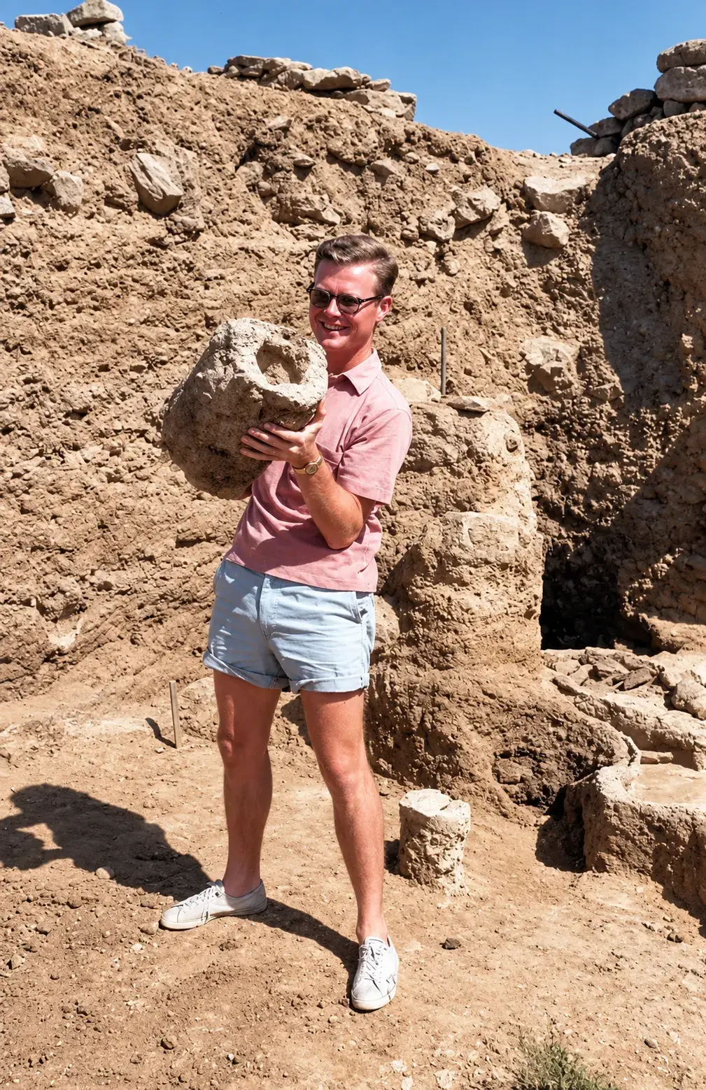
Een onderzoeker met zonnebril, roze shirt en korte broek houdt een grote aardewerken pot omhoog in een opgravingssleuf in Lerna (digitaal opgeknapt)
Bron: Visit Myloi collection
-
Vergroten:
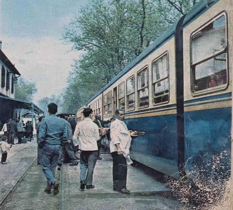
jaren 50
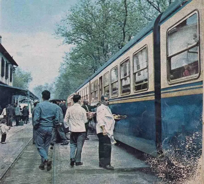
Obers in witte jasjes dragen dienbladen met souvlaki langs een blauwe trein op station Myloi
Bron: Magazine scan, 1960s (Visit Myloi collection)
-
Vergroten:
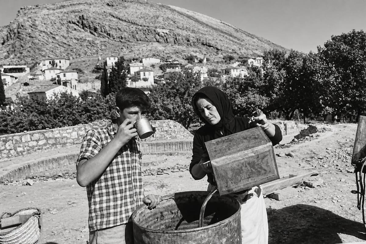
jaren 50
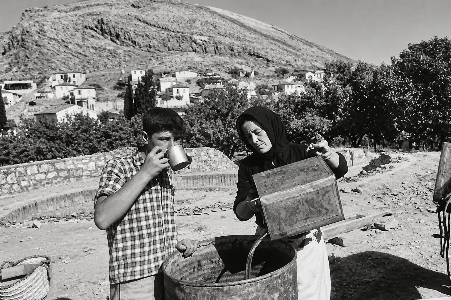
Leden van het opgravingsteam van Lerna in de jaren 50: een jongen drinkt uit een blikken beker en een vrouw met hoofddoek giet water in een ton, met de huizen van Myloi en de Pontinos erachter (digitaal opgeknapt)
Bron: Visit Myloi collection
-
Vergroten:
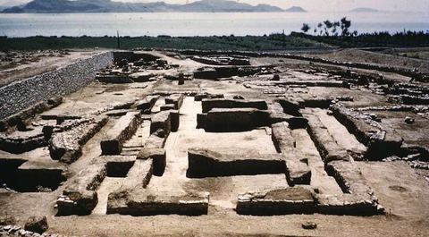
ca. 1954–1957 (schatting)
Faded colour slide of the House of Tiles at Lerna seen from the west, still without its shelter, with a stone retaining wall, the railway with poles, the coastal plain, trees and the gulf.
Bron: University of Texas at Austin, Classics Department (slide collection)
-
Vergroten:
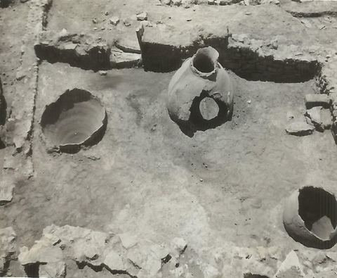
1956
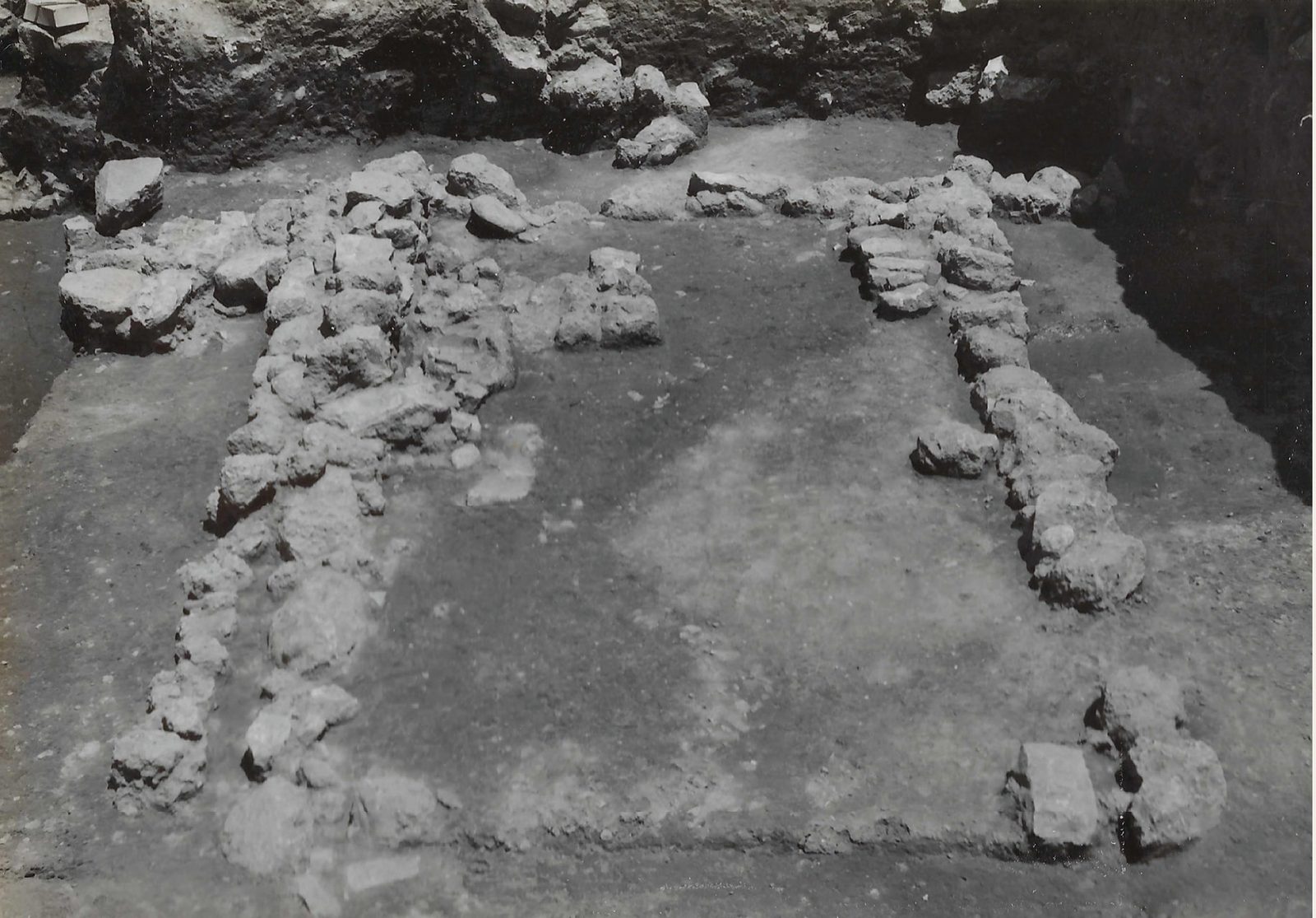
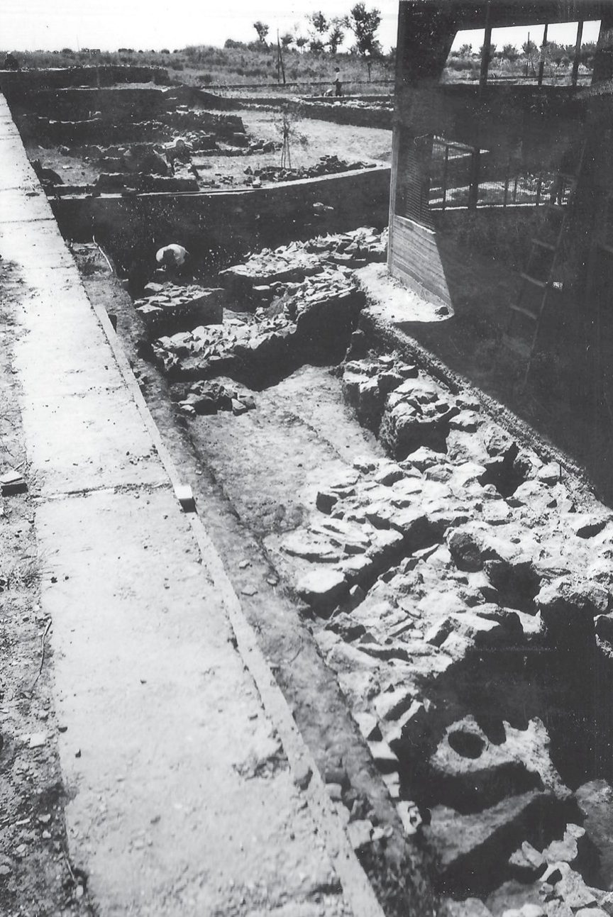
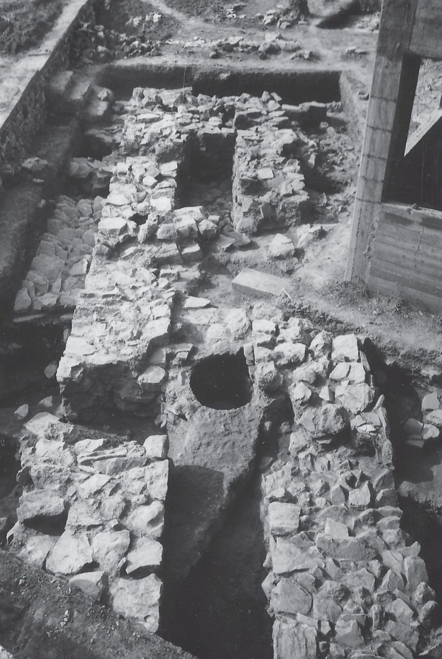
Lerna excavation: Room 45, a Middle Helladic food storeroom with pithoi.
Bron: Lerna excavation team (J.L. Caskey), ASCSA Lerna Excavations Archive; reproduced by the Ephorate of Antiquities of Argolida
-
Vergroten:
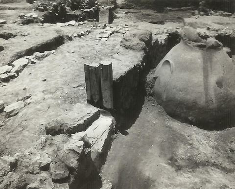
1956
Lerna excavation: entrance of Room 45 with the partly restored wooden door post.
Bron: Lerna excavation team (J.L. Caskey), ASCSA Lerna Excavations Archive; reproduced by the Ephorate of Antiquities of Argolida
-
Vergroten:
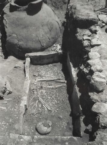
1956
Lerna excavation: cist grave later than Room 45.
Bron: Lerna excavation team (J.L. Caskey), ASCSA Lerna Excavations Archive; reproduced by the Ephorate of Antiquities of Argolida
-
Vergroten:
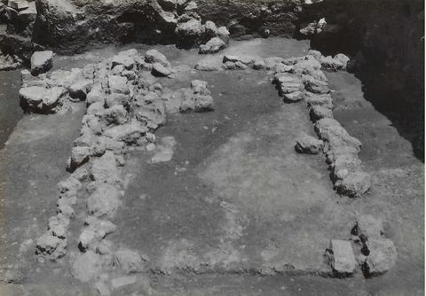
1956
Lerna excavation: the Neolithic house W-5 seen from the south.
Bron: Lerna excavation team (J.L. Caskey), ASCSA Lerna Excavations Archive; reproduced by the Ephorate of Antiquities of Argolida
-
Vergroten:
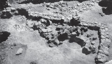
1956
Lerna excavation: the Early Helladic III Building W-84 during excavation.
Bron: Lerna excavation team (J.L. Caskey), ASCSA Lerna Excavations Archive; reproduced by the Ephorate of Antiquities of Argolida
-
Vergroten:
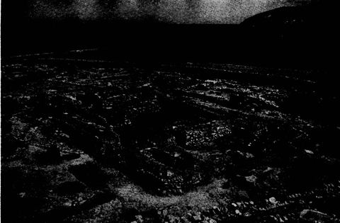
1956
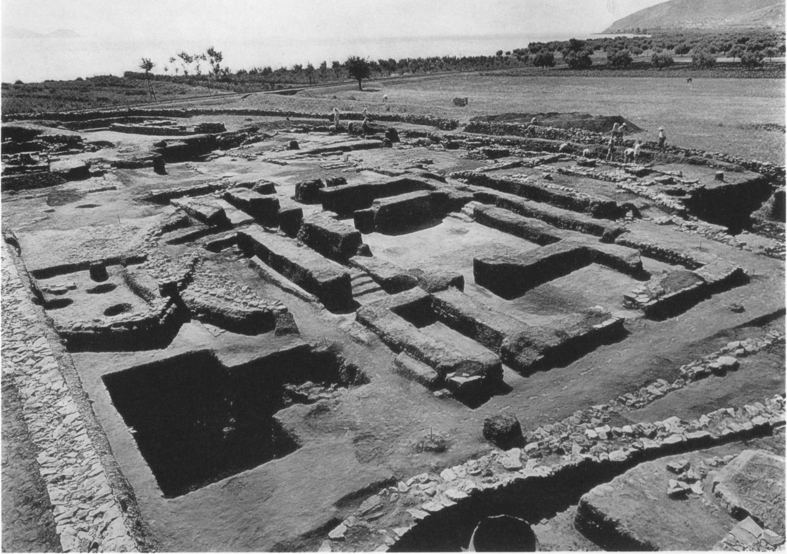
The House of the Tiles at Lerna from the northwest, its mud-brick walls temporarily protected with small stones, with the Pontinos ridge behind.
Bron: Bulletin de Correspondance Hellénique, Chronique des fouilles (photos probably supplied by ASCSA/Caskey)
-
Vergroten:
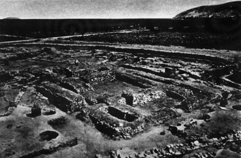
herfst 1956
The House of Tiles at Lerna after the 1956 season, walls covered with earth and stones, with Mt Pontinos and the plain behind.
Bron: Lerna excavation (J.L. Caskey, ASCSA), published in ILN
-
Vergroten:
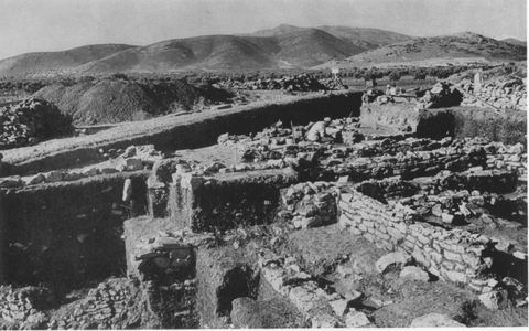
1956
Overview of the Lerna excavation from the north, with hills behind.
Bron: J. L. Caskey / ASCSA Lerna excavation
-
Vergroten:
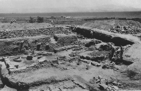
1956
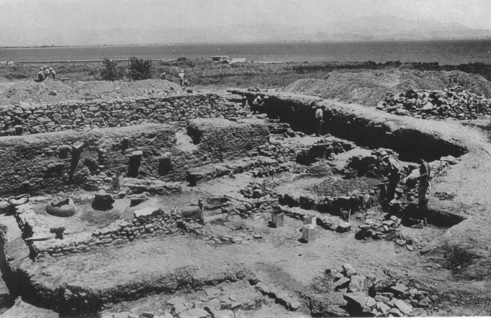
The Lerna excavation from the south-west with the gulf and workmen.
Bron: J. L. Caskey / ASCSA Lerna excavation
-
Vergroten:
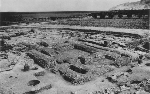
1956
The House of the Tiles at Lerna from the north-west, with Mt Pontinos and an olive grove.
Bron: J. L. Caskey / ASCSA Lerna excavation
-
Vergroten:
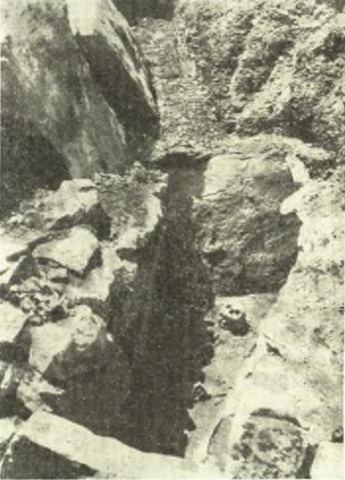
augustus 1956
Stone cist grave A after cleaning, found on the plot of K. Bompos at the entrance of Myloi from Argos.
Bron: E. Protonotariou (excavation); Αρχαιολογική Εφημερίς 1955 (printed 1961)
-
Vergroten:
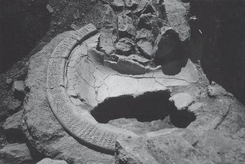
1957
Lerna excavation: the hearth of Building BG as found in situ.
Bron: Lerna excavation team (J.L. Caskey), ASCSA Lerna Excavations Archive; reproduced by the Ephorate of Antiquities of Argolida
-
Vergroten:
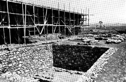
juni–september 1957
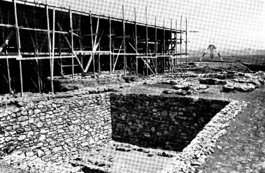
Lerna: a Neolithic house in the foreground and, at left behind, the shelter for the House of the Tiles under construction with wooden scaffolding.
Bron: Bulletin de Correspondance Hellénique, Chronique des fouilles (photos probably supplied by ASCSA/Caskey)
-
Vergroten:
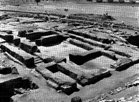
1957
The House of the Tiles at Lerna seen from the northwest, with the plain, trees and some workers behind.
Bron: Bulletin de Correspondance Hellénique, Chronique des fouilles (photos probably supplied by ASCSA/Caskey)
-
Vergroten:
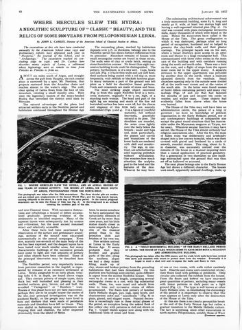
1957 (publicatie; foto's 1954 en 1956)
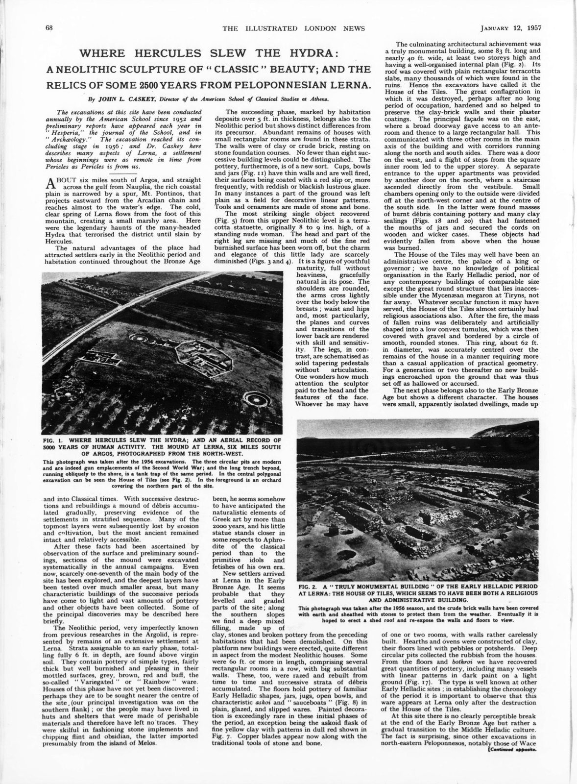
Full page 68 of the Illustrated London News of 12 January 1957 with Caskey's article on Lerna and its two photos.
Bron: Illustrated London News; J.L. Caskey
-
Vergroten:
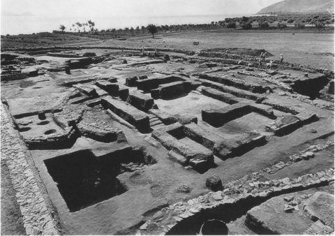
juli 1957
The Lerna excavation from the north-west, with the railway and the sea in the background.
Bron: Alison Frantz (photographer) / ASCSA
-
Vergroten:
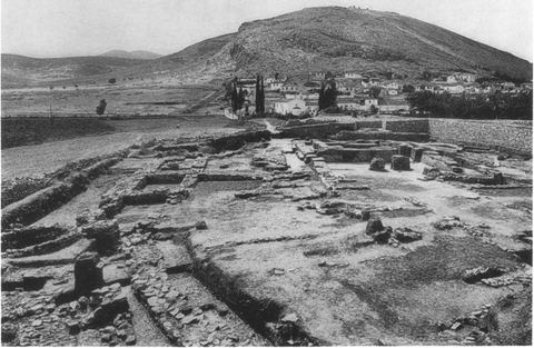
1957
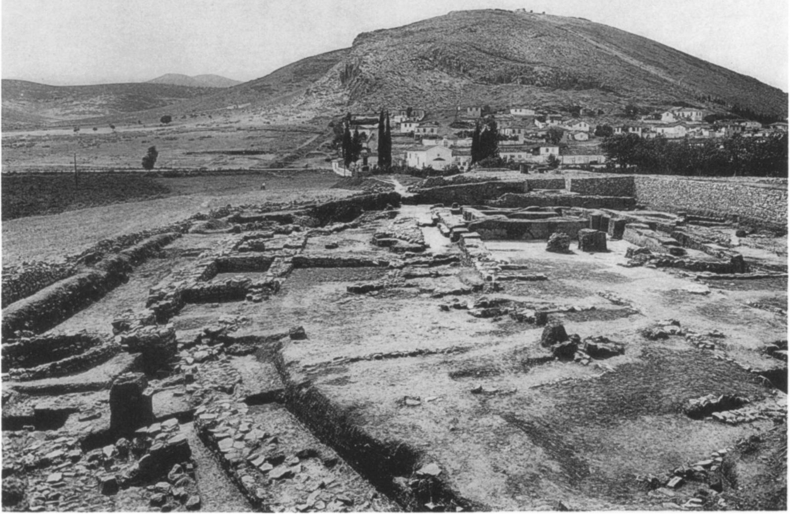
The Lerna excavation from the east, with the village of Myloi and Mt Pontinos in the background.
Bron: Alison Frantz (photographer) / ASCSA
-
Vergroten:
1957
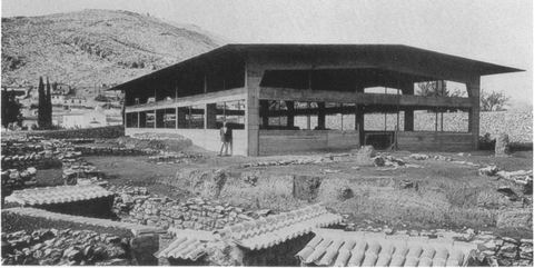
The new protective shelter over the House of the Tiles, with houses of Myloi and Mt Pontinos behind.
Bron: J. L. Caskey / ASCSA Lerna excavation
-
Vergroten:
september 1957
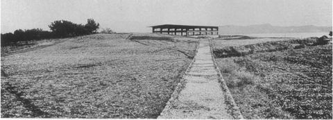
The Lerna site from the south-west, with the shelter and the gulf.
Bron: J. L. Caskey / ASCSA Lerna excavation
-
Vergroten:
1957
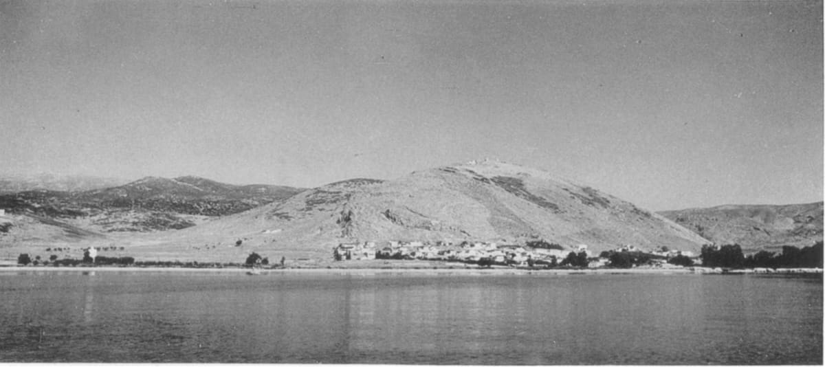
Myloi vanaf zee in 1957: een lage rij witte huizen onder de heuvel Pontinos
Bron: American School of Classical Studies at Athens · Hesperia 27 (1958), pl. 40c
-
Vergroten:
1957
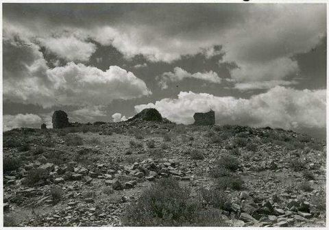
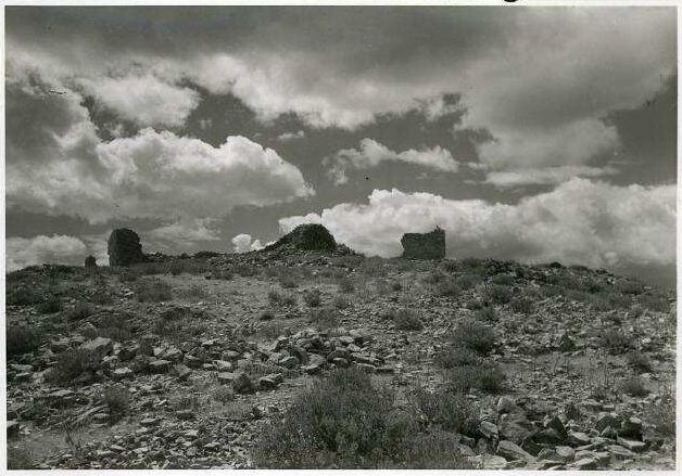
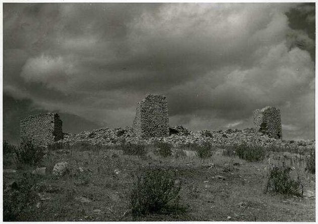
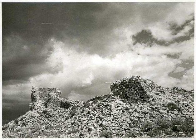
"Kastell Kiveri": castle ruins with scattered towers on the hilltop under clouds.
Bron: Wulf Schaefer; DAI Athens, NL-Schaefer-W-1-A-07-004
-
Vergroten:
1957
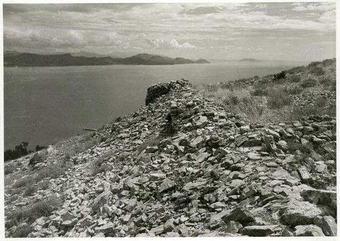
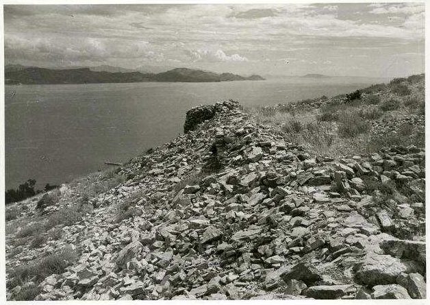
"Kastell Kiveri": rubble of the castle walls with a tower stump and the gulf behind.
Bron: Wulf Schaefer; DAI Athens, NL-Schaefer-W-1-A-07-005
-
Vergroten:
1957
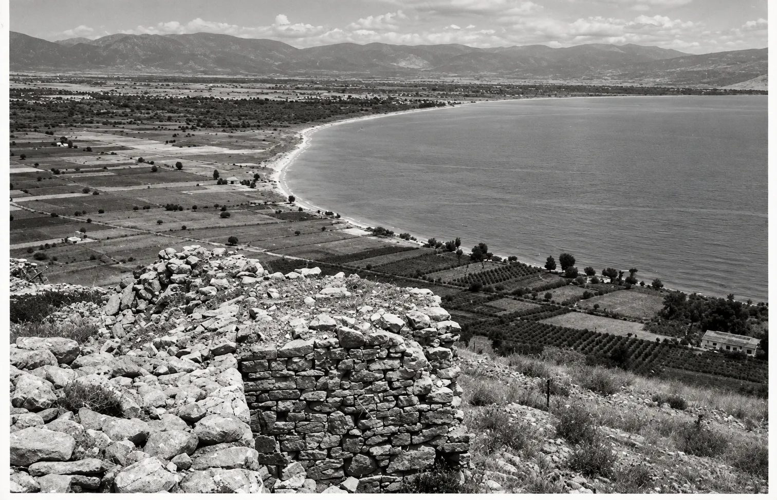
"Kastell Kiveri": corner of the castle wall with a view down to the coastal plain, fields and a curving beach.
Bron: Wulf Schaefer; DAI Athens, NL-Schaefer-W-1-A-07-006 · digitaal opgeknapt
-
Vergroten:
1957
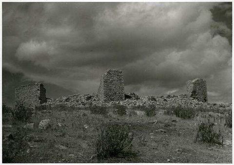
"Kastell Kiveri": towers and walls of the castle on the hilltop.
Bron: Wulf Schaefer; DAI Athens, NL-Schaefer-W-1-A-07-007
-
Vergroten:
1957
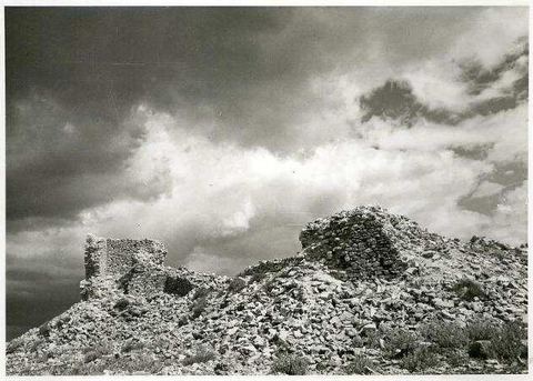
"Kastell Kiveri": ruined towers on the rocky hilltop under clouds.
Bron: Wulf Schaefer; DAI Athens, NL-Schaefer-W-1-A-07-008
-
Vergroten:
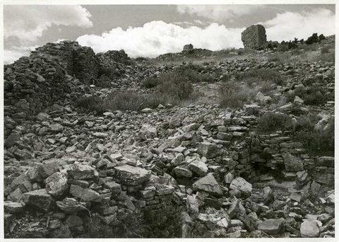
1957
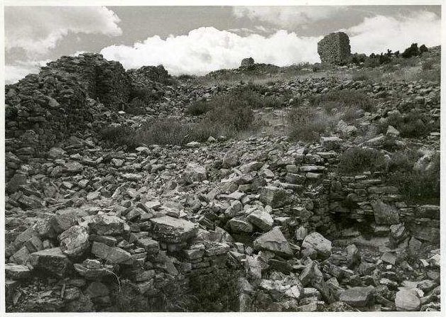
"Kastell Kiveri": rubble-filled interior of the castle with a tower in the background.
Bron: Wulf Schaefer; DAI Athens, NL-Schaefer-W-1-A-07-009
-
Vergroten:
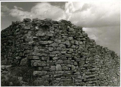
1957
"Kastell Kiveri": rubble masonry of a castle tower.
Bron: Wulf Schaefer; DAI Athens, NL-Schaefer-W-1-A-07-011
-
Vergroten:
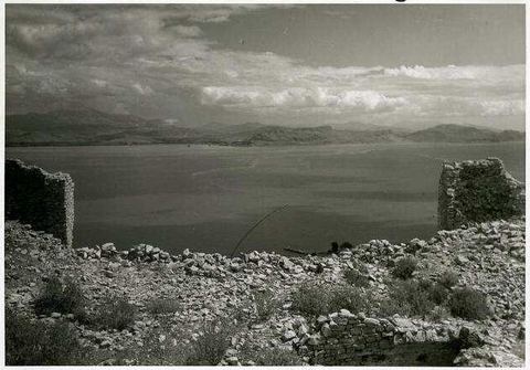
1957
"Kastell Kiveri": wall remains framing a view over the gulf.
Bron: Wulf Schaefer; DAI Athens, NL-Schaefer-W-1-A-07-012
-
Vergroten:
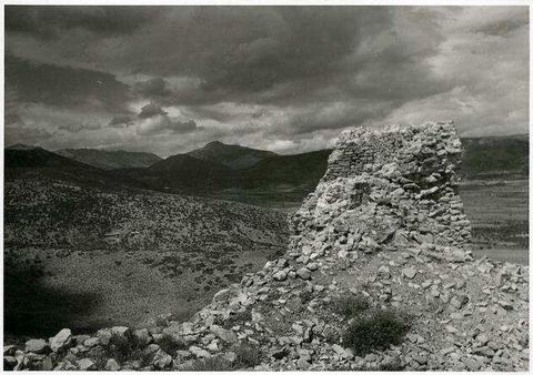
1957
"Kastell Kiveri": ruined wall with mountains behind.
Bron: Wulf Schaefer; DAI Athens, NL-Schaefer-W-1-A-07-013
-
Vergroten:
1957
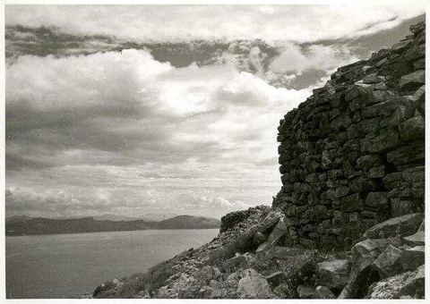
"Kastell Kiveri": rubble masonry tower above the gulf.
Bron: Wulf Schaefer; DAI Athens, NL-Schaefer-W-1-A-07-014
-
Vergroten:
6 september 1957
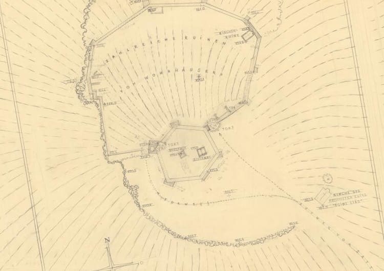
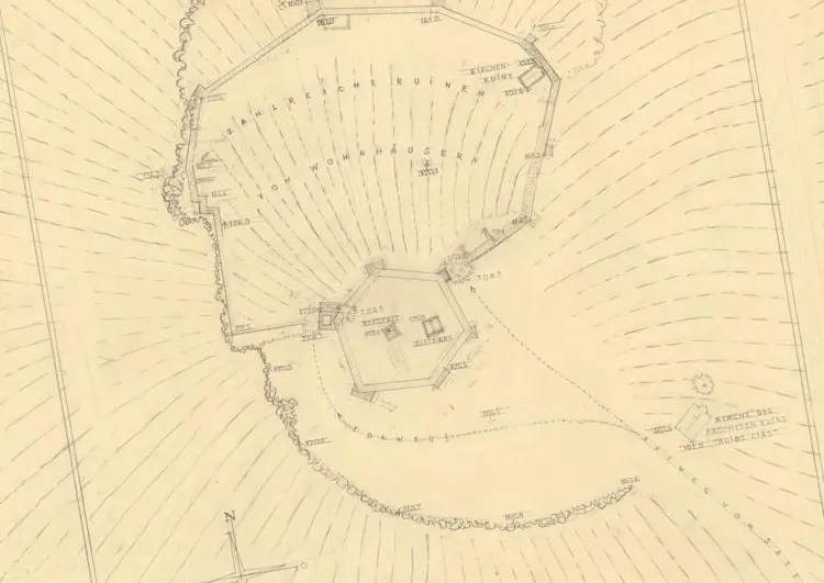
Opmetingsplan in potlood van het kasteel op Pontinos, met de kerkruïne aangegeven bij de oostmuur
Bron: D-DAI-ATH-Archiv, Nachlass Schaefer, W-1-Z-07-002
-
Vergroten:
5 augustus 1957
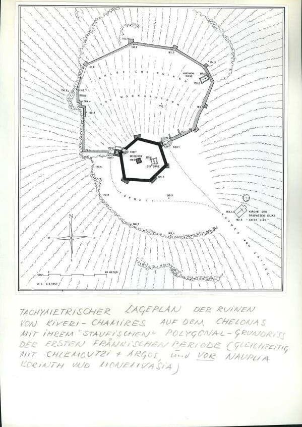
In inkt uitgewerkt plan uit 1957 van de kasteelruïne van Kiveri–Chamires, met de kerkruïne en de kapel van Profitis Ilias
Bron: Plan W.S., 5.8.1957 (Schaefer papers, German Archaeological Institute, Athens; supplied by Visit Myloi)
-
Vergroten:
1958
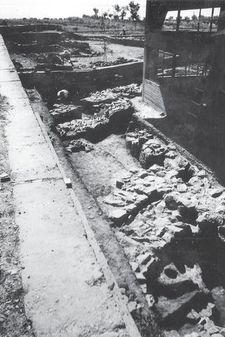
Lerna excavation: the excavated northern part of Building BG seen from the northwest, with the newly built shelter over the House of Tiles, a worker, trees and a telegraph pole.
Bron: Lerna excavation team (J.L. Caskey), ASCSA Lerna Excavations Archive; reproduced by the Ephorate of Antiquities of Argolida
-
Vergroten:
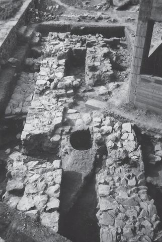
1958
Lerna excavation: the southeast corridor of Building BG seen from the north, with the shelter visible.
Bron: Lerna excavation team (J.L. Caskey), ASCSA Lerna Excavations Archive; reproduced by the Ephorate of Antiquities of Argolida
-
Vergroten:
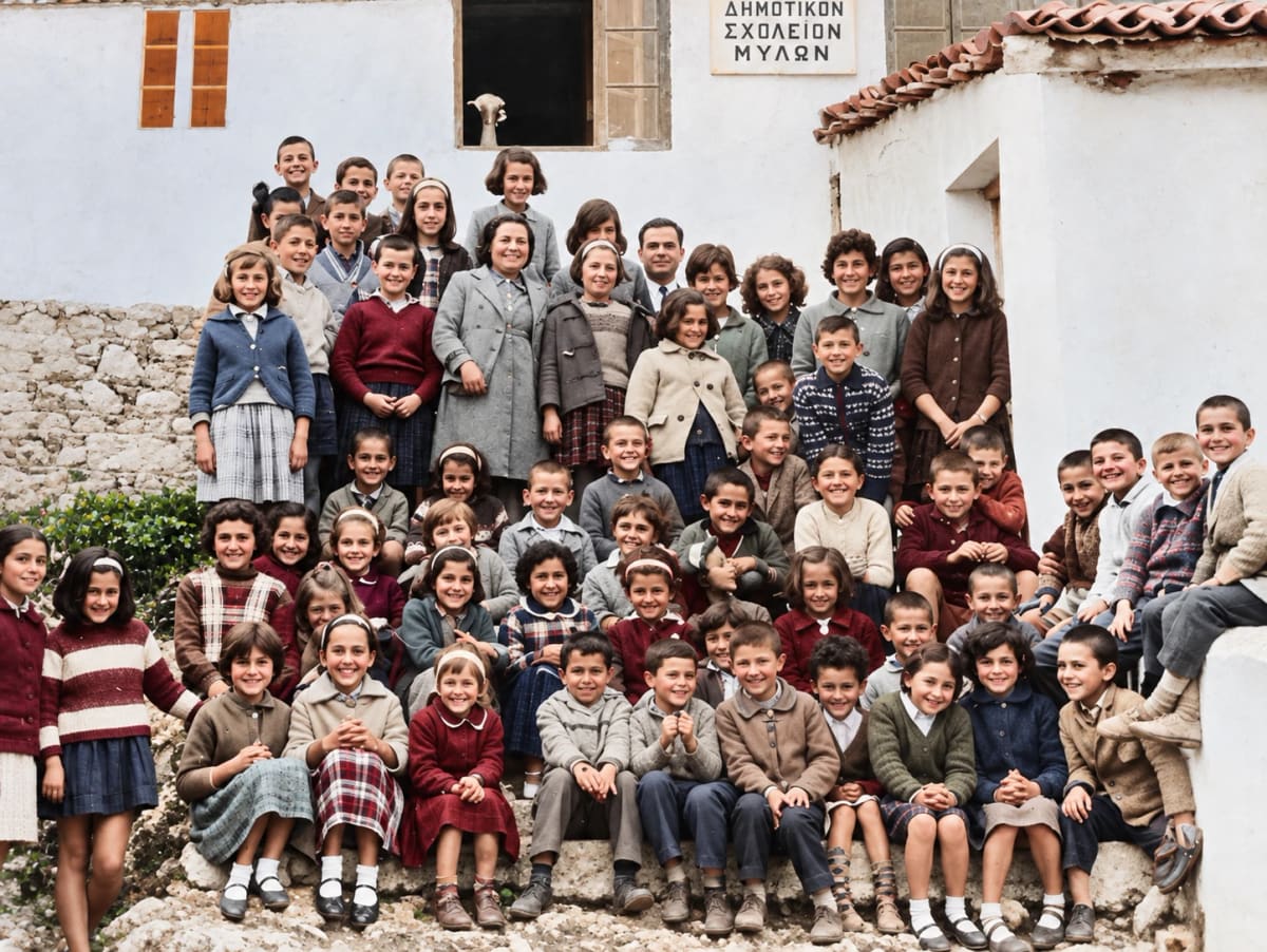
ca. 1955–1965
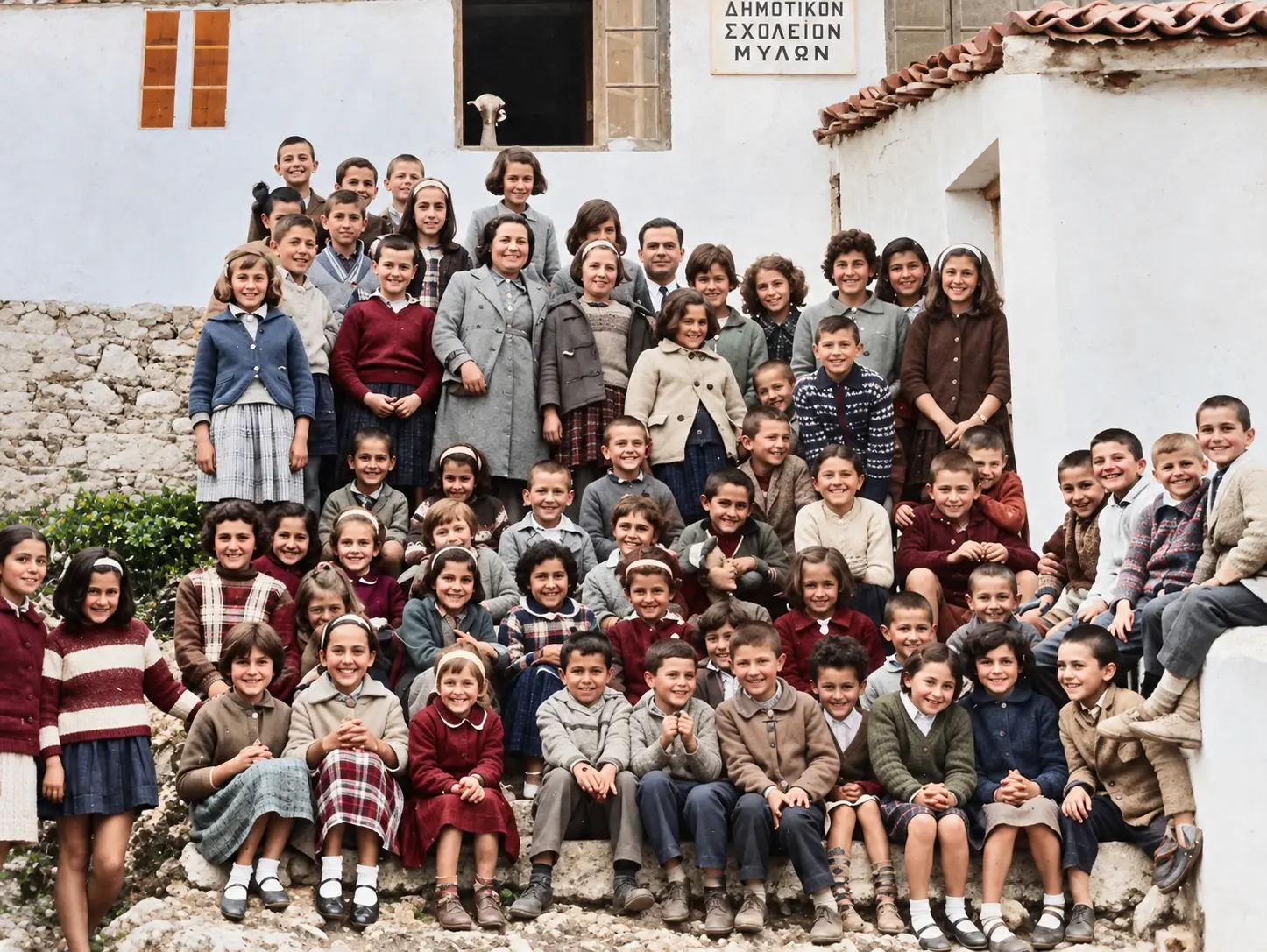
Ingekleurde klassenfoto van de leerlingen en leerkrachten voor het Dimotikon Scholeion Mylon, de lagere school van Myloi (digitaal opgeknapt)
Bron: Visit Myloi collection
-
Vergroten:
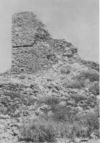
ca. 1958–1960
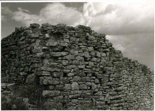
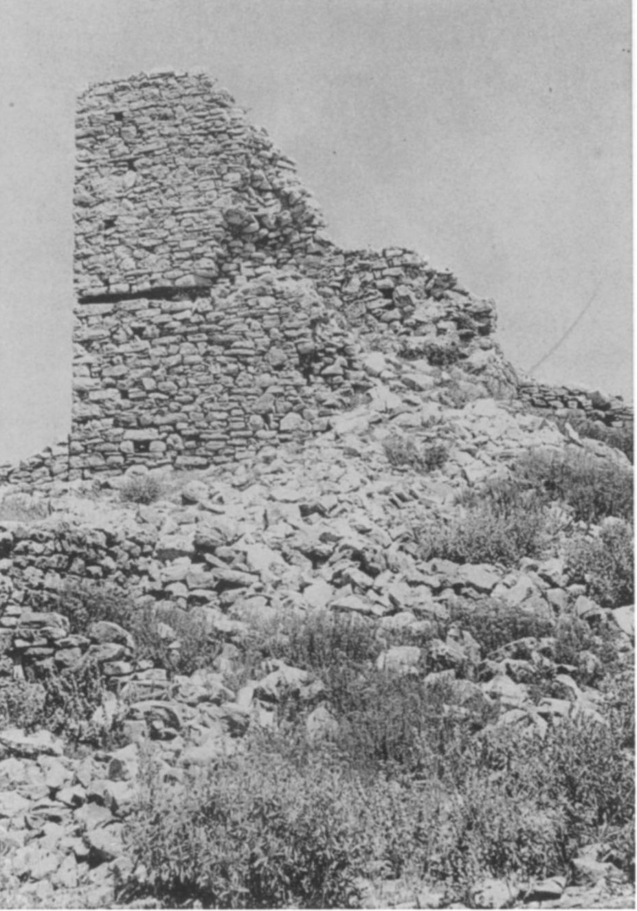
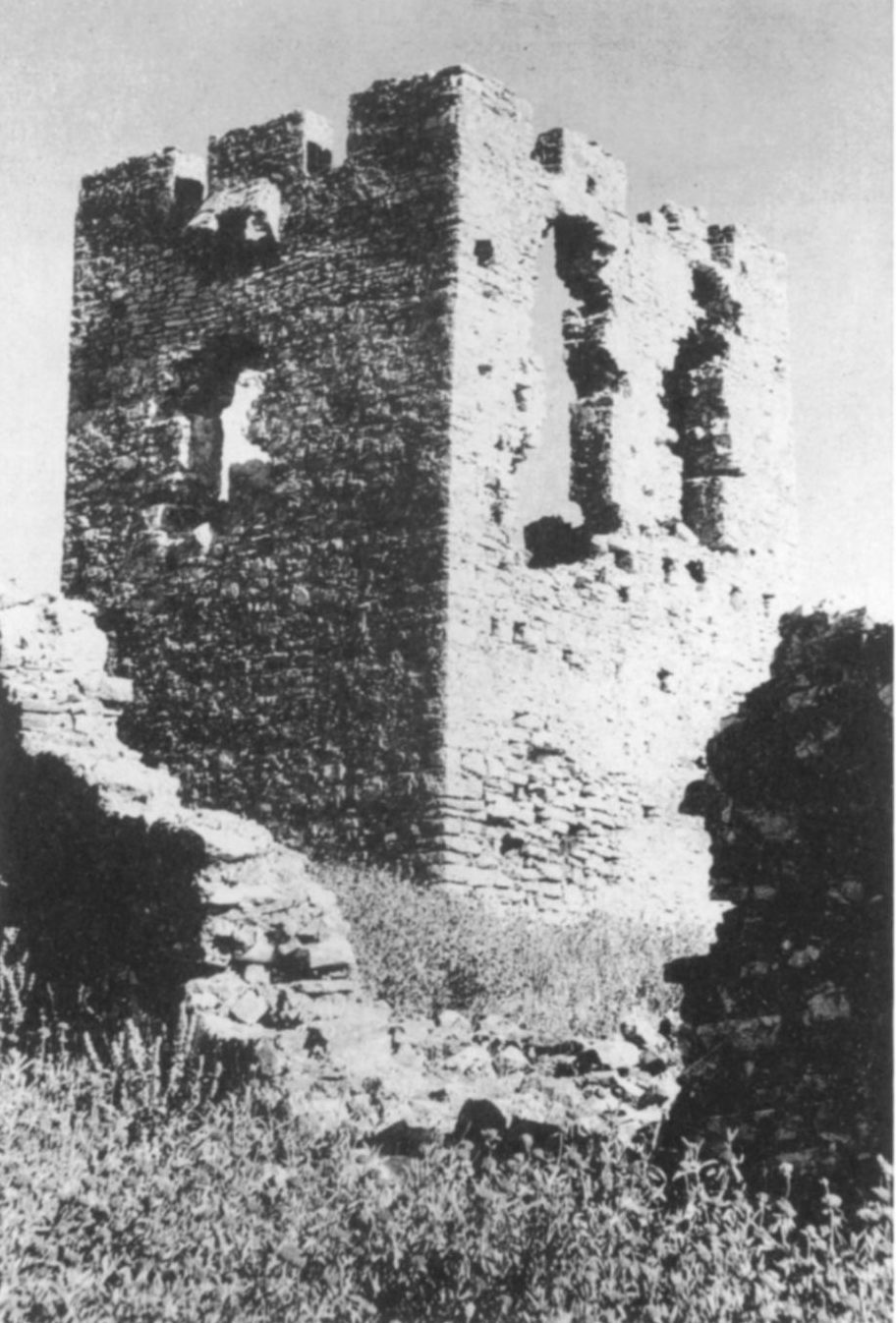
Pl. 114b 'Kiveri, Redoubt. Northwest Tower, from Northwest': the northwest tower of the redoubt of the castle on Mt Pontinos above Myloi, showing the line of a horizontal beam.
Bron: Probably W.E. McLeod
-
Vergroten:
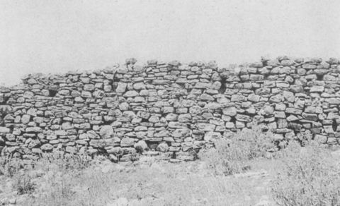
ca. 1958–1960
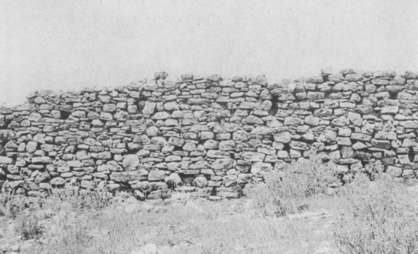
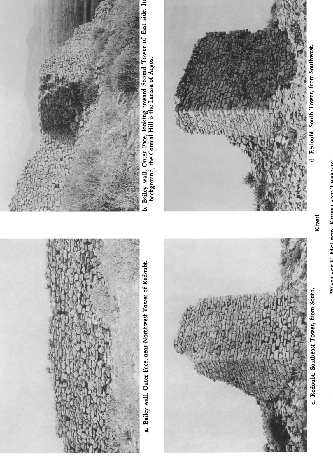
Pl. 115a 'Bailey wall. Outer Face, near Northwest Tower of Redoubt': outer face of the bailey wall of the Pontinos castle.
Bron: Probably W.E. McLeod
-
Vergroten:
ca. 1958–1960
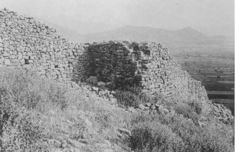
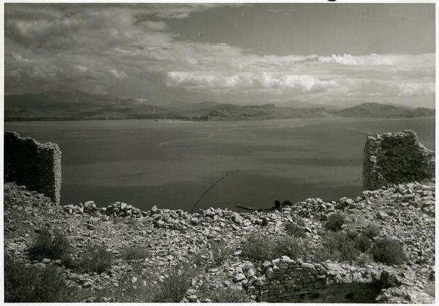
Pl. 115b: outer face of the bailey wall of the Pontinos castle looking toward the second tower of the east side, with the plain of Argos and the Larissa hill in the background.
Bron: Probably W.E. McLeod
-
Vergroten:
ca. 1958–1960
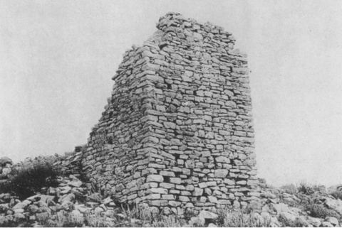
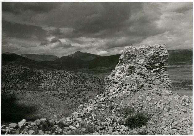
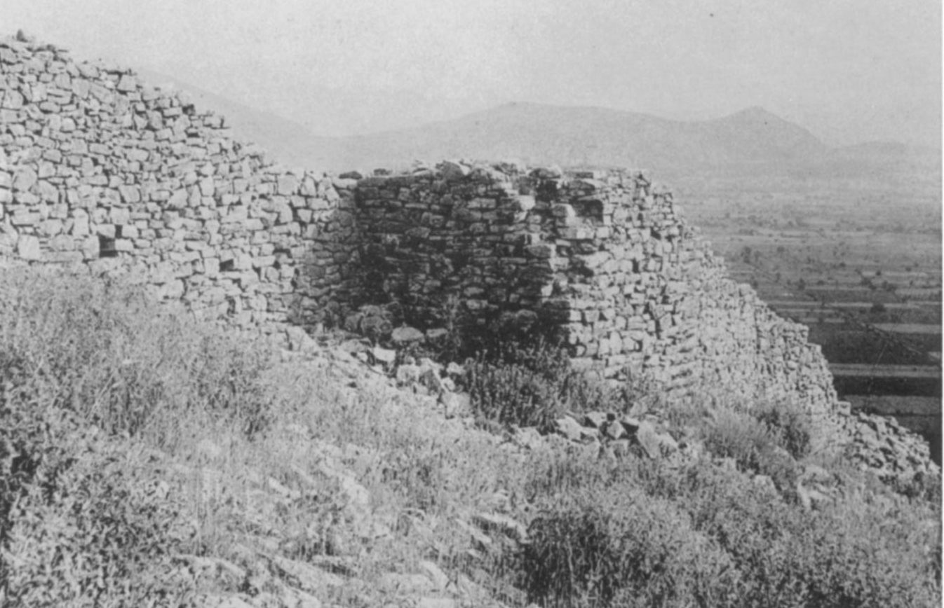
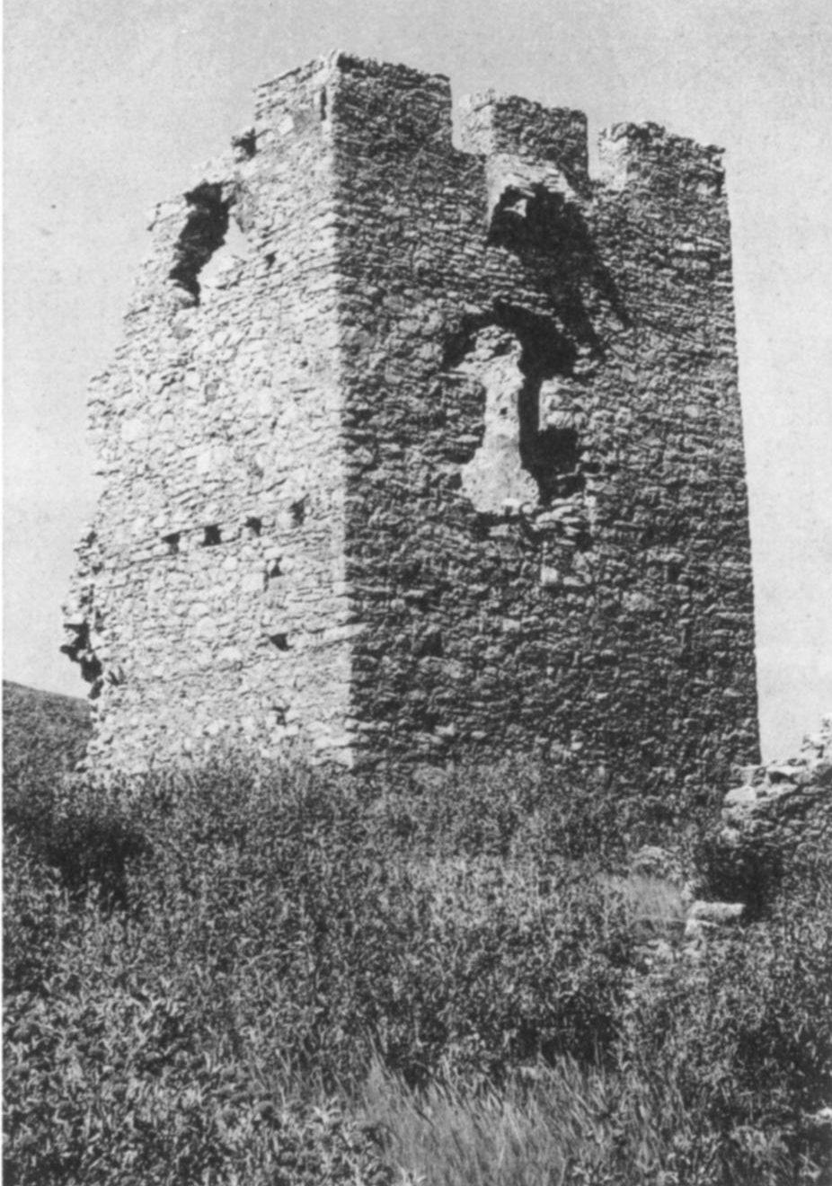
Pl. 115c 'Redoubt. Southeast Tower, from South' of the castle on Mt Pontinos.
Bron: Probably W.E. McLeod
-
Vergroten:
ca. 1958–1960
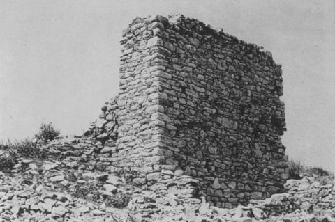
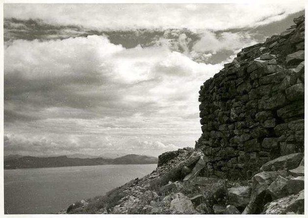
Pl. 115d 'Redoubt. South Tower, from Southwest' of the castle on Mt Pontinos.
Bron: Probably W.E. McLeod
-
Vergroten:
ca. 1958–1960
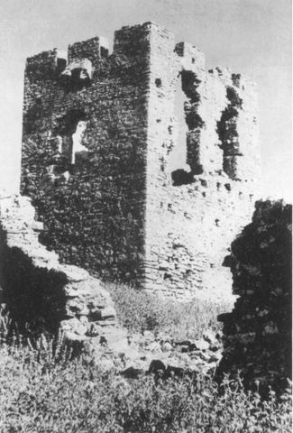
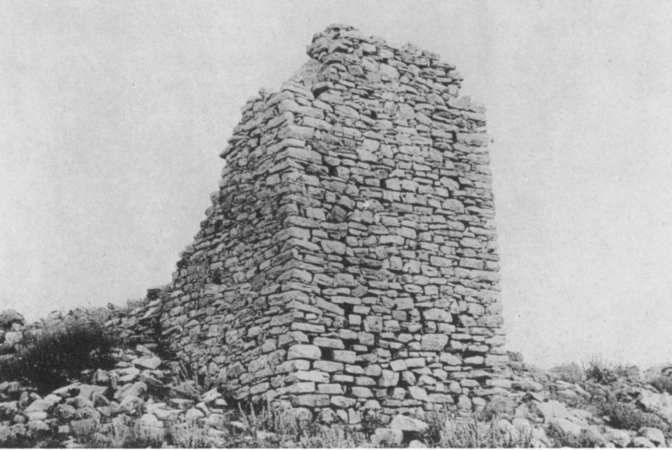
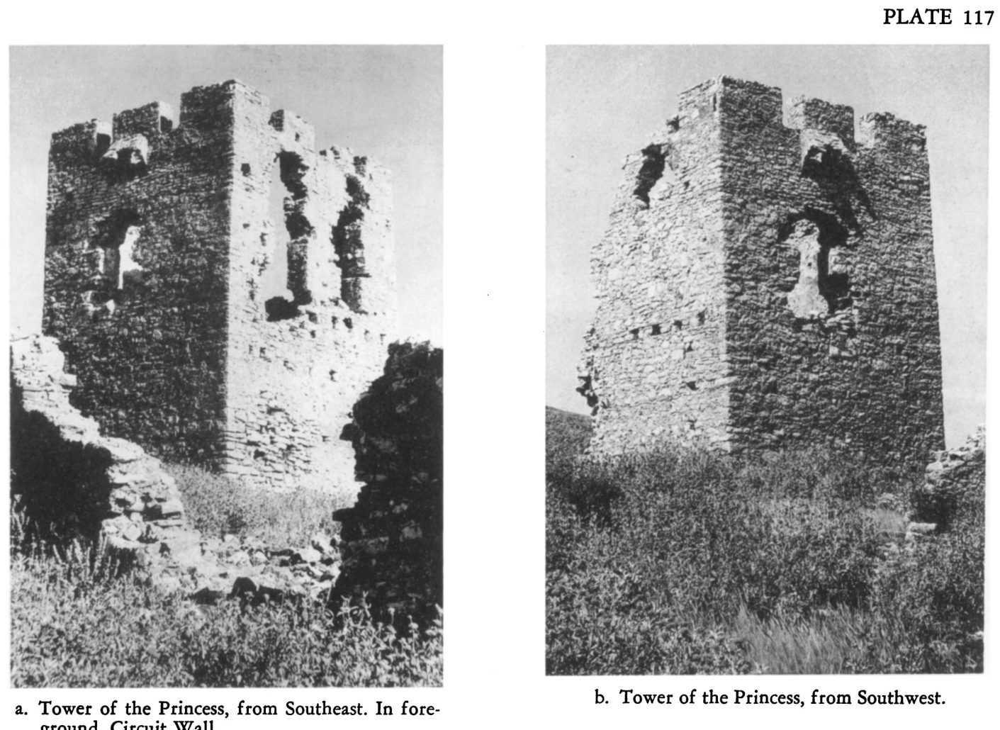
Pl. 117a 'Tower of the Princess, from Southeast': the Pyrgos Vasilopoulas tower about 500 m south of the Pontinos castle, with the circuit wall in the foreground.
Bron: Probably W.E. McLeod
-
Vergroten:
ca. 1958–1960
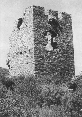
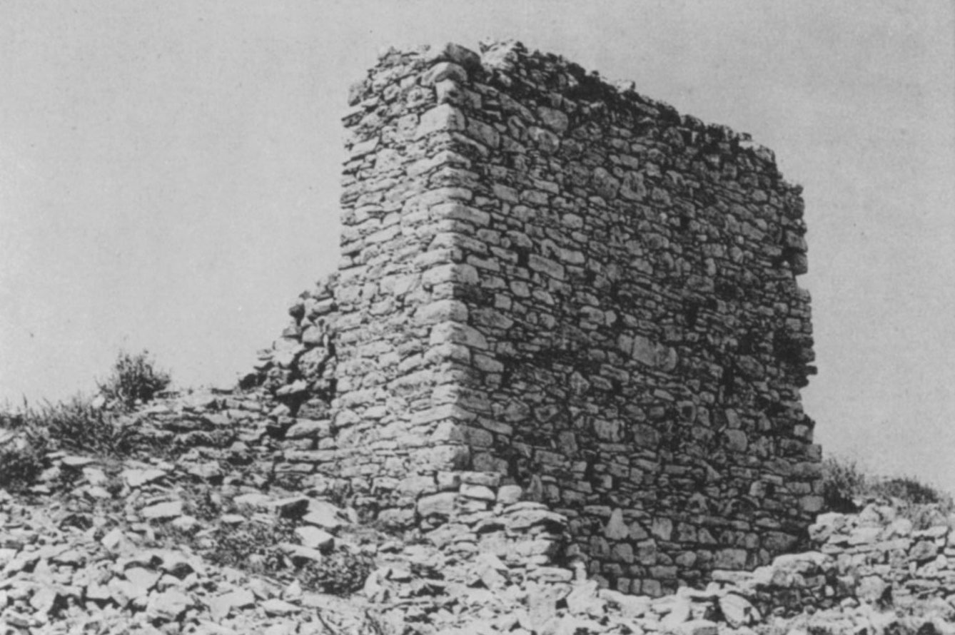
Pl. 117b 'Tower of the Princess, from Southwest' (Pyrgos Vasilopoulas).
Bron: Probably W.E. McLeod
-
Vergroten:
ca. 1959 (foto); 1686 (gravure)
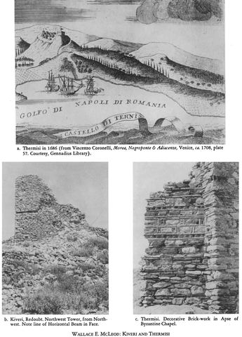
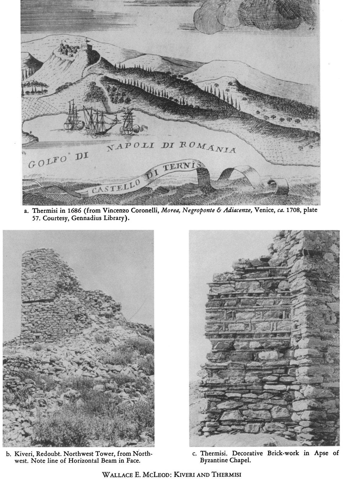
Full Hesperia 31 plate 114: (a) Coronelli's 1686 engraving of Thermisi and (b) the northwest tower of the redoubt of the Pontinos castle ('Kiveri').
Bron: W.E. McLeod (photo); V. Coronelli (engraving)
-
Vergroten:
ca. 1959
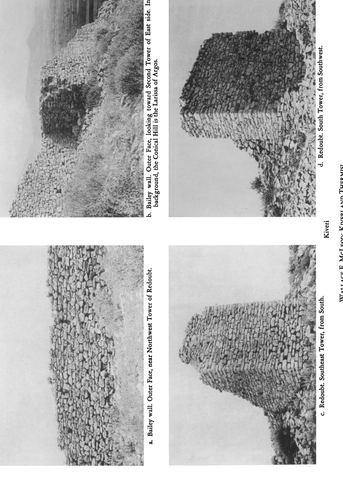
Full Hesperia 31 plate 115 (a–d): bailey wall and redoubt towers of the Pontinos castle ('Kiveri'), one with the Larissa of Argos in the background.
Bron: W.E. McLeod
-
Vergroten:
ca. 1959
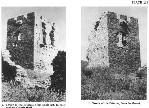
Full Hesperia 31 plate 117: the Tower of the Princess (Pyrgos Vasilopoulas) from southeast and southwest.
Bron: W.E. McLeod
-
Vergroten:
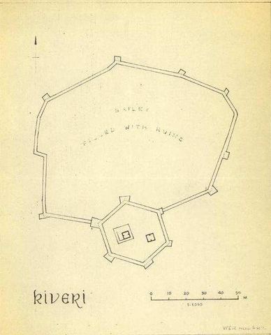
1959
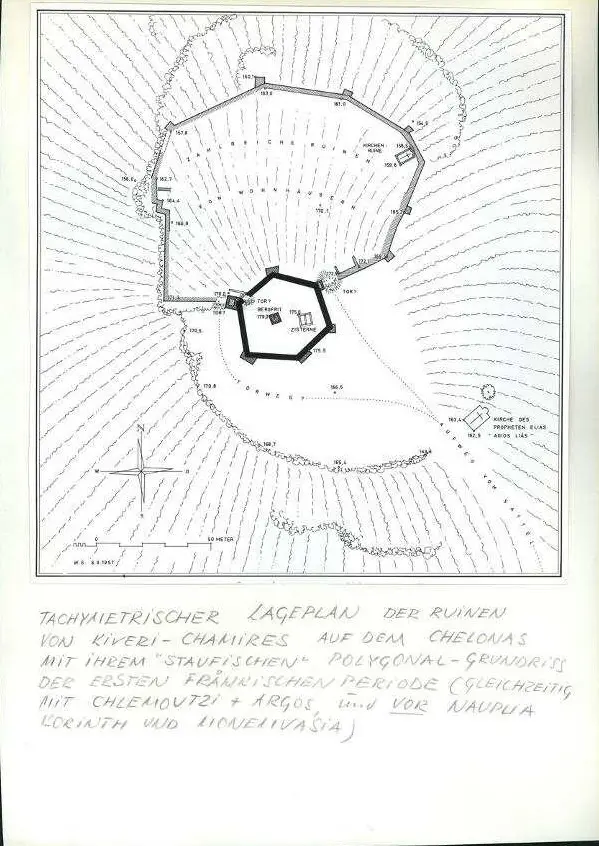
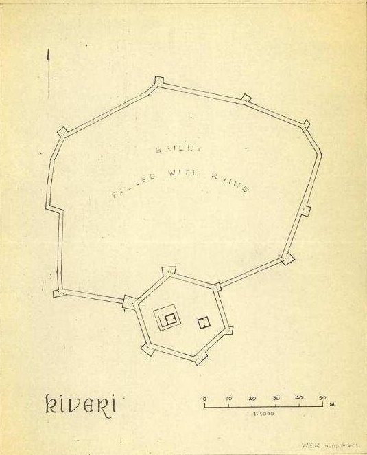
Plan of the castle "Kiveri": walled enclosure with a polygonal keep, interior "filled with ruins".
Bron: Wulf Schaefer; DAI Athens, NL-Schaefer-K-1-08-008
1960–1979 (27)
-
Vergroten:
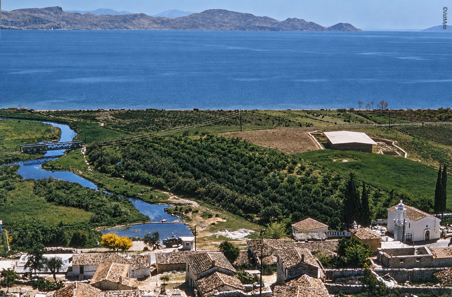
1960
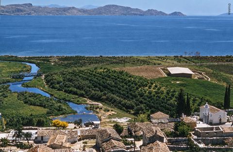
Colour view from Pontinos over the roofs of Myloi, a church with a bell tower, the winding stream of the Lerna springs, the roofed excavation and the Argolic Gulf.
Bron: Unknown photographer
-
Vergroten:
vóór 1970
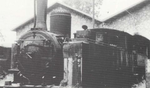
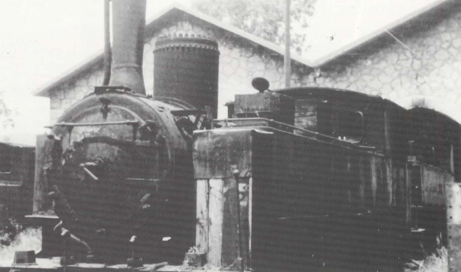
Steam locomotive "Ελληνίς" in front of the twin-gabled stone locomotive shed at Myloi.
Bron: D. Koutelidis (photo); SFS magazine Σιδηροτροχιά (article by M. Konstantinidis, c. 1998)
-
Vergroten:
1966
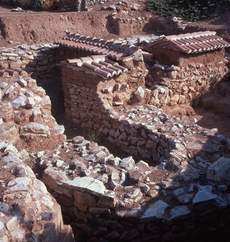
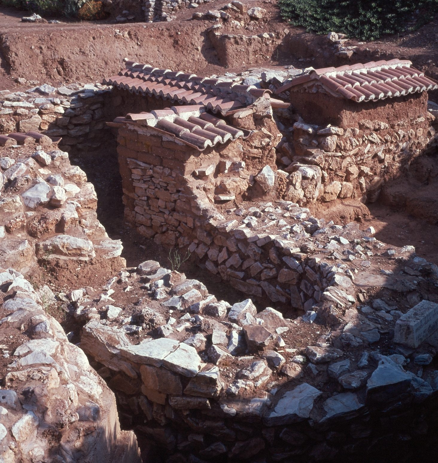
Lerna: the Early Helladic fortification wall (early 3rd millennium BC) topped with mud bricks, under protective roofs, on red earth.
Bron: Konrad Helbig; Deutsche Fotothek (obj. 71479638)
-
Vergroten:
ca. 1966
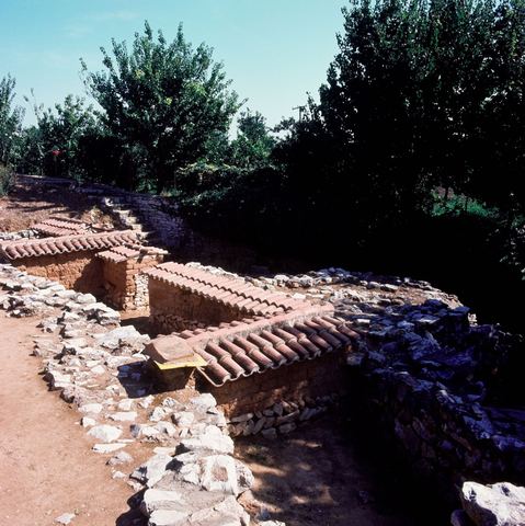
Lerna excavation: walls under small protective roofs and an olive or citrus orchard.
Bron: Konrad Helbig; Deutsche Fotothek (obj. 71497081)
-
Vergroten:
ca. 1966
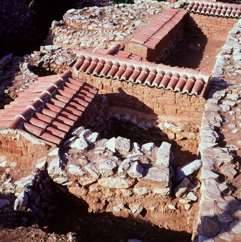
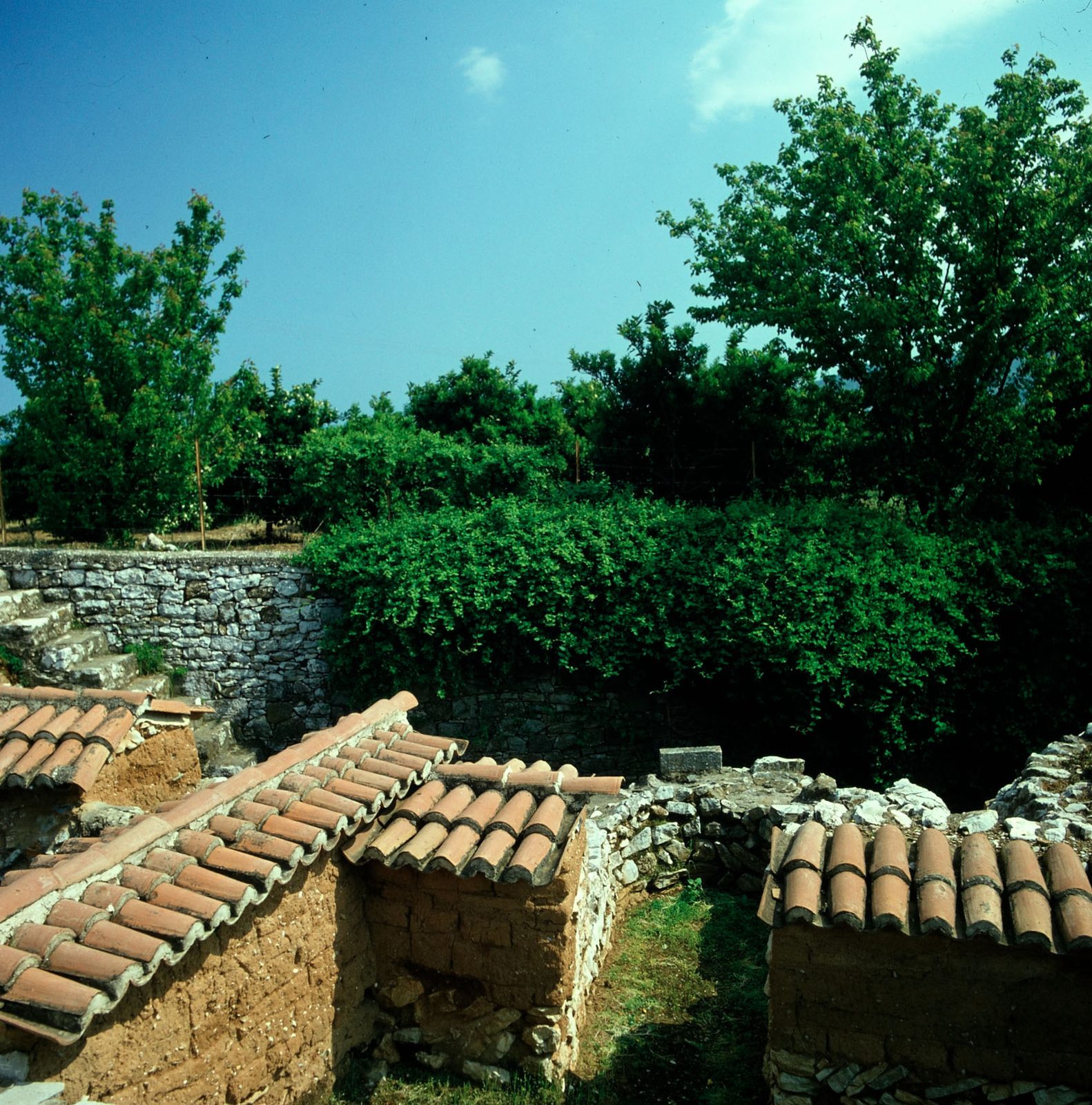
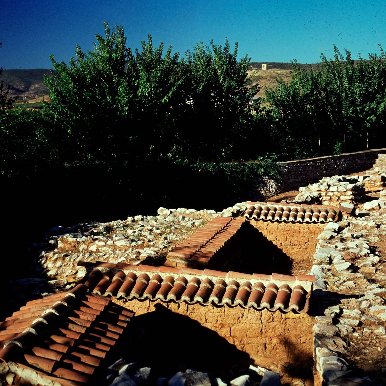
Lerna excavation: detail of walls with small tiled protective roofs, seen from above.
Bron: Konrad Helbig; Deutsche Fotothek (obj. 71497083)
-
Vergroten:
ca. 1966
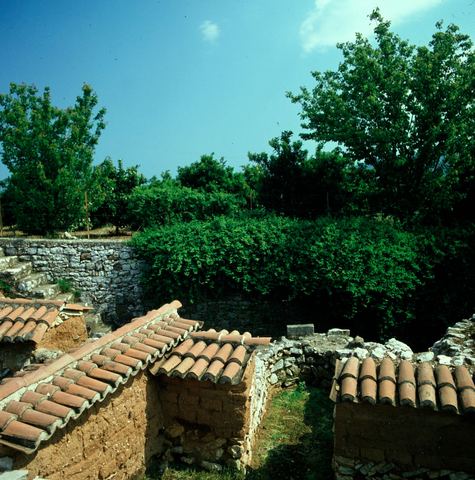
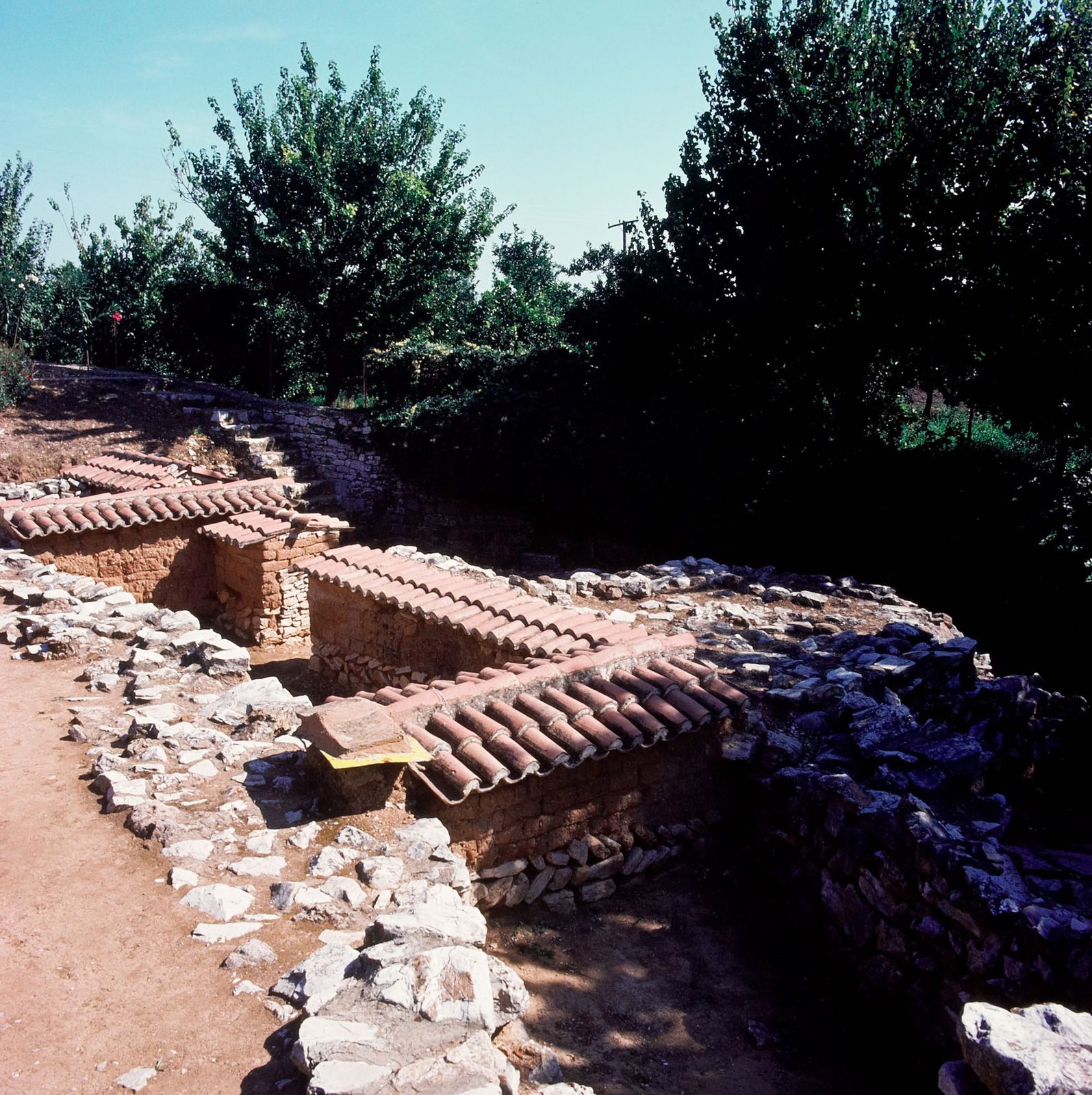
Lerna excavation: walls under small tiled roofs, a dry-stone boundary wall and an orchard.
Bron: Konrad Helbig; Deutsche Fotothek (obj. 71497084)
-
Vergroten:
ca. 1966
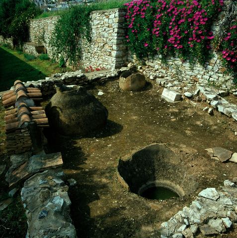
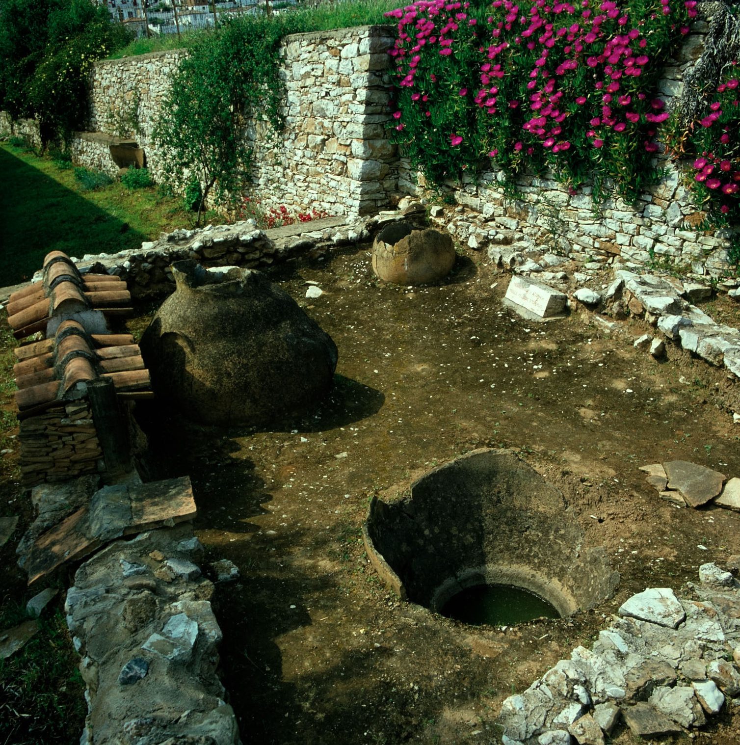
Lerna excavation: pithoi and a bothros, a dry-stone wall with flowering bougainvillea/oleander, and houses behind.
Bron: Konrad Helbig; Deutsche Fotothek (obj. 71497086)
-
Vergroten:
waarschijnlijk 1966
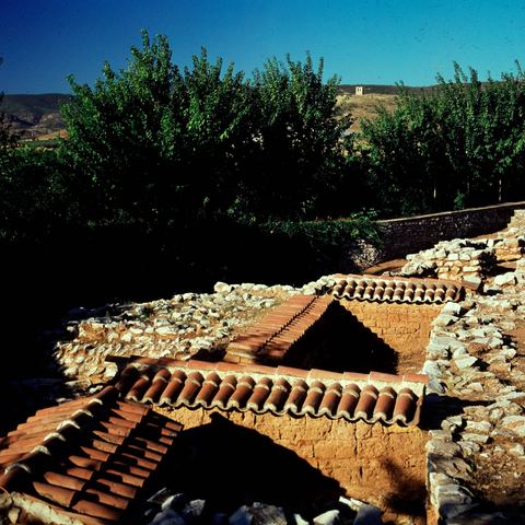
Colour slide of the Lerna excavation with its protective roofs, trees, hills and a building behind.
Bron: Konrad Helbig
-
Vergroten:
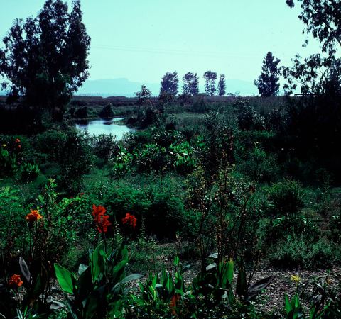
augustus 1966
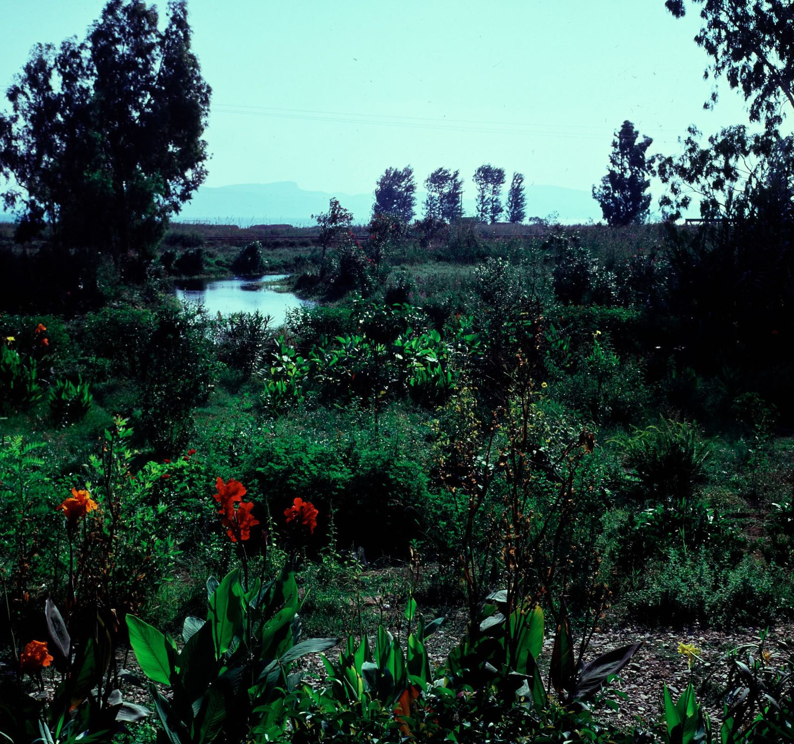
Colour slide of the marsh zone at Lerna.
Bron: Konrad Helbig
-
Vergroten:
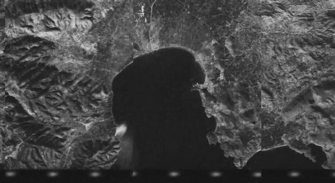
1 februari 1968
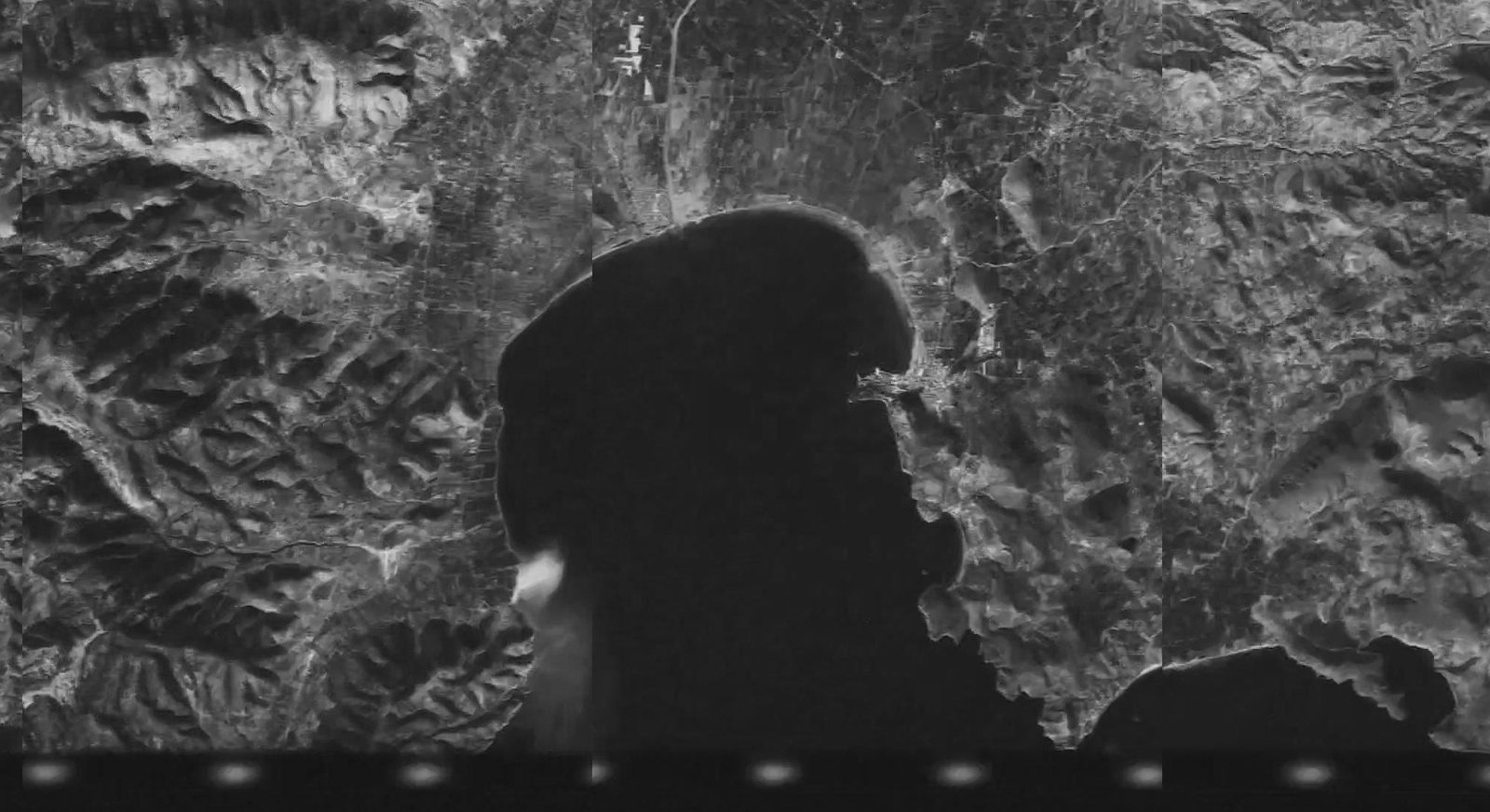
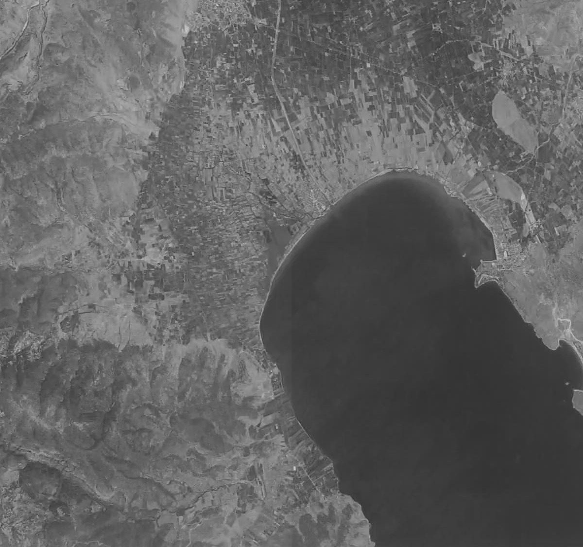
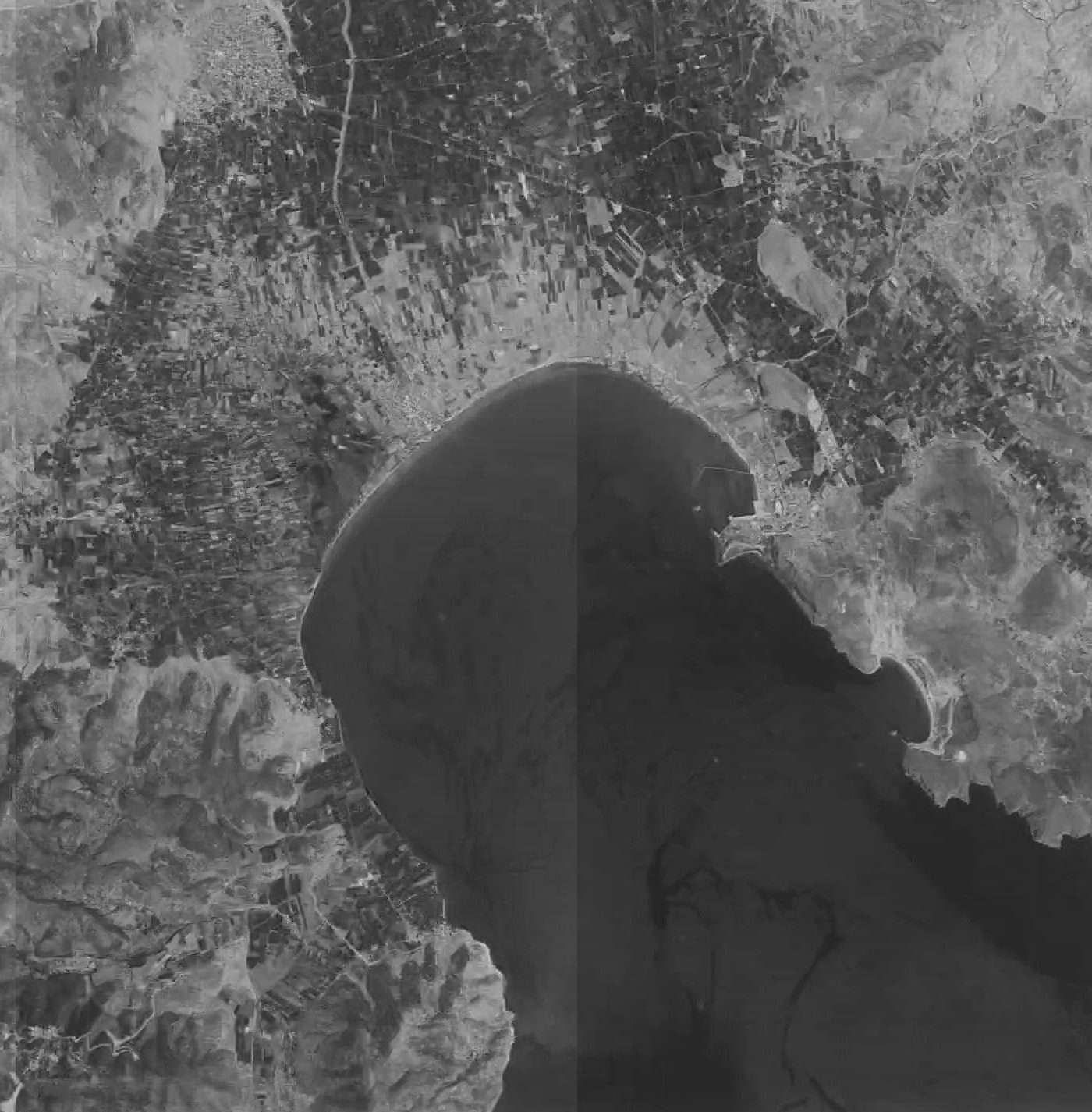
CORONA satellite image of the Argolic Gulf including Myloi (browse image crop).
Bron: USGS EarthExplorer, KH-4B CORONA, DS1045-2120DF021
-
Vergroten:
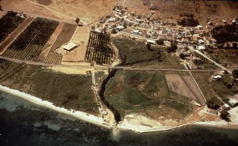
1968 (zeer waarschijnlijk juni 1968)
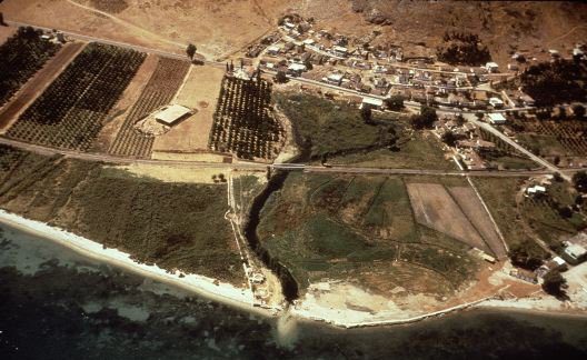
Oblique aerial view of Lerna and Myloi from the east: the excavation with the House of Tiles shelter, the village, railway and road, the spring stream reaching the sea, beach and orchards.
Bron: Raymond V. Schoder SJ; Perseus Digital Library 1990.30.0068 (courtesy Bolchazy-Carducci)
-
Vergroten:
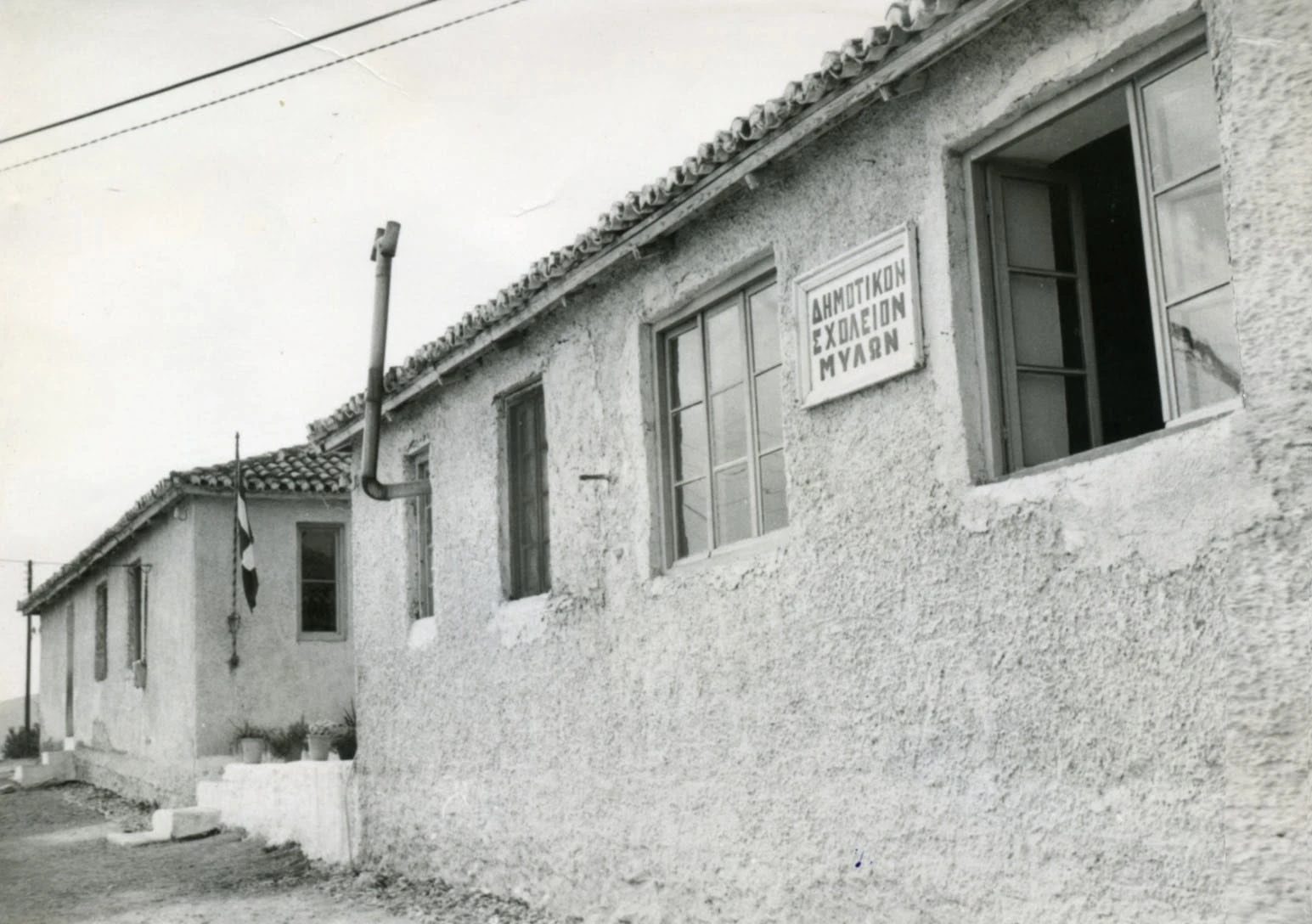
ca. 1960–1975
The primary school building of Myloi (Δημοτικόν Σχολείον Μύλων).
Bron: Αργολική Αρχειακή Βιβλιοθήκη Ιστορίας & Πολιτισμού
-
Vergroten:
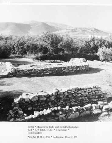
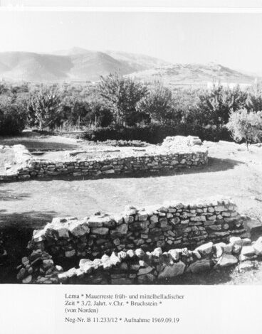
19 september 1969
Early and Middle Helladic wall remains at the Lerna excavation from the north, with trees and hills behind.
Bron: Bildarchiv Foto Marburg, neg. B 11.233/12
-
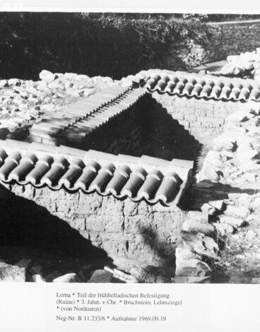
Vergroten:
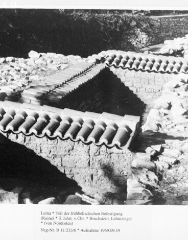
19 september 1969
Part of the Early Helladic fortification at Lerna under protective tiled roofs, from the north-east.
Bron: Bildarchiv Foto Marburg, neg. B 11.233/6
-
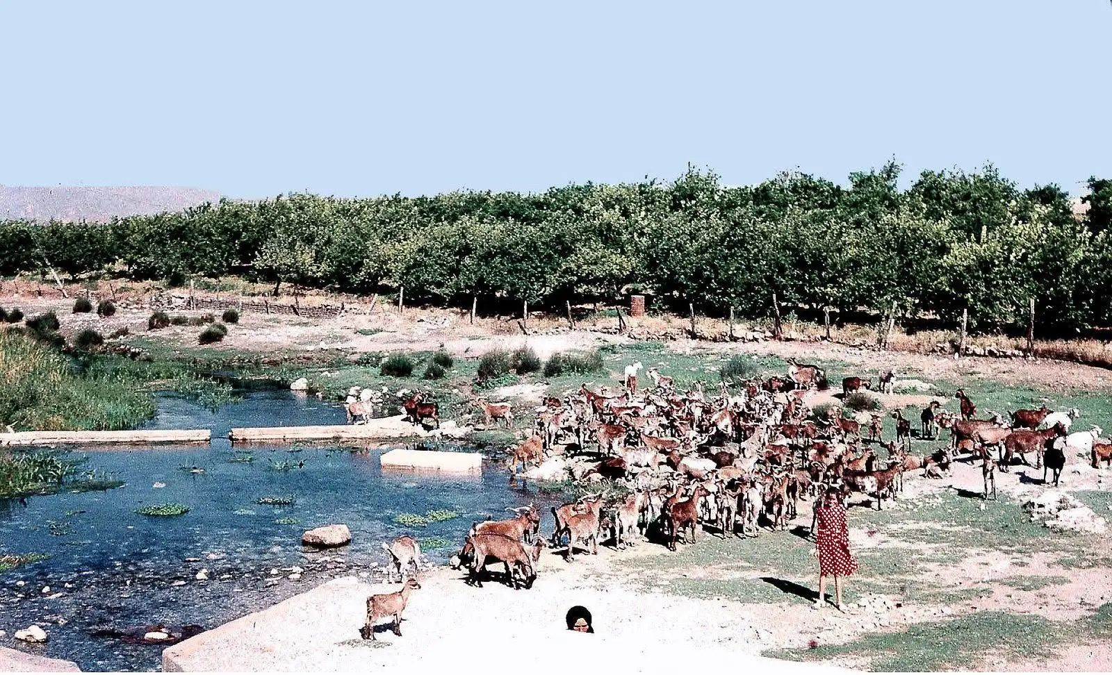
Vergroten:
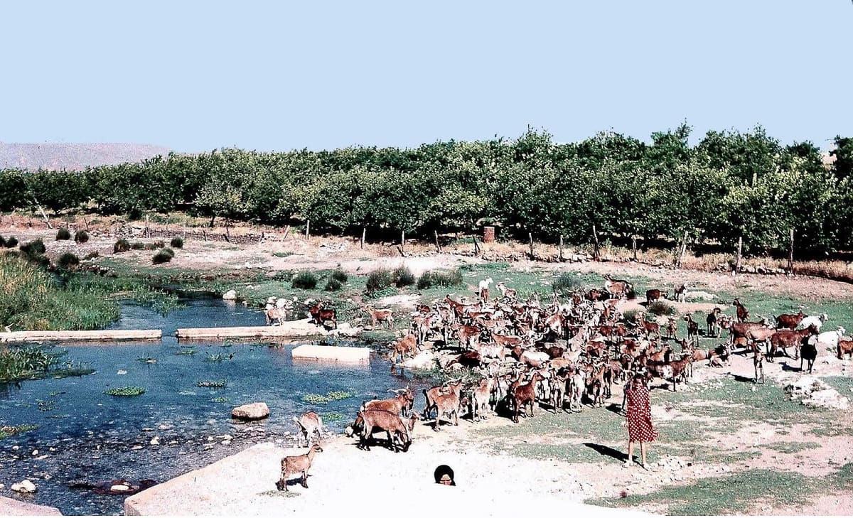
ca. 1965–1975
Kleurendia van een grote kudde geiten bij het water van de bronnen, met boomgaarden erachter
Bron: Visit Myloi collection
-
Vergroten:
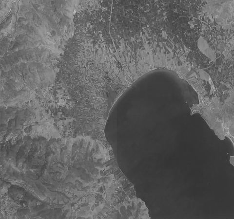
24 juli 1973
KH-9 Hexagon satellite image of the Argolic Gulf including Myloi (browse image crop).
Bron: USGS EarthExplorer, KH-9 Hexagon, D3C1206-100131A018
-
Vergroten:
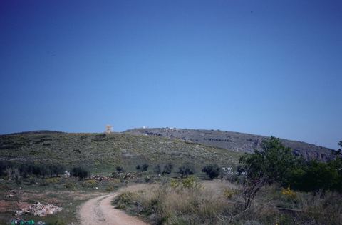
1960–1990
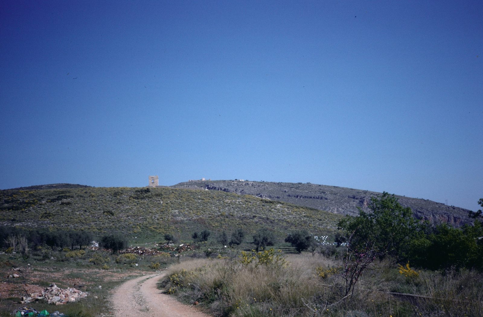
35 mm colour slide 'Myli; Castle of Lerna': dirt path leading up to the Frankish tower on Mt Pontinos.
Bron: Paul Hetherington; Dumbarton Oaks Research Library and Collection
-
Vergroten:
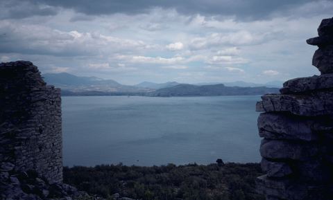
1960–1990
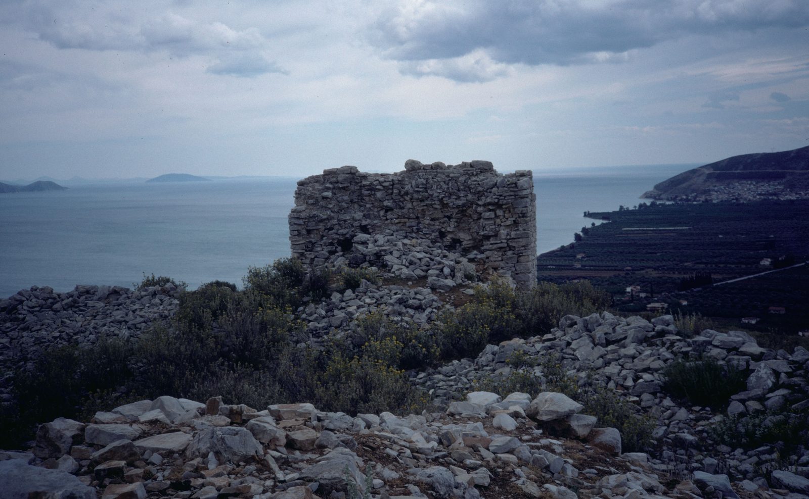
35 mm colour slide 'Myli; Castle of Lerna': the castle tower on Mt Pontinos with the gulf beyond.
Bron: Paul Hetherington; Dumbarton Oaks Research Library and Collection
-
Vergroten:
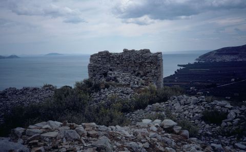
1960–1990
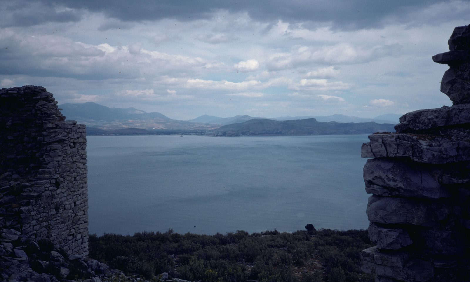
35 mm colour slide 'Myli; Castle of Lerna': wall remains of the castle with a view over the gulf and the plain with citrus groves.
Bron: Paul Hetherington; Dumbarton Oaks Research Library and Collection
-
Vergroten:
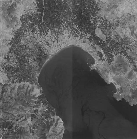
31 juli 1977
KH-9 Hexagon satellite image of the Argolic Gulf including Myloi (browse image crop).
Bron: USGS EarthExplorer, KH-9 Hexagon, D3C1213-100194A043
-
Vergroten:
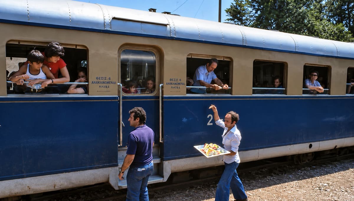
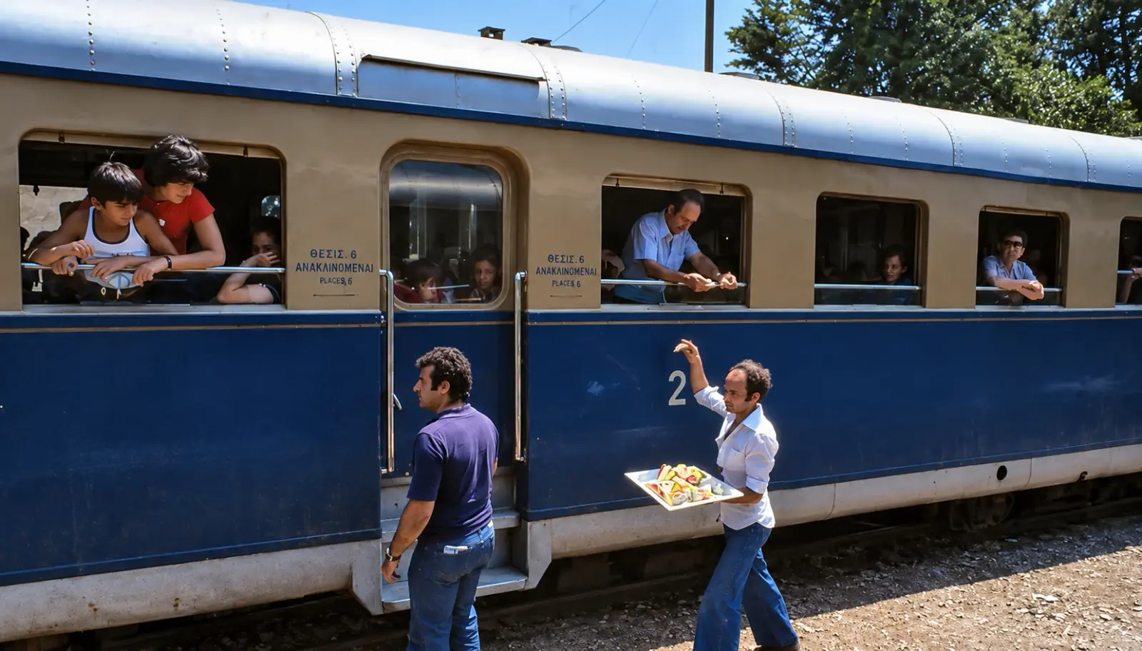
ca. 1975–1980
Een souvlakiverkoper houdt een dienblad omhoog naar passagiers die in Myloi uit de treinramen leunen (digitaal opgeknapt)
Bron: © Ole Holbech
-
Vergroten:
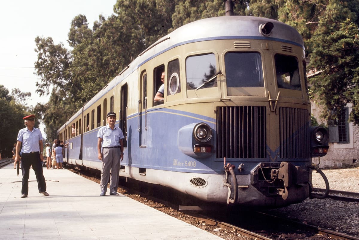
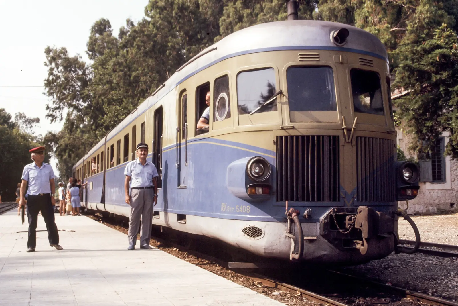
vóór 1980
Voorkant van een blauw-beige motorrijtuig in Myloi met twee spoorwegmannen op het perron
Bron: Visit Myloi collection
-
Vergroten:
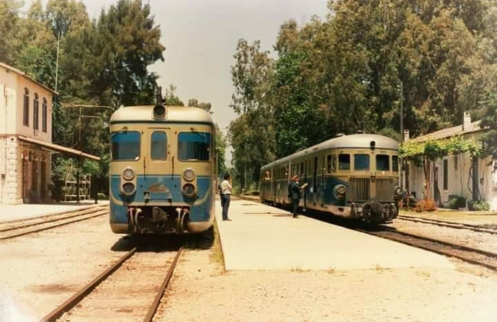
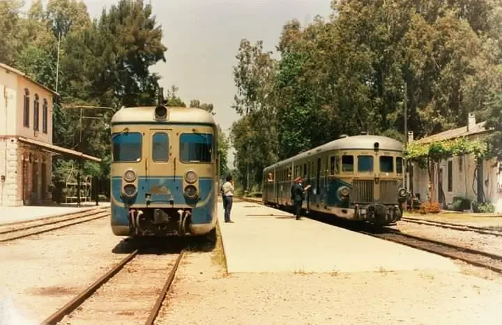
vóór 1980
Twee motorrijtuigen naast elkaar in Myloi, met links het stenen stationsgebouw
Bron: Visit Myloi collection
-
Vergroten:
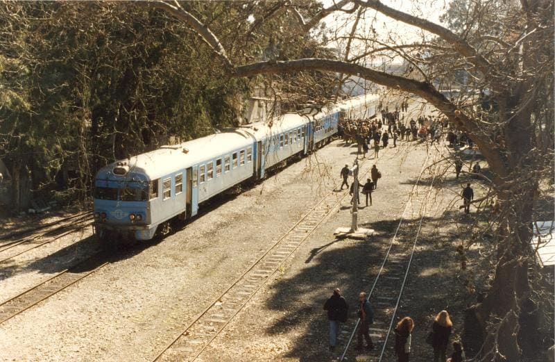
vóór 1980
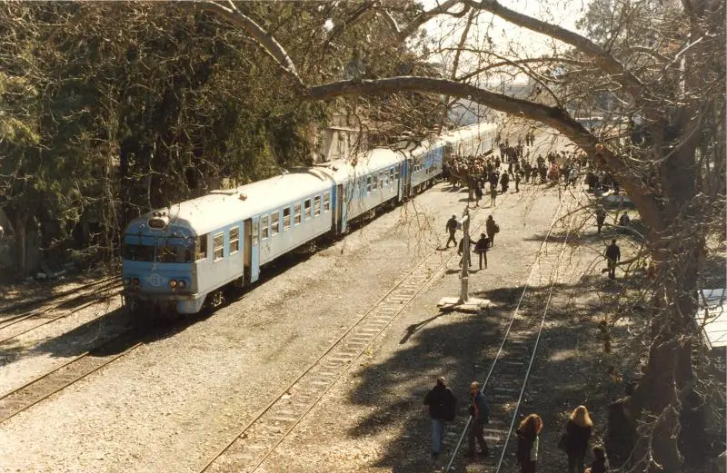
Een trein komt onder de bomen aan in Myloi terwijl passagiers het spoor oversteken
Bron: Visit Myloi collection
-
Vergroten:
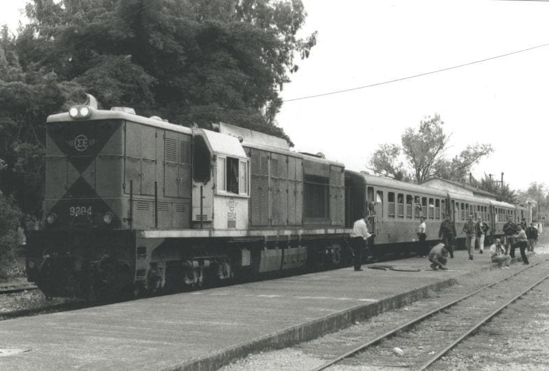
vóór 1980
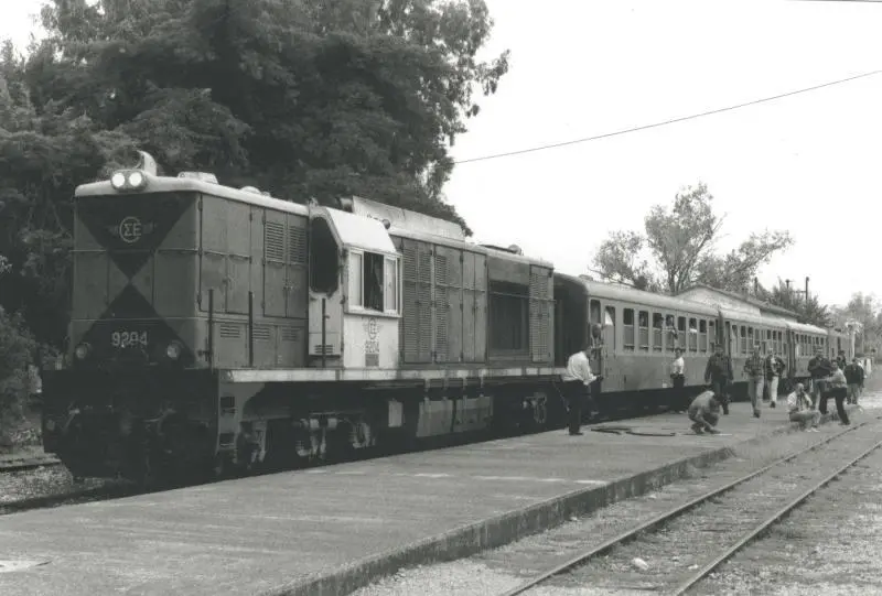
Zwart-witfoto van een diesellocomotief en reizigerstrein op station Myloi
Bron: Visit Myloi collection
-
Vergroten:
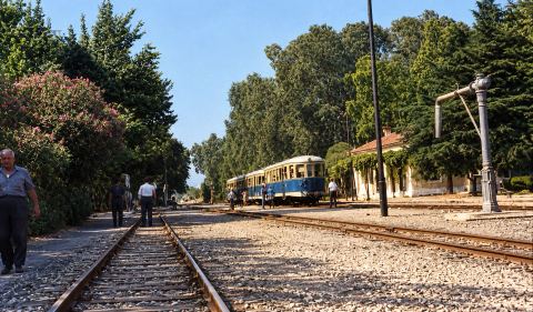
vóór 1980
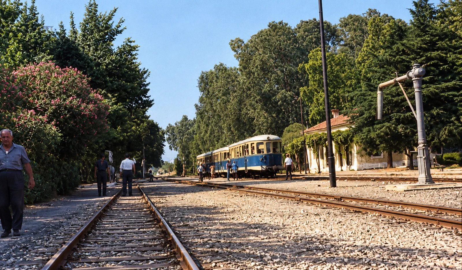
Colour print (colours restored) of the platform and tracks at Myloi station with a railcar under the trees.
Bron: Visit Myloi collection (photographer not recorded) · digitaal opgeknapt
-
Vergroten:
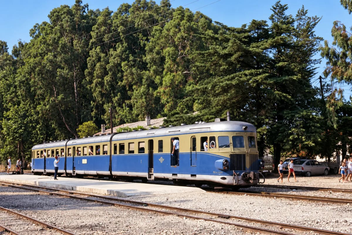
vóór 1980
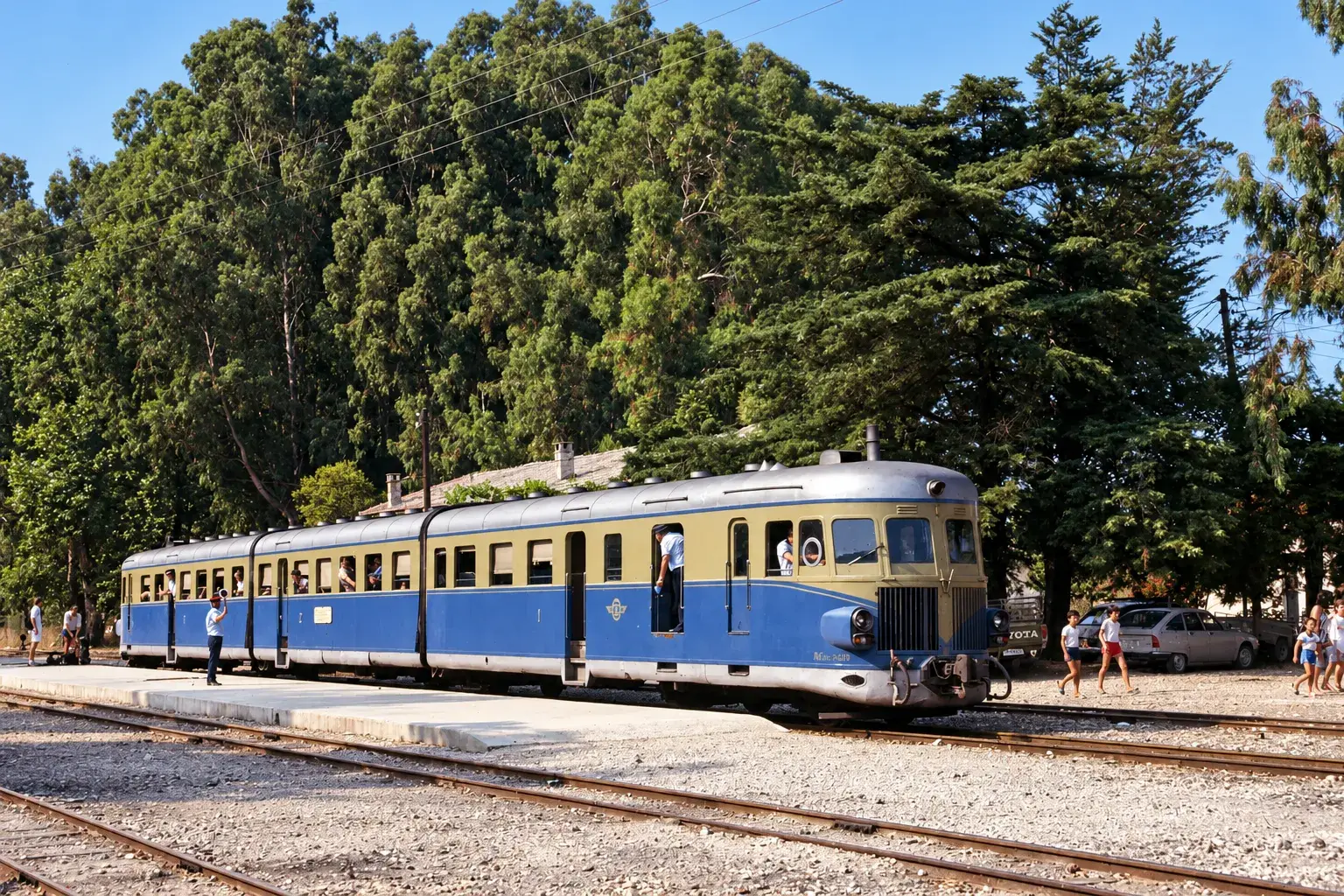
Een blauw-beige motorrijtuig wacht langs het perron van station Myloi onder hoge bomen (digitaal opgeknapt)
Bron: Visit Myloi collection

1980–1995 (17)
-
Vergroten:
15 december 1980
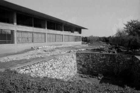
Neolithic house remains at the Lerna excavation, with the concrete House of Tiles shelter and an orchard.
Bron: Steingräber; DAI Rom, photo 80.4292
-
Vergroten:
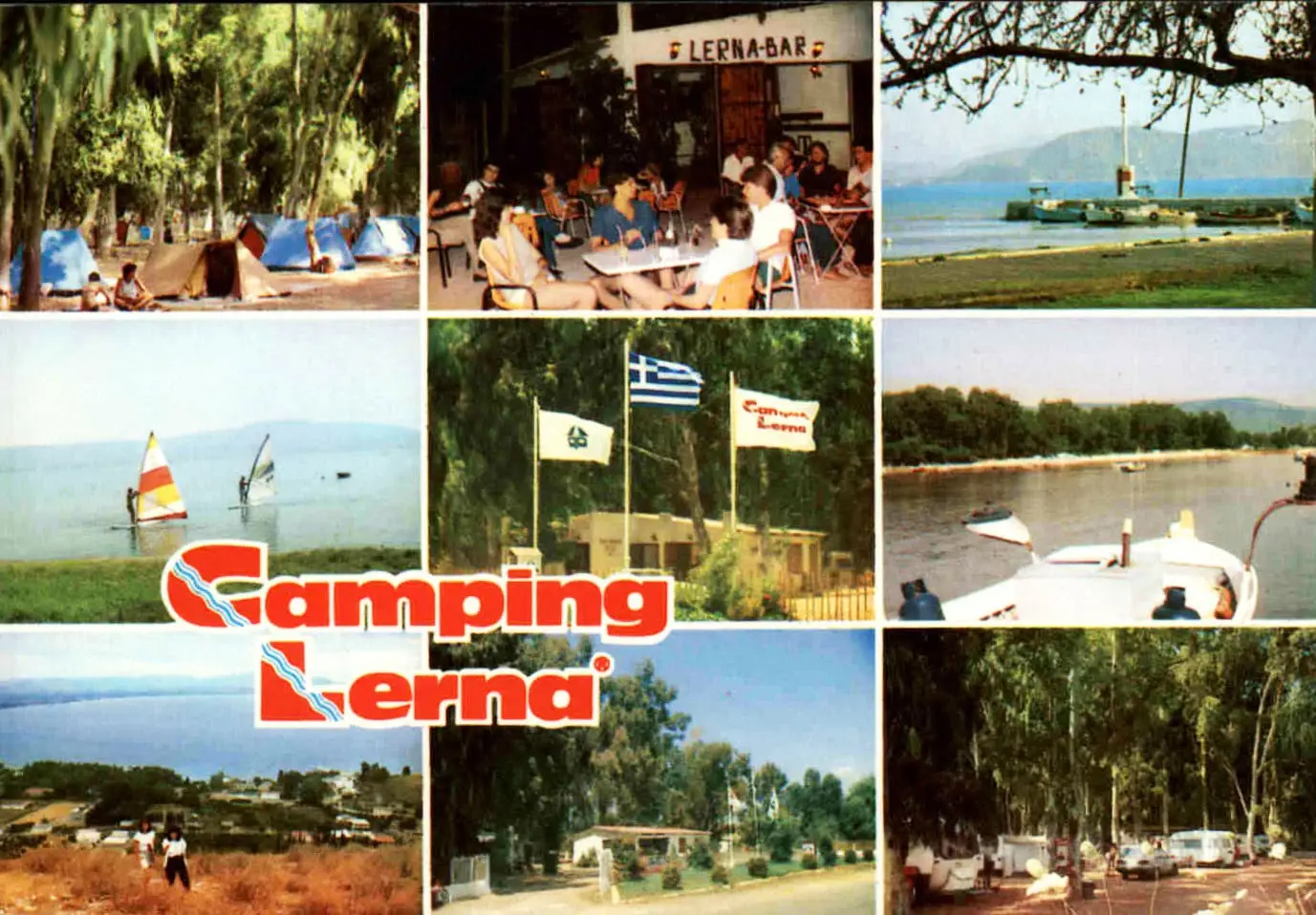
ca. 1980–1985 (schatting)
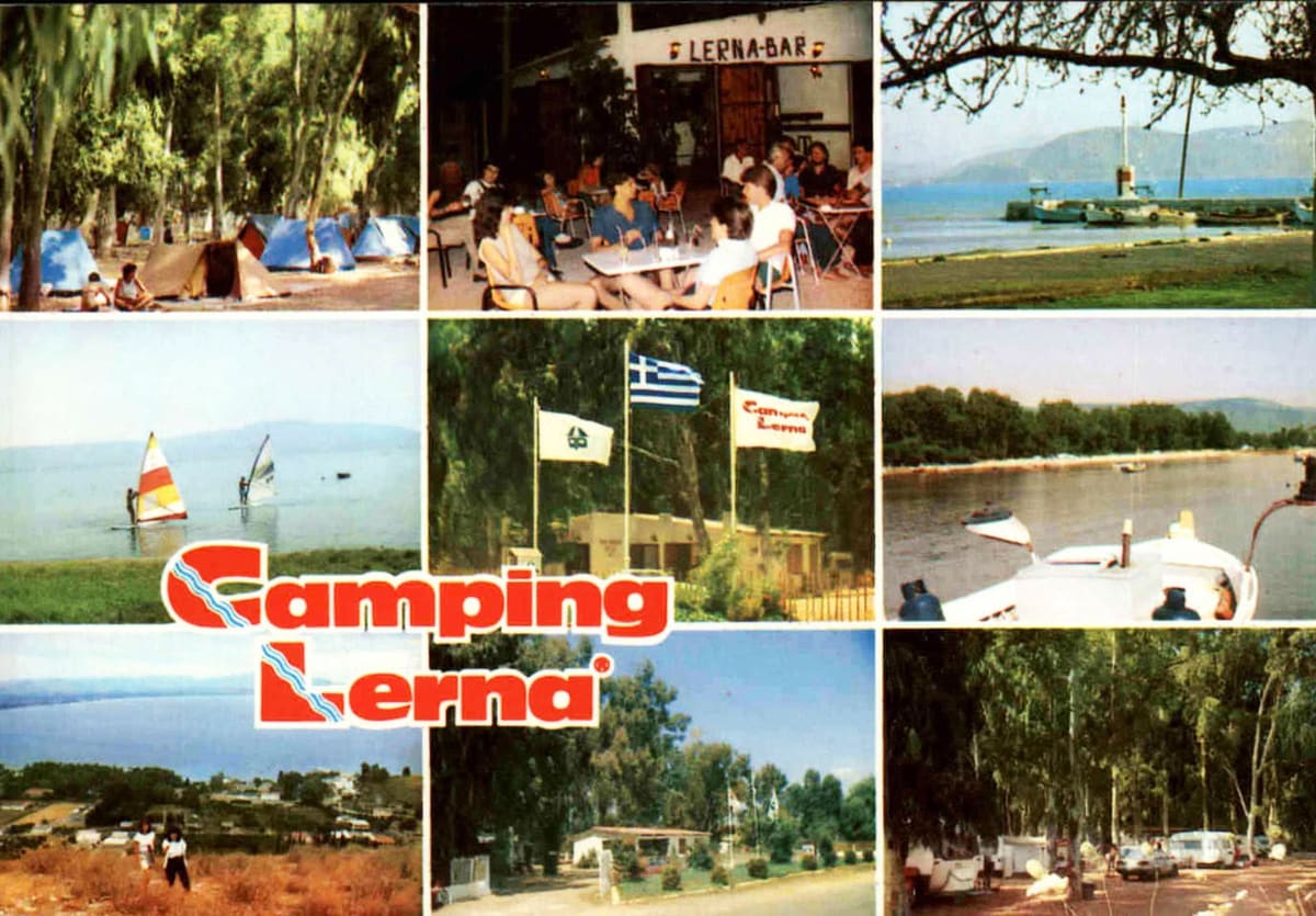
Meerluik-ansichtkaart van Camping Lerna, met tenten onder de bomen, een terras, vlaggen, het havenlicht en het strand
Bron: Visit Myloi collection
-
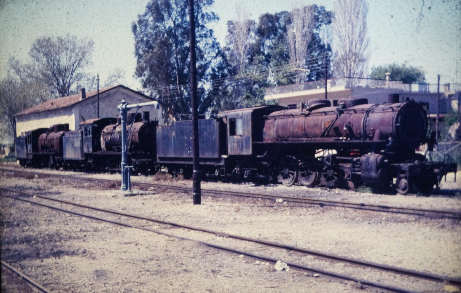
Vergroten:
maart/april 1986
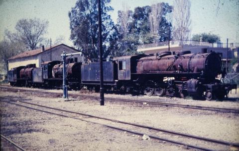
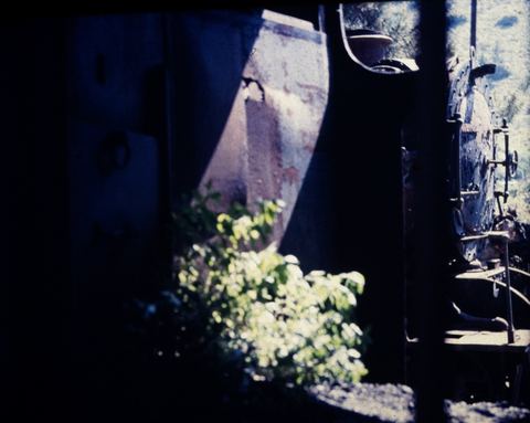
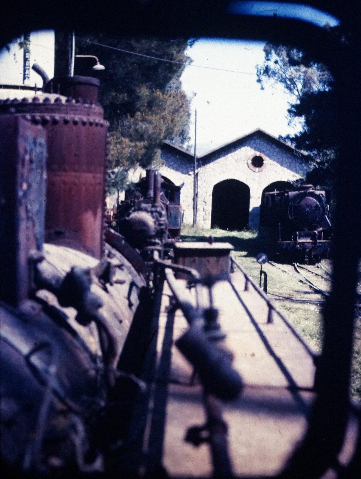
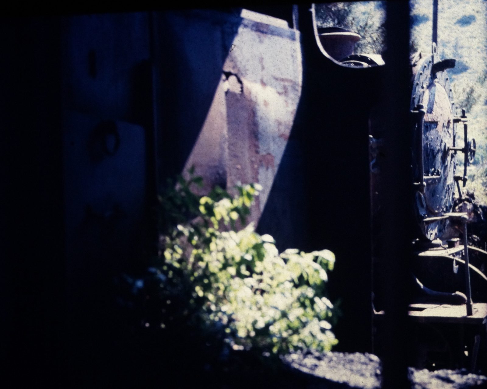
Graveyard of withdrawn metre-gauge steam locomotives at Myloi station.
Bron: NearEMPTiness (Wikimedia Commons)
-
Vergroten:
maart/april 1986
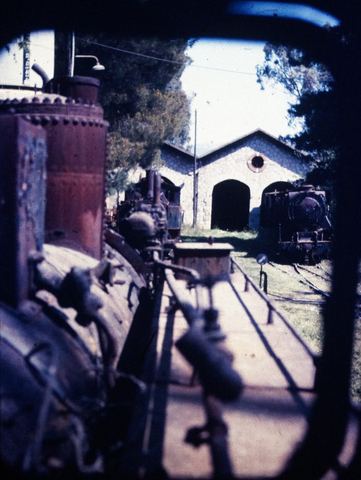
Graveyard of withdrawn metre-gauge steam locomotives at Myloi station.
Bron: NearEMPTiness (Wikimedia Commons)
-
Vergroten:
maart/april 1986
Graveyard of withdrawn metre-gauge steam locomotives at Myloi station.
Bron: NearEMPTiness (Wikimedia Commons)
-
Vergroten:
1986
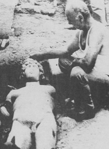
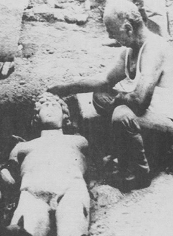
Black-and-white photograph of the marble statue of Antinoos lying in the earth at its find-spot near Myloi.
Bron: Unknown photographer
-
Vergroten:
1986
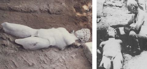
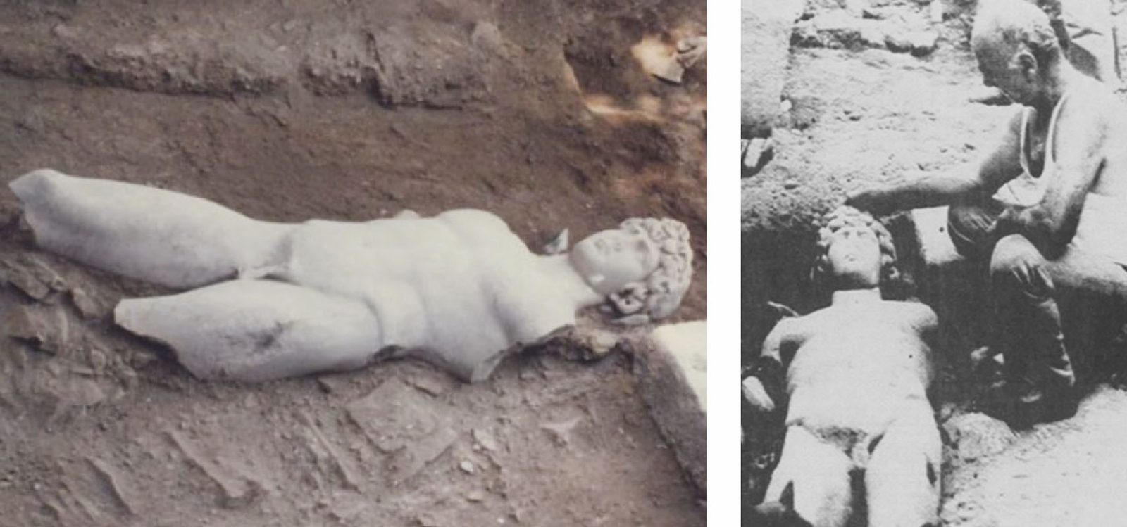
Two black-and-white photographs side by side of the marble statue of Antinoos at its find-spot near Myloi.
Bron: Unknown photographer
-
Vergroten:
waarschijnlijk na 1985
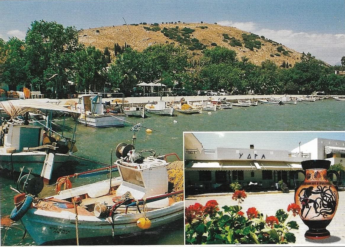
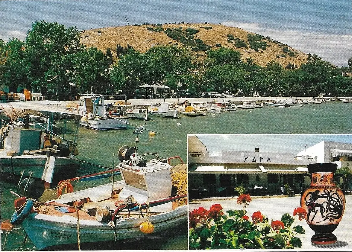
Ansichtkaart van de haven met vissersboten onder de heuvel Pontinos, met een inzet van restaurant ΥΔΡΑ met bloemen en een amfora
Bron: Visit Myloi collection
-
Vergroten:
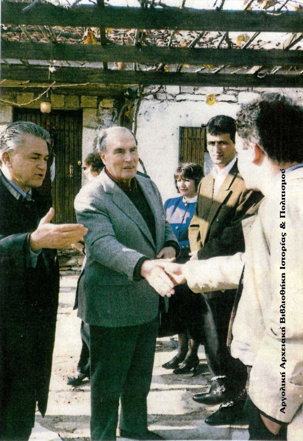
december 1991
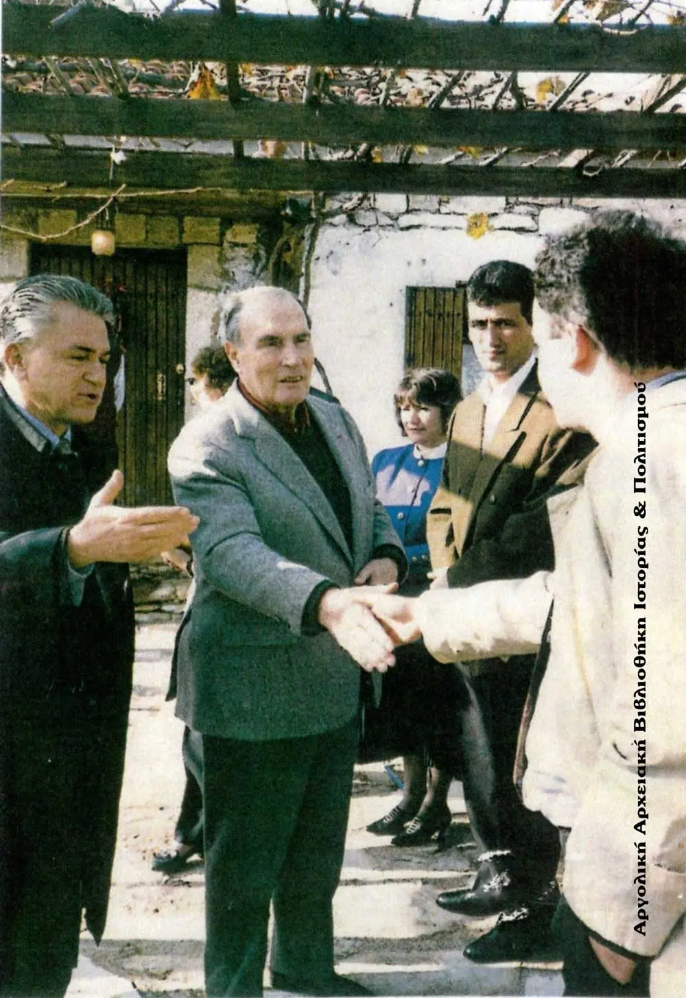
Onder de pergola van het huis geeft Mitterrand dorpelingen van Myloi een hand. Naast hem staat diplomaat Christos Machairitsas, die de reis regelde.
Bron: Kotsonaros family collection, via the Argolic Archival Library of History and Culture (argolikivivliothiki.gr)
-
Vergroten:
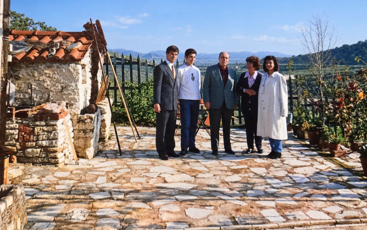
december 1991
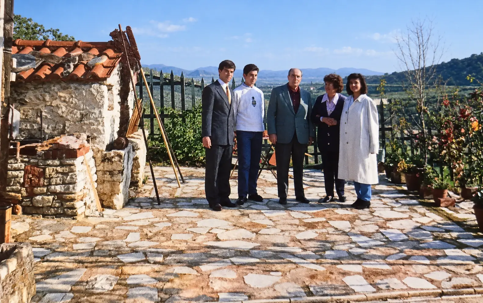
François Mitterrand (midden) met de familie Kotsonaros op het stenen terras van hun huis, december 1991.
Bron: Kotsonaros family collection, published with permission
-
Vergroten:
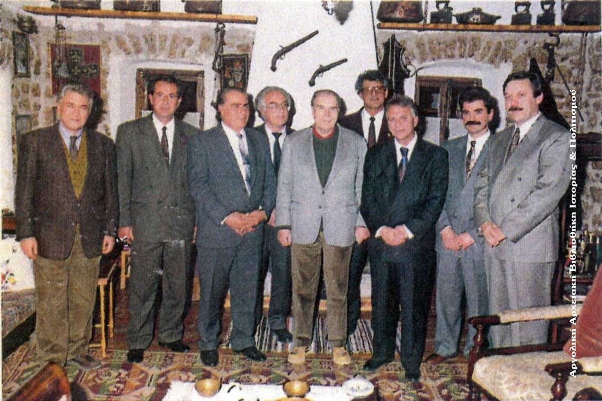
26 december 1991
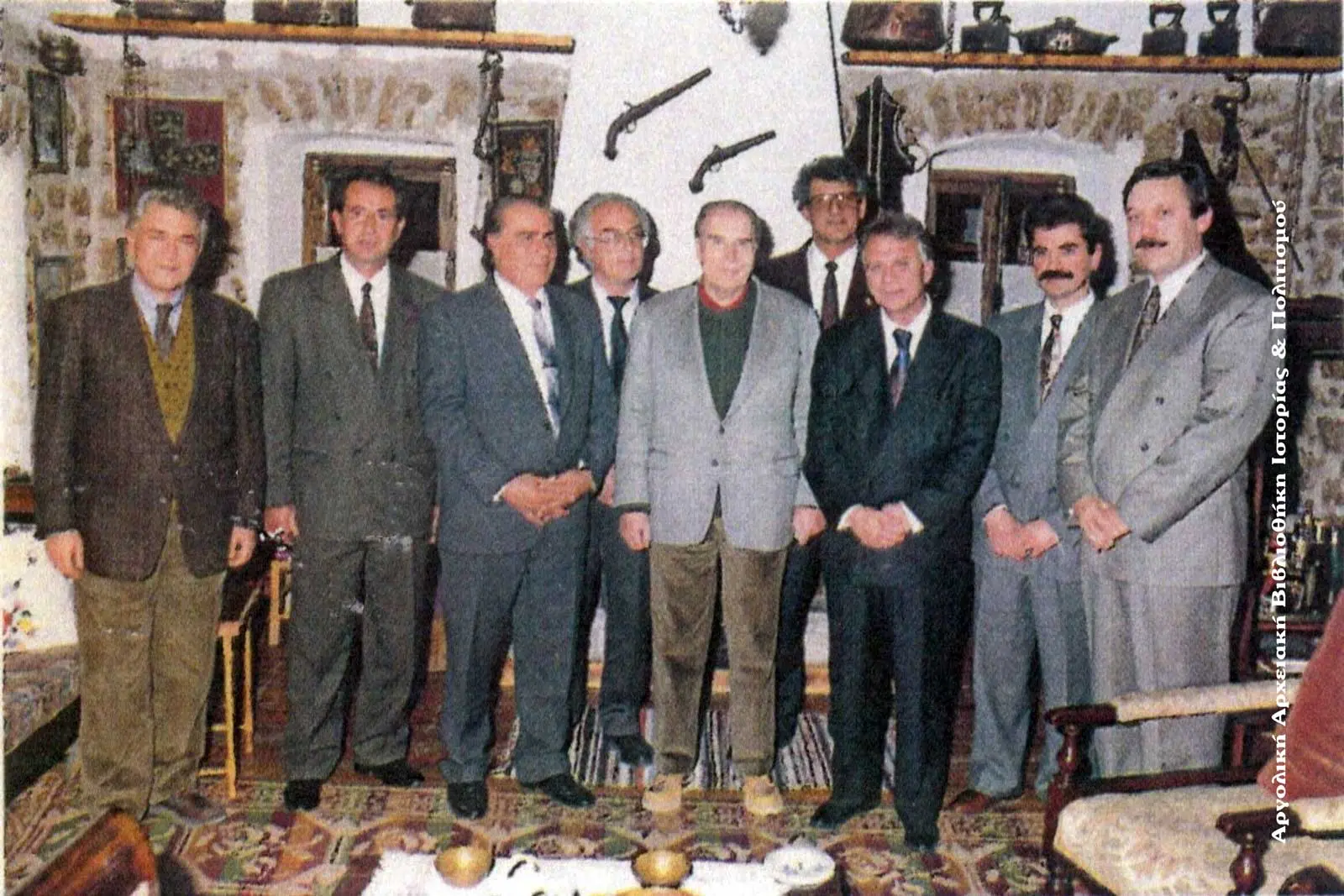
Ontvangst in de woonkamer in Myloi, 26 december 1991. Van rechts naar links: S. Kotsovos, P. Panagakis, burgemeester D. Papanikolaou van Argos, P. Kotsonaros, François Mitterrand, N. Gkikopoulos, M. Koromichis (voorzitter van de gemeenschap Myloi), N. Kodelas en Chr. Machairitsas.
Bron: Kotsonaros family collection, via the Argolic Archival Library of History and Culture (argolikivivliothiki.gr)
-
Vergroten:
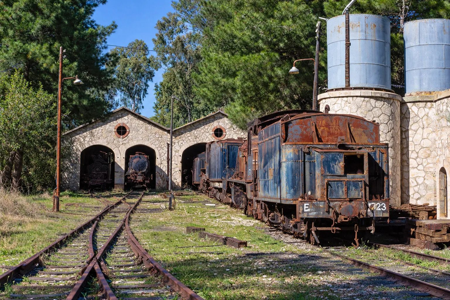
23 februari 1995
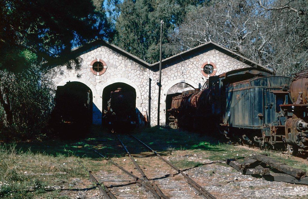
'Metre gauge graveyard. Mili Nafpliou Depot': the engine shed with arched doors at left, two water towers (stone base, blue tank) at right and tender locomotive 7723 in front.
Bron: Adrian Nicholls (Flickr 'Marra Man') · digitaal opgeknapt
-
Vergroten:
23 februari 1995
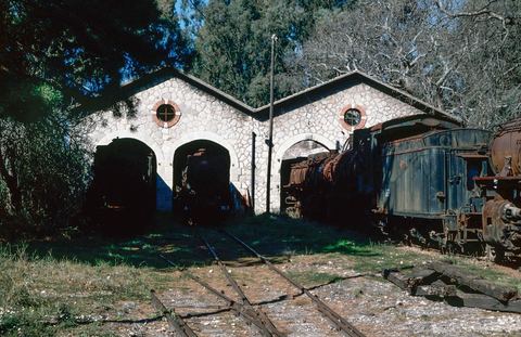
'Mili Nafpliou Depot. Greece. 1995.': the stone front of the double engine shed with two gables, three arched doors and two round brick-edged windows, with steam locomotives (Di 7112, 7118, Es 7728) in and beside the doors.
Bron: Adrian Nicholls (Flickr 'Marra Man')
-
Vergroten:
23 februari 1995
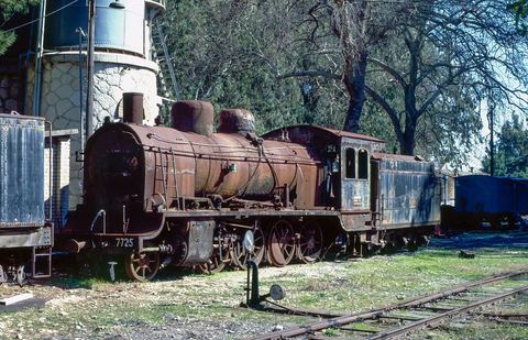
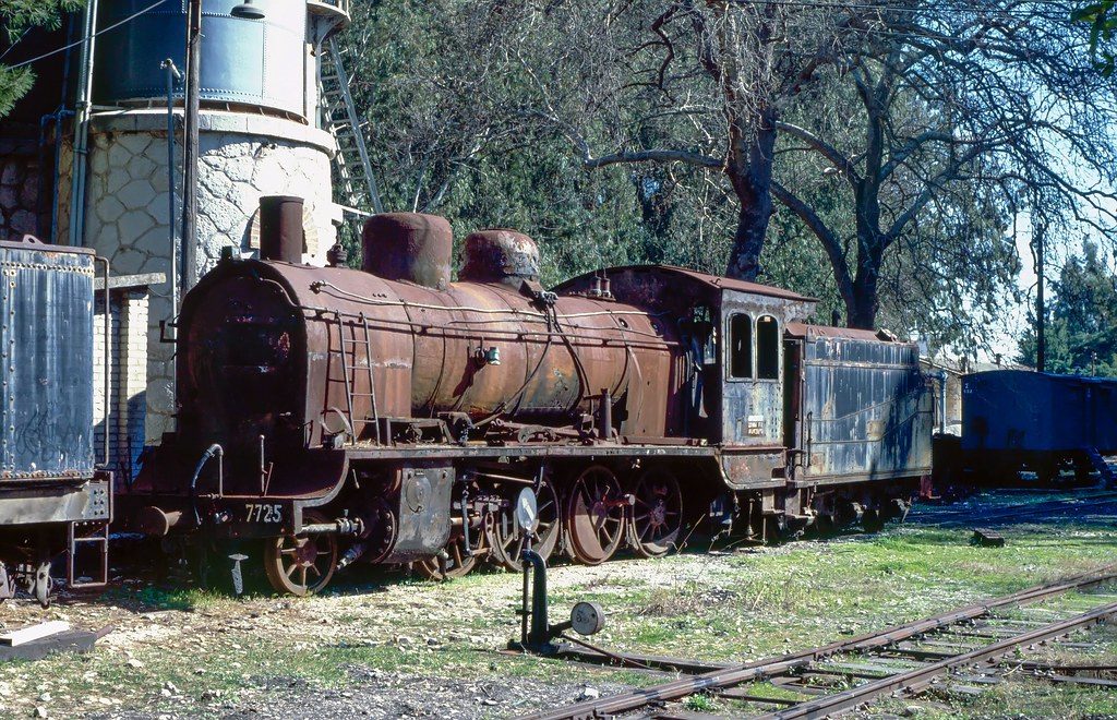
'Class Es no.7725 dumped at Mili Nafpliou depot': locomotive 7725 with a water tower behind and part of a stone building at left.
Bron: Adrian Nicholls (Flickr 'Marra Man')
-
Vergroten:
23 februari 1995
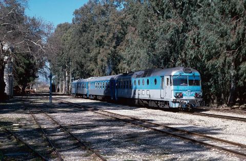
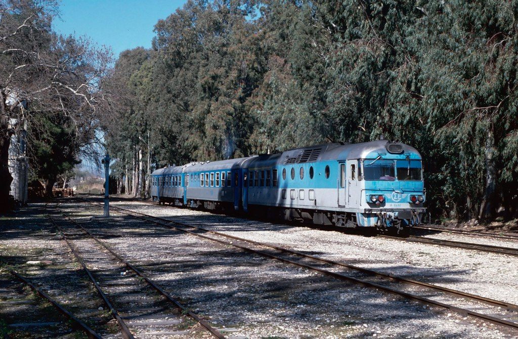
Myloi station yard under eucalyptus trees with blue OSE railcar A.6461, three coaches and a water crane.
Bron: Adrian Nicholls (Flickr)
-
Vergroten:
ca. 1990–2005
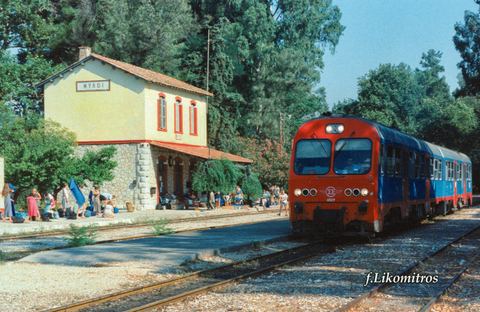
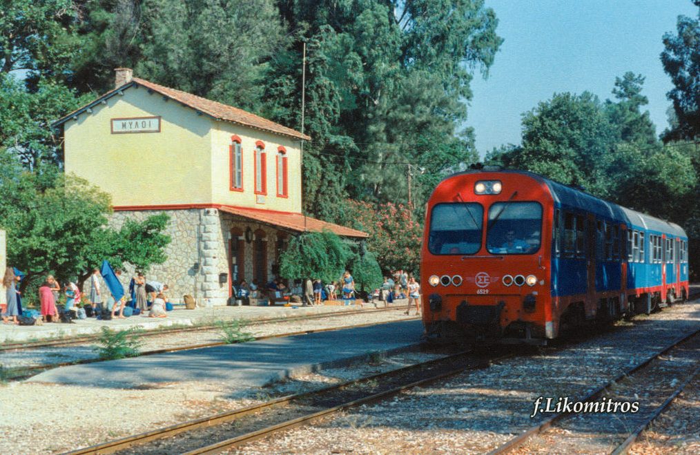
Colour photo of Myloi station in use: the SPAP station building with the ΜΥΛΟΙ sign and canopy, many passengers with luggage on the platform, and OSE railcar 6529 arriving.
Bron: F. Likomitros; ΣΦΣ (Friends of the Railway Society)
-
Vergroten:
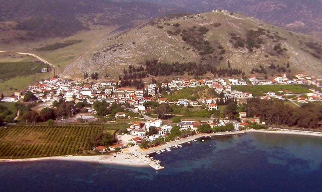
2005
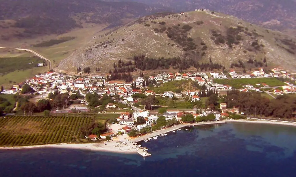
Kleurenluchtfoto van het dorp onder de heuvel Pontinos, met de baai, het strand, de pier en boomgaarden
Bron: Visit Myloi collection
Herken je een gezicht, een plek of een jaartal? Of heb je zelf oude foto's van Myloi? Laat het ons weten, dan vertellen we hun verhaal.
Stuur ons een bericht op Facebook (opent in een nieuw tabblad)